The locations of National Register properties and districts (at least for all showing latitude and longitude coordinates below) may be seen in a Google map by clicking on "Map of all coordinates".[1]
|
Landmark name |
Image |
Date listed |
Location |
Neighborhood |
Summary |
| 1 |
Adams-Magoun House |
 |
01989-09-18 September 18, 1989 |
438 Broadway
42°23′46″N 71°6′3″W / 42.39611°N 71.10083°W / 42.39611; -71.10083 (Adams-Magoun House) |
Winter Hill |
|
| 2 |
Charles Adams-Woodbury Locke House |
 |
01989-09-18 September 18, 1989 |
178 Central St.
42°23′39″N 71°5′59″W / 42.39417°N 71.09972°W / 42.39417; -71.09972 (Adams, Charles-Woodbury Locke House) |
Winter Hill |
|
| 3 |
Alewife Brook Parkway |
 |
02004-03-13 March 13, 2004 |
Alewife Brook Parkway
42°24′34.4″N 71°7′50.1″W / 42.409556°N 71.130583°W / 42.409556; -71.130583 (Alewife Brook Parkway) |
West Somerville |
Extends into Cambridge |
| 4 |
Clifton Bacon House |
 |
01989-09-18 September 18, 1989 |
27 Chester St.
42°23′39.4885″N 71°7′25.578″W / 42.394302361°N 71.12377167°W / 42.394302361; -71.12377167 (Bacon, Clifton, House) |
Davis Square |
|
| 5 |
Walter S. and Melissa E. Barnes House |
 |
01990-03-08 March 8, 1990 |
140 Highland Ave.
42°23′17″N 71°6′12″W / 42.38806°N 71.10333°W / 42.38806; -71.10333 (Barnes, Walter S. and Melissa E., House) |
Central Hill |
|
| 6 |
Bow Street Historic District |
 |
01976-03-26 March 26, 1976 |
Bow St.
42°22′53″N 71°5′54″W / 42.38139°N 71.09833°W / 42.38139; -71.09833 (Bow Street Historic District) |
Union Square |
|
| 7 |
S. E. Brackett House |
 |
01989-09-18 September 18, 1989 |
63 Columbus Ave.
42°22′54″N 71°5′43″W / 42.38167°N 71.09528°W / 42.38167; -71.09528 (Brackett, S. E., House) |
Prospect Hill |
|
| 8 |
Broadway Winter Hill Congregational Church |
 |
01989-09-18 September 18, 1989 |
404 Broadway
42°23′42″N 71°5′58″W / 42.395°N 71.09944°W / 42.395; -71.09944 (Broadway Winter Hill Congregational Church) |
Winter Hill |
|
| 9 |
James H. Brooks House |
 |
01989-09-18 September 18, 1989 |
61 Columbus Ave.
42°22′54″N 71°5′42″W / 42.38167°N 71.095°W / 42.38167; -71.095 (Brooks, James H., House) |
Prospect Hill |
|
| 10 |
Martin W. Carr School |
 |
01984-07-05 July 5, 1984 |
25 Atherton St.
42°23′5″N 71°6′28″W / 42.38472°N 71.10778°W / 42.38472; -71.10778 (Carr, Martin W., School) |
Spring Hill |
|
| 11 |
Central Library |
 |
01989-09-18 September 18, 1989 |
79 Highland Ave.
42°23′9″N 71°5′40″W / 42.38583°N 71.09444°W / 42.38583; -71.09444 (Central Library) |
Central Hill |
|
| 12 |
Z. E. Cliff House |
 |
01989-09-18 September 18, 1989 |
29 Powder House Terr.
42°23′58.8794″N 71°6′59.8151″W / 42.399688722°N 71.116615306°W / 42.399688722; -71.116615306 (Cliff, Z. E., House) |
Powder House |
|
| 13 |
Thomas Cook House |
 |
01989-09-18 September 18, 1989 |
21 College Hill Rd.
42°24′32″N 71°7′44″W / 42.40889°N 71.12889°W / 42.40889; -71.12889 (Cook, Thomas, House) |
West Somerville |
|
| 14 |
Cooper-Davenport Tavern Wing |
 |
01989-09-18 September 18, 1989 |
81 Eustis St.
42°23′1″N 71°6′51″W / 42.38361°N 71.11417°W / 42.38361; -71.11417 (Cooper-Davenport Tavern Wing) |
Ward 2 |
|
| 15 |
C. C. Crowell House |
 |
01989-09-18 September 18, 1989 |
85 Benton Rd.
42°23′23″N 71°6′19″W / 42.38972°N 71.10528°W / 42.38972; -71.10528 (Crowell, C. C., House) |
Spring Hill |
|
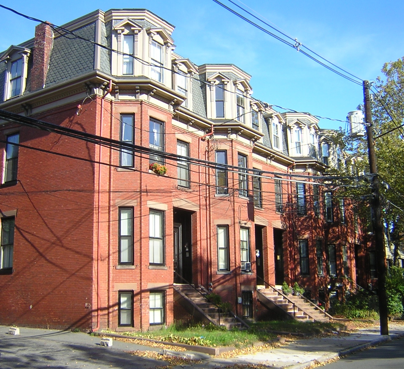
| 16 |
Downer Rowhouses (Adams Street) |
 |
01989-09-18 September 18, 1989 |
55 Adams St.
42°23′40″N 71°6′1″W / 42.39444°N 71.10028°W / 42.39444; -71.10028 (Downer Rowhouses (Adams Street)) |
Winter Hill |
|
| 17 |
Downer Rowhouses (Central Street) |
 |
01989-09-18 September 18, 1989 |
192-200 Central St.
42°23′41″N 71°5′59″W / 42.39472°N 71.09972°W / 42.39472; -71.09972 (Downer Rowhouses (Central Street)) |
Winter Hill |
|
| 18 |
First Unitarian Church |
 |
01989-09-18 September 18, 1989 |
130 Highland Ave.
42°23′15″N 71°6′7″W / 42.3875°N 71.10194°W / 42.3875; -71.10194 (First Unitarian Church) |
Central Hill |
|
| 19 |
First Universalist Church |
 |
01989-09-18 September 18, 1989 |
125 Highland Ave.
42°23′15″N 71°6′5″W / 42.3875°N 71.10139°W / 42.3875; -71.10139 (First Universalist Church) |
Central Hill |
|
| 20 |
Alexander Foster House |
 |
01989-09-18 September 18, 1989 |
45 Laurel St.
42°23′4″N 71°6′15″W / 42.38444°N 71.10417°W / 42.38444; -71.10417 (Foster, Alexander, House) |
Spring Hill |
|
| 21 |
Samuel Gaut House |
 |
01989-09-18 September 18, 1989 |
137 Highland Ave.
42°23′17″N 71°6′9″W / 42.38806°N 71.1025°W / 42.38806; -71.1025 (Gaut, Samuel, House) |
Central Hill |
|
| 22 |
The Grandview |
 |
01989-09-18 September 18, 1989 |
82 Munroe St.
42°22′56″N 71°5′42″W / 42.38222°N 71.095°W / 42.38222; -71.095 (Grandview, The) |
Prospect Hill |
|
| 23 |
The Highland |
 |
01989-09-18 September 18, 1989 |
66 Highland St.
42°23′13″N 71°5′55″W / 42.38694°N 71.09861°W / 42.38694; -71.09861 (Highland, The) |
Central Hill |
|
| 24 |
Hollander Blocks |
 |
01989-09-18 September 18, 1989 |
Walnut St. and Pleasant Ave.
42°23′2″N 71°5′44″W / 42.38389°N 71.09556°W / 42.38389; -71.09556 (Hollander Blocks) |
Prospect Hill |
|
| 25 |
Elisha Hopkins House |
 |
01989-09-18 September 18, 1989 |
237 School St.
42°23′30.83″N 71°5′43.07″W / 42.3918972°N 71.0952972°W / 42.3918972; -71.0952972 (Hopkins, Elisha, House) |
Winter Hill |
|
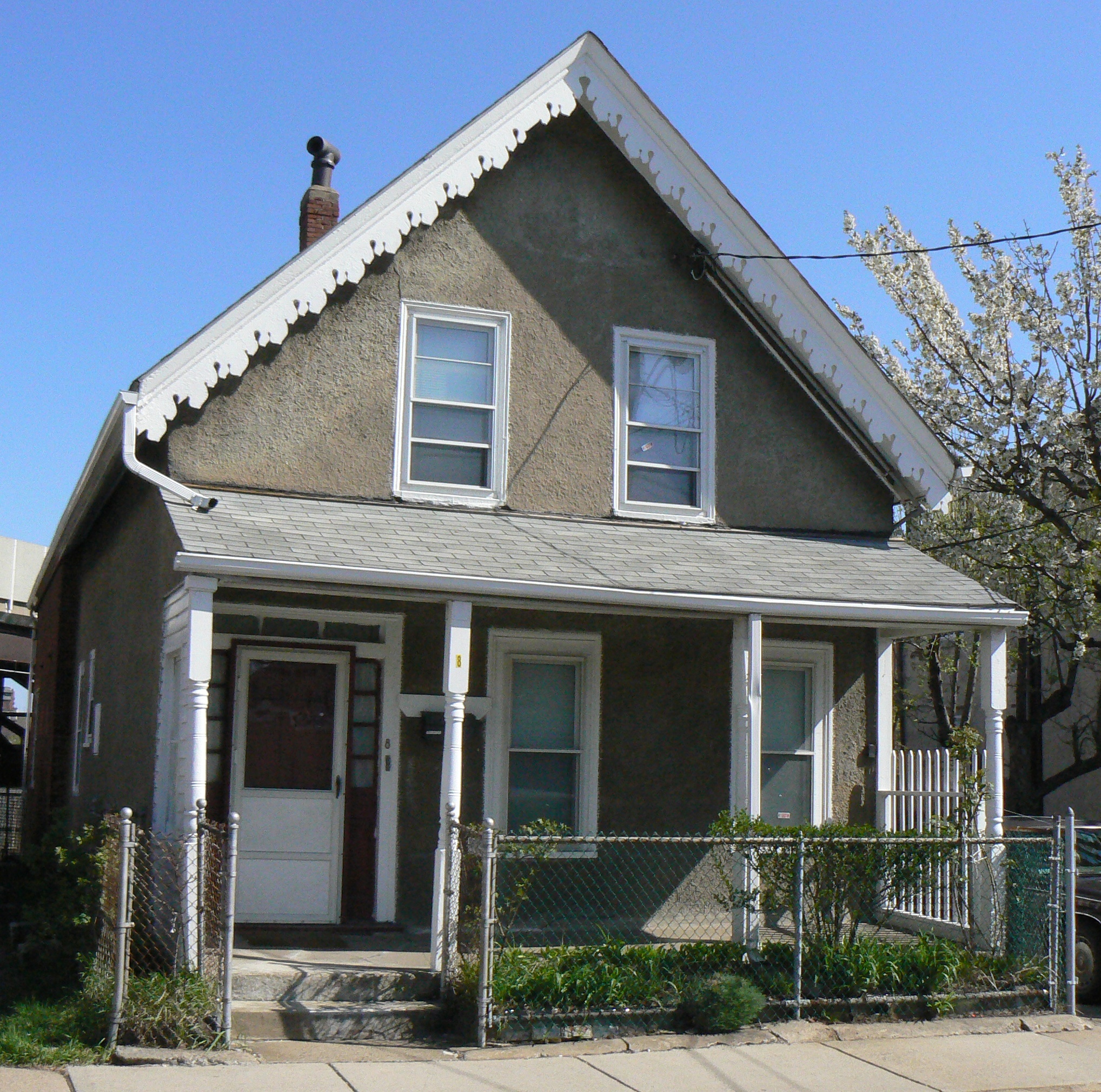
| 26 |
House at 10 Arlington Street |
 |
01989-09-18 September 18, 1989 |
10 Arlington St.
42°23′9″N 71°4′57″W / 42.38583°N 71.0825°W / 42.38583; -71.0825 (House at 10 Arlington Street) |
East Somerville |
|
| 27 |
Houses at 28-36 Beacon Street |
 |
01989-09-18 September 18, 1989 |
28–36 Beacon St.
42°22′31″N 71°6′12″W / 42.37528°N 71.10333°W / 42.37528; -71.10333 (Houses at 28-36 Beacon Street) |
Inman Square |
|
| 28 |
House at 14 Chestnut Street |
Demolished |
01989-09-18 September 18, 1989 |
14 Chestnut St.
42°22′29″N 71°5′11″W / 42.37472°N 71.08639°W / 42.37472; -71.08639 (House at 14 Chestnut Street) |
Brickbottom |
|
| 29 |
House at 25 Clyde Street |
 |
01989-09-18 September 18, 1989 |
25 Clyde St.
42°23′40.8893″N 71°6′33.0084″W / 42.394691472°N 71.109169°W / 42.394691472; -71.109169 (House at 25 Clyde Street) |
Magoun Square |
|
| 30 |
House at 72R Dane Street |
 |
01989-09-18 September 18, 1989 |
72R Dane St.
42°22′34″N 71°6′16″W / 42.37611°N 71.10444°W / 42.37611; -71.10444 (House at 72R Dane Street) |
Perry Park |
|
| 31 |
House at 21 Dartmouth Street |
 |
01989-09-18 September 18, 1989 |
21 Dartmouth St.
42°23′27″N 71°5′50″W / 42.39083°N 71.09722°W / 42.39083; -71.09722 (House at 21 Dartmouth Street) |
Winter Hill |
|
| 32 |
House at 343 Highland Avenue |
 |
01989-09-18 September 18, 1989 |
343 Highland Ave.
42°23′38.7332″N 71°6′59.046″W / 42.394092556°N 71.11640167°W / 42.394092556; -71.11640167 (House at 343 Highland Avenue) |
Powder House |
|
| 33 |
House at 6 Kent Court |
 |
01989-09-18 September 18, 1989 |
6 Kent Ct.
42°22′57″N 71°6′41″W / 42.3825°N 71.11139°W / 42.3825; -71.11139 (House at 6 Kent Court) |
Ward 2 |
|
| 34 |
House at 197 Morrison Avenue |
 |
01989-09-18 September 18, 1989 |
197 Morrison Ave.
42°23′51.0654″N 71°7′9.56543″W / 42.397518167°N 71.1193237306°W / 42.397518167; -71.1193237306 (House at 197 Morrison Avenue) |
Davis Square |
|
| 35 |
House at 29 Mt. Vernon Street |
 |
01989-09-18 September 18, 1989 |
29 Mt. Vernon St.
42°23′8″N 71°4′48″W / 42.38556°N 71.08°W / 42.38556; -71.08 (House at 29 Mt. Vernon Street) |
East Somerville |
|
| 36 |
House at 81 Pearl Street |
 |
01989-09-18 September 18, 1989 |
81 Pearl St.
42°23′5″N 71°5′6″W / 42.38472°N 71.085°W / 42.38472; -71.085 (House at 81 Pearl Street) |
East Somerville |
|
| 37 |
House at 16-18 Preston Road |
 |
01989-09-18 September 18, 1989 |
16–18 Preston Rd.
42°23′1″N 71°6′8″W / 42.38361°N 71.10222°W / 42.38361; -71.10222 (House at 16-18 Preston Road) |
Spring Hill |
|
| 38 |
House at 5 Prospect Hill |
 |
01989-09-18 September 18, 1989 |
5 Prospect Hill Avenue
42°22′55″N 71°5′29″W / 42.38194°N 71.09139°W / 42.38194; -71.09139 (House at 5 Prospect Hill) |
Prospect Hill |
|
| 39 |
House at 35 Temple Street |
 |
01989-09-18 September 18, 1989 |
35 Temple St.
42°23′37″N 71°5′34″W / 42.39361°N 71.09278°W / 42.39361; -71.09278 (House at 35 Temple Street) |
Ten Hills |
|
| 40 |
House at 42 Vinal Avenue |
 |
01989-09-18 September 18, 1989 |
42 Vinal Ave.
42°23′4″N 71°5′51″W / 42.38444°N 71.0975°W / 42.38444; -71.0975 (House at 42 Vinal Avenue) |
Prospect Hill |
|
| 41 |
House at 49 Vinal Avenue |
 |
01989-09-18 September 18, 1989 |
49 Vinal Ave.
42°23′5″N 71°5′49″W / 42.38472°N 71.09694°W / 42.38472; -71.09694 (House at 49 Vinal Avenue) |
Prospect Hill |
|
| 42 |
Samuel Ireland House |
 |
01989-09-18 September 18, 1989 |
117 Washington
42°22′52″N 71°5′15″W / 42.38111°N 71.0875°W / 42.38111; -71.0875 (Ireland, Samuel, House) |
East Somerville |
|
| 43 |
Joseph K. James House |
 |
01998-02-11 February 11, 1998 |
83 Belmont St.
42°23′18″N 71°6′30″W / 42.38833°N 71.10833°W / 42.38833; -71.10833 (James, Joseph K., House) |
Spring Hill |
|
| 44 |
Amos Keyes House |
 |
01989-09-18 September 18, 1989 |
12 Adams St.
42°23′37″N 71°6′6″W / 42.39361°N 71.10167°W / 42.39361; -71.10167 (Keyes, Amos, House) |
Magoun Square |
|
| 45 |
R. A. Knight-Eugene Lacount House |
 |
01989-09-18 September 18, 1989 |
34 Day St.
42°23′42.6608″N 71°7′26.4844″W / 42.395183556°N 71.124023444°W / 42.395183556; -71.124023444 (Knight, R. A.-Eugene Lacount House) |
Davis Square |
|
| 46 |
Langmaid Building |
 |
01989-09-18 September 18, 1989 |
48-52 Highland Ave.
42°23′7″N 71°5′45″W / 42.38528°N 71.09583°W / 42.38528; -71.09583 (Langmaid Building) |
Central Hill |
|
| 47 |
Langmaid Terrace |
 |
01989-09-18 September 18, 1989 |
359-365 Broadway
42°23′39″N 71°5′47″W / 42.39417°N 71.09639°W / 42.39417; -71.09639 (Langmaid Terrace) |
Ten Hills |
|
| 48 |
Charles H. Lockhardt House |
 |
01989-09-18 September 18, 1989 |
88 College Ave.
42°23′57.2452″N 71°7′10.8563″W / 42.399234778°N 71.119682306°W / 42.399234778; -71.119682306 (Lockhardt, Charles H., House) |
Davis Square |
|
| 49 |
George Loring House |
 |
01989-09-18 September 18, 1989 |
76 Highland Ave.
42°23′10″N 71°5′51″W / 42.38611°N 71.0975°W / 42.38611; -71.0975 (Loring, George, House) |
Central Hill |
|
| 50 |
A. L. Lovejoy House |
 |
01989-09-18 September 18, 1989 |
30 Warren Ave.
42°22′53″N 71°5′45″W / 42.38139°N 71.09583°W / 42.38139; -71.09583 (Lovejoy, A. L., House) |
Prospect Hill |
|
| 51 |
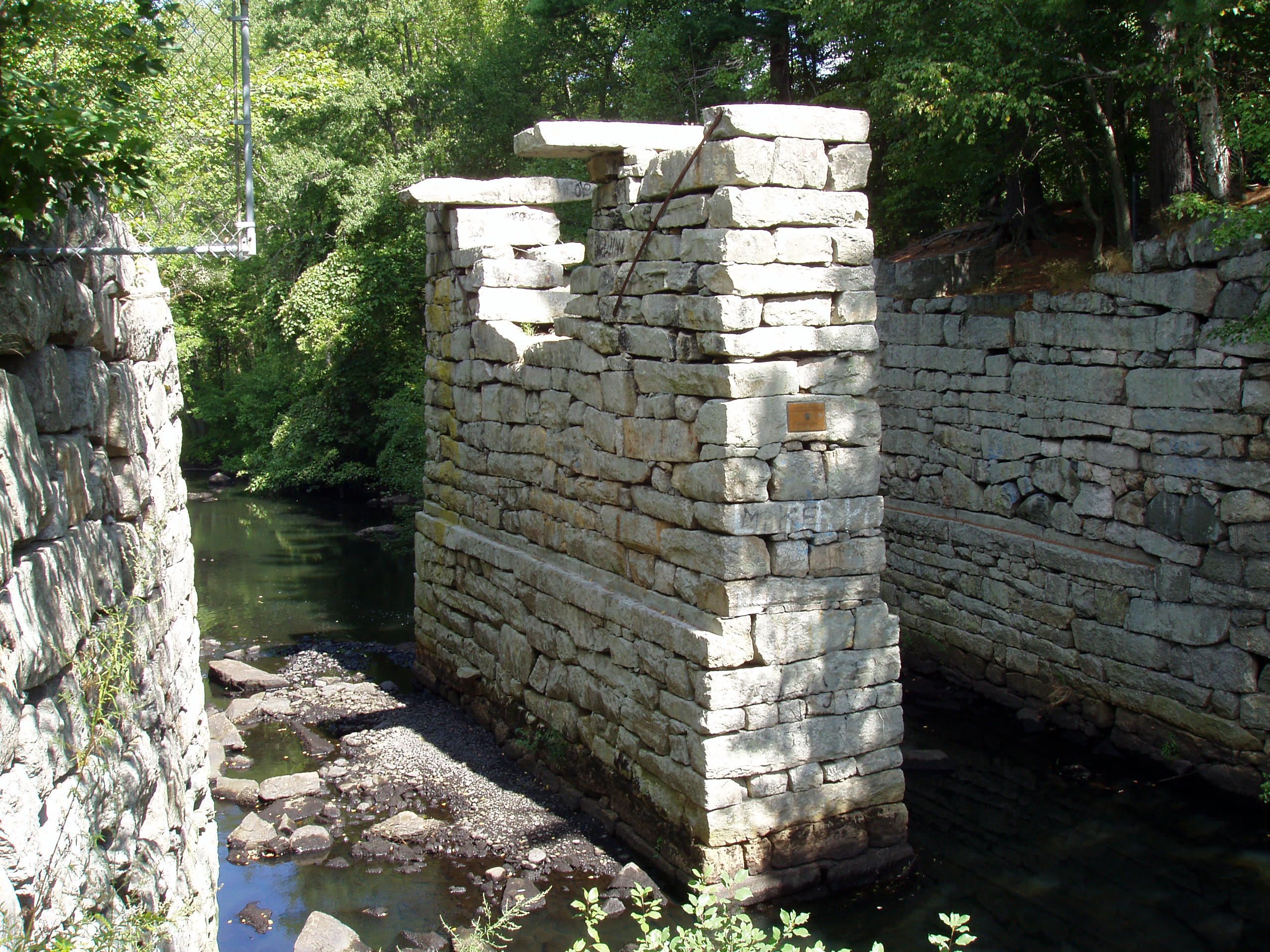
Middlesex Canal Historic and Archaeological District |
 |
02009-11-19 November 19, 2009 |
Numerous locations along the historic route of the Middlesex Canal |
West Somerville
Ten Hills
East Somerville |
Extends into other Middlesex County communities and Boston in Suffolk County; encompasses Middlesex Canal and other listings. |
| 52 |
Mt. Vernon Street Historic District |
 |
01989-09-18 September 18, 1989 |
8-24 Mt. Vernon St.
42°23′8″N 71°4′47″W / 42.38556°N 71.07972°W / 42.38556; -71.07972 (Mt. Vernon Street Historic District) |
East Somerville |
|
| 53 |
Robert Munroe House |
 |
01989-09-18 September 18, 1989 |
37 Walnut St.
42°22′57″N 71°5′46″W / 42.3825°N 71.09611°W / 42.3825; -71.09611 (Munroe, Robert, House) |
Prospect Hill |
|
| 54 |
Mystic Pumping Station |
 |
01990-01-18 January 18, 1990 |
Alewife Brook Parkway
42°24′54″N 71°7′52″W / 42.415°N 71.13111°W / 42.415; -71.13111 (Mystic Pumping Station) |
West Somerville |
Listing duplicates Mystic Water Works, below. |
| 55 |
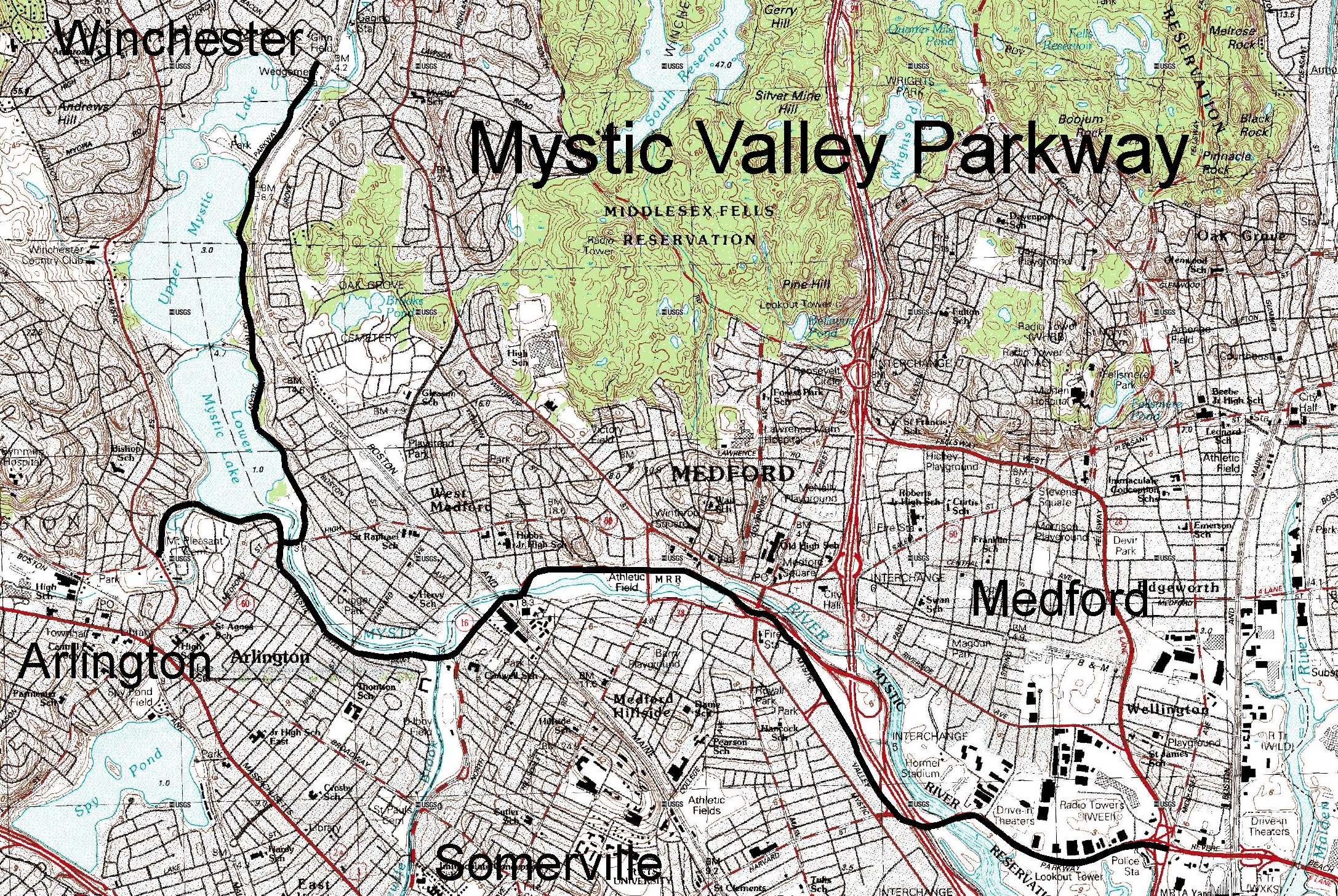
Mystic Valley Parkway, Metropolitan Park System of Greater Boston MPS |
 |
02006-01-18 January 18, 2006 |
Mystic Valley Parkway
42°25′47″N 71°7′49″W / 42.42972°N 71.13028°W / 42.42972; -71.13028 (Mystic Valley Parkway, Metropolitan Park System of Greater Boston MPS) |
West Somerville |
Also in
Arlington
Medford and
Winchester |
| 56 |
Mystic Water Works |
|
01989-09-18 September 18, 1989 |
Alewife Brook Parkway and Capen St.
42°24′54″N 71°7′52″W / 42.415°N 71.13111°W / 42.415; -71.13111 (Mystic Water Works) |
West Somerville |
Listing duplicates Mystic Pumping Station, above. |
| 57 |
John F. Nichols House |
 |
01989-09-18 September 18, 1989 |
17 Summit St.
42°23′59.6622″N 71°7′10.7739″W / 42.399906167°N 71.119659417°W / 42.399906167; -71.119659417 (Nichols, John F., House) |
Davis Square |
|
| 58 |
Louville V. Niles House |
 |
01989-09-18 September 18, 1989 |
97 Munroe St.
42°22′59″N 71°5′44″W / 42.38306°N 71.09556°W / 42.38306; -71.09556 (Niles, Louville V., House) |
Prospect Hill |
|
| 59 |
Louville Niles House |
 |
01989-09-18 September 18, 1989 |
45 Walnut St.
42°22′59″N 71°5′45″W / 42.38306°N 71.09583°W / 42.38306; -71.09583 (Niles, Louville, House) |
Prospect Hill |
|
| 60 |
Old Cemetery |
 |
01989-09-18 September 18, 1989 |
Somerville Ave. and School St.
42°22′53″N 71°6′25″W / 42.38139°N 71.10694°W / 42.38139; -71.10694 (Old Cemetery) |
Union Square |
|
| 61 |
Otis-Wyman House |
 |
01989-09-18 September 18, 1989 |
67 Thurston St.
42°23′31″N 71°5′51″W / 42.39194°N 71.0975°W / 42.39194; -71.0975 (Otis-Wyman House) |
Winter Hill |
|
| 62 |
Parker-Burnett House |
 |
01989-09-18 September 18, 1989 |
48 Vinal Ave.
42°23′5″N 71°5′51″W / 42.38472°N 71.0975°W / 42.38472; -71.0975 (Parker-Burnett House) |
Prospect Hill |
|
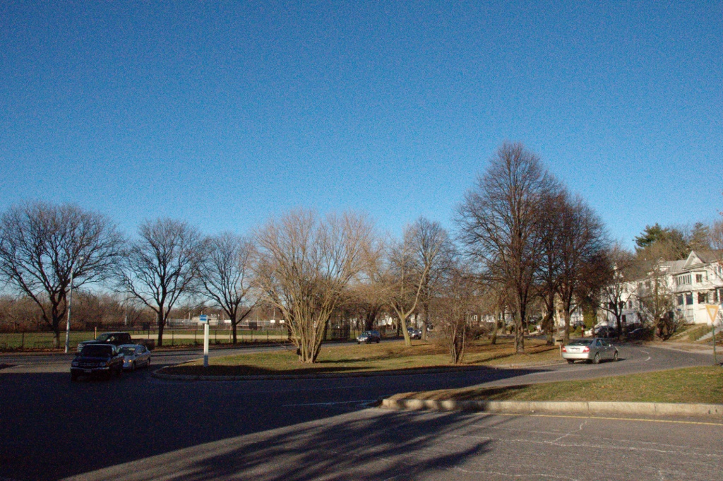
| 63 |
Powder House Park |
 |
01975-04-21 April 21, 1975 |
Powder House Circle
42°24′1″N 71°7′2″W / 42.40028°N 71.11722°W / 42.40028; -71.11722 (Powder House Park) |
Powder House |
|
| 64 |
Gustavus G. Prescott House |
 |
01989-09-18 September 18, 1989 |
65-67 Perkins St.
42°23′3″N 71°4′45″W / 42.38417°N 71.07917°W / 42.38417; -71.07917 (Prescott, Gustavus G., House) |
East Somerville |
|
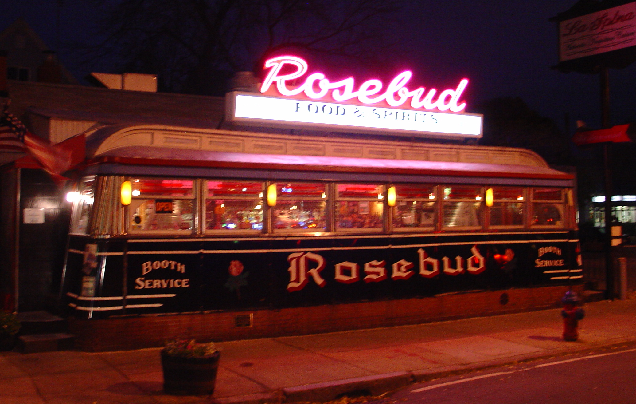
| 65 |
The Rosebud |
 |
01999-09-22 September 22, 1999 |
381 Summer St.
42°23′40″N 71°7′17″W / 42.39444°N 71.12139°W / 42.39444; -71.12139 (Rosebud, The) |
Davis Square |
|
| 66 |
Philemon Russell House |
 |
01989-09-18 September 18, 1989 |
25 Russell St.
42°23′33.858″N 71°7′21.925″W / 42.39273833°N 71.12275694°W / 42.39273833; -71.12275694 (Russell, Philemon, House) |
Davis Square |
|
| 67 |
Susan Russell House |
 |
01989-09-18 September 18, 1989 |
58 Sycamore St.
42°23′24″N 71°6′4″W / 42.39°N 71.10111°W / 42.39; -71.10111 (Russell, Susan, House) |
Winter Hill |
|
| 68 |
Charles Schuebeler House |
 |
01989-09-18 September 18, 1989 |
384 Washington St.
42°22′31″N 71°6′15″W / 42.37528°N 71.10417°W / 42.37528; -71.10417 (Schuebeler, Charles, House) |
Perry Park |
|
| 69 |
Lemuel Snow, Jr., House |
 |
01989-09-18 September 18, 1989 |
81 Benton Rd.
42°23′22″N 71°6′20″W / 42.38944°N 71.10556°W / 42.38944; -71.10556 (Snow, Lemuel, Jr., House) |
Spring Hill |
|
| 70 |
Somerville High School |
 |
01989-09-18 September 18, 1989 |
93 Highland St.
42°23′13″N 71°5′55″W / 42.38694°N 71.09861°W / 42.38694; -71.09861 (Somerville High School) |
Central Hill |
|
| 71 |
Somerville Journal Building |
 |
01989-09-18 September 18, 1989 |
8-10 Walnut St.
42°22′53″N 71°5′51″W / 42.38139°N 71.0975°W / 42.38139; -71.0975 (Somerville Journal Building) |
Union Square |
|
| 72 |
Somerville Theatre |
 |
01990-01-26 January 26, 1990 |
55 Davis Sq.
42°23′48.3463″N 71°7′22.3645″W / 42.396762861°N 71.122879028°W / 42.396762861; -71.122879028 (Somerville Theatre) |
Davis Square |
|
| 73 |
Spring Hill Historic District |
 |
01989-09-18 September 18, 1989 |
Roughly bounded by Summer, Central, Atherton, and Spring
42°23′7″N 71°6′29″W / 42.38528°N 71.10806°W / 42.38528; -71.10806 (Spring Hill Historic District) |
Spring Hill |
|
| 74 |
Peter and Oliver Tufts House |
 |
01989-09-18 September 18, 1989 |
78 Sycamore St.
42°23′27″N 71°6′2″W / 42.39083°N 71.10056°W / 42.39083; -71.10056 (Tufts, Peter and Oliver, House) |
Winter Hill |
|
| 75 |
US Post Office-Somerville Main |
 |
01986-05-30 May 30, 1986 |
237 Washington St.
42°22′47″N 71°5′39″W / 42.37972°N 71.09417°W / 42.37972; -71.09417 (US Post Office-Somerville Main) |
Union Square |
|
| 76 |
H. Warren House |
 |
01989-09-18 September 18, 1989 |
205 School St.
42°23′25″N 71°5′47″W / 42.39028°N 71.09639°W / 42.39028; -71.09639 (Warren, H., House) |
Winter Hill |
|
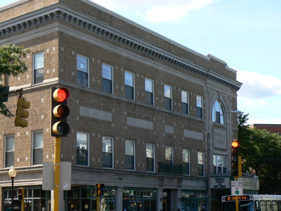
| 77 |
West Somerville Branch Library |
 |
01989-09-18 September 18, 1989 |
40 College Ave.
42°23′53.0429″N 71°7′17.558″W / 42.398067472°N 71.12154389°W / 42.398067472; -71.12154389 (West Somerville Branch Library) |
Davis Square |
|
| 78 |
Charles Williams House |
 |
01989-09-18 September 18, 1989 |
108 Cross St.
42°23′3″N 71°5′22″W / 42.38417°N 71.08944°W / 42.38417; -71.08944 (Williams, Charles, House) |
East Somerville |
|
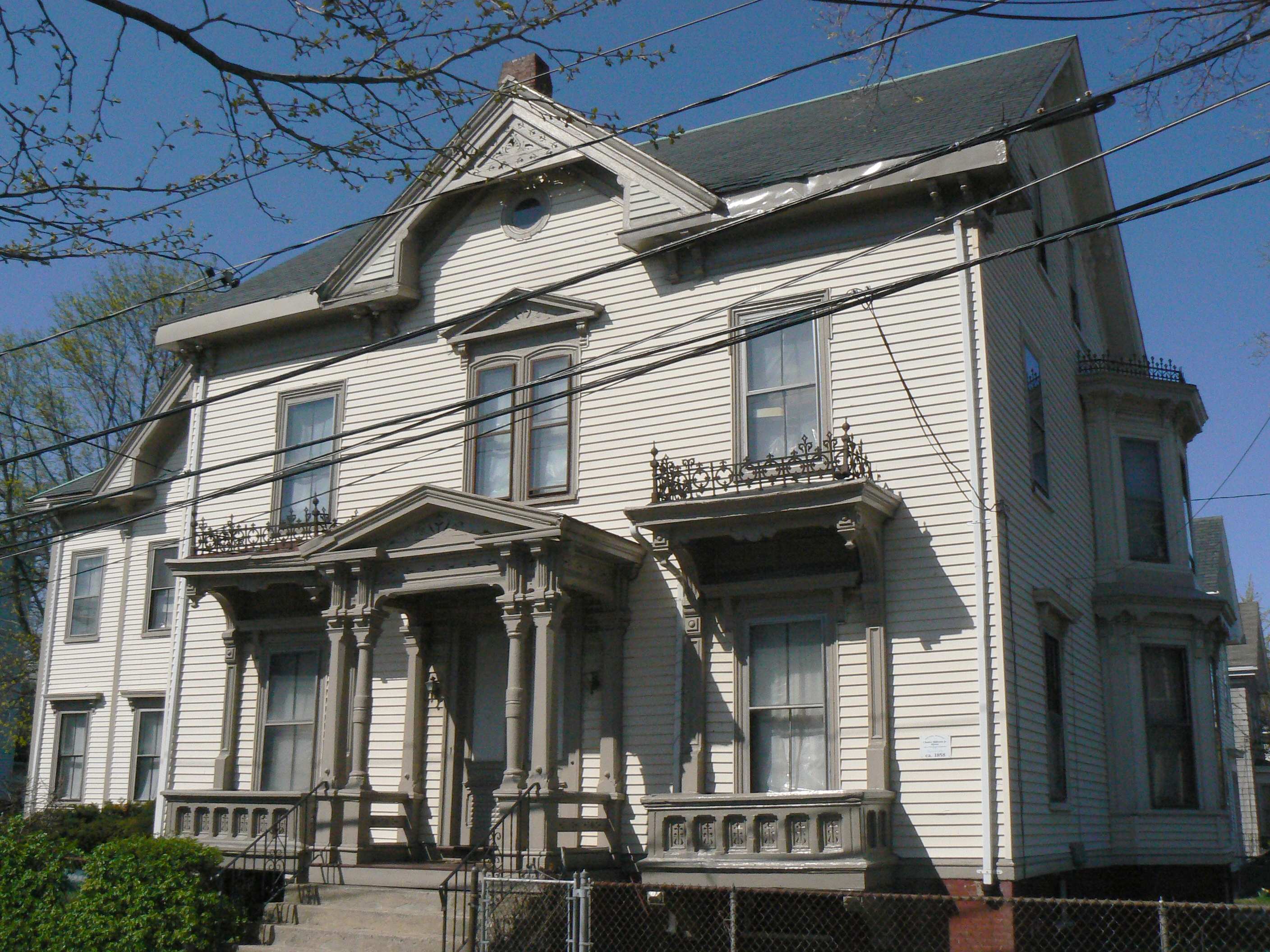
| 79 |
Charles Williams, Jr., House |
 |
01989-09-18 September 18, 1989 |
1 Arlington St.
42°23′9″N 71°4′55″W / 42.38583°N 71.08194°W / 42.38583; -71.08194 (Williams, Charles, Jr., House) |
East Somerville |
|
| 80 |
F. G. Williams House |
 |
01989-09-18 September 18, 1989 |
37 Albion St.
42°23′26″N 71°6′18″W / 42.39056°N 71.105°W / 42.39056; -71.105 (Williams, F. G., House) |
Central Hill |
|
| 81 |
Daniel Worthen House |
 |
01989-09-18 September 18, 1989 |
8 Mt. Pleasant St.
42°23′7″N 71°4′43″W / 42.38528°N 71.07861°W / 42.38528; -71.07861 (Worthen, Daniel, House) |
East Somerville |
|
| 82 |
Wright House |
 |
01989-09-18 September 18, 1989 |
54 Vinal Ave.
42°23′6″N 71°5′51″W / 42.385°N 71.0975°W / 42.385; -71.0975 (Wright House) |
Prospect Hill |
|
| 83 |
George Wyatt House |
 |
01989-09-18 September 18, 1989 |
33 Beacon St.
42°22′31.45″N 71°6′9.41″W / 42.3754028°N 71.1026139°W / 42.3754028; -71.1026139 (Wyatt, George, House) |
Inman Square |
|
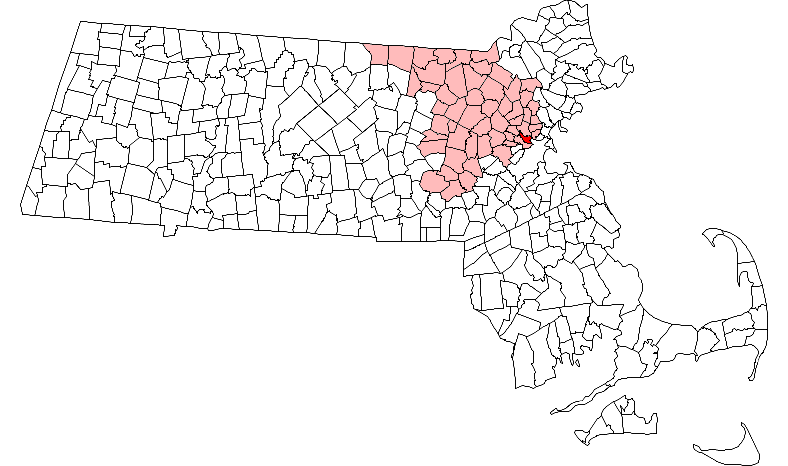
 Location of Somerville in Massachusetts