| [2] |
Landmark name[3] |
Image |
Date listed |
Location |
Summary |
| 1 |
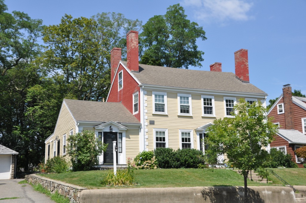
Albree-Hall-Lawrence House |
 |
01976-04-30 April 30, 1976 |
353 Lawrence Rd.
42°25′29″N 71°7′12″W / 42.42472°N 71.12°W / 42.42472; -71.12 (Albree-Hall-Lawrence House) |
|
| 2 |
John B. Angier House |
 |
01975-04-23 April 23, 1975 |
129 High St.
42°25′12″N 71°6′54″W / 42.42°N 71.115°W / 42.42; -71.115 (Angier, John B., House) |
|
| 3 |
Bigelow Block |
 |
01975-02-24 February 24, 1975 |
NE Corner of Forest and Salem Sts.
42°25′6″N 71°6′36″W / 42.41833°N 71.11°W / 42.41833; -71.11 (Bigelow Block) |
|
| 4 |
Charles Brooks House |
 |
01975-06-18 June 18, 1975 |
309 High St.
42°25′18″N 71°7′28″W / 42.42167°N 71.12444°W / 42.42167; -71.12444 (Brooks, Charles, House) |
|
| 5 |
Jonathan Brooks House |
 |
01975-06-26 June 26, 1975 |
2 Woburn St.
42°25′18″N 71°7′26″W / 42.42167°N 71.12389°W / 42.42167; -71.12389 (Brooks, Jonathan, House) |
|
| 6 |
Shepherd Brooks Estate |
 |
01975-04-21 April 21, 1975 |
275 Grove St.
42°26′0″N 71°8′22″W / 42.433333°N 71.13944°W / 42.433333; -71.13944 (Brooks, Shepherd, Estate) |
|
| 7 |
Paul Curtis House |
 |
01975-05-06 May 6, 1975 |
114 South St.
42°25′2″N 71°7′1″W / 42.41722°N 71.11694°W / 42.41722; -71.11694 (Curtis, Paul, House) |
|
| 8 |
Fells Connector Parkways, Metropolitan System of Greater Boston |
 |
02003-05-09 May 9, 2003 |
Fellsway East:E. Border Rd. To Fellsway W
Fellsway West: Fulton St. to Fellsway E
Fellsway:Fellsway E to Wellington Br
42°26′40″N 71°4′45″W / 42.44444°N 71.07917°W / 42.44444; -71.07917 (Fells Connector Parkways, Metropolitan System of Greater Boston) |
Extends into Malden. |
| 9 |
George P. Fernald House |
 |
01976-04-30 April 30, 1976 |
12 Rock Hill St.
42°25′14″N 71°7′23″W / 42.42056°N 71.12306°W / 42.42056; -71.12306 (Fernald, George P., House) |
|
| 10 |
Jonathan Fletcher House |
 |
01975-06-23 June 23, 1975 |
283 High St.
42°25′18″N 71°7′23″W / 42.42167°N 71.12306°W / 42.42167; -71.12306 (Fletcher, Jonathan, House) |
|
| 11 |
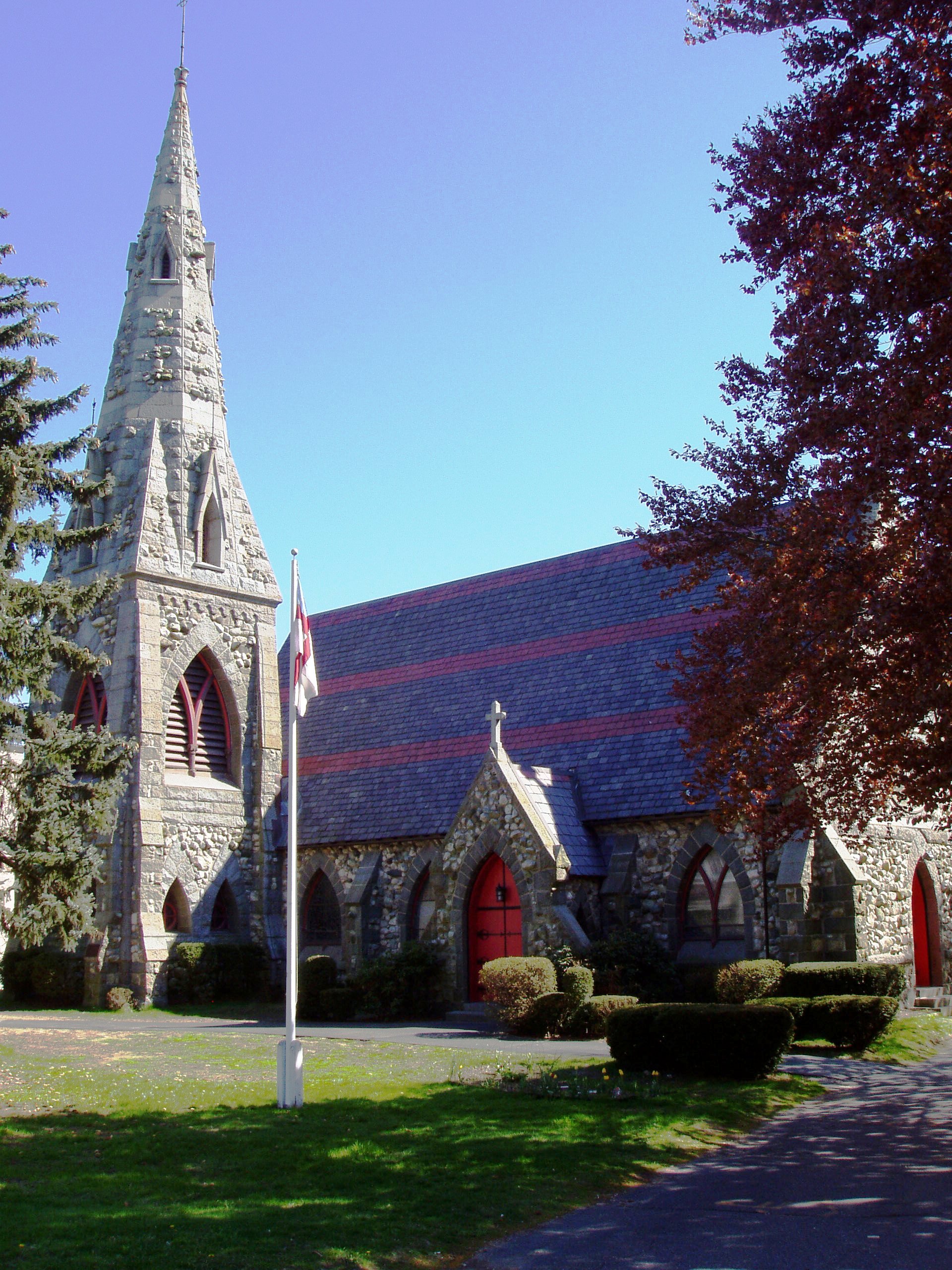
Grace Episcopal Church |
 |
01972-11-03 November 3, 1972 |
160 High St.
42°25′12″N 71°7′0″W / 42.42°N 71.116667°W / 42.42; -71.116667 (Grace Episcopal Church) |
|
| 12 |
Isaac Hall House |
 |
01975-04-16 April 16, 1975 |
43 High St.
42°25′7″N 71°6′41″W / 42.41861°N 71.11139°W / 42.41861; -71.11139 (Hall, Isaac, House) |
|
| 13 |
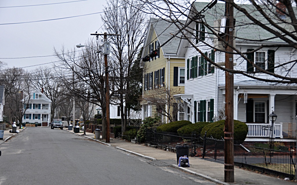
Hillside Avenue Historic District |
 |
01975-04-21 April 21, 1975 |
Property on both sides of Hillside and Grand View Aves.
42°25′13″N 71°6′46″W / 42.42028°N 71.11278°W / 42.42028; -71.11278 (Hillside Avenue Historic District) |
|
| 14 |
Lawrence Light Guard Armory |
 |
01975-03-10 March 10, 1975 |
90 High St.
42°25′7″N 71°6′47″W / 42.41861°N 71.11306°W / 42.41861; -71.11306 (Lawrence Light Guard Armory) |
|
| 15 |
Joseph K. Manning House |
 |
01989-04-07 April 7, 1989 |
35–37 Forest St.
42°25′11″N 71°6′37″W / 42.41972°N 71.11028°W / 42.41972; -71.11028 (Manning, Joseph K., House) |
|
| 16 |
John H. McGill House |
 |
01980-04-09 April 9, 1980 |
56 Vernon St.
42°25′28″N 71°7′41″W / 42.42444°N 71.12806°W / 42.42444; -71.12806 (McGill, John H., House) |
|
| 17 |
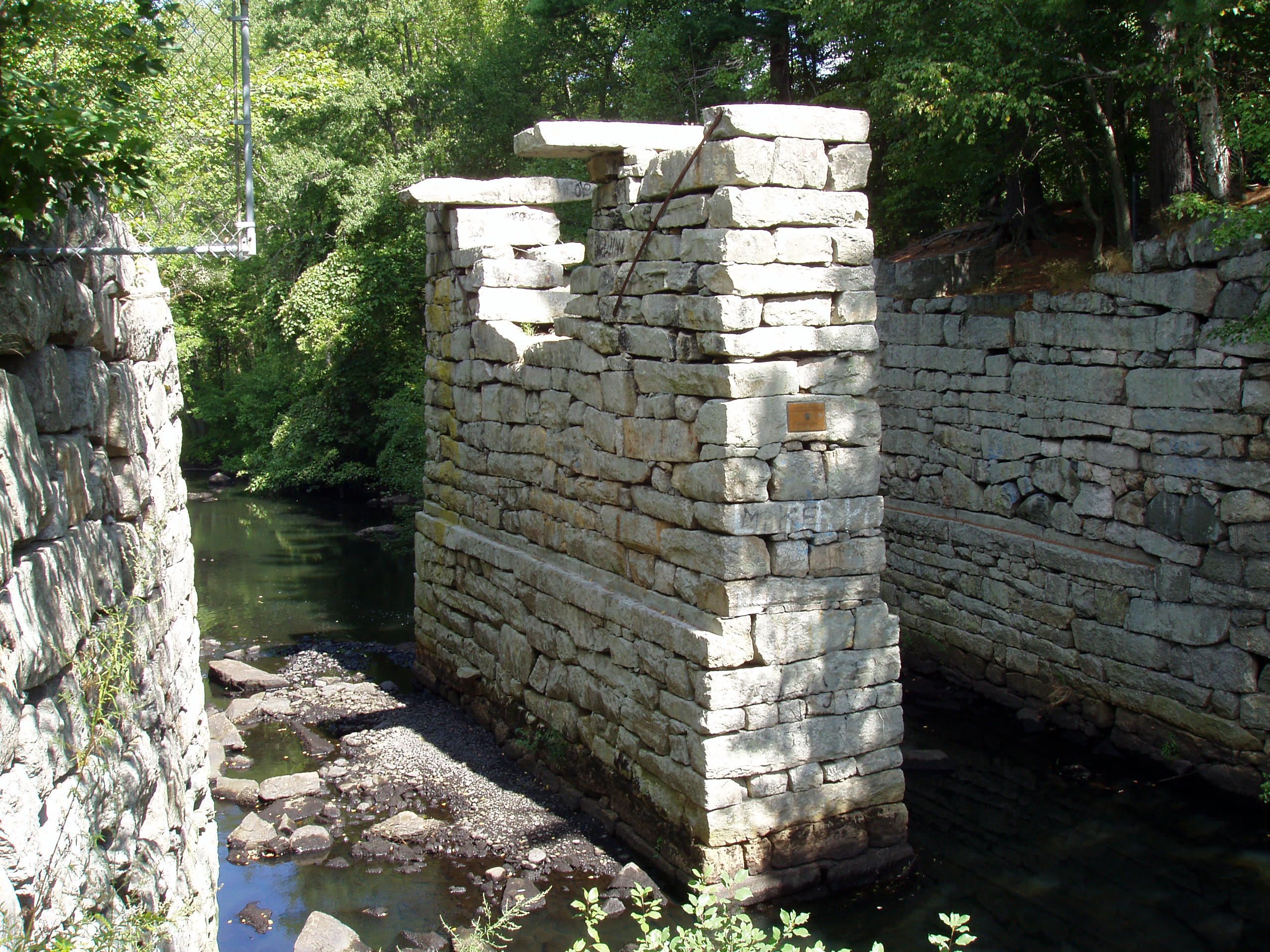
Medford Pipe Bridge |
 |
01990-01-18 January 18, 1990 |
Over the Mystic River, between S. Court St. and Mystic Valley Parkway.
42°25′6″N 71°6′44″W / 42.41833°N 71.11222°W / 42.41833; -71.11222 (Medford Pipe Bridge) |
|
| 18 |
Middlesex Canal Historic and Archaeological District |
 |
02009-11-19 November 19, 2009 |
Numerous locations along the historic route of the Middlesex Canal |
Extends into other Middlesex County communities and Boston in Suffolk County; encompasses Middlesex Canal and other listings. |
| 19 |
Middlesex Fells Reservation Parkways |
 |
02003-02-04 February 4, 2003 |
E Border Rd., Fellsway E, Fellsway W, Hillcrest Pky., South St., Pond St., S Border Rd., Ravine Rd., and Woodland Rd.
42°26′43″N 71°6′10″W / 42.44528°N 71.10278°W / 42.44528; -71.10278 (Middlesex Fells Reservation Parkways) |
Included roadways are in Medford, Stoneham,
and Winchester. |
| 20 |
Middlesex Fells Reservoirs Historic District |
 |
01990-01-18 January 18, 1990 |
Roughly bounded by Pond St., Woodland Rd., I-93, and MA 28
42°27′18″N 71°5′43″W / 42.455°N 71.09528°W / 42.455; -71.09528 (Middlesex Fells Reservoirs Historic District) |
Extends into Stoneham. |
| 21 |
Mystic Valley Parkway, Metropolitan Park System of Greater Boston MPS |
 |
02006-01-18 January 18, 2006 |
Mystic Valley Parkway
42°25′47″N 71°7′49″W / 42.42972°N 71.13028°W / 42.42972; -71.13028 (Mystic Valley Parkway, Metropolitan Park System of Greater Boston MPS) |
Runs through Arlington,
Medford, Somerville,
and Winchester. |
| 22 |
Edward Oakes House |
 |
01980-04-09 April 9, 1980 |
5 Sylvia Rd.
42°24′43″N 71°6′39″W / 42.41194°N 71.11083°W / 42.41194; -71.11083 (Oakes, Edward, House) |
|
| 23 |
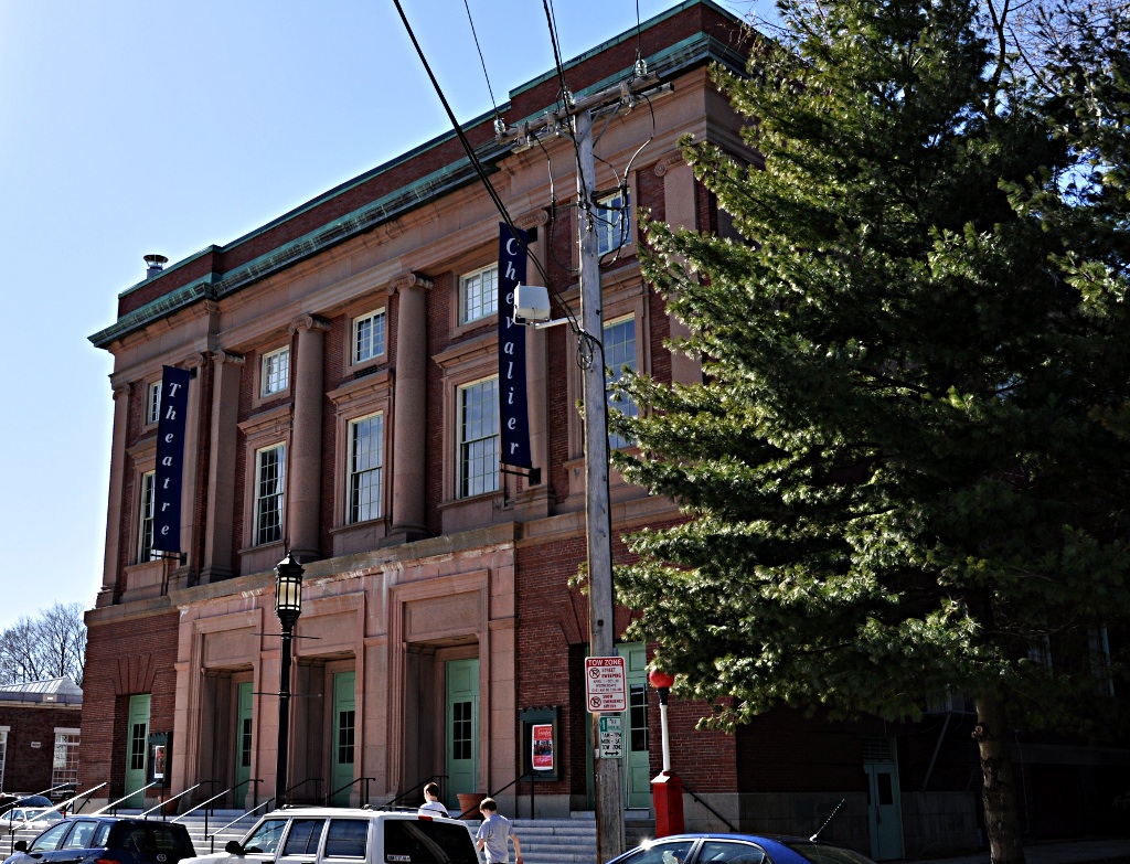
Old Medford High School |
 |
01983-10-06 October 6, 1983 |
22-24 Forest St.
42°25′15″N 71°6′32″W / 42.42083°N 71.10889°W / 42.42083; -71.10889 (Old Medford High School) |
Now houses condominiums and a community theater. |
| 24 |
Old Ship Street Historic District |
 |
01975-04-14 April 14, 1975 |
Both sides of Pleasant St. from Riverside Ave. to Park St.
42°24′59″N 71°6′6″W / 42.41639°N 71.10167°W / 42.41639; -71.10167 (Old Ship Street Historic District) |
|
| 25 |
Park Street Railroad Station |
 |
01975-04-21 April 21, 1975 |
20 Magoun Ave.
42°24′58″N 71°5′56″W / 42.41611°N 71.09889°W / 42.41611; -71.09889 (Park Street Railroad Station) |
Now houses a community service organization. |
| 26 |
Richard Pinkham House |
 |
02008-01-16 January 16, 2008 |
24 Brooks Park
42°24′43″N 71°6′35″W / 42.41194°N 71.10972°W / 42.41194; -71.10972 (Pinkham, Richard, House) |
|
| 27 |
Revere Beach Parkway-Metropolitan Park System of Greater Boston |
 |
02007-12-06 December 6, 2007 |
Revere Beach Pkwy
42°24′15.79″N 71°1′49.3″W / 42.4043861°N 71.030361°W / 42.4043861; -71.030361 (Revere Beach Parkway-Metropolitan Park System of Greater Boston) |
Extends into Everett and Chelsea |
| 28 |
Isaac Royall House |
 |
01966-10-15 October 15, 1966 |
15 George St.
42°24′43″N 71°6′44″W / 42.41194°N 71.11222°W / 42.41194; -71.11222 (Royall, Isaac, House) |
|
| 29 |
Salem Street Burying Ground |
 |
01981-08-27 August 27, 1981 |
Medford Sq.
42°25′5.42″N 71°6′27.41″W / 42.4181722°N 71.1076139°W / 42.4181722; -71.1076139 (Salem Street Burying Ground) |
|
| 30 |
Peter Tufts House |
 |
01968-11-24 November 24, 1968 |
350 Riverside Ave.
42°24′40″N 71°5′39″W / 42.41111°N 71.09417°W / 42.41111; -71.09417 (Tufts, Peter, House) |
|
| 31 |
Unitarian Universalist Church and Parsonage |
 |
01975-04-21 April 21, 1975 |
141 and 147 High St.
42°25′13″N 71°6′55″W / 42.42028°N 71.11528°W / 42.42028; -71.11528 (Unitarian Universalist Church and Parsonage) |
|
| 32 |
US Post Office-Medford Main |
 |
01986-06-18 June 18, 1986 |
20 Forest St.
42°25′8″N 71°6′36″W / 42.41889°N 71.11°W / 42.41889; -71.11 (US Post Office-Medford Main) |
|
| 33 |
John Wade House |
 |
01975-06-18 June 18, 1975 |
253 High St.
42°25′15″N 71°7′18″W / 42.42083°N 71.12167°W / 42.42083; -71.12167 (Wade, John, House) |
|
| 34 |
Jonathan Wade House |
 |
01975-04-21 April 21, 1975 |
13 Bradlee Rd.
42°25′8″N 71°6′39″W / 42.41889°N 71.11083°W / 42.41889; -71.11083 (Wade, Jonathan, House) |
|
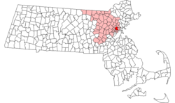 Location of Medford in Massachusetts