| [3] |
Landmark name[4] |
Image |
Date listed |
Location |
Neighborhood[5] |
Summary |
| 1 |
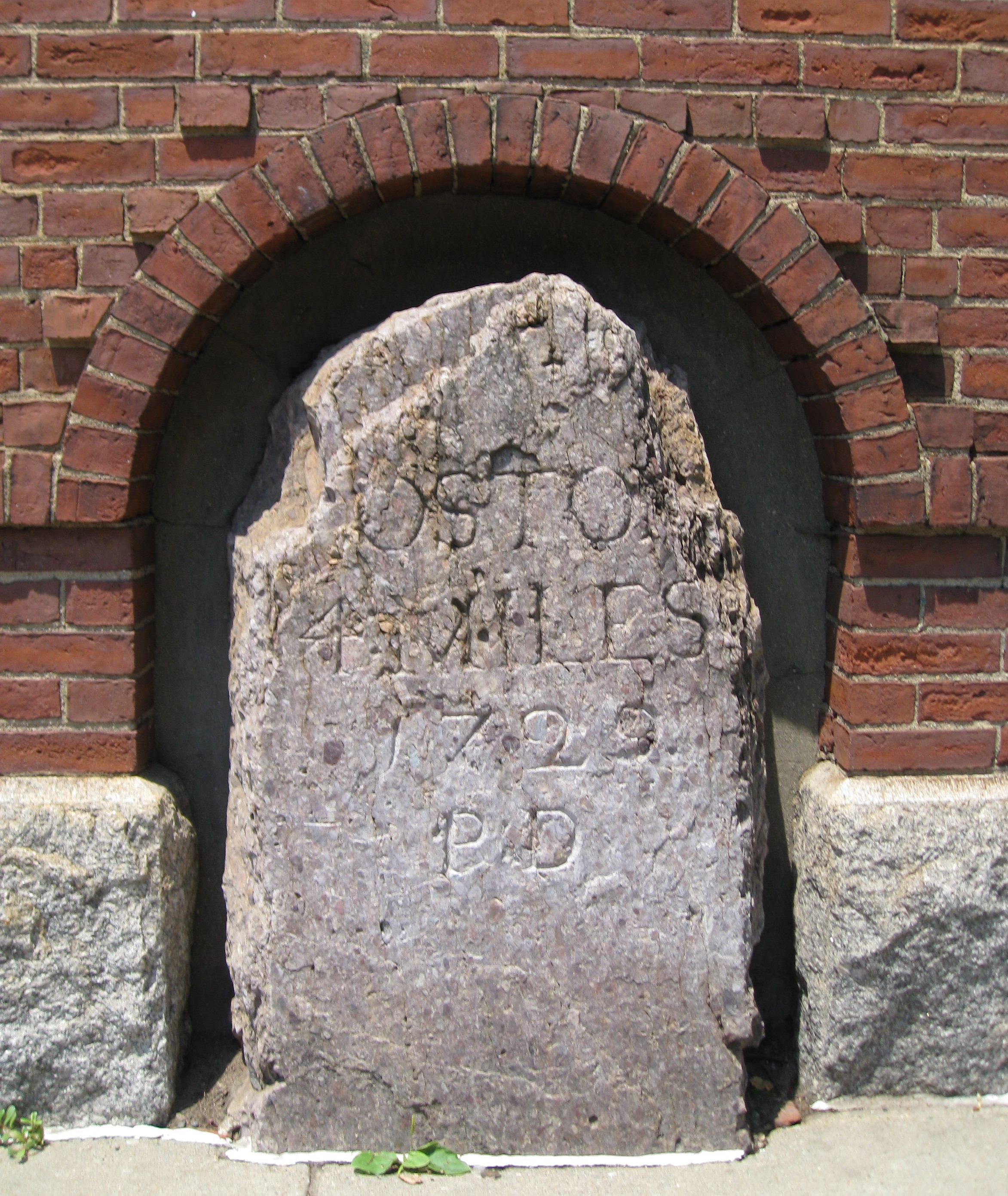
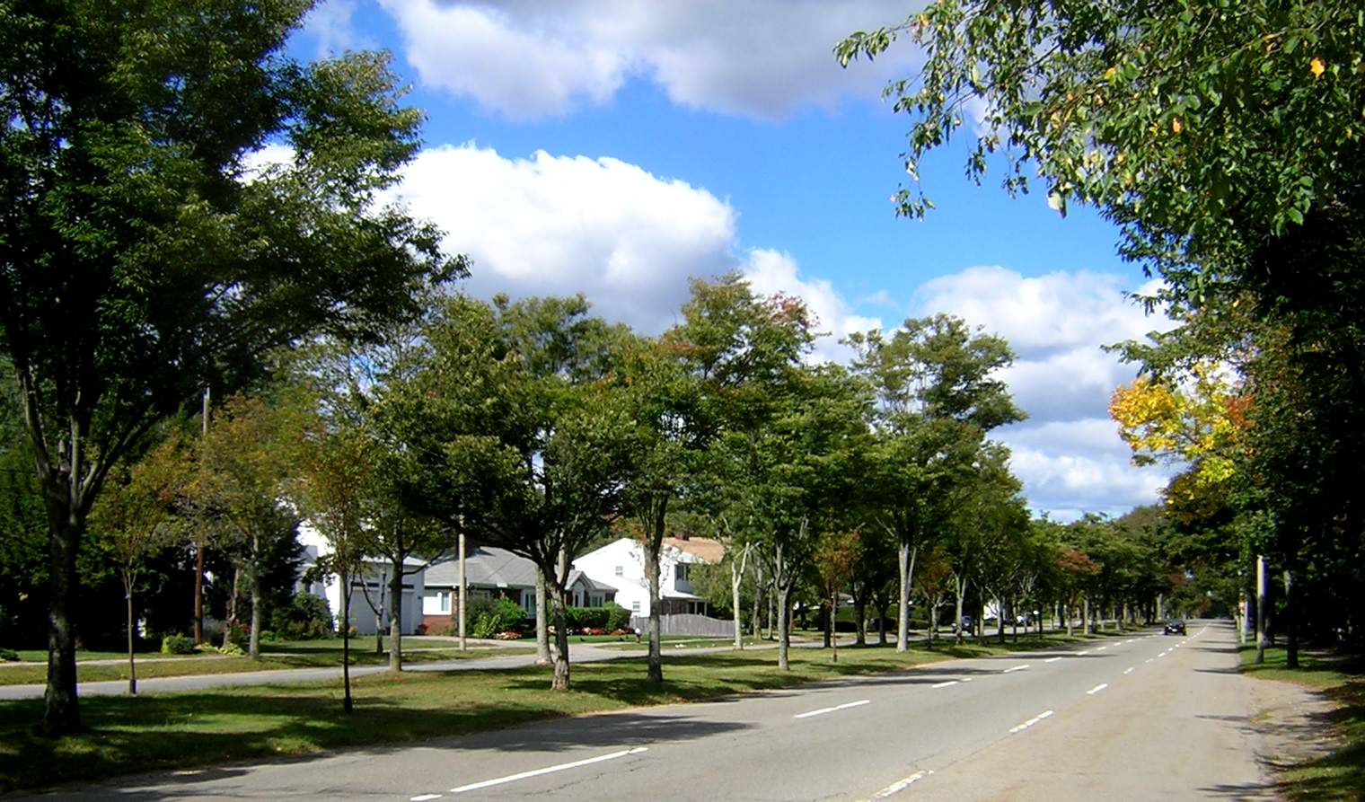
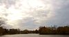
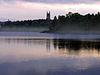
1767 Milestones |
 |
01971-04-07 April 7, 1971 |
Between Boston and Springfield along Old Post Rd.
42°19′48″N 71°5′29″W / 42.33°N 71.09139°W / 42.33; -71.09139 (1767 Milestones) |
multiple |
Extends into Hampden, Middlesex, and Worcester counties |
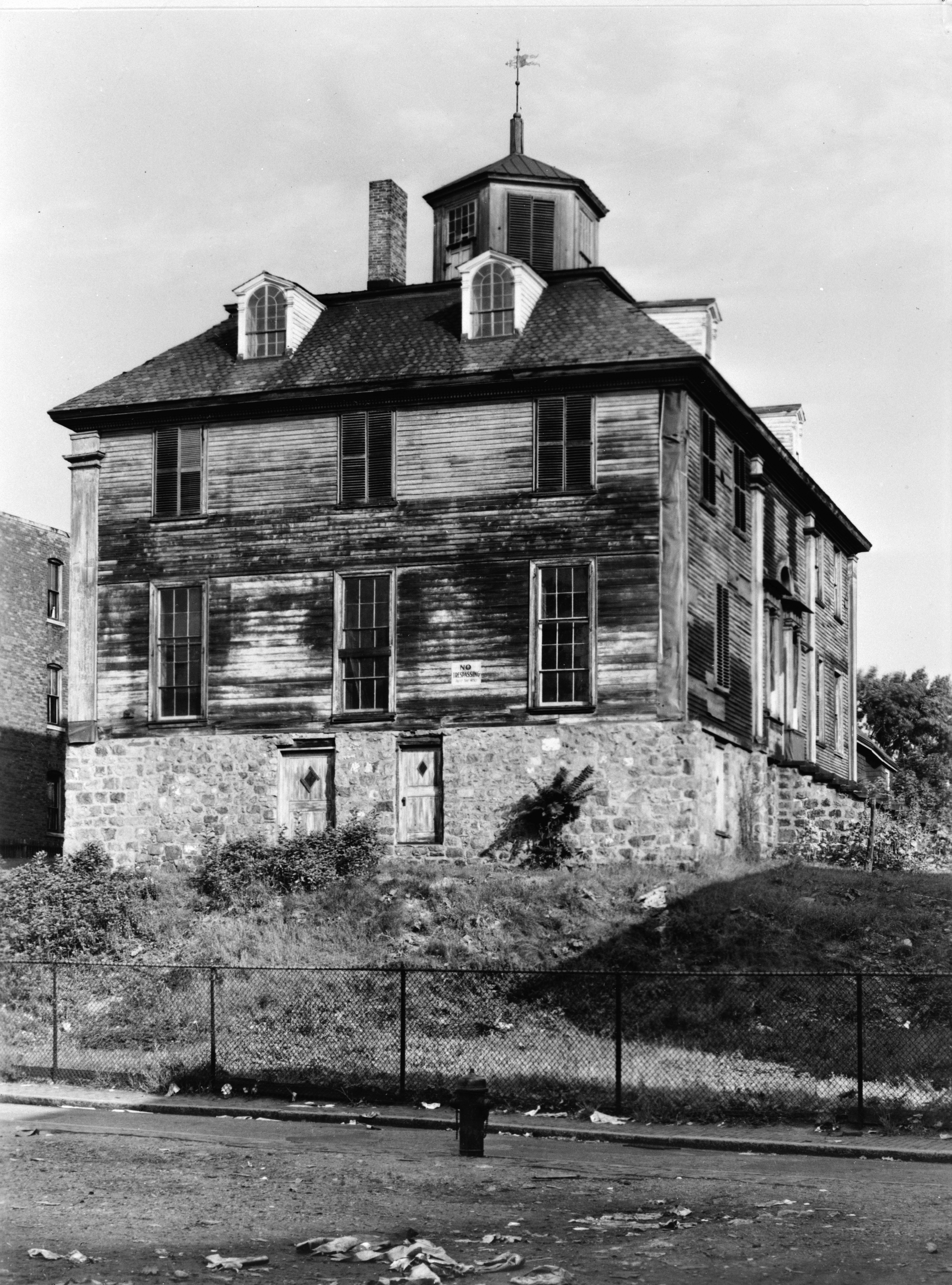
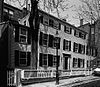
| 2 |
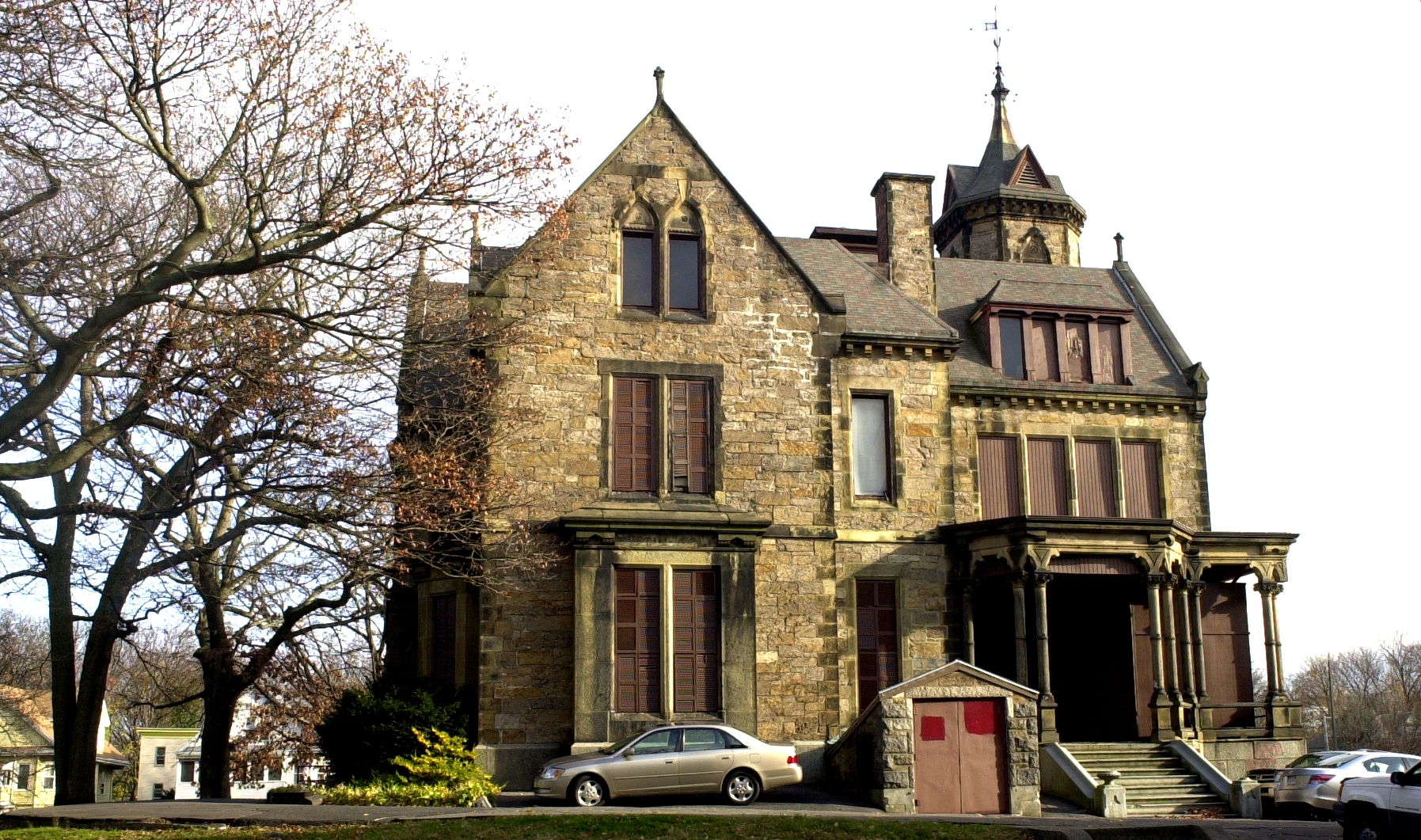
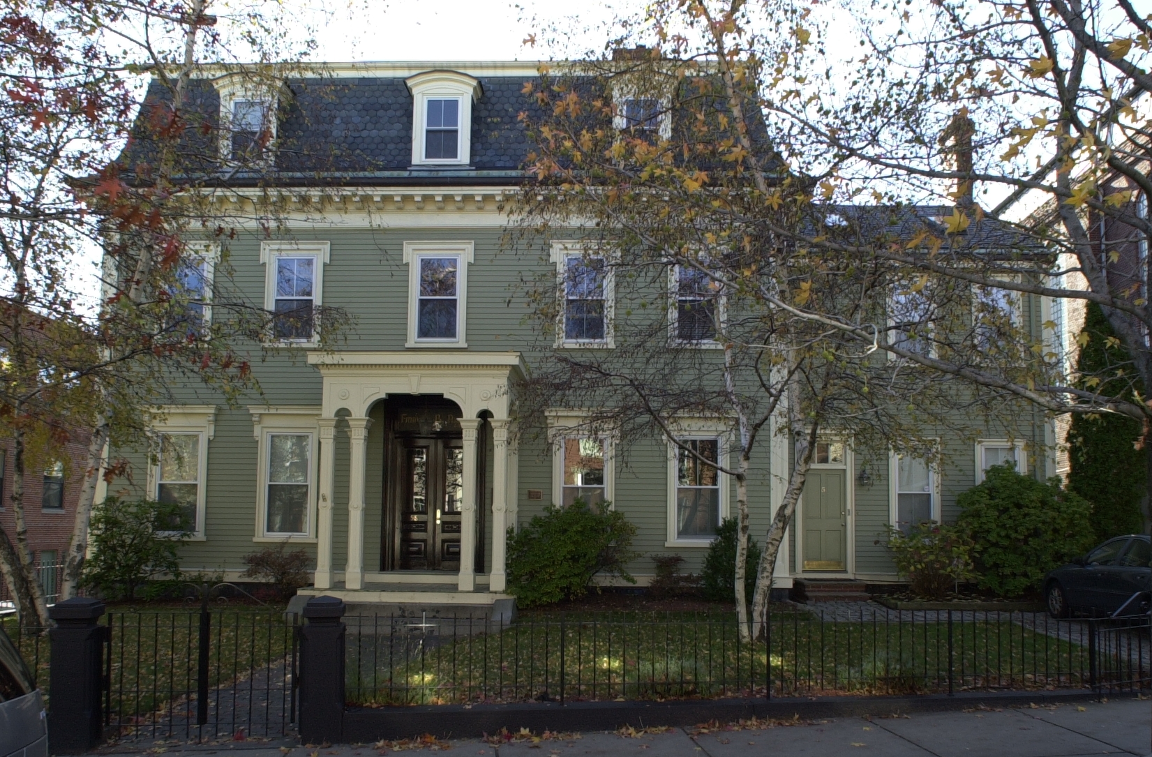
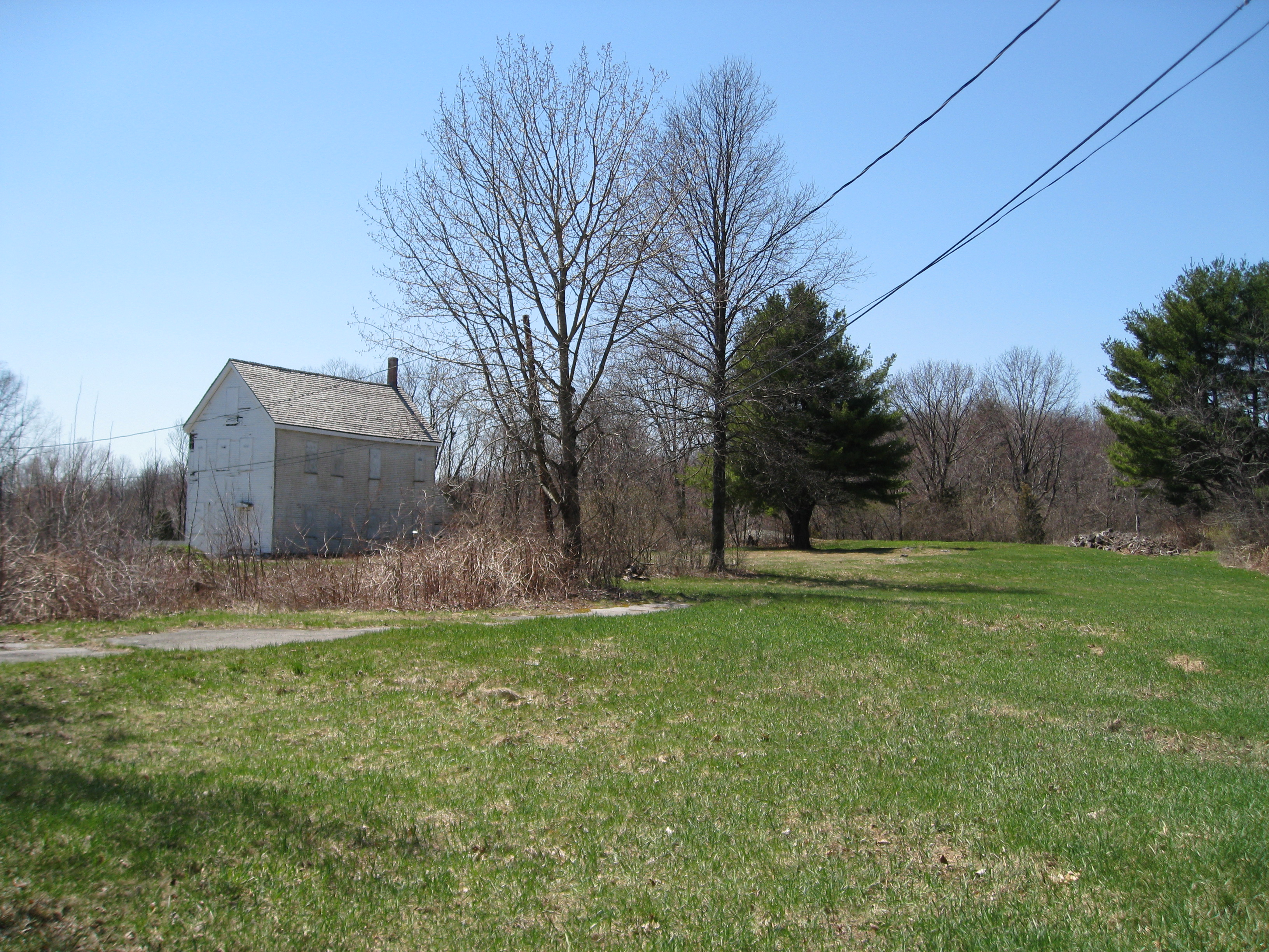
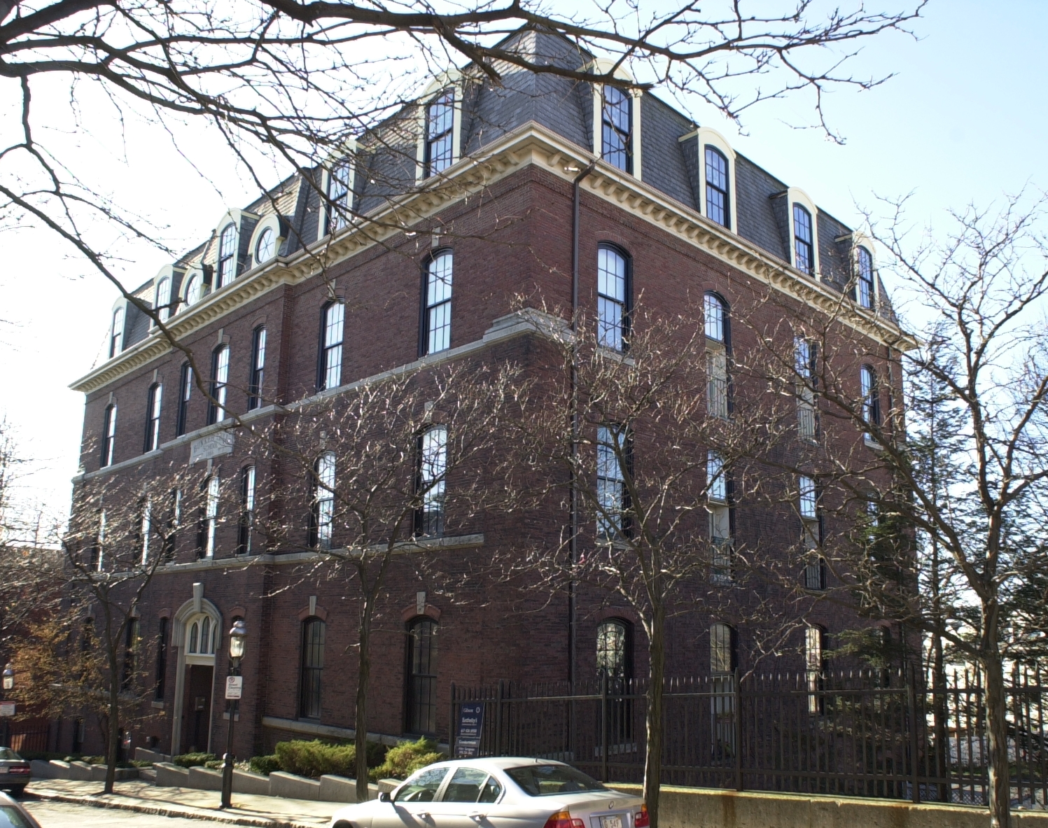
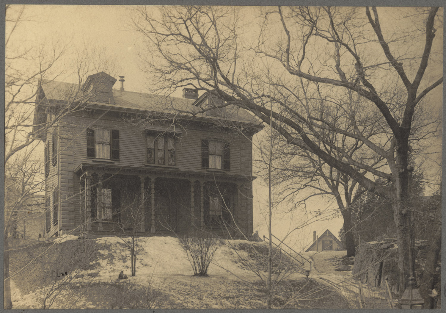
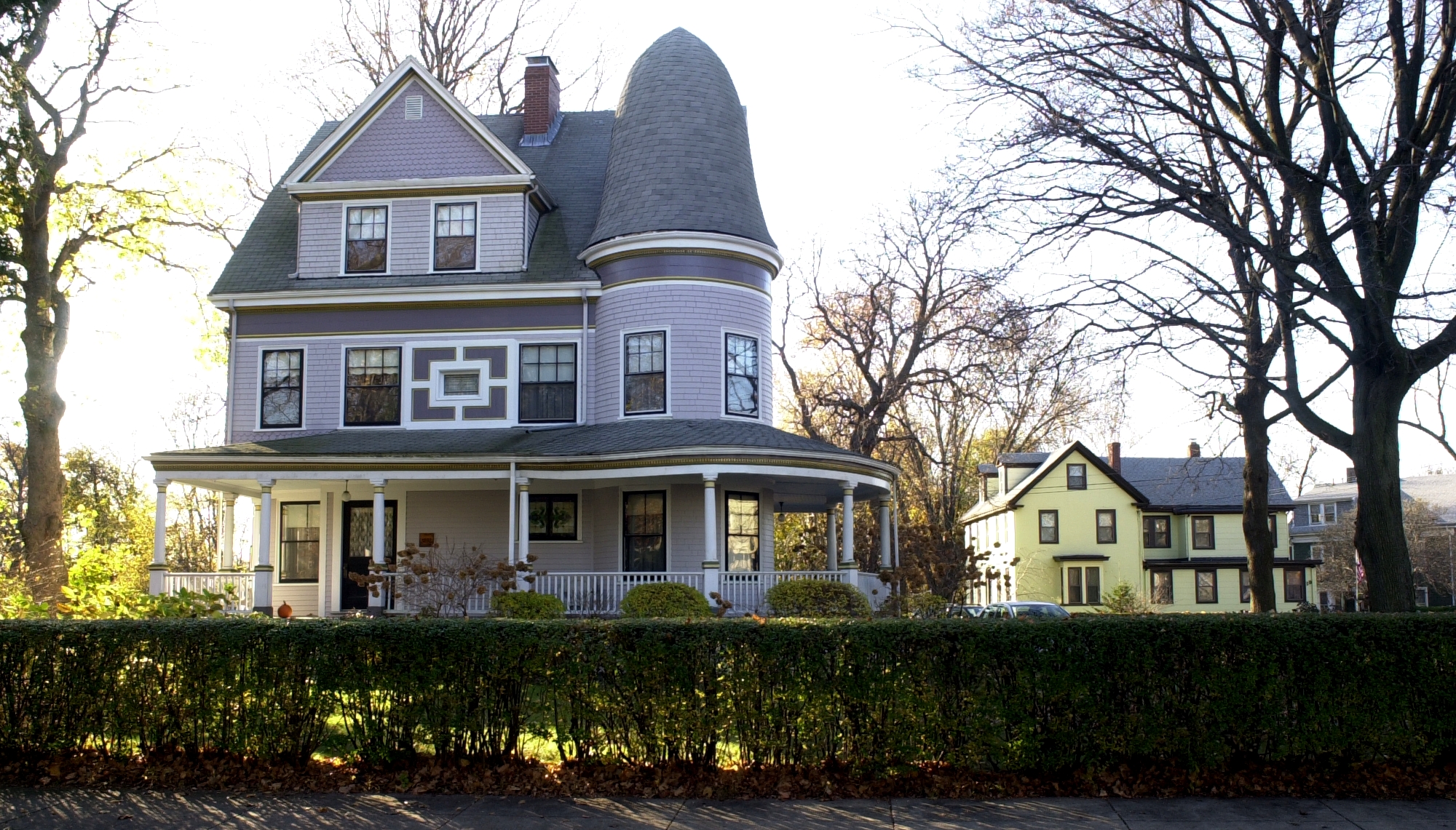
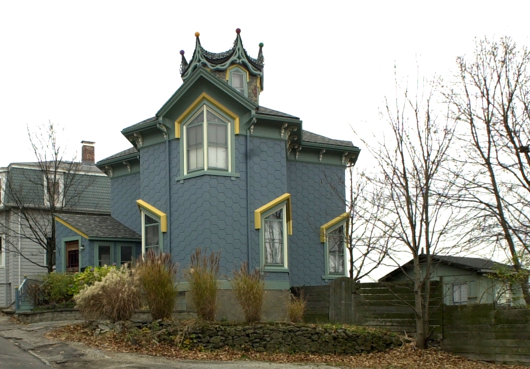
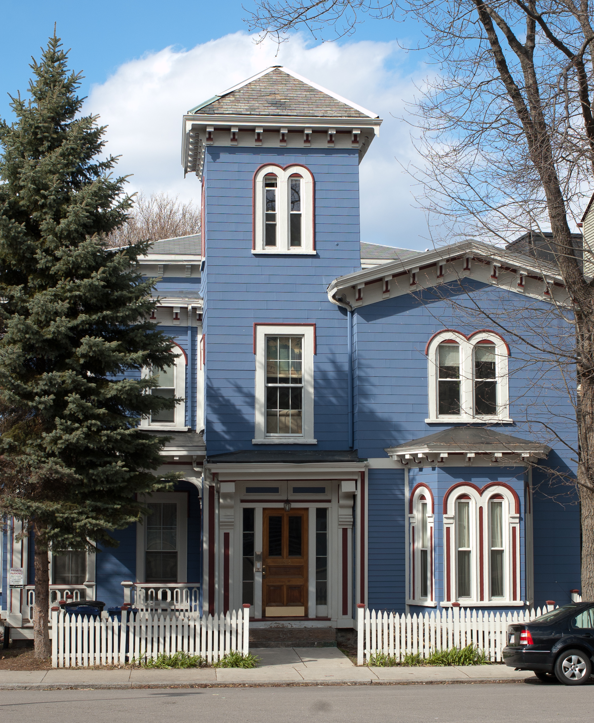
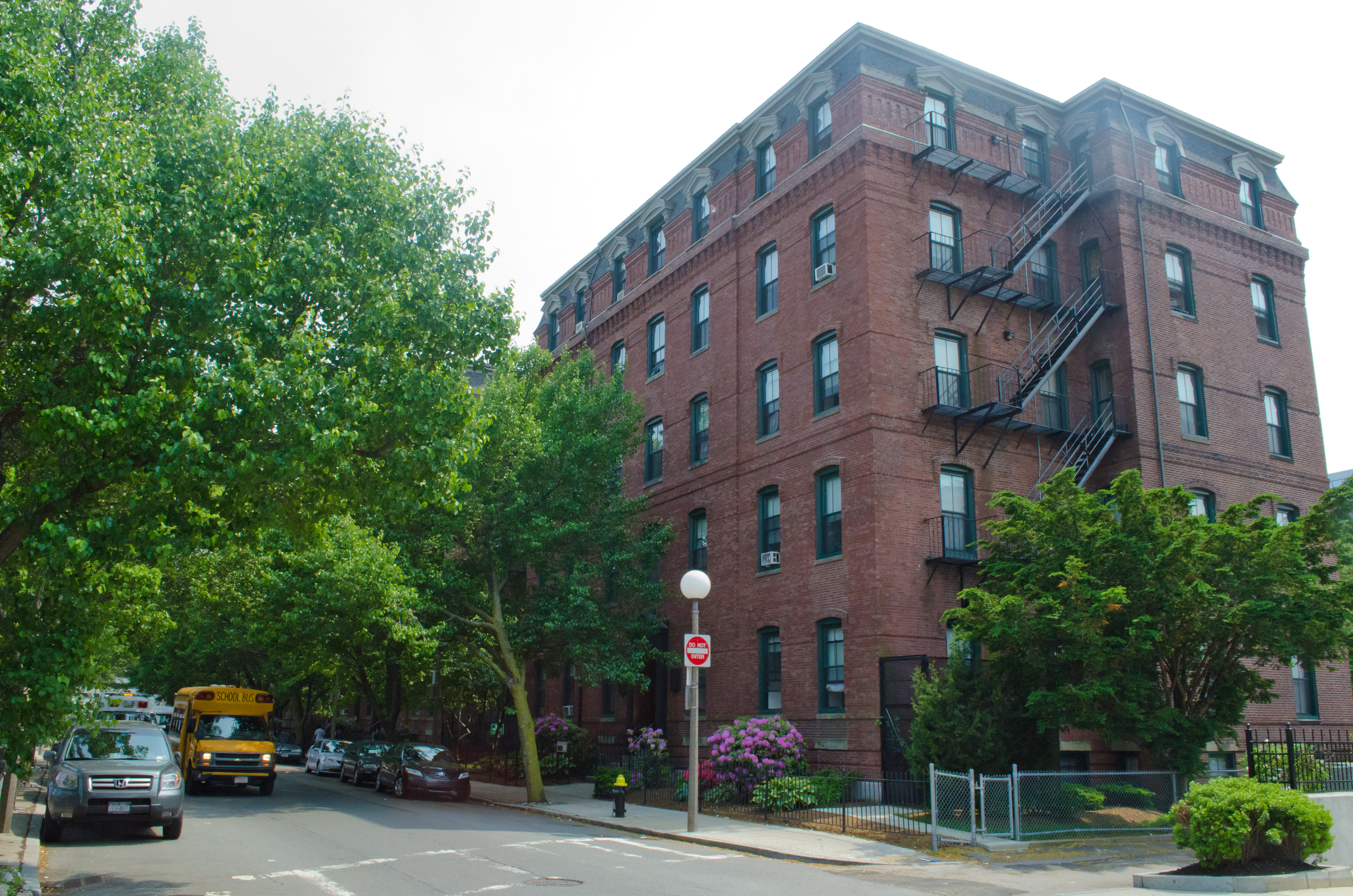
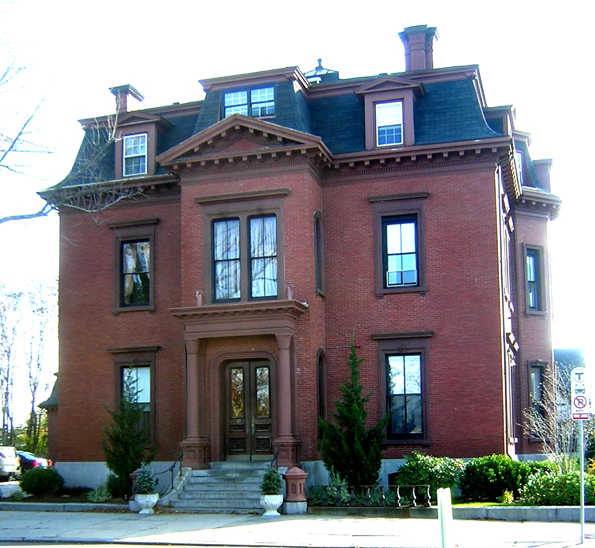
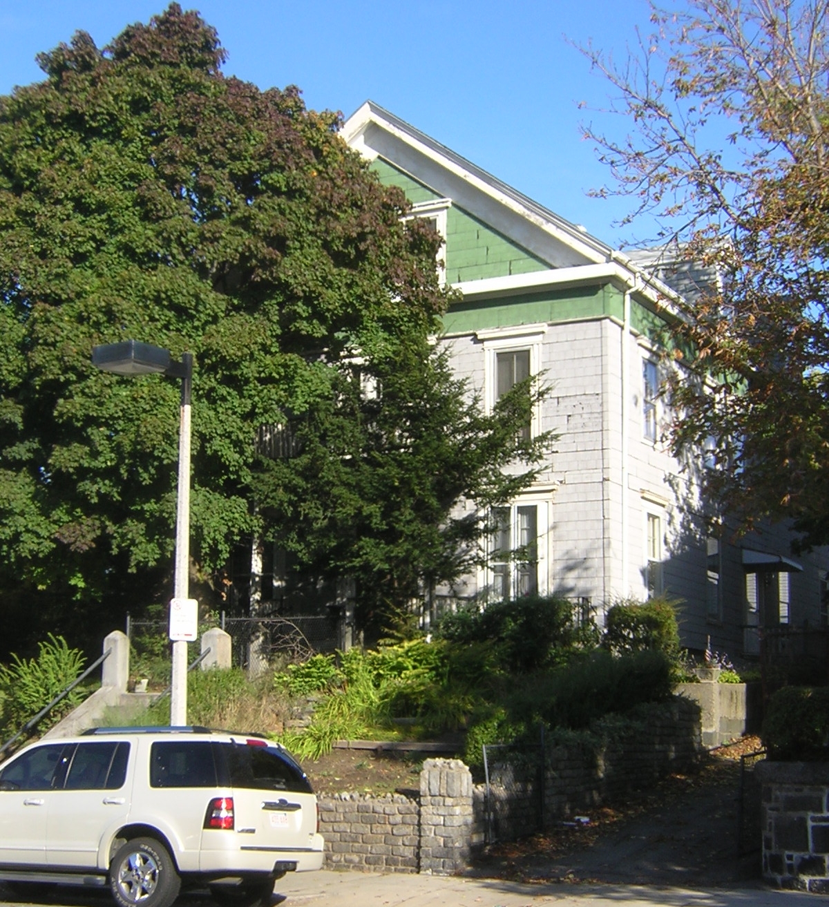
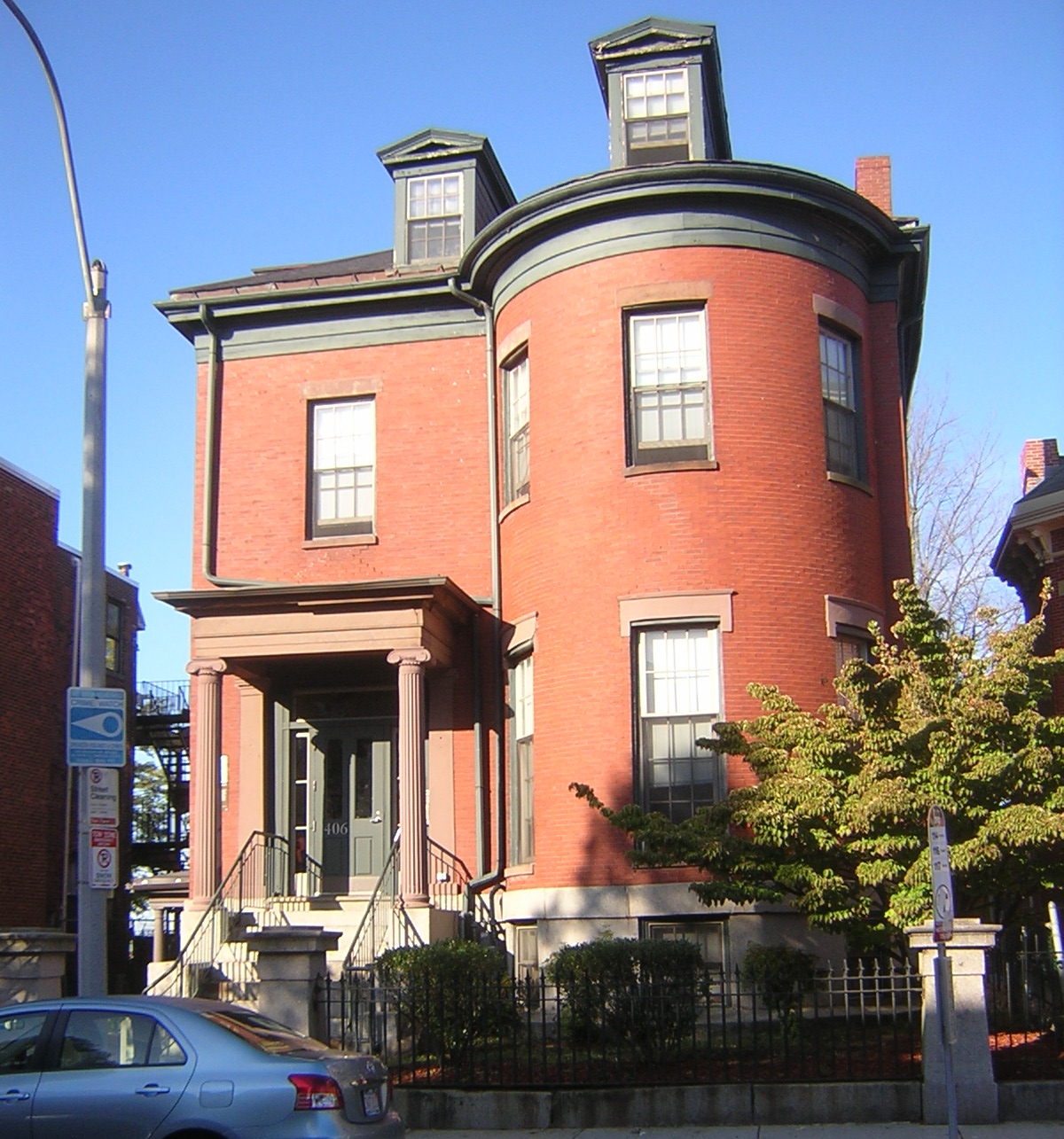
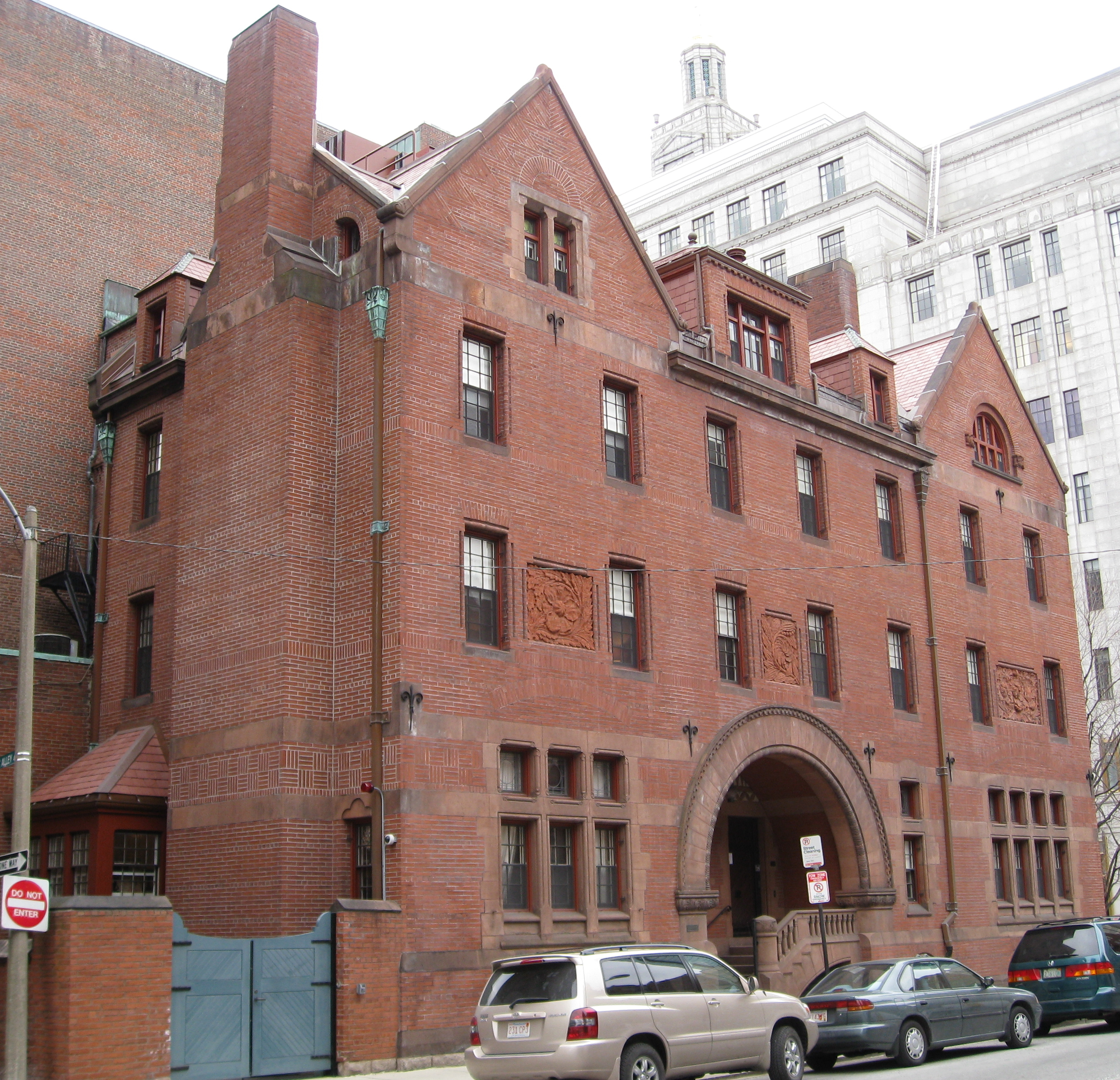
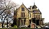
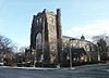
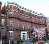
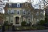
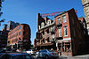
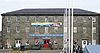
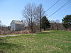
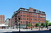
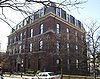
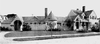
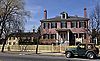
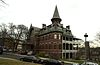
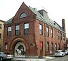
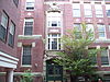
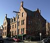
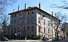
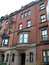
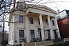
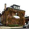
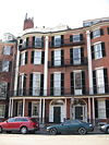
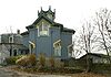
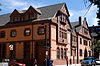
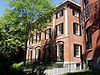
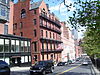
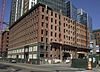
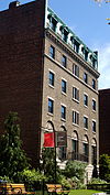
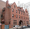
Abbotsford |
 |
01987-09-16 September 16, 1987 |
300 Walnut Ave.
42°18′58″N 71°5′35″W / 42.31611°N 71.09306°W / 42.31611; -71.09306 (Abbotsford) |
Roxbury |
|
| 3 |
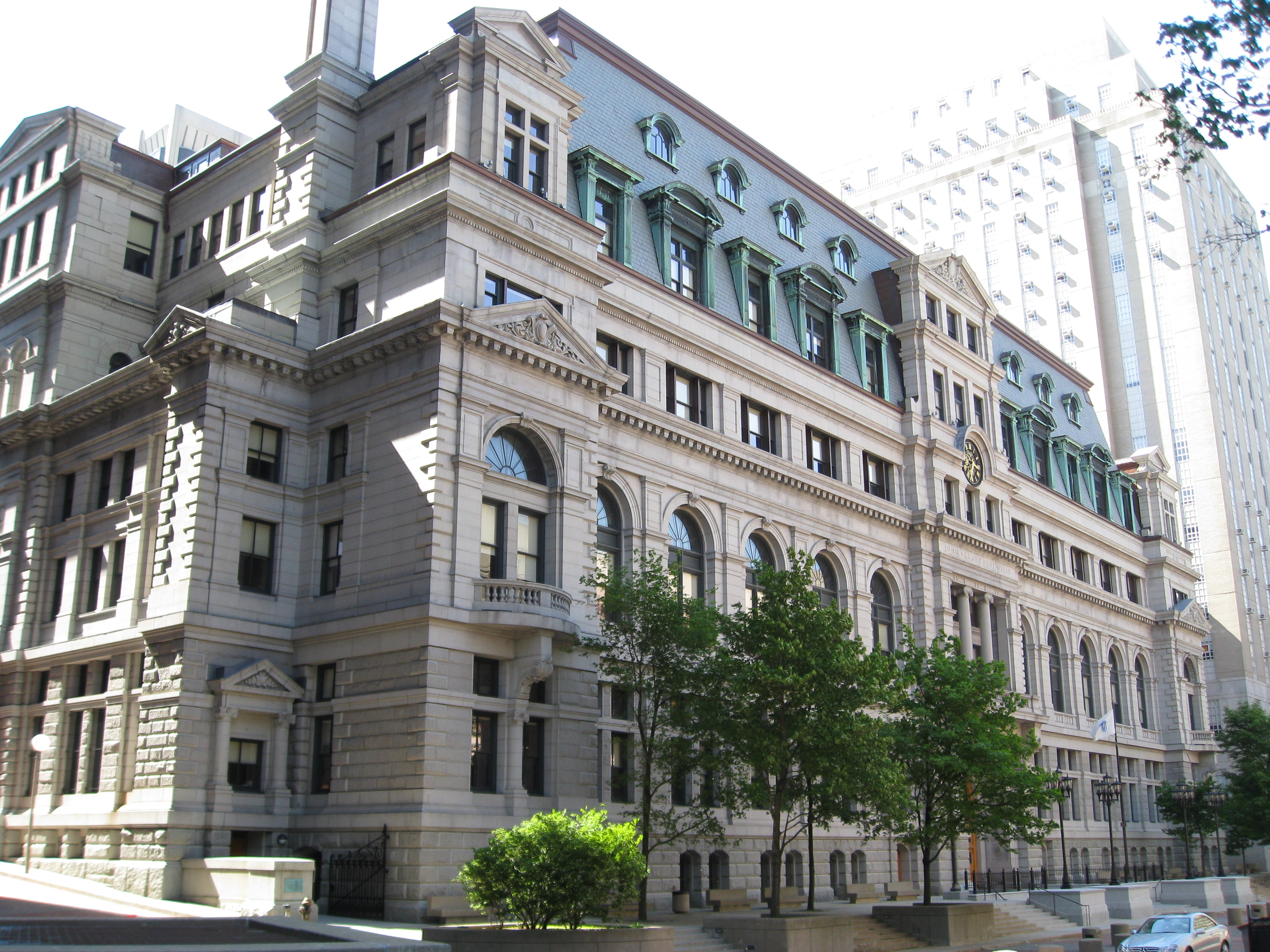
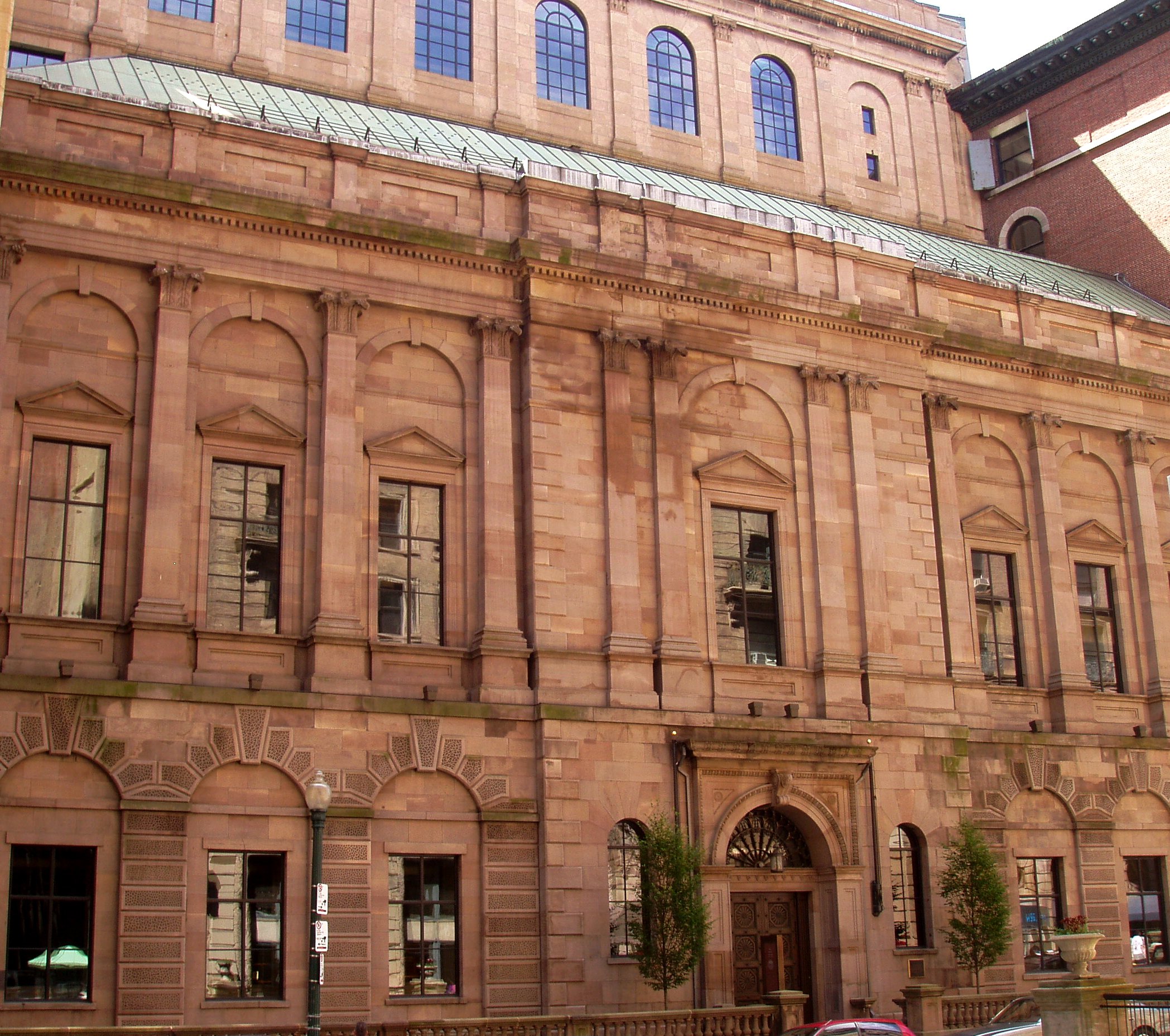
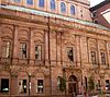
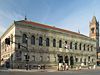
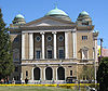
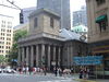
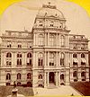
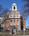
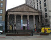
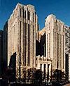
John Adams Courthouse |
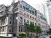 |
01974-05-08 May 8, 1974 |
Pemberton Sq.
42°21′33″N 71°3′42″W / 42.35917°N 71.06167°W / 42.35917; -71.06167 (Suffolk County Courthouse) |
Downtown |
|
| 4 |
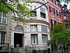
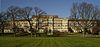
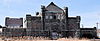
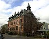
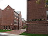
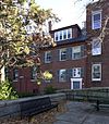
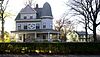
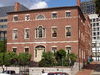
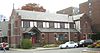
Adams-Nervine Asylum |
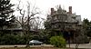 |
01982-06-01 June 1, 1982 |
990-1020 Centre St.
42°18′13″N 71°7′31″W / 42.30361°N 71.12528°W / 42.30361; -71.12528 (Adams-Nervine Asylum) |
Jamaica Plain |
|
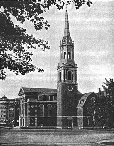
| 5 |
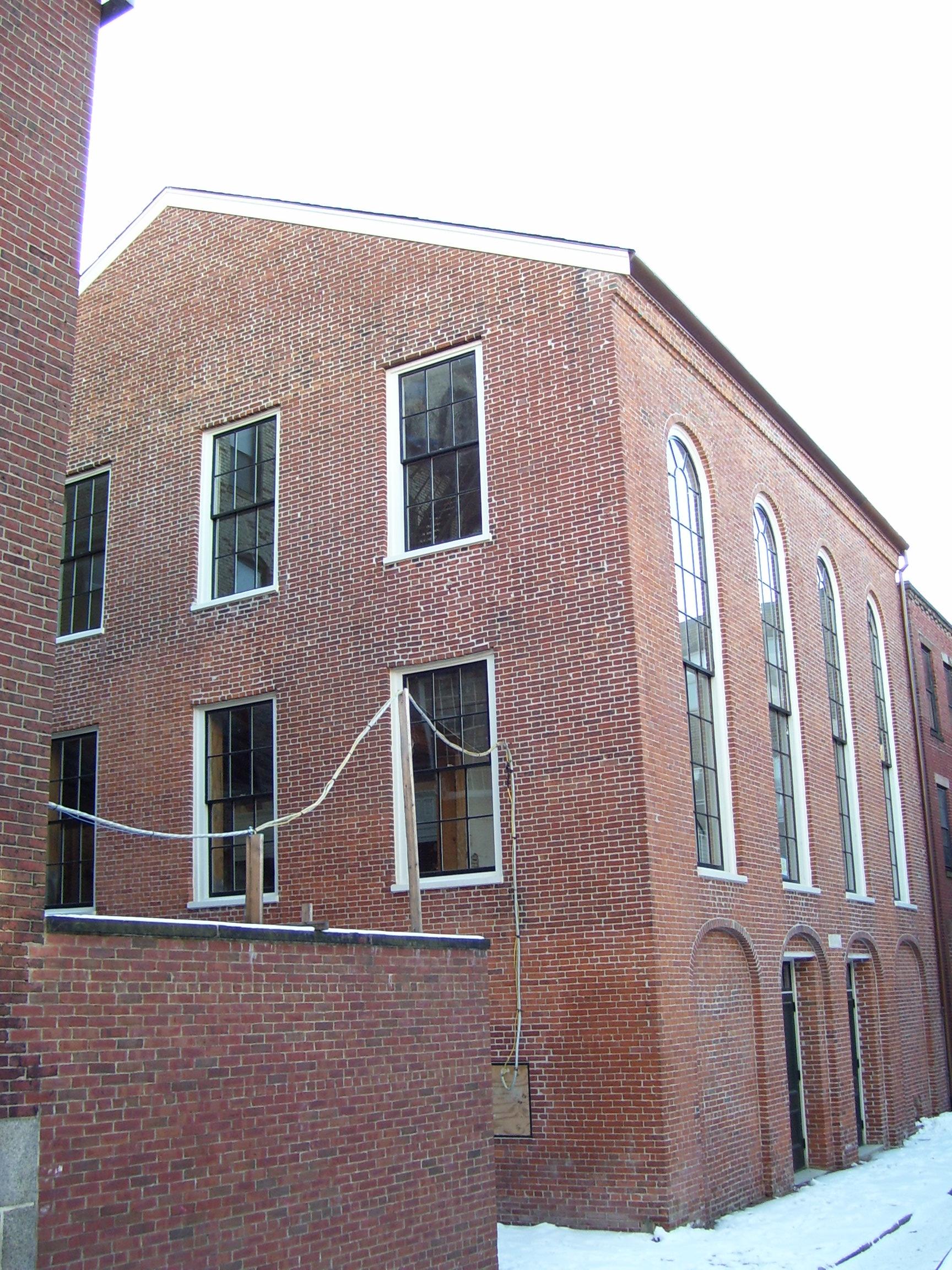
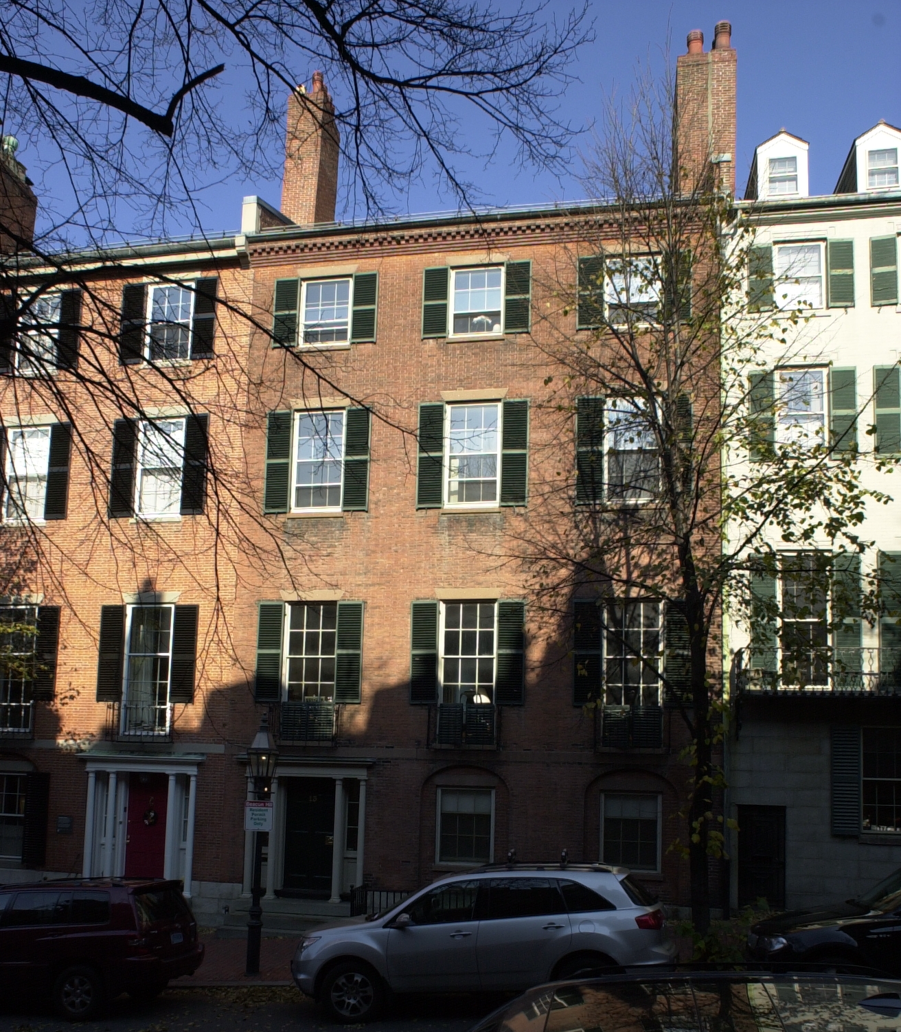
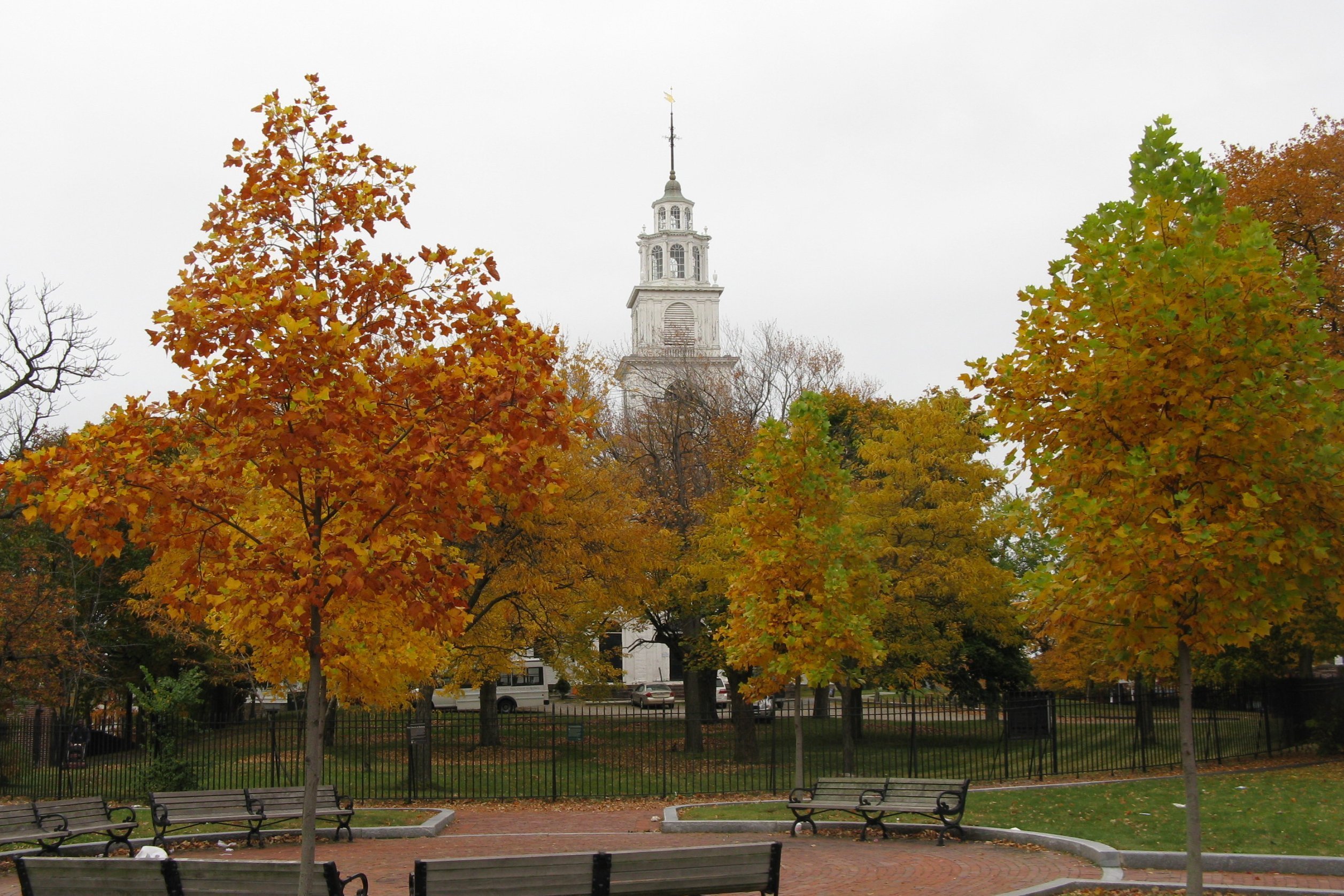
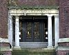
African Meetinghouse |
 |
01971-10-07 October 7, 1971 |
8 Smith St.
42°21′35″N 71°3′57″W / 42.35972°N 71.06583°W / 42.35972; -71.06583 (African Meetinghouse) |
Beacon Hill |
|
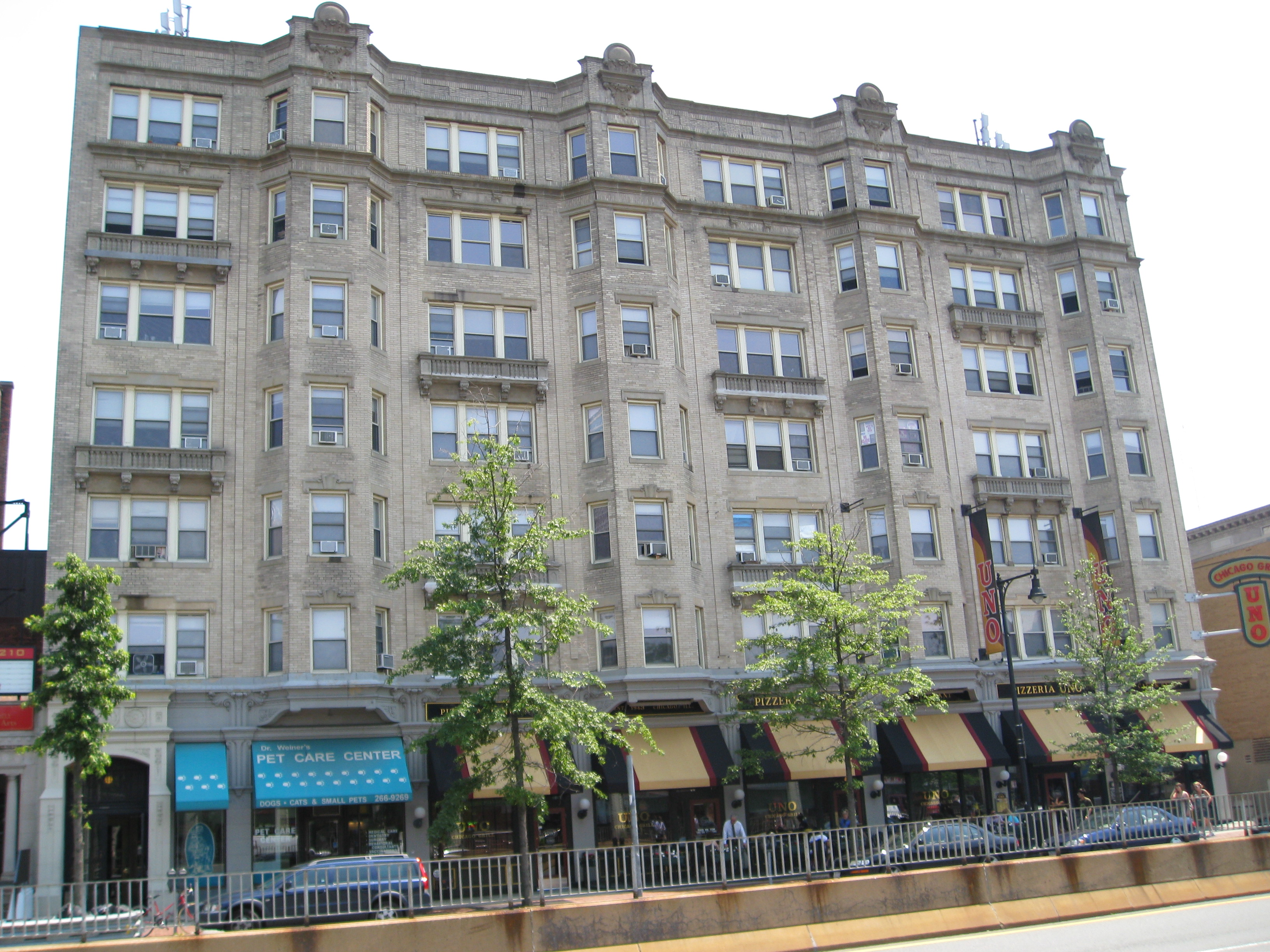
| 6 |
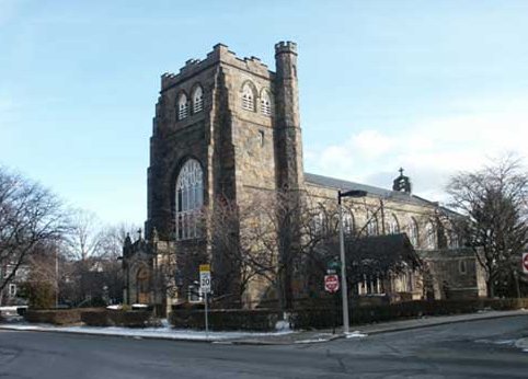
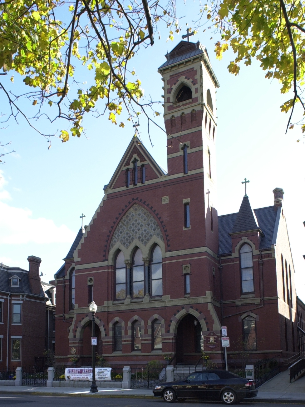
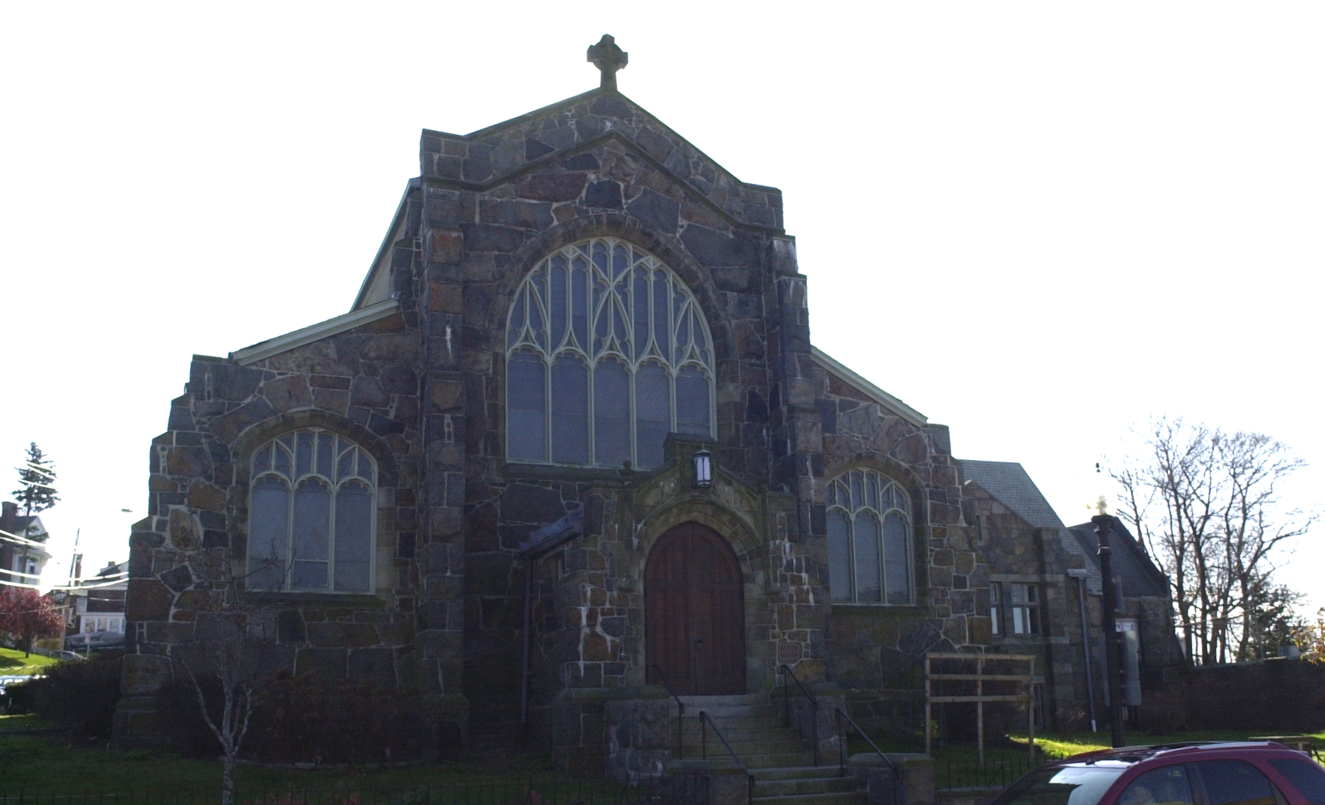
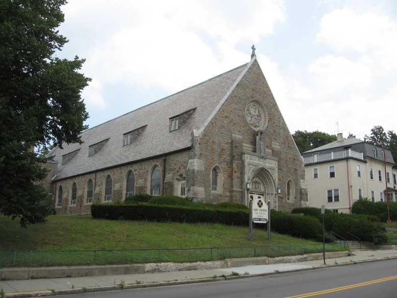
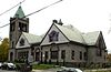
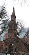
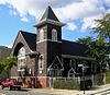
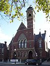
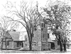
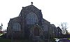
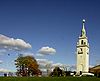
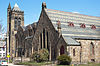
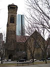
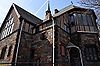
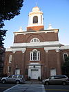
All Saints' Church |
 |
01980-06-16 June 16, 1980 |
211 Ashmont St.
42°17′9″N 71°3′48″W / 42.28583°N 71.06333°W / 42.28583; -71.06333 (All Saints' Church) |
Dorchester |
|
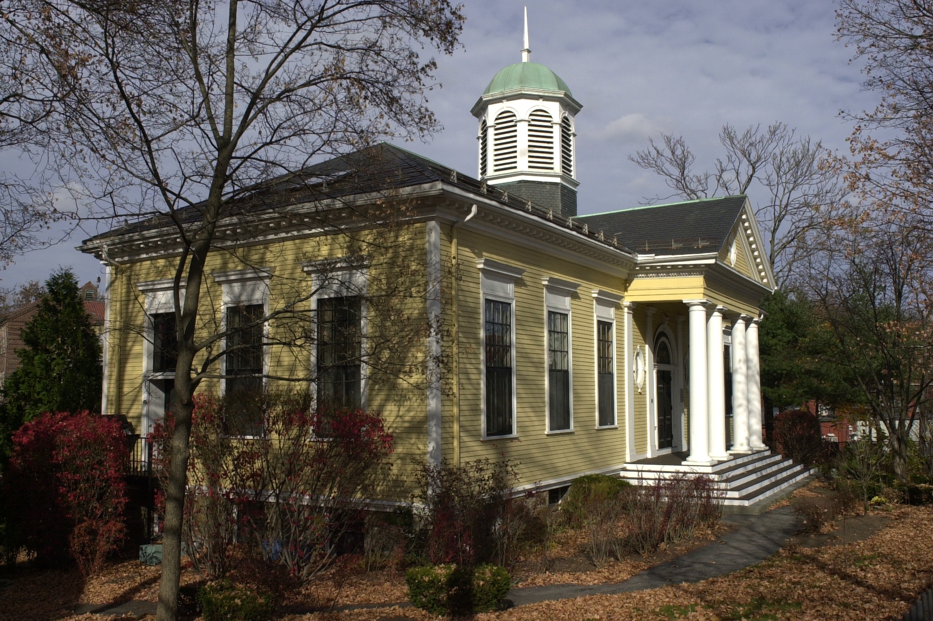
| 7 |
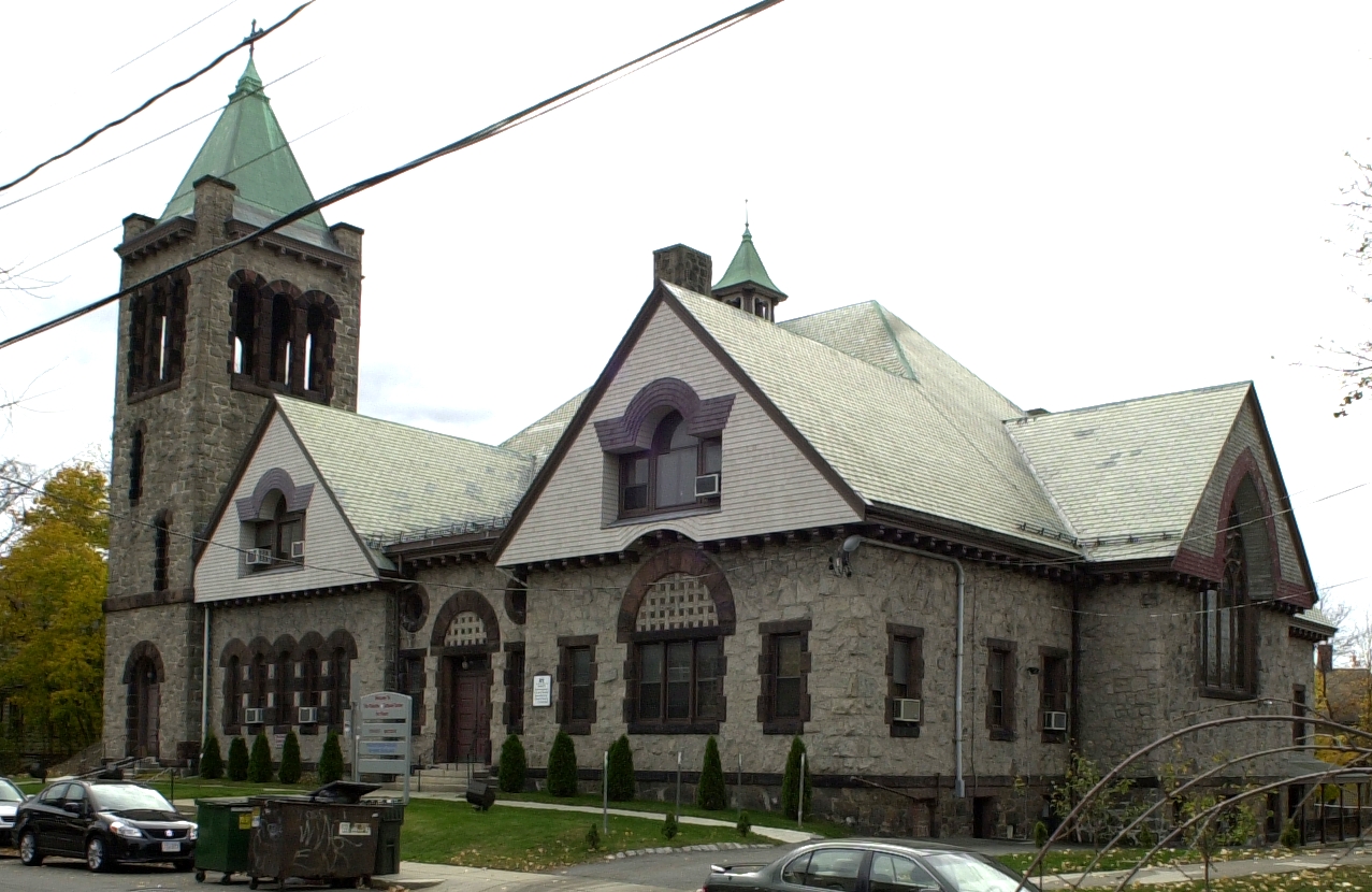
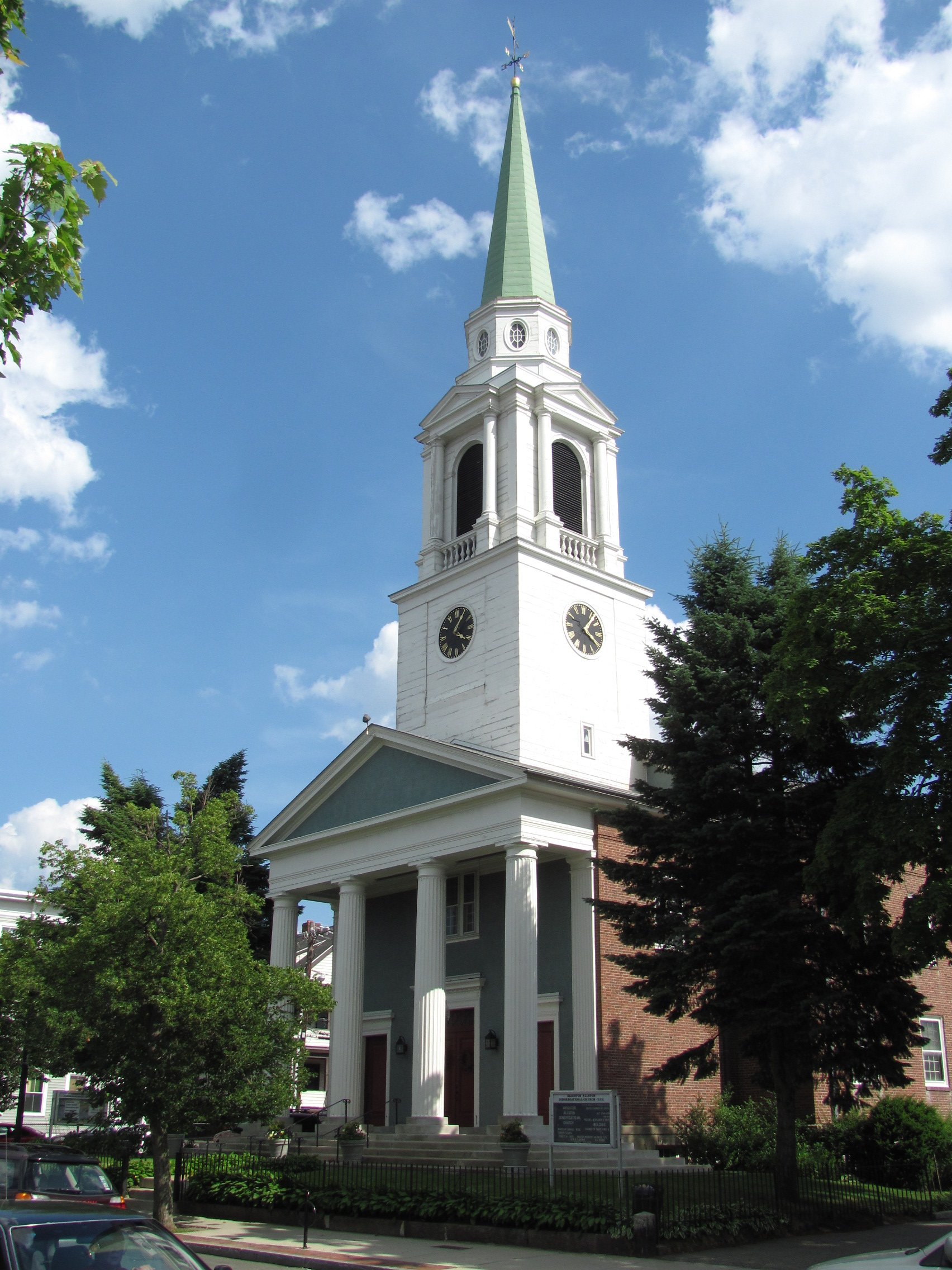
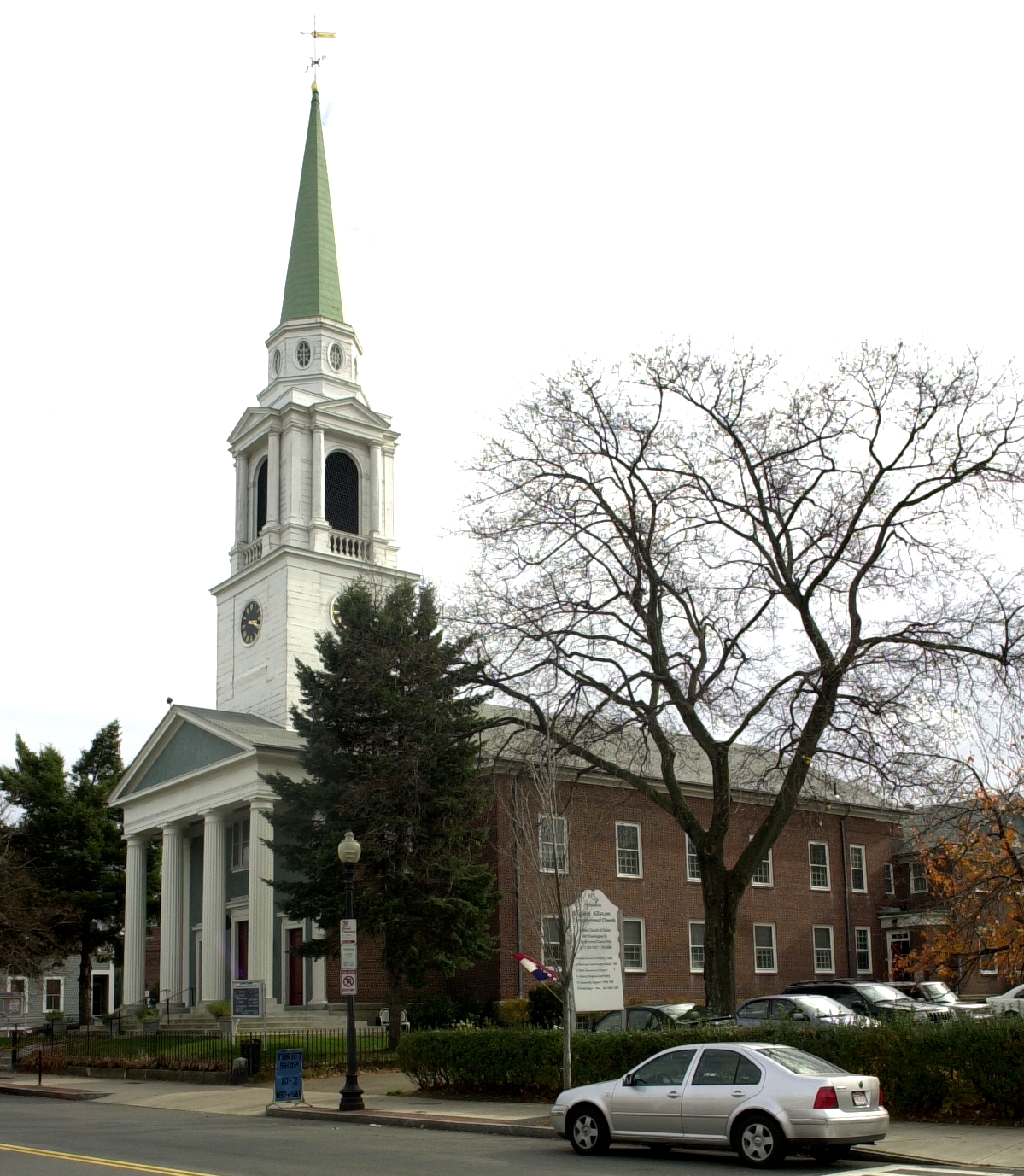
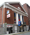
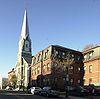
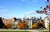
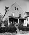
Allston Congregational Church |
 |
01997-11-07 November 7, 1997 |
31-41 Quint Ave.
42°21′6″N 71°8′5″W / 42.35167°N 71.13472°W / 42.35167; -71.13472 (Allston Congregational Church) |
Allston |
|
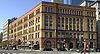
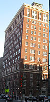
| 8 |
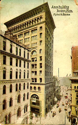
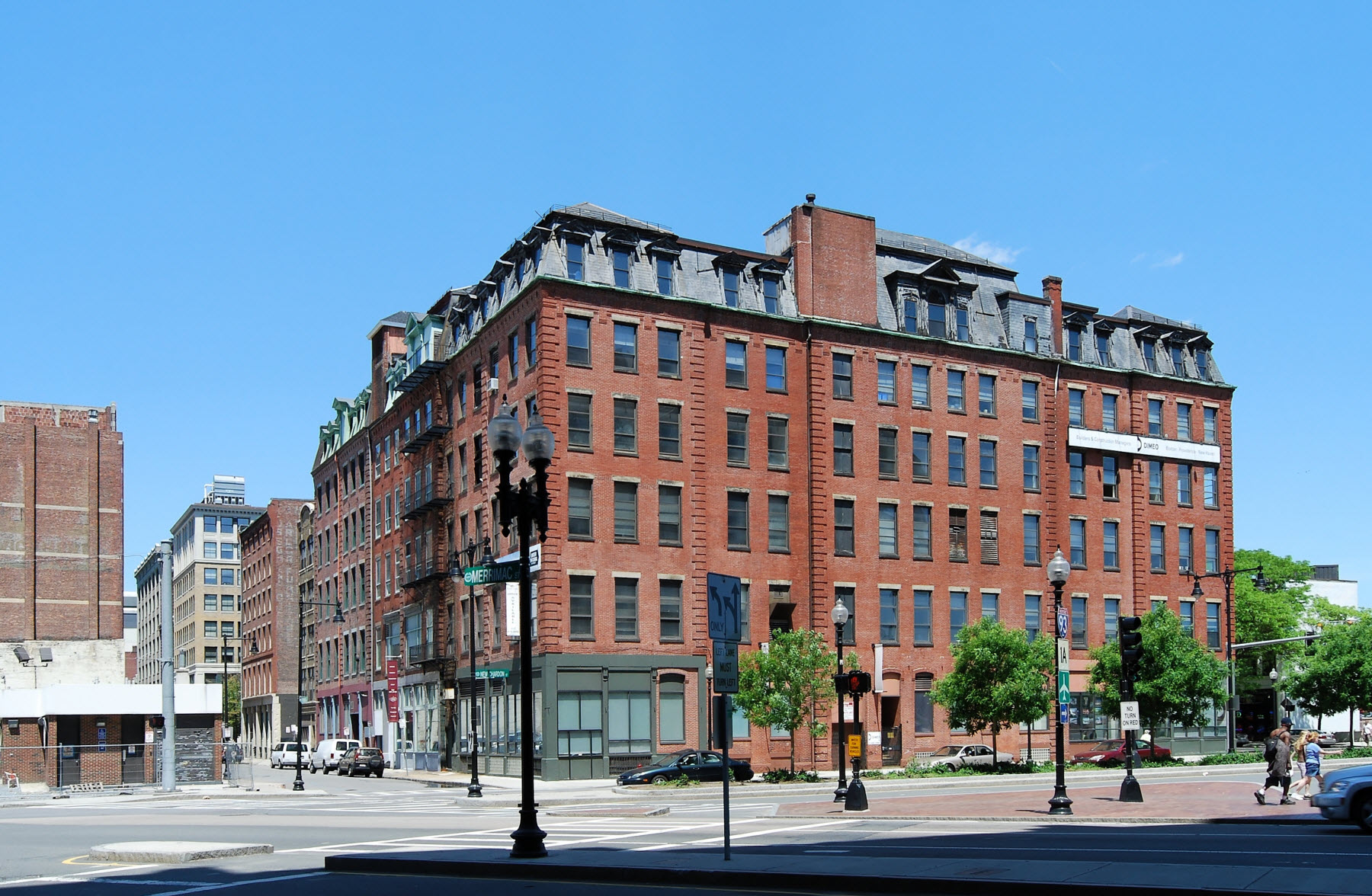
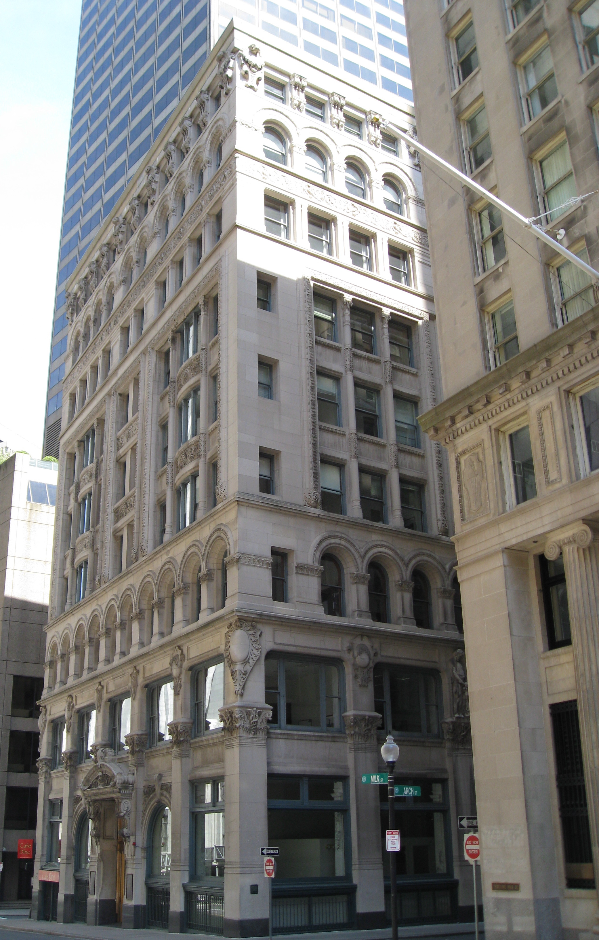
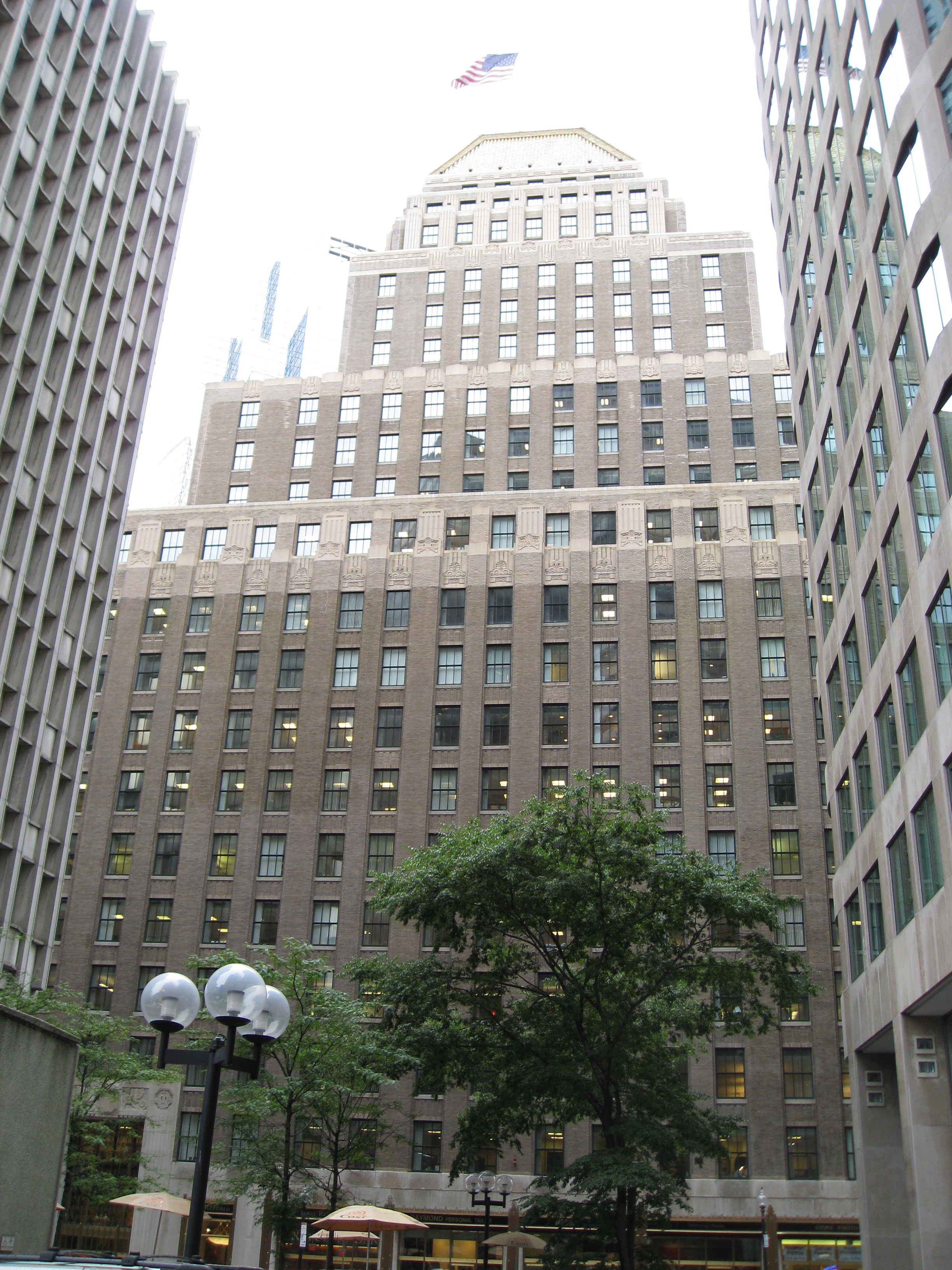
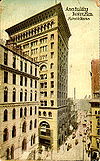
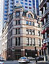
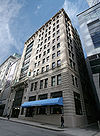
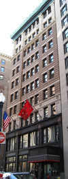
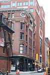
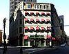
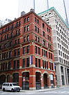
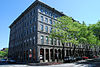
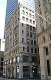
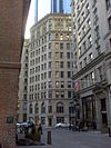
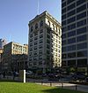
Ames Building |
 |
01974-04-26 April 26, 1974 |
1 Court St.
42°21′32″N 71°3′31″W / 42.35889°N 71.05861°W / 42.35889; -71.05861 (Ames Building) |
Downtown |
|
| 9 |
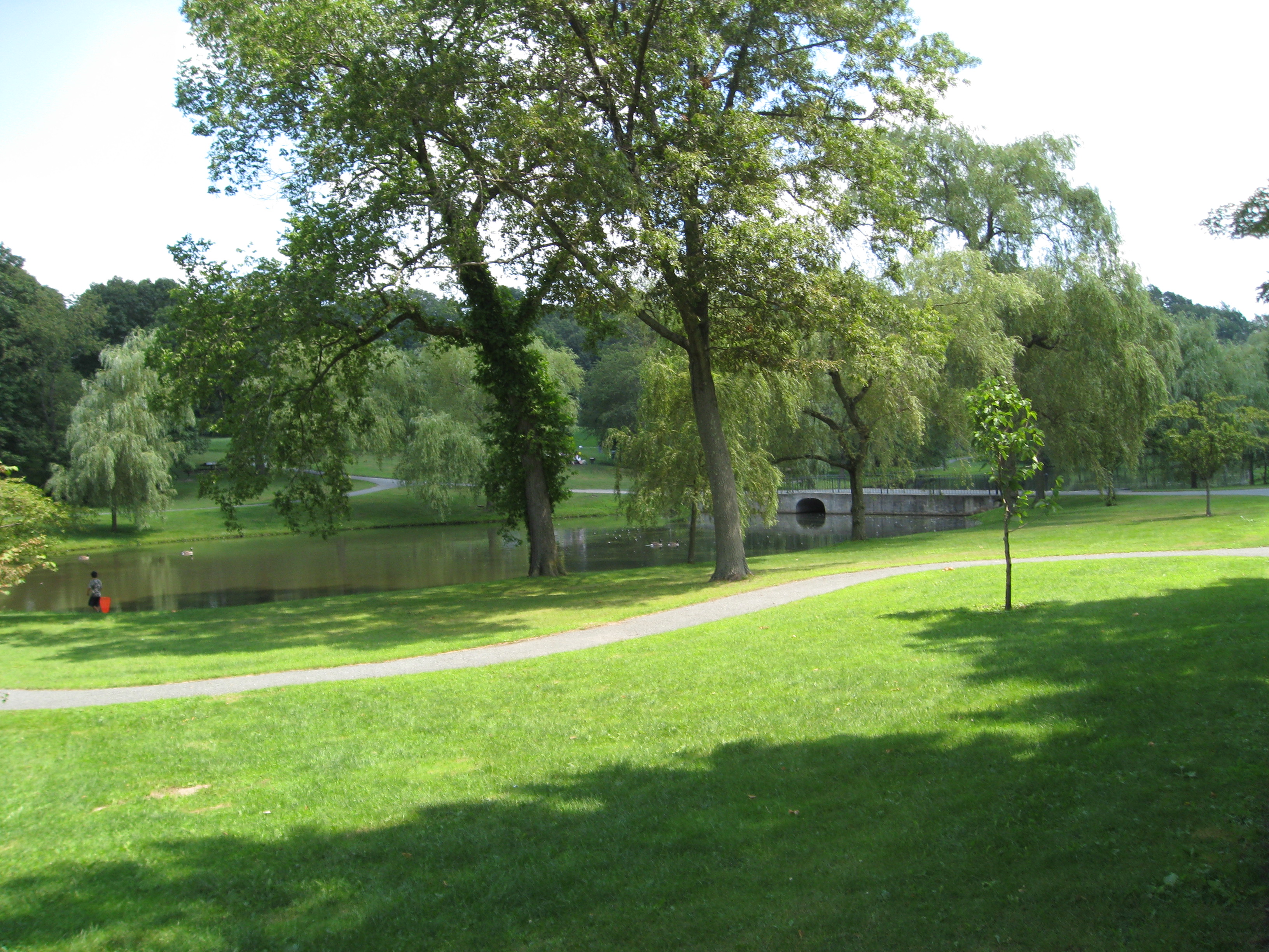
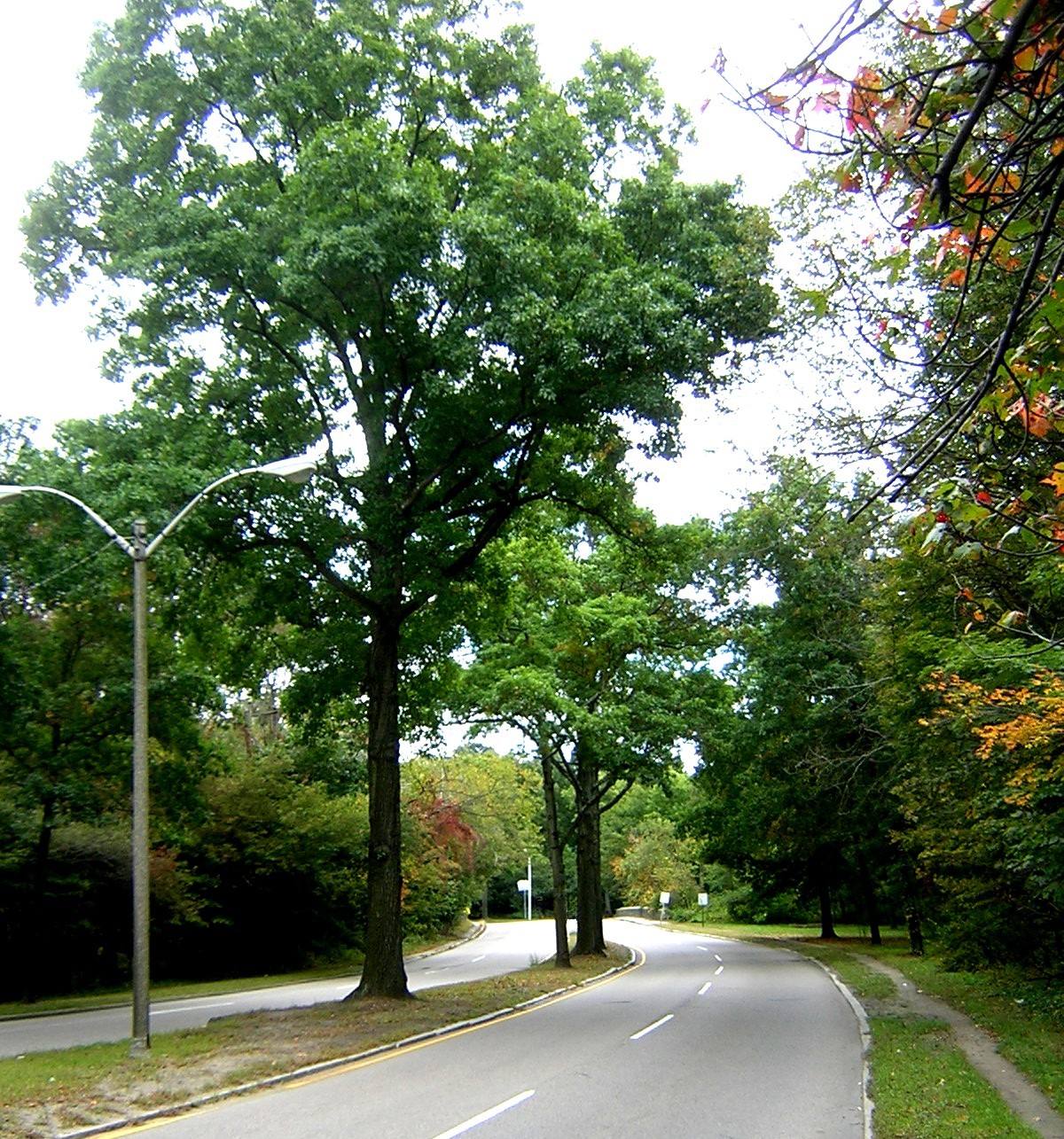
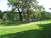
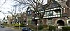
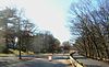
Larz Anderson Park Historic District |
 |
01985-10-17 October 17, 1985 |
Bounded by Goddard and Avon Sts.
42°18′43″N 71°8′10″W / 42.31194°N 71.13611°W / 42.31194; -71.13611 (Anderson, Larz, Park Historic District) |
Jamaica Plain |
Extends into Brookline in Norfolk County |
| 10 |
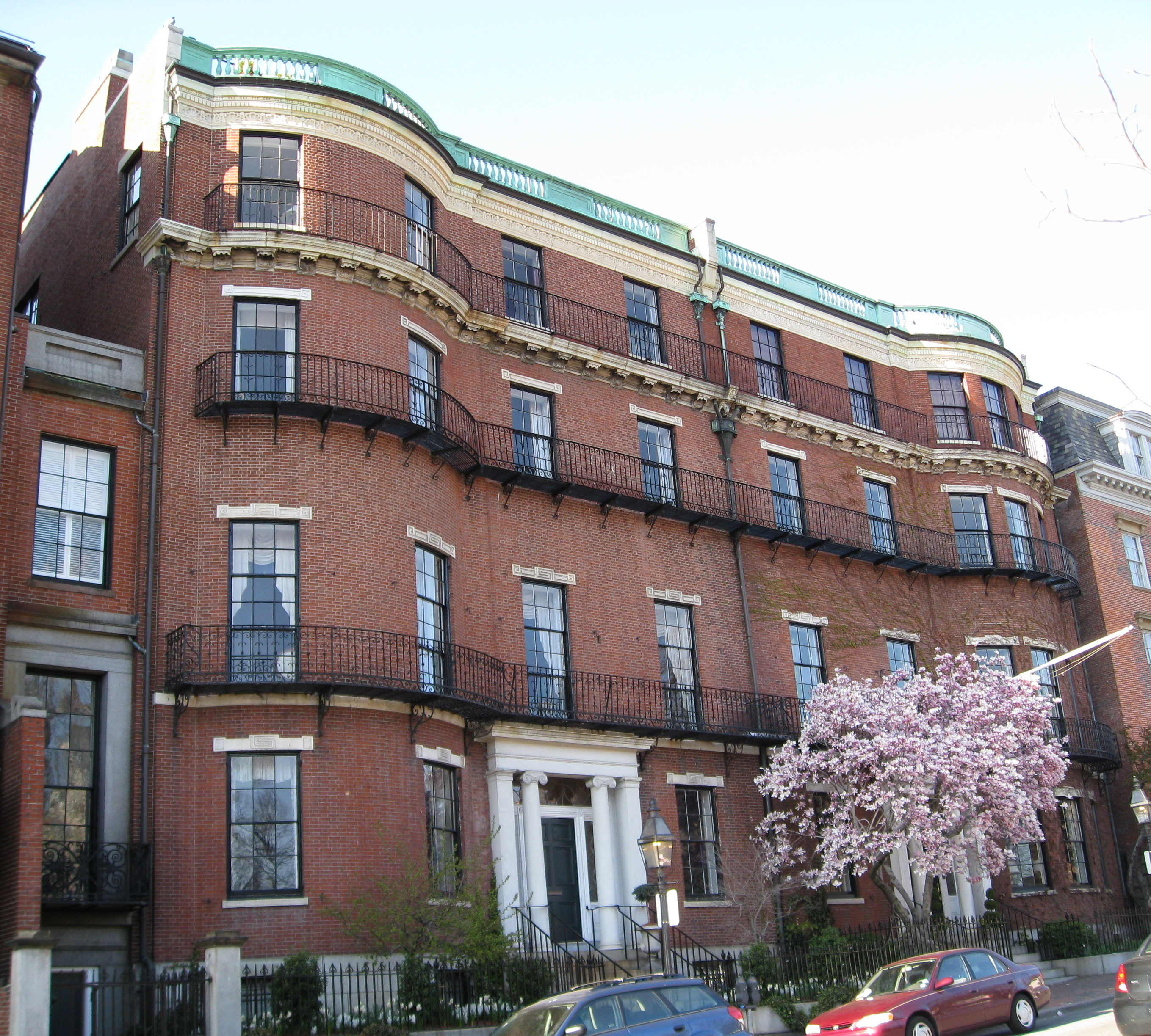
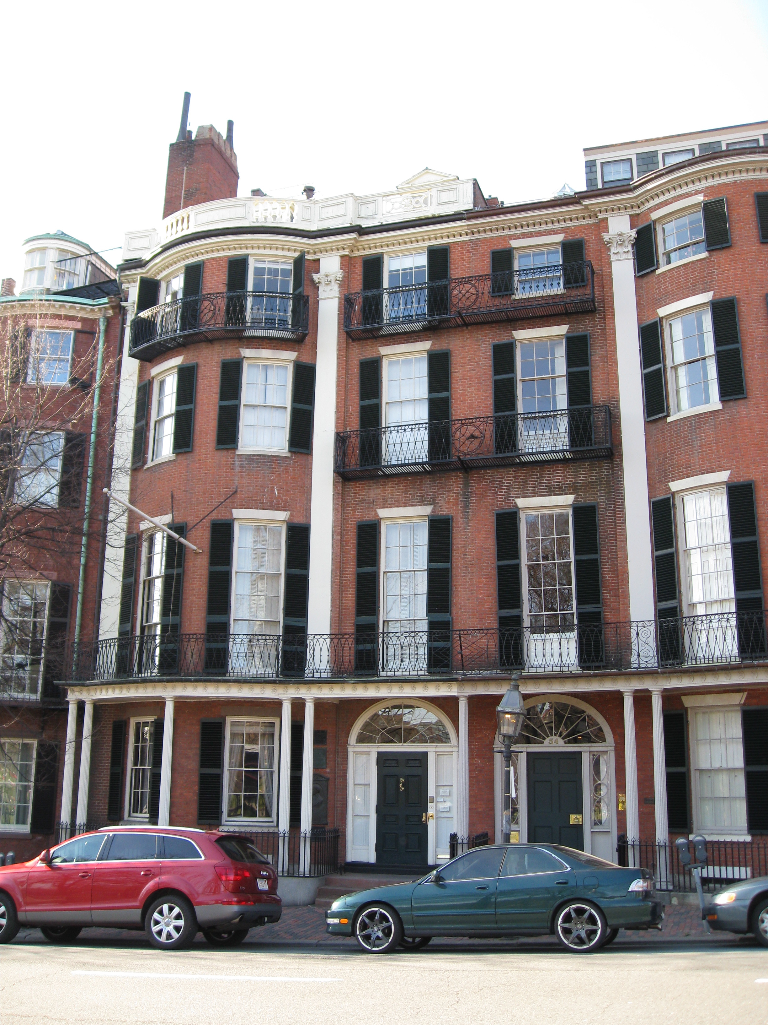
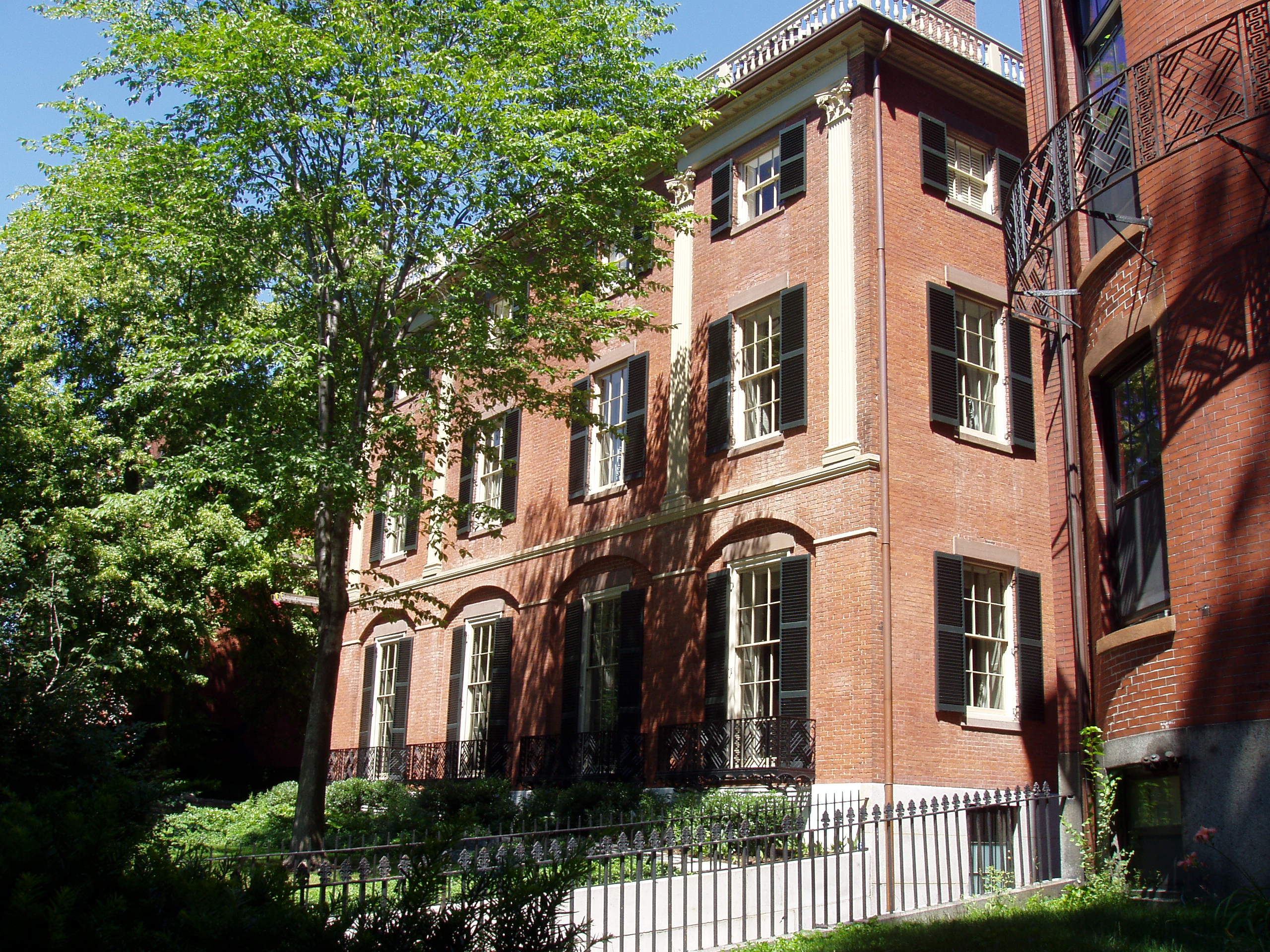
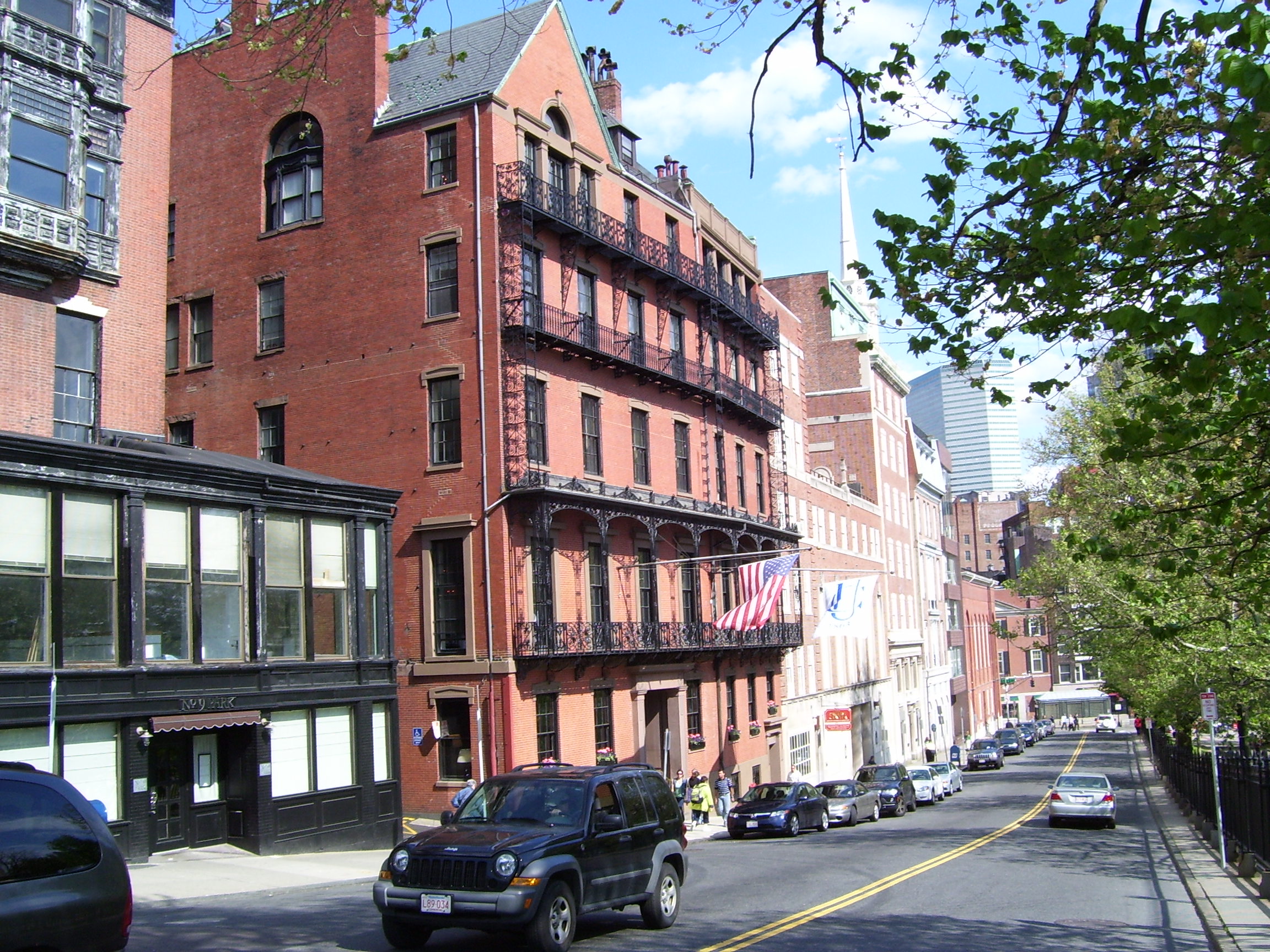
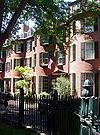
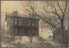
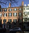
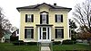
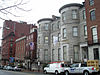
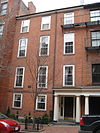
Nathan Appleton Residence |
 |
01977-12-22 December 22, 1977 |
39-40 Beacon St.
42°21′25″N 71°4′1″W / 42.35694°N 71.06694°W / 42.35694; -71.06694 (Appleton, Nathan, Residence) |
Beacon Hill |
|
| 11 |
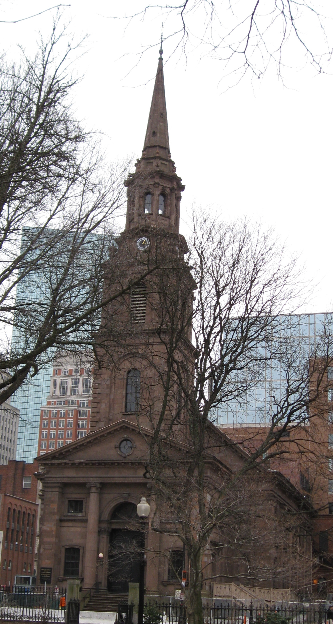
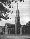
Arlington Street Church |
 |
01973-05-04 May 4, 1973 |
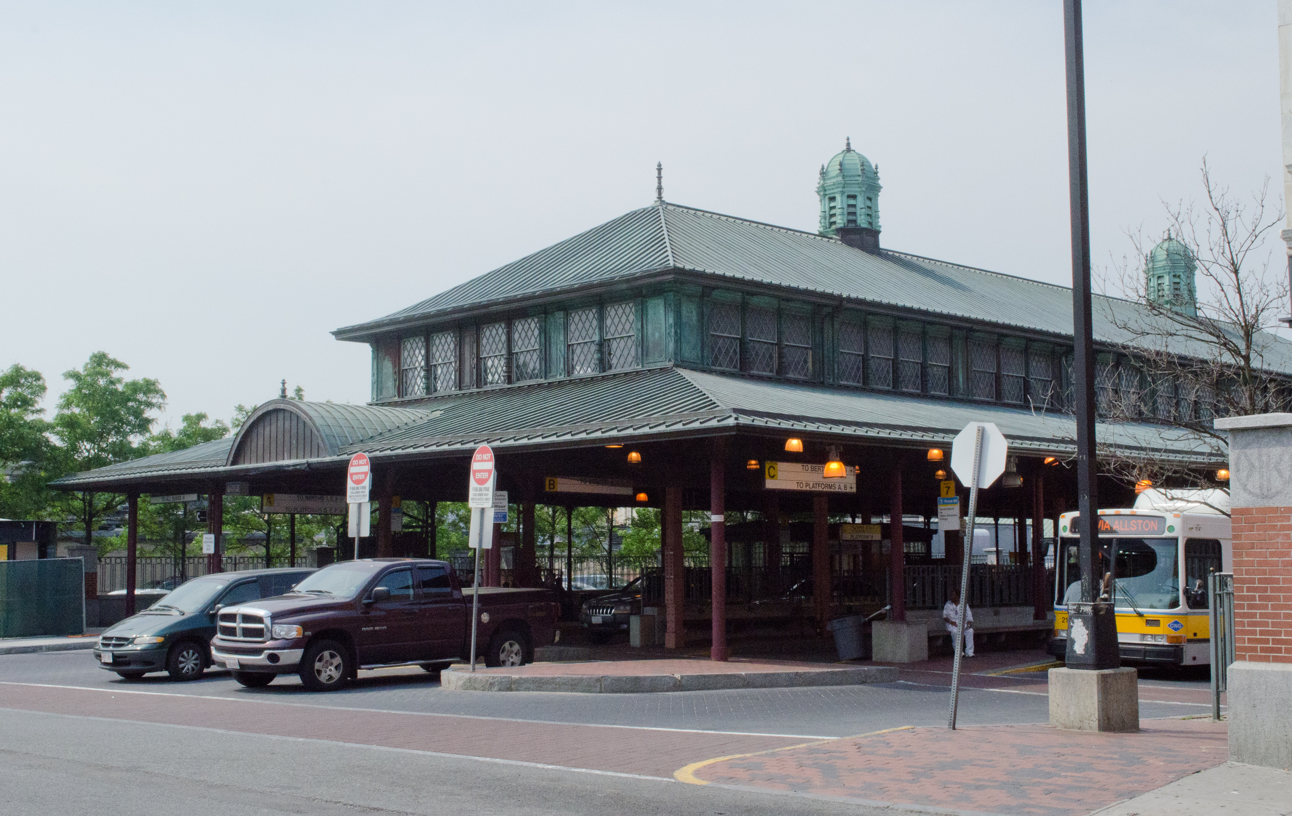
Arlington and Boylston Sts.
42°21′7.3″N 71°4′16.1″W / 42.352028°N 71.071139°W / 42.352028; -71.071139 (Arlington Street Church) |
Back Bay |
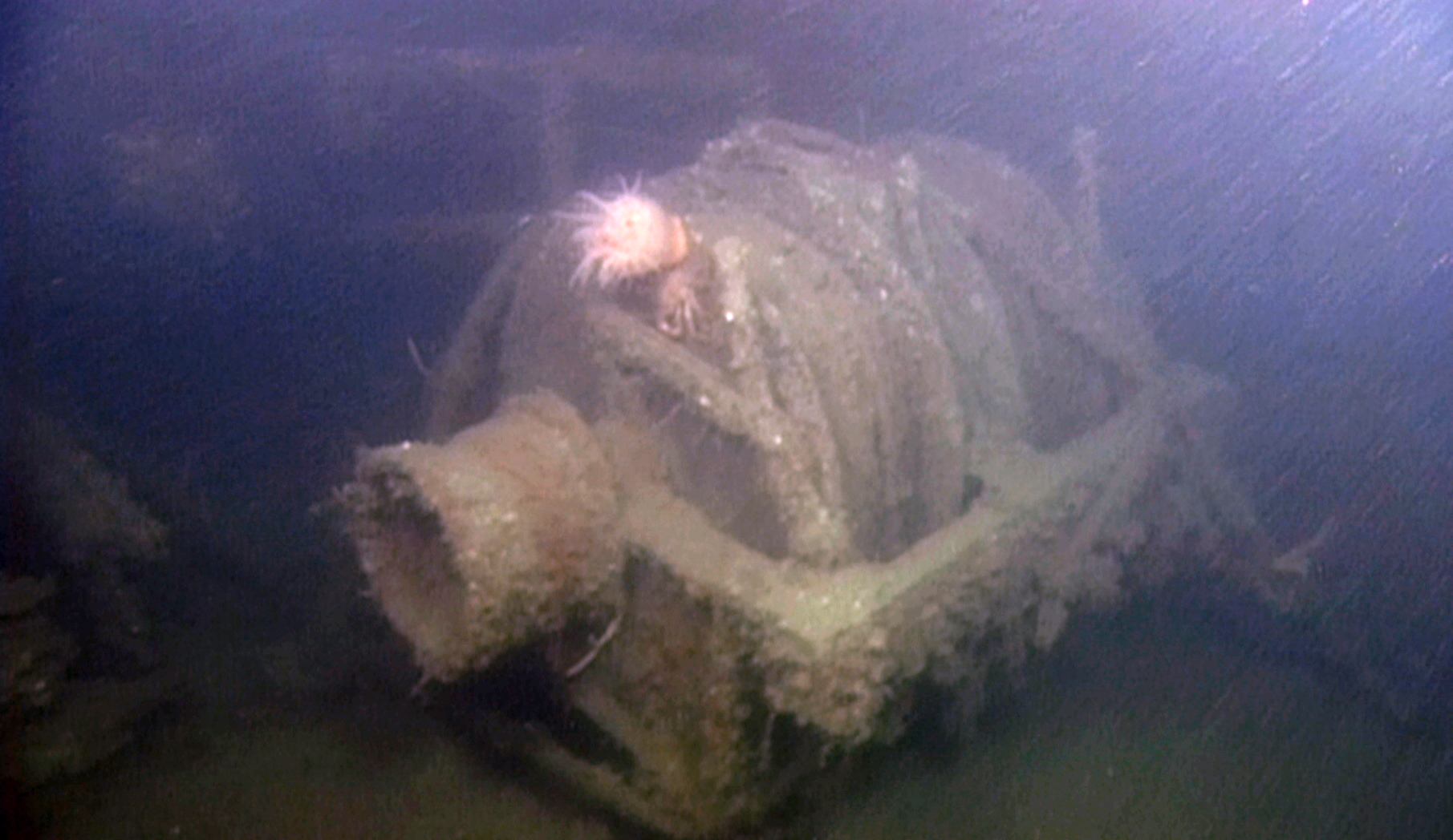
|
| 12 |
Armory of the First Corps of Cadets |
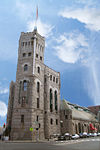 |
01973-05-22 May 22, 1973 |
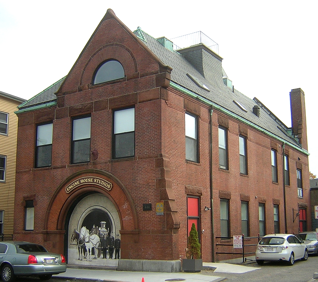
97-105 Arlington St. and 130 Columbus Ave.
42°20′59″N 71°4′14″W / 42.34972°N 71.07056°W / 42.34972; -71.07056 (Armory of the First Corps of Cadets) |
Bay Village |
|
| 13 |
Arnold Arboretum |
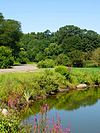 |
01966-10-15 October 15, 1966 |
22 Divinity Ave.
42°17′55″N 71°7′30″W / 42.29861°N 71.125°W / 42.29861; -71.125 (Arnold Arboretum) |
Jamaica Plain and Roslindale |
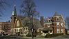
|
| 14 |
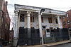
Francis B. Austin House |
 |
01988-10-21 October 21, 1988 |
58 High St.
42°22′34″N 71°4′37″W / 42.37611°N 71.07694°W / 42.37611; -71.07694 (Austin, Francis B., House) |
Charlestown |
|
| 15 |
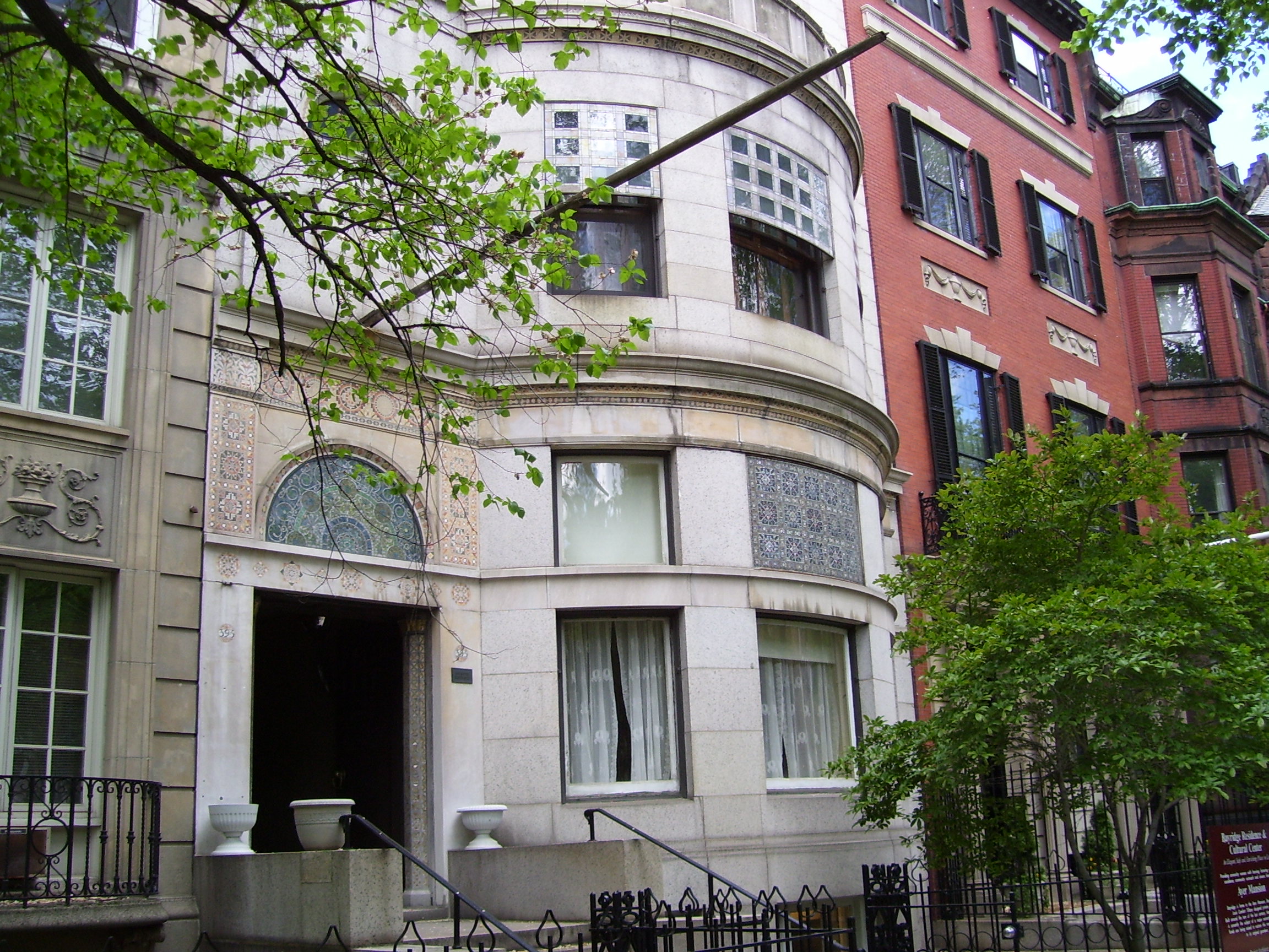
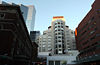
Frederick Ayer Mansion |
 |
02005-04-05 April 5, 2005 |
395 Commonwealth Ave.
42°20′57.32″N 71°5′25.14″W / 42.3492556°N 71.0903167°W / 42.3492556; -71.0903167 (Ayer, Frederick, Mansion) |
Back Bay |
|
| 16 |
Back Bay Historic District |
 |
01973-08-14 August 14, 1973 |
Roughly bounded by the Charles River, Arlington, Providence, Boylston, and Newbury Sts., and Charlesgate East
42°21′4.30″N 71°4′50.32″W / 42.351194°N 71.0806444°W / 42.351194; -71.0806444 (Back Bay Historic District) |
Back Bay |
|
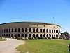
| 17 |
Baker Congregational Church |
 |
01998-11-19 November 19, 1998 |
760 Saratoga St.
42°23′2″N 71°1′4″W / 42.38389°N 71.01778°W / 42.38389; -71.01778 (Baker Congregational Church) |
East Boston |
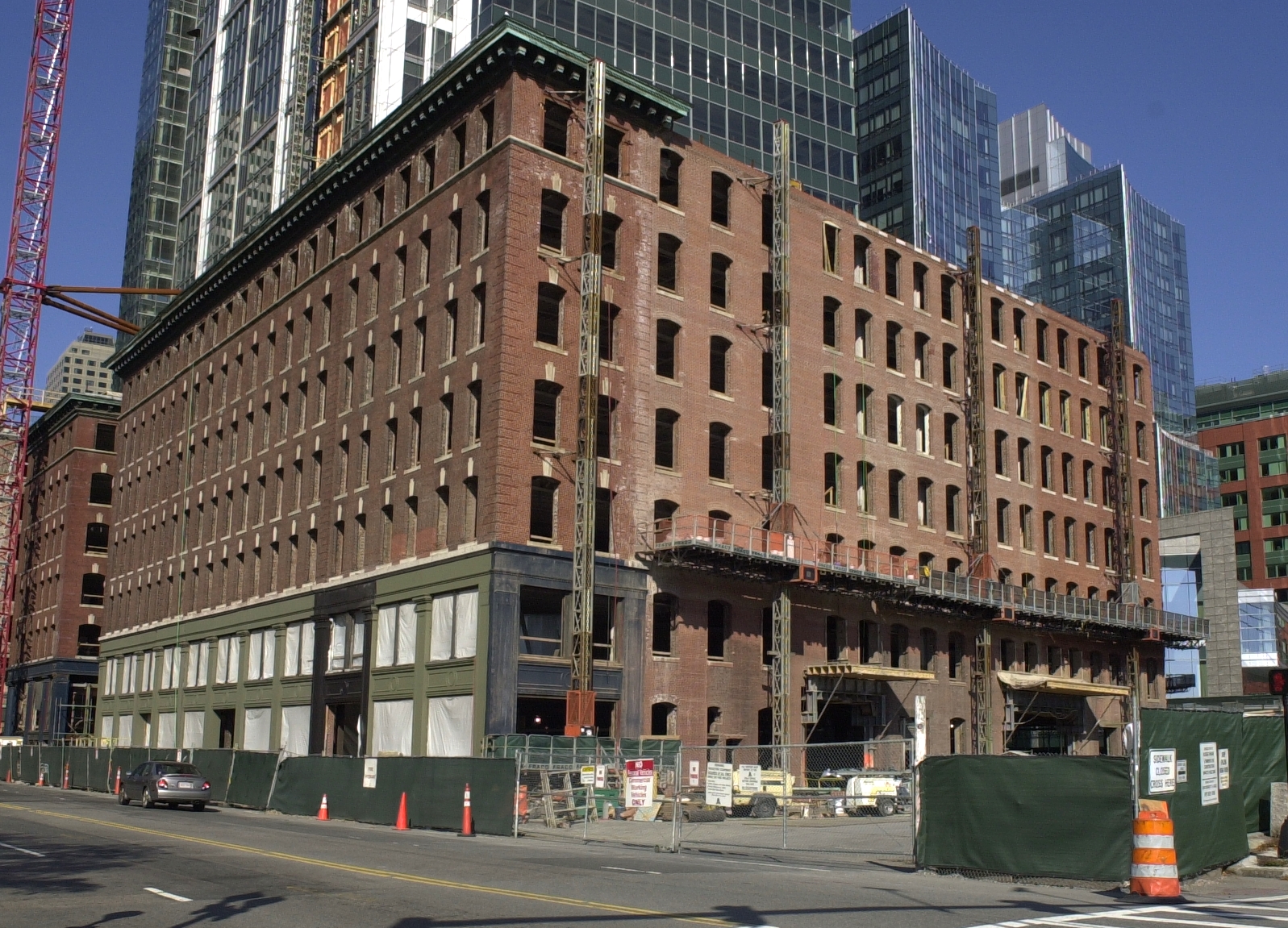
|
| 18 |
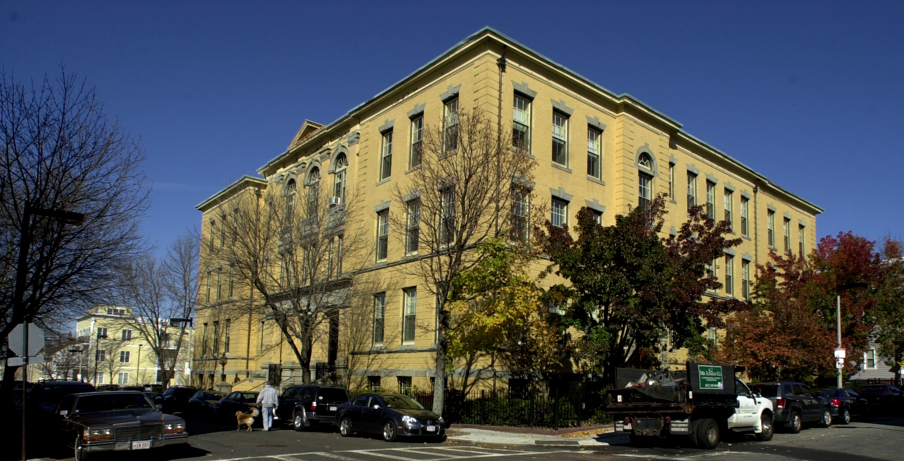
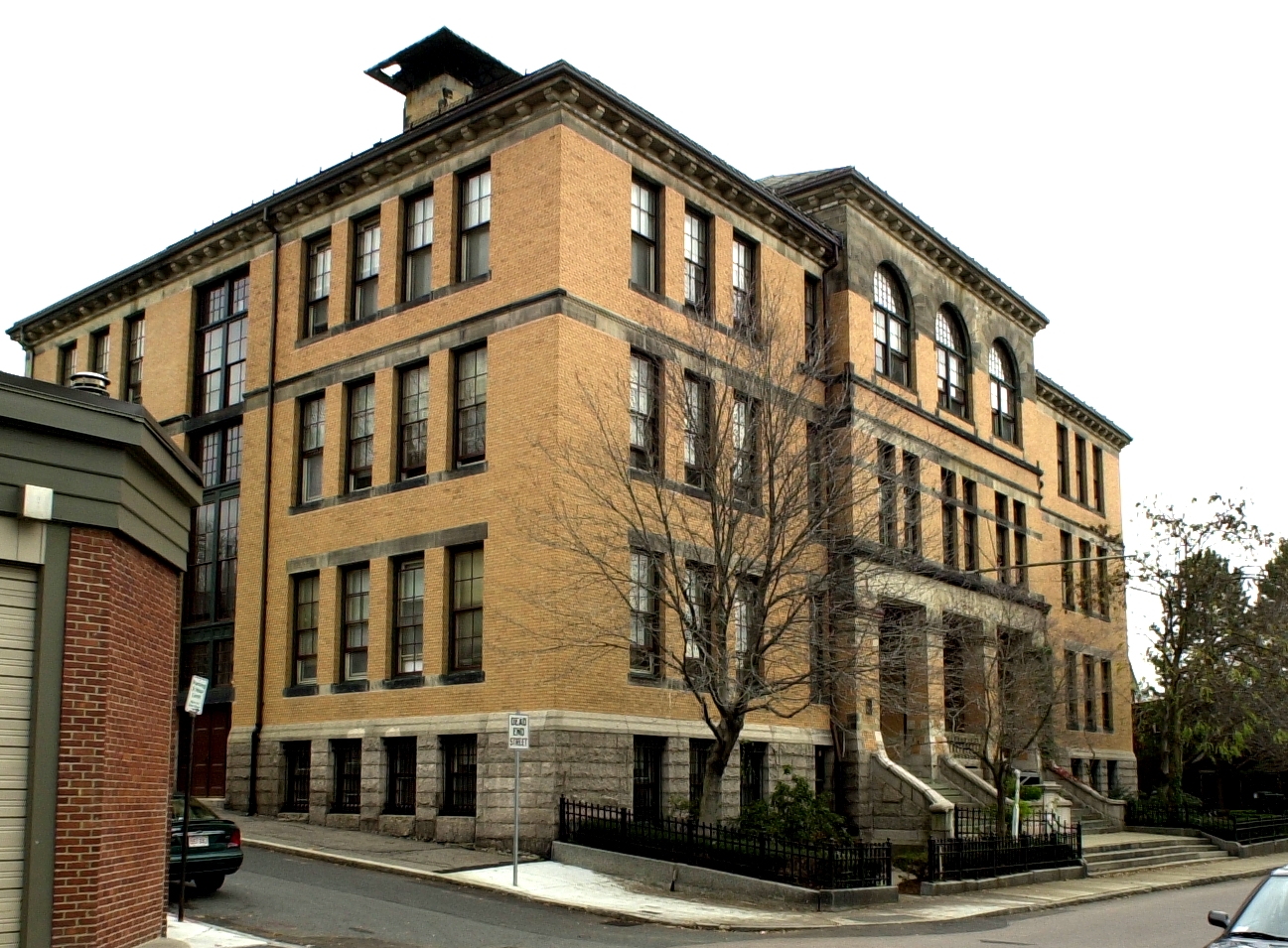
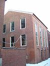
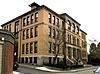
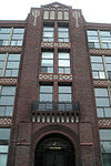
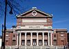
Sarah J. Baker School |
|
01983-07-07 July 7, 1983 |
33 Perrin St.
42°19′20″N 71°4′48″W / 42.32222°N 71.08°W / 42.32222; -71.08 (Baker, Sarah J., School) |
Roxbury |
|
| 19 |
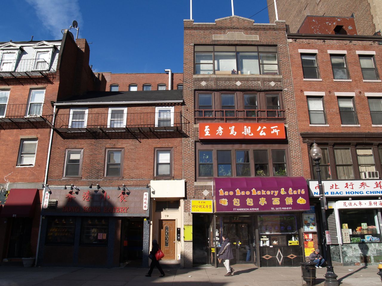
Beach-Knapp District |
 |
01980-12-09 December 9, 1980 |
Roughly bounded by Harrison Ave., Washington, Kneeland, and Beach Sts.
42°21′4″N 71°3′44″W / 42.35111°N 71.06222°W / 42.35111; -71.06222 (Beach-Knapp District) |
Chinatown |
|
| 20 |
Beacon Hill Historic District |
 |
01966-10-15 October 15, 1966 |
Bounded by Beacon St., the Charles River Embankment, and Pinckney, Revere, and Hancock Sts.
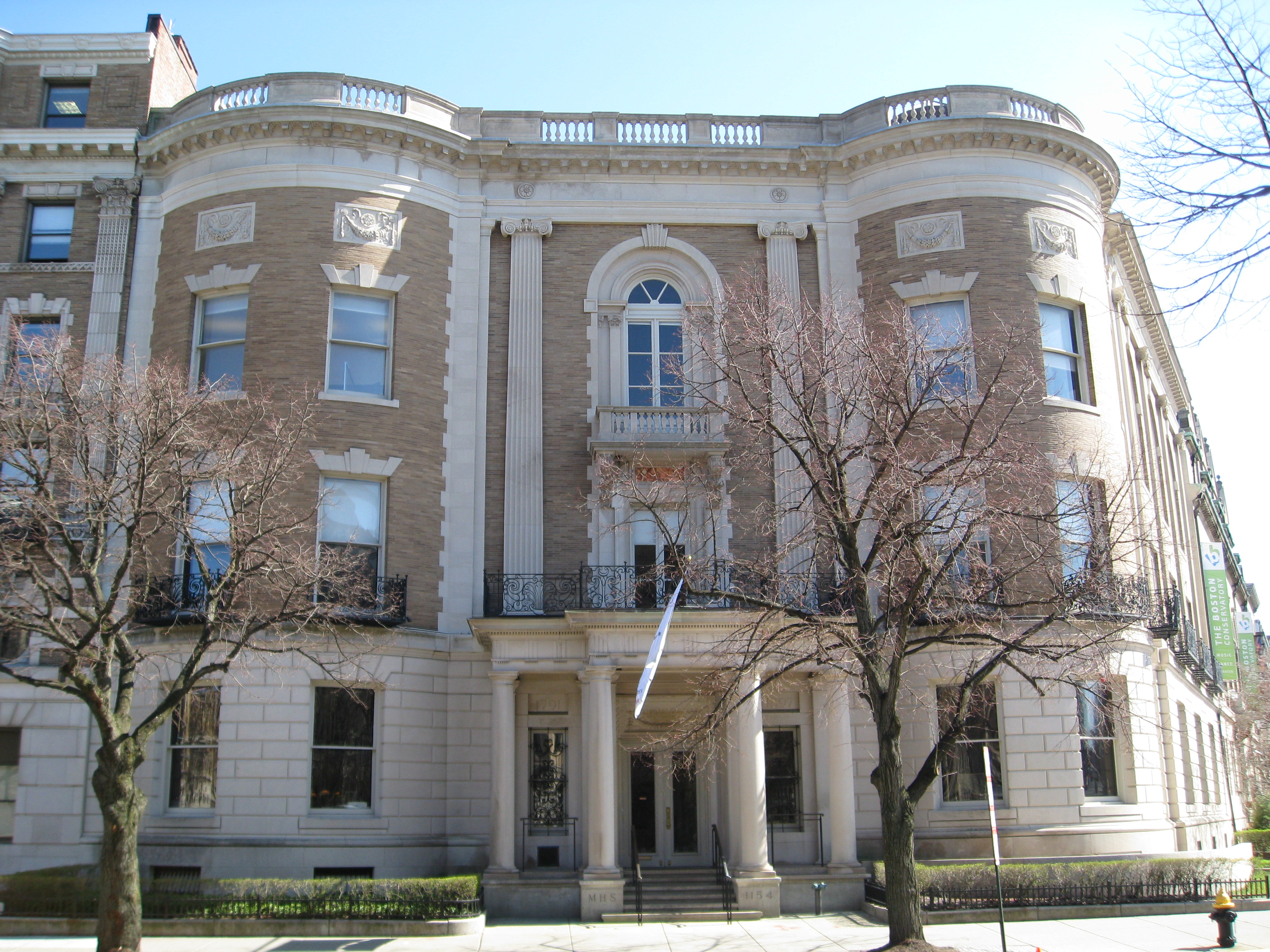
42°21′32.66″N 71°4′5.22″W / 42.3590722°N 71.0681167°W / 42.3590722; -71.0681167 (Beacon Hill Historic District) |
Beacon Hill |
|
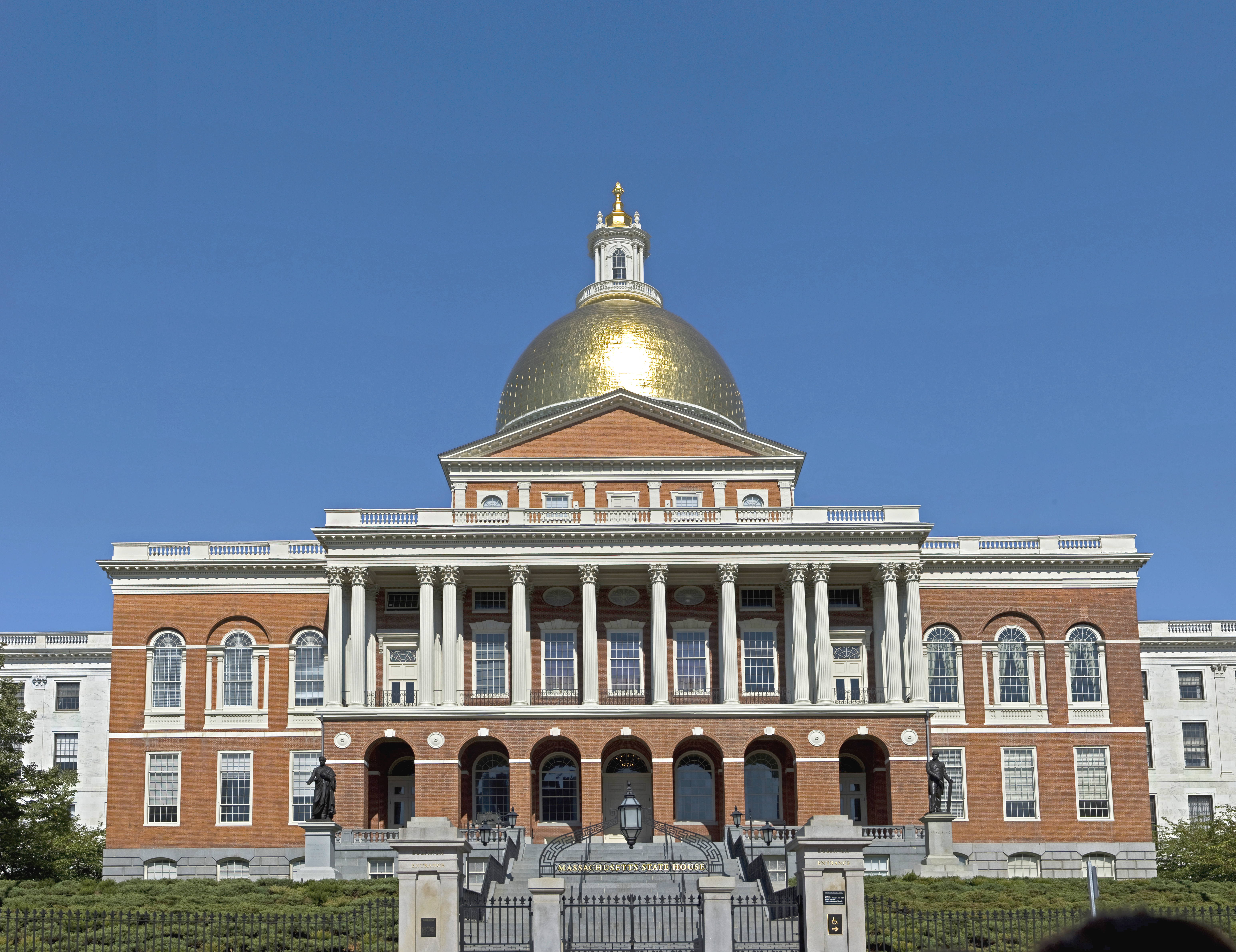
| 21 |
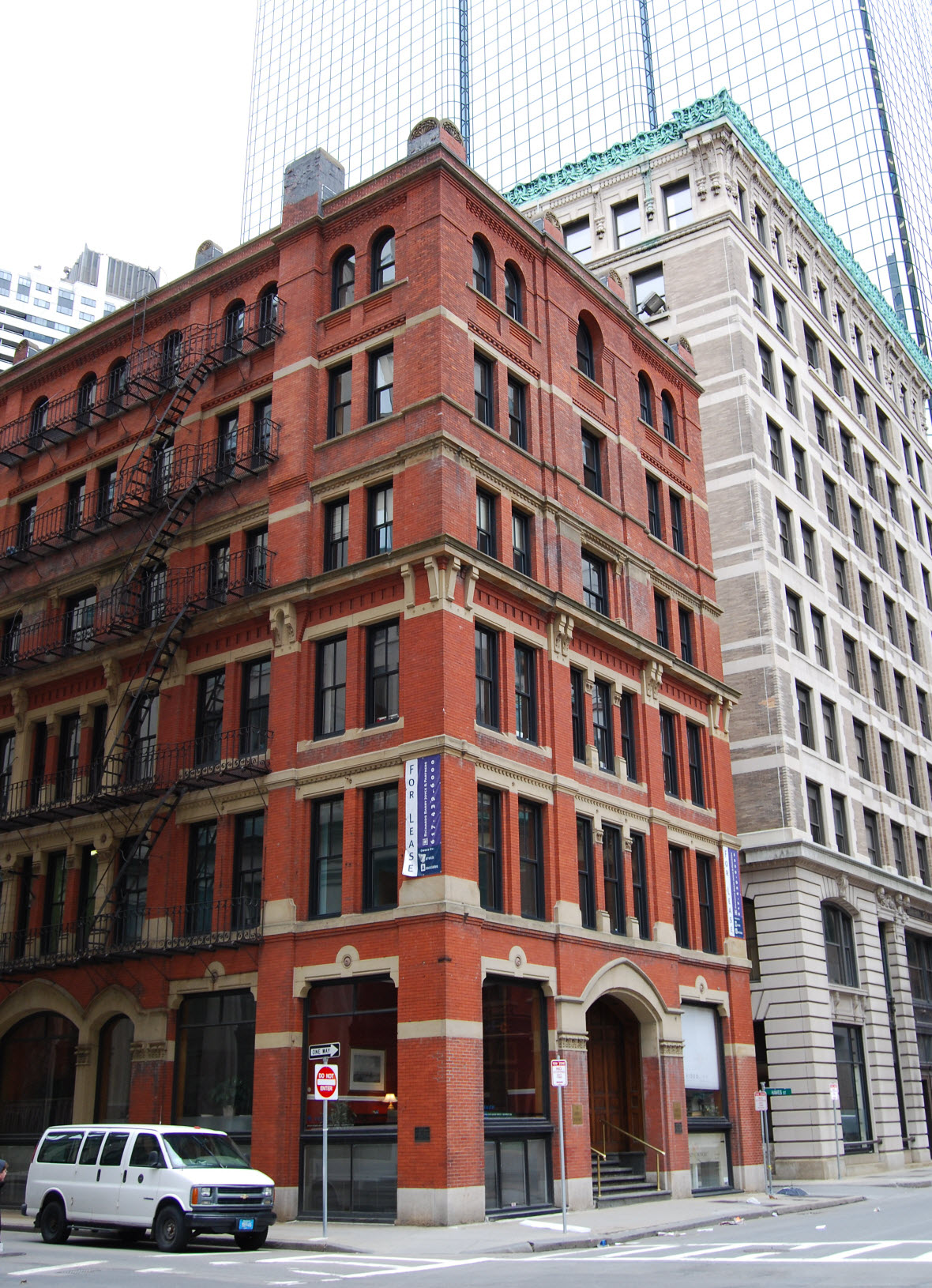
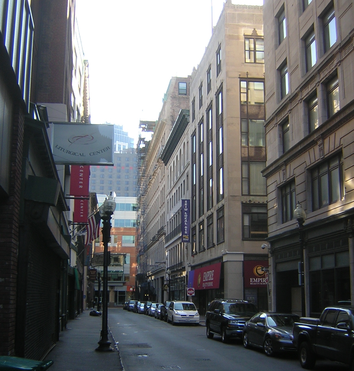
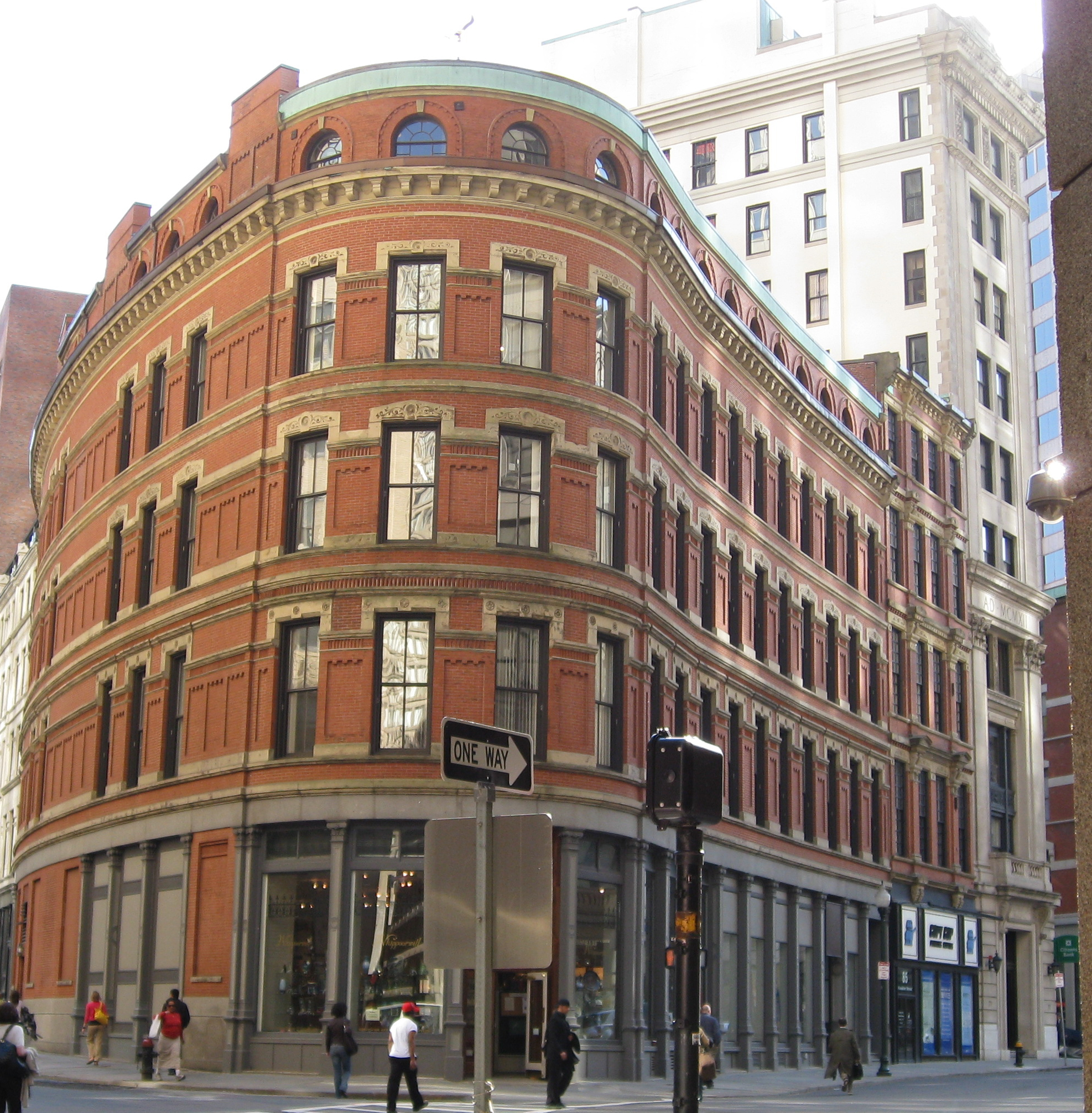
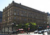
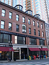
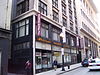
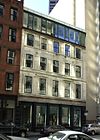
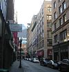
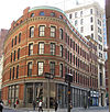
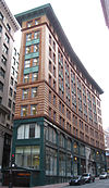
Bedford Building |
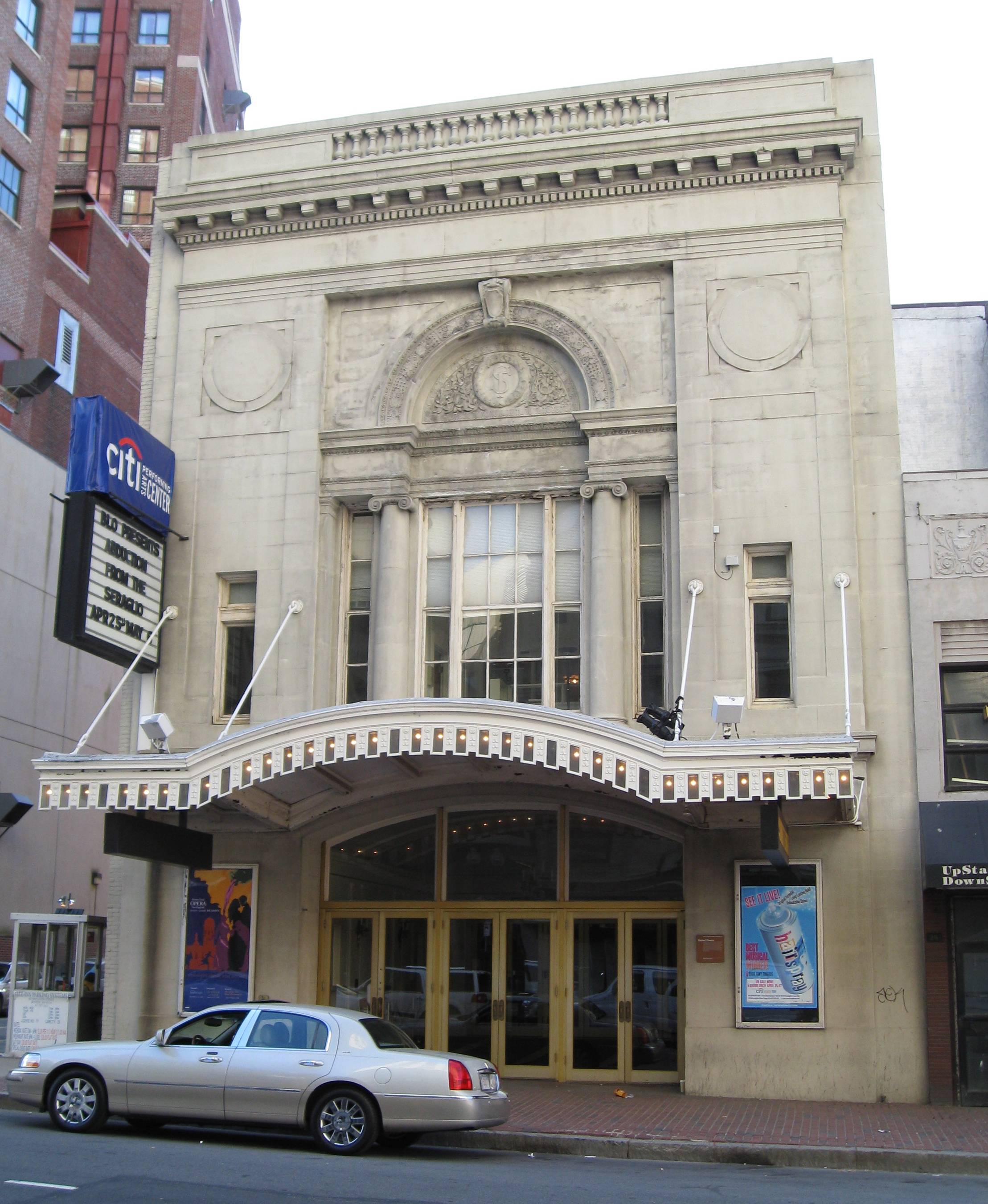
 |
01979-08-21 August 21, 1979 |
89-103 Bedford St.
42°21′10″N 71°3′32″W / 42.35278°N 71.05889°W / 42.35278; -71.05889 (Bedford Building) |
Downtown |
|
| 22 |
Bellevue Standpipe |
 |
01990-01-18 January 18, 1990 |
On Bellevue Hill at Washington St. and Roxbury Parkway
42°16′31″N 71°8′40″W / 42.27528°N 71.14444°W / 42.27528; -71.14444 (Bellevue Standpipe) |
West Roxbury |
|
| 23 |
Benedict Fenwick School |
|
02004-02-11 February 11, 2004 |
150 Magnolia St.
42°18′49″N 71°4′21″W / 42.31361°N 71.0725°W / 42.31361; -71.0725 (Benedict Fenwick School) |
Dorchester |
|
| 24 |
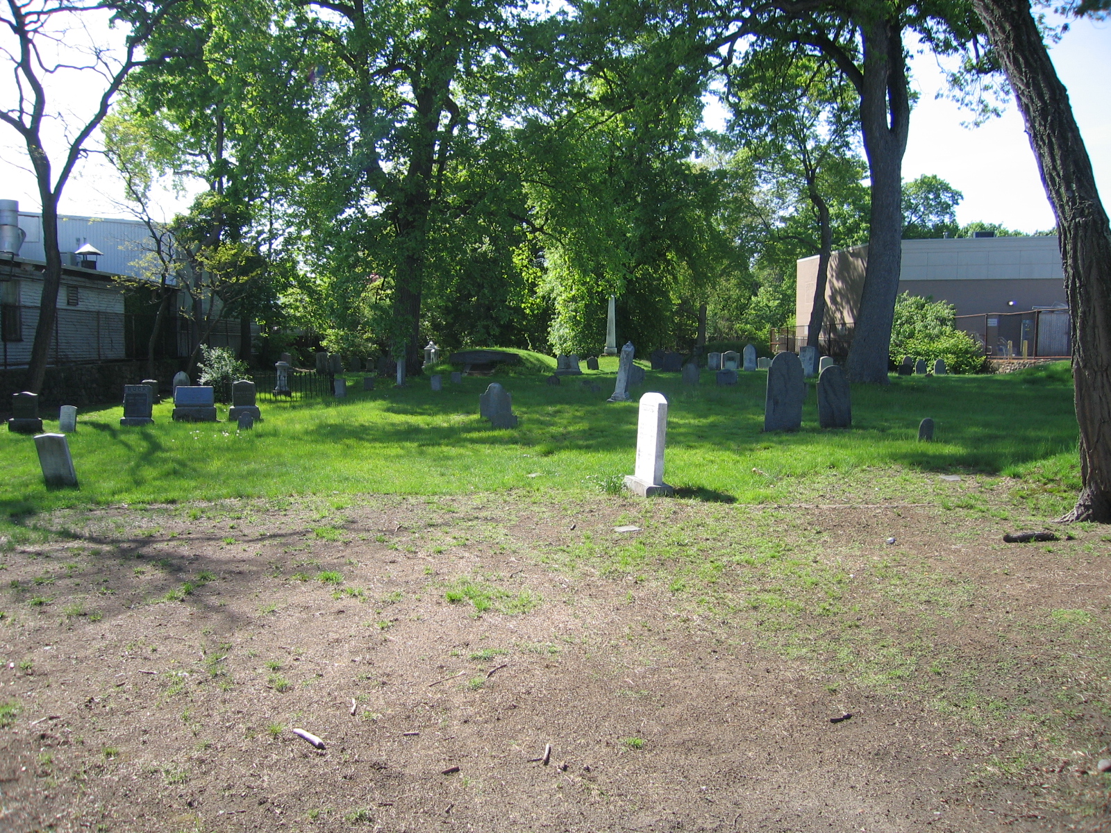
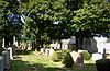
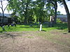
Bennington Street Burying Ground |
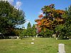 |
02002-05-22 May 22, 2002 |
Bennington St., between Swift and Harmony Sts.
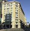
42°22′50″N 71°1′19″W / 42.38056°N 71.02194°W / 42.38056; -71.02194 (Bennington Street Burying Ground) |
East Boston |
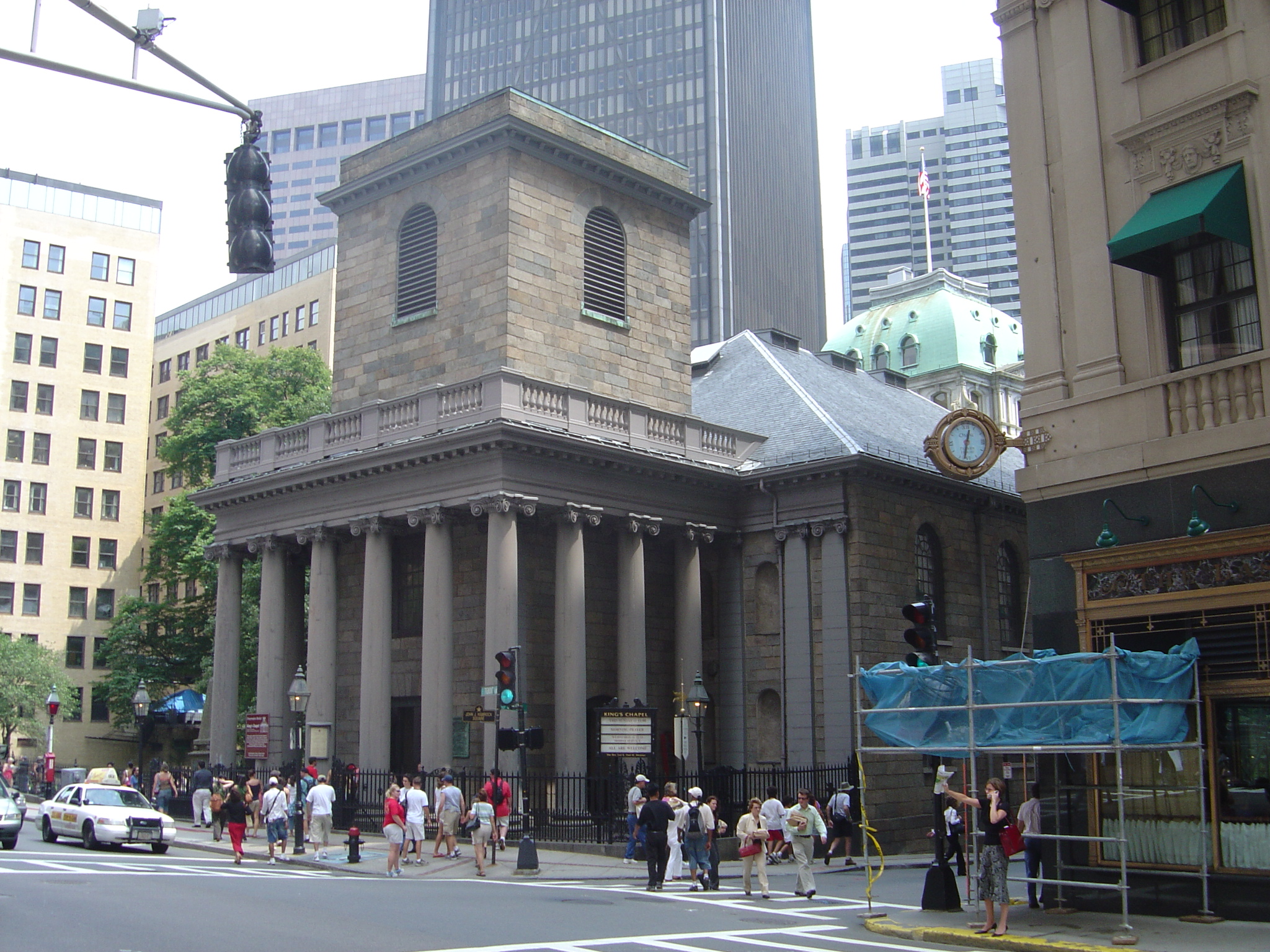
|
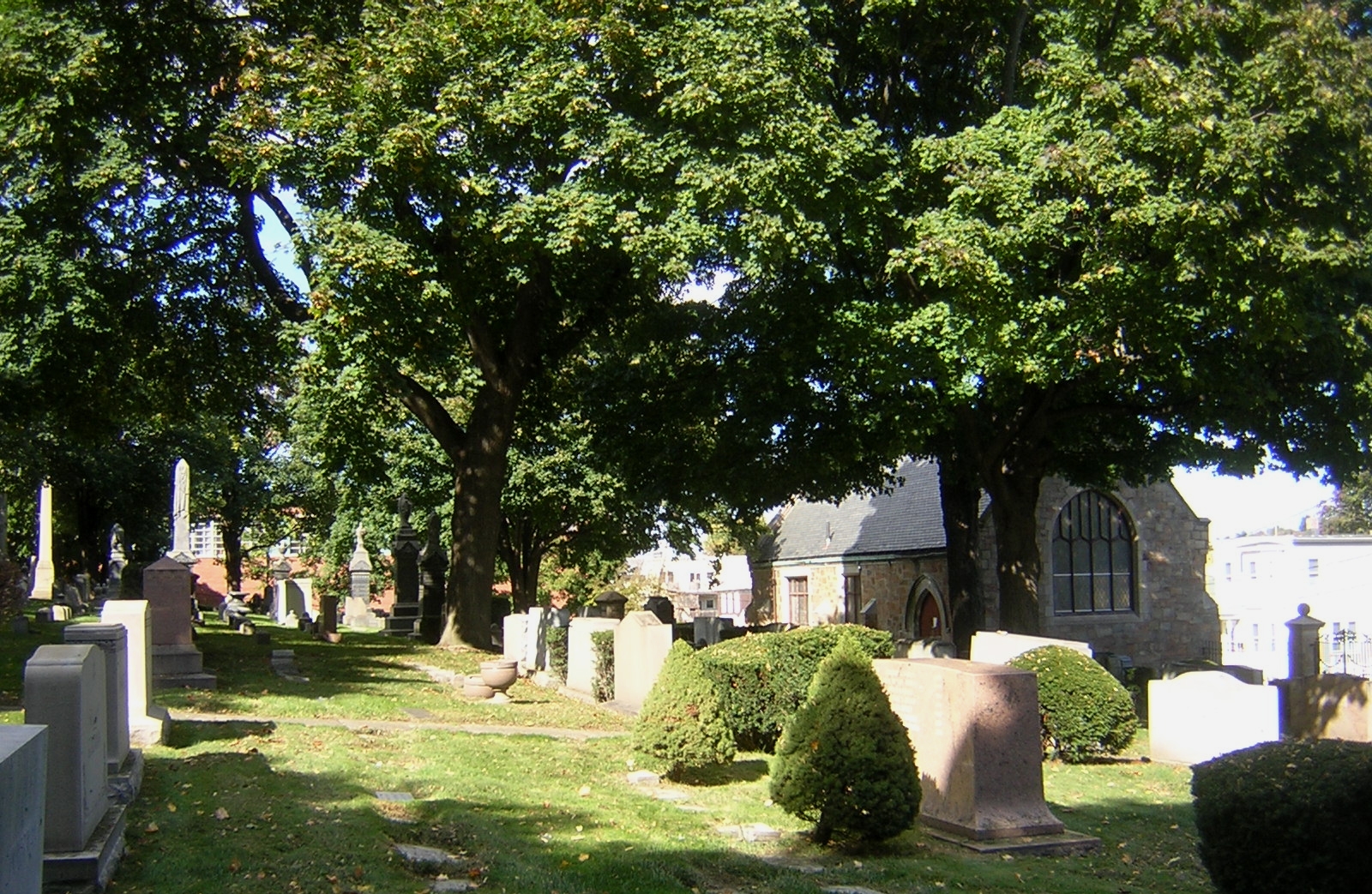
| 25 |
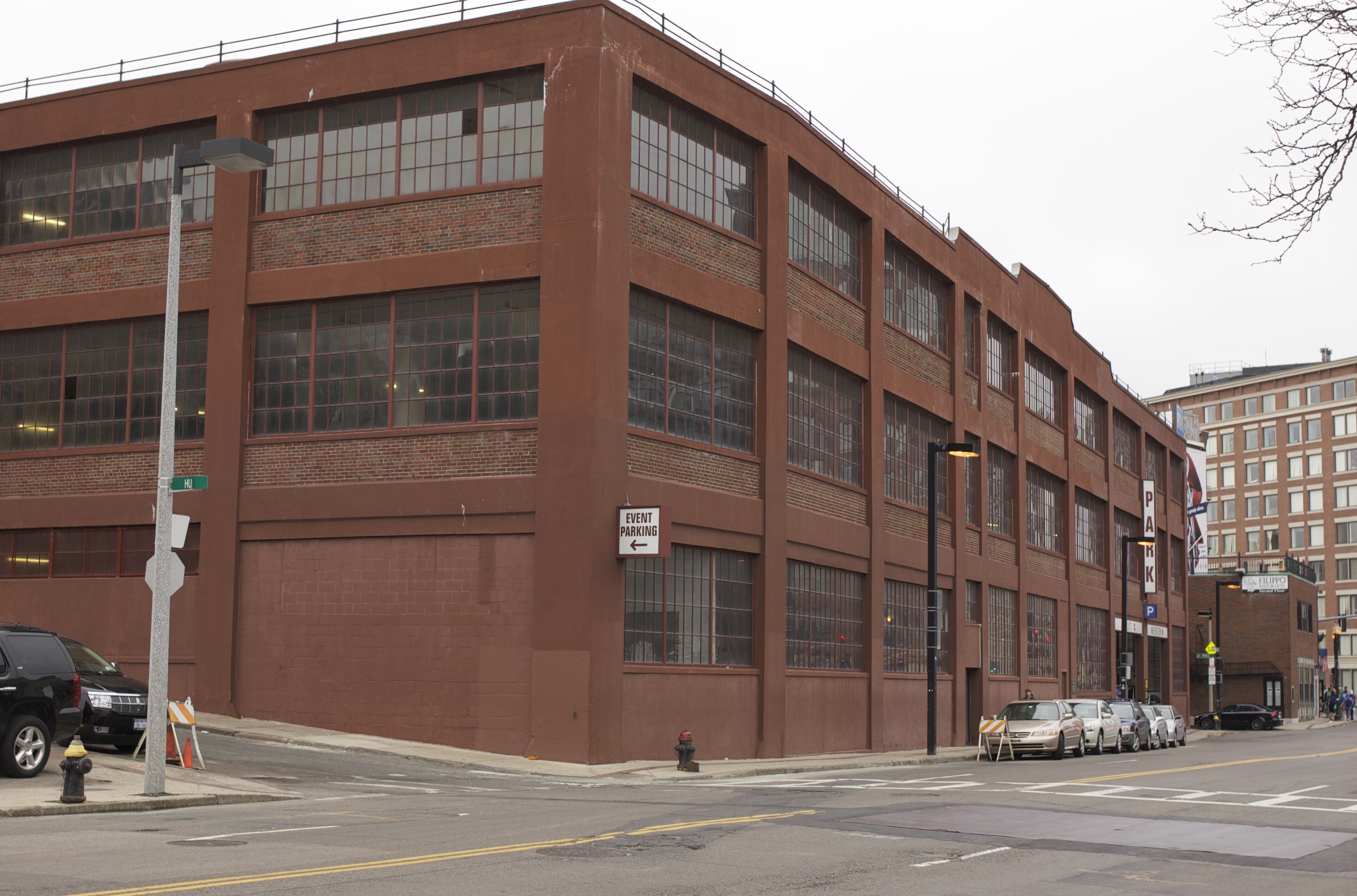
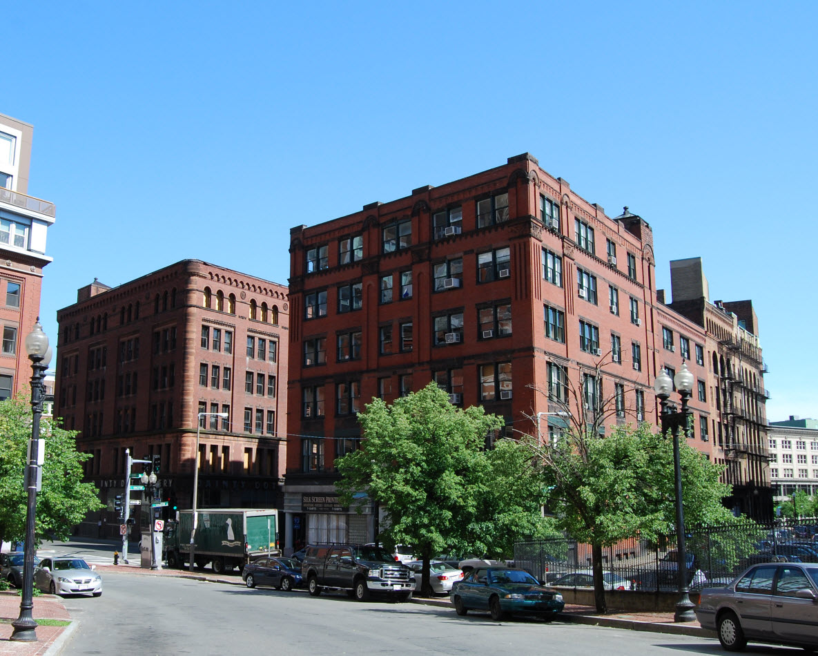
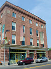
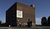
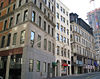
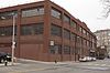
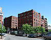
Berger Factory |
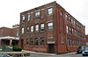 |
01980-04-09 April 9, 1980 |
37 Williams St.
42°19′58″N 71°4′59″W / 42.33278°N 71.08306°W / 42.33278; -71.08306 (Berger Factory) |
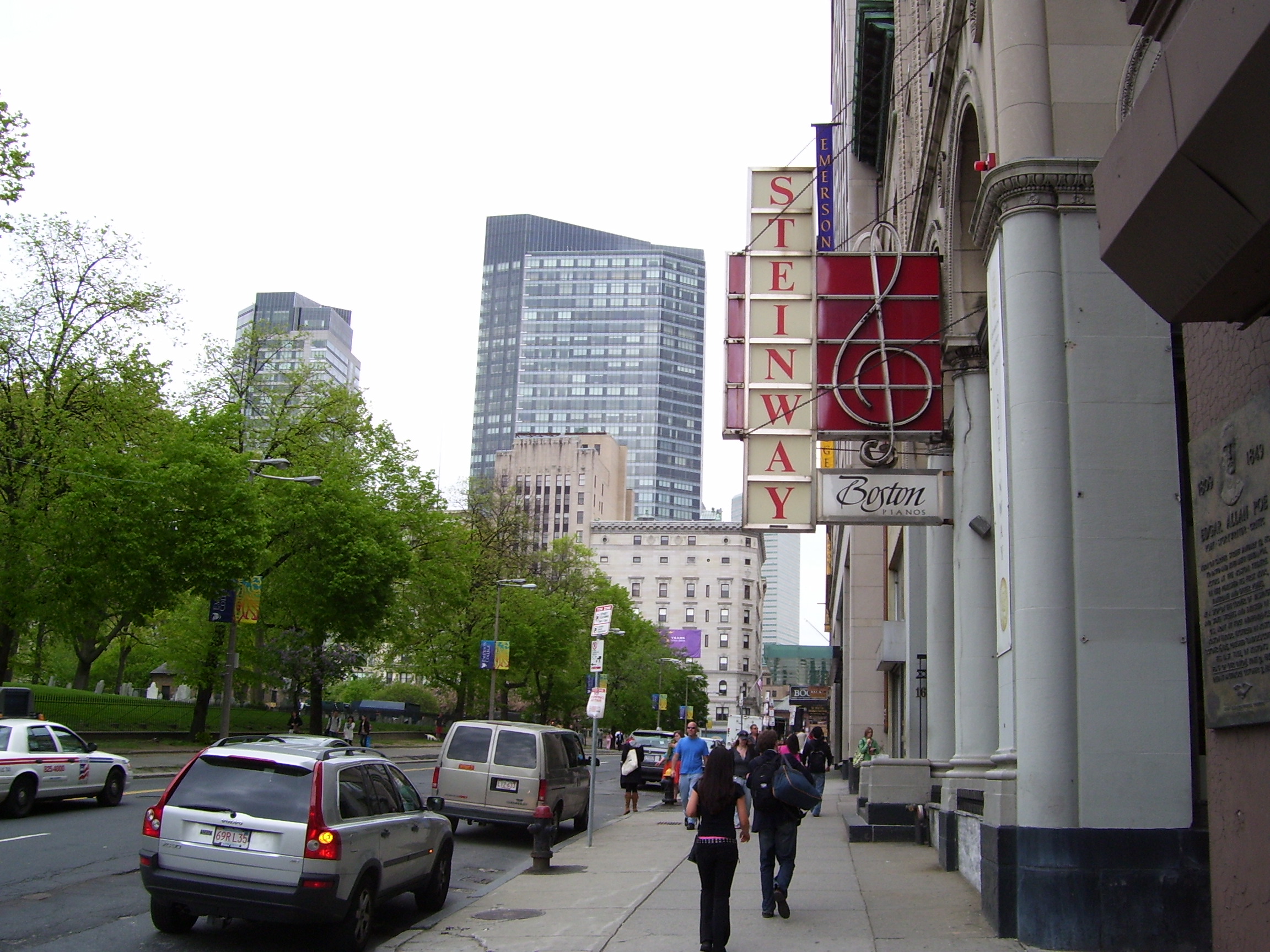
Roxbury |
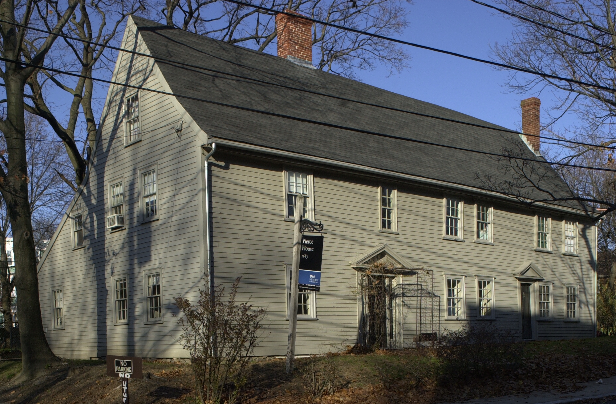
|
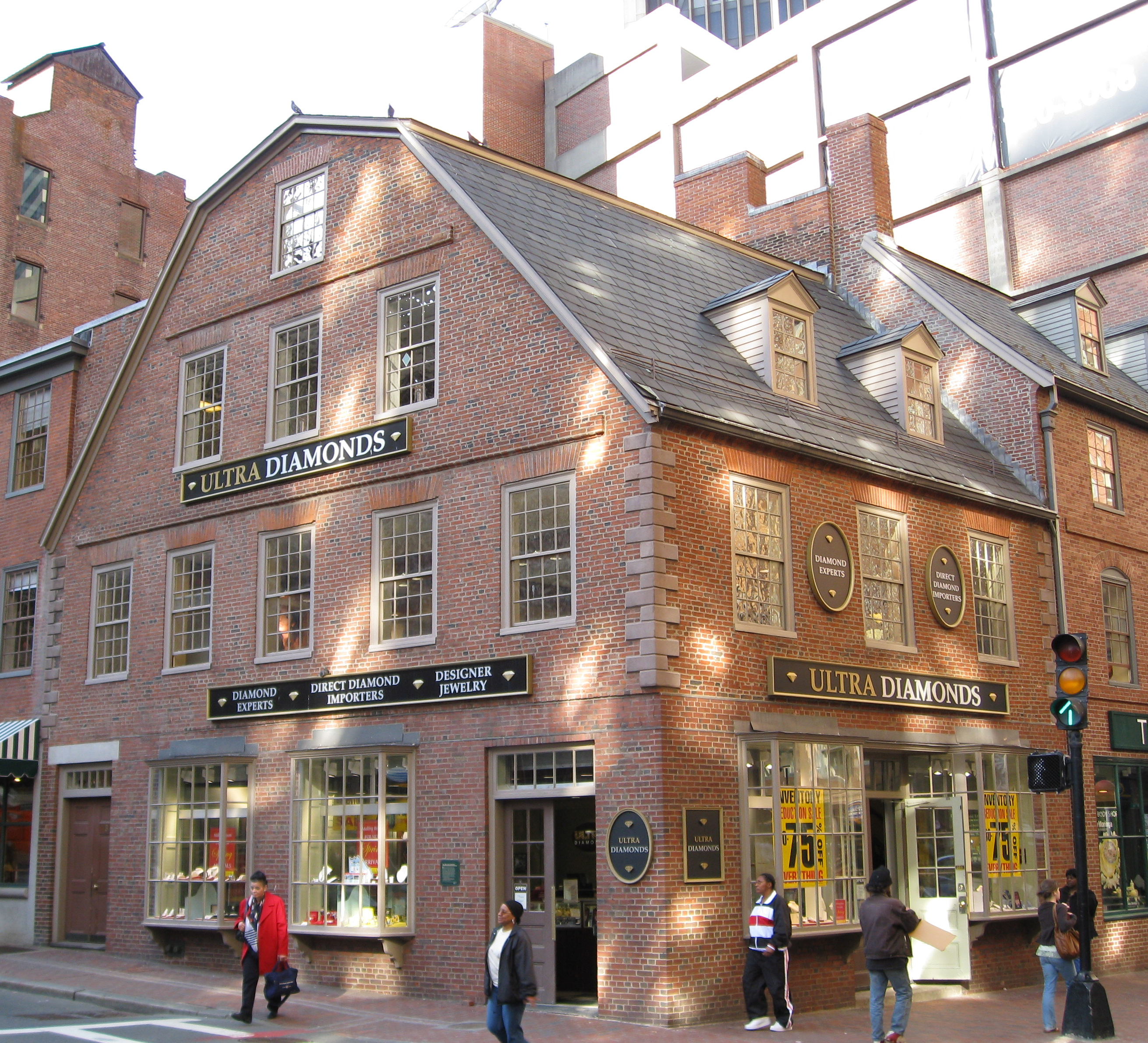
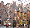
| 26 |
Bigelow School |
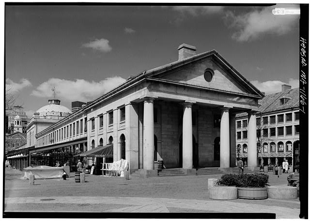
 |
01985-02-21 February 21, 1985 |
350 W. 4th St.
42°21′8″N 71°2′52″W / 42.35222°N 71.04778°W / 42.35222; -71.04778 (Bigelow School) |
South Boston |
|
| 27 |
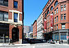
Blackstone Block Historic District |
 |
01973-05-26 May 26, 1973 |
Area bound by Union, Hanover, Blackstone, and North Sts.
42°21′40″N 71°3′25″W / 42.36111°N 71.05694°W / 42.36111; -71.05694 (Blackstone Block Historic District) |
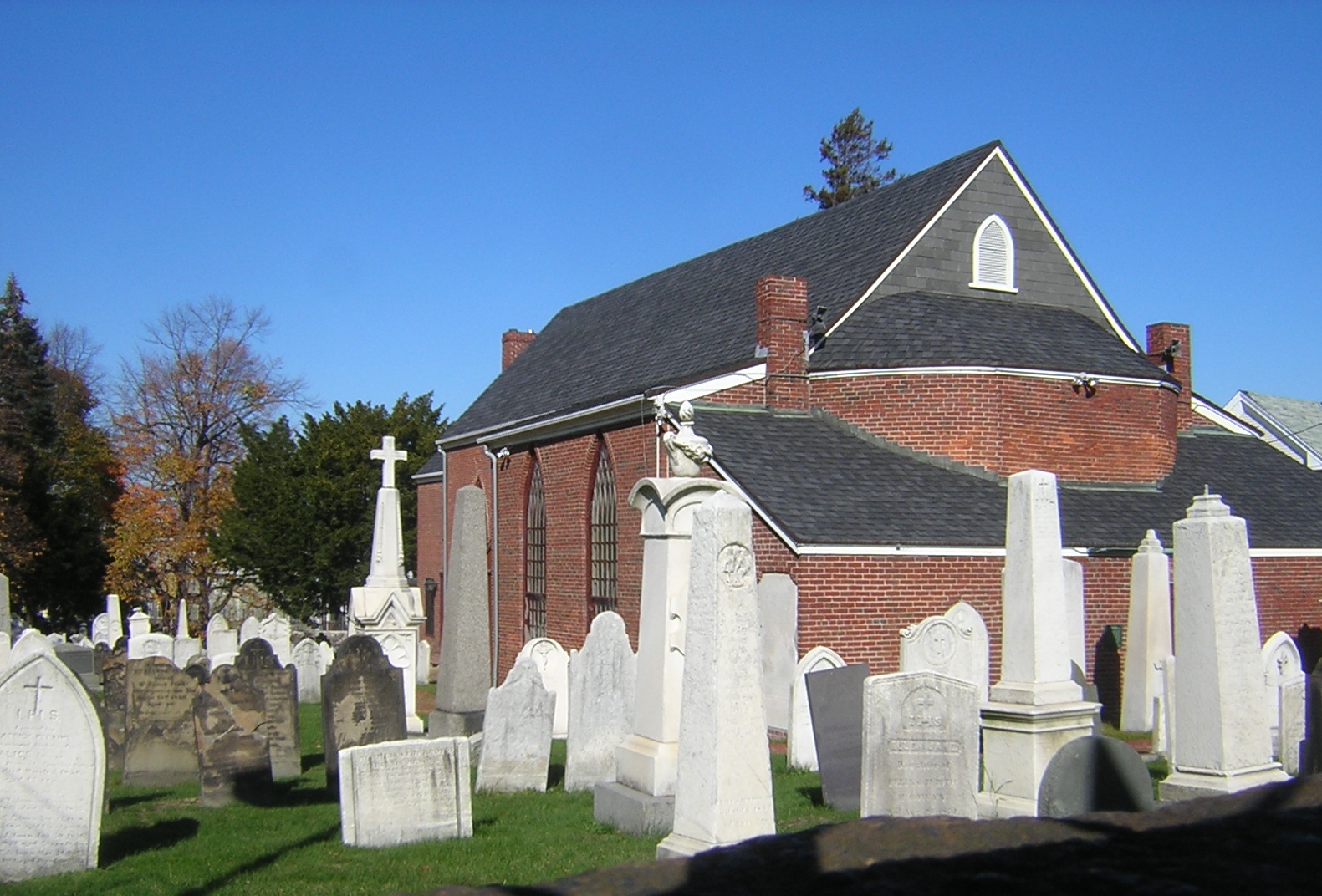
Downtown |
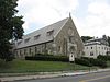
|
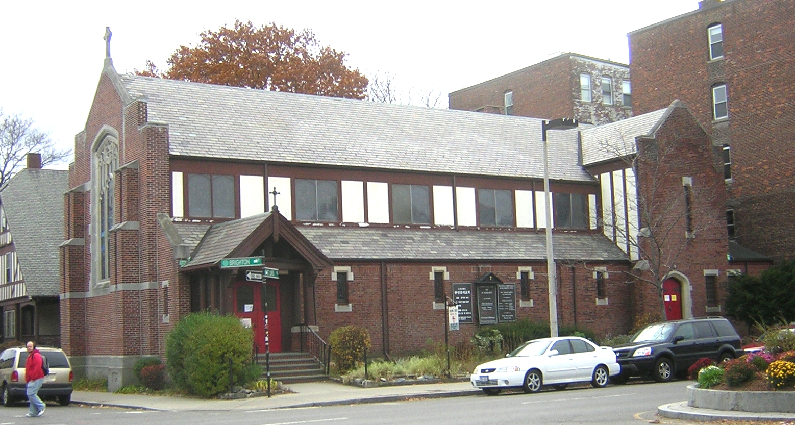
| 28 |
James Blake House |
 |
01974-05-01 May 1, 1974 |
735 Columbia Rd.
42°19′11″N 71°3′37″W / 42.31972°N 71.06028°W / 42.31972; -71.06028 (Blake, James, House) |
Dorchester |
|
| 29 |
Blue Hills Parkway |
 |
02003-06-23 June 23, 2003 |
Blue Hills Parkway
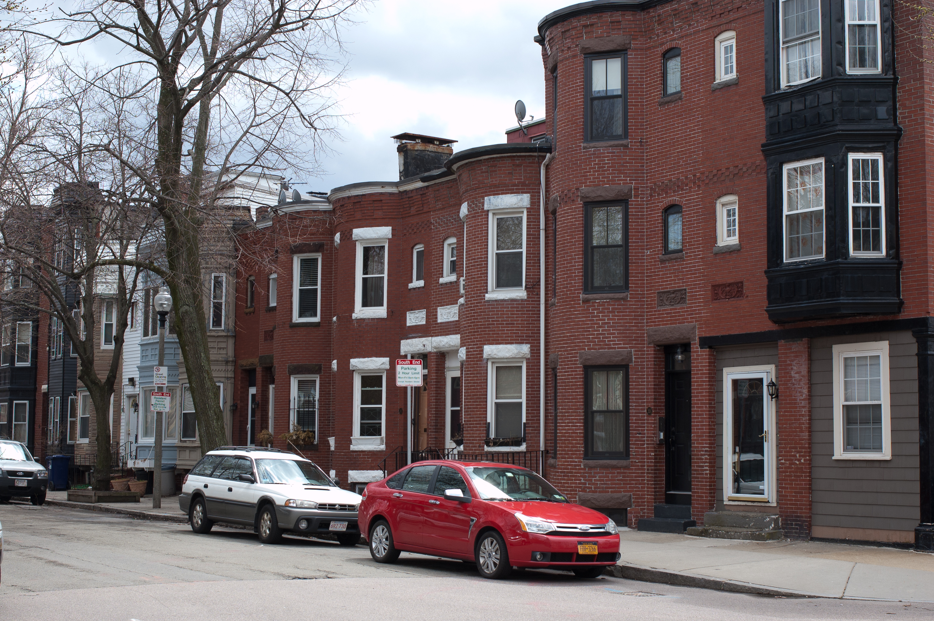
42°15′21″N 71°5′38″W / 42.25583°N 71.09389°W / 42.25583; -71.09389 (Blue Hills Parkway) |
Mattapan |
Extends into Milton in Norfolk County |
| 30 |
Boston African American National Historic Site |
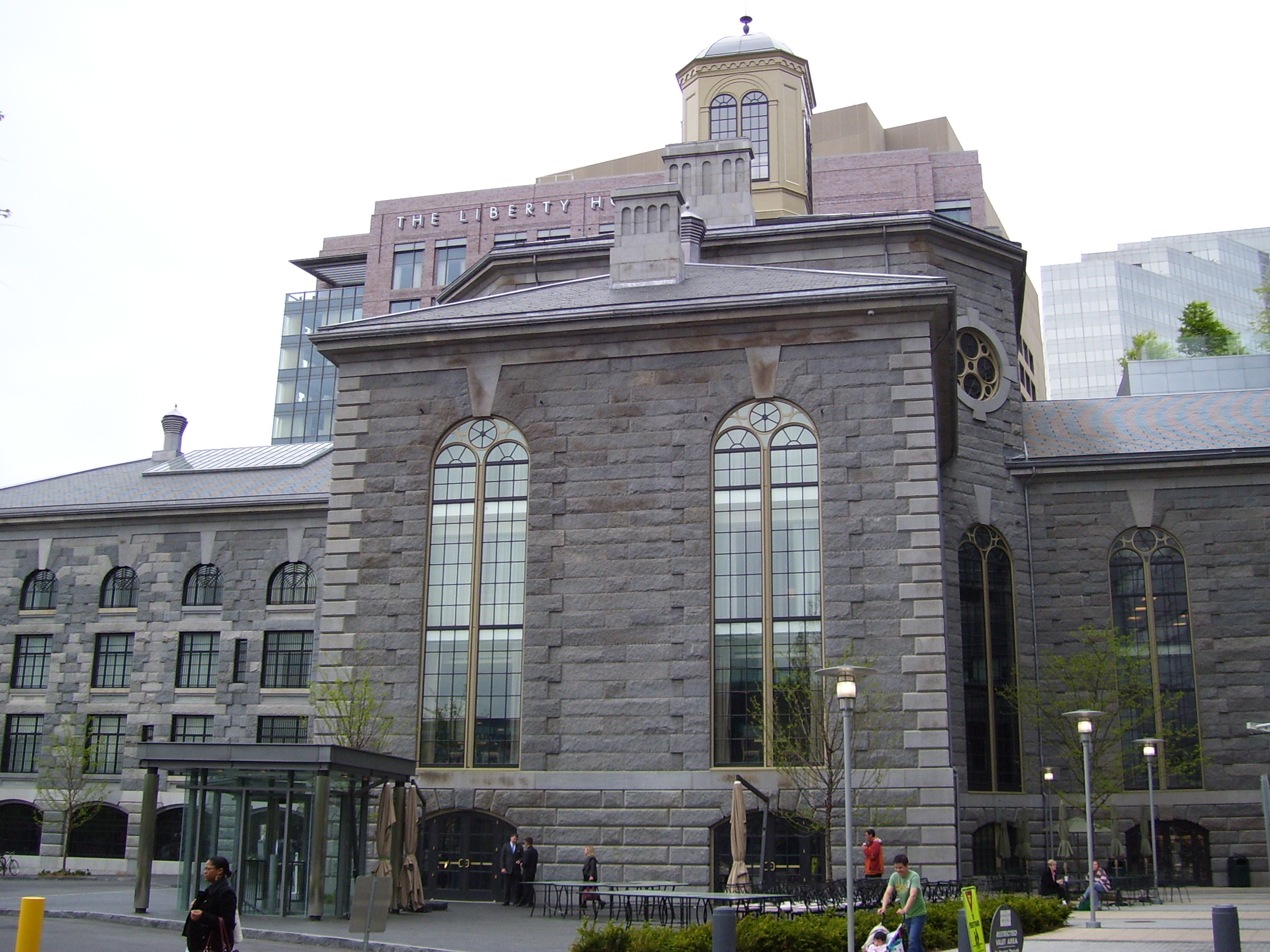
|
01980-10-10 October 10, 1980 |
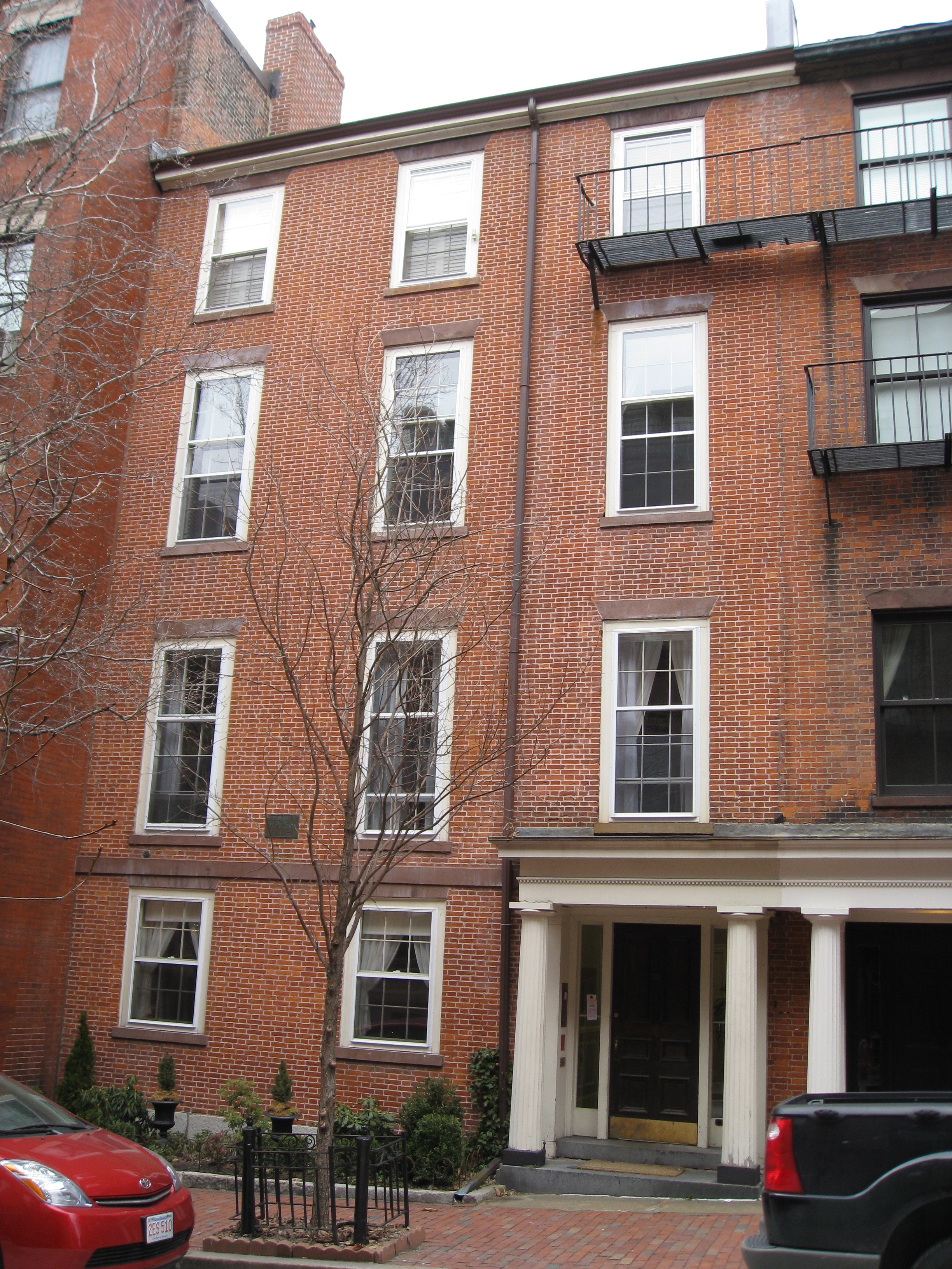
Joy St.
42°21′35.95″N 71°3′54.78″W / 42.3599861°N 71.0652167°W / 42.3599861; -71.0652167 (Boston African American National Historic Site) |
Beacon Hill |
|
| 31 |
Boston Athenaeum |
 |
01966-10-15 October 15, 1966 |
10½ Beacon St.
42°21′28″N 71°3′45″W / 42.35778°N 71.0625°W / 42.35778; -71.0625 (Boston Athenaeum) |
Beacon Hill |
|
| 32 |
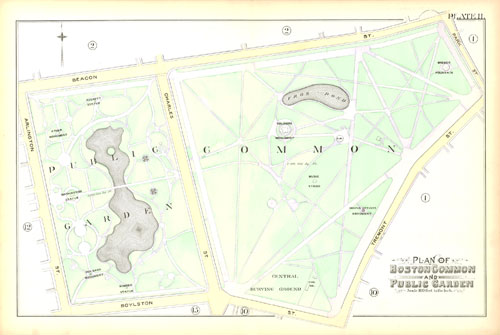
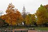
Boston Common |
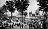 |
01987-02-27 February 27, 1987 |
Beacon, Park, Tremont, Boylston, and Charles St.
42°21′16″N 71°3′54″W / 42.35444°N 71.065°W / 42.35444; -71.065 (Boston Common) |
multiple |
|
| 33 |
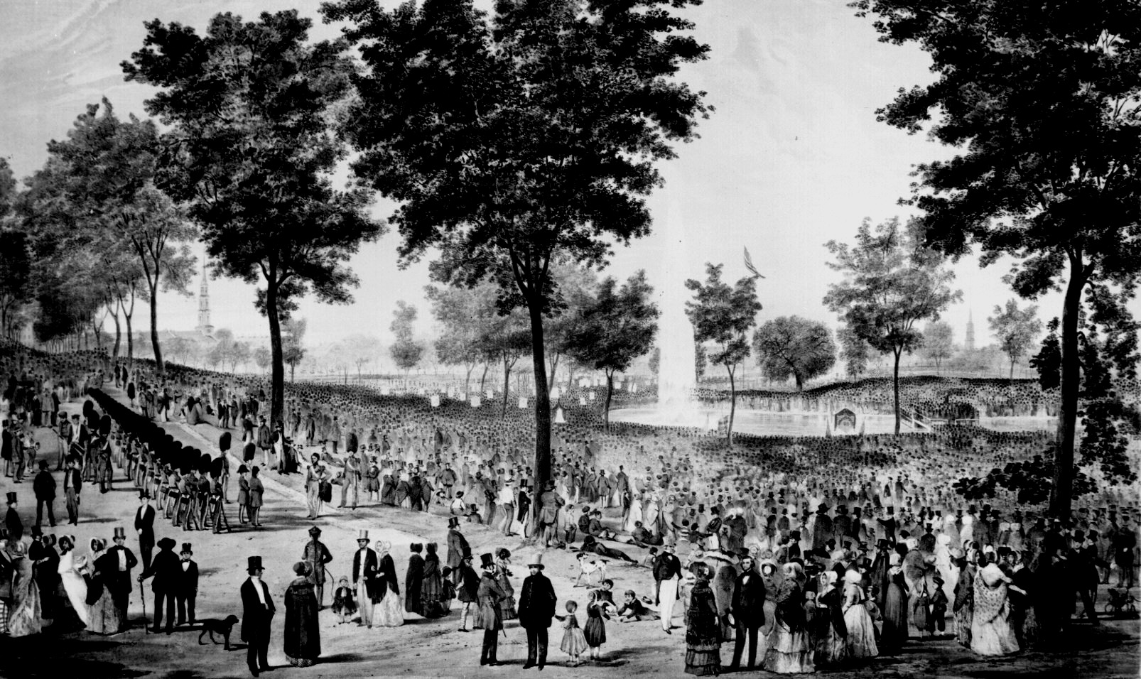
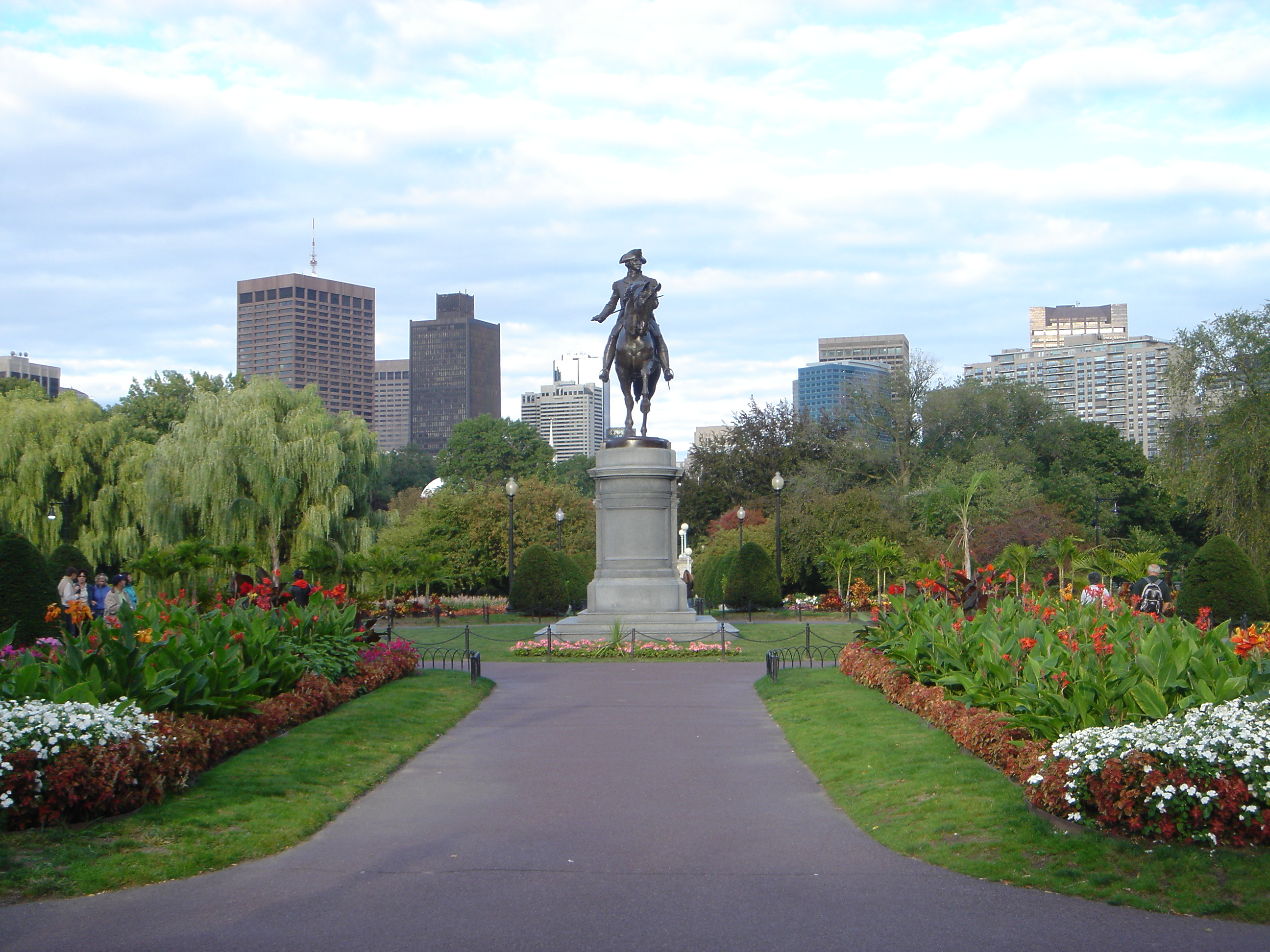
Boston Common and Public Garden |
 |
01972-07-12 July 12, 1972 |
Beacon, Park, Tremont, Boylston, and Arlington Sts.
42°21′14.68″N 71°4′12.14″W / 42.3540778°N 71.0700389°W / 42.3540778; -71.0700389 (Boston Public Garden) |
multiple |
|
| 34 |
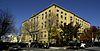
Boston Consumptives Hospital |
 |
02002-02-07 February 7, 2002 |
249 River St.
42°16′34″N 71°5′1″W / 42.27611°N 71.08361°W / 42.27611; -71.08361 (Boston Consumptives Hospital) |
Dorchester |
|
| 35 |
Boston Edison Electric Illuminating Company |
 |
01980-12-09 December 9, 1980 |
25-39 Boylston St.
42°21′8″N 71°3′51″W / 42.35222°N 71.06417°W / 42.35222; -71.06417 (Boston Edison Electric Illuminating Company) |
Chinatown |
|
| 36 |
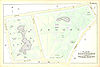
Boston Harbor Islands Archeological District |
 |
01985-12-21 December 21, 1985 |
Address Restricted |
Boston Harbor |
Extends into Quincy in Norfolk County and Hingham in Plymouth County |
| 37 |
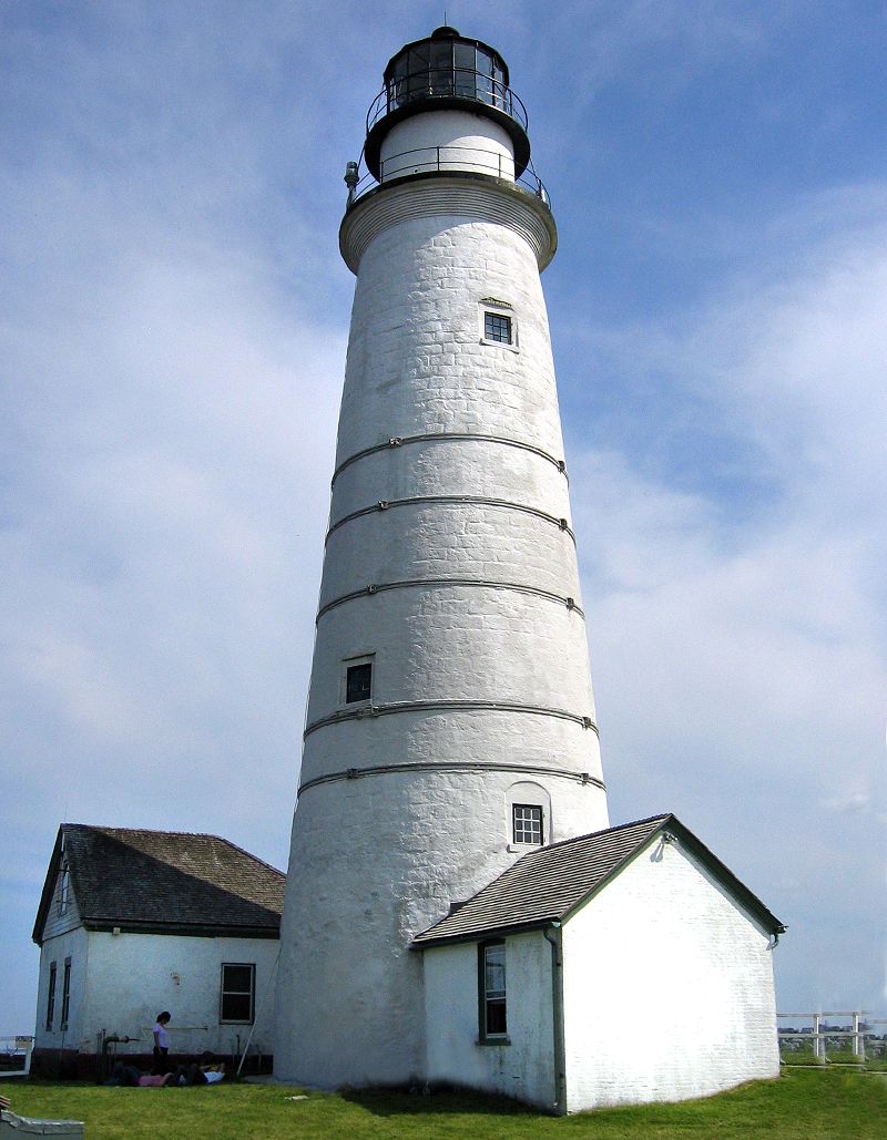
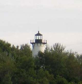
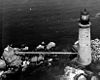
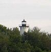
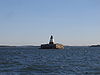
Boston Light |
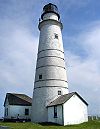 |
01966-10-15 October 15, 1966 |
Little Brewster Island, Boston Harbor
42°19′41″N 70°53′26″W / 42.32806°N 70.89056°W / 42.32806; -70.89056 (Boston Light) |
Boston Harbor |
|
| 38 |
Boston National Historical Park |
 |
01974-10-26 October 26, 1974 |
Inner harbor at the mouth of the Charles River
42°22′12″N 71°3′20″W / 42.37°N 71.05556°W / 42.37; -71.05556 (Boston National Historical Park) |
Boston Harbor |
|
| 39 |
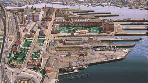
Boston Naval Shipyard |
 |
01966-11-15 November 15, 1966 |
East of Chelsea St., Charlestown
42°22′30″N 71°3′9″W / 42.375°N 71.0525°W / 42.375; -71.0525 (Boston Naval Shipyard) |
Charlestown |
|
| 40 |
Boston Public Garden |
 |
01987-02-27 February 27, 1987 |
Beacon, Charles, Boylston, and Arlington Sts.
42°21′14.68″N 71°4′12.14″W / 42.3540778°N 71.0700389°W / 42.3540778; -71.0700389 (Boston Public Garden) |
Back Bay |
|
| 41 |
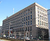
Boston Public Library |
 |
01973-05-06 May 6, 1973 |
Copley Sq.
42°20′57″N 71°4′43″W / 42.34917°N 71.07861°W / 42.34917; -71.07861 (Boston Public Library) |
Back Bay |
|
| 42 |
Boston Transit Commission Building |
 |
02007-08-31 August 31, 2007 |
15 Beacon St.
42°21′30″N 71°3′46″W / 42.35833°N 71.06278°W / 42.35833; -71.06278 (Boston Transit Commission Building) |
Beacon Hill |
|
| 43 |
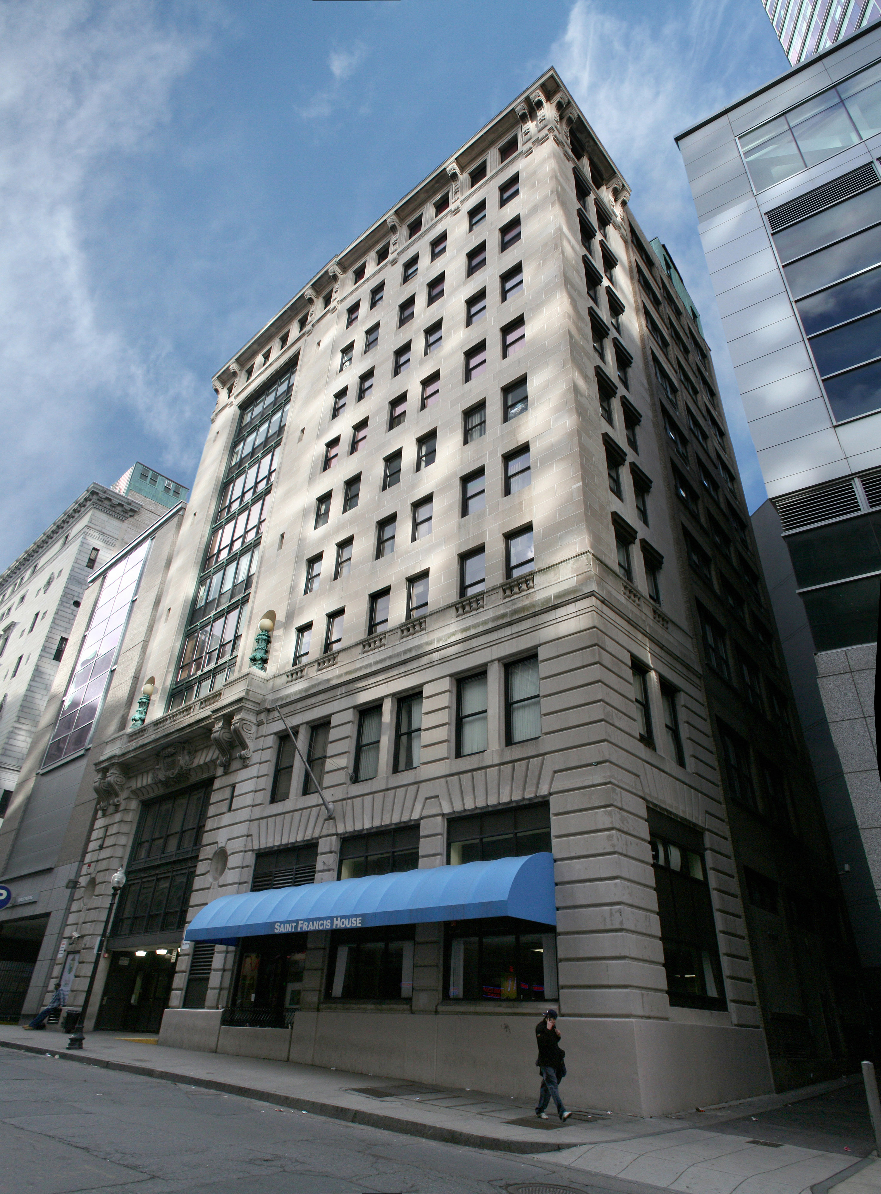
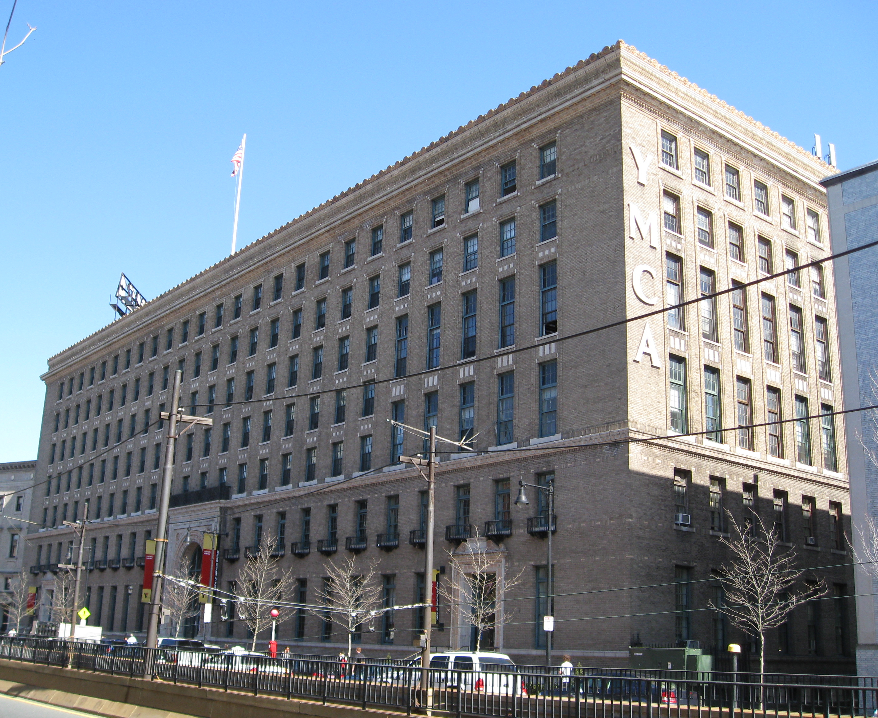
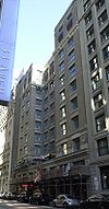
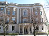
Boston Young Men's Christian Association |
 |
01998-08-20 August 20, 1998 |
312-320 Huntington Ave.
42°20′26.4″N 71°5′14.1″W / 42.340667°N 71.08725°W / 42.340667; -71.08725 (Boston Young Men's Christian Association) |
Fenway-Kenmore |
|
| 44 |
Boston Young Men's Christian Union |
 |
01980-12-09 December 9, 1980 |
48 Boylston St.
42°21′7″N 71°3′53″W / 42.35194°N 71.06472°W / 42.35194; -71.06472 (Boston Young Men's Christian Union) |
Chinatown |
|
| 45 |
Bowditch School |
 |
01990-08-03 August 3, 1990 |
80-82 Greene St.
42°18′42″N 71°6′36″W / 42.31167°N 71.11°W / 42.31167; -71.11 (Bowditch School) |
Jamaica Plain |
|
| 46 |
Boylston Building |
 |
01980-12-09 December 9, 1980 |
2-22 Boylston St.
42°21′7″N 71°3′49″W / 42.35194°N 71.06361°W / 42.35194; -71.06361 (Boylston Building) |
Chinatown |
|
| 47 |
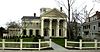
Brandegee Estate |
|
01985-10-17 October 17, 1985 |
280 Newton St.
42°18′18″N 71°8′5″W / 42.305°N 71.13472°W / 42.305; -71.13472 (Brandegee Estate) |
West Roxbury |
Extends into Brookline in Norfolk County |
| 48 |
Brighton Center Historic District |
 |
02001-02-20 February 20, 2001 |
Academy Hill Rd., Chestnut Hill Ave., Dighton, Elko, Henshaw, Leicester, Market, Washington, and Winship Sts.
42°20′56.88″N 71°9′12.49″W / 42.3491333°N 71.1534694°W / 42.3491333; -71.1534694 (Brighton Evangelical Congregational Church) |
Brighton |
|
| 49 |
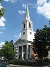
Brighton Evangelical Congregational Church |
 |
01997-08-21 August 21, 1997 |
404-410 Washington St.
42°20′55″N 71°9′22″W / 42.34861°N 71.15611°W / 42.34861; -71.15611 (Brighton Evangelical Congregational Church) |
Brighton |
|
| 50 |
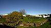
Brook Farm |
 |
01966-10-15 October 15, 1966 |
670 Baker St.
42°17′14″N 71°10′43″W / 42.28722°N 71.17861°W / 42.28722; -71.17861 (Brook Farm) |
West Roxbury |
|
| 51 |
Building at 138-142 Portland Street |
 |
01985-09-05 September 5, 1985 |
138-142 Portland St.
42°21′51″N 71°3′43″W / 42.36417°N 71.06194°W / 42.36417; -71.06194 (Building at 138--142 Portland Street) |
Downtown |
|
| 52 |
Bulfinch Triangle Historic District |
 |
01986-02-27 February 27, 1986 |
Roughly bounded by Canal, Market, Merrimac, and Causeway Sts.
42°21′50″N 71°3′41″W / 42.36389°N 71.06139°W / 42.36389; -71.06139 (Bulfinch Triangle Historic District) |
Downtown |
|
| 53 |
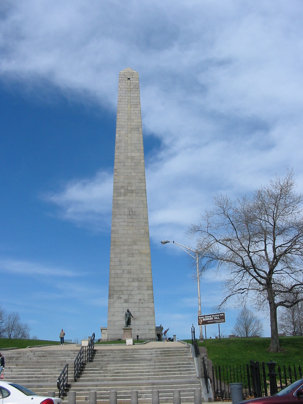
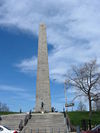
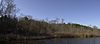
Bunker Hill Monument |
 |
01966-10-15 October 15, 1966 |
Breed's Hill
42°22′35″N 71°3′41″W / 42.37639°N 71.06139°W / 42.37639; -71.06139 (Bunker Hill Monument) |
Charlestown |
|
| 54 |
Bunker Hill School |
 |
01987-10-15 October 15, 1987 |
68 Baldwin St.
42°22′56″N 71°4′15″W / 42.38222°N 71.07083°W / 42.38222; -71.07083 (Bunker Hill School) |
Charlestown |
|
| 55 |
Calf Pasture Pumping Station Complex |
 |
01990-08-02 August 2, 1990 |
435 Mount Vernon St.
42°18′48″N 71°2′1″W / 42.31333°N 71.03361°W / 42.31333; -71.03361 (Calf Pasture Pumping Station Complex) |
Dorchester |
|
| 56 |
Cathedral of St. George Historic District |
 |
01998-11-25 November 25, 1998 |
517-523-525 E. Broadway
42°20′7.1″N 71°2′36.8″W / 42.335306°N 71.043556°W / 42.335306; -71.043556 (Cathedral of St. George Historic District) |
South Boston |
|
| 57 |
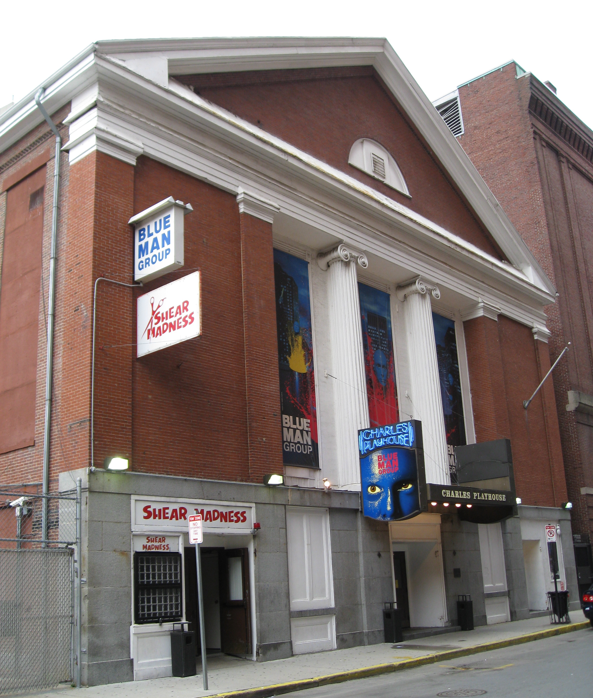
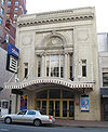
Charles Playhouse |
 |
01980-06-16 June 16, 1980 |
74-78 Warenton St.
42°20′58″N 71°3′59″W / 42.34944°N 71.06639°W / 42.34944; -71.06639 (Charles Playhouse) |
Theatre District |
|
| 58 |
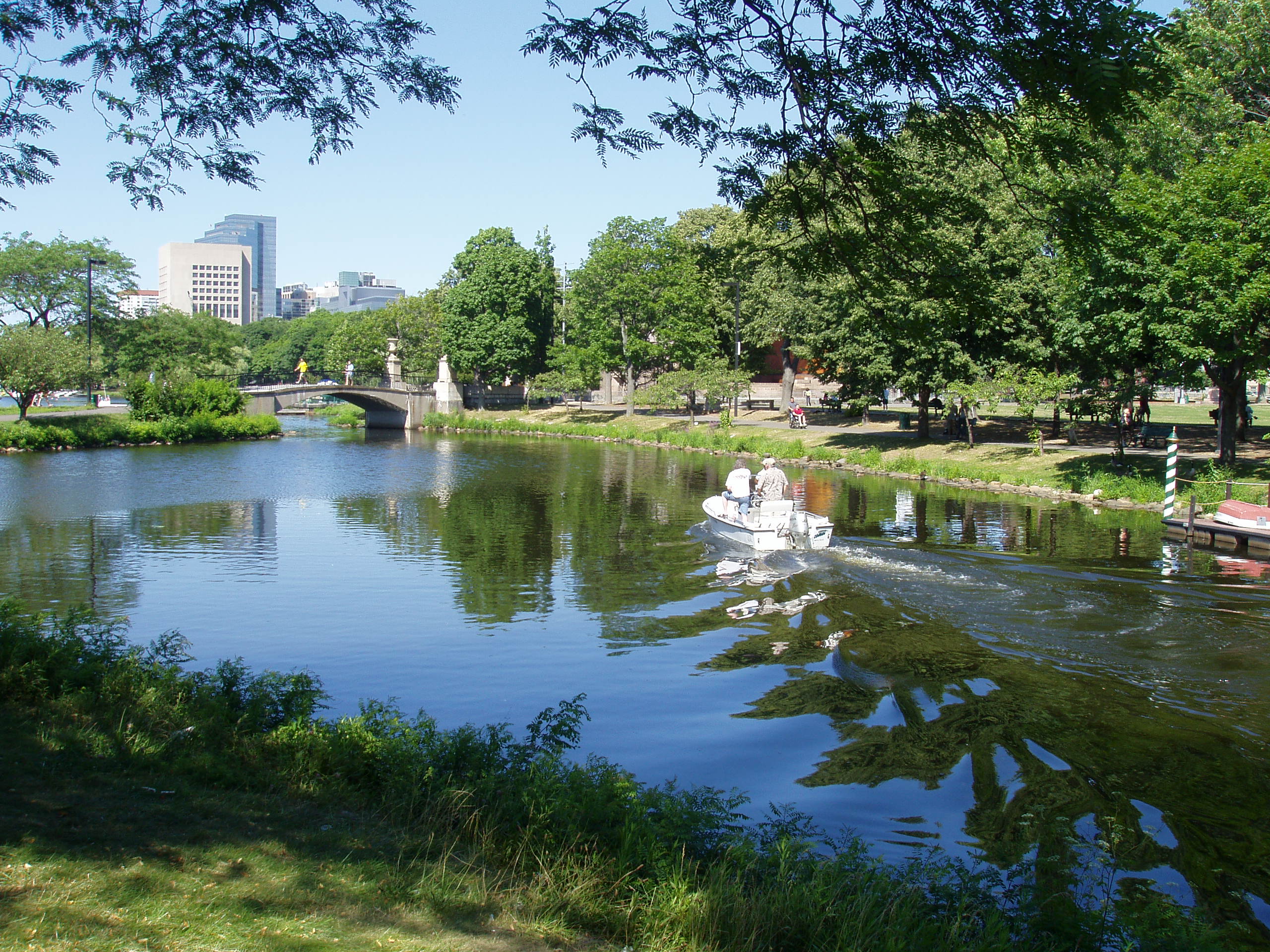
Charles River Basin Historic District |
 |
01978-12-22 December 22, 1978 |
Both banks of the Charles River from Eliot Bridge to Charles River Dam
42°21′46″N 71°6′28″W / 42.36278°N 71.10778°W / 42.36278; -71.10778 (Charles River Basin Historic District) |
Back Bay |
|
| 59 |
Charles River Reservation Parkways |
 |
02006-01-18 January 18, 2006 |
Soldiers Field, Nonantum, Leo Birmingham, Arsenal, Greenough, N. Beacon, Charles River, Norumbega, Recreation
42°21′42″N 71°9′31″W / 42.36167°N 71.15861°W / 42.36167; -71.15861 (Charles River Reservation Parkways) |
Allston/Brighton |
Extends into Cambridge, Newton, Waltham, and Watertown and Weston in Middlesex County |
| 60 |
Charles River Reservation (Speedway)-Upper Basin Headquarters |
 |
02010-07-19 July 19, 2010 |
1420-1440 Soldiers Field Rd.
42°21′41″N 71°8′47″W / 42.36139°N 71.14639°W / 42.36139; -71.14639 (Charles River Reservation (Speedway)-Upper Basin Headquarters) |
Brighton |
|
| 61 |
Charles Street African Methodist Episcopal Church |
 |
01983-09-01 September 1, 1983 |
551 Warren St.
42°18′45″N 71°5′3″W / 42.3125°N 71.08417°W / 42.3125; -71.08417 (Charles Street African Methodist Episcopal Church) |
Roxbury |
|
| 62 |
Charlestown Heights |
 |
01998-01-08 January 8, 1998 |
Roughly bounded by St. Martin, Bunker Hill, Medford, and Sackville Sts.
42°22′56″N 71°4′5″W / 42.38222°N 71.06806°W / 42.38222; -71.06806 (Charlestown Heights) |
Charlestown |
|
| 63 |
Chestnut Hill Reservoir Historic District |
 |
01990-01-18 January 18, 1990 |
Beacon St. and Commonwealth Ave.
42°19′58″N 71°9′27″W / 42.33278°N 71.1575°W / 42.33278; -71.1575 (Chestnut Hill Reservoir Historic District) |
Brighton |
|
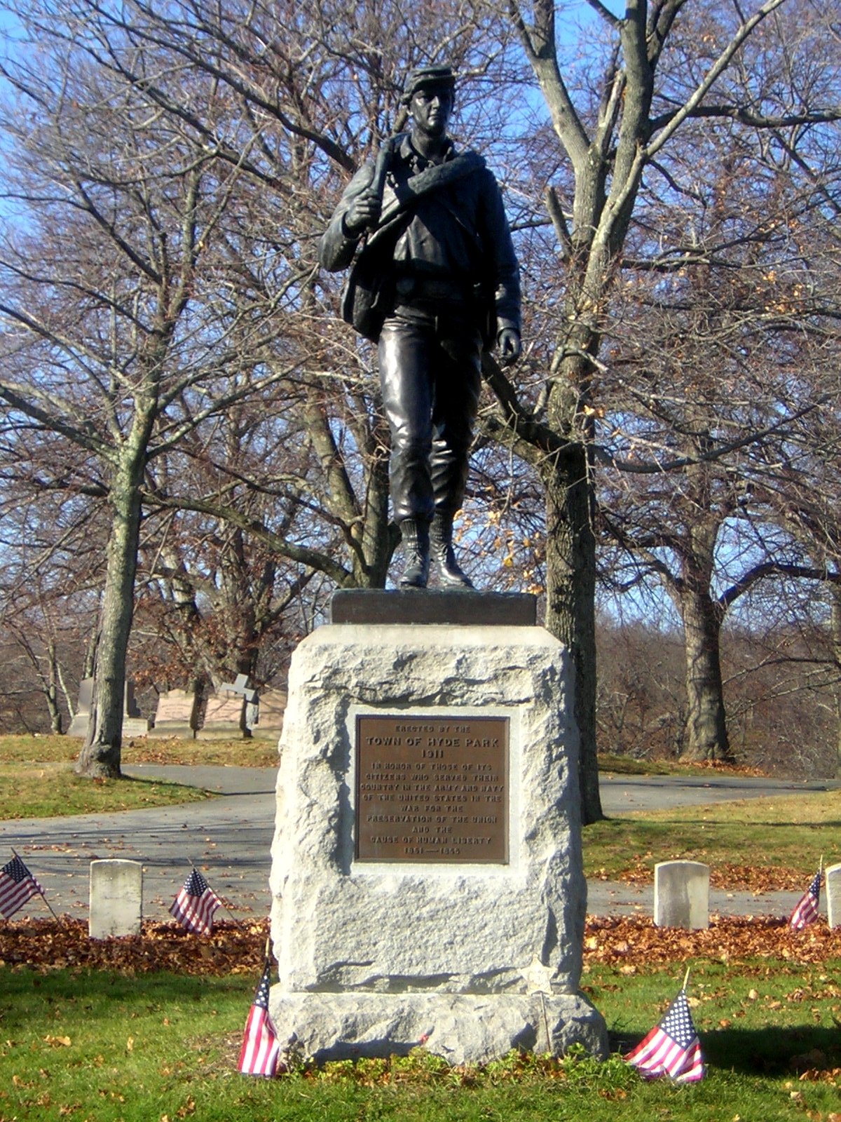
| 64 |
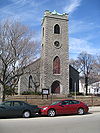
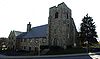
Christ Church |
 |
01986-01-30 January 30, 1986 |
1220 River St.
42°15′38″N 71°7′48″W / 42.26056°N 71.13°W / 42.26056; -71.13 (Christ Church) |
Hyde Park |
|
| 65 |
Church Green Buildings Historic District |
 |
01999-12-30 December 30, 1999 |
101-113 Summer St.
42°21′12″N 71°3′30″W / 42.35333°N 71.05833°W / 42.35333; -71.05833 (Church Green Buildings Historic District) |
Downtown |
|
| 66 |
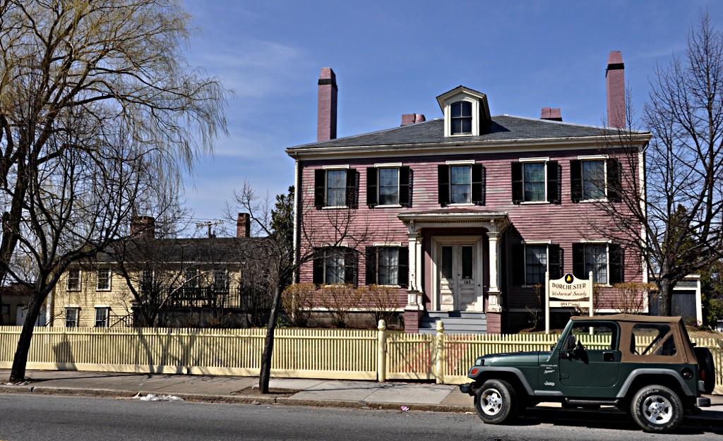
Clapp Houses |
 |
01974-05-02 May 2, 1974 |
199 and 195 Boston St.
42°19′12″N 71°3′25″W / 42.32°N 71.05694°W / 42.32; -71.05694 (Clapp Houses) |
Dorchester |
Home of the Dorchester Historic Society |
| 67 |
Codman Building |
 |
01983-10-19 October 19, 1983 |
55 Kilby St.
42°21′28″N 71°3′23″W / 42.35778°N 71.05639°W / 42.35778; -71.05639 (Codman Building) |
Downtown |
|
| 68 |
Codman Square District |
|
01983-06-23 June 23, 1983 |
Norfolk, Talbot, Epping, Lithgow, Centre, and Moultrie Sts.
42°21′28″N 71°3′23″W / 42.35778°N 71.05639°W / 42.35778; -71.05639 (Codman Building) |
Dorchester |
|
| 69 |
Collins Building |
|
02005-06-08 June 8, 2005 |
213-217 Washington St.
42°18′2″N 71°4′37″W / 42.30056°N 71.07694°W / 42.30056; -71.07694 (Collins Building) |
Dorchester |
|
| 70 |
Compton Building |
 |
02008-12-31 December 31, 2008 |
159, 161–175 Devonshire Street, 18–20 Arch Street
42°21′21″N 71°3′27″W / 42.35583°N 71.0575°W / 42.35583; -71.0575 (Compton Building) |
Downtown |
|
| 71 |
Congregation Adath Jeshurun |
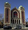 |
01999-11-12 November 12, 1999 |
397 Blue Hill Ave.
42°18′43″N 71°4′53″W / 42.31194°N 71.08139°W / 42.31194; -71.08139 (Congregation Adath Jeshurun) |
Dorchester |
|
| 72 |
Congress Street Fire Station |
 |
01987-09-03 September 3, 1987 |
344 Congress St.
42°20′58″N 71°2′56″W / 42.34944°N 71.04889°W / 42.34944; -71.04889 (Congress Street Fire Station) |
South Boston |
|
| 73 |
Copp's Hill Burial Ground |
 |
01974-04-18 April 18, 1974 |
Charter, Snowhill, and Hull Sts.
42°22′2″N 71°3′23″W / 42.36722°N 71.05639°W / 42.36722; -71.05639 (Copp's Hill Burial Ground) |
North End |
|
| 74 |
Copp's Hill Terrace |
 |
01990-04-19 April 19, 1990 |
Between Commercial and Charter Sts. west of Jackson Place
42°22′4″N 71°3′22″W / 42.36778°N 71.05611°W / 42.36778; -71.05611 (Copp's Hill Terrace) |
North End |
|
| 75 |
Crowninshield House |
 |
01972-02-23 February 23, 1972 |
164 Marlborough St.
42°21′9″N 71°4′45″W / 42.3525°N 71.07917°W / 42.3525; -71.07917 (Crowninshield House) |
Back Bay |
|
| 76 |
Custom House District |
 |
01973-05-11 May 11, 1973 |
Between the J.F.K. Expressway and Kirby St. and S. Market and High and Batterymarch Sts.
42°21′28″N 71°3′12″W / 42.35778°N 71.05333°W / 42.35778; -71.05333 (Custom House District) |
Downtown |
|
| 77 |
Cyclorama Building |
 |
01973-04-13 April 13, 1973 |
543-547 Tremont St.
42°20′40″N 71°4′19″W / 42.34444°N 71.07194°W / 42.34444; -71.07194 (Cyclorama Building) |
South End |
|
| 78 |
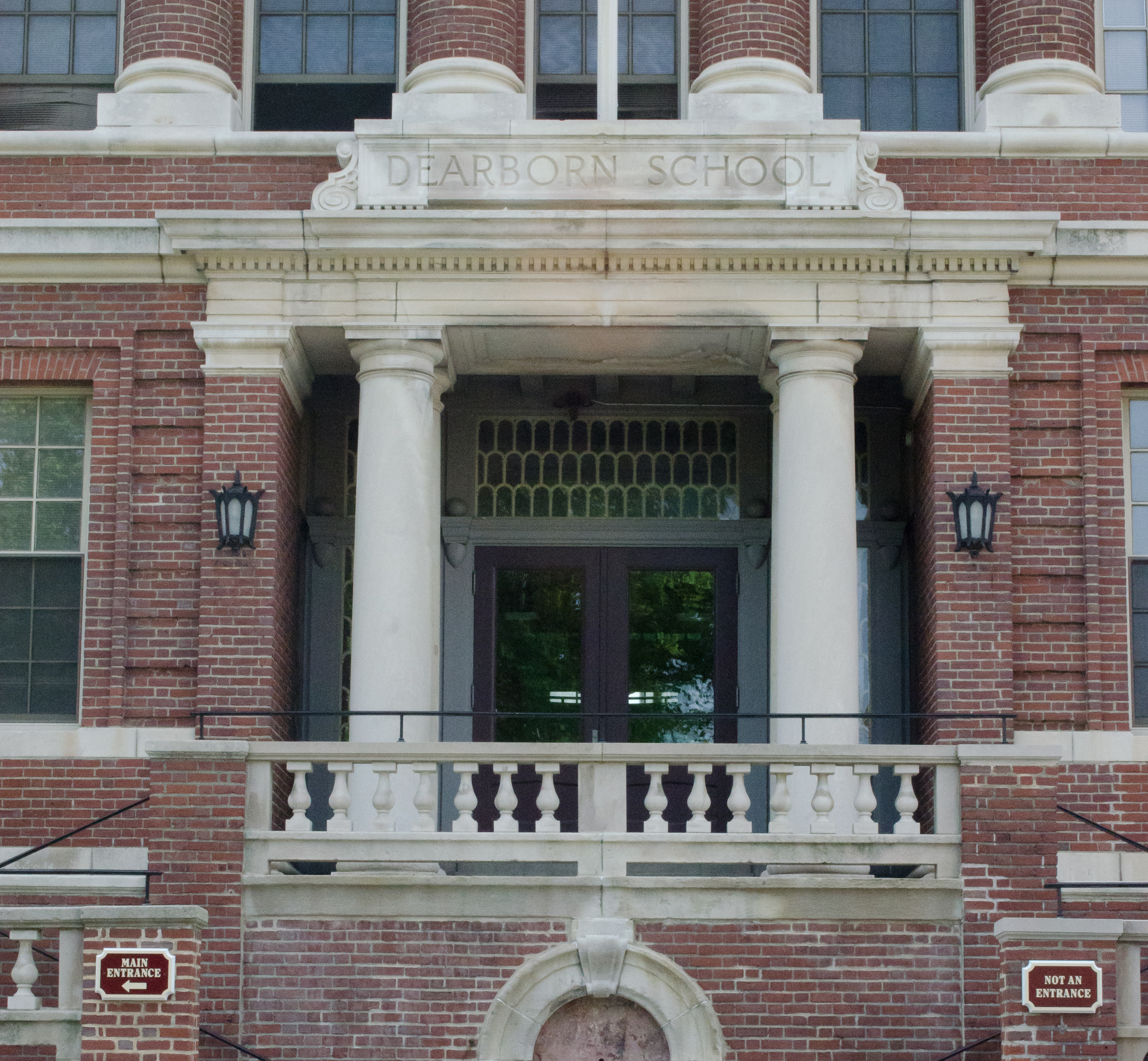
Dearborn School |
 |
02000-08-02 August 2, 2000 |
25 Ambrose St.
42°19′46″N 71°4′42″W / 42.32944°N 71.07833°W / 42.32944; -71.07833 (Dearborn School) |
Roxbury |
|
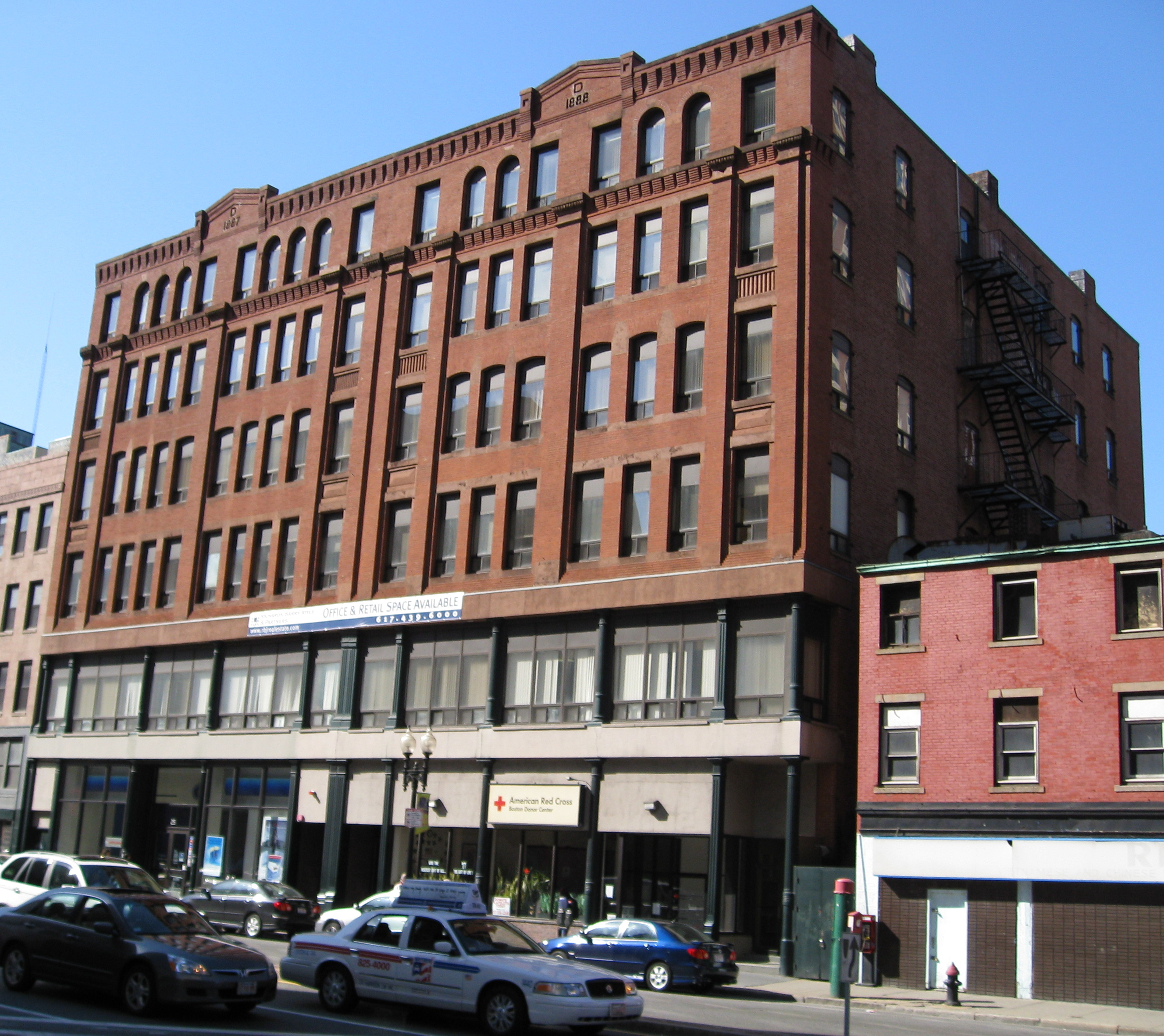
| 79 |
Dill Building |
 |
01980-12-09 December 9, 1980 |
11-25 Stuart St.
42°21′4″N 71°3′50″W / 42.35111°N 71.06389°W / 42.35111; -71.06389 (Dill Building) |
Theatre District |
|
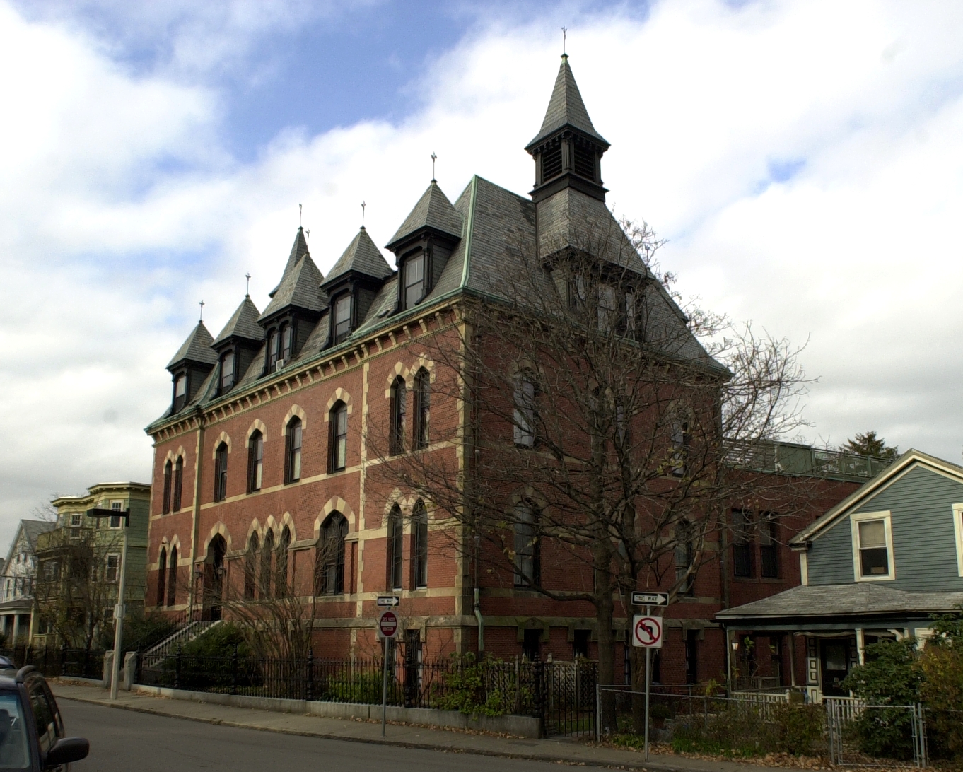
| 80 |
Dillaway School |
 |
01980-04-09 April 9, 1980 |
16-20 Kenilworth St.
42°19′43″N 71°5′14″W / 42.32861°N 71.08722°W / 42.32861; -71.08722 (Dillaway School) |
Roxbury |
|
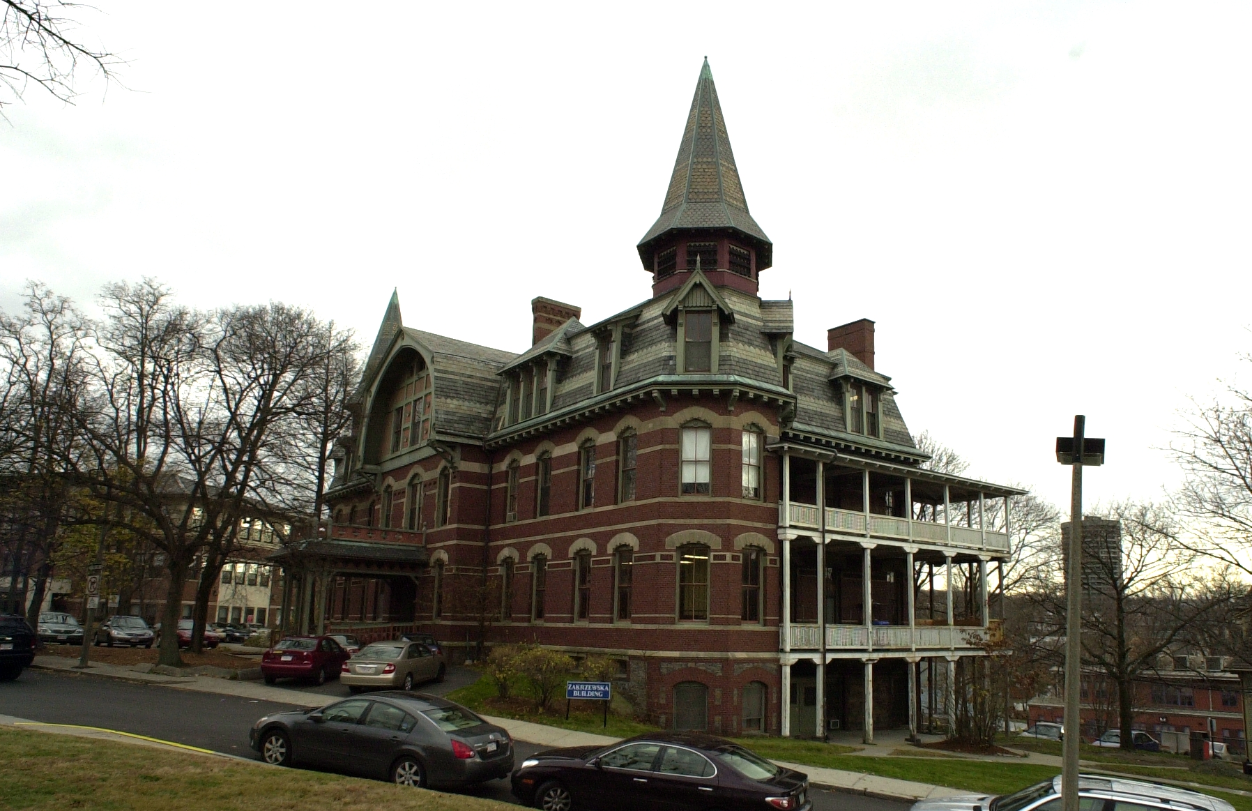
| 81 |
Dimock Community Health Center Complex |
 |
01985-02-21 February 21, 1985 |
41 and 55 Dimock St.
42°19′14″N 71°5′51″W / 42.32056°N 71.0975°W / 42.32056; -71.0975 (Dimock Community Health Center Complex) |
Roxbury |
|
| 82 |
District 13 Police Station |
 |
01988-02-10 February 10, 1988 |
28 Seaverns Ave.
42°18′43″N 71°6′46″W / 42.31194°N 71.11278°W / 42.31194; -71.11278 (District 13 Police Station) |
Jamaica Plain |
|
| 83 |
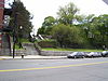
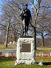
Dorchester Heights National Historic Site |
 |
01966-10-15 October 15, 1966 |
South Boston
42°19′58″N 71°2′47″W / 42.33278°N 71.04639°W / 42.33278; -71.04639 (Dorchester Heights National Historic Site) |
South Boston |
|
| 84 |
Dorchester Heights Historic District |
 |
02001-11-01 November 1, 2001 |
Roughly a one block area surrounding Telegraph Hill
42°19′58″N 71°2′48″W / 42.33278°N 71.04667°W / 42.33278; -71.04667 (Dorchester Heights Historic District) |
South Boston |
|
| 85 |
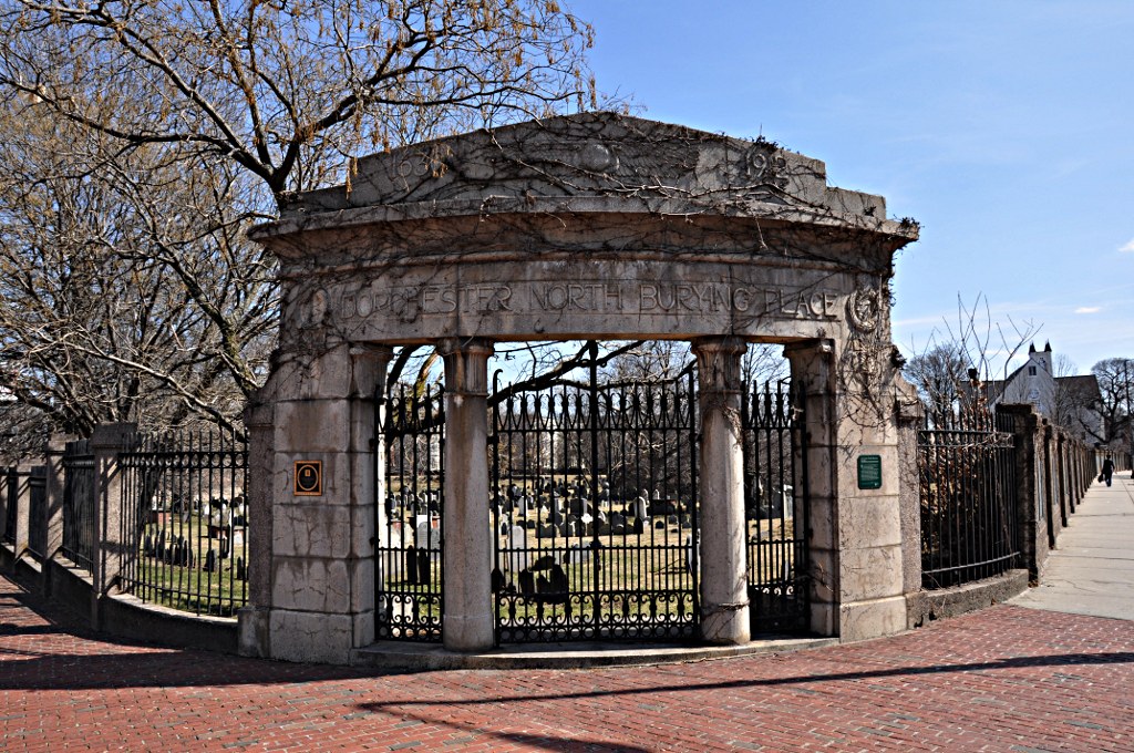
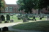
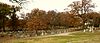
Dorchester North Burying Ground |
 |
01974-04-18 April 18, 1974 |
Stoughton St. and Columbia Rd.
42°19′0″N 71°3′52″W / 42.316667°N 71.06444°W / 42.316667; -71.06444 (Dorchester North Burying Ground) |
Dorchester |
|
| 86 |
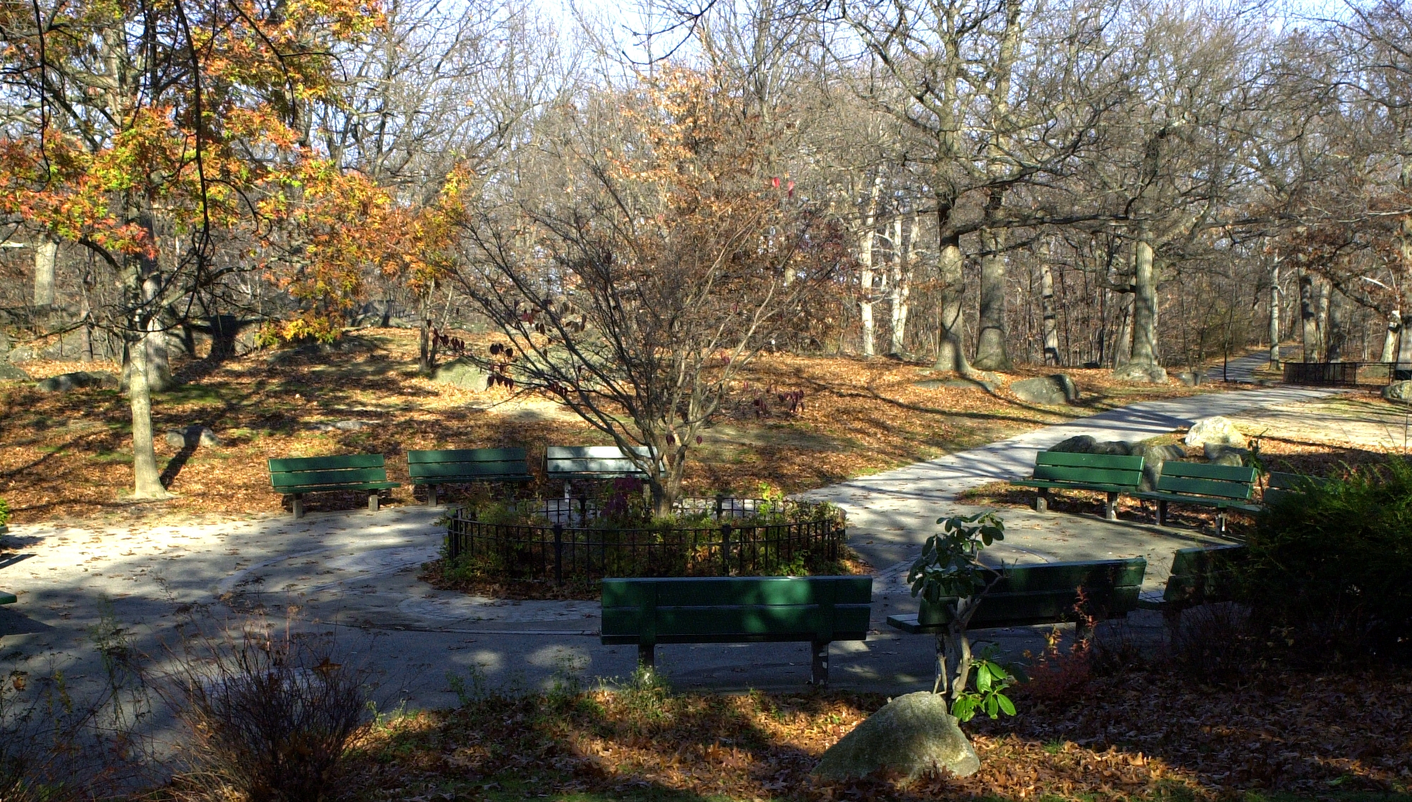
Dorchester Park |
 |
02008-02-20 February 20, 2008 |
Bounded by Dorchester Ave., Richmond, Adams, and Richview Sts.
42°16′34.02″N 71°4′1.25″W / 42.2761167°N 71.0670139°W / 42.2761167; -71.0670139 (Dorchester Park) |
Dorchester |
|
| 87 |
Dorchester Pottery Works |
 |
01985-02-21 February 21, 1985 |
101-105 Victory Rd.
42°17′49″N 71°3′5″W / 42.29694°N 71.05139°W / 42.29694; -71.05139 (Dorchester Pottery Works) |
Dorchester |
|
| 88 |
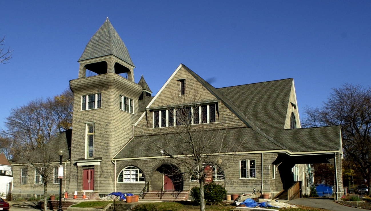
Dorchester Temple Baptist Church |
 |
01998-01-16 January 16, 1998 |
670 Washington St.
42°17′17″N 71°4′17″W / 42.28806°N 71.07139°W / 42.28806; -71.07139 (Dorchester Temple Baptist Church) |
Dorchester |
|
| 89 |
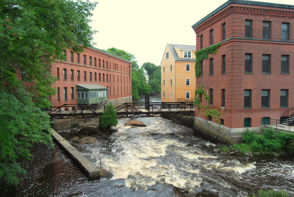
Dorchester-Milton Lower Mills Industrial District |
 |
01980-04-02 April 2, 1980 |
Both sides of the Neponset River; also Adams, River, and Medway Sts., Millers Lane, and Eliot and Adams Sts.
42°16′16″N 71°4′8″W / 42.27111°N 71.06889°W / 42.27111; -71.06889 (Dorchester-Milton Lower Mills Industrial District) |
Dorchester |
Extends into Milton in Norfolk County; second set of addresses represents a boundary increase |
| 90 |
Frederick Douglass Square Historic District |
 |
01996-10-03 October 3, 1996 |
Roughly bounded by Hammond St., Cobat St., Windsor St., and Westminister St., Lower Roxbury
42°20′9″N 71°5′4″W / 42.33583°N 71.08444°W / 42.33583; -71.08444 (Douglass, Frederick, Square Historic District) |
Roxbury |
|
| 91 |
Dudley Station Historic District |
 |
01985-12-05 December 5, 1985 |
Washington, Warren, and Dudley Sts.
42°19′48″N 71°5′4″W / 42.33°N 71.08444°W / 42.33; -71.08444 (Dudley Station Historic District) |
Roxbury |
|
| 92 |
Eagle Hill Historic District |
|
01998-02-26 February 26, 1998 |
Roughly bounded by Border, Lexington, Trenton, and Falcon Sts.
42°22′18″N 71°2′10″W / 42.37167°N 71.03611°W / 42.37167; -71.03611 (Eagle Hill Historic District) |
East Boston |
|
| 93 |
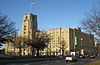
Old East Boston High School |
 |
02006-03-15 March 15, 2006 |
127 Marion St.
42°22′41″N 71°2′16″W / 42.37806°N 71.03778°W / 42.37806; -71.03778 (East Boston High School, Old) |
East Boston |
|
| 94 |
Edna G. shipwreck (eastern rig dragger) |
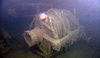 |
02010-11-22 November 22, 2010 |
Stellwagen Bank National Marine Sanctuary |
Boston vicinity |
Eastern Rig Dragger Fishing Vessel Shipwrecks in the Stellwagen Bank National Marine Sanctuary MPS |
| 95 |
Egleston Substation |
|
02010-12-27 December 27, 2010 |
3025 Washington St.
42°19′1″N 71°5′51″W / 42.31694°N 71.0975°W / 42.31694; -71.0975 (Egleston Substation) |
Jamaica Plain |
|
| 96 |
Eliot Burying Ground |
 |
01974-06-25 June 25, 1974 |
Eustis and Washington Sts.
42°19′55″N 71°4′55″W / 42.33194°N 71.08194°W / 42.33194; -71.08194 (Eliot Burying Ground) |
Roxbury |
|
| 97 |
Eliot Congregational Church |
 |
01994-02-09 February 9, 1994 |
56 Dale St., corner 118-120 Walnut St.
42°19′10″N 71°4′55″W / 42.31944°N 71.08194°W / 42.31944; -71.08194 (Eliot Congregational Church) |
Roxbury |
|
| 98 |
Eliot Hall |
 |
01988-07-15 July 15, 1988 |
7A Eliot St.
42°18′37″N 71°6′59″W / 42.31028°N 71.11639°W / 42.31028; -71.11639 (Eliot Hall) |
Jamaica Plain |
|
| 99 |
Engine House No. 34 |
 |
01985-10-24 October 24, 1985 |
444 Western Ave.
42°21′43″N 71°8′30″W / 42.36194°N 71.14167°W / 42.36194; -71.14167 (Engine House No. 34) |
Brighton |
|
| 100 |
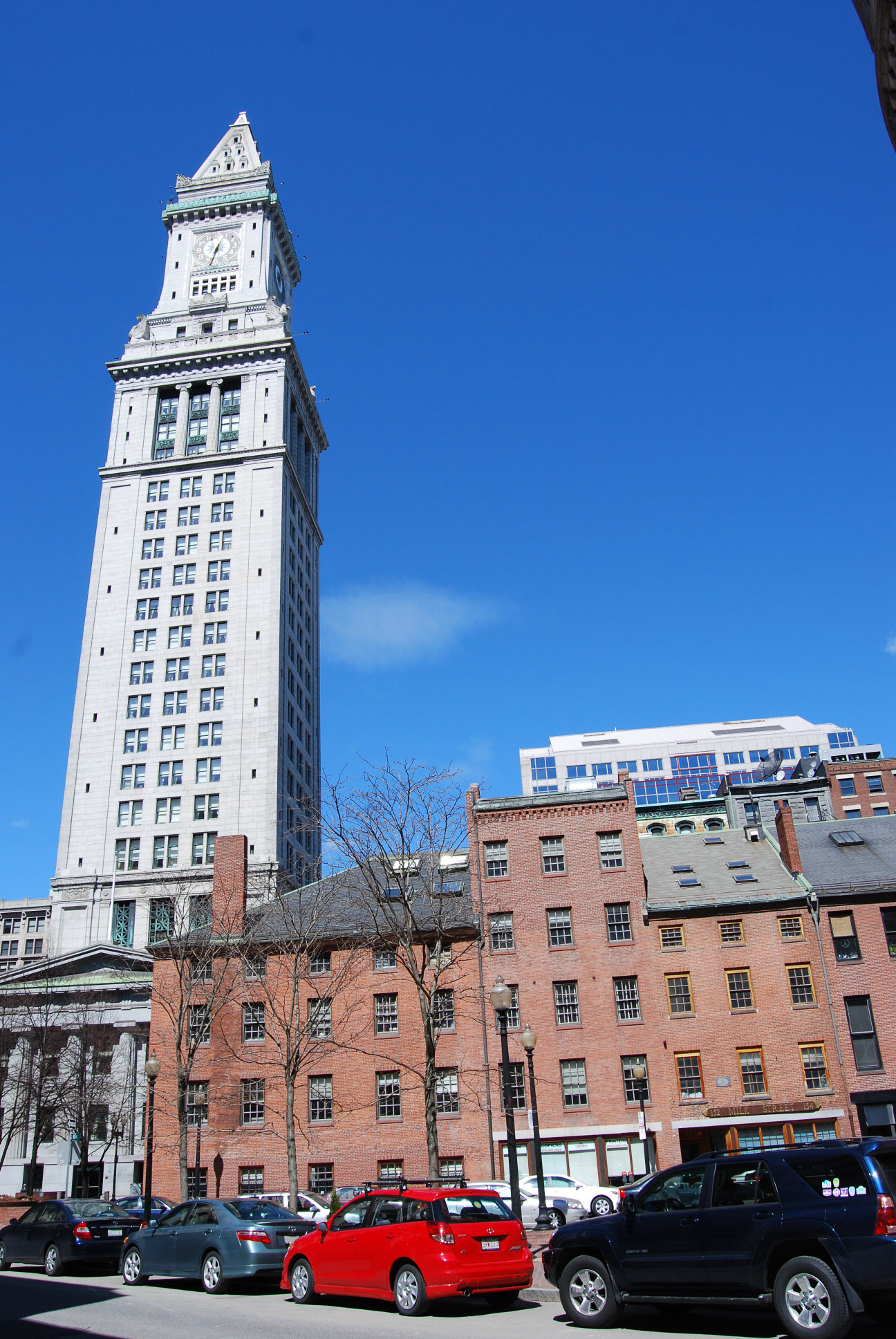
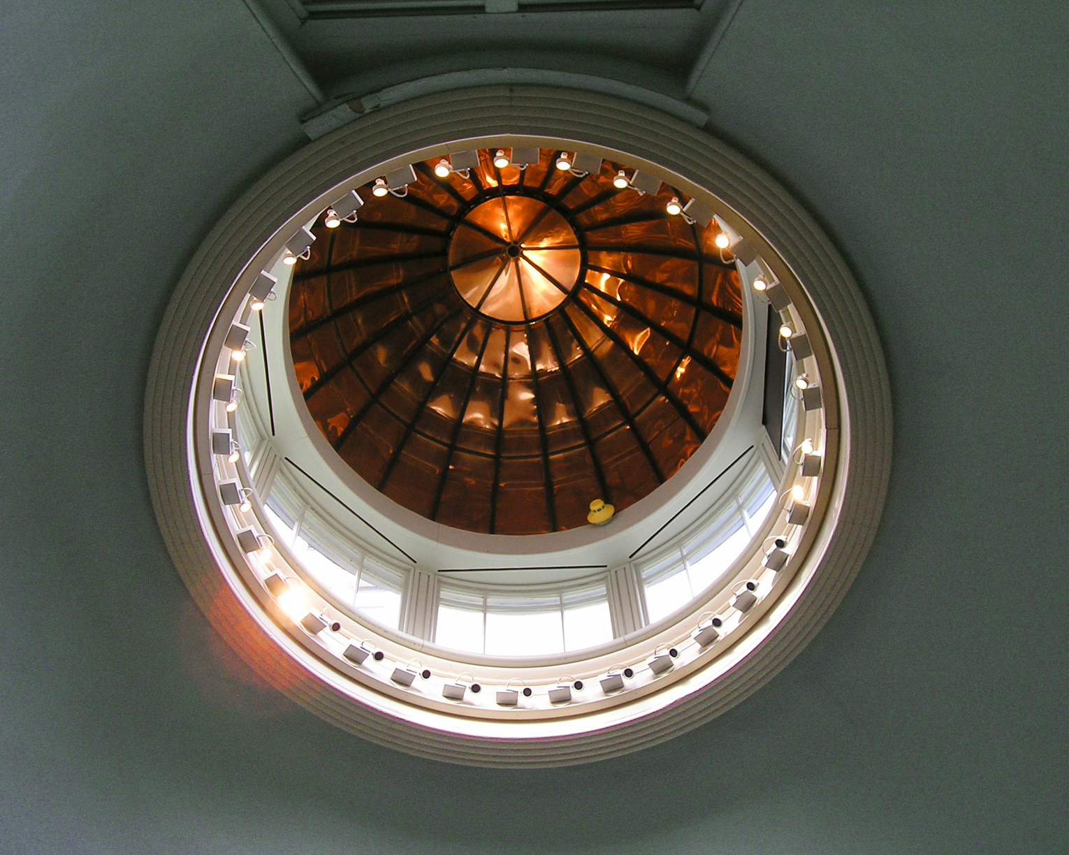
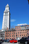
Ether Dome |
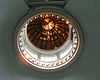 |
01966-10-15 October 15, 1966 |
Fruit St.
42°21′48″N 71°4′7″W / 42.36333°N 71.06861°W / 42.36333; -71.06861 (Ether Dome, Massachusetts General Hospital) |
West End |
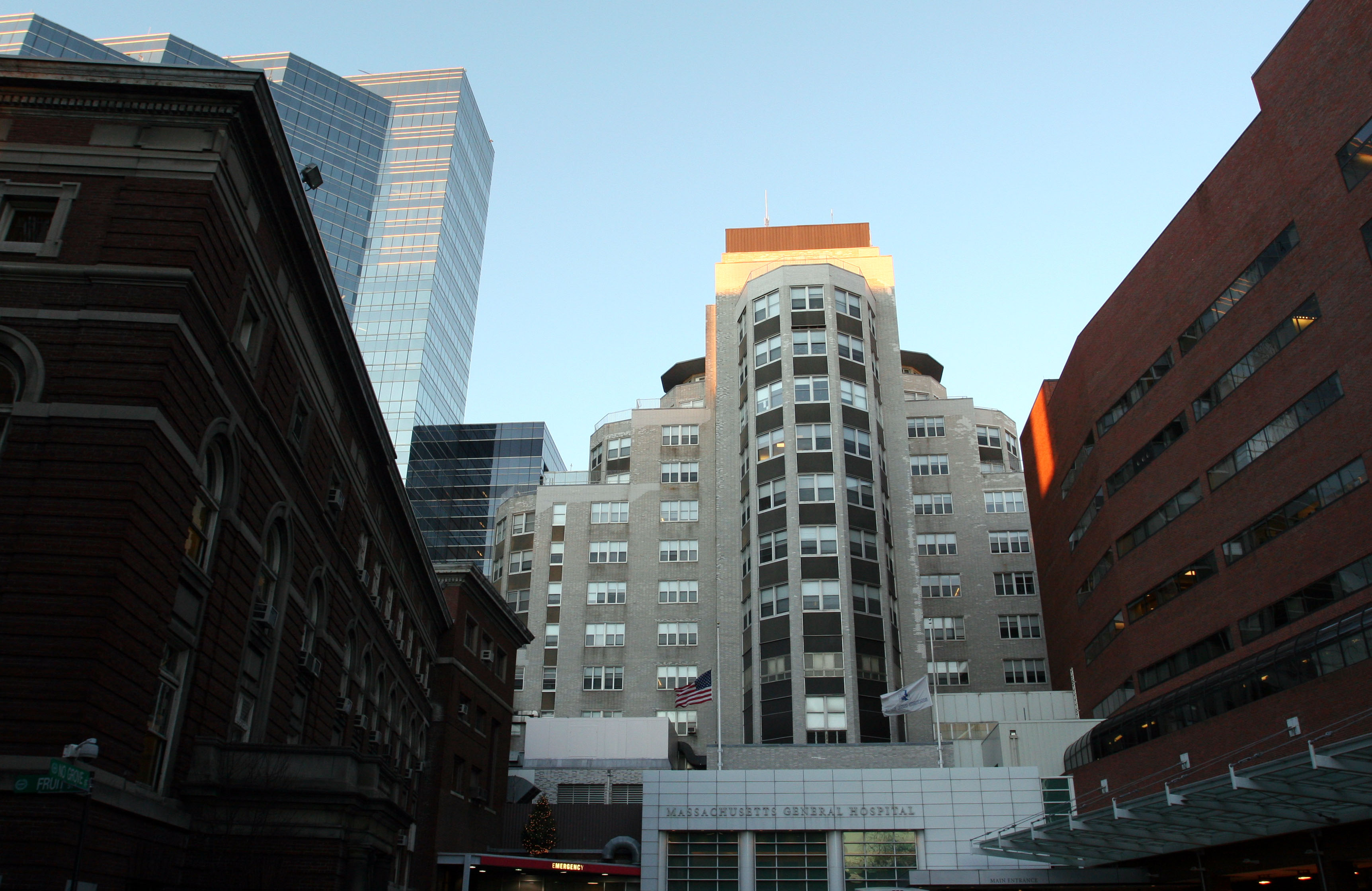
Part of Massachusetts General Hospital |
| 101 |
Evergreen Cemetery |
 |
02009-08-14 August 14, 2009 |
2060 Commonwealth Ave.
42°20′20″N 71°9′43″W / 42.33889°N 71.16194°W / 42.33889; -71.16194 (Evergreen Cemetery) |
Brighton |
|
| 102 |
Fairview Cemetery |
 |
02009-09-16 September 16, 2009 |
45 Fairview Ave.
42°14′45.23″N 71°8′18.47″W / 42.2458972°N 71.1384639°W / 42.2458972; -71.1384639 (Fairview Cemetery) |
Hyde Park |
|
| 103 |
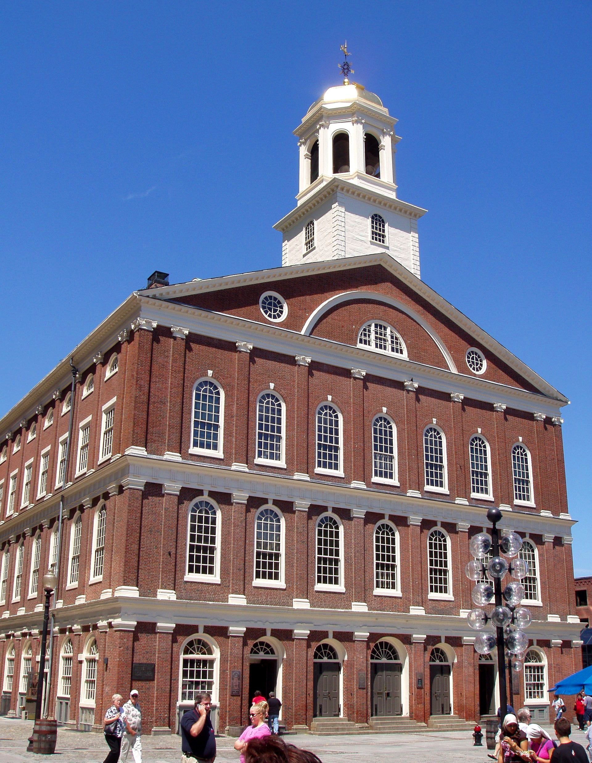
Faneuil Hall |
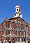 |
01966-10-15 October 15, 1966 |
Dock Sq.
42°21′36″N 71°3′24″W / 42.36°N 71.05667°W / 42.36; -71.05667 (Faneuil Hall) |
Downtown |
|
| 104 |
Peter Faneuil School |
 |
01994-12-16 December 16, 1994 |
60 Joy St.
42°21′37″N 71°3′58″W / 42.36028°N 71.06611°W / 42.36028; -71.06611 (Faneuil, Peter, School) |
Beacon Hill |
|
| 105 |
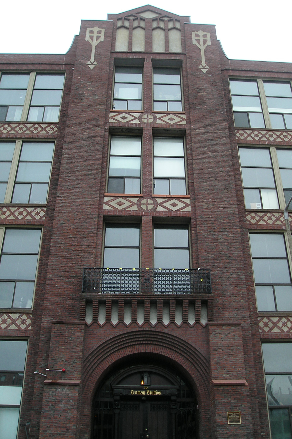
Fenway Studios |
 |
01978-09-13 September 13, 1978 |
30 Ipswich St.
42°20′50″N 71°5′28″W / 42.34722°N 71.09111°W / 42.34722; -71.09111 (Fenway Studios) |
Fenway-Kenmore |
|
| 106 |
Fenway-Boylston Street District |
 |
01984-09-04 September 4, 1984 |
Fenway, Boylston, Westland, and Hemenway Sts.
42°20′43″N 71°5′26″W / 42.34528°N 71.09056°W / 42.34528; -71.09056 (Fenway-Boylston Street District) |
Fenway-Kenmore |
|
| 107 |
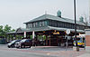
Fields Corner Municipal Building |
 |
01981-11-12 November 12, 1981 |
1 Arcadia St., 195 Adams St.
42°18′7″N 71°3′38″W / 42.30194°N 71.06056°W / 42.30194; -71.06056 (Fields Corner Municipal Building) |
Dorchester |
|
| 108 |
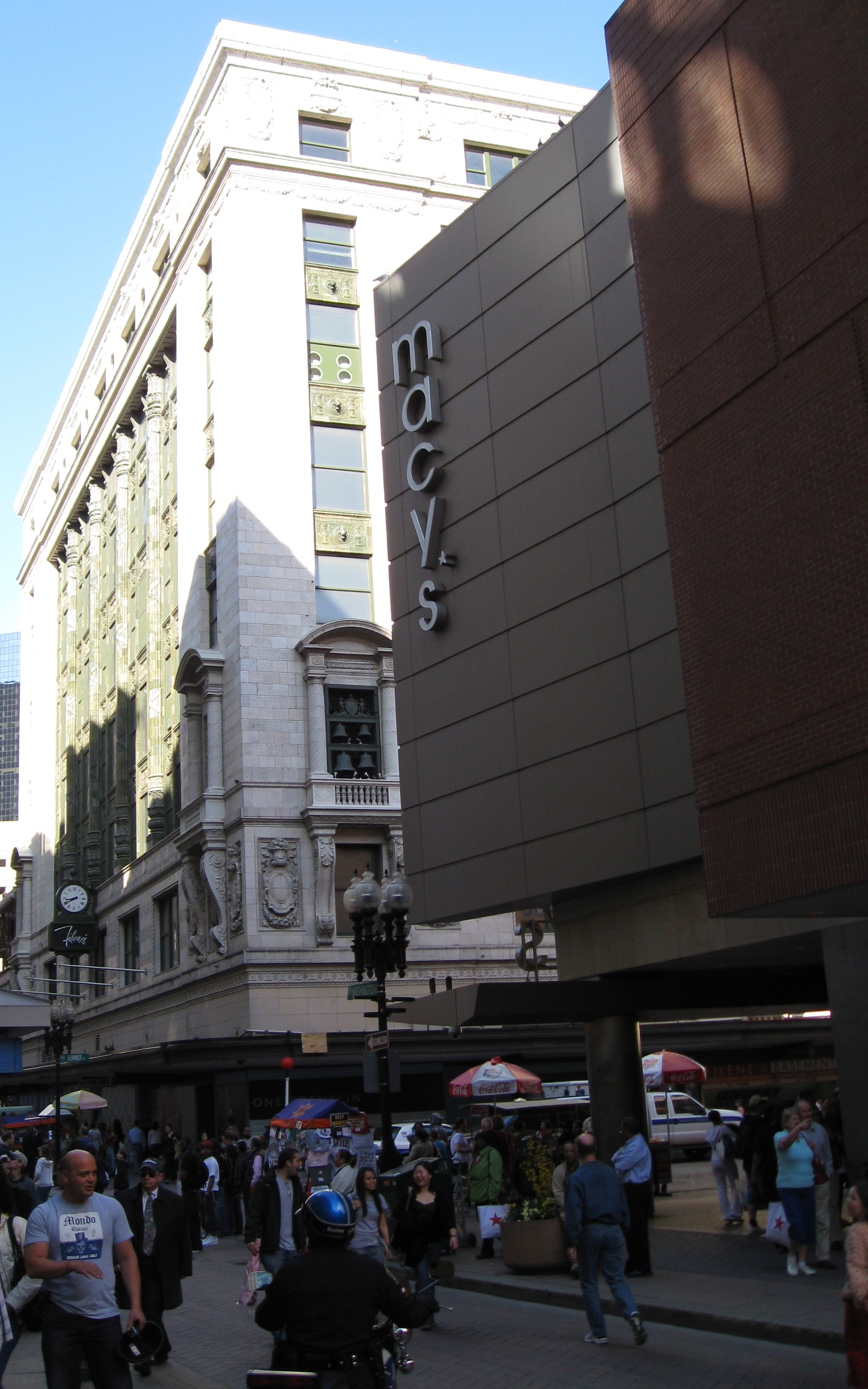
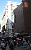
Filene's Department Store |
 |
01986-07-24 July 24, 1986 |
426 Washington St.
42°21′18″N 71°3′39″W / 42.355°N 71.06083°W / 42.355; -71.06083 (Filene's Department Store) |
Downtown |
|
| 109 |
First Baptist Church |
 |
01972-02-23 February 23, 1972 |
Commonwealth Ave. and Clarendon St.
42°21′6″N 71°4′36″W / 42.35167°N 71.07667°W / 42.35167; -71.07667 (First Baptist Church) |
Back Bay |
|
| 110 |
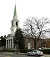
First Church of Jamaica Plain |
 |
01988-07-15 July 15, 1988 |
6 Eliot St.
42°18′35″N 71°7′0″W / 42.30972°N 71.116667°W / 42.30972; -71.116667 (First Church of Jamaica Plain) |
Jamaica Plain |
|
| 111 |
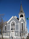
First Congregational Church of Hyde Park |
 |
01999-11-12 November 12, 1999 |
6 Webster St.
42°15′27″N 71°7′15″W / 42.2575°N 71.12083°W / 42.2575; -71.12083 (First Congregational Church of Hyde Park) |
Hyde Park |
|
| 112 |
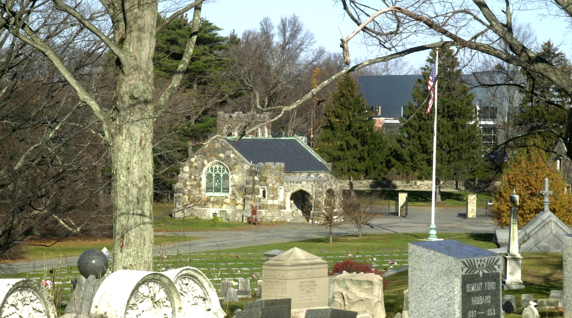
Forest Hills Cemetery |
 |
02004-11-17 November 17, 2004 |
95 Forest Hills Ave.
42°17′35″N 71°6′29″W / 42.29306°N 71.10806°W / 42.29306; -71.10806 (Forest Hills Cemetery) |
Roslindale |
|
| 113 |
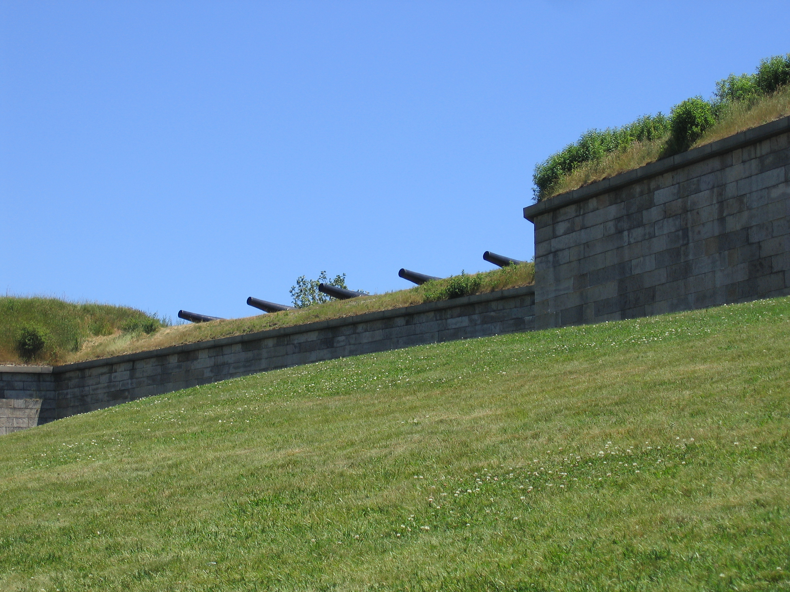
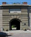
Fort Independence |
 |
01970-10-15 October 15, 1970 |
Castle Island
42°20′17″N 71°0′42″W / 42.33806°N 71.01167°W / 42.33806; -71.01167 (Fort Independence) |
South Boston |
|
| 114 |
Fort Point Channel Historic District |
 |
02004-09-10 September 10, 2004 |
Necco Court, Thomson Place, and A, Binford, Congress, Farnsworth, Melcher, Midway, Sleeper, Stillings, and Summer Sts.
42°20′59″N 71°3′5″W / 42.34972°N 71.05139°W / 42.34972; -71.05139 (Fort Point Channel Historic District) |
South Boston |
|
| 115 |
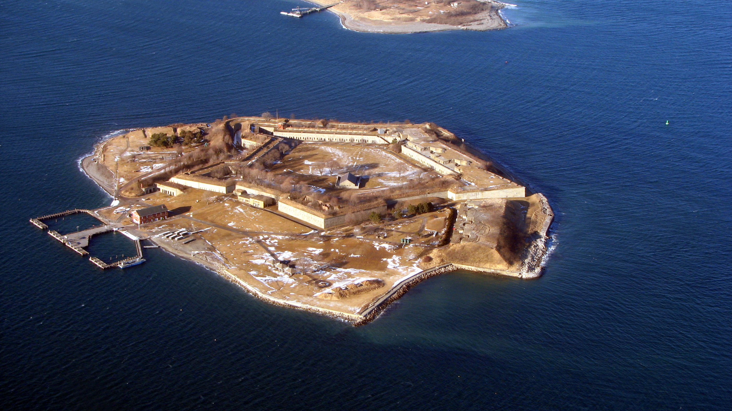
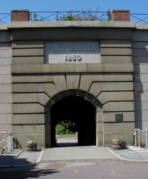
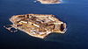
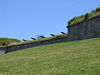
Fort Warren |
 |
01970-08-29 August 29, 1970 |
Georges Island, Boston Harbor
42°19′11″N 70°55′43″W / 42.31972°N 70.92861°W / 42.31972; -70.92861 (Fort Warren) |
Boston Harbor |
|
| 116 |
Frances and Isabella Apartments |
|
02002-02-22 February 22, 2002 |
430-432 and 434-436 Dudley St.
42°19′27″N 71°4′29″W / 42.32417°N 71.07472°W / 42.32417; -71.07472 (Frances and Isabella Apartments) |
Roxbury |
|
| 117 |
Fulton-Commercial Streets District |
 |
01973-03-21 March 21, 1973 |
Fulton, Commercial, Mercantile, Lewis, and Richmond Sts.; also 81-95 Richmond St.
42°21′43″N 71°3′12″W / 42.36194°N 71.05333°W / 42.36194; -71.05333 (Fulton-Commercial Streets District) |
North End |
81-95 Richmond St. represent a boundary increase |
| 118 |
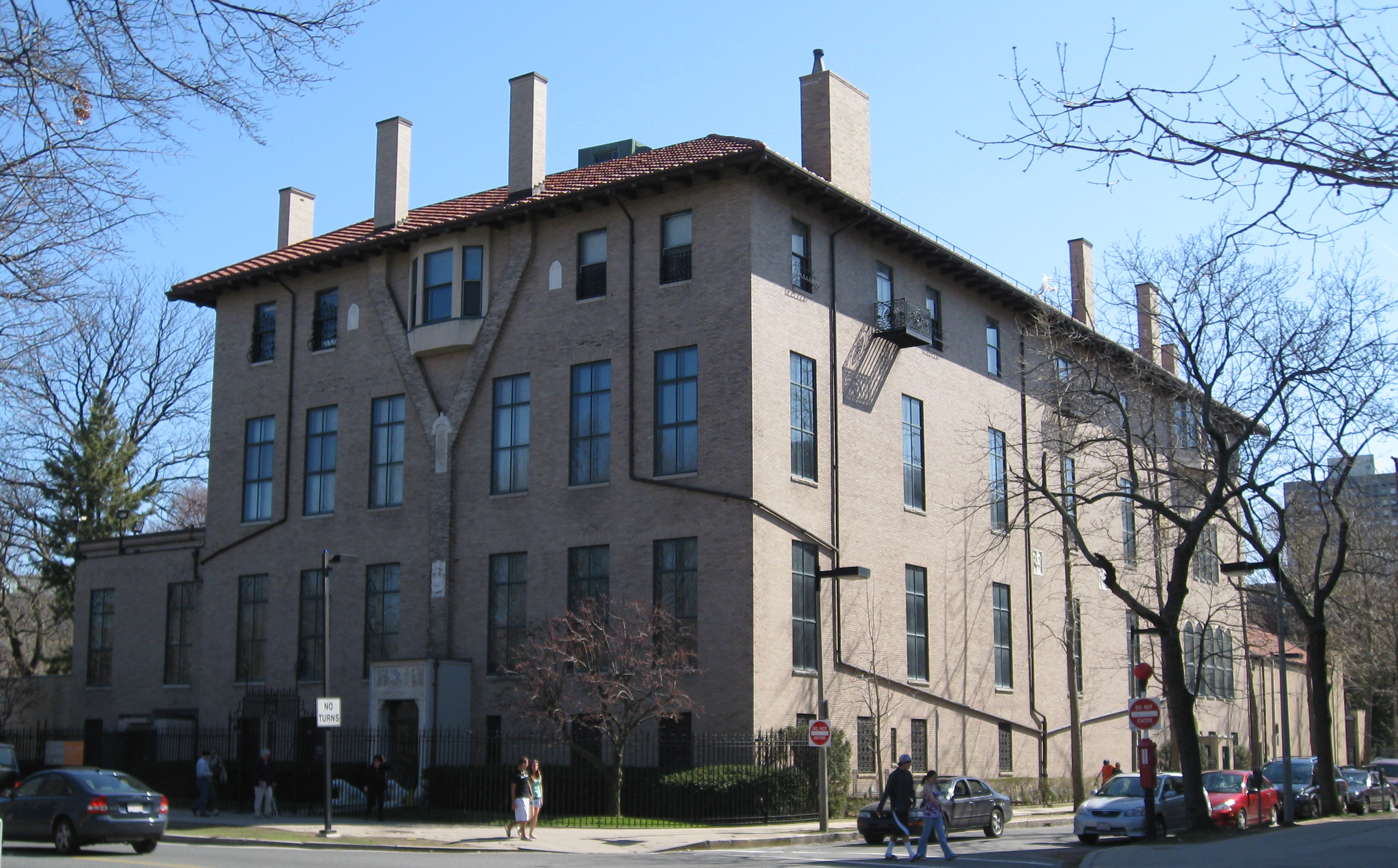
Isabella Stewart Gardner Museum |
 |
01983-01-27 January 27, 1983 |
280 The Fenway
42°20′17″N 71°5′59″W / 42.33806°N 71.09972°W / 42.33806; -71.09972 (Gardner, Isabella Stewart, Museum) |
Fenway-Kenmore |
|
| 119 |
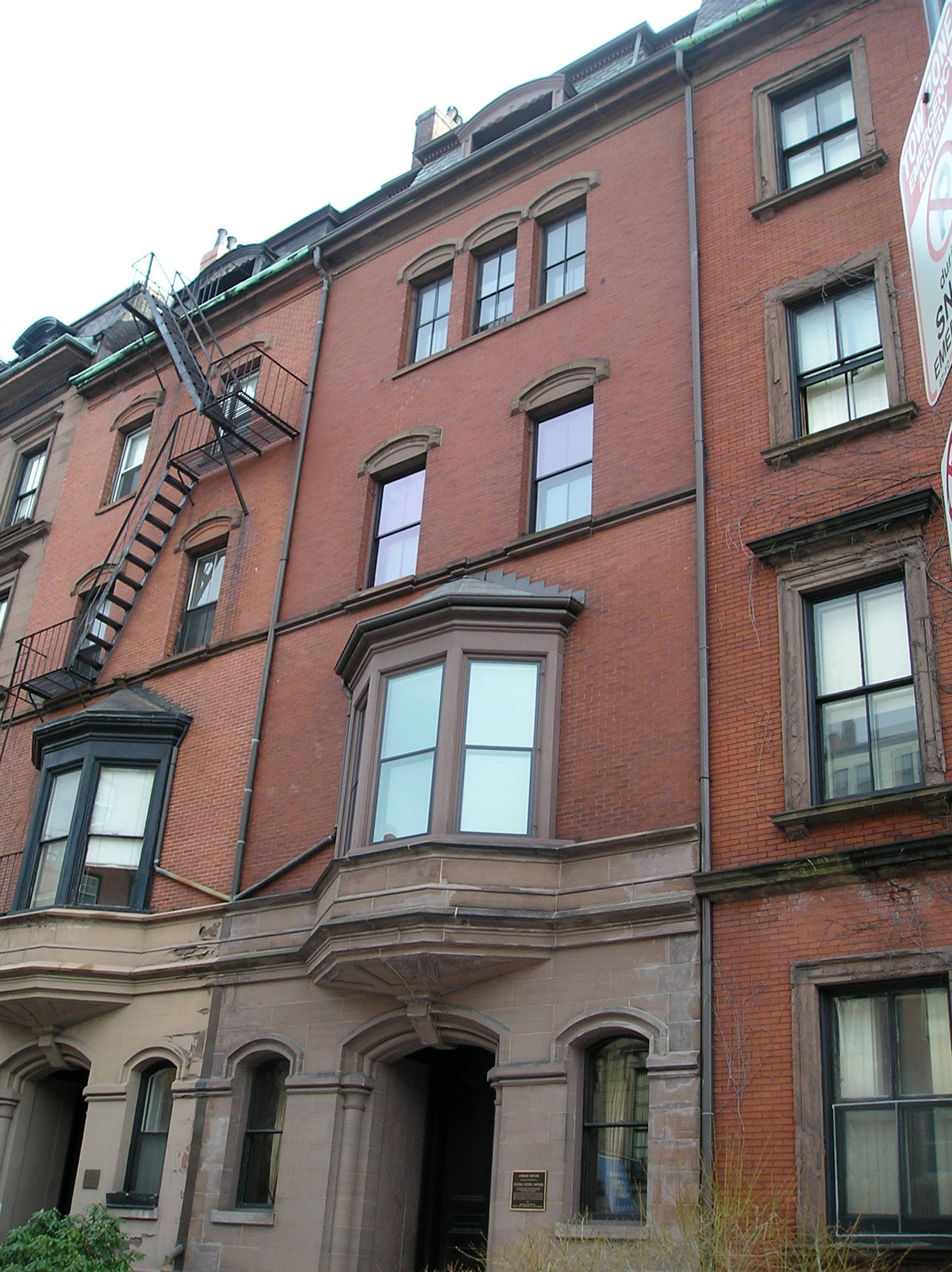
William Lloyd Garrison House |
 |
01966-10-15 October 15, 1966 |
125 Highland St.
42°19′34″N 71°5′38″W / 42.32611°N 71.09389°W / 42.32611; -71.09389 (Garrison, William Lloyd, House) |
Roxbury |
|
| 120 |
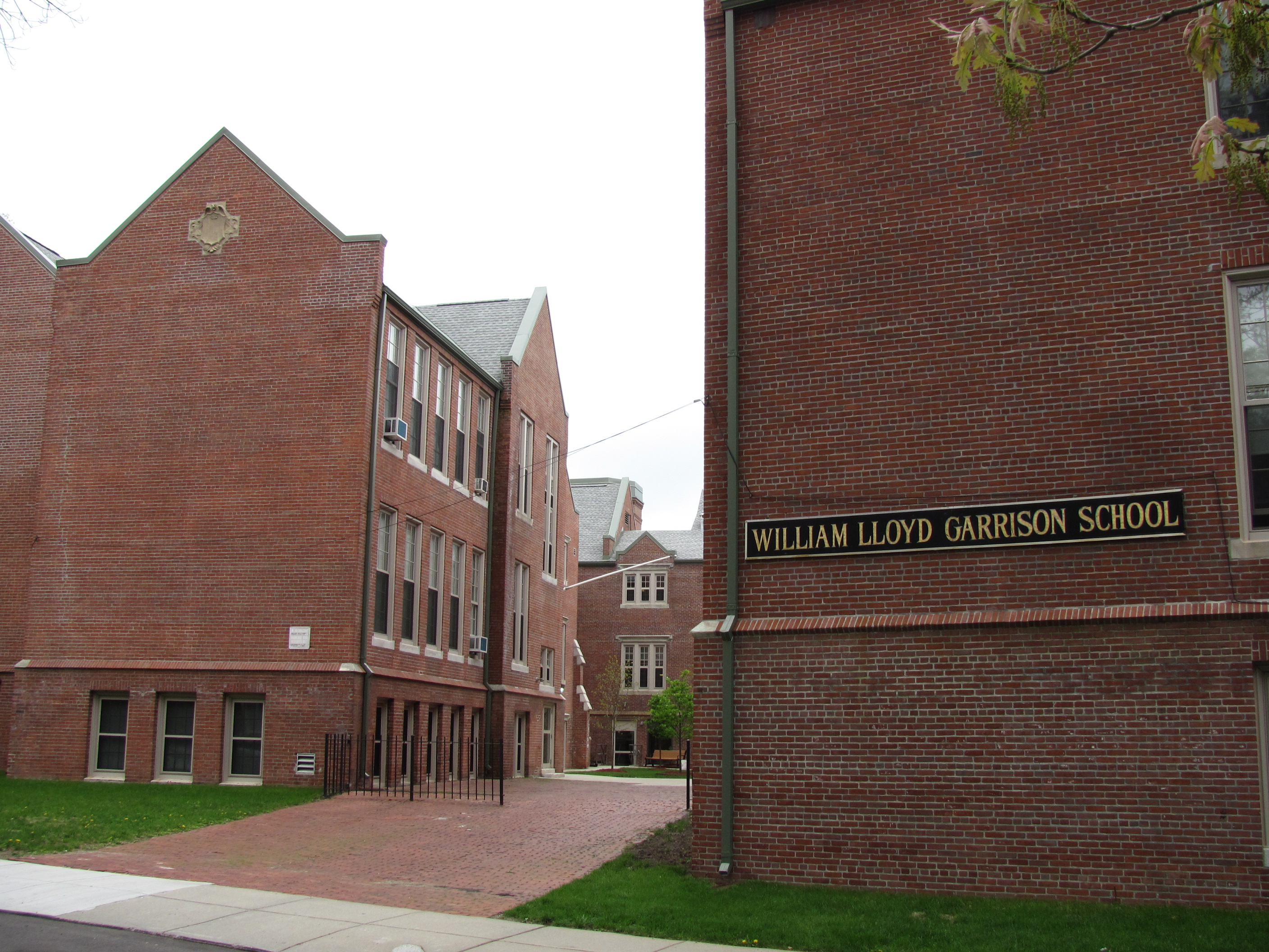
William Lloyd Garrison School |
 |
01980-04-16 April 16, 1980 |
20 Hutchings St.
42°18′34″N 71°5′22″W / 42.30944°N 71.08944°W / 42.30944; -71.08944 (Garrison, William Lloyd, School) |
Roxbury |
|
| 121 |
Gibson House |
 |
02001-08-07 August 7, 2001 |
137 Beacon St.
42°21′16.59″N 71°4′26.81″W / 42.3546083°N 71.0741139°W / 42.3546083; -71.0741139 (Gibson House) |
Back Bay |
|
| 122 |
Goldsmith Block |
|
02007-06-05 June 5, 2007 |
41 Ruggles St., 746-750 Shawmut Ave.
42°19′56″N 71°5′2″W / 42.33222°N 71.08389°W / 42.33222; -71.08389 (Goldsmith Block) |
Roxbury |
|
| 123 |
Ozias Goodwin House |
 |
01988-06-23 June 23, 1988 |
7 Jackson Ave.
42°22′3″N 71°3′19″W / 42.3675°N 71.05528°W / 42.3675; -71.05528 (Goodwin, Ozias, House) |
North End |
|
| 124 |
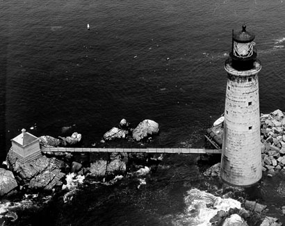
Graves Light Station |
 |
01987-09-28 September 28, 1987 |
Entrance to North Channel, Boston Harbor
42°21′54″N 70°52′11″W / 42.365°N 70.86972°W / 42.365; -70.86972 (Graves Light Station) |
Boston Harbor |
|
| 125 |
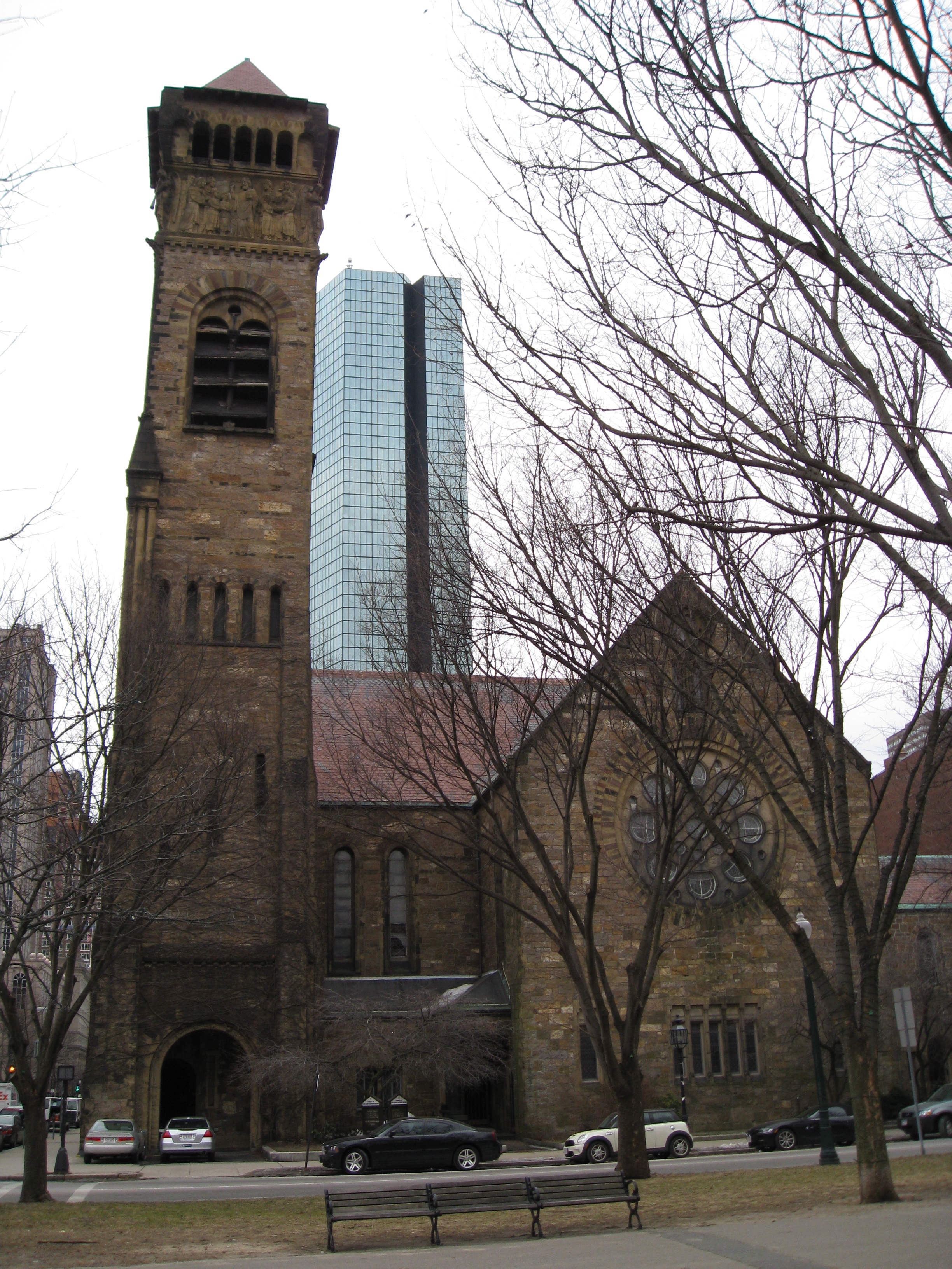
Greek Orthodox Cathedral of New England |
 |
01988-06-30 June 30, 1988 |
520 Parker St.
42°20′11″N 71°5′39″W / 42.33639°N 71.09417°W / 42.33639; -71.09417 (Greek Orthodox Cathedral of New England) |
Fenway-Kenmore |
|
| 126 |
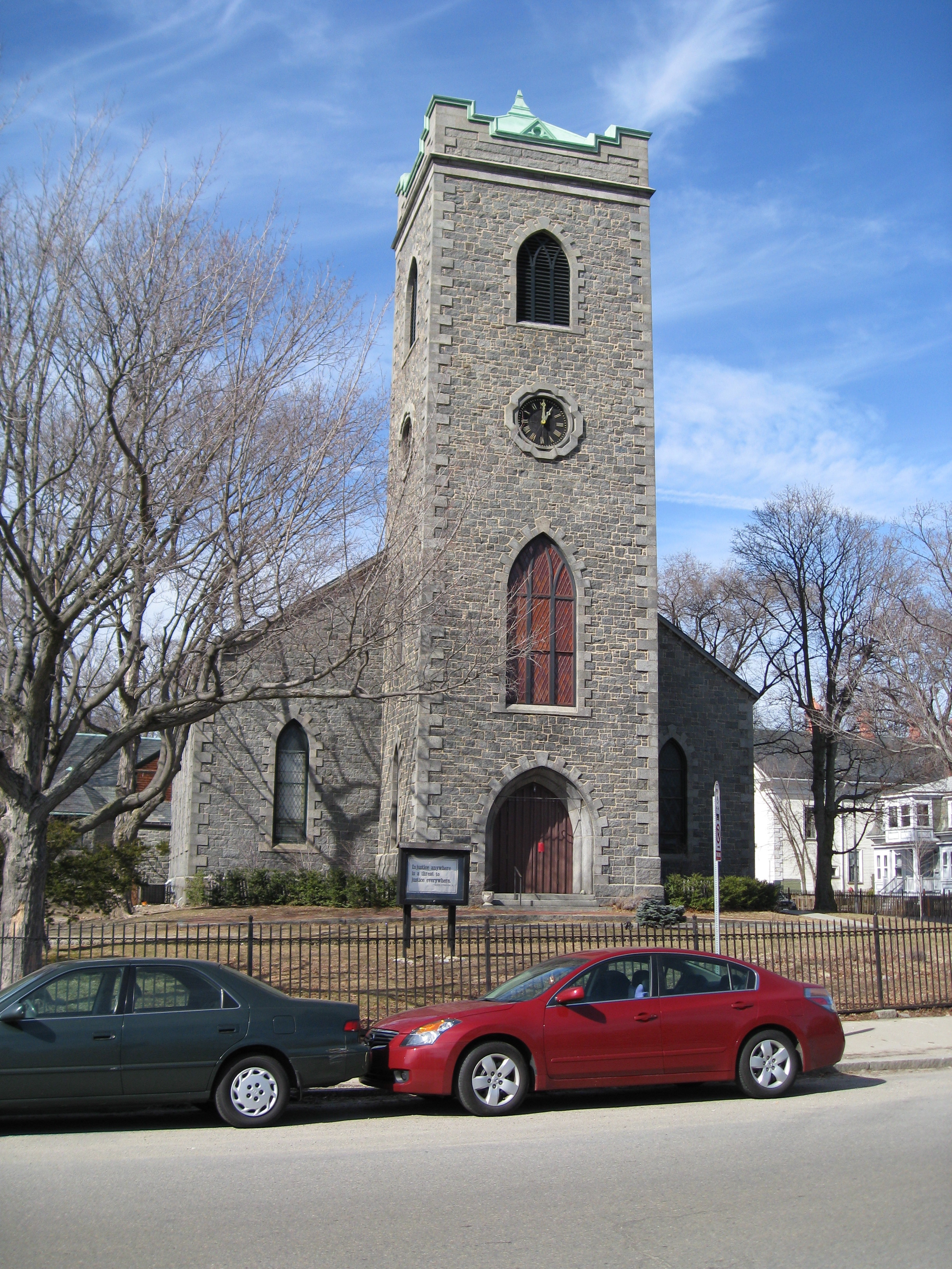
Greenwood Memorial United Methodist Church |
 |
02002-03-08 March 8, 2002 |
378A-380 Washington St.
42°17′49″N 71°4′19″W / 42.29694°N 71.07194°W / 42.29694; -71.07194 (Greenwood Memorial United Methodist Church) |
Dorchester |
|
| 127 |
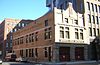
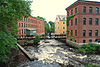
Haffenreffer Brewery |
 |
01982-05-02 May 2, 1982 |
Germania St.
42°18′52″N 71°6′15″W / 42.31444°N 71.10417°W / 42.31444; -71.10417 (Haffenreffer Brewery) |
Jamaica Plain |
|
| 128 |
Edward Everett Hale House |
 |
01979-03-21 March 21, 1979 |
12 Morley St.
42°19′44″N 71°5′33″W / 42.32889°N 71.0925°W / 42.32889; -71.0925 (Hale, Edward Everett, House) |
Roxbury |
|
| 129 |
Chester Harding House |
 |
01966-10-15 October 15, 1966 |
16 Beacon St.
42°21′28″N 71°3′47″W / 42.35778°N 71.06306°W / 42.35778; -71.06306 (Harding, Chester, House) |
Beacon Hill |
|
| 130 |
John Harris House and Farm |
|
01985-10-17 October 17, 1985 |
284 Newton St.
42°18′16″N 71°8′19″W / 42.30444°N 71.13861°W / 42.30444; -71.13861 (Harris, John, House and Farm) |
West Roxbury |
Extends into Brookline in Norfolk County |
| 131 |
Harrison Square Historic District |
 |
02002-10-22 October 22, 2002 |
Bounded by MBTA Braintree line embankment, Park, Everett, Freeport, Mill, Asland, Blanche Sts., Victory Rd.
42°18′7.31″N 71°3′12.71″W / 42.3020306°N 71.0535306°W / 42.3020306; -71.0535306 (Harrison Square Historic District) |
Dorchester |
|
| 132 |
Harriswood Crescent |
 |
01986-03-13 March 13, 1986 |
60-88 Harold St.
42°19′5″N 71°5′47″W / 42.31806°N 71.09639°W / 42.31806; -71.09639 (Harriswood Crescent) |
Roxbury |
|
| 133 |
Harvard Avenue Fire Station |
 |
01983-03-31 March 31, 1983 |
16 Harvard Ave.
42°21′19″N 71°7′58″W / 42.35528°N 71.13278°W / 42.35528; -71.13278 (Harvard Avenue Fire Station) |
Allston |
|
| 134 |
Harvard Avenue Historic District |
 |
02000-04-28 April 28, 2000 |
Roughly bounded by Linden St., Commonwealth Ave., Harvard Ave., and Park Vale Ave.
42°21′12″N 71°7′58″W / 42.35333°N 71.13278°W / 42.35333; -71.13278 (Harvard Avenue Historic District) |
Allston |
|
| 135 |
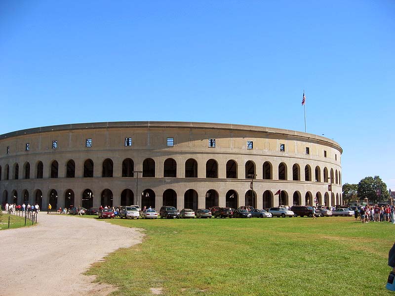
Harvard Stadium |
 |
01987-02-27 February 27, 1987 |
60 N. Harvard St.
42°22′0.71″N 71°7′35.71″W / 42.3668639°N 71.1265861°W / 42.3668639; -71.1265861 (Harvard Stadium) |
Allston |
|
| 136 |
Edward H. Haskell Home for Nurses |
 |
02004-02-26 February 26, 2004 |
220 Fisther Ave., 63 Parker Hill Ave.
42°19′49″N 71°6′36″W / 42.33028°N 71.11°W / 42.33028; -71.11 (Haskell, Edward H., Home for Nurses) |
Mission Hill |
|
| 137 |
Hayden Building |
 |
01980-12-09 December 9, 1980 |
681-683 Washington St.
42°21′5″N 71°3′50″W / 42.35139°N 71.06389°W / 42.35139; -71.06389 (Hayden Building) |
Downtown |
|
| 138 |
Headquarters House |
 |
01966-10-15 October 15, 1966 |
55 Beacon St.
42°21′23″N 71°4′8″W / 42.35639°N 71.06889°W / 42.35639; -71.06889 (Headquarters House) |
Beacon Hill |
|
| 139 |
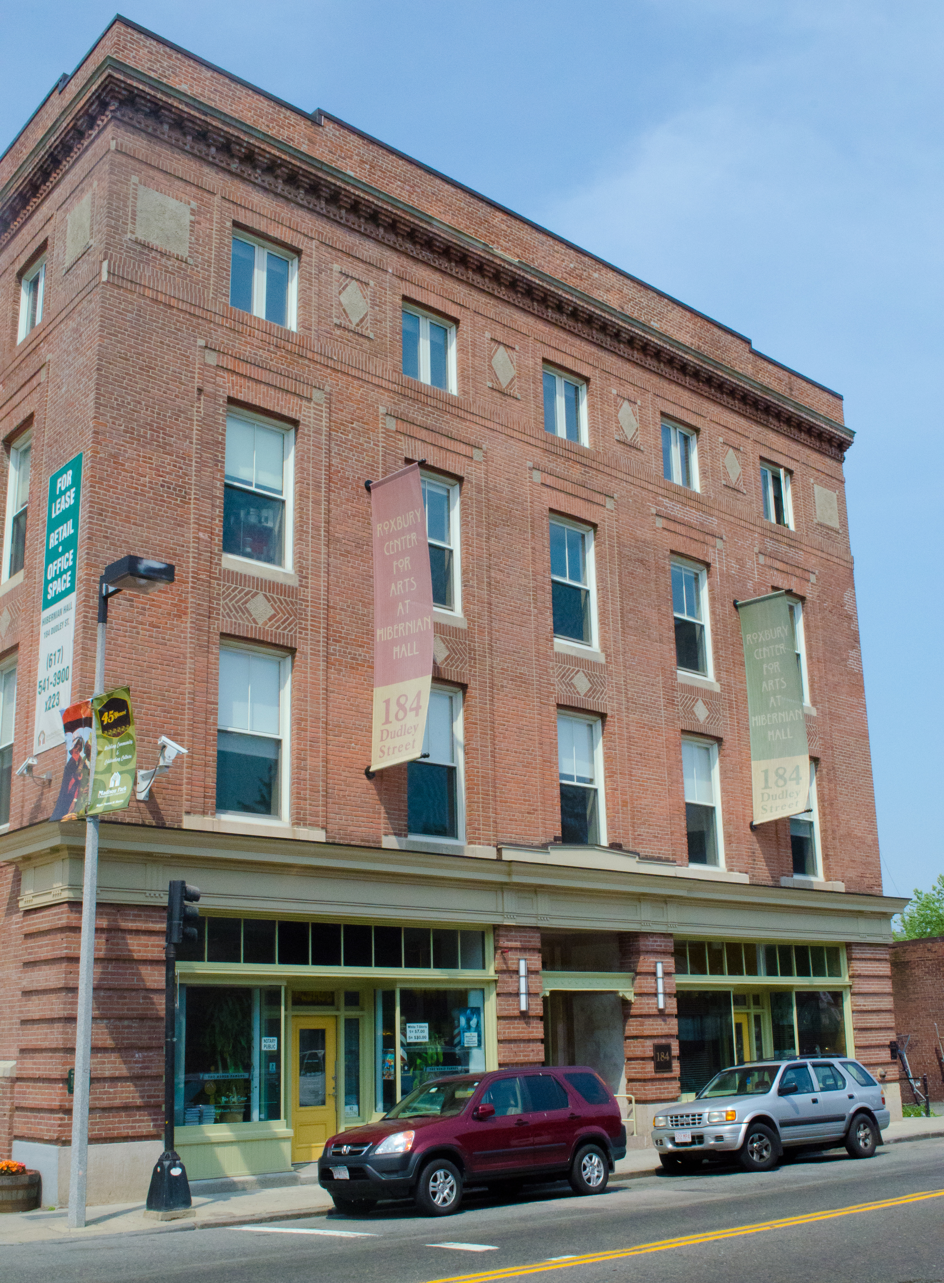
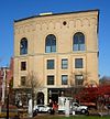
Hibernian Hall |
 |
02004-06-02 June 2, 2004 |
182-186 Dudley St.
42°19′43″N 71°4′57″W / 42.32861°N 71.0825°W / 42.32861; -71.0825 (Hibernian Hall) |
Roxbury |
|
| 140 |
Highland Spring Brewery Bottling and Storage Buildings |
|
02010-05-28 May 28, 2010 |
154-166 Terrace St.
42°19′37″N 71°5′54.73″W / 42.32694°N 71.0985361°W / 42.32694; -71.0985361 (Highland Spring Brewery Bottling and Storage Buildings) |
Mission Hill |
|
| 141 |
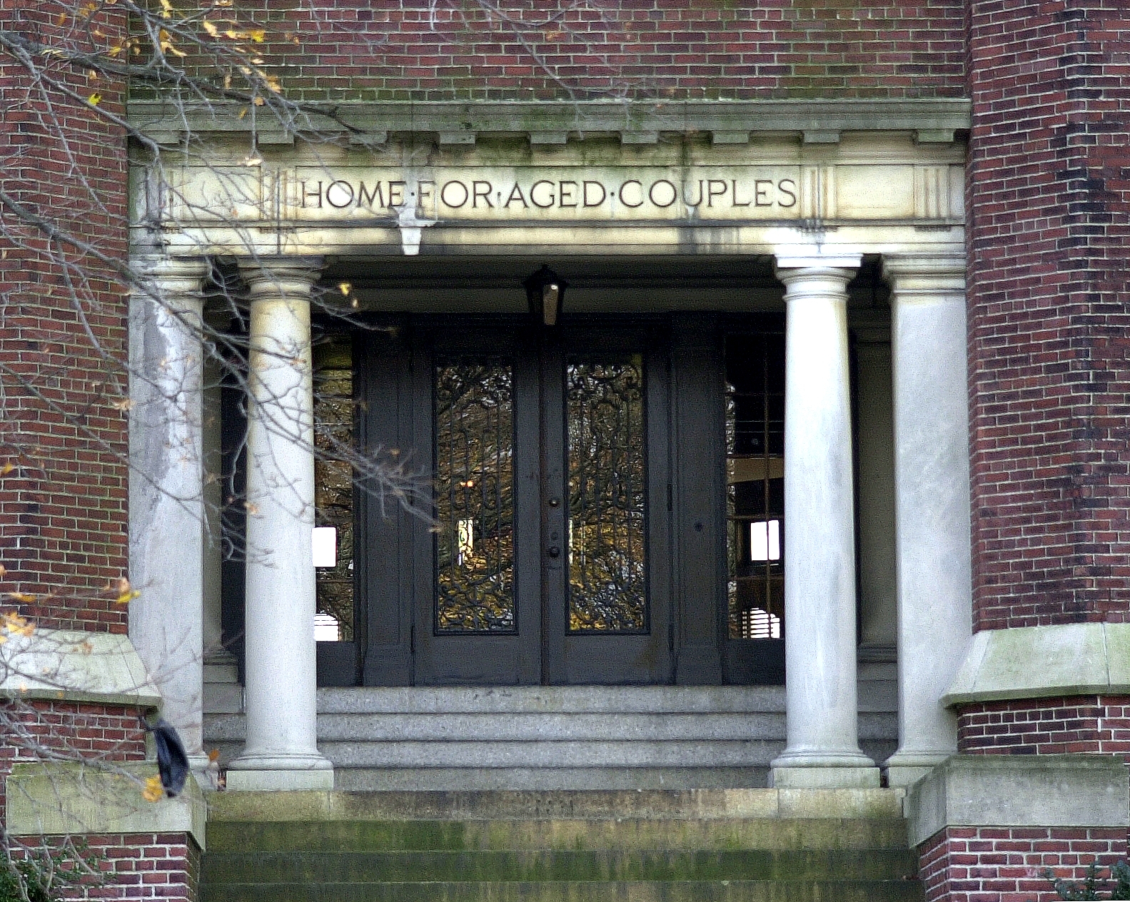
Home for Aged Couples |
 |
02005-08-11 August 11, 2005 |
409, 419 Walnut Ave. and 2055 Columbus Ave.
42°18′49″N 71°5′43″W / 42.31361°N 71.09528°W / 42.31361; -71.09528 (Home for Aged Couples) |
Jamaica Plain |
|
| 142 |
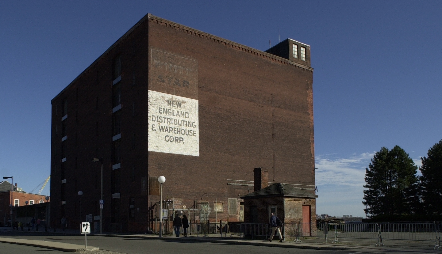
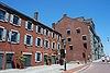
Hoosac Stores 1 & 2-Hoosac Stores 3 |
 |
01985-08-14 August 14, 1985 |
25 and 115 Water St.
42°22′16″N 71°3′40″W / 42.37111°N 71.06111°W / 42.37111; -71.06111 (Hoosac Stores 1 & 2-Hoosac Stores 3) |
Charlestown |
|
| 143 |
House at 1 Bay Street |
|
01994-02-09 February 9, 1994 |
1 Bay St.
42°20′53″N 71°4′7″W / 42.34806°N 71.06861°W / 42.34806; -71.06861 (House at 1 Bay Street) |
Bay Village |
|
| 144 |
House at 17 Cranston Street |
 |
01987-11-20 November 20, 1987 |
17 Cranston St.
42°19′14″N 71°6′35″W / 42.32056°N 71.10972°W / 42.32056; -71.10972 (House at 17 Cranston Street) |
Jamaica Plain |
|
| 145 |
Samuel Gridley and Julia Ward Howe House |
 |
01974-09-13 September 13, 1974 |
13 Chestnut St.
42°21′27″N 71°4′3″W / 42.3575°N 71.0675°W / 42.3575; -71.0675 (Howe, Samuel Gridley and Julia Ward, House) |
Beacon Hill |
|
| 146 |
Timothy Hoxie House |
 |
01987-11-20 November 20, 1987 |
135 Hillside St.
42°19′52″N 71°6′19″W / 42.33111°N 71.10528°W / 42.33111; -71.10528 (Hoxie, Timothy, House) |
Mission Hill |
|
| 147 |
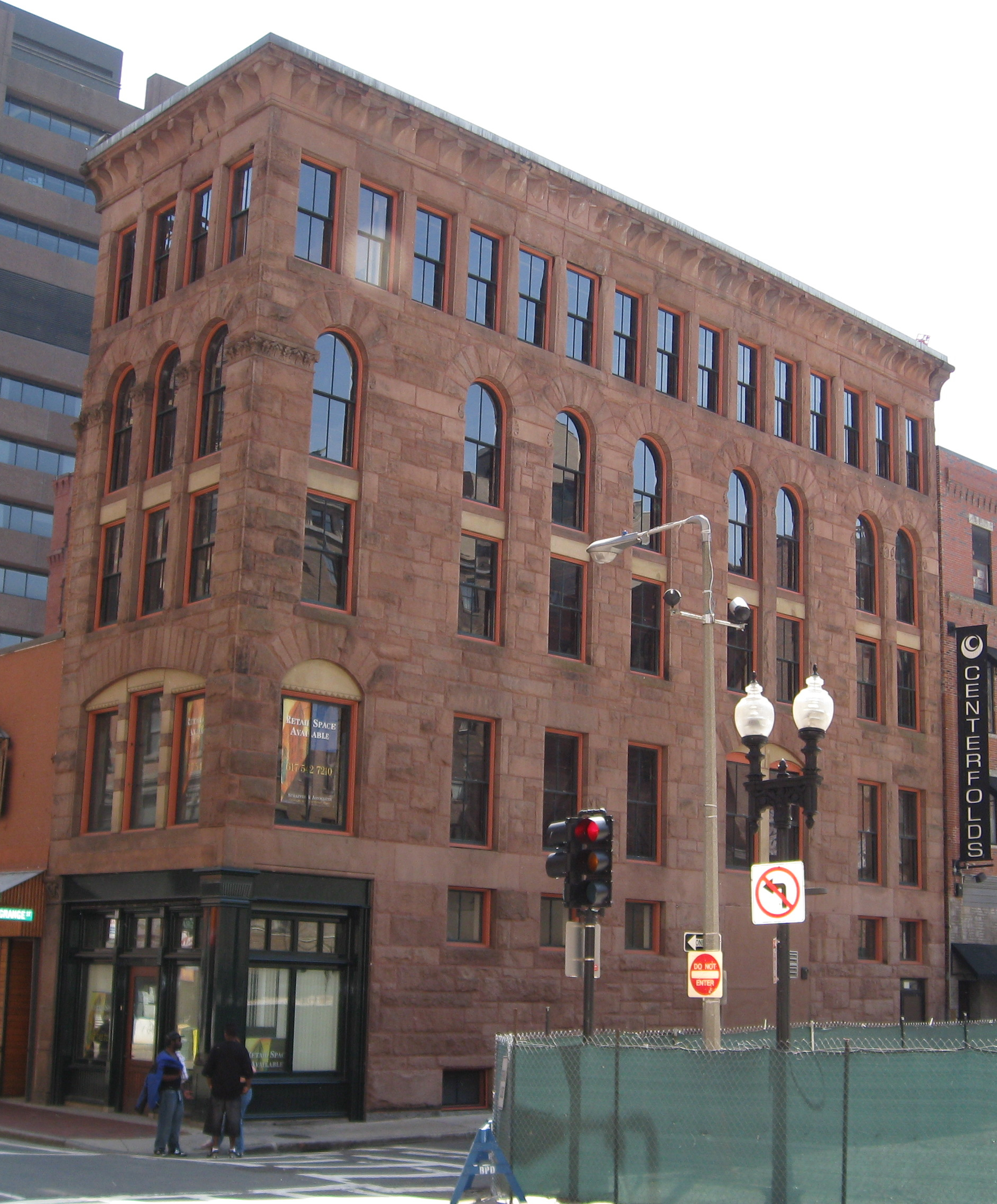
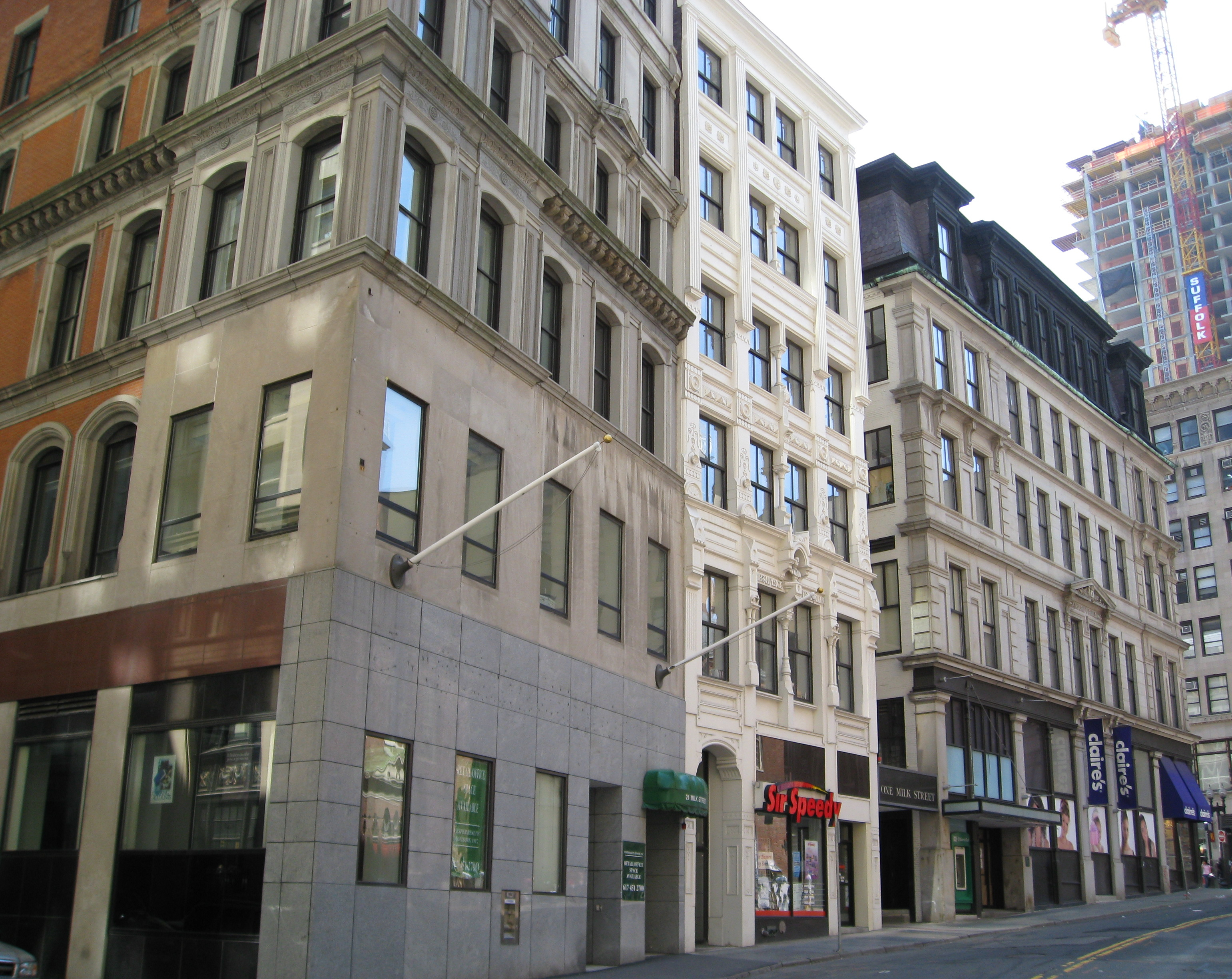
International Trust Company Building |
 |
01979-09-10 September 10, 1979 |
39-47 Milk St.
42°21′23″N 71°3′29″W / 42.35639°N 71.05806°W / 42.35639; -71.05806 (International Trust Company Building) |
Downtown |
|
| 148 |
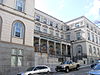
John Eliot Square District |
 |
01973-04-23 April 23, 1973 |
John Eliot Sq.
42°19′47″N 71°5′27″W / 42.32972°N 71.09083°W / 42.32972; -71.09083 (John Eliot Square District) |
Roxbury |
|
| 149 |
Joshua Bates School |
|
02008-08-22 August 22, 2008 |
731 Harrison Ave.
42°20′15.4536″N 71°4′18.5622″W / 42.337626°N 71.071822833°W / 42.337626; -71.071822833 (Joshua Bates School) |
South End |
|
| 150 |
King's Chapel |
 |
01974-05-02 May 2, 1974 |
Tremont and School Sts.
42°21′28″N 71°3′38″W / 42.35778°N 71.06056°W / 42.35778; -71.06056 (King's Chapel) |
Downtown |
|
| 151 |
Alvah Kittredge House |
 |
01973-05-08 May 8, 1973 |
12 Linwood St.
42°19′47″N 71°5′38″W / 42.32972°N 71.09389°W / 42.32972; -71.09389 (Kittredge, Alvah, House) |
Roxbury |
|
| 152 |
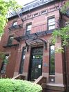
Lawrence Model Lodging Houses |
 |
01983-09-22 September 22, 1983 |
79, 89, 99 and 109 E. Canton St.
42°20′17″N 71°4′14″W / 42.33806°N 71.07056°W / 42.33806; -71.07056 (Lawrence Model Lodging Houses) |
South End |
|
| 153 |
Leather District |
 |
01983-12-21 December 21, 1983 |
Roughly bounded by Atlantic Ave., Kneeland, Lincoln, and Essex Sts.
42°21′3″N 71°3′30″W / 42.35083°N 71.05833°W / 42.35083; -71.05833 (Leather District) |
Leather District |
|
| 154 |
Liberty Tree District |
 |
01980-12-09 December 9, 1980 |
Roughly bounded by Harrison Ave., Washington, Essex and Beach Sts.
42°21′7″N 71°3′47″W / 42.35194°N 71.06306°W / 42.35194; -71.06306 (Liberty Tree District) |
Downtown |
|
| 155 |
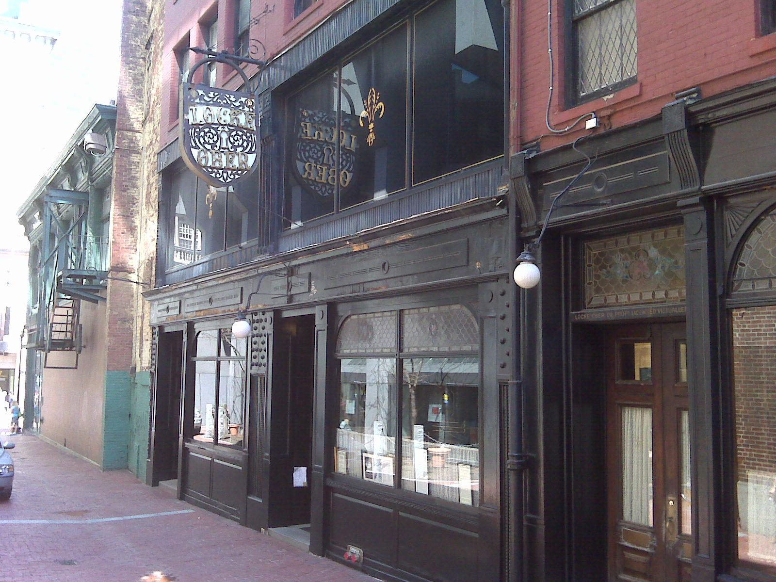
Locke-Ober Restaurant |
 |
01986-07-24 July 24, 1986 |
3-4 Winter Pl.
42°21′20″N 71°3′46″W / 42.35556°N 71.06278°W / 42.35556; -71.06278 (Locke--Ober Restaurant) |
Downtown |
|
| 156 |
Long Island Head Light |
 |
01987-06-15 June 15, 1987 |
Long Island
42°19′49″N 70°57′28″W / 42.33028°N 70.95778°W / 42.33028; -70.95778 (Long Island Head Light) |
Boston Harbor |
|
| 157 |
Long Wharf and Customhouse Block |
 |
01966-11-13 November 13, 1966 |
Foot of State St.
42°21′37″N 71°2′59″W / 42.36028°N 71.04972°W / 42.36028; -71.04972 (Long Wharf and Customhouse Block) |
Downtown |
|
| 158 |
Harrison Loring House |
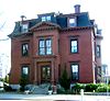 |
01983-09-01 September 1, 1983 |
789 E. Broadway St.
42°20′7″N 71°2′1″W / 42.33528°N 71.03361°W / 42.33528; -71.03361 (Loring, Harrison, House) |
South Boston |
|
| 159 |
Loring-Greenough House |
 |
01972-04-26 April 26, 1972 |
12 South St.
42°18′35″N 71°6′56″W / 42.30972°N 71.11556°W / 42.30972; -71.11556 (Loring-Greenough House) |
Jamaica Plain |
|
| 160 |
Lower Roxbury Historic District |
|
01994-12-09 December 9, 1994 |
Roughly the area surrounding Coventry, Cunard, and Walpole Sts.
42°20′11″N 71°5′12″W / 42.33639°N 71.08667°W / 42.33639; -71.08667 (Lower Roxbury Historic District) |
Roxbury |
|
| 161 |
Luna (tugboat) |
|
01983-10-06 October 6, 1983 |
NDC Pier, Charles River
42°22′4″N 71°4′27″W / 42.36778°N 71.07417°W / 42.36778; -71.07417 (Luna (tugboat)) |
Charlestown |
Currently in repairs at Boothbay Harbor, Maine[6] |
| 162 |
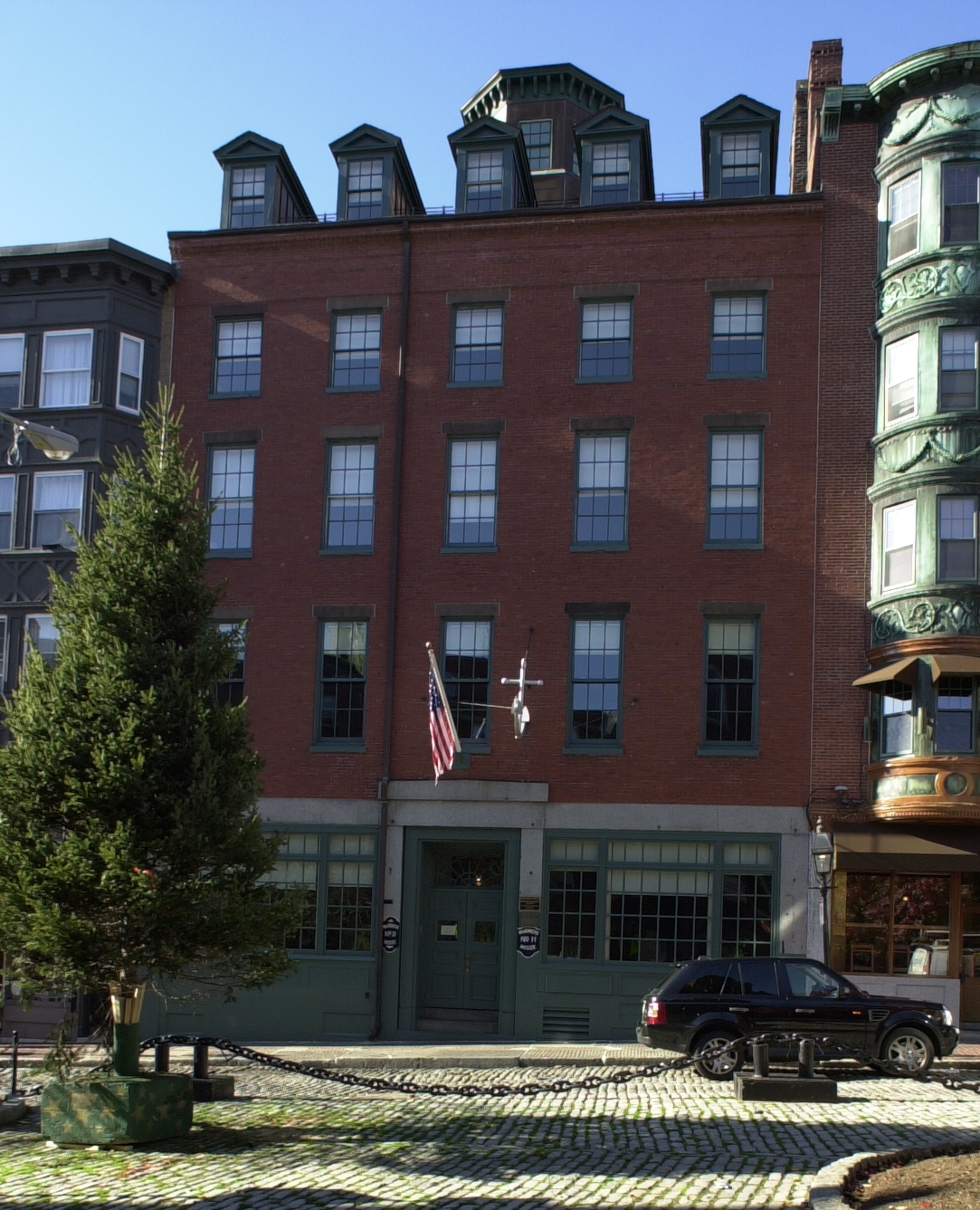
Mariner's House |
 |
01999-11-12 November 12, 1999 |
11 North Square
42°21′50″N 71°3′13″W / 42.36389°N 71.05361°W / 42.36389; -71.05361 (Mariner's House) |
North End |
|
| 163 |
Massachusetts General Hospital |
 |
01970-12-30 December 30, 1970 |
Fruit Street
42°21′48″N 71°4′8″W / 42.36333°N 71.06889°W / 42.36333; -71.06889 (Massachusetts General Hospital) |
West End |
|
| 164 |
Massachusetts Historical Society Building |
 |
01966-10-15 October 15, 1966 |
1154 Boylston St.
42°20′47″N 71°5′26″W / 42.34639°N 71.09056°W / 42.34639; -71.09056 (Massachusetts Historical Society Building) |
Fenway-Kenmore |
|
| 165 |
Massachusetts Mental Health Center |
|
01994-01-21 January 21, 1994 |
74 Fenwood Rd.
42°20′8″N 71°6′35″W / 42.33556°N 71.10972°W / 42.33556; -71.10972 (Massachusetts Mental Health Center) |
Fenway-Kenmore |
|
| 166 |
Massachusetts School of Art |
 |
01989-08-03 August 3, 1989 |
364 Brookline Ave.
42°20′20″N 71°6′24″W / 42.33889°N 71.10667°W / 42.33889; -71.10667 (Massachusetts School of Art) |
Fenway-Kenmore |
|
| 167 |
Massachusetts Statehouse |
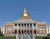 |
01966-10-15 October 15, 1966 |
Beacon Hill
42°21′31″N 71°3′52″W / 42.35861°N 71.06444°W / 42.35861; -71.06444 (Massachusetts Statehouse) |
Beacon Hill |
|
| 168 |
Donald McKay House |
 |
01982-06-02 June 2, 1982 |
78-80 White St.
42°22′49″N 71°2′14″W / 42.38028°N 71.03722°W / 42.38028; -71.03722 (McKay, Donald, House) |
East Boston |
|
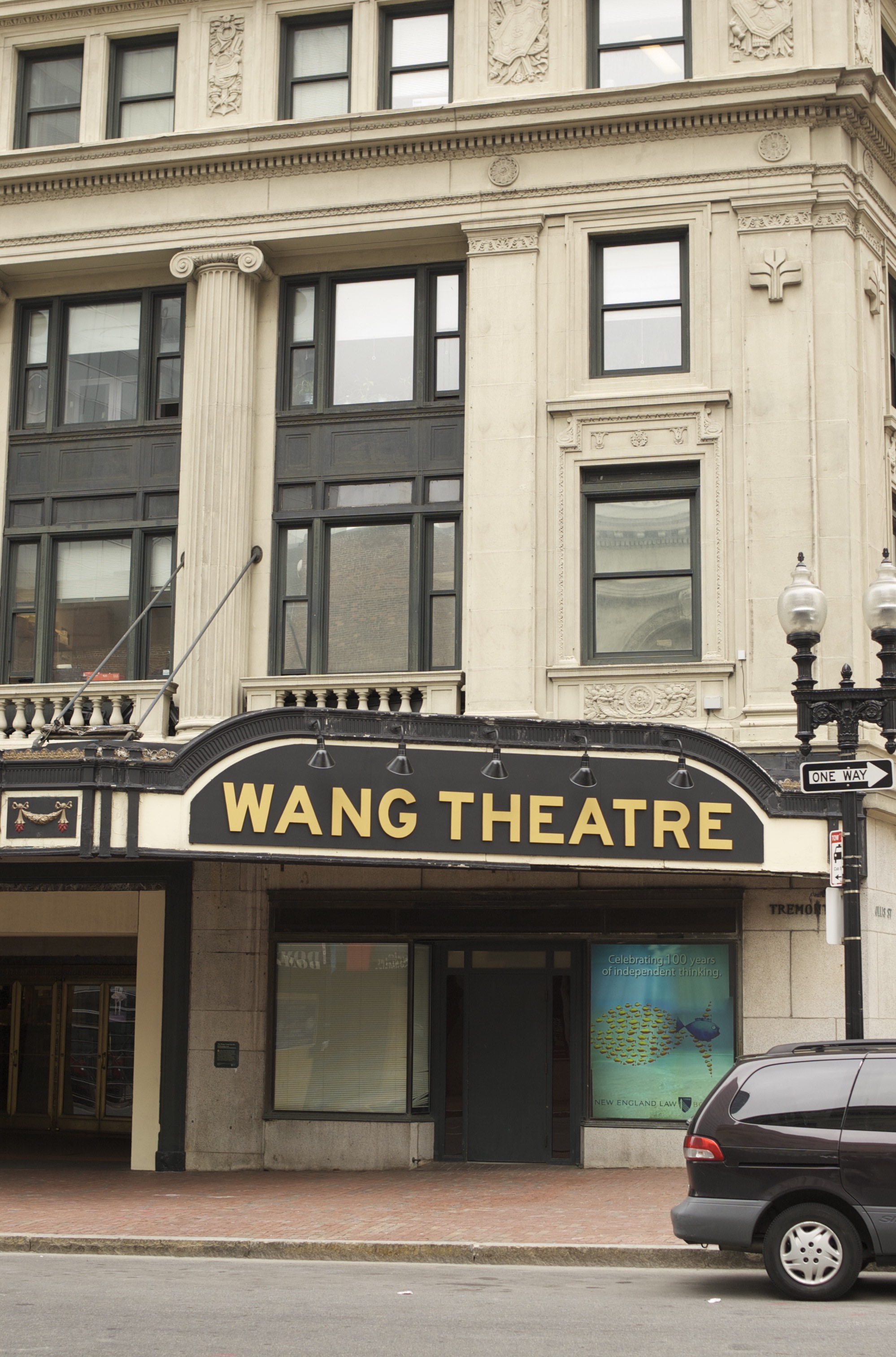
| 169 |
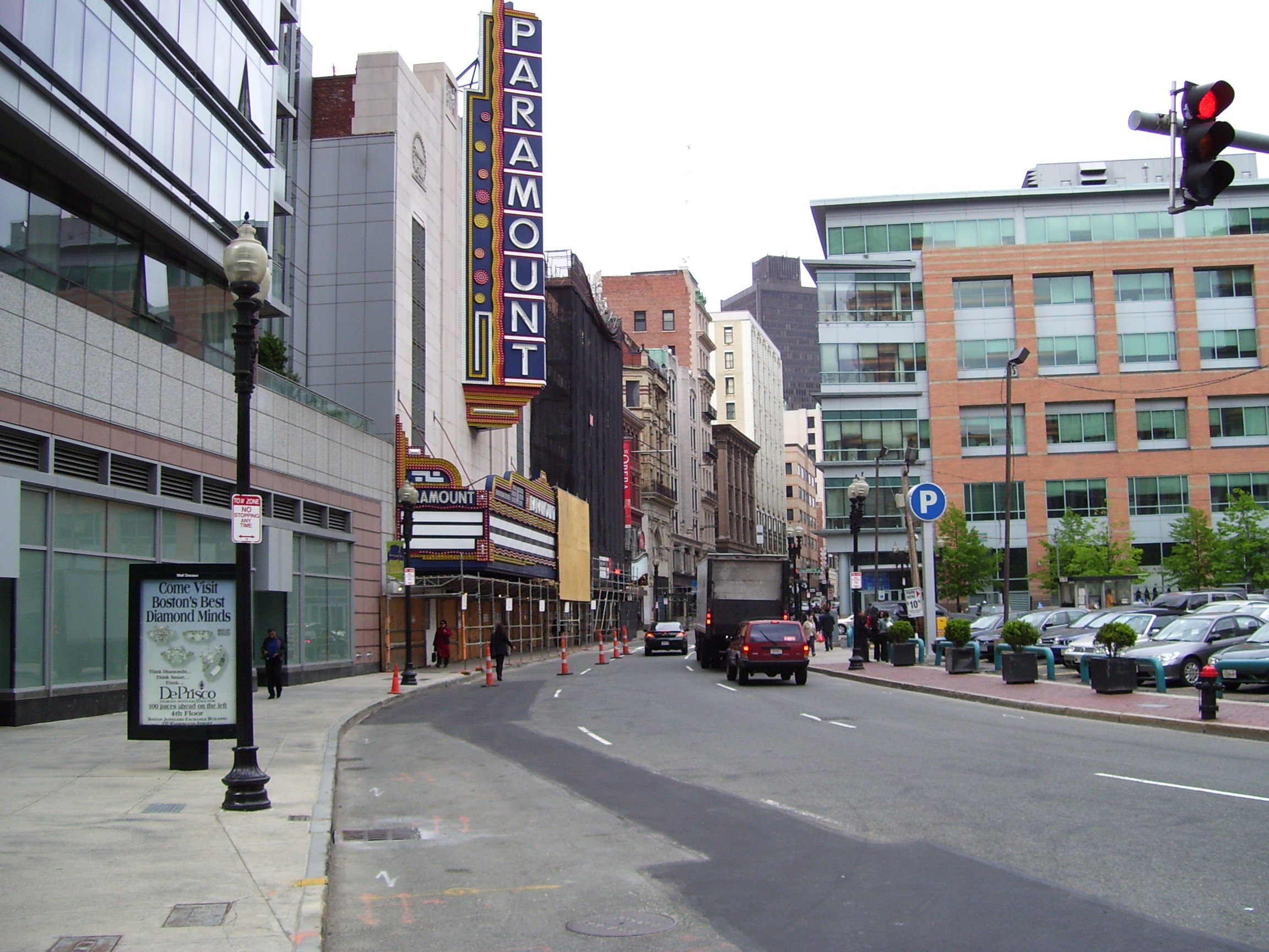
Metropolitan Theatre |
 |
01980-12-09 December 9, 1980 |
252-272 Tremont St.
42°21′1″N 71°3′56″W / 42.35028°N 71.06556°W / 42.35028; -71.06556 (Metropolitan Theatre) |
Theatre District |
|
| 170 |
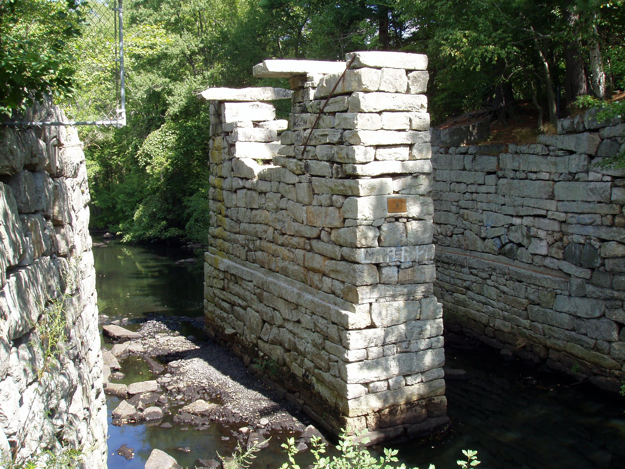
Middlesex Canal Historic and Archaeological District |
 |
02009-11-19 November 19, 2009 |
Numerous locations along the historic route of the Middlesex Canal |
Charlestown |
Extends into Middlesex County.[7] |
| 171 |
Mission Hill Triangle Historic District |
 |
01989-11-06 November 6, 1989 |
Roughly bounded by Smith St., Worthington St., Tremont St., and Huntington Ave.
42°20′2″N 71°6′9″W / 42.33389°N 71.1025°W / 42.33389; -71.1025 (Mission Hill Triangle Historic District) |
Mission Hill |
|
| 172 |
Monument Square Historic District |
 |
01987-06-02 June 2, 1987 |
Monument Sq.; also roughly bounded by Jamaicaway, Pond, Centre and Eliot Sts.
42°18′33.9″N 71°6′56.8″W / 42.309417°N 71.115778°W / 42.309417; -71.115778 (Monument Square Historic District) |
Jamaica Plain |
Second set of addresses represents a boundary increase |
| 173 |
Moreland Street Historic District |
|
01984-03-29 March 29, 1984 |
Roughly bounded by Kearsarge, Blue Hill Aves., Warren, Waverly, and Winthrop Sts.
42°19′25″N 71°4′48″W / 42.32361°N 71.08°W / 42.32361; -71.08 (Moreland Street Historic District) |
Roxbury |
|
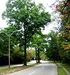
| 174 |
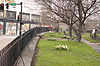
Morton Street, Metropolitan Park System of Greater Boston |
 |
02005-01-24 January 24, 2005 |
Morton St.
42°17′11″N 71°5′27″W / 42.28639°N 71.09083°W / 42.28639; -71.09083 (Morton Street, Metropolitan Park System of Greater Boston) |
Jamaica Plain |
|
| 175 |
Mount Hope Cemetery |
 |
02009-09-24 September 24, 2009 |
355 Walk Hill St.
42°17′11.66″N 71°6′18.93″W / 42.2865722°N 71.1052583°W / 42.2865722; -71.1052583 (Mount Hope Cemetery) |
Roslindale |
|
| 176 |
Mount Pleasant Historic District |
|
01989-02-09 February 9, 1989 |
Roughly bounded by Forest St. and Mount Pleasant Ave.
42°19′33″N 71°4′43″W / 42.32583°N 71.07861°W / 42.32583; -71.07861 (Mount Pleasant Historic District) |
Roxbury |
|
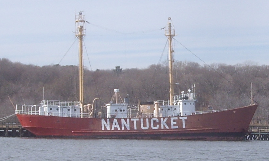
| 177 |
Lightship No. 112, Nantucket |
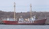 |
01989-12-20 December 20, 1989 |
Boston 42°21′40.2″N 71°2′7″W / 42.361167°N 71.03528°W / 42.361167; -71.03528 |
East Boston |
Largest lightship ever built. Listed in Portland Maine. Arrived in Boston May 11, 2010 |
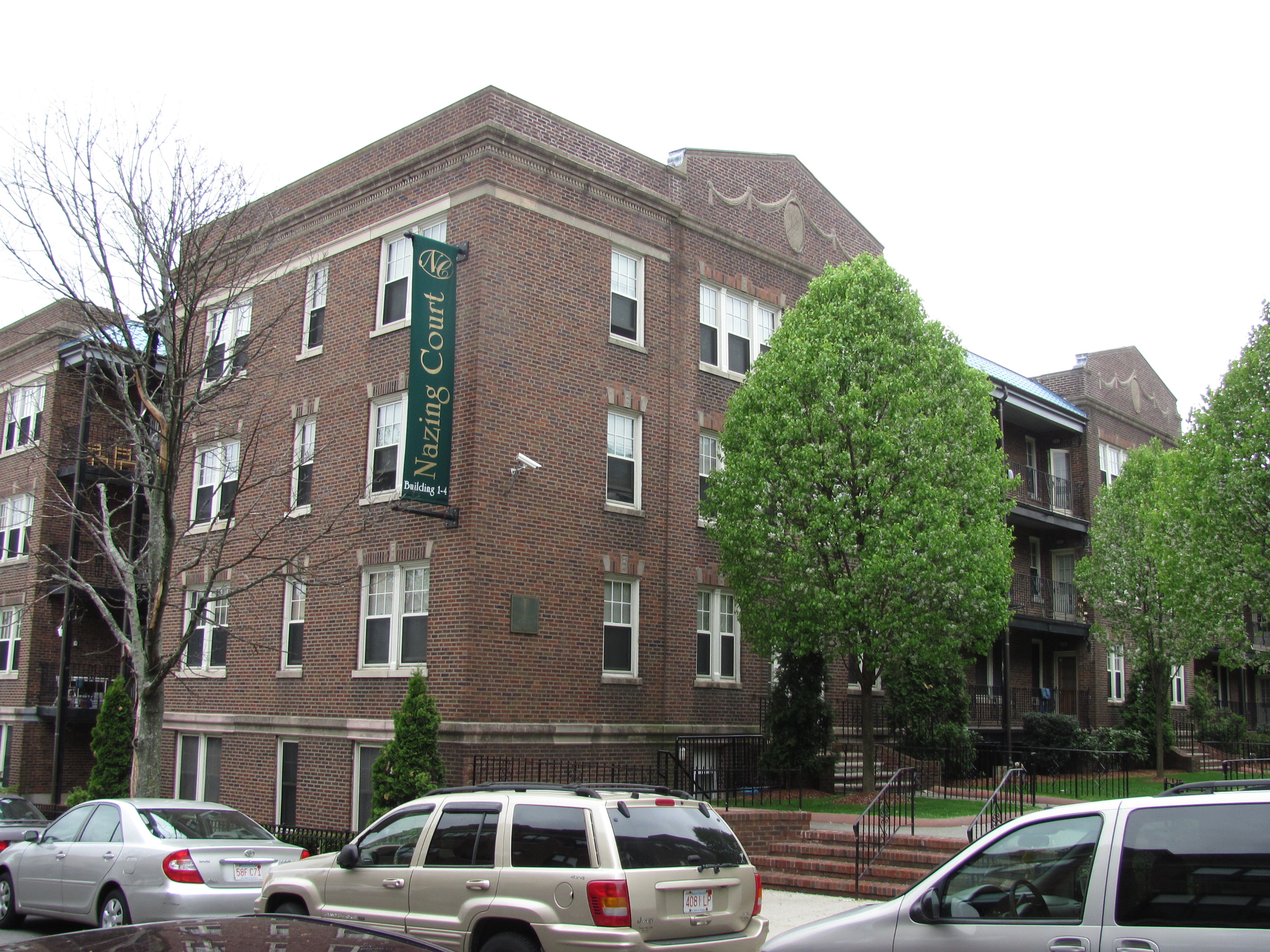
| 178 |
Nazing Court Apartments |
 |
02004-05-12 May 12, 2004 |
224-236 Seaver St. and 1-8 Nazing Court
42°18′13″N 71°5′36″W / 42.30361°N 71.09333°W / 42.30361; -71.09333 (Nazing Court Apartments) |
Roxbury |
|
| 179 |
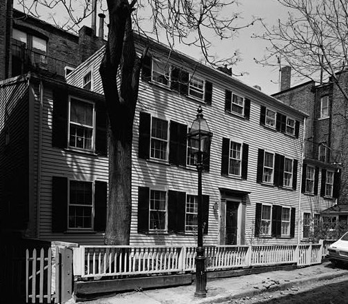
William C. Nell House |
 |
01976-05-11 May 11, 1976 |
3 Smith Ct.
42°21′28″N 71°3′53″W / 42.35778°N 71.06472°W / 42.35778; -71.06472 (Nell, William C., House) |
Beacon Hill |
|
| 180 |
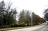
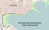
Neponset Valley Parkway, Metropolitan Park System of Greater Boston |
 |
02005-01-24 January 24, 2005 |
Neponset Valley Parkway
42°14′14″N 71°7′36″W / 42.23722°N 71.12667°W / 42.23722; -71.12667 (Neponset Valley Parkway, Metropolitan Park System of Greater Boston) |
Hyde Park |
Extends into Milton in Norfolk County |
| 181 |
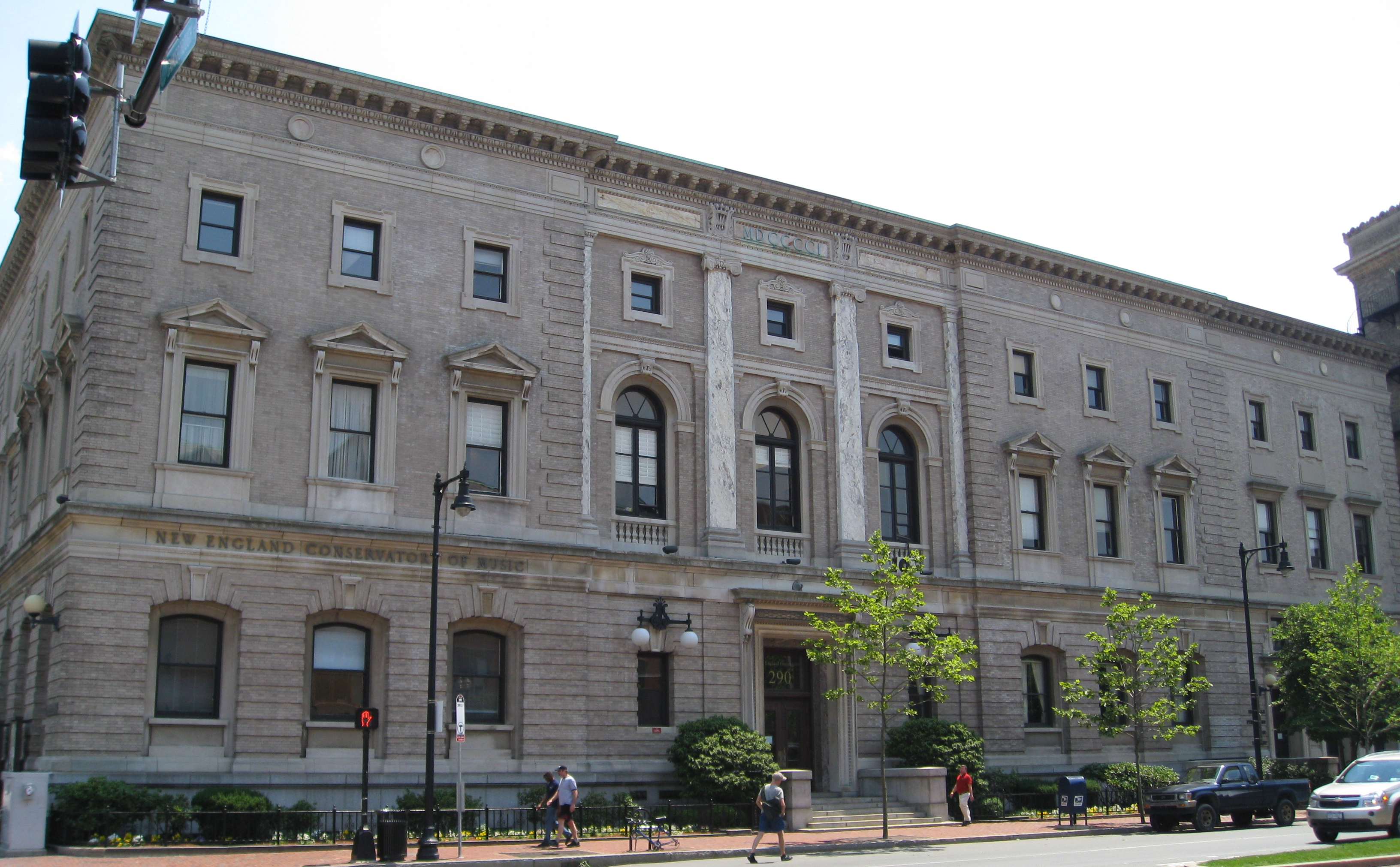
New England Conservatory of Music |
 |
01980-05-14 May 14, 1980 |
290 Huntington Ave.
42°20′26″N 71°5′13″W / 42.34056°N 71.08694°W / 42.34056; -71.08694 (New England Conservatory of Music) |
Fenway-Kenmore |
|
| 182 |
New Riding Club |
 |
01987-08-20 August 20, 1987 |
52 Hemenway St.
42°20′42″N 71°5′23″W / 42.345°N 71.08972°W / 42.345; -71.08972 (New Riding Club) |
Fenway-Kenmore |
|
| 183 |
Newspaper Row |
 |
01983-07-07 July 7, 1983 |
322-328 Washington St., 5-23 Milk St., and 11 Hawley St.
42°21′24″N 71°3′33″W / 42.35667°N 71.05917°W / 42.35667; -71.05917 (Newspaper Row) |
Downtown |
|
| 184 |
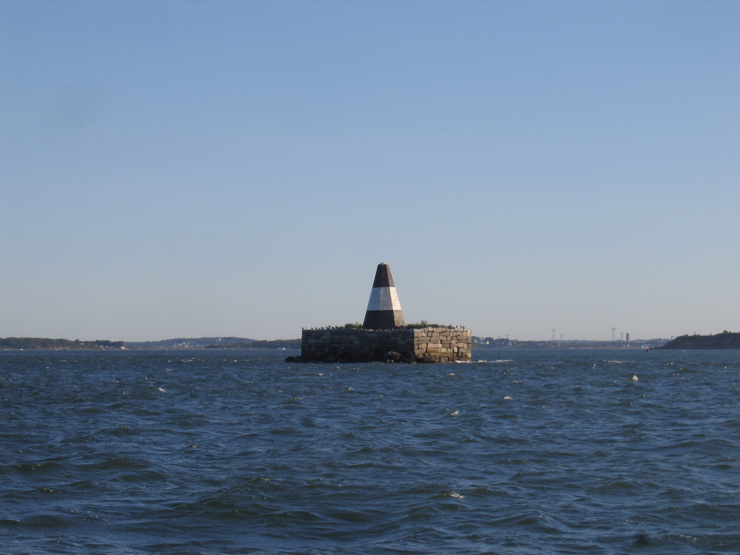
Nix's Mate Daybeacon |
 |
02004-03-18 March 18, 2004 |
Nubble Channel, The Narrows, Boston Harbor
42°19′56″N 70°56′42″W / 42.33222°N 70.945°W / 42.33222; -70.945 (Nix's Mate Daybeacon) |
Boston Harbor |
|
| 185 |
North Terminal Garage |
 |
01997-09-11 September 11, 1997 |
600 Commercial St.
42°22′1″N 71°3′28″W / 42.36694°N 71.05778°W / 42.36694; -71.05778 (North Terminal Garage) |
North End |
|
| 186 |
Oak Square School |
 |
01980-11-10 November 10, 1980 |
35 Nonantum St.
42°20′59″N 71°10′10″W / 42.34972°N 71.16944°W / 42.34972; -71.16944 (Oak Square School) |
Brighton |
|
| 187 |
Ohabei Shalom Cemetery |
 |
02008-08-19 August 19, 2008 |
147 Wordsworth St.
42°22′58.7022″N 71°0′52.077″W / 42.382972833°N 71.01446583°W / 42.382972833; -71.01446583 (Ohabei Shalom Cemetery) |
East Boston |
|
| 188 |
Old City Hall |
 |
01970-12-30 December 30, 1970 |
School and Providence Sts.
42°21′29″N 71°3′35″W / 42.35806°N 71.05972°W / 42.35806; -71.05972 (Old City Hall) |
Downtown |
|
| 189 |
Old Corner Bookstore |
 |
01973-04-11 April 11, 1973 |
Northwestern corner of Washington and School Sts.
42°21′27″N 71°3′32″W / 42.3575°N 71.05889°W / 42.3575; -71.05889 (Old Corner Bookstore) |
Downtown |
|
| 190 |
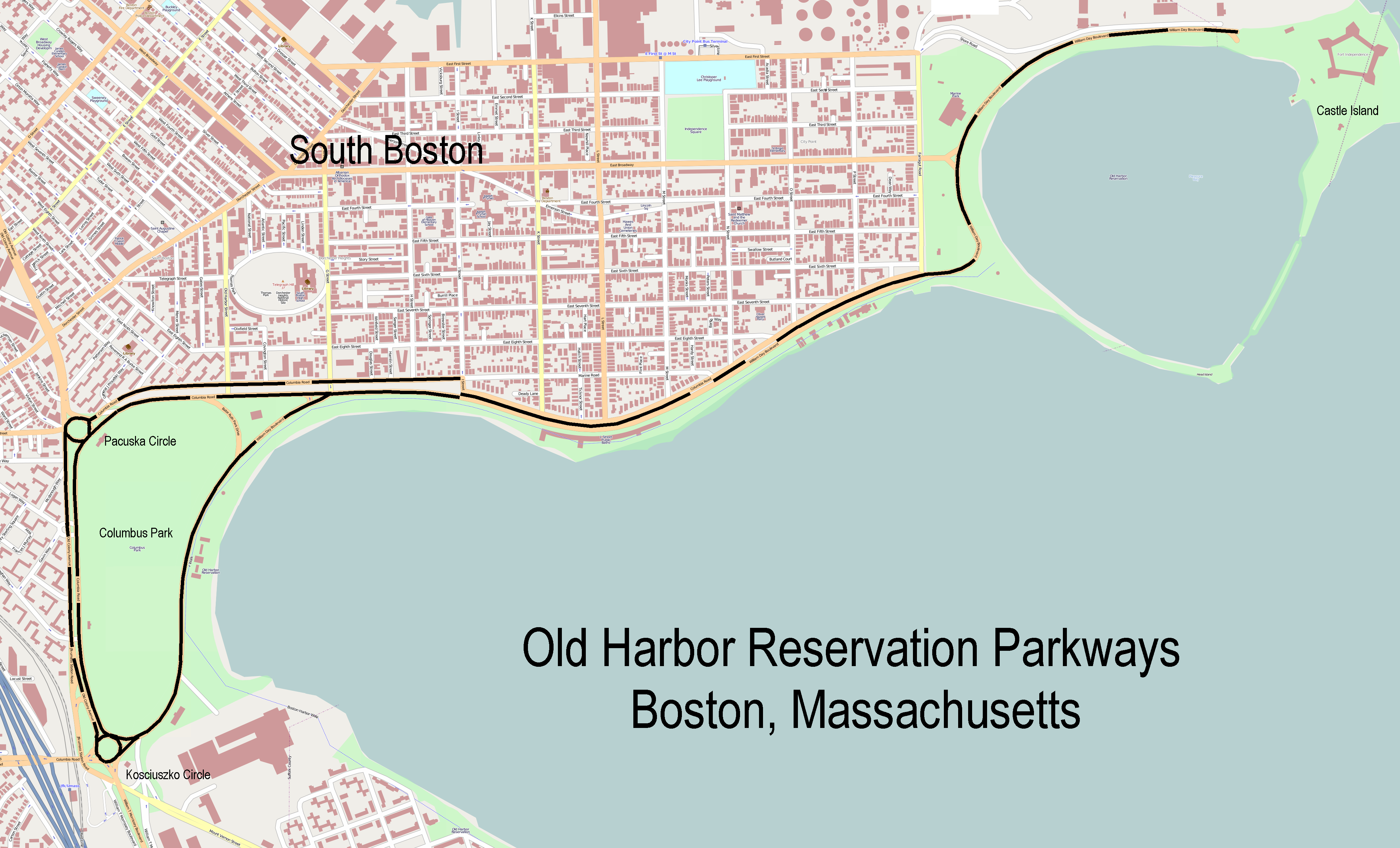
Old Harbor Reservation Parkways, Metropolitan Park System of Greater Boston |
 |
02008-07-24 July 24, 2008 |
William J. Day Boulevard, Columbia Rd. between Farragut Rd and Kosciuszko Cir., and Old Colony Ave. between Pacuska Ave.
42°19′45.78″N 71°2′44.6″W / 42.3293833°N 71.045722°W / 42.3293833; -71.045722 (Old Harbor Reservation Parkways, Metropolitan Park System of Greater Boston) |
South Boston |
|
| 191 |
Old North Church |
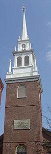 |
01966-10-15 October 15, 1966 |
193 Salem St.
42°21′58″N 71°3′18″W / 42.36611°N 71.055°W / 42.36611; -71.055 (Old North Church) |
North End |
|
| 192 |
Old South Church in Boston |
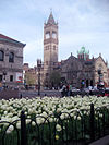 |
01970-12-30 December 30, 1970 |
645 Boylston St.
42°21′1″N 71°4′43″W / 42.35028°N 71.07861°W / 42.35028; -71.07861 (Old South Church in Boston) |
Back Bay |
|
| 193 |
Old South Meetinghouse |
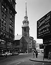 |
01966-10-15 October 15, 1966 |
Milk and Washington Sts.
42°21′25″N 71°3′31″W / 42.35694°N 71.05861°W / 42.35694; -71.05861 (Old South Meetinghouse) |
Downtown |
|
| 194 |
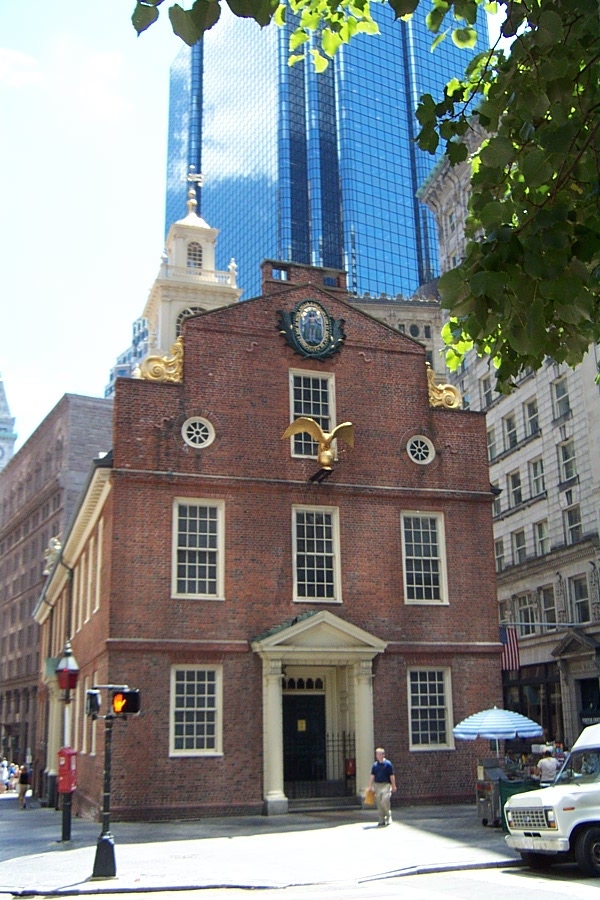
Old Statehouse |
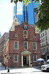 |
01966-10-15 October 15, 1966 |
Washington and State Sts.
42°21′32″N 71°3′28″W / 42.35889°N 71.05778°W / 42.35889; -71.05778 (Old Statehouse) |
Downtown |
|
| 195 |
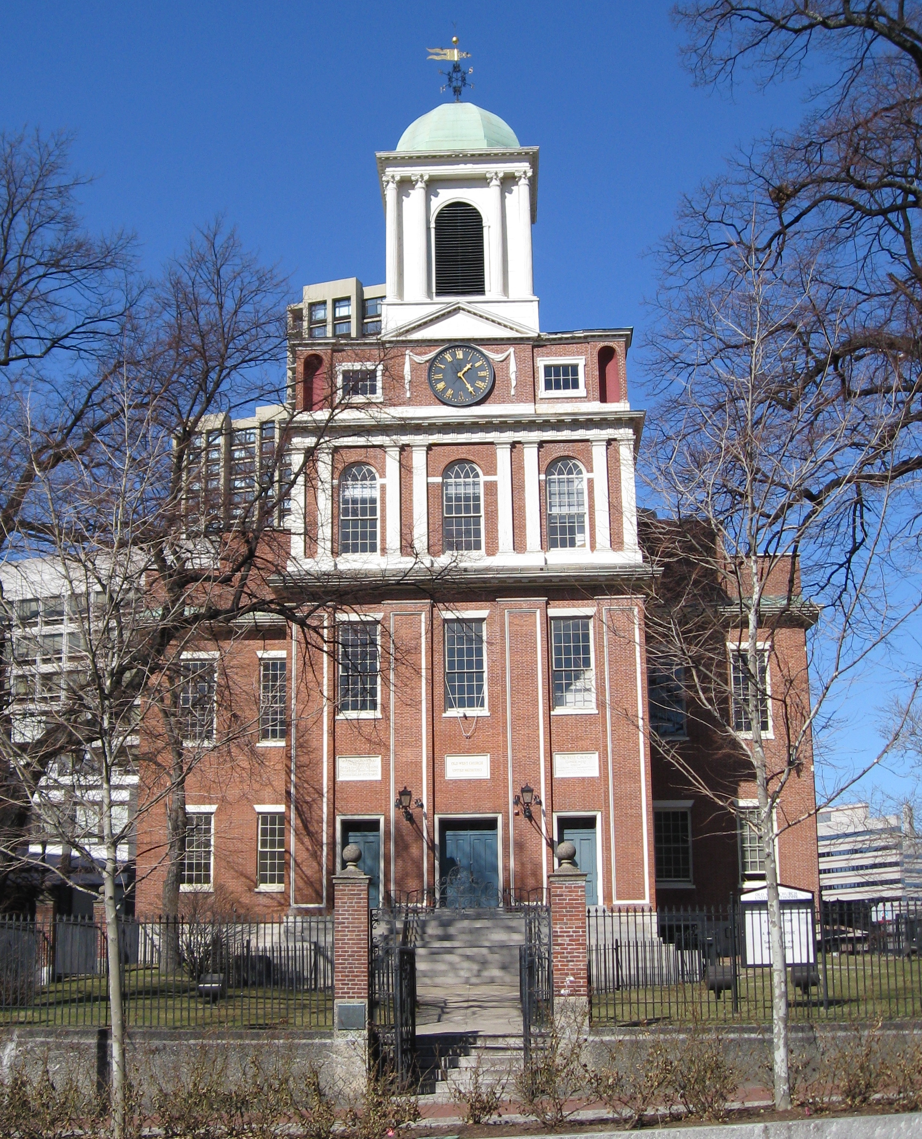
Old West Church |
 |
01970-12-30 December 30, 1970 |
131 Cambridge St.
42°21′41″N 71°3′55″W / 42.36139°N 71.06528°W / 42.36139; -71.06528 (Old West Church) |
West End |
|
| 196 |
Olmsted Park System |
 |
01971-12-08 December 8, 1971 |
Encompassing the Back Bay Fens, Muddy River, Olmsted (Leverett Park), Jamaica Park, Arborway, and Franklin Park
42°20′43″N 71°5′45″W / 42.34528°N 71.09583°W / 42.34528; -71.09583 (Olmsted Park System) |
Jamaica Plain and Fenway-Kenmore |
|
| 197 |
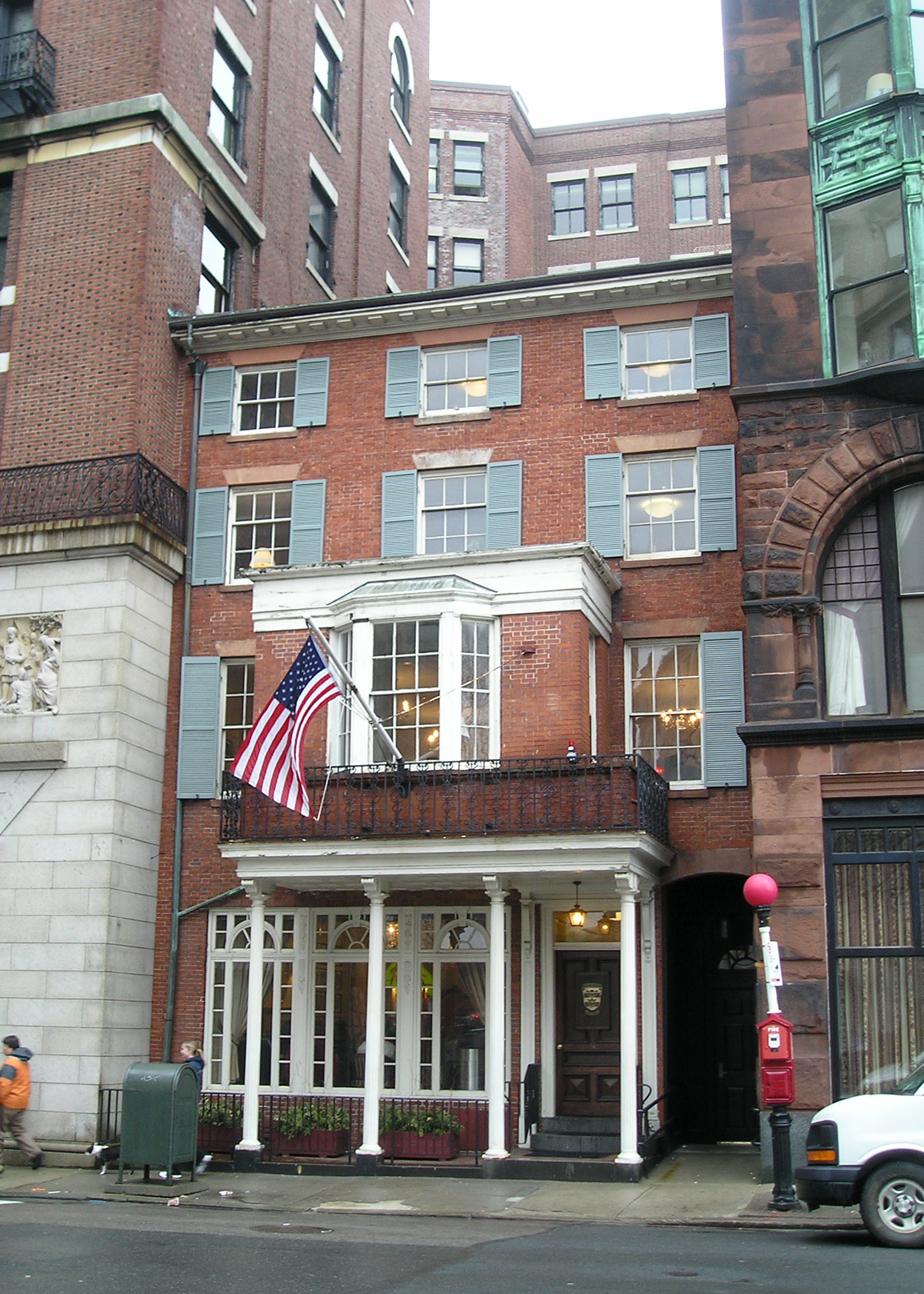
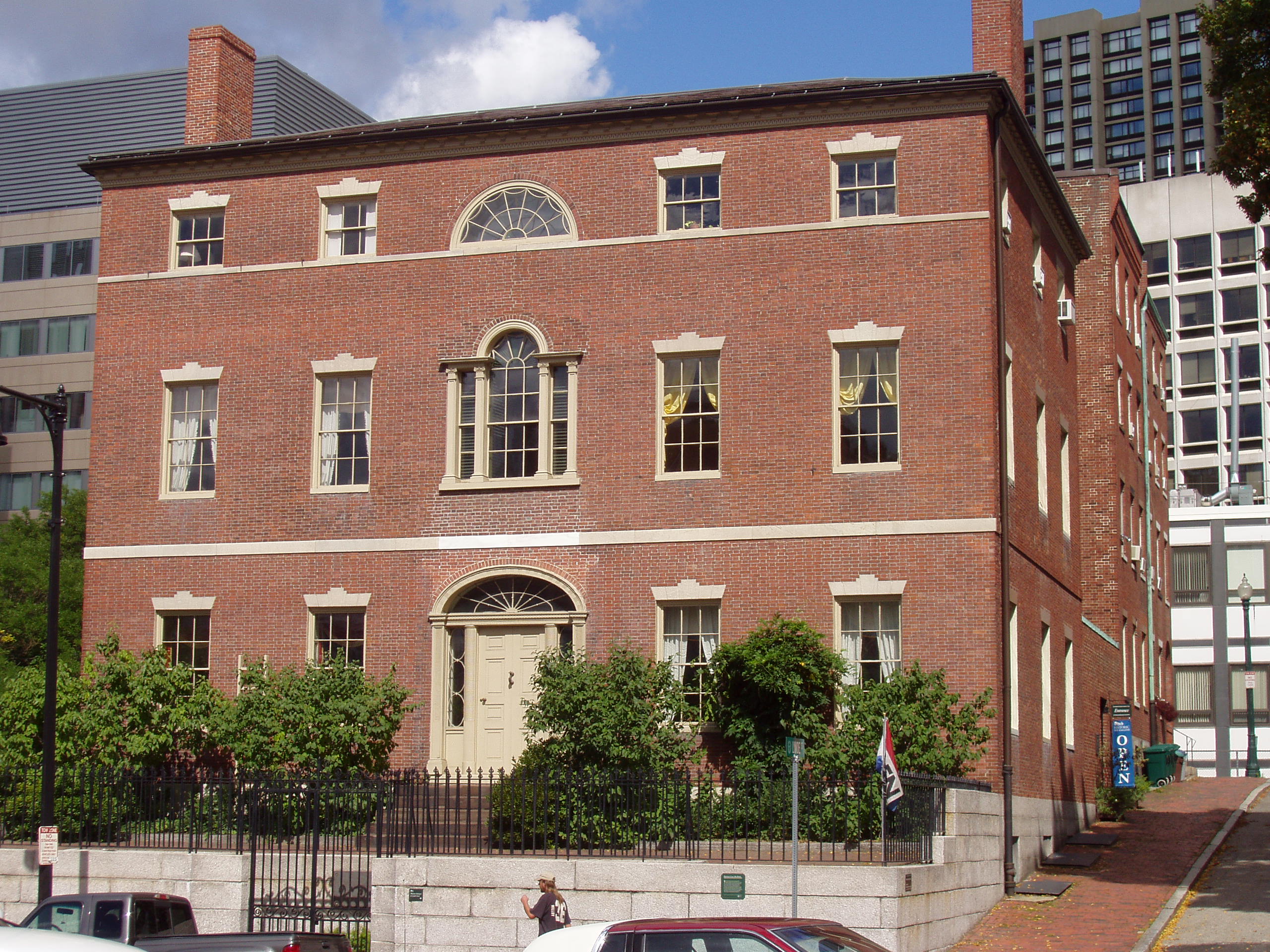
(First) Harrison Gray Otis House |
 |
01970-12-30 December 30, 1970 |
141 Cambridge St.
42°21′41″N 71°3′57″W / 42.36139°N 71.06583°W / 42.36139; -71.06583 (Otis, (First) Harrison Gray, House) |
West End |
|
| 198 |
(Second) Harrison Gray Otis House |
 |
01973-07-27 July 27, 1973 |
85 Mt. Vernon St.
42°21′29″N 71°4′5″W / 42.35806°N 71.06806°W / 42.35806; -71.06806 (Otis, (Second) Harrison Gray, House) |
Beacon Hill |
|
| 199 |
Paine Furniture Building |
 |
02002-09-12 September 12, 2002 |
75-81 Arlington St.
42°21′4″N 71°4′17″W / 42.35111°N 71.07139°W / 42.35111; -71.07139 (Paine Furniture Building) |
Back Bay |
|
| 200 |
Park Street District |
 |
01974-05-01 May 1, 1974 |
Tremont, Park, and Beacon Sts.
42°21′26″N 71°3′44″W / 42.35722°N 71.06222°W / 42.35722; -71.06222 (Park Street District) |
Beacon Hill |
|
| 201 |
Francis Parkman House |
 |
01966-10-15 October 15, 1966 |
50 Chestnut St.
42°21′25″N 71°4′9″W / 42.35694°N 71.06917°W / 42.35694; -71.06917 (Parkman, Francis, House) |
Beacon Hill |
|
| 202 |
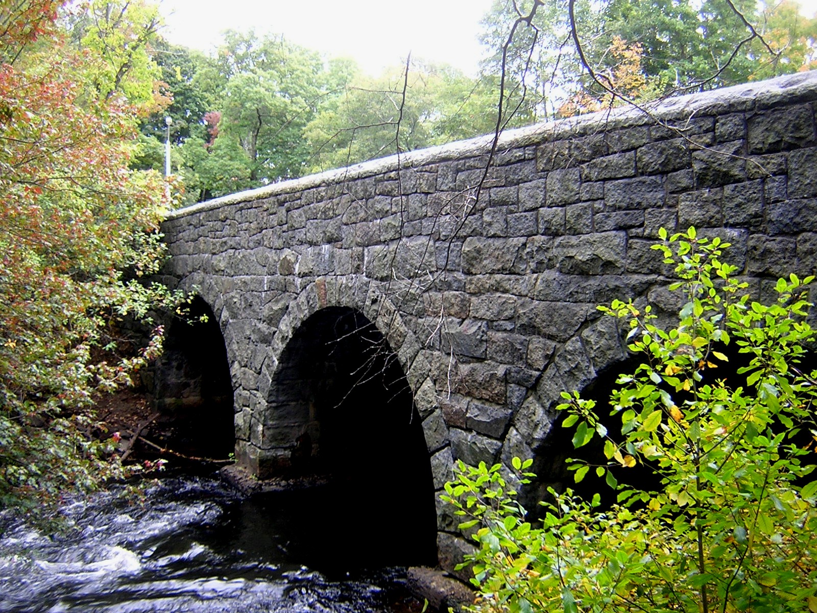
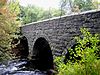
Paul's Bridge |
 |
01972-12-11 December 11, 1972 |
Neponset Valley Parkway over the Neponset River
42°14′4″N 71°7′24″W / 42.23444°N 71.12333°W / 42.23444; -71.12333 (Paul's Bridge) |
Hyde Park |
Extends into Milton in Norfolk County |
| 203 |
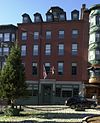
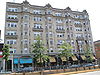
The Peabody |
 |
02001-08-08 August 8, 2001 |
195-197 Ashmont St.
42°17′7″N 71°3′53″W / 42.28528°N 71.06472°W / 42.28528; -71.06472 (Peabody, The) |
Dorchester |
|
| 204 |
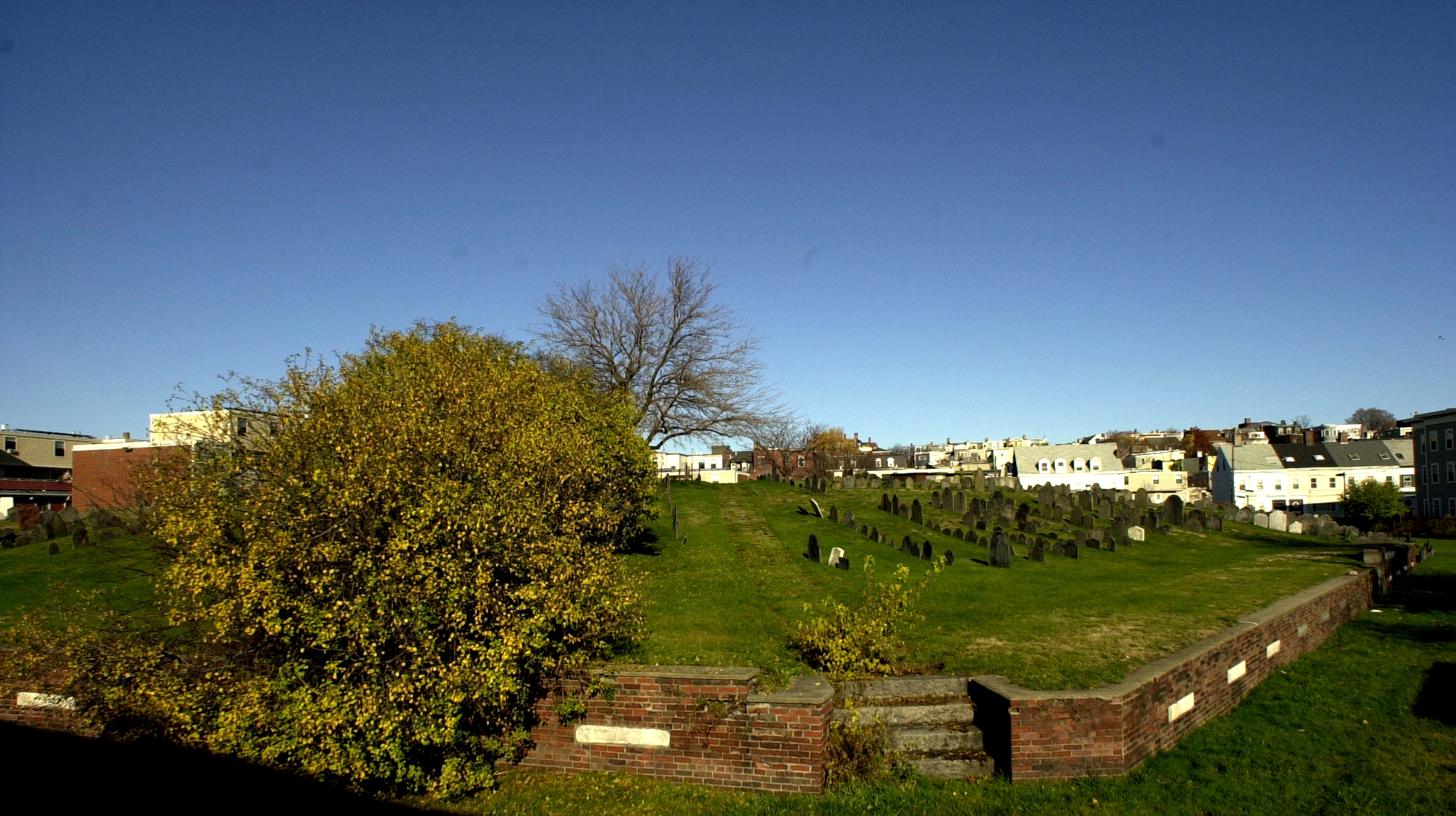
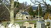
Phipps Street Burying Ground |
 |
01974-05-14 May 14, 1974 |
Phipps St.
42°22′34″N 71°4′13″W / 42.37611°N 71.07028°W / 42.37611; -71.07028 (Phipps Street Burying Ground) |
Charlestown |
|
| 205 |
Piano Row District |
 |
01980-12-09 December 9, 1980 |
Boston Common, Park Sq., Boylston Pl. and Tremont St.
42°21′8″N 71°3′55″W / 42.35222°N 71.06528°W / 42.35222; -71.06528 (Piano Row District) |
Downtown |
|
| 206 |
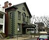
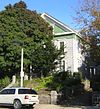
Pierce House |
 |
01974-04-26 April 26, 1974 |
24 Oakton Ave.
42°17′13″N 71°3′13″W / 42.28694°N 71.05361°W / 42.28694; -71.05361 (Pierce House) |
Dorchester |
|
| 207 |
Pierce-Hichborn House |
 |
01968-11-24 November 24, 1968 |
29 North Sq.
42°21′48″N 71°3′16″W / 42.36333°N 71.05444°W / 42.36333; -71.05444 (Pierce-Hichborn House) |
North End |
|
| 208 |
Publicity Building |
 |
02003-08-20 August 20, 2003 |
40-44 Bromfield St.
42°21′23″N 71°3′41″W / 42.35639°N 71.06139°W / 42.35639; -71.06139 (Publicity Building) |
Downtown |
|
| 209 |
Quincy Market |
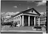 |
01966-11-13 November 13, 1966 |
S. Market St.
42°21′36″N 71°3′18″W / 42.36°N 71.055°W / 42.36; -71.055 (Quincy Market) |
Downtown |
|
| 210 |
Paul Revere House |
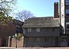 |
01966-10-15 October 15, 1966 |
19 North Sq.
42°21′49″N 71°3′16″W / 42.36361°N 71.05444°W / 42.36361; -71.05444 (Revere, Paul, House) |
North End |
|
| 211 |
Ellen H. Swallow Richards House |
 |
01992-03-31 March 31, 1992 |
32 Eliot St.
42°18′57″N 71°7′6″W / 42.31583°N 71.11833°W / 42.31583; -71.11833 (Richards, Ellen H. Swallow, House) |
Jamaica Plain |
|
| 212 |
Richardson Block |
 |
01986-08-09 August 9, 1986 |
113-151 Pearl and 109-119 High Sts.
42°21′18″N 71°3′17″W / 42.355°N 71.05472°W / 42.355; -71.05472 (Richardson Block) |
Downtown |
|
| 213 |
The Riviera |
 |
01995-12-07 December 7, 1995 |
270 Huntington Ave.
42°20′30″N 71°5′11″W / 42.34167°N 71.08639°W / 42.34167; -71.08639 (Riviera, The) |
Fenway-Kenmore |
|
| 214 |
Roslindale Baptist Church |
 |
01998-11-05 November 5, 1998 |
52 Cummins Highway
42°17′7″N 71°7′41″W / 42.28528°N 71.12806°W / 42.28528; -71.12806 (Roslindale Baptist Church) |
Roslindale |
|
| 215 |
Roslindale Congregational Church |
 |
01991-07-26 July 26, 1991 |
25 Cummins Highway at its junction with Summer Ave.
42°17′42″N 71°7′43″W / 42.295°N 71.12861°W / 42.295; -71.12861 (Roslindale Congregational Church) |
Roslindale |
|
| 216 |
Roughan Hall |
 |
01982-04-15 April 15, 1982 |
15-18 City Sq.
42°22′20″N 71°3′44″W / 42.37222°N 71.06222°W / 42.37222; -71.06222 (Roughan Hall) |
Charlestown |
|
| 217 |
Roxbury High Fort |
 |
01973-04-23 April 23, 1973 |
Beech Glen St. at Fort Ave.
42°19′16″N 71°5′24″W / 42.32111°N 71.09°W / 42.32111; -71.09 (Roxbury High Fort) |
Roxbury |
|
| 218 |
Roxbury Highlands Historic District |
|
01989-02-22 February 22, 1989 |
Roughly bounded by Dudley St., Washington St., and Columbus Ave.
42°19′32″N 71°5′26″W / 42.32556°N 71.09056°W / 42.32556; -71.09056 (Roxbury Highlands Historic District) |
Roxbury |
|
| 219 |
Roxbury Presbyterian Church |
|
01991-03-15 March 15, 1991 |
328 Warren St.
42°19′10″N 71°4′55″W / 42.31944°N 71.08194°W / 42.31944; -71.08194 (Roxbury Presbyterian Church) |
Roxbury |
|
| 220 |
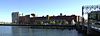
Russia Wharf Buildings |
 |
01980-12-02 December 2, 1980 |
518-540 Atlantic Ave., 270 Congress St. and 276-290 Congress St.
42°21′12″N 71°3′11″W / 42.35333°N 71.05306°W / 42.35333; -71.05306 (Russia Wharf Buildings) |
Downtown |
|
| 221 |
Saint Augustine Chapel and Cemetery |
 |
01987-09-18 September 18, 1987 |
Dorchester St. between W. 6th and Tudor Sts.
42°20′2″N 71°3′0″W / 42.33389°N 71.05°W / 42.33389; -71.05 (Saint Augustine Chapel and Cemetery) |
South Boston |
|
| 222 |
St. Joseph's Roman Catholic Church Complex |
|
01989-12-28 December 28, 1989 |
Bounded by Circuit, Regent, Hulbert, and Fenwick Sts.
42°19′26″N 71°5′16″W / 42.32389°N 71.08778°W / 42.32389; -71.08778 (St. Joseph's Roman Catholic Church Complex) |
Roxbury |
|
| 223 |
St. Luke's and St. Margaret's Church |
 |
01997-11-12 November 12, 1997 |
5-7 St. Luke's Rd.
42°21′7″N 71°7′40″W / 42.35194°N 71.12778°W / 42.35194; -71.12778 (St. Luke's and St. Margaret's Church) |
Allston |
|
| 224 |
St. Mary's Episcopal Church |
 |
01998-10-30 October 30, 1998 |
14-16 Cushing Ave.
42°18′59″N 71°3′54″W / 42.31639°N 71.065°W / 42.31639; -71.065 (St. Mary's Episcopal Church) |
Dorchester |
|
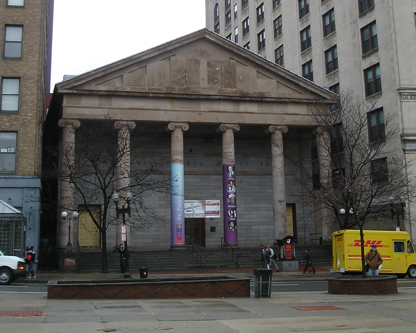
| 225 |
St. Paul's Church |
 |
01970-12-30 December 30, 1970 |
136 Tremont St.
42°21′21″N 71°3′46″W / 42.35583°N 71.06278°W / 42.35583; -71.06278 (St. Paul's Church) |
Downtown |
|
| 226 |
St. Stephen's Church |
 |
01975-04-14 April 14, 1975 |
Hanover St. between Clark and Harris Sts.
42°21′56″N 71°3′10″W / 42.36556°N 71.05278°W / 42.36556; -71.05278 (St. Stephen's Church) |
North End |
|
| 227 |
Savin Hill Historic District |
|
02003-05-09 May 9, 2003 |
Roughly bounded by Savin Hill Ave., Morrissey Boulevard, Dorchester Bay, and Interstate 93
42°18′33″N 71°3′1″W / 42.30917°N 71.05028°W / 42.30917; -71.05028 (Savin Hill Historic District) |
Dorchester |
|
| 228 |
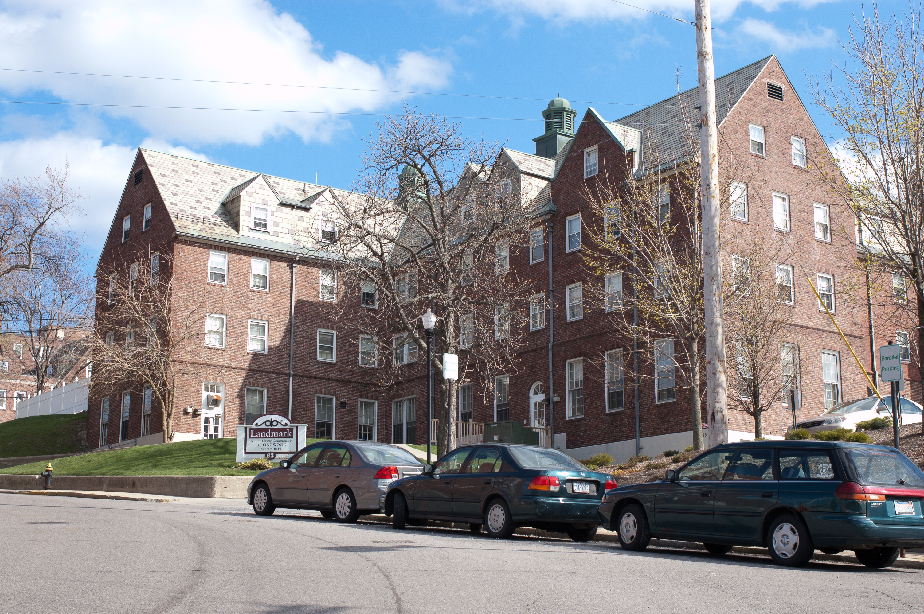
Sears Roebuck and Company Mail Order Store |
 |
01991-01-15 January 15, 1991 |
309 Park Dr. and 201 Brookline Ave.
42°20′41″N 71°6′12″W / 42.34472°N 71.10333°W / 42.34472; -71.10333 (Sears Roebuck and Company Mail Order Store) |
Fenway-Kenmore |
A former Sears building now known as Landmark Center |
| 229 |
Sears' Crescent and Sears' Block |
 |
01986-08-09 August 9, 1986 |
38-68 and 70-72 Cornhill
42°21′34″N 71°3′34″W / 42.35944°N 71.05944°W / 42.35944; -71.05944 (Sears' Crescent and Sears' Block) |
Downtown |
|
| 230 |
David Sears House |
 |
01970-12-30 December 30, 1970 |
42 Beacon St.
42°21′25″N 71°4′3″W / 42.35694°N 71.0675°W / 42.35694; -71.0675 (Sears, David, House) |
Beacon Hill |
|
| 231 |
Second Brazer Building |
 |
01986-07-24 July 24, 1986 |
25-29 State St.
42°21′30″N 71°3′28″W / 42.35833°N 71.05778°W / 42.35833; -71.05778 (Second Brazer Building) |
Downtown |
|
| 232 |
Second Church in Boston |
 |
02010-06-24 June 24, 2010 |
874, 876, 880 Beacon St.
42°20′49″N 71°6′17″W / 42.34694°N 71.10472°W / 42.34694; -71.10472 (Second Church in Boston) |
Fenway–Kenmore |
|
| 233 |
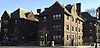
Shirley-Eustis House |
 |
01966-10-15 October 15, 1966 |
31-37 Shirley St.
42°19′24″N 71°4′21″W / 42.32333°N 71.0725°W / 42.32333; -71.0725 (Shirley-Eustis House) |
Roxbury |
|
| 234 |
Sam S. Shubert Theatre |
 |
01980-12-09 December 9, 1980 |
263-265 Tremont St.
42°21′0″N 71°3′58″W / 42.35°N 71.06611°W / 42.35; -71.06611 (Shubert, Sam S., Theatre) |
Theatre District |
|
| 235 |
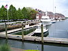
South Boston Boat Clubs Historic District |
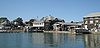 |
02005-09-01 September 1, 2005 |
1793-1849 William J. Day Boulevard
42°19′56″N 71°1′37″W / 42.33222°N 71.02694°W / 42.33222; -71.02694 (South Boston Boat Clubs Historic District) |
South Boston |
|
| 236 |
South End District |
 |
01973-05-08 May 8, 1973 |
South Bay area between Huntington and Harrison Aves.
42°20′23″N 71°4′23″W / 42.33972°N 71.07306°W / 42.33972; -71.07306 (South End District) |
South End |
|
| 237 |
South Station Headhouse |
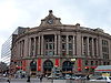 |
01975-02-13 February 13, 1975 |
Atlantic Ave. and Summer St.
42°21′7″N 71°3′21″W / 42.35194°N 71.05583°W / 42.35194; -71.05583 (South Station Headhouse) |
Downtown |
|
| 238 |
R.H. Stearns House |
 |
01980-06-16 June 16, 1980 |
140 Tremont St.
42°21′20″N 71°3′47″W / 42.35556°N 71.06306°W / 42.35556; -71.06306 (Stearns, R. H., House) |
Downtown |
Although the site is named the "R.H. Stearns House", it is the former main building of the R.H. Stearns Department Store company. |
| 239 |
Stony Brook Reservation Parkways, Metropolitan Park System of Great Boston MPS |
 |
02006-01-03 January 3, 2006 |
Dedham, Enneking, Turtle Pond Parkways, Smith Field, Reservation, W. Border Rds.
42°15′28″N 71°8′32″W / 42.25778°N 71.14222°W / 42.25778; -71.14222 (Stony Brook Reservation Parkways, Metropolitan Park System of Great Boston MPS) |
Hyde Park and West Roxbury |
|
| 240 |
Students House |
 |
01997-09-11 September 11, 1997 |
96 The Fenway
42°20′31″N 71°5′33″W / 42.34194°N 71.0925°W / 42.34194; -71.0925 (Students House) |
Fenway-Kenmore |
|
| 241 |
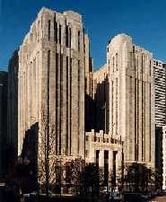
Suffolk County Jail |
 |
01980-04-23 April 23, 1980 |
215 Charles St.
42°21′43″N 71°4′13″W / 42.36194°N 71.07028°W / 42.36194; -71.07028 (Suffolk County Jail) |
West End |
|
| 242 |
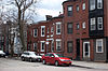
Sumner Hill Historic District |
 |
01987-10-22 October 22, 1987 |
Roughly bounded by Seaverns Ave., Everett St., Carolina Ave., and Newbern St.
42°18′35″N 71°6′43″W / 42.30972°N 71.11194°W / 42.30972; -71.11194 (Sumner Hill Historic District) |
Jamaica Plain |
|
| 243 |
Charles Sumner House |
 |
01973-11-07 November 7, 1973 |
20 Hancock St.
42°21′36″N 71°3′56″W / 42.36°N 71.06556°W / 42.36; -71.06556 (Sumner, Charles, House) |
Beacon Hill |
|
| 244 |
Symphony and Horticultural Halls |
 |
01975-05-30 May 30, 1975 |
Massachusetts and Huntington Aves.
42°20′33″N 71°5′9″W / 42.3425°N 71.08583°W / 42.3425; -71.08583 (Symphony and Horticultural Halls) |
Fenway-Kenmore |
|
| 245 |
Symphony Hall |
 |
01999-01-20 January 20, 1999 |
301 Massachusetts Ave.
42°20′33″N 71°5′9″W / 42.3425°N 71.08583°W / 42.3425; -71.08583 (Symphony Hall) |
South End |
|
| 246 |
Temple Place Historic District |
 |
01988-07-26 July 26, 1988 |
11-55, 26-58 Temple Pl.
42°21′18″N 71°3′40″W / 42.355°N 71.06111°W / 42.355; -71.06111 (Temple Place Historic District) |
Downtown |
|
| 247 |
Textile District |
 |
01990-11-29 November 29, 1990 |
Roughly Essex St. from Phillips Sq. to Columbia St. and Chauncy St. from Phillips Sq. to Rowe Pl.
42°20′52″N 71°3′17″W / 42.34778°N 71.05472°W / 42.34778; -71.05472 (Textile District) |
Downtown |
|
| 248 |
Town Hill District |
 |
01973-05-11 May 11, 1973 |
Bounded roughly by Rutherford Ave. and Main and Warren Sts.
42°22′21″N 71°3′44″W / 42.3725°N 71.06222°W / 42.3725; -71.06222 (Town Hill District) |
Charlestown |
|
| 249 |
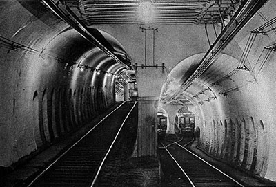
Tremont Street Subway |
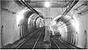 |
01966-10-15 October 15, 1966 |
Beneath Tremont, Boylston, and Washington Sts.
42°21′23″N 71°3′47″W / 42.35639°N 71.06306°W / 42.35639; -71.06306 (Tremont Street Subway) |
Downtown |
|
| 250 |
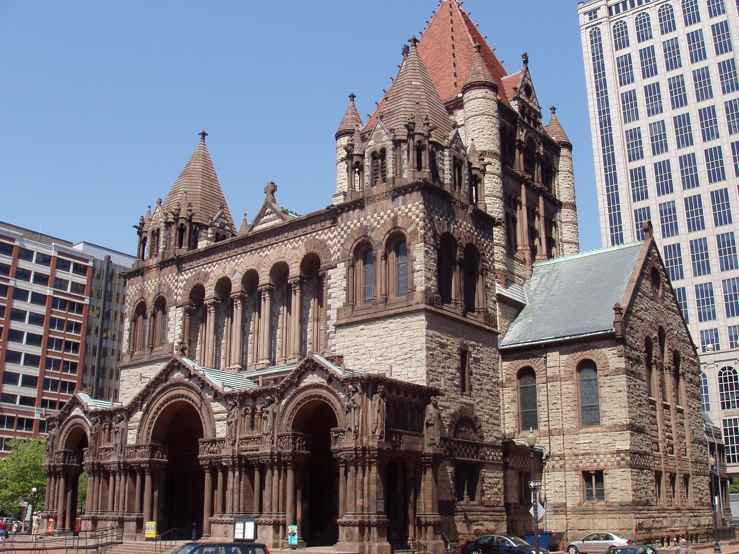
Trinity Church |
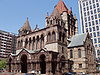 |
01970-07-01 July 1, 1970 |
Copley Sq.
42°21′7″N 71°4′28″W / 42.35194°N 71.07444°W / 42.35194; -71.07444 (Trinity Church) |
Back Bay |
|
| 251 |
Trinity Neighborhood House |
 |
01992-04-14 April 14, 1992 |
406 Meridian St.
42°22′49″N 71°2′22.6″W / 42.38028°N 71.039611°W / 42.38028; -71.039611 (Trinity Neighborhood House) |
East Boston |
|
| 252 |
Trinity Rectory |
 |
01972-02-23 February 23, 1972 |
Clarendon and Newbury Sts.
42°21′6″N 71°4′34″W / 42.35167°N 71.07611°W / 42.35167; -71.07611 (Trinity Rectory) |
Back Bay |
|
| 253 |
William Monroe Trotter House |
 |
01976-05-11 May 11, 1976 |
97 Sawyer Ave.
42°18′47″N 71°3′46″W / 42.31306°N 71.06278°W / 42.31306; -71.06278 (Trotter, William Monroe, House) |
Dorchester |
|
| 254 |
Truman Parkway-Metropolitan Park System of Greater Boston |
 |
02005-01-05 January 5, 2005 |
Truman Parkway
42°14′53″N 71°6′59″W / 42.24806°N 71.11639°W / 42.24806; -71.11639 (Truman Parkway-Metropolitan Park System of Greater Boston) |
Hyde Park |
Extends into Milton in Norfolk County |
| 255 |
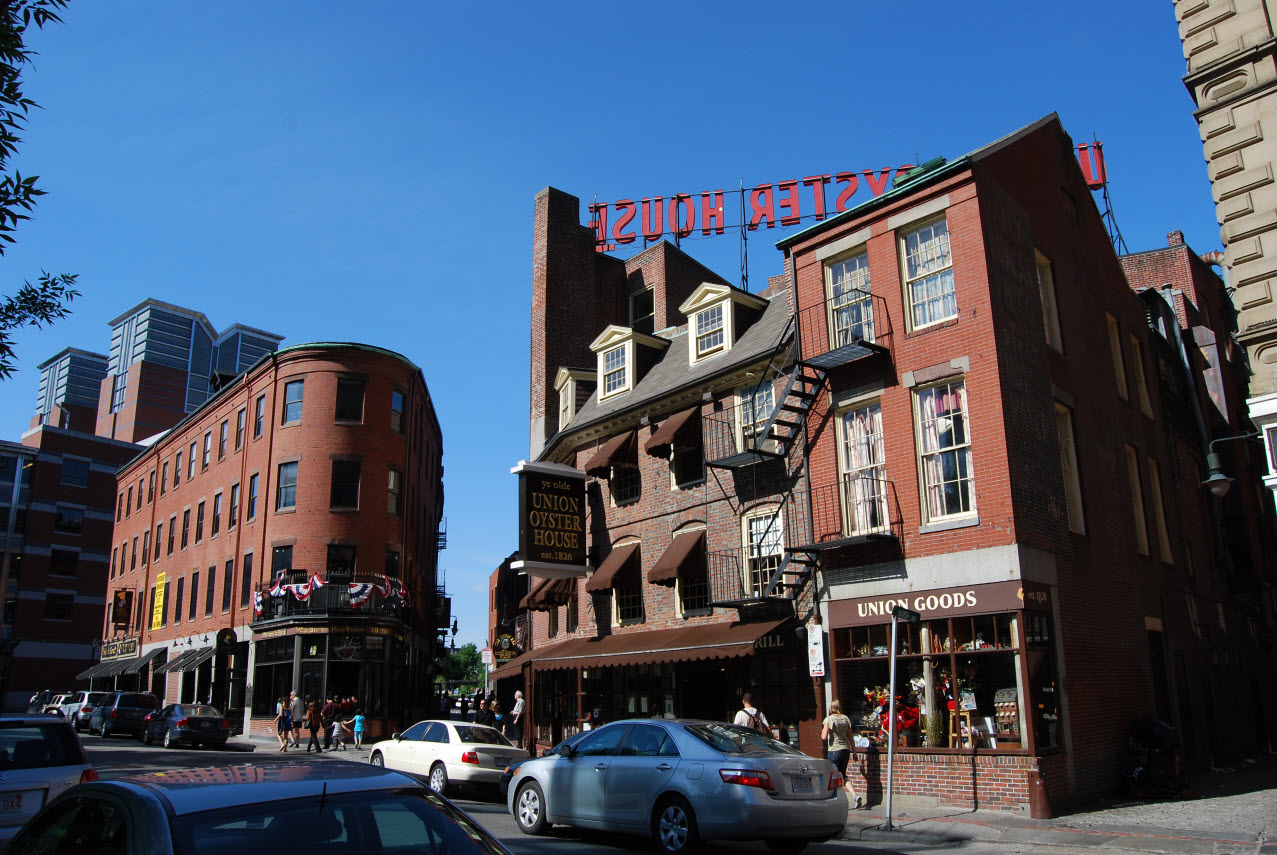
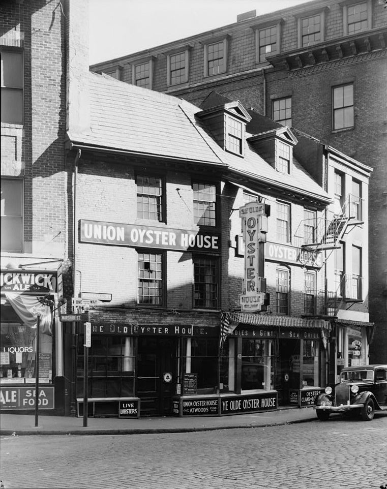
Union Oyster House |
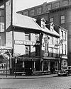 |
02003-05-27 May 27, 2003 |
41-43 Union Street
42°21′46″N 71°3′38″W / 42.36278°N 71.06056°W / 42.36278; -71.06056 (Union Oyster House) |
Downtown |
|
| 256 |
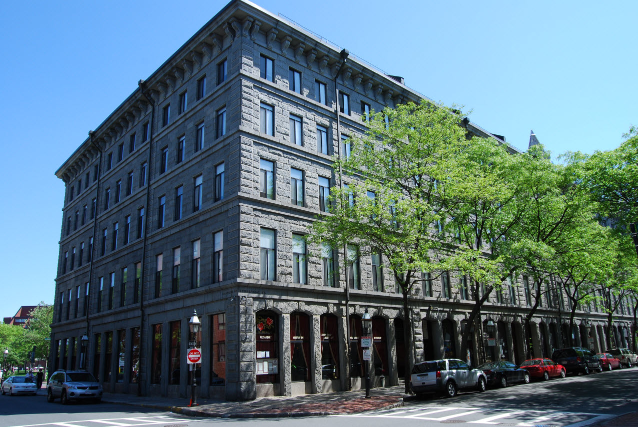
Union Wharf |
 |
01980-06-22 June 22, 1980 |
295-353 Commercial St.
42°21′56″N 71°3′3″W / 42.36556°N 71.05083°W / 42.36556; -71.05083 (Union Wharf) |
North End |
|
| 257 |
United Shoe Machinery Corporation Building |
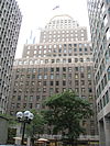 |
01980-08-19 August 19, 1980 |
138-164 Federal St.
42°21′14″N 71°3′23″W / 42.35389°N 71.05639°W / 42.35389; -71.05639 (United Shoe Machinery Corporation Building) |
Downtown |
|
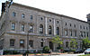
| 258 |
United States Post Office, Courthouse, and Federal Building |
 |
02011-04-08 April 8, 2011 |
5 Post Office Square
42°21′26″N 71°3′25″W / 42.35722°N 71.05694°W / 42.35722; -71.05694 (United States Post Office, Courthouse, and Federal Building) |
Downtown |
|
| 259 |
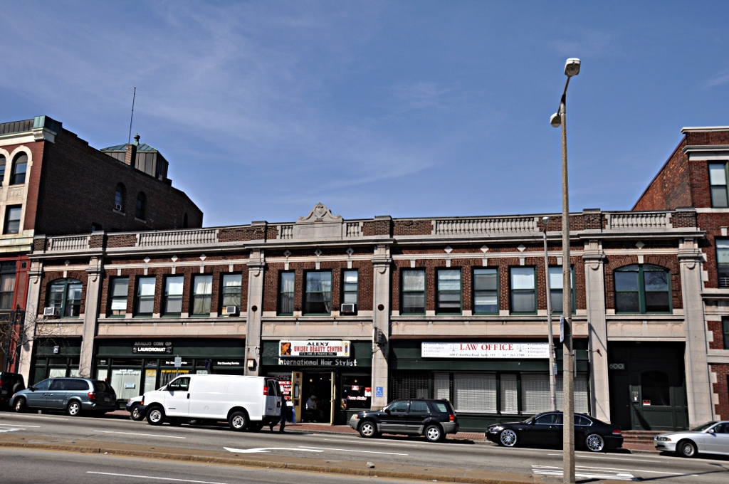
Upham's Corner Market |
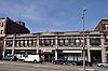 |
01990-10-11 October 11, 1990 |
600 Columbia Rd.
42°19′2″N 71°3′55″W / 42.31722°N 71.06528°W / 42.31722; -71.06528 (Upham's Corner Market) |
Dorchester |
|
| 260 |
US Post Office Garage |
 |
01986-06-26 June 26, 1986 |
135 A St.
42°20′36″N 71°3′14″W / 42.34333°N 71.05389°W / 42.34333; -71.05389 (US Post Office Garage) |
South Boston |
Destroyed |
| 261 |
USS Cassin Young (destroyer) |
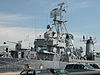 |
01986-01-14 January 14, 1986 |
Charlestown Navy Yard
42°22′17″N 71°3′18″W / 42.37139°N 71.055°W / 42.37139; -71.055 (USS Cassin Young (destroyer)) |
Charlestown |
|
| 262 |
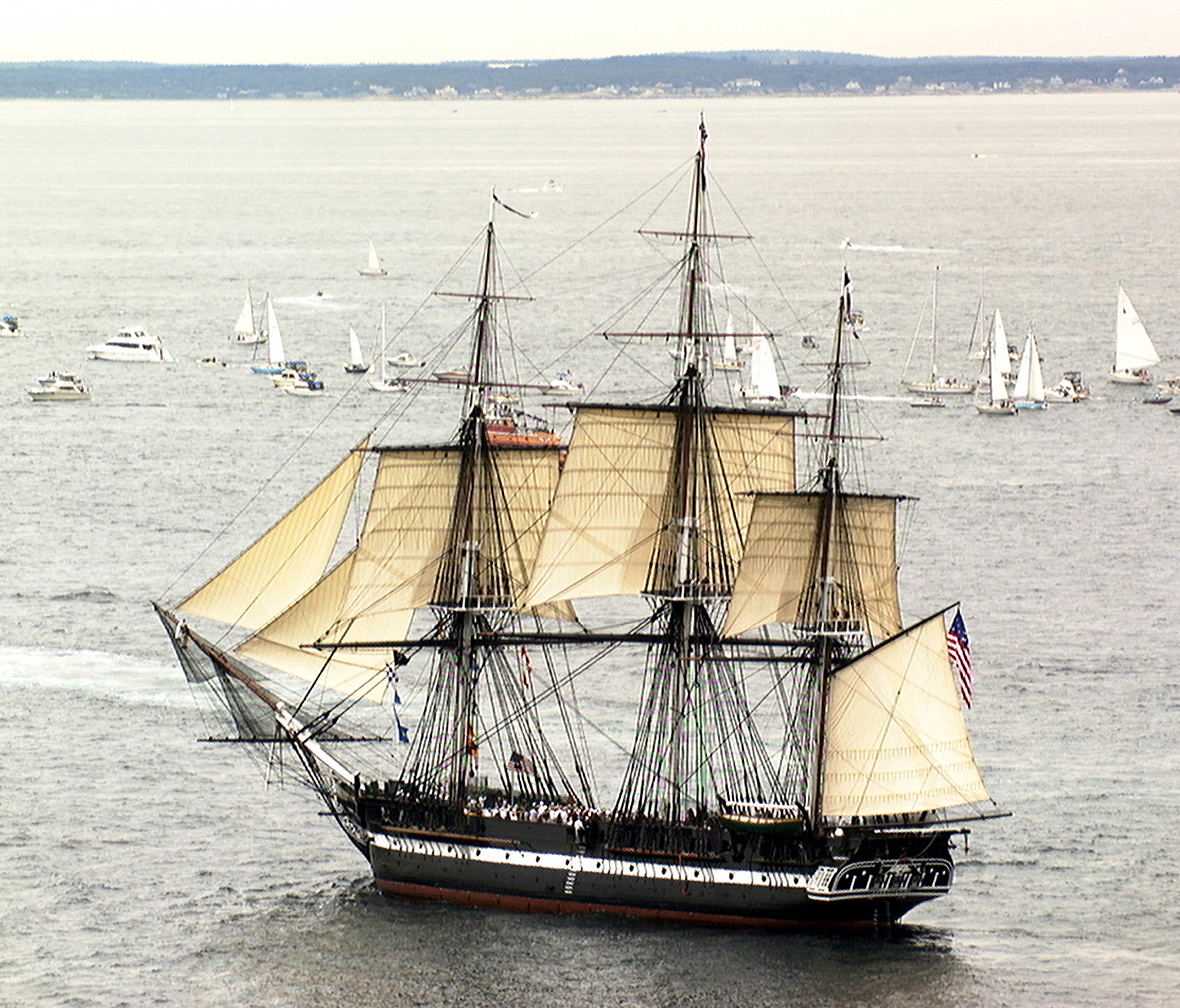
USS Constitution |
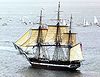 |
01966-10-15 October 15, 1966 |
Boston Naval Shipyard
42°22′21″N 71°3′25″W / 42.3725°N 71.05694°W / 42.3725; -71.05694 (USS Constitution) |
Charlestown |
|
| 263 |
Vermont Building |
 |
01984-11-13 November 13, 1984 |
6-12 Thacher St.
42°21′56″N 71°3′28″W / 42.36556°N 71.05778°W / 42.36556; -71.05778 (Vermont Building) |
North End |
|
| 264 |
VFW Parkway, Metropolitan Park System of Greater Boston |
 |
02005-01-05 January 5, 2005 |
VFW Parkway, between Spring and Centre Sts.
42°17′10″N 71°9′31″W / 42.28611°N 71.15861°W / 42.28611; -71.15861 (VFW Parkway, Metropolitan Park System of Greater Boston) |
West Roxbury |
|
| 265 |
Washington Street Theatre District |
 |
01979-03-19 March 19, 1979 |
511-559 Washington St.
42°21′14″N 71°3′46″W / 42.35389°N 71.06278°W / 42.35389; -71.06278 (Washington Street Theatre District) |
Theatre District |
|
| 266 |
West Roxbury Parkway, Metropolitan Park System of Greater Boston |
|
02006-01-19 January 19, 2006 |
West Roxbury Parkway, Bellevue Hill, East Border Rd., and West Border Rd.
42°18′10″N 71°9′11″W / 42.30278°N 71.15306°W / 42.30278; -71.15306 (West Roxbury Parkway, Metropolitan Park System of Greater Boston) |
West Roxbury |
Extends into Brookline in Norfolk County |
| 267 |
West Street District |
 |
01980-12-09 December 9, 1980 |
West St.
42°21′18″N 71°3′49″W / 42.355°N 71.06361°W / 42.355; -71.06361 (West Street District) |
Downtown |
|
| 268 |
Westerly Burial Ground |
 |
01987-11-20 November 20, 1987 |
Centre St.
42°16′53″N 71°9′34″W / 42.28139°N 71.15944°W / 42.28139; -71.15944 (Westerly Burial Ground) |
West Roxbury |
|
| 269 |
Wigglesworth Building |
 |
01982-10-21 October 21, 1982 |
89-83 Franklin St.
42°21′18″N 71°3′29″W / 42.355°N 71.05806°W / 42.355; -71.05806 (Wigglesworth Building) |
Downtown |
|
| 270 |
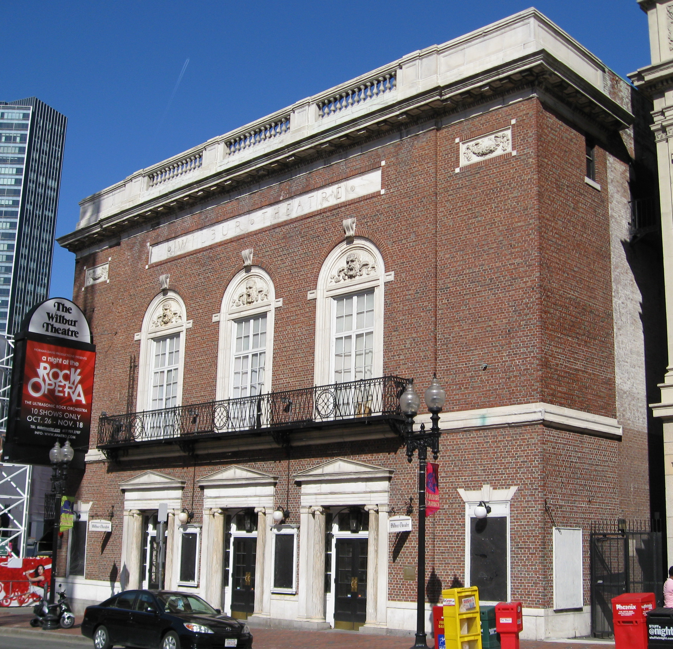
Wilbur Theatre |
 |
01980-12-09 December 9, 1980 |
244-250 Tremont St.
42°21′2″N 71°3′56″W / 42.35056°N 71.06556°W / 42.35056; -71.06556 (Wilbur Theatre) |
Theatre District |
|
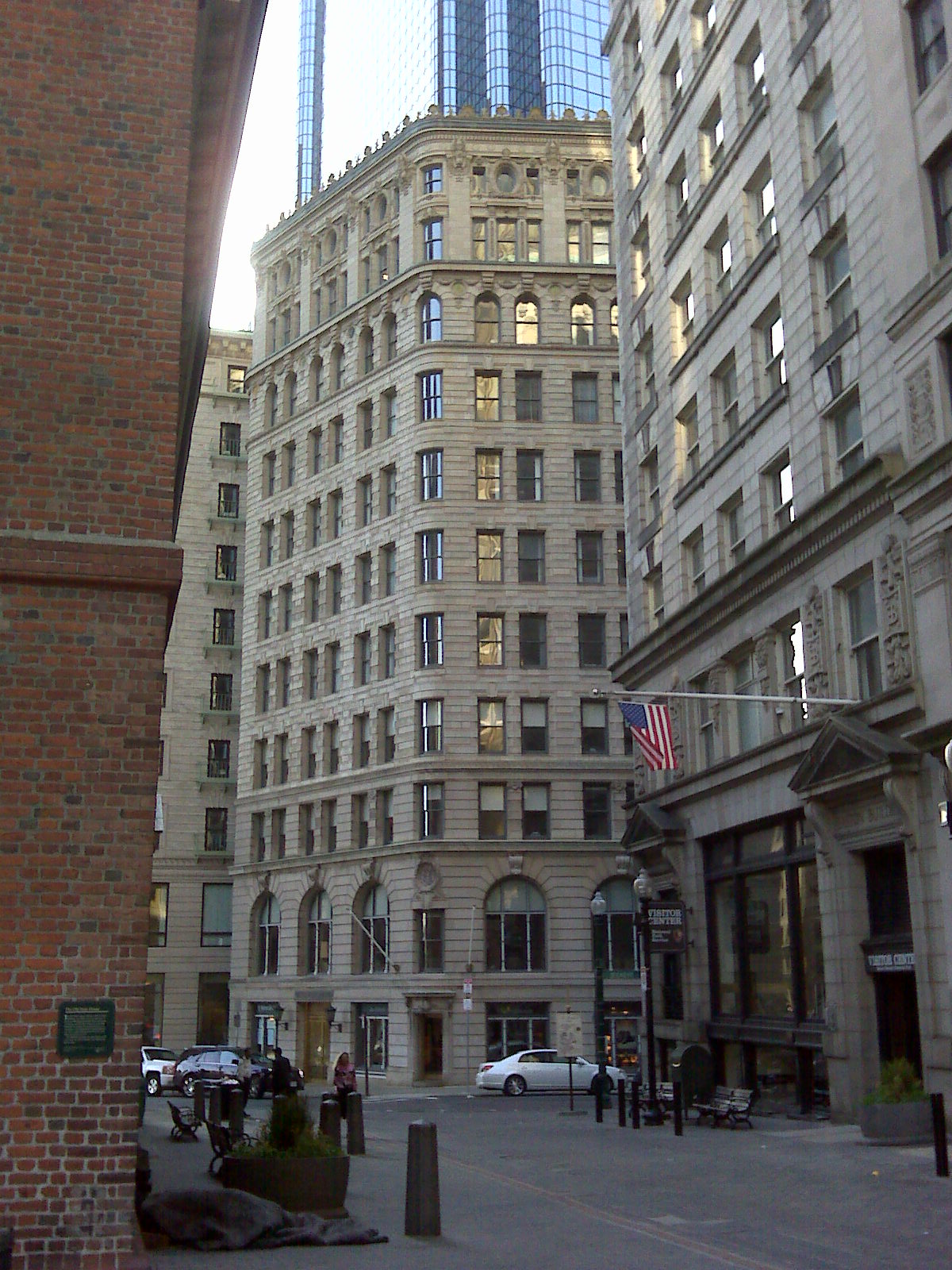
| 271 |
Winthrop Building |
 |
01974-04-18 April 18, 1974 |
7 Water St.
42°21′27″N 71°3′29″W / 42.3575°N 71.05806°W / 42.3575; -71.05806 (Winthrop Building) |
Downtown |
|
| 272 |
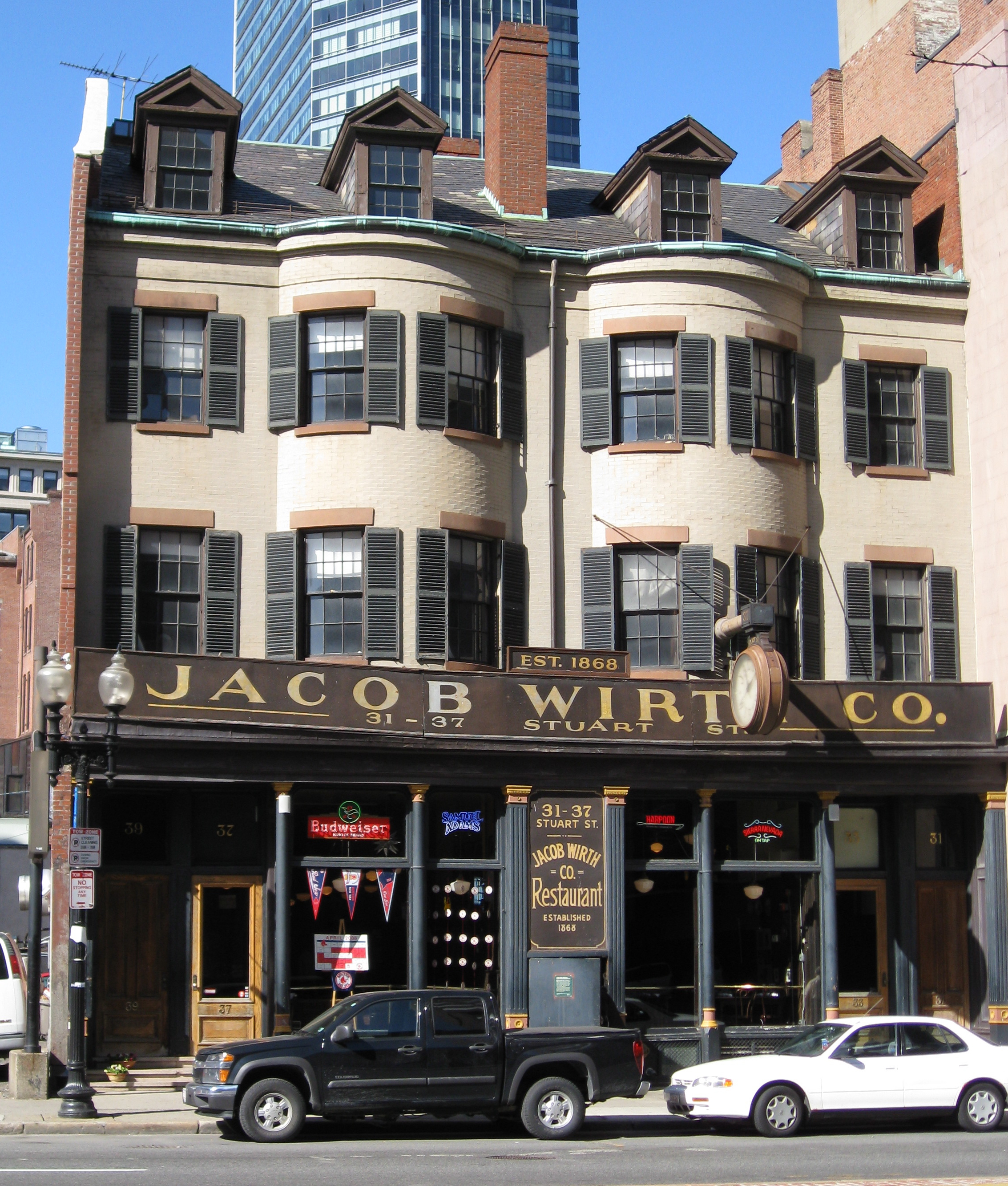
Jacob Wirth Buildings |
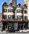 |
01980-12-09 December 9, 1980 |
31-39 Stuart St.
42°21′4″N 71°3′52″W / 42.35111°N 71.06444°W / 42.35111; -71.06444 (Wirth, Jacob, Buildings) |
Theatre District |
|
| 273 |
Woodbourne Historic District |
 |
01999-06-04 June 4, 1999 |
Roughly bounded by Walk Hill, Goodway, and Wachusett Sts.
42°17′30″N 71°6′58″W / 42.29167°N 71.11611°W / 42.29167; -71.11611 (Woodbourne Historic District) |
Jamaica Plain |
|
| 274 |
Youth's Companion Building |
 |
01974-05-02 May 2, 1974 |
209 Columbus Ave.
42°20′54″N 71°4′22″W / 42.34833°N 71.07278°W / 42.34833; -71.07278 (Youth's Companion Building) |
Back Bay |
|
| 275 |
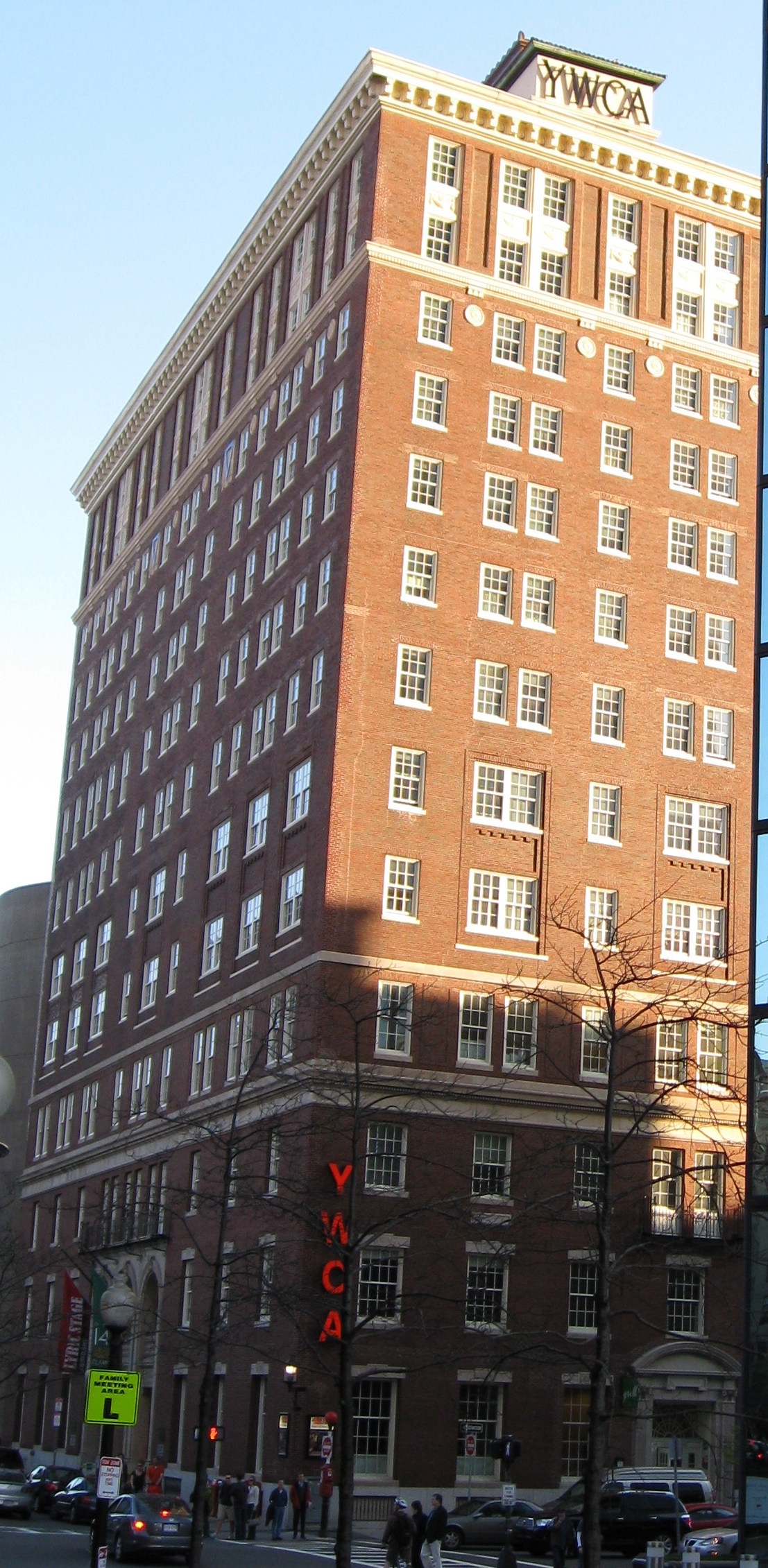
YWCA Boston |
 |
02004-03-03 March 3, 2004 |
140 Clarendon St.
42°21′1″N 71°4′33″W / 42.35028°N 71.07583°W / 42.35028; -71.07583 (YWCA Boston) |
Back Bay |
Landmark building, in Classical Revival style, of YWCA Boston. |
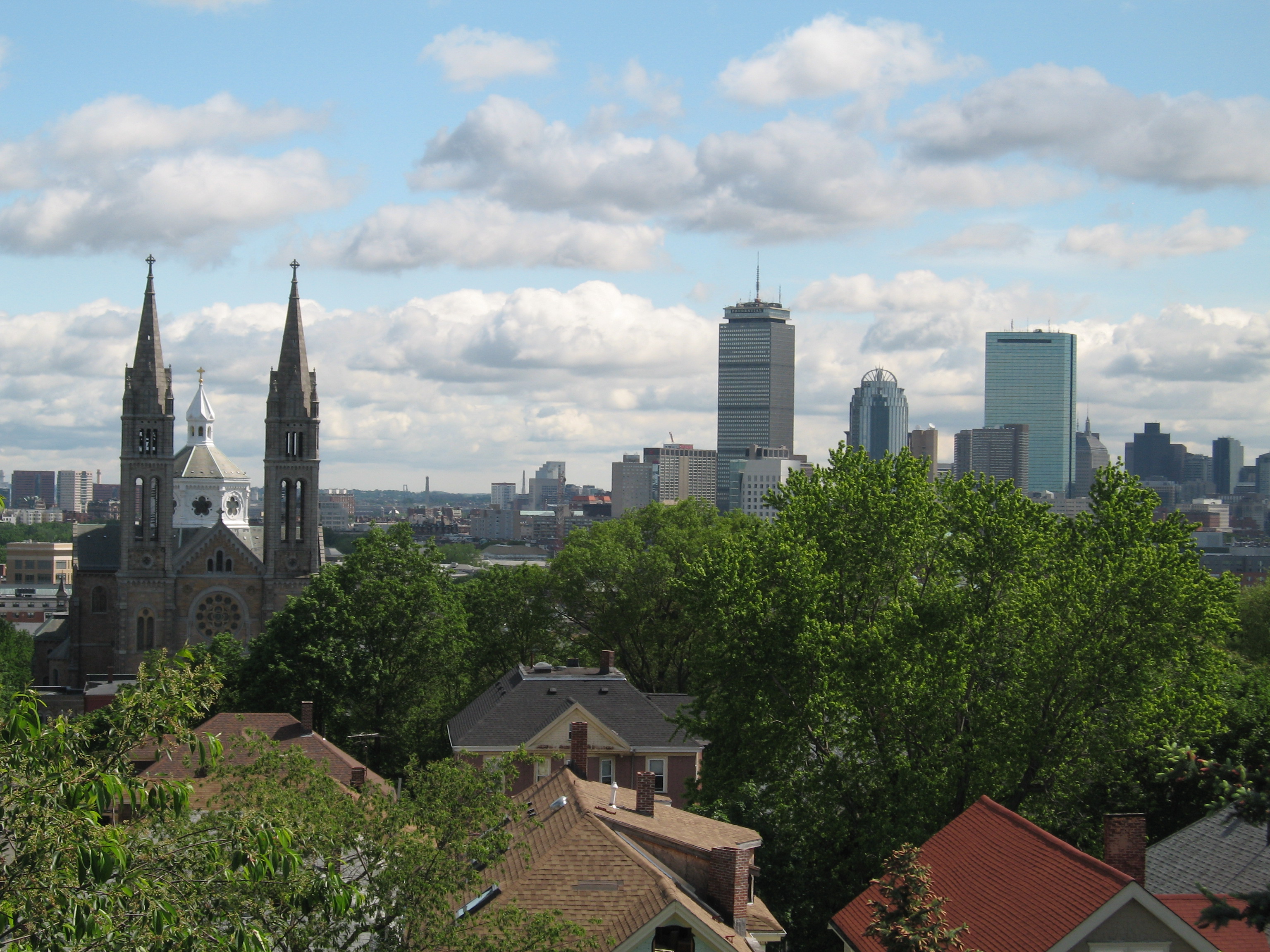
 Location of Boston in Massachusetts