- South Boston
-
For other uses, see South Boston, Virginia and South Boston, Indiana.
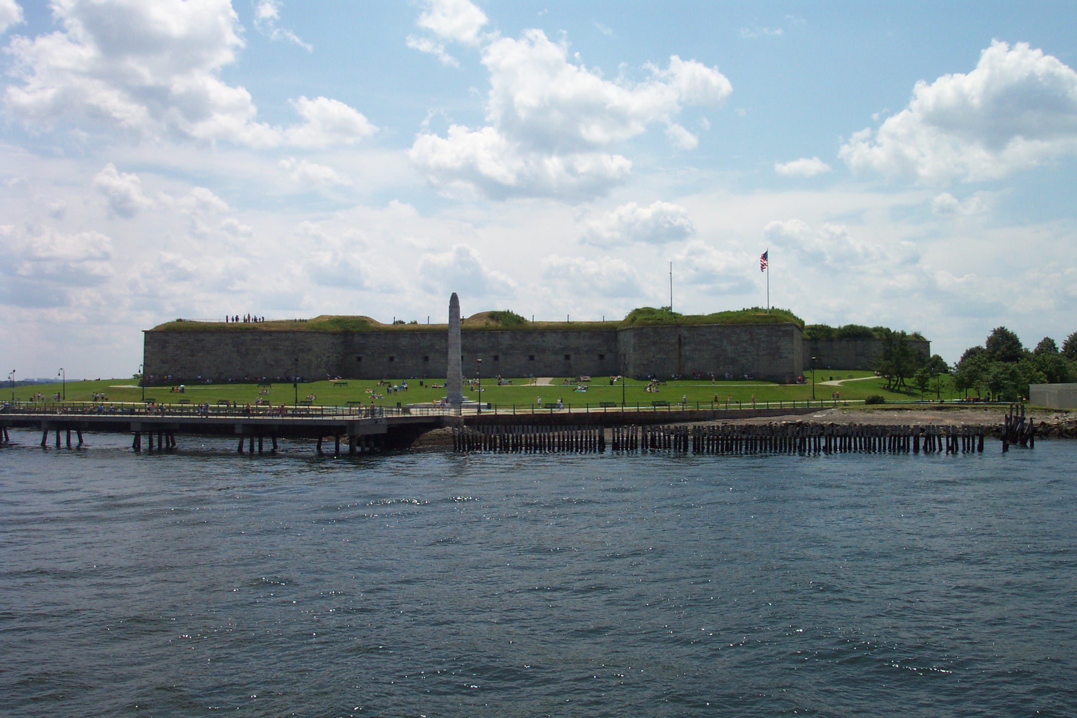
South Boston — Neighborhood of Boston — Fort Independence at Castle Island in South Boston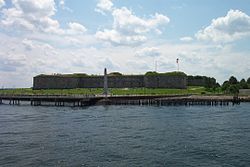
Nickname(s): Southie Country United States State Massachusetts County Suffolk Neighborhood of Boston Annexed by Boston 1804 Population (2010) 35,200 Time zone Eastern (UTC-5) Zip Code 02127 Area code(s) 617 / 857  Mural in South Boston saying "Welcome to South Boston" in English and "Fáilte go mBoston dheas" in Irish. Also shown is a Celtic cross, the coats of arms of the Provinces of Ireland and the words "Sinn Féin" "Irish Republican Army" and "NORAID." This Mural has been torn down along with the building to make way for high end condominiums.
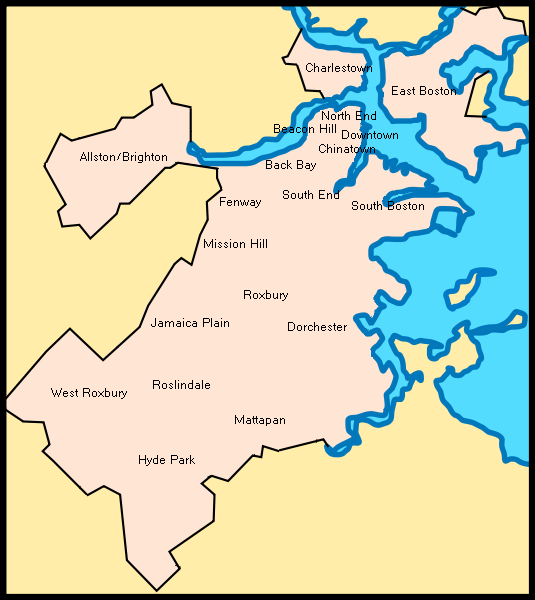
South Boston is a densely populated neighborhood of Boston, Massachusetts, located south and east of the Fort Point Channel and abutting Dorchester Bay. One of America's oldest and most historic neighborhoods, South Boston was formerly known as Dorchester Neck, and today is called "Southie" by residents. Long known as a working class Irish-American neighborhood, it is also home to the Boston area's small but vibrant Polish and Lithuanian communities. South Boston contains Dorchester Heights, where George Washington forced British troops to evacuate during the American Revolutionary War. Home to some of the oldest U.S. housing projects, South Boston has more recently seen property values join the highest in the city.
Contents
History
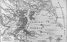
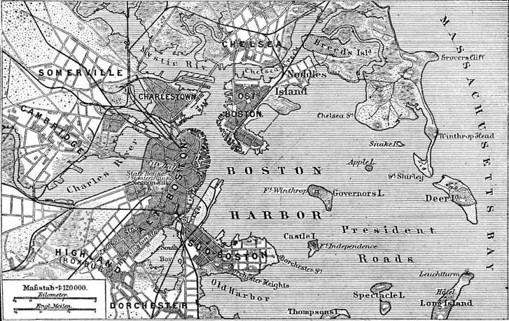
 Dorchester neck can be seen on this early map of Boston in the lower right.
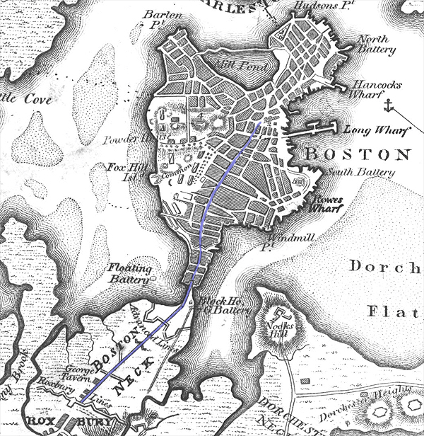
Geographically, Dorchester Neck was an isthmus, a narrow strip of land that connected the mainland of the colonial settlement of Dorchester with Dorchester Heights. Landfill has since greatly increased the amount of land on the eastern side of the historical neck, and widened the connection to the mainland to the point that South Boston is no longer considered separate from it. South Boston gained an identity separate from Dorchester, but the two were annexed by Boston in pieces, from 1804 to 1870.
 South Boston in 1888 ("Süd Boston" on this German map.)
It was here on Dorchester Heights, during the American Revolutionary War that George Washington placed his cannon and forced the evacuation of the British troops from Boston on March 17, 1776. The British evacuated Boston and Fort William and Mary for Halifax, Nova Scotia. Fort William and Mary was replaced with a brick fortification known as Fort Independence. That fort was replaced by a granite fortification (bearing the same name) prior to the American Civil War, and still stands on Castle Island as a National Historic Landmark. Edgar Allan Poe was stationed at Castle Island for five months in 1827 and was inspired to write The Cask of Amontillado based on an early Castle Island legend.
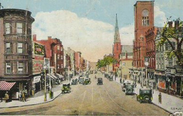
 West Broadway and Dorchester Street
During the 1970s, South Boston received national attention for its opposition to court-mandated school (de facto) desegregation by busing students to different neighborhoods.
In the 1990s, South Boston became the focus for a Supreme Court case on the right of gay and lesbian groups to participate in the Saint Patrick's Day (Evacuation Day) parade. The case was decided in favor of the parade's sponsors when the United States Supreme Court supported the South Boston Allied War Veterans' right to determine who can participate in their annual St. Patrick's Day parade.[1] In 1996, local Dorchester author Paul Walkowski and Attorney William Connolly detailed the case in their book "From Trial Court to the United States Supreme Court".[2]
"Southie" is home to what is thought to be the first Vietnam veterans memorial in the United States. It predated the Vietnam Veterans Memorial in Washington, D.C. by 13 months. It was dedicated on September 13, 1981 and is located at Independence Square, which is more commonly called M Street Park.[3]
In recent years, the realty of South Boston has changed drastically as property values, especially in the City Point neighborhood near Castle Island, have risen to the level of some of the highest in the city. The City Point area of South Boston, labeled "East Side" by realtors, has seen a major increase in property values due to its close proximity to downtown Boston and gentrification. The "West Side" of South Boston, also known as the "lower end" by life long residents, though slower to begin the gentrification process also benefits from the proximity to not only downtown but also the popular South End. Additionally, the West Side is home to the first Green Residence (Gold LEED Certified) in Boston - the Macallen Building which was featured in the movie "The Greening of Southie". The City of Boston is also investing in the West Side through developments like the ~150,000-square-foot (14,000 m2) mixed use (residential and commercial) building being developed by the Boston Redevelopment Authority on West Broadway.
Waterfront redevelopment
The section of South Boston north of First Street is targeted for massive redevelopment by the administration of Mayor Thomas Menino and the Boston Redevelopment Authority (BRA).[4] As of September 2010, the Seaport Square project was expected to cost $3 billion and replace parking lots between the federal courthouse and convention center with a 6,300,000-square-foot (590,000 m2) mixed-use development. Construction was expected to begin in 2011.[5]
Initially referred to as the "Seaport District" by the BRA, this area was officially restyled the "South Boston Waterfront" after virulent protest from natives and local politicians, including City Council President James M. Kelly.[citation needed] The Central Artery/Tunnel (CA/T) Project, also known as the Big Dig, has created a completely new transportation network for this area and quite a few new hotel and office projects have come online in the past few years.[6] The Boston Convention and Exhibition Center straddles D Street, the Seaport Hotel and Seaport World Trade Center is located on Commonwealth Pier, and a new home for the Institute of Contemporary Art hangs over Boston Harbor just north of Northern Avenue.
Economy
In 2009 Fish & Richardson agreed to lease space in One Marina Park in South Boston as its new headquarters and abandon its current headquarters at the State Street Bank Building in the Financial District.[7] It will move beginning in the third quarter of 2010.[8]
MassChallenge also has its headquarters at One Marina Park.
Schools
Boston Public Schools operates public schools.
Public
- South Boston High School,which is now divided into three different high schools all within the same building, 1st floor is Monument high school which focuses on public safety studies,2nd floor is Excel high school which focuses on computer technology, 3rd floor is Odyssey which focuses on science studies(9-12).
- James Condon Elementary School (K-5)
- Joseph P. Tynan School (K-5)
- Michael J. Perkins School (K-5)
- Oliver Hazard Perry School (K-8)
- UP Academy Charter School of Boston (6-8)
Private
- St. Peter Academy (K-8)
- South Boston Catholic Academy (K-8) (formerly St. Brigid's School and Gate of Heaven which were combined)
- Julie's Family Learning Center (P,K,Montessori)
Cultural and Language Schools
- Szkola Jezyka Polskiego w Bostonie (John Paul II Polish School for Children and Teens)
- Wood's School of Irish Dance
Places of worship
Catholic Churches
- Gate of Heaven
- Our Lady of Czestochowa (Polish)
- Saint Monica - Saint Augustine (currently closed)
- Saint Peter (Lithuanian)
- Saint Vincent de Paul[9]
- Our Lady of Good Voyage
- Saint Brigid
Albanian Orthodox Churches
- St George Cathedral: Located near the intersection of East and West Broadway, St George is the largest Orthodox Christian house of worship in Massachusetts. As the mother church of the Albanian diocese, the Cathedral serves as episcopal seat of His Grace, Bishop Nikon, Bishop of Boston, New England and the Albanian Archdiocese.
- Holy Trinity
- St John the Baptist
Episcopal
- St Matthew and the Redeemer (former)
Baptist
Community Resources
- South Boston Neighborhood House[12]
- Boys and Girls Club of Boston[13]
- South Boston Branch Library[14]
- South Boston Community Health Center[15]
- The Paraclete Center
- Tynan Community Center
Parks
Castle Island, Pleasure Bay, M Street Beach and Carson Beach
Fort Independence, a pentagonal five-bastioned, granite fort built between 1834 and 1851, is the dominating feature of Castle Island. This 22-acre urban park is connected to the mainland by both pedestrian and vehicular causeways. Pleasure Bay, the M Street Beach and Carson Beach form a three-mile segment of parkland and beach along the South Boston shoreline of Dorchester Bay. Carson Beach offers some beautiful views and great public amenities: a rehabilitated Mothers' Rest, public restrooms, exhibit space, first aid and lifeguard functions, while the outdoor courtyards allow space for passive recreation. Carson Beach also features a walkway which allows one to walk, bike, or run along the water's edge from Castle Island to the Kennedy Library.
Fort Independence and Castle Island are on the State and National Registers of Historic Places, and the fort is a National Historic Landmark. Fort Independence is open from Memorial Day to Columbus Day, hours vary. Fort tours are conducted by the Castle Island Association in the summer months and there is interpretive signage for self-guided tours. The principal program theme, the History of Castle Island, stresses the role of the fort in harbor defense."[16]
Dorchester Heights (Thomas Park)
Atop the Dorchester Heights hill sits a tall monument commemorating the Patriot battery that drove the British out of Boston. A popular site to view the Fourth of July fireworks, the Thomas Park (the oval drive around Dorchester Heights) area is one of the most attractive areas in South Boston.
Medal Of Honor Park (M Street Park)
Between M and N streets and north of Broadway, the M Street Park was one of the most desirable addresses in Boston in the late 19th century, and the brownstone buildings overlooking the park on the south side of the park remain some of the best examples of this style of architecture in New England. M Street Park is also home to the 1st standing Vietnam memorial in the nation included in this memorial are all the names of the South Boston residents who gave their lives fighting for the freedom of the United States. Also a popular spot for, families, dog lovers, and for watching the St Patrick's Day Parade. In addition also, two softball fields, little league field, basketball court, and play ground all attribute to the beautiful neighborhood which is South Boston The M Street Softball League.
Public housing
South Boston is home to some of the oldest public housing projects in the United States.[17][dead link] In the last 30 years they have changed from having a mostly white population to a more ethnically mixed population.[citation needed] The housing facilities are under the control of the Boston Housing Authority (BHA)[18] and include West Broadway which was built in 1949 and occupies 20 acres (81,000 m2),[19] West Ninth Street[20] (these three facilities are next to each other and commonly called D street), Old Colony which was built in 1941,[21] and Mary Ellen McCormack, which is the BHA's oldest development, being constructed in the 1930s. It was originally called Old Harbor Village.[22] The West Broadway Ninth Street Projects were knocked down in 2005 and are now a retirement housing building.[citation needed]
Other developments are Harbor Point, Foley[23] and Monsignor Powers.[24]
Transportation
South Boston is served by two Massachusetts Bay Transportation Authority Red Line rapid transit stations: Broadway and Andrew.
MBTA bus service connects these stations with the residential areas of South Boston, downtown Boston and the Back Bay. The MBTA Silver Line, a Bus rapid transit service running partly in a tunnel from South Station, also serves the north side of South Boston. South Boston is also served by five bus routes including the numbers 5, 7, 9, 10, 11.
Notable residents
South Boston has been the birthplace and home to a number of notable people, including:
- James "Whitey" Bulger, brother of William M. Bulger and alleged organized crime head. Was on the FBI's Ten Most Wanted list until his arrest in Santa Monica, California on June 22, 2011.
- William M. Bulger, former president of the Massachusetts Senate, former president of the University of Massachusetts and brother of James "Whitey" Bulger.
- Patricia Wright, Director of the South Boston Action Center
- James Connolly, athlete and author who, in 1896, became the first modern Olympic champion.
- John Cunniff, National Hockey League hockey coach and former professional player who appeared in 65 World Hockey Association regular season games between 1972 and 1976.
- Richard Cushing, prelate of the Roman Catholic Church who served as Archbishop of Boston from 1944 to 1970, and was elevated to the cardinalate in 1958.
- John Ferruggio, led the evacuation of Pan Am Flight 93 in 1970[25]
- Michael F. Flaherty, an at-large member of Boston City Council. He is a member of the Democratic Party and was elected City Council President every year from 2002 to 2006.
- Raymond Flynn, Mayor of Boston from 1984 to 1993, and United States ambassador to the Holy See from 1993 to 1997.
- Brian Goodman, film and television director, writer, and actor.
- Eugene F. Lally, Pioneer rocket scientist, planetary spacecraft designer at the Jet Propulsion Laboratory Caltech and photographer and inventor of digital photography.
- David Lindsay-Abaire, Pulitzer Prize-winning playwright and lyricist.
- Stephen Lynch, politician, a Democratic member of the United States House of Representatives. He was one of the lead investigators in the "Banned substances in baseball" investigation.
- Michael Patrick MacDonald, activist against crime and violence and author.
- John William McCormack, politician who served as a member of House of Representatives from 1928 until he retired from political life in 1971. A member of the Democratic Party, he served as House Majority Leader three times, and as Speaker of the House of Representatives from 1962 until 1971.
- Will McDonough, sportswriter for The Boston Globe and television analyst.
- Joe Moakley, Democratic Congressman, and the last chairman of the United States House Committee on Rules.
- Patrick Nee, former mobster, Vietnam veteran, author. Former associate of James "Whitey" Bulger.
- Brian Noonan, Hockey player who won the Stanley Cup in 1994 with New York Rangers.
- Kevin Weeks, former mobster, and former lieutenant to James Bulger in the Winter Hill Gang, Federal witness, and author.
- James M. "Jim" Kelly, Former Boston City Councilor, Council President and community activist.
- James Healy America's first Catholic bishop of African descent.
- Sean Patrick McColgan Actor (Black Irish) and Screenwriter (Forever Ink)
References in popular culture
Film
- The 2010 crime thriller The Town starring and directed by Ben Affleck, was partly filmed in South Boston. Scenes taking place at the fictional Town Flowers were filmed at Thornton Flower Shop on Dorchester Street.
- Gone Baby Gone (2007), the directorial debut of Ben Affleck, was shot in South Boston.
- The Departed (2006), starring Leonardo DiCaprio, Matt Damon, Jack Nicholson and Mark Wahlberg was shot in South Boston and was loosely based on the life of famed Irish mob leader James "Whitey" Bulger and the events leading up to his hiatus and being an informant for the FBI.
- In Good Will Hunting, a 1997 drama film directed by Gus Van Sant and written by Ben Affleck and Matt Damon, South Boston is the home of the fictional Irish American character Will Hunting, a troubled young prodigy played by Damon, who works as a janitor at the Massachusetts Institute of Technology.
- Mystic River directed by Clint Eastwood and starring Tim Robbins, Kevin Bacon, and Sean Penn was partially filmed in South Boston. A local corner store, Miller's Market of 366 K Street, was used as one of the character's businesses.
- The movie The Boondock Saints, about fraternal twins, Connor and Murphy MacManus, who become vigilantes after killing two members of the Russian Mafia in self-defense, also takes place in South Boston.
- The 1999 movie Southie centers around Danny Quinn, played by Donnie Wahlberg, who returns home to South Boston from New York City and gets stuck between his friends, who are supported by one Irish gang, and his family, who are members of another. Wahlberg is a native of nearby Dorchester.
- The Verdict, a 1982 feature film which tells the story of a down-on-his-luck alcoholic lawyer who pushes a medical malpractice case in order to improve his own situation, but discovers along the way that he is doing the right thing, takes place in, and was filmed in, South Boston. It starred Paul Newman.
- In the 1987 romantic comedy film, Broadcast News, about a virtuoso television news producer (Holly Hunter), who has daily emotional breakdowns, a brilliant yet prickly reporter (Albert Brooks) and his charismatic but far less seasoned rival (William Hurt), a young Aaron Altman (played by Dwayne Markee) states, "You're never gonna leave South Boston and I'm gonna see the whole damn world."
Television
- In the TV series Buffy the Vampire Slayer the character of Faith Lehane (Eliza Dushku) is a Slayer who originally hails from South Boston. Dushku grew up in nearby Watertown.
- Eliza Dushku's character refers to being a Southie native in the "Stage Fright" episode of the TV series Dollhouse.
- The Leverage character of Nathan Ford is possibly from South Boston, as the episode "The Beantown Bailout Job" indicated he had grown up with a ranking member of the Irish Mob.
- Julianne Moore's character in a series of 2009 episodes of 30 Rock referenced the fact that she was from South Boston.
- In an episode of Sabrina Goes to College. Soleil Moon Frye's character mentions that "its better than living in a shack in Southie."
Books
There have been a number of books written about the South Boston culture ranging from the political, in The Boston Irish, the personal in All Souls, the gang-related Black Mass, and the historical, political, social, and personal in That Old Gang of Mine.
Music
The Plastic Paddy band Dropkick Murphys frequently reference South Boston's Irish heritage and sports loyalties in their songs, although they were formed in nearby Quincy.
Video games
The Scout from online game Team Fortress 2 hails from South Boston.
Voodoo, in Medal of Honor (2010), is from South Boston. He has a very distinct accent.
Comedy
The Chicago improvised comedy show Dirty Water takes place in a fictional bar by the same name in "Southie." The bar is loosely based on Kiley's Tavern, a popular bar and restaurant during World War II, called Lally's Tavern owned by Tom Lally.
References
- ^ "U.S. Supreme Court HURLEY v. IRISH-AMERICAN GAY GROUP OF BOSTON, ___ U.S. ___ (1995)". FindLaw. 18 June 1995. http://caselaw.lp.findlaw.com/cgi-bin/getcase.pl?court=US&vol=000&invol=U10260. Retrieved 2009-02-02.
- ^ Walkowski, Paul; Connolly, William (April 1996). From Trial Court to the United States Supreme Court Anatomy of a Free Speech Case: The Incredible Inside Story Behind the Theft of the St. Patrick's Parade. Branden Books. ISBN 0828320128.
- ^ "History of the Memorial". South Boston Vietnam Memorial. http://www.sbvnm.com/history.html. Retrieved 2009-02-02.
- ^ "South Boston Waterfront Public Realm Plan". Boston Redevelopment Authority. October 21, 2003. http://www.ci.boston.ma.us/bra/Planning/PlanningInitsIndividual.asp?action=ViewInit&InitID=3. Retrieved 2009-02-01.
- ^ "Seaport makeover to begin next year". Boston Metro, 23 September 2010, p 3.
- ^ James M. Kelly, long-time city councilor and South Boston icon, dies. Boston Globe, January 9, 2007.
- ^ Qualters, Sheri. "Fish & Richardson to Move Flagship Office to South Boston Waterfront." The National Law Journal. September 23, 2009. Retrieved on November 11, 2009.
- ^ Hillman, Michelle. "Fish & Richardson inks new Boston lease." Boston Business Journal. Monday September 21, 2009. Retrieved on November 11, 2009.
- ^ Bostoncatholic.org
- ^ Cf. Sammarco (2006), p.25
- ^ History of the South Baptist Church, Boston, Boston : Alfred Mudge & Son, 1865.
- ^ SBNH.org
- ^ BGXB.org
- ^ BPL.org
- ^ SBCHC.org
- ^ Mass.gov
- ^ Boston Connects. South Boston
- ^ "Welcome to the Boston Housing Authority". Boston Housing Authority. http://www.bostonhousing.org/index.html. Retrieved 2009-02-01.
- ^ "West Broadway". Boston Housing Authority. http://www.bostonhousing.org/detpages/devinfo60.html. Retrieved 2009-02-01.
- ^ "West Ninth Street". Boston Housing Authority. http://www.bostonhousing.org/detpages/devinfo63.html. Retrieved 2009-02-01.
- ^ "Old Colony". Boston Housing Authority. http://www.bostonhousing.org/detpages/devinfo42.html. Retrieved 2009-02-01.
- ^ "Mary Ellen McCormack". Boston Housing Authority. http://www.bostonhousing.org/detpages/devinfo37.html. Retrieved 2009-02-01.
- ^ "Foley". Boston Housing Authority. http://www.bostonhousing.org/detpages/devinfo19.html. Retrieved 2009-02-01.
- ^ "Monsignor Powers". Boston Housing Authority. http://www.bostonhousing.org/detpages/devinfo41.html. Retrieved 2009-02-01.
- ^ Marquard, Bryan (2010-06-22). "John Ferruggio, at 84; hero of 1970 Pan Am hijacking". Boston Globe. http://www.boston.com/bostonglobe/obituaries/articles/2010/06/22/john_ferruggio_of_milton_hero_of_1970_pan_am_hijacking_dies_at_84/. Retrieved 2010-06-27.
- Sammarco, Anthony Mitchell; Rosenberg, Charlie, South Boston: Then & Now, Arcadia Publishing Company, 2006
Further reading
- Malloy, Ione (1 October 1986). Southie Won't Go: A Teacher's Diary of the Desegregation of South Boston High School. University of Illinois Press. ISBN 0252012763.
- O'Connor, Thomas (24 February 1994). South Boston, My Home Town: The History of an Ethnic Neighborhood. Northeastern University Press. ISBN 1555531881.
- Alcorn, Frank (7 October 2005). Southie Boy. Cork Hill Press. ISBN 1594080542.
- Weeks, Kevin; Karas, Phyllis (10 March 2006). Brutal: The Untold Story of My Life Inside Whitey Bulger's Irish Mob. William Morrow. ISBN 0061122696.
- MacDonald, Michael Patrick (4 October 2007). All Souls: A Family Story from Southie. Beacon Press. ISBN 0807072133.
- Born before plastic: stories from Boston's most enduring neighborhoods; North End, Roxbury, and South Boston, Boston, Massachusetts, USA: City of Boston and Grub Street, Inc., 2007, http://openlibrary.org/books/OL24643200M/Born_before_plastic_stories_from_Boston's_most_enduring_neighborhoods
External links
- South Boston Online
- South Boston Tribune
- South Boston Neighborhood at City of Boston.gov
- Topographic Map of South Boston
- Southies St Patrick's Day Parade
- South Boston Little League
- South Boston on Boston.com
- Boston Public Library. Boston Pictorial Archive. Images of South Boston
Neighborhoods in Boston Allston/Brighton · Back Bay · Bay Village · Beacon Hill · Charlestown · Chestnut Hill · Chinatown · Columbia Point · Dorchester · Downtown Crossing · East Boston · Fenway–Kenmore · Financial District · Forest Hills · Fort Point · Government Center · Hyde Park · Jamaica Plain · Leather District · Longwood · Mattapan · Mission Hill · North End · Readville · Roslindale · Roxbury · South Bay · South Boston · South End · West End · West Roxbury

Categories:- Neighborhoods in Boston, Massachusetts
- Irish-American culture
- Irish American history
- Irish-American neighborhoods
- Ethnic enclaves in the United States
- South Boston, Boston

Wikimedia Foundation. 2010.