- Dorchester Heights
-
Dorchester Heights National Historic Site

Location: South Boston, Boston, Massachusetts Coordinates: 42°19′58″N 71°2′46″W / 42.33278°N 71.04611°WCoordinates: 42°19′58″N 71°2′46″W / 42.33278°N 71.04611°W Area: 5.4 acres (2.2 ha) Built: 1776 Architect: Peabody & Stearns Architectural style: Colonial Revival, Georgian Colonial Revival Governing body: National Park Service NRHP Reference#: 66000050[1] Added to NRHP: October 15, 1966 Dorchester Heights is the central area of South Boston. It is the highest area in the neighborhood and commands a view of both Boston Harbor and downtown.
Contents
History
Main articles: Boston campaign and Fortification of Dorchester HeightsDorchester Heights was and is remembered in American history for an action in the American Revolutionary War known as the Fortification of Dorchester Heights. After the battles of Lexington and Concord, Revolutionary sentiment within New England reached a new high, and thousands of militiamen from the Northern colonies converged on Boston, pushing the British back within what where then relatively narrow city limits. In June 1775 British soldiers under General William Howe attacked and seized Bunker Hill, but in the process sustained many losses. Following this encounter, the Continental Congress in Philadelphia gave George Washington the title of commander-in-chief and sent him to oversee the Siege of Boston.
The stalemate in Boston lasted for months, only breaking when Colonel Henry Knox returned from Fort Ticonderoga in New York, having led a team of sleds loaded with tens of thousands of pounds of artillery (cannon) in winter from the fort across hundreds of miles to Boston. This added artillery gave Washington the firepower needed to make a decisive move. On the night of March 4, 1776, as 800 American soldiers stood guard along the river of Dorchester shores, 1,200 American soldiers occupied Dorchester Heights. They began working through the night to build structures suitable to defend against the British Army. A large portion of the artillery, pulled by oxen, was moved and installed, without being noticed by the British, at Dorchester Heights, a point of strategic importance due to its elevation and commanding view of all of Boston and Boston Harbor.
In response, Howe planned a counteroffensive to take the fortified positions on the Heights, but bad weather forced him to reconsider. The Royal Navy evacuated the British Army from Boston on March 17, 1776, along with many Loyalists.
Monument
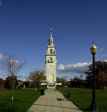

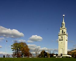
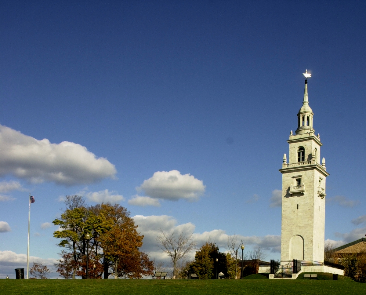
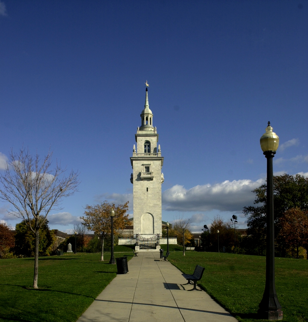
The Dorchester Heights Monument was completed in 1902 to designs by Boston architects Peabody and Stearns. It is 115 feet (35m) tall, built of Georgia white marble capped with octagonal cupola and weather vane, and is generally reminiscent of a church steeple in the Federal style. The monument is now operated by the National Park Service as part of Boston National Historical Park.
Panoramic fireworks displays on the Fourth of July
Dorchester Heights is one of the highest natural geographical locations in greater Boston, and affords panoramic views of many communities to the south and west of the city. This view is of particular interest on July 4, where after sunset one can watch the official fireworks from over a dozen communities, along with countless amateur displays, as they unfold on the horizon over the course of the evening.
References and external links
- National Park Service: Dorchester Heights
- Sammarco, Anthony Mitchell; Rosenberg, Charlie Rosenberg (2006). South Boston. Then & now; Images of America: a history of American life in images and texts. Charleston, SC, USA: Arcadia Publishing. p. 43. ISBN 0738539481. OCLC 649681931.
- ^ "National Register Information System". National Register of Historic Places. National Park Service. 2009-03-13. http://nrhp.focus.nps.gov/natreg/docs/All_Data.html.
U.S. National Register of Historic Places Topics Lists by states Alabama • Alaska • Arizona • Arkansas • California • Colorado • Connecticut • Delaware • Florida • Georgia • Hawaii • Idaho • Illinois • Indiana • Iowa • Kansas • Kentucky • Louisiana • Maine • Maryland • Massachusetts • Michigan • Minnesota • Mississippi • Missouri • Montana • Nebraska • Nevada • New Hampshire • New Jersey • New Mexico • New York • North Carolina • North Dakota • Ohio • Oklahoma • Oregon • Pennsylvania • Rhode Island • South Carolina • South Dakota • Tennessee • Texas • Utah • Vermont • Virginia • Washington • West Virginia • Wisconsin • WyomingLists by territories Lists by associated states Other  Category:National Register of Historic Places •
  Portal:National Register of Historic PlacesCategories:
- National Register of Historic Places in Massachusetts
- Landmarks in Boston, Massachusetts
- American Revolutionary War sites
- Peabody and Stearns buildings
- Geography of Suffolk County, Massachusetts
- South Boston, Boston

Wikimedia Foundation. 2010.