- Mattapan
-
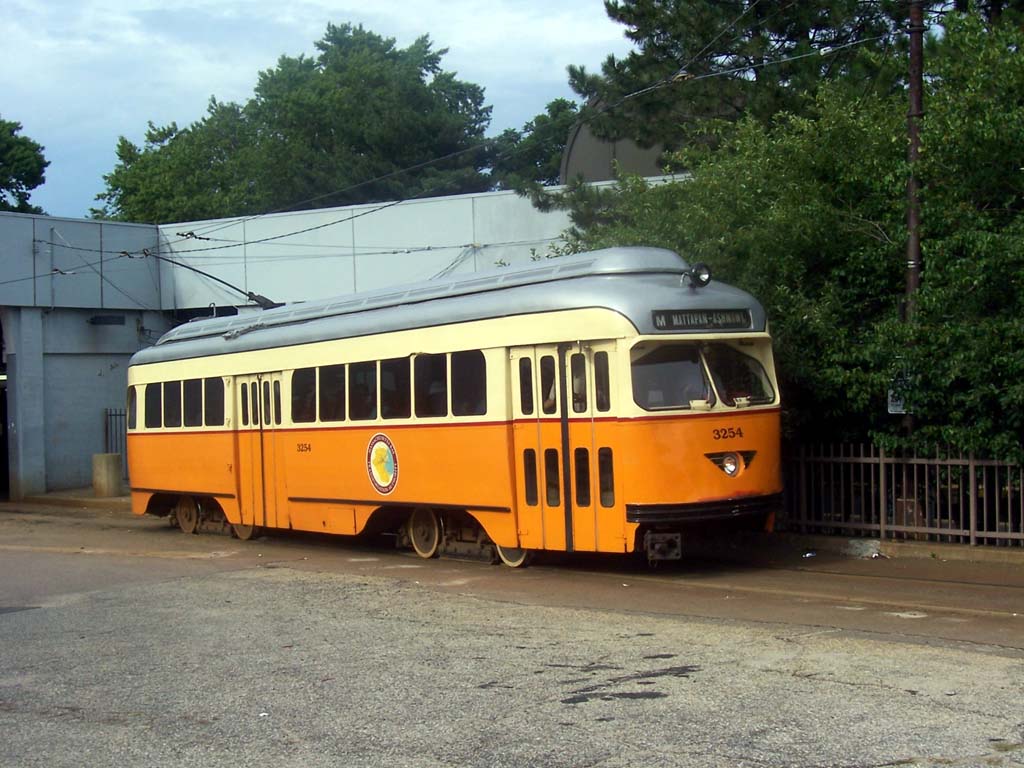
Mattapan — Neighborhood of Boston — The Mattapan-Ashmont Trolley
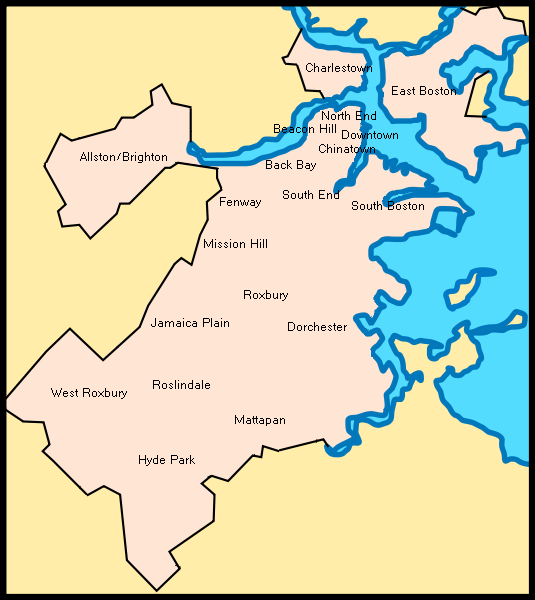
Country United States State Massachusetts County Suffolk Neighborhood of Boston Annexed by Boston 1870 Population (2010) 36,480 Time zone Eastern (UTC-5) Zip Code 02126 Area code(s) 617 / 857 Mattapan is a neighborhood in Boston, Massachusetts. Historically a section of neighboring Dorchester, Mattapan became a part of Boston when Dorchester was annexed in 1870. As of the 2010 census, it had a population of 36,480. Like other neighborhoods of the late 19th and early 20th century, Mattapan developed, residentially and commercially, as the railroads and streetcars made downtown Boston increasingly accessible. Predominantly residential, Mattapan is a mix of public housing, small apartment buildings, single-family houses, and two- and three-family houses (known locally as "Three-Deckers" or "Triple-Deckers"). Blue Hill Avenue and Mattapan Square, where Blue Hill Avenue, River Street, and Cummins Highway meet, are the commercial heart of the neighborhood, home to banks, law offices, restaurants, and retail shops. The new Mattapan Branch of the Boston Public library opened 2009, at a cost of more than $4 million.
Mattapan is the original Native American name for the Dorchester area and meant "a good place to be," or "a good place to sit." [1][2]
Contents
Demographic change
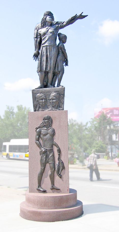
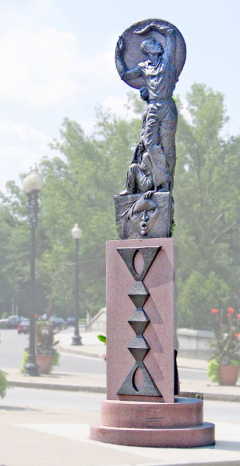
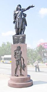 "Rise," a pair of statues installed in 2005, flank Blue Hill Avenue in Mattapan and define it as a gateway to Boston. This statue is by Fern Cunningham.
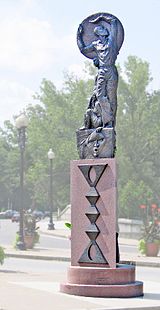 "Rise;" this member of the pair is by Karen Eutemy.
In the 1960s/70s Mattapan went through a major change in the makeup of its population. It changed from a predominantly Jewish neighborhood to one that is now largely African American and Caribbean American having a population of 37,486 that is over 77% African American and Caribbean American.[3]
The years between 1968 and 1970 made up the most dramatic period of ethnic transition in Boston. According to Levine and Harmon in their book, Death of an American Jewish Community, redlining the area, blockbusting, and fear in neighborhood residents created by real estate agents allegedly brought about panic selling and white flight. The banking consortium Boston Banks Urban Renewal Group (B-BURG) allegedly drove the Jewish community out of Mattapan and are held partially responsible for the ensuing deterioration of the neighborhood, especially along the Blue Hill Avenue corridor. This widely held belief has been disputed, with differences between the Catholic and Jewish communities in Boston being the greater contributing factor.[4] According to Levine and Harmon, the reason behind this orchestrated attack on the community was to lower market values to buy property, sell the housing with federally guaranteed loans at inflated prices to black families who could not afford it, and to get the white community to buy property owned by the banks in the suburbs. Today Mattapan is seeing another major population shift, albeit a natural turn over of housing, as a large number of immigrants from Haiti and other Caribbean countries continue to move in. Mattapan now has the largest Haitian community in Massachusetts, and is also largely made up of African Americans and immigrants from other Caribbean countries.[citation needed].
Boston-based rapper Big Shug frequently refers to the neighborhood as "Murdapan", due to its high crime rate.
Transportation
The Mattapan-Ashmont trolley line of the MBTA serves Mattapan as well as several bus routes. The Fairmount Line of the MBTA Commuter Rail also serves Mattapan at Morton Street, providing service to downtown Boston and the suburbs.
Government and infrastructure
The United States Postal Service operates the Mattapan Post Office.[5]
Education
Primary and secondary schools
Boston Public Schools (BPS) operates public schools in Mattapan. Ellison/Parks Early Education School is in Mattapan.[6] Elementary schools include James J. Chittick,[7] Mattahunt,[8] and Charles H. Taylor.[9] Mildred Avenue K-8 School is located in Mattapan.[10] The Young Achievers Science and Mathematics Pilot K-8 School, a BPS school,[11] occupies the former campus of Solomon Lewenberg Middle School, which closed in 2009.[12]
Pope John Paul II Catholic Academy of the Roman Catholic Archdiocese of Boston operates the Mattapan Square Campus. (Formally the Saint Angela Merci elementary school)[13]
Public libraries
Boston Public Library operates the Mattapan Branch Library. On December 18, 1849 a Mattapan resident named Increase S. Smith opened the Mattapan Library Association. In 1870 Dorchester, Massachusetts, which included Mattapan, was annexed into Boston. The Mattapan branch began as a reading room attached to the Oakland Hall Building's delivery station. In 1923 the reading room was declared a branch of the Boston Public Library. On June 22, 1931 the Mattapan Library Branch opened on Hazelton Street. The current library opened on February 28, 2009 at 1350 Blue Hill Avenue.[14]
Notable residents
- Dana Barros - Former player in the National Basketball Association and member of the Boston Celtics
- Leonard Bernstein - Conductor and composer
- Big Shug - Rapper under DJ Premier and Guru of Gang Starr
- Thomas M. Finneran – Massachusetts politician
- Nat Hentoff - Jazz critic and social commentator
- Theodore White - author, political commentator
Notes
- ^ Cf. "Heart of the City, Mattapan", The Rappaport Institute for Greater Boston, at the John F. Kennedy School of Government, Harvard University
- ^ Galvin, William Francis, (Secretary of the Commonwealth of Massachusetts), " Archaic Community, District, Neighborhood, Section and Village, Names in Massachusetts", Citizen Information Service, Office of The Secretary of the Commonwealth of Massachusetts, 2008. It lists: "Mattapan / Archaic Name of Dorchester / Suffolk".
- ^ City of Boston: Neighborhood Profile: Mattapan
- ^ Urban Exodus: Why the Jews Left Boston and the Catholics Stayed by Gamm, Gerald, Harvard University Press, 1999. ISBN 0-674-93070-3
- ^ "Post Office™ Location - MATTAPAN." United States Postal Service. Retrieved on May 23, 2010.
- ^ "Ellison/Parks Early Education School." Boston Public Schools. Retrieved on May 23, 2010.
- ^ "James J. Chittick Elementary School." Boston Public Schools. Retrieved on May 23, 2010.
- ^ "Mattahunt Elementary School." Boston Public Schools. Retrieved on May 23, 2010.
- ^ "Charles H. Taylor Elementary School." Boston Public Schools. Retrieved on May 23, 2010.
- ^ "Mildred Avenue K-8 School." Boston Public Schools. Retrieved on May 23, 2010.
- ^ "Young Achievers Science and Mathematics Pilot K-8 School." Boston Public Schools. Retrieved on May 23, 2010.
- ^ Vaznis, James. "A school’s roller coaster ride ends." The Boston Globe. June 27, 2009. 1. Retrieved on May 23, 2010.
- ^ "Mattapan Square Campus." Pope John Paul II Catholic Academy. Retrieved on May 23, 2010.
- ^ "Mattapan Branch Library." Boston Public Library. Retrieved on May 23, 2010.
External links
- "Why the Jews Left Boston", New York Times book review of Urban Exodus: Why the Jews Left Boston and the Catholics Stayed.
- Death of an American Jewish Community (ISBN 0-02-913866-3).
- First Year Urban Project, A Harvard University urban program.
- Historian Francis Russell on ethnic change in Mattapan - from Russell's book "The Knave of Boston & Other Ambiguous Massachusetts Characters"
Neighborhoods in Boston Allston/Brighton · Back Bay · Bay Village · Beacon Hill · Charlestown · Chestnut Hill · Chinatown · Columbia Point · Dorchester · Downtown Crossing · East Boston · Fenway–Kenmore · Financial District · Forest Hills · Fort Point · Government Center · Hyde Park · Jamaica Plain · Leather District · Longwood · Mattapan · Mission Hill · North End · Readville · Roslindale · Roxbury · South Bay · South Boston · South End · West End · West Roxbury

Coordinates: 42°16′20″N 71°05′13″W / 42.27222°N 71.08694°WCategories:- Streetcar suburbs
- Populated places in Massachusetts with African American majority populations
- Mattapan, Boston
- Dorchester, Boston
Wikimedia Foundation. 2010.