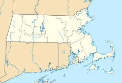
- Neponset Valley Parkway
-
Neponset Valley Parkway, Metropolitan Park System of Greater Boston

Location: Boston and Milton, Massachusetts Coordinates: 42°14′5″N 71°7′26″W / 42.23472°N 71.12389°WCoordinates: 42°14′5″N 71°7′26″W / 42.23472°N 71.12389°W Built: 1898 Architect: Eliot, Charles; Olmstead Bros. Architectural style: No Style Listed Governing body: State MPS: Metropolitan Park System of Greater Boston MPS NRHP Reference#: 04001573
[1]Added to NRHP: January 24, 2005 Neponset Valley Parkway is a historic parkway in Boston and Milton, Massachusetts, United States. The parkway was constructed from 1898 to 1929 by Charles Eliot and the Olmstead Brothers and added to the National Register of Historic Places in 2005. The parkway serves as a connector between the Blue Hills Reservation, the Neponset River Reservation, and the Stony Brook Reservation. Paul's Bridge, a Historic Place in its own regard, is on this route and passes over the Neponset River.
References
- ^ "National Register Information System". National Register of Historic Places. National Park Service. 2008-04-15. http://nrhp.focus.nps.gov/natreg/docs/All_Data.html.
U.S. National Register of Historic Places Topics Lists by states Alabama • Alaska • Arizona • Arkansas • California • Colorado • Connecticut • Delaware • Florida • Georgia • Hawaii • Idaho • Illinois • Indiana • Iowa • Kansas • Kentucky • Louisiana • Maine • Maryland • Massachusetts • Michigan • Minnesota • Mississippi • Missouri • Montana • Nebraska • Nevada • New Hampshire • New Jersey • New Mexico • New York • North Carolina • North Dakota • Ohio • Oklahoma • Oregon • Pennsylvania • Rhode Island • South Carolina • South Dakota • Tennessee • Texas • Utah • Vermont • Virginia • Washington • West Virginia • Wisconsin • WyomingLists by territories Lists by associated states Other This article about a National Register of Historic Places listing in Suffolk County, Massachusetts is a stub. You can help Wikipedia by expanding it.


