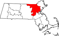
The following Middlesex County communities have large numbers of sites listed in the National Register of Historic Places. Lists of their sites are on separate pages, linked below.
|
Landmark name |
Image |
Date listed |
Location |
City or Town |
Summary |
| 1 |
1767 Milestones |
 |
01971-04-07 April 7, 1971 |
Between Boston and Springfield along Old Post Rd.
42°21′36″N 71°25′30″W / 42.36°N 71.425°W / 42.36; -71.425 (1767 Milestones (Milestone 26)) |
Sudbury, Cambridge, Wayland |
Includes locations in Suffolk, Norfolk, Worcester, and Hampden counties. |
| 2 |
1790 House |
 |
01974-10-09 October 9, 1974 |
827 Main St.
42°30′11″N 71°9′40″W / 42.50306°N 71.16111°W / 42.50306; -71.16111 (1790 House) |
Woburn |
|
| 3 |
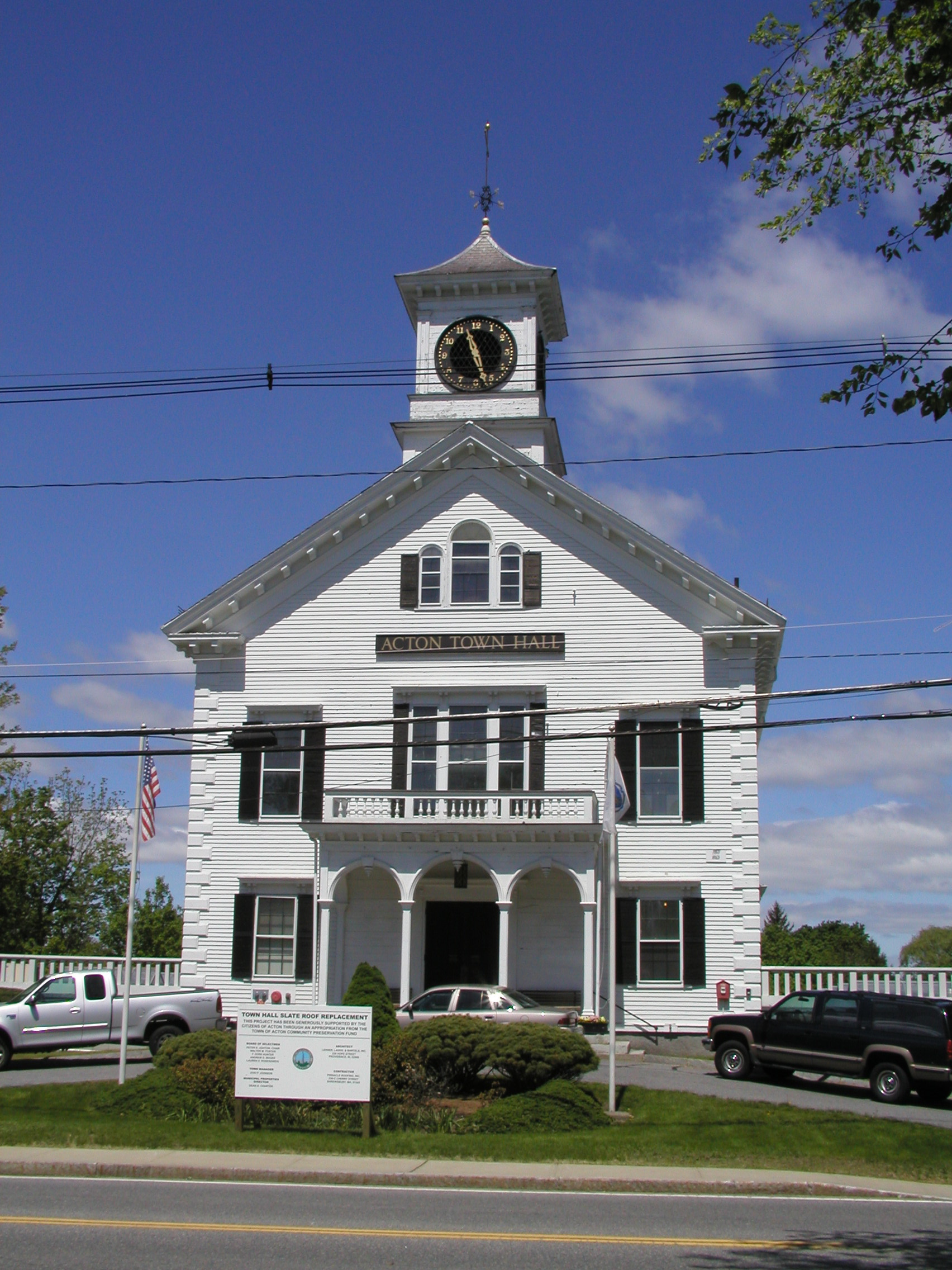
Acton Centre Historic District |
 |
01983-03-10 March 10, 1983 |
Main St., Wood and Woodbur Lanes, Newton, Concord, and Nagog Hill Rds.
42°29′11″N 71°25′58″W / 42.48639°N 71.43278°W / 42.48639; -71.43278 (Acton Centre Historic District) |
Acton |
|
| 4 |
Abel Allen House |
 |
01978-01-09 January 9, 1978 |
South of Weston at 1 Chestnut St.
42°21′16″N 71°18′17″W / 42.35444°N 71.30472°W / 42.35444; -71.30472 (Allen, Abel, House) |
Weston |
|
| 5 |
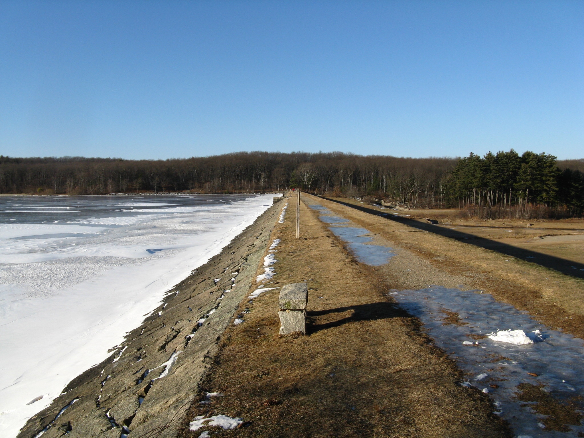
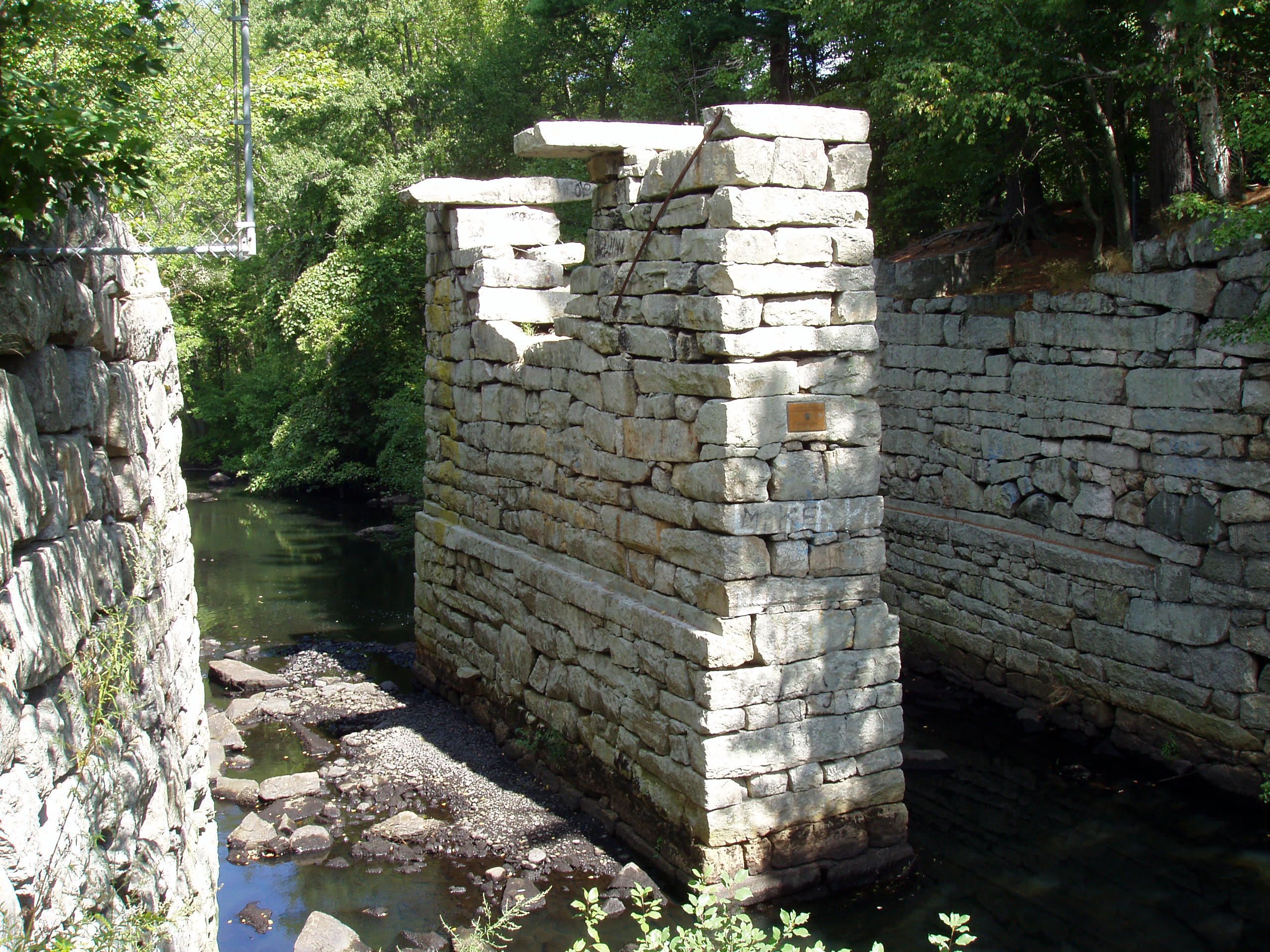
Ashland Dam and Spillway |
 |
01990-01-18 January 18, 1990 |
Northern end of the Ashland Reservoir in Ashland State Park
42°14′46″N 71°27′37″W / 42.24611°N 71.46028°W / 42.24611; -71.46028 (Ashland Dam and Spillway) |
Ashland |
|
| 6 |
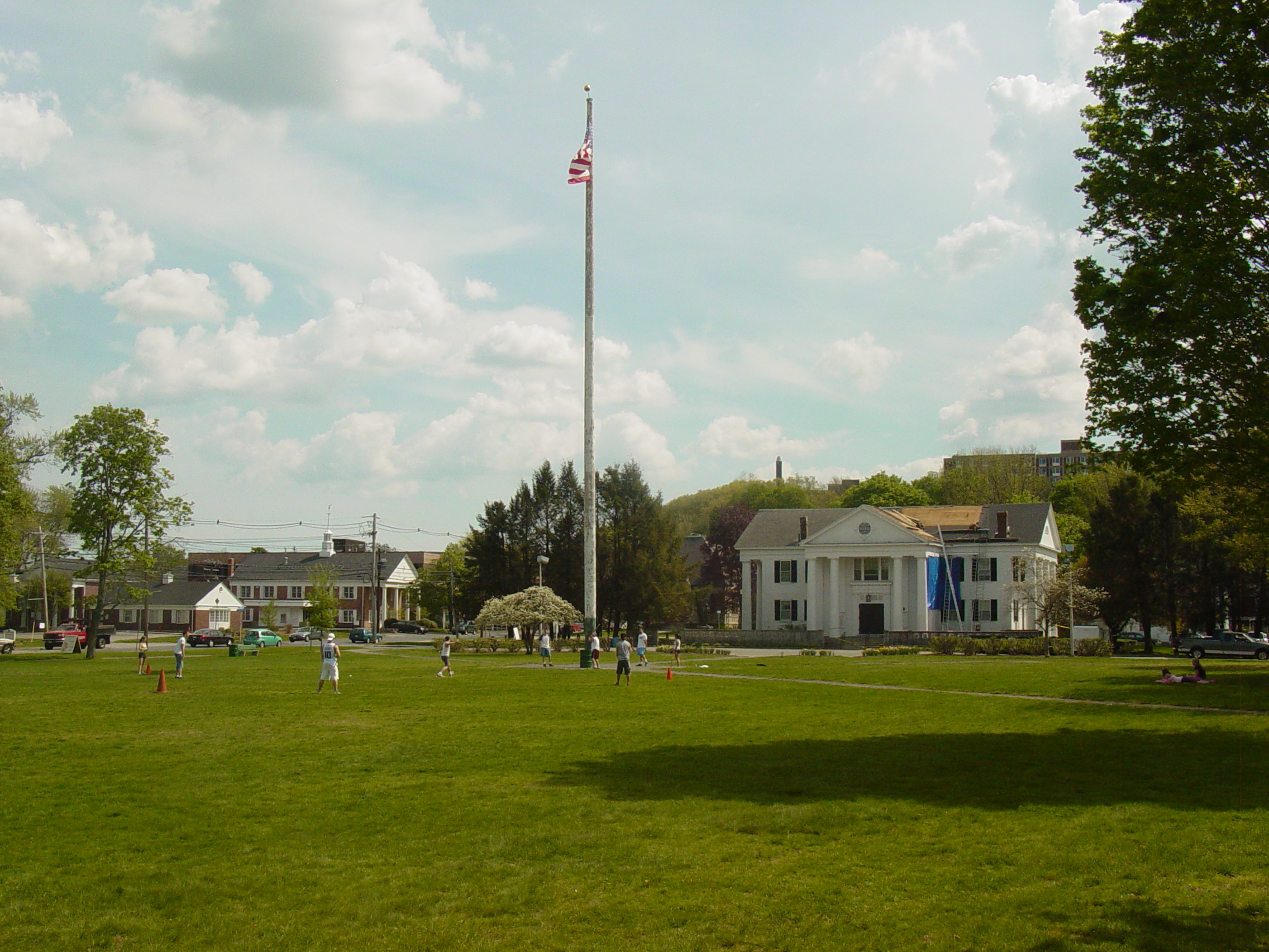
Ashland Town House |
 |
02004-03-03 March 3, 2004 |
101 Main St.
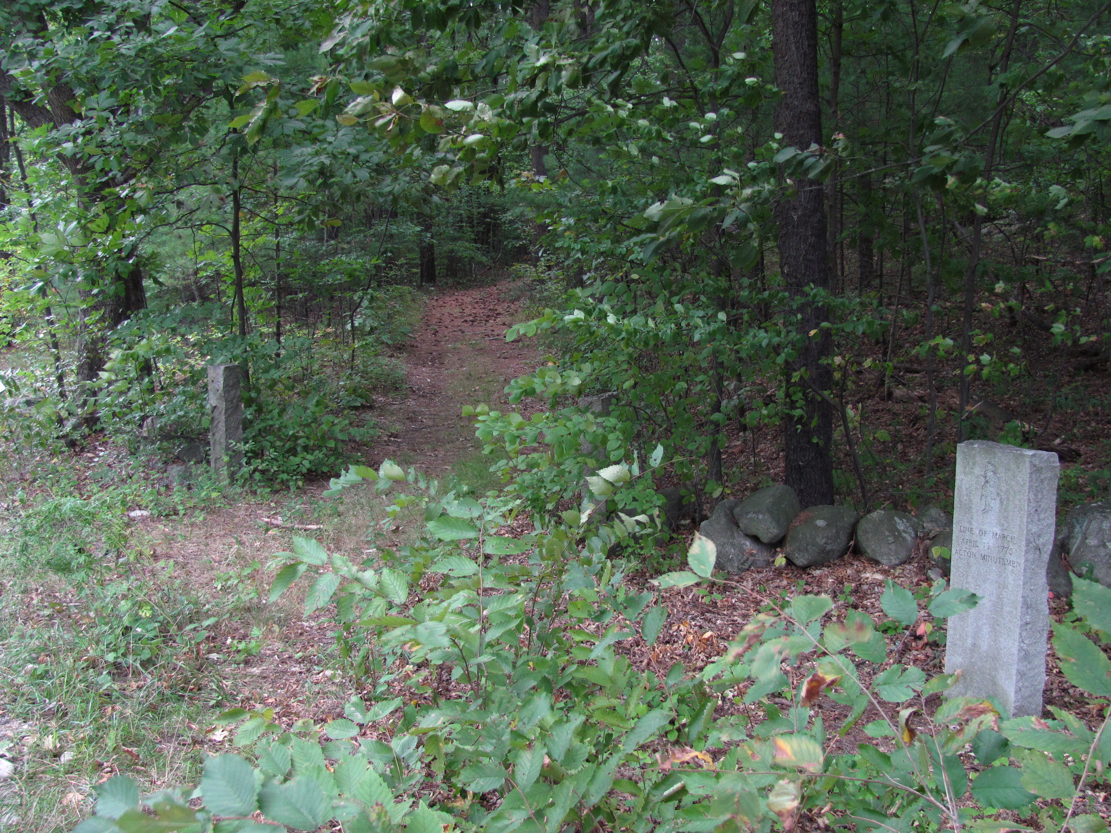
42°15′40.33″N 71°27′58.10″W / 42.2612028°N 71.466139°W / 42.2612028; -71.466139 (Ashland Town House) |
Ashland |
|
| 7 |
Ayer Main Street Historic District |
 |
01989-03-16 March 16, 1989 |
Main St. roughly between Park and Columbia Sts.
42°33′34″N 71°35′20″W / 42.55944°N 71.58889°W / 42.55944; -71.58889 (Ayer Main Street Historic District) |
Ayer |
|
| 8 |
Stephen Bacon House |
|
01990-03-09 March 9, 1990 |
105 N. Main St.
42°17′30″N 71°21′24″W / 42.29167°N 71.35667°W / 42.29167; -71.35667 (Bacon, Stephen, House) |
Natick |
|
| 9 |
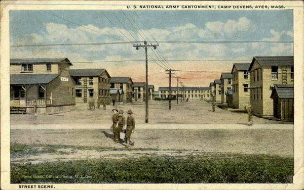
Bacon-Gleason-Blodgett Homestead |
 |
01977-04-14 April 14, 1977 |
118 Wilson Rd.
42°30′1″N 71°14′51″W / 42.50028°N 71.2475°W / 42.50028; -71.2475 (Bacon-Gleason-Blodgett Homestead) |
Bedford |
|
| 10 |
Rev. Stephen Badger House |
 |
01980-04-01 April 1, 1980 |
87 Eliot St.
42°16′11″N 71°19′7″W / 42.26972°N 71.31861°W / 42.26972; -71.31861 (Badger, Rev. Stephen, House) |
Natick |
|
| 11 |
Loammi Baldwin Mansion |
 |
01971-10-07 October 7, 1971 |
2 Alfred St.
42°30′8″N 71°9′29″W / 42.50222°N 71.15806°W / 42.50222; -71.15806 (Baldwin, Loammi, Mansion) |
Woburn |
Home of Col. Loammi Baldwin, engineer of the Middlesex Canal, which the mansion overlooks |
| 12 |
Bedford Center Historic District |
 |
01977-11-17 November 17, 1977 |
Irregular pattern along Great Rd. from Bacon to Concord and North Rds.
42°29′33″N 71°16′52″W / 42.4925°N 71.28111°W / 42.4925; -71.28111 (Bedford Center Historic District) |
Bedford |
|
| 13 |
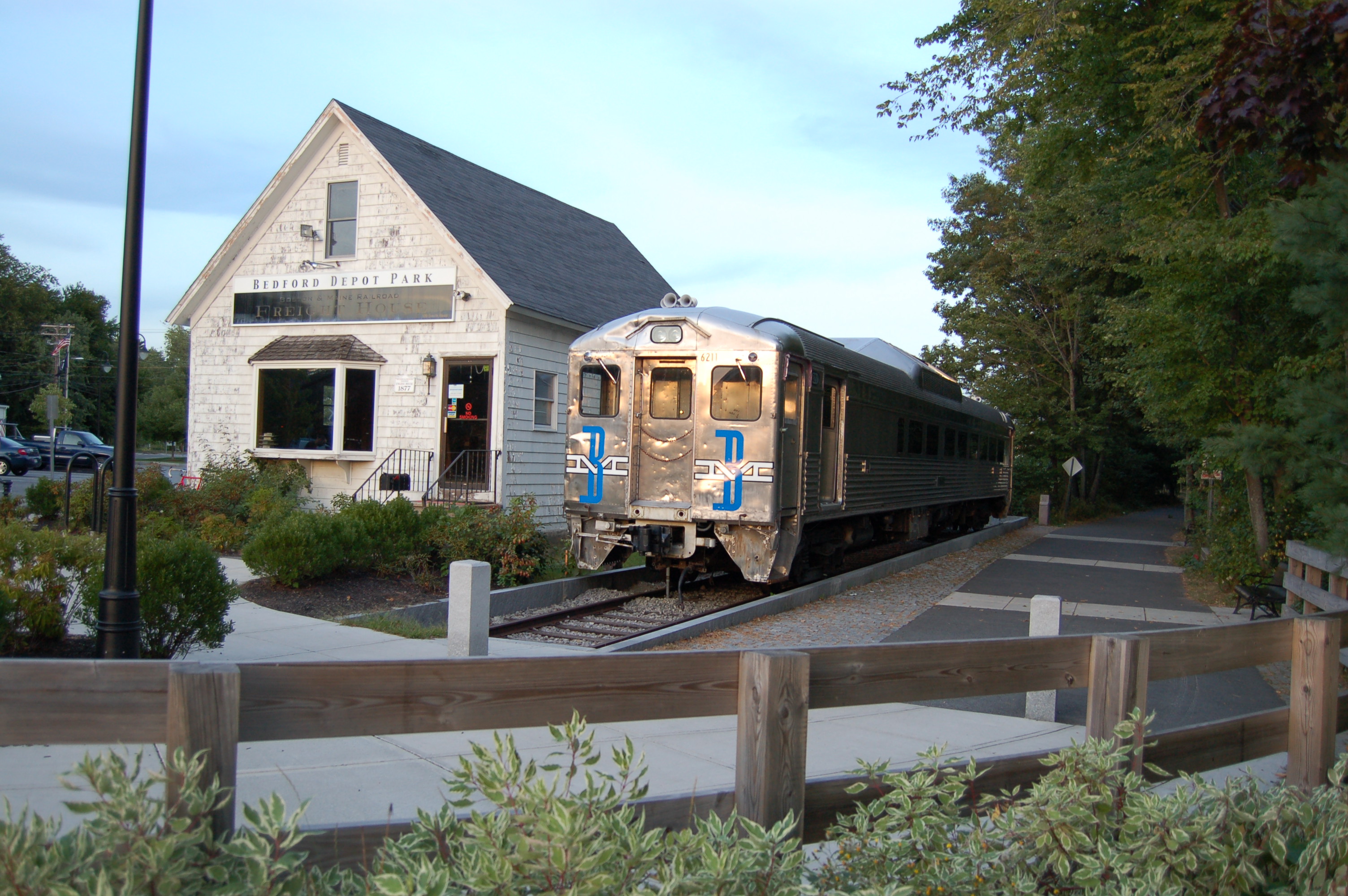
Bedford Depot |
 |
02003-08-21 August 21, 2003 |
80 Loomis St. and 120 South Rd.
42°29′9.45″N 71°16′33.65″W / 42.4859583°N 71.2760139°W / 42.4859583; -71.2760139 (Bedford Depot) |
Bedford |
|
| 14 |
Beebe Estate |
 |
01981-05-20 May 20, 1981 |
235 W. Foster St.
42°27′20″N 71°4′13″W / 42.45556°N 71.07028°W / 42.45556; -71.07028 (Beebe Estate) |
Melrose |
|
| 15 |
Bell Rock Memorial Park |
 |
02001-02-09 February 9, 2001 |
Bounded by Main, Wigglesworth, Meridan, and Ellis Sts.
42°25′13″N 71°4′4″W / 42.42028°N 71.06778°W / 42.42028; -71.06778 (Bell Rock Memorial Park) |
Malden |
|
| 16 |
Belmont Railroad Station |
 |
01998-12-04 December 4, 1998 |
1 Common St.
42°23′45″N 71°10′36″W / 42.39583°N 71.17667°W / 42.39583; -71.17667 (Belmont Railroad Station) |
Belmont |
|
| 17 |
Bennett-Shattuck House |
|
02006-02-22 February 22, 2006 |
653 Martins Pond Rd.
42°37′22″N 71°32′5″W / 42.62278°N 71.53472°W / 42.62278; -71.53472 (Bennett–Shattuck House) |
Groton |
|
| 18 |
John Bickford House |
 |
01990-03-09 March 9, 1990 |
235 Elm St.
42°34′38″N 71°4′2″W / 42.57722°N 71.06722°W / 42.57722; -71.06722 (Bickford, John, House) |
North Reading |
|
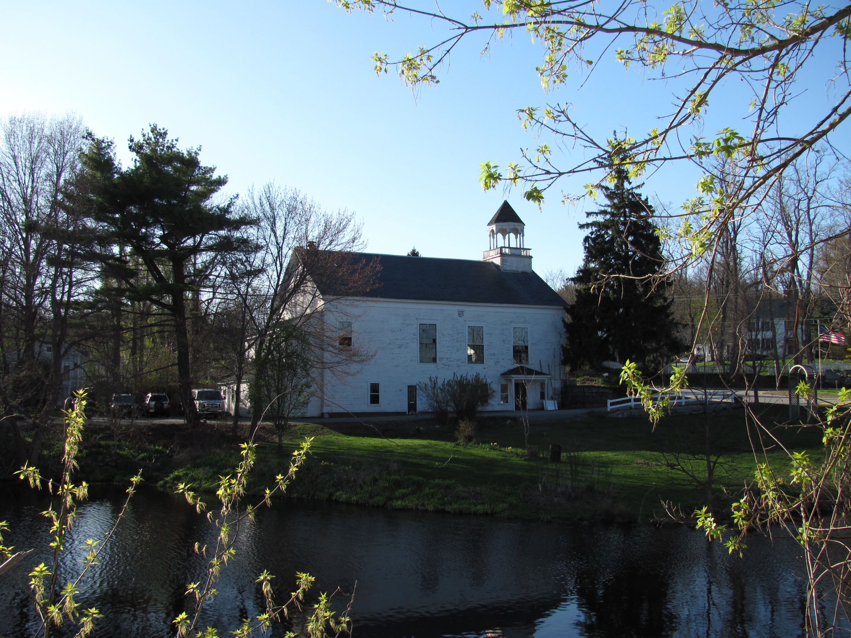
| 19 |
Billerica Mills Historic District |
 |
01983-11-10 November 10, 1983 |
Roughly bounded by Concord River, Treble Cove Terr., Kohlrausch Ave., Indian Rd., Holt Ruggles, and Rogers Sts.
42°35′22.73″N 71°17′6.23″W / 42.5896472°N 71.2850639°W / 42.5896472; -71.2850639 (Billerica Mills Historic District) |
Billerica |
|
| 20 |
Billerica Town Common District |
 |
01973-08-14 August 14, 1973 |
Bounded by Cummings St., Concord Rd., and Boston Rd.
42°33′35.88″N 71°16′11.19″W / 42.5599667°N 71.269775°W / 42.5599667; -71.269775 (Billerica Town Common District) |
Billerica |
|
| 21 |
Bogle-Walker House |
 |
01992-08-27 August 27, 1992 |
55 and 62 Goodman's Rd.
42°21′54″N 71°24′6″W / 42.365°N 71.40167°W / 42.365; -71.40167 (Bogle–Walker House) |
Sudbury |
|
| 22 |
Boston Post Road Historic District |
 |
01983-02-11 February 11, 1983 |
Both sides of the Boston Post Rd. from Plain Rd. to Stony Brook
42°21′57″N 71°18′30″W / 42.36583°N 71.30833°W / 42.36583; -71.30833 (Boston Post Road Historic District) |
Weston |
|
| 23 |
Boutell-Hathorn House |
 |
02004-10-27 October 27, 2004 |
280 Woburn St.
42°33′54″N 71°8′47″W / 42.565°N 71.14639°W / 42.565; -71.14639 (Boutell–Hathorn House) |
Wilmington |
|
| 24 |
Gov. George S. Boutwell House |
 |
02005-01-05 January 5, 2005 |
172 Main St.
42°36′29″N 71°34′17″W / 42.60806°N 71.57139°W / 42.60806; -71.57139 (Boutwell, Gov. George S., House) |
Groton |
|
| 25 |
Boxborough Old Town Center |
 |
02006-12-12 December 12, 2006 |
Hill Rd., Middle Rd., Picnic St.
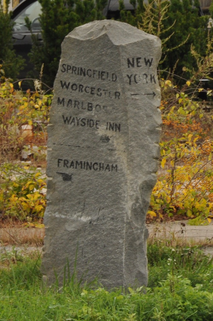
42°29′46″N 71°31′37″W / 42.49611°N 71.52694°W / 42.49611; -71.52694 (Boxborough Old Town Center) |
Boxborough |
|
| 26 |
Moses Brewer House |
 |
01990-03-09 March 9, 1990 |
88 Concord Rd.
42°22′3″N 71°24′52″W / 42.3675°N 71.41444°W / 42.3675; -71.41444 (Brewer, Moses, House) |
Sudbury |
|
| 27 |
Daniel Brooks House |
 |
01973-10-25 October 25, 1973 |
Brooks Rd. E.
42°26′50″N 71°18′35″W / 42.44722°N 71.30972°W / 42.44722; -71.30972 (Brooks, Daniel, House) |
Lincoln |
|
| 28 |
Brookside Historic District |
 |
02003-01-23 January 23, 2003 |
1–44 Brookside, 5 Moore Rd., 1–7 Coolidge Ave.
42°36′36″N 71°24′42″W / 42.61°N 71.41167°W / 42.61; -71.41167 (Brookside Historic District) |
Westford |
|
| 29 |
Brown-Stow House |
 |
01990-03-09 March 9, 1990 |
172 Harvard Rd.
42°26′24″N 71°32′12″W / 42.44°N 71.53667°W / 42.44; -71.53667 (Brown–Stow House) |
Stow |
|
| 30 |
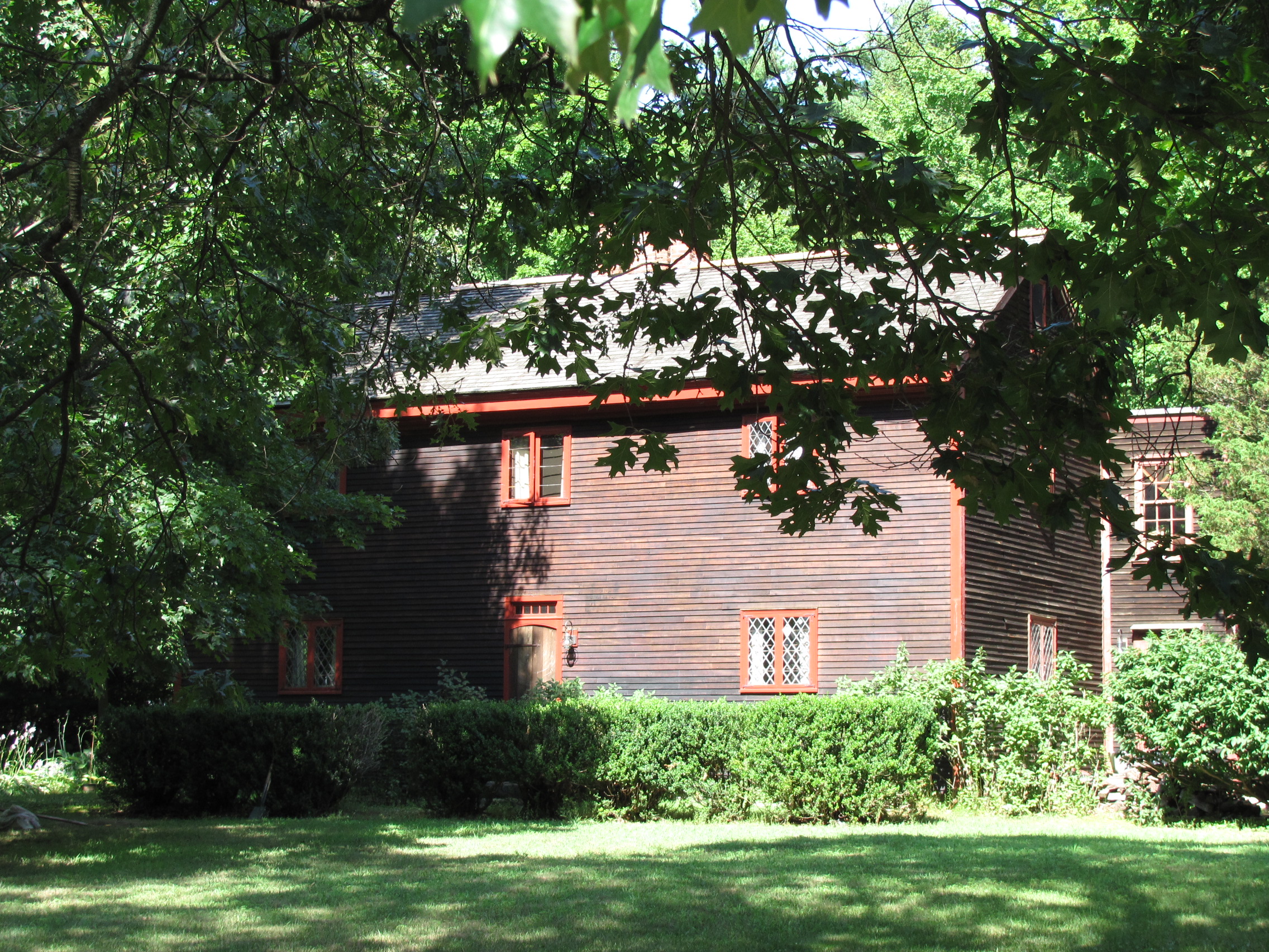
Abraham Browne House |
 |
01990-03-09 March 9, 1990 |
562 Main St.
42°22′20″N 71°12′3″W / 42.37222°N 71.20083°W / 42.37222; -71.20083 (Browne, Abraham, House) |
Watertown |
|
| 31 |
Buck's Corner Historic District |
 |
02003-11-21 November 21, 2003 |
216 Wildwood St., 580,584,588,590,602,603,604 Woburn St.
42°32′52″N 71°9′5″W / 42.54778°N 71.15139°W / 42.54778; -71.15139 (Buck's Corner Historic District) |
Wilmington |
|
| 32 |
Ephraim Buck House |
 |
01990-03-09 March 9, 1990 |
216 Wildwood St.
42°32′49″N 71°9′6″W / 42.54694°N 71.15167°W / 42.54694; -71.15167 (Buck, Ephraim, House) |
Wilmington |
|
| 33 |
Buckman Tavern |
 |
01966-10-15 October 15, 1966 |
Hancock St., on the eastern side of Lexington Green
42°26′57″N 71°13′49″W / 42.44917°N 71.23028°W / 42.44917; -71.23028 (Buckman Tavern) |
Lexington |
National Historic Landmark |
| 34 |
Bullard Farm |
|
01995-05-26 May 26, 1995 |
7 Bullard Ln.
42°11′44″N 71°23′17″W / 42.19556°N 71.38806°W / 42.19556; -71.38806 (Bullard Farm) |
Holliston |
|
| 35 |
Isaac Bullard House |
 |
01990-03-09 March 9, 1990 |
77 Ashland St.
42°13′42″N 71°26′8″W / 42.22833°N 71.43556°W / 42.22833; -71.43556 (Bullard, Isaac, House) |
Holliston |
|
| 36 |
Butters-Avery House |
|
02010-07-03 July 3, 2010 |
165 Chestnut St.
42°31′57″N 71°10′34″W / 42.5325°N 71.17611°W / 42.5325; -71.17611 (Butters-Avery House) |
Wilmington |
|
| 37 |
Case's Corner Historic District |
 |
02002-09-12 September 12, 2002 |
School, Wellesley, Newton and Ash Sts.
42°21′29″N 71°17′55″W / 42.35806°N 71.29861°W / 42.35806; -71.29861 (Case's Corner Historic District) |
Weston |
|
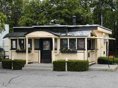
| 38 |
Casey's Diner |
 |
01999-09-22 September 22, 1999 |
36 South Ave.
42°17′8″N 71°20′43″W / 42.28556°N 71.34528°W / 42.28556; -71.34528 (Casey's Diner) |
Natick |
|
| 39 |
Cedar Swamp Archeological District |
|
01988-05-23 May 23, 1988 |
Along the border with Westborough in Worcester County
42°15′35.8888″N 71°35′5.784″W / 42.259969111°N 71.58494°W / 42.259969111; -71.58494 (Cedar Swamp Archeological District)[2] |
Hopkinton |
Extends into Worcester County |
| 40 |
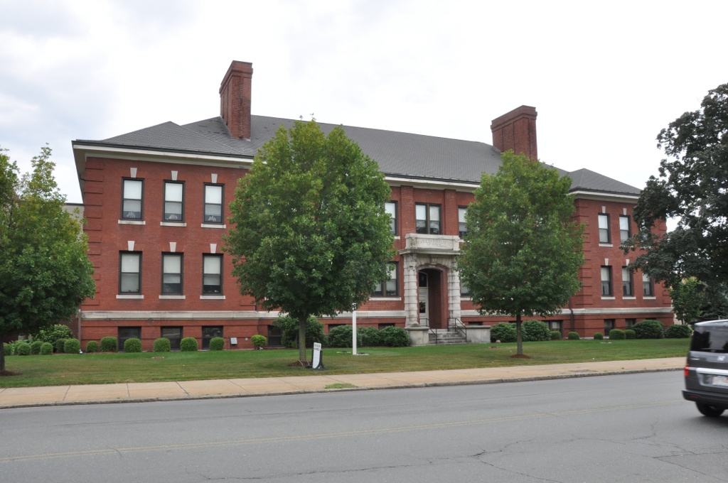
Center School |
 |
02006-06-21 June 21, 2006 |
13 Bedford St.
42°30′17″N 71°11′46″W / 42.50472°N 71.19611°W / 42.50472; -71.19611 (Center School) |
Burlington |
|
| 41 |
Gen. Samuel Chandler House |
 |
01977-04-13 April 13, 1977 |
8 Goodwin Rd.
42°27′4″N 71°13′45″W / 42.45111°N 71.22917°W / 42.45111; -71.22917 (Chandler, Gen. Samuel, House) |
Lexington |
|
| 42 |
Charles River Reservation Parkways |
 |
02006-01-18 January 18, 2006 |
Soldiers Field, Nonantum, Leo Birmingham, Arsenal, Greenough, N. Beacon, Charles River, Norumbega, Recreation
42°21′42″N 71°9′31″W / 42.36167°N 71.15861°W / 42.36167; -71.15861 (Charles River Reservation Parkways) |
Watertown and Weston |
Extends into Cambridge, Newton, and Waltham in Middlesex County and into Boston in Suffolk County |
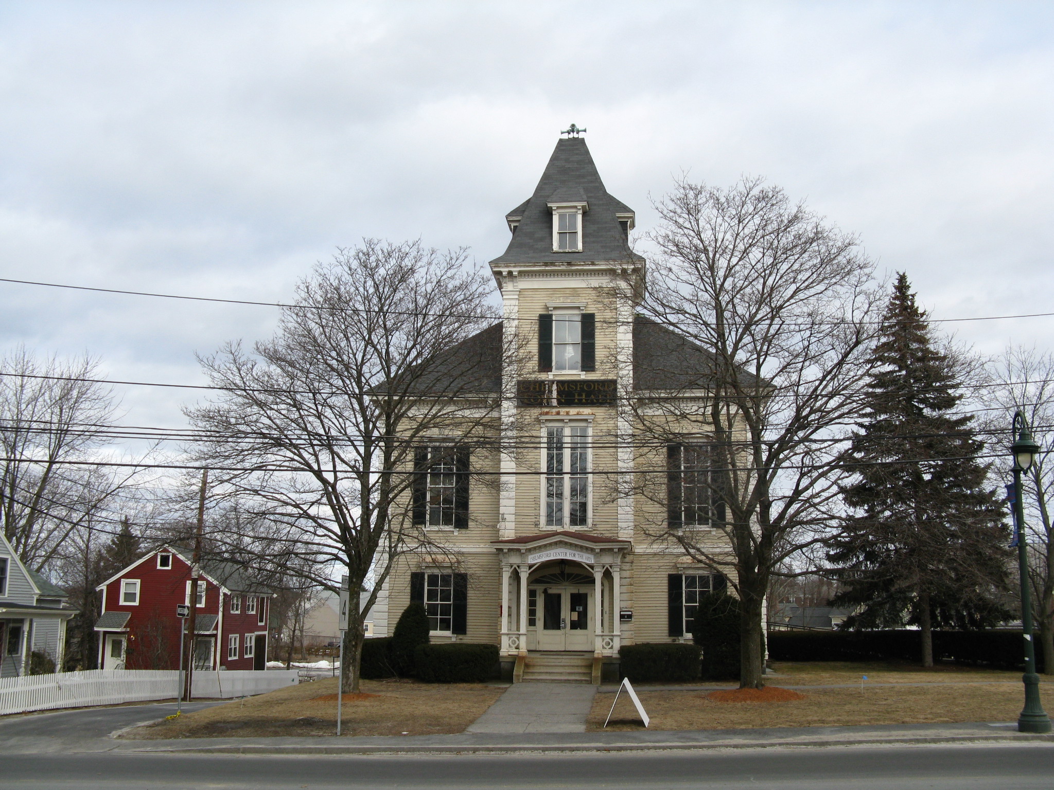
| 43 |
Chelmsford Center Historic District |
 |
01980-02-20 February 20, 1980 |
MA 4, MA 110 and MA 27
42°35′53″N 71°21′15″W / 42.59806°N 71.35417°W / 42.59806; -71.35417 (Chelmsford Center Historic District) |
Chelmsford |
|
| 44 |
Church Street Historic District |
 |
02003-11-21 November 21, 2003 |
72–150 and 117–135 Church St., 4 Central St.
42°33′9″N 71°10′7″W / 42.5525°N 71.16861°W / 42.5525; -71.16861 (Church Street Historic District) |
Wilmington |
|
| 45 |
Clark Houses |
 |
01978-02-17 February 17, 1978 |
74 and 76 W. Central St.
42°16′56″N 71°21′25″W / 42.28222°N 71.35694°W / 42.28222; -71.35694 (Clark Houses) |
Natick |
|
| 46 |
Commanding Officer's Quarters, Watertown Arsenal |
 |
01976-10-07 October 7, 1976 |
443 Arsenal St.
42°21′37″N 71°9′50″W / 42.36028°N 71.16389°W / 42.36028; -71.16389 (Commanding Officer's Quarters, Watertown Arsenal) |
Watertown |
|
| 47 |
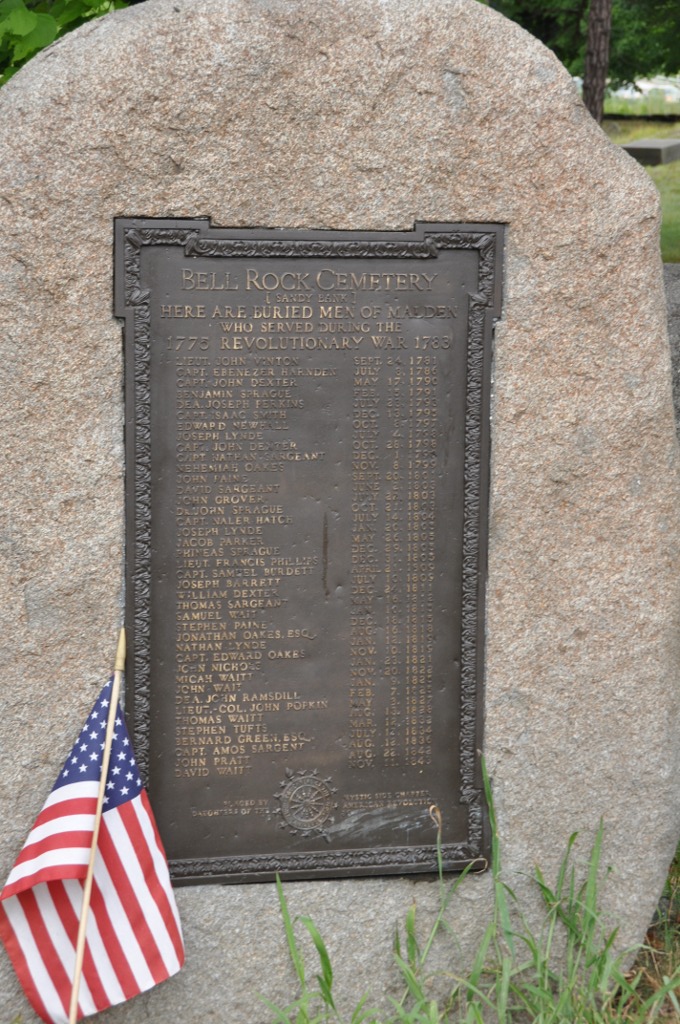
Common Burying Ground at Sandy Bank |
 |
01981-08-27 August 27, 1981 |
Green St.
42°25′3″N 71°4′19″W / 42.4175°N 71.07194°W / 42.4175; -71.07194 (Common Burying Ground at Sandy Bank) |
Malden |
|
| 48 |
Community Memorial Hospital |
 |
02004-05-14 May 14, 2004 |
15 Winthrop Ave.
42°33′39.7″N 71°34′50.03″W / 42.561028°N 71.5805639°W / 42.561028; -71.5805639 (Community Memorial Hospital) |
Ayer |
|
| 49 |
Concord Square Historic District |
 |
01983-03-10 March 10, 1983 |
Park, Concord, and Kendall Sts., and Union Ave.
42°16′42″N 71°25′6″W / 42.27833°N 71.41833°W / 42.27833; -71.41833 (Concord Square Historic District) |
Framingham |
|
| 50 |
Converse Memorial Building |
 |
01985-09-05 September 5, 1985 |
36 Salem St.
42°25′39″N 71°3′59″W / 42.4275°N 71.06639°W / 42.4275; -71.06639 (Converse Memorial Building) |
Malden |
National Historic Landmark |
| 51 |
Coolidge School |
 |
02009-02-25 February 25, 2009 |
319 Arlington St.
42°22′23.25″N 71°9′27.3″W / 42.373125°N 71.157583°W / 42.373125; -71.157583 (Coolidge School) |
Watertown |
|
| 52 |
Charles A. Daniels School |
 |
01987-01-06 January 6, 1987 |
Daniels St.
42°25′44″N 71°3′13″W / 42.42889°N 71.05361°W / 42.42889; -71.05361 (Daniels, Charles A., School) |
Malden |
|
| 53 |
Isaac Davis Trail |
 |
01972-04-11 April 11, 1972 |
Running E-W between towns of Acton and Concord
42°28′48″N 71°23′57″W / 42.48°N 71.39917°W / 42.48; -71.39917 (Davis, Isaac, Trail) |
Acton |
|
| 54 |
District 7 School |
|
02008-01-29 January 29, 2008 |
Chicopee Row
42°37′54″N 71°32′54″W / 42.63167°N 71.54833°W / 42.63167; -71.54833 (District 7 School) |
Groton |
|
| 55 |
Dunstable Town Hall |
 |
01999-05-12 May 12, 1999 |
511 Main St.
42°40′35″N 71°29′10″W / 42.67639°N 71.48611°W / 42.67639; -71.48611 (Dunstable Town Hall) |
Dunstable |
|
| 56 |
Dutton-Holden Homestead |
 |
02001-03-29 March 29, 2001 |
28 Pond St.
42°33′56″N 71°15′52″W / 42.56556°N 71.26444°W / 42.56556; -71.26444 (Dutton–Holden Homestead) |
Billerica |
|
| 57 |
East Holliston Historic District |
 |
02002-06-14 June 14, 2002 |
Washington, Baker, Curve, Woodland St., Quail Run
42°12′50″N 71°25′14″W / 42.21389°N 71.42056°W / 42.21389; -71.42056 (East Holliston Historic District) |
Holliston |
|
| 58 |
Moses Ellis House |
 |
01983-11-29 November 29, 1983 |
283 Pleasant St.
42°18′16″N 71°26′58″W / 42.30444°N 71.44944°W / 42.30444; -71.44944 (Ellis, Moses, House) |
Framingham |
|
| 59 |
Exchange Hall |
 |
01986-06-13 June 13, 1986 |
Quimby Sq. on School St.
42°27′38.6″N 71°27′15.7″W / 42.460722°N 71.454361°W / 42.460722; -71.454361 (Exchange Hall) |
Acton |
|
| 60 |
Fairview Cemetery |
 |
02005-01-12 January 12, 2005 |
Main St.
42°35′13″N 71°25′15″W / 42.58694°N 71.42083°W / 42.58694; -71.42083 (Fairview Cemetery) |
Westford |
|
| 61 |
Faulkner Homestead |
 |
01971-12-16 December 16, 1971 |
5 High St.
42°27′32″N 71°27′14″W / 42.45889°N 71.45389°W / 42.45889; -71.45389 (Faulkner Homestead) |
Acton |
|
| 62 |
Fells Connector Parkways, Metropolitan System of Greater Boston |
 |
02003-05-09 May 9, 2003 |
Fellsway East: E. Border Rd. to Fellsway W.; Fellsway West: Fulton St. to Fellway E.; Fellsway:Fellsway E. to the Wellington Bridge
42°24′54.31″N 71°5′3.26″W / 42.4150861°N 71.0842389°W / 42.4150861; -71.0842389 (Fells Connector Parkways, Metropolitan System of Greater Boston) |
Malden and Medford |
|
| 63 |
Fellsmere Park Parkways, Metropolitan Park System of Greater Boston |
 |
02003-05-09 May 9, 2003 |
W. Border Rd, Boundary Rd.
42°25′41.06″N 71°5′11.93″W / 42.4280722°N 71.0866472°W / 42.4280722; -71.0866472 (Fellsmere Park Parkways, Metropolitan Park System of Greater Boston) |
Malden |
|
| 64 |
Felton Street School |
 |
01986-02-27 February 27, 1986 |
20 Felton St.
42°23′33″N 71°34′12″W / 42.3925°N 71.57°W / 42.3925; -71.57 (Felton Street School) |
Hudson |
|
| 65 |
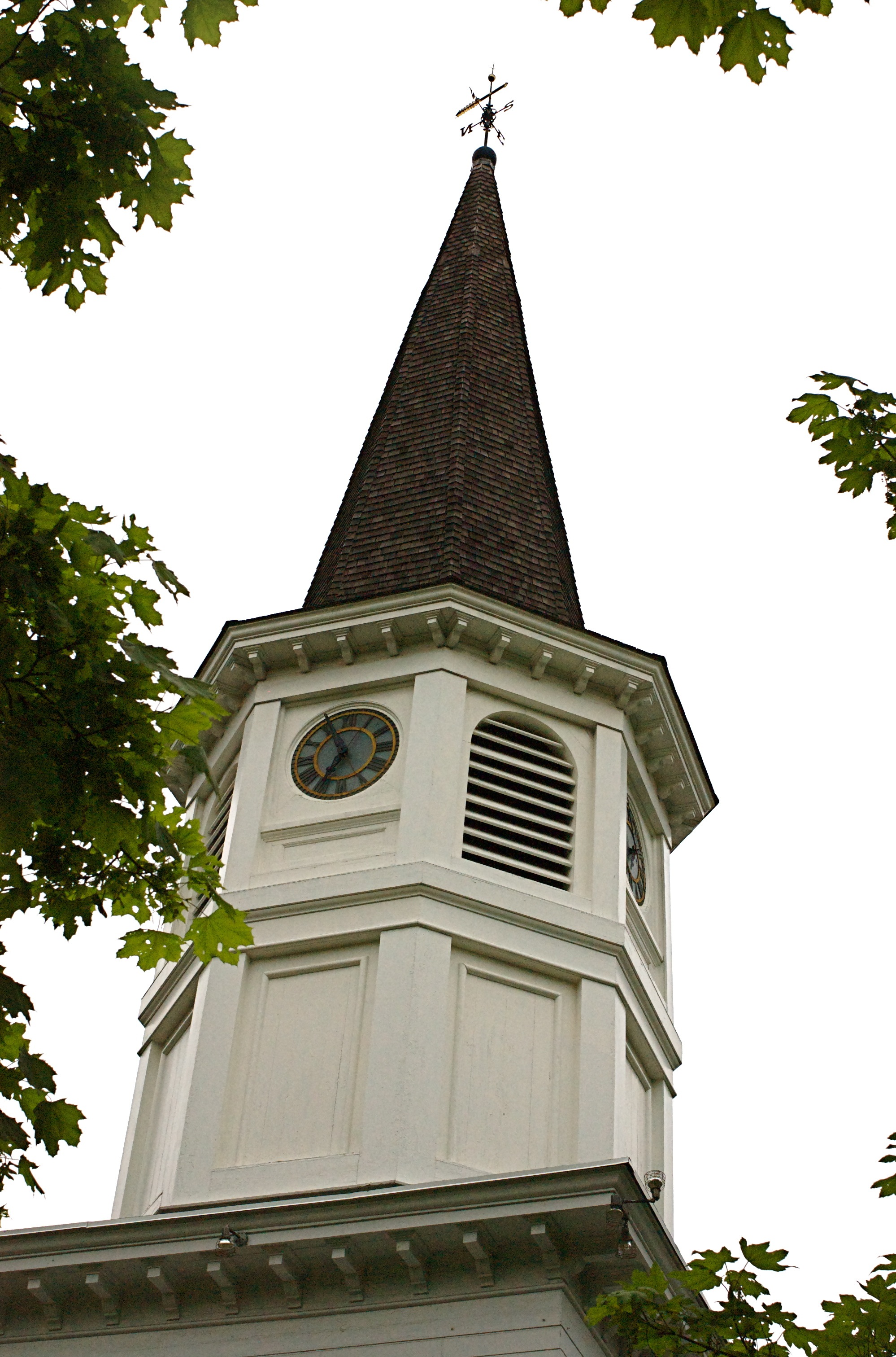
First Baptist Church |
 |
01980-04-09 April 9, 1980 |
1013 Worcester Rd.
42°18′1.12″N 71°26′19.9″W / 42.3003111°N 71.438861°W / 42.3003111; -71.438861 (First Baptist Church) |
Framingham |
|
| 66 |
First Burial Ground |
 |
02004-11-13 November 13, 2004 |
Park St. near Centre St.
42°28′54″N 71°9′11″W / 42.48167°N 71.15306°W / 42.48167; -71.15306 (First Burial Ground) |
Woburn |
|
| 67 |
First Congregational Church in Woburn |
 |
01992-01-06 January 6, 1992 |
322 Main St.
42°28′43″N 71°9′9″W / 42.47861°N 71.1525°W / 42.47861; -71.1525 (First Congregational Church in Woburn) |
Woburn |
|
| 68 |
Fiske House |
 |
01977-12-09 December 9, 1977 |
1 Billerica Rd.
42°35′47″N 71°21′6″W / 42.59639°N 71.35167°W / 42.59639; -71.35167 (Fiske House) |
Chelmsford Center |
|
| 69 |
Henry Fletcher House |
 |
01993-09-30 September 30, 1993 |
224 Concord Rd.
42°33′4″N 71°25′39″W / 42.55111°N 71.4275°W / 42.55111; -71.4275 (Fletcher, Henry, House) |
Westford |
|
| 70 |
Flint House |
 |
02003-07-25 July 25, 2003 |
28 Lexington Rd.
42°25′44″N 71°17′46″W / 42.42889°N 71.29611°W / 42.42889; -71.29611 (Flint House) |
Lincoln |
|
| 71 |
Follen Community Church |
 |
01976-04-30 April 30, 1976 |
755 Massachusetts Ave.
42°25′47″N 71°12′27″W / 42.42972°N 71.2075°W / 42.42972; -71.2075 (Follen Community Church) |
Lexington |
|
| 72 |
Forge Village Historic District |
 |
02002-05-02 May 2, 2002 |
Roughly bounded by Forge Pond, W. Prescott St., Story St., Orchard St., Abbott St., and Pleasant St.
42°34′51″N 71°28′58″W / 42.58083°N 71.48278°W / 42.58083; -71.48278 (Forge Village Historic District) |
Westford |
|
| 73 |
Fort Devens Historic District |
 |
01993-06-10 June 10, 1993 |
Roughly bounded by El Caney St., Antietam St., Sherman Ave., MacArthur Ave. and Buena Vista St.
42°32′46″N 71°36′46″W / 42.54611°N 71.61278°W / 42.54611; -71.61278 (Fort Devens Historic District) |
Ayer |
|
| 74 |
Edmund Fowle House |
 |
01977-11-11 November 11, 1977 |
26–28 Marshall St.
42°22′6″N 71°10′51″W / 42.36833°N 71.18083°W / 42.36833; -71.18083 (Fowle, Edmund, House) |
Watertown |
|
| 75 |
Framingham Centre Common Historic District |
 |
01990-10-25 October 25, 1990 |
Roughly centered on Framingham Centre Common, between MA 9 and Interstate 90
42°18′13″N 71°26′8″W / 42.30361°N 71.43556°W / 42.30361; -71.43556 (Framingham Centre Common Historic District) |
Framingham |
|
| 76 |
Framingham Railroad Station |
 |
01975-01-17 January 17, 1975 |
417 Waverly St.
42°16′35″N 71°25′6″W / 42.27639°N 71.41833°W / 42.27639; -71.41833 (Framingham Railroad Station) |
Framingham |
|
| 77 |
Framingham Reservoir No. 1 Dam and Gatehouse |
 |
01990-01-18 January 18, 1990 |
Eastern end of Framingham Reservoir No. 1, off Winter St. north of Long Ave.
42°17′30″N 71°26′34″W / 42.29167°N 71.44278°W / 42.29167; -71.44278 (Framingham Reservoir No. 1 Dam and Gatehouse) |
Framingham |
|
| 78 |
Framingham Reservoir No. 2 Dam and Gatehouse |
 |
01990-01-18 January 18, 1990 |
Between Framingham Reservoirs Nos. 1 and 2, west of the junction of Winter and Fountain Sts.
42°16′58″N 71°26′45″W / 42.28278°N 71.44583°W / 42.28278; -71.44583 (Framingham Reservoir No. 2 Dam and Gatehouse) |
Framingham |
|
| 79 |
Framingham Reservoir No. 3 Dam and Gatehouse |
 |
01990-01-18 January 18, 1990 |
Southeastern end of Framingham Reservoir No. 3, off MA 9/30
42°17′38″N 71°27′36″W / 42.29389°N 71.46°W / 42.29389; -71.46 (Framingham Reservoir No. 3 Dam and Gatehouse) |
Framingham |
|
| 80 |
Franklin School |
 |
02009-09-25 September 25, 2009 |
7 Stedman Rd.
42°25′40.52″N 71°13′45.72″W / 42.4279222°N 71.2293667°W / 42.4279222; -71.2293667 (Franklin School) |
Lexington |
|
| 81 |
Paul Gibbs House |
 |
01983-03-10 March 10, 1983 |
1147 Edmands Rd.
42°19′49″N 71°28′52″W / 42.33028°N 71.48111°W / 42.33028; -71.48111 (Gibbs, Paul, House) |
Framingham |
|
| 82 |
Glen Road Historic District |
 |
02006-09-06 September 6, 2006 |
233–317 Glen Rd.
42°19′32″N 71°17′17″W / 42.32556°N 71.28806°W / 42.32556; -71.28806 (Glen Road Historic District) |
Weston |
|
| 83 |
Glenwood Cemetery |
 |
02004-05-12 May 12, 2004 |
Northeast of Parker St. and Great Rd.
42°25′27.78″N 71°26′53.46″W / 42.4243833°N 71.4481833°W / 42.4243833; -71.4481833 (Glenwood Cemetery) |
Maynard |
|
| 84 |
Golden Ball Tavern |
 |
01972-09-28 September 28, 1972 |
662 Boston Post Rd.
42°21′57″N 71°18′35″W / 42.36583°N 71.30972°W / 42.36583; -71.30972 (Golden Ball Tavern) |
Weston |
|
| 85 |
Goodale Homestead |
 |
01975-01-21 January 21, 1975 |
100 Chestnut St.
42°22′46″N 71°30′14″W / 42.37944°N 71.50389°W / 42.37944; -71.50389 (Goodale Homestead) |
Hudson |
|
| 86 |
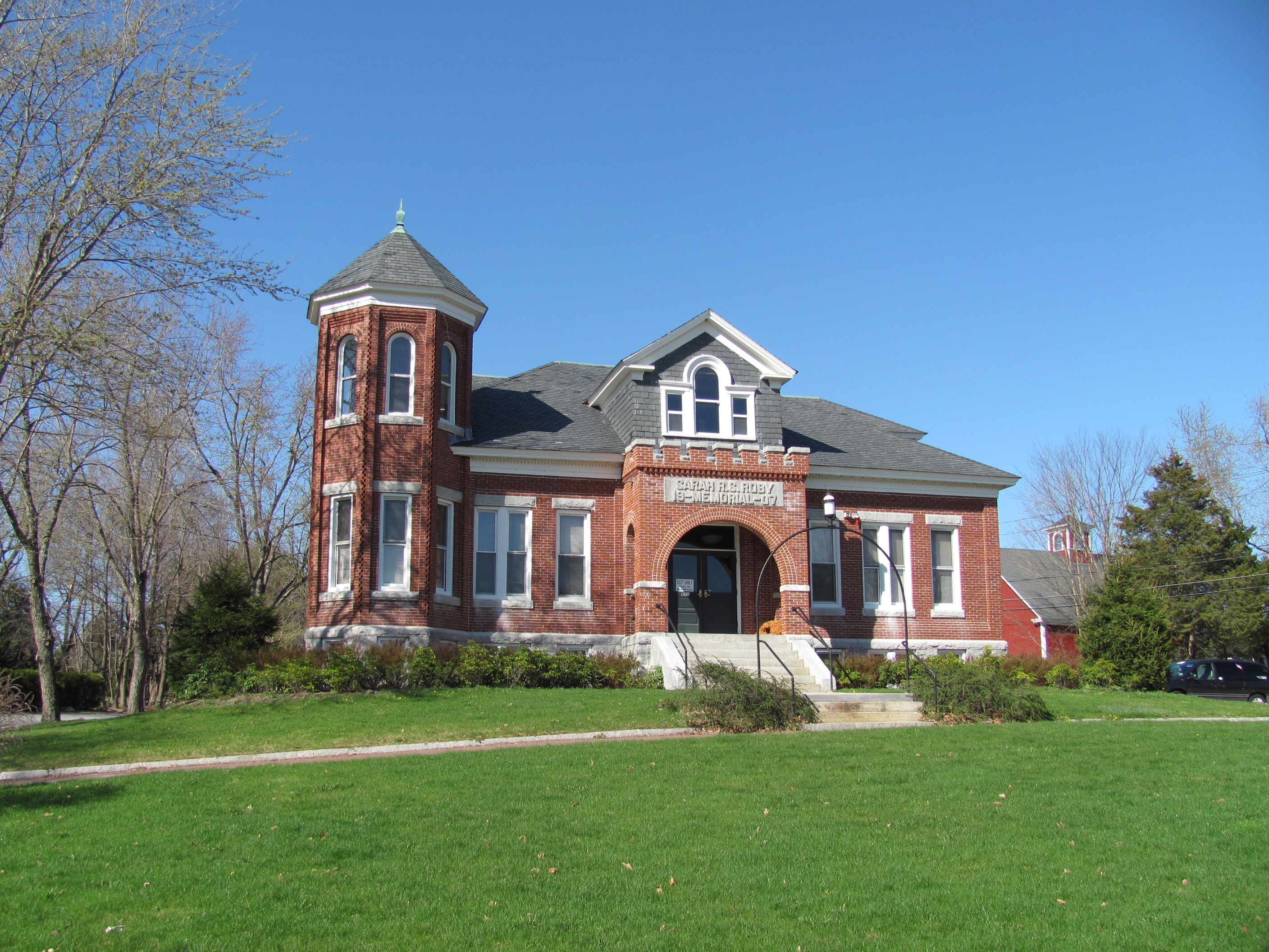
Goodnow Library |
 |
02002-05-22 May 22, 2002 |
21 Concord Rd.
42°21′47″N 71°25′2″W / 42.36306°N 71.41722°W / 42.36306; -71.41722 (Goodnow Library) |
Sudbury |
|
| 87 |
Gowing-Sheldon Historic District |
 |
02003-11-21 November 21, 2003 |
642 and 643 Woburn St.
42°32′30″N 71°9′1″W / 42.54167°N 71.15028°W / 42.54167; -71.15028 (Gowing–Sheldon Historic District) |
Wilmington |
|
| 88 |
The Grange |
 |
01974-04-18 April 18, 1974 |
Codman Rd.
42°25′2″N 71°19′52″W / 42.41722°N 71.33111°W / 42.41722; -71.33111 (Grange, The) |
Lincoln |
Boundary increase (added 1976-05-28): Codman Rd. |
| 89 |
Graniteville Historic District |
 |
02002-01-17 January 17, 2002 |
Broadway, Church, Cross, First, Fourth, N. Main, River School, Second, and Third Sts.
42°35′42″N 71°28′12″W / 42.595°N 71.47°W / 42.595; -71.47 (Graniteville Historic District) |
Westford |
|
| 90 |
Gropius House |
 |
02000-05-16 May 16, 2000 |
68 Baker Bridge Rd.
42°25′37″N 71°19′37″W / 42.42694°N 71.32694°W / 42.42694; -71.32694 (Gropius House) |
Lincoln |
National Historic Landmark |
| 91 |
Groton High School |
 |
02010-03-02 March 2, 2010 |
145 Main St.
42°36′25.53″N 71°34′11.14″W / 42.6070917°N 71.5697611°W / 42.6070917; -71.5697611 (Groton High School) |
Groton |
|
| 92 |
Groton Inn |
 |
01976-08-03 August 3, 1976 |
Main St.
42°36′24″N 71°34′7″W / 42.60667°N 71.56861°W / 42.60667; -71.56861 (Groton Inn) |
Groton |
Destroyed in a 2011 fire.[3] |
| 93 |
Groton Leatherboard Company |
|
02002-04-18 April 18, 2002 |
6 W. Main St.
42°36′8″N 71°37′39″W / 42.60222°N 71.6275°W / 42.60222; -71.6275 (Groton Leatherboard Company) |
Groton |
|
| 94 |
Hancock School |
 |
01975-08-22 August 22, 1975 |
33 Forest St.
42°26′50″N 71°13′56″W / 42.44722°N 71.23222°W / 42.44722; -71.23222 (Hancock School) |
Lexington |
|
| 95 |
Hancock-Clarke House |
 |
01971-07-17 July 17, 1971 |
36 Hancock St.
42°27′12.8″N 71°13′42.8″W / 42.453556°N 71.228556°W / 42.453556; -71.228556 (Hancock-Clarke House) |
Lexington |
National Historic Landmark |
| 96 |
Hapgood House |
 |
01990-03-09 March 9, 1990 |
76 Treaty Elm Ln.
42°25′14″N 71°30′35″W / 42.42056°N 71.50972°W / 42.42056; -71.50972 (Hapgood House) |
Stow |
|
| 97 |
Harnden Tavern |
 |
01975-04-08 April 8, 1975 |
430 Salem St.
42°34′46″N 71°8′52″W / 42.57944°N 71.14778°W / 42.57944; -71.14778 (Harnden Tavern) |
Wilmington |
Currently houses the Wilmington Town Museum. |
| 98 |
Harrington House |
 |
01976-06-22 June 22, 1976 |
555 Wellesley St.
42°19′38″N 71°18′39″W / 42.32722°N 71.31083°W / 42.32722; -71.31083 (Harrington House) |
Weston |
|
| 99 |
Wilbur Fiske Haven House |
 |
01992-12-17 December 17, 1992 |
339 Pleasant St.
42°25′40″N 71°4′35″W / 42.42778°N 71.07639°W / 42.42778; -71.07639 (Haven, Wilbur Fiske, House) |
Malden |
|
| 100 |
Henry Higginson House |
 |
02005-05-26 May 26, 2005 |
44 Baker Farm Rd.
42°26′3″N 71°19′42″W / 42.43417°N 71.32833°W / 42.43417; -71.32833 (Higginson, Henry, House) |
Lincoln |
|
| 101 |
High Street Historic District |
 |
02003-11-21 November 21, 2003 |
Even nos. 8–72 High St. except 20A and 20R, plus nos. 31, 47, 57 and 67.
42°34′21″N 71°9′11″W / 42.5725°N 71.15306°W / 42.5725; -71.15306 (High Street Historic District) |
Wilmington |
|
| 102 |
Hildreth-Robbins House |
 |
02006-11-29 November 29, 2006 |
19 Maple Rd.
42°34′18″N 71°22′48″W / 42.57167°N 71.38°W / 42.57167; -71.38 (Hildreth–Robbins House) |
Chelmsford |
|
| 103 |
Abraham Hill House |
 |
01990-03-09 March 9, 1990 |
388 Pleasant St.
42°24′10″N 71°10′6″W / 42.40278°N 71.16833°W / 42.40278; -71.16833 (Hill, Abraham, House) |
Belmont |
|
| 104 |
Deacon Samuel Hill House |
 |
01990-03-09 March 9, 1990 |
33 Riverhurst Rd.
42°32′10″N 71°18′12″W / 42.53611°N 71.30333°W / 42.53611; -71.30333 (Hill, Deacon Samuel, House) |
Billerica |
|
| 105 |
Hillside Cemetery |
 |
02005-12-06 December 6, 2005 |
Depot and Nutting Rds.
42°36′26.26″N 71°26′39.73″W / 42.6072944°N 71.4443694°W / 42.6072944; -71.4443694 (Hillside Cemetery) |
Westford |
|
| 106 |
Hoar Tavern |
 |
01973-07-23 July 23, 1973 |
Northeast of Lincoln on MA 2
42°26′8.0″N 71°16′35.9″W / 42.43556°N 71.276639°W / 42.43556; -71.276639 (Hoar Tavern) |
Lincoln |
|
| 107 |
Isaac Hobbs House |
 |
01982-06-01 June 1, 1982 |
87 North Ave.
42°22′48″N 71°16′54″W / 42.38°N 71.28167°W / 42.38; -71.28167 (Hobbs, Isaac, House) |
Weston |
|
| 108 |
Thomas Hollis Historic District |
 |
01989-10-30 October 30, 1989 |
Washington St. from Winter to Highland Sts.
42°11′42″N 71°26′0″W / 42.195°N 71.433333°W / 42.195; -71.433333 (Hollis, Thomas, Historic District) |
Holliston |
|
| 109 |
Hopestill Bent Tavern |
 |
01990-03-09 March 9, 1990 |
252 Old Connecticut Path
42°20′30″N 71°22′14″W / 42.34167°N 71.37056°W / 42.34167; -71.37056 (Hopestill Bent Tavern) |
Wayland |
|
| 110 |
Hopkinton Dam and Spillway |
 |
01990-01-18 January 18, 1990 |
Eastern end of Hopkinton Reservoir in Hopkinton State Park
42°15′25″N 71°30′40″W / 42.25694°N 71.51111°W / 42.25694; -71.51111 (Hopkinton Dam and Spillway) |
Ashland |
|
| 111 |
Hopkinton Supply Co. Building |
 |
01983-03-10 March 10, 1983 |
26–28 Main St.
42°13′43″N 71°31′16″W / 42.22861°N 71.52111°W / 42.22861; -71.52111 (Hopkinton Supply Co. Building) |
Hopkinton |
|
| 112 |
Jonathan and Simon Hosmer House |
 |
02002-05-02 May 2, 2002 |
300 Main St.
42°28′36.31″N 71°27′4.11″W / 42.4767528°N 71.4511417°W / 42.4767528; -71.4511417 (Hosmer, Jonathan and Simon, House) |
Acton |
|
| 113 |
Houghton Memorial Building |
 |
01991-03-18 March 18, 1991 |
4 Rogers St.
42°32′20″N 71°29′3″W / 42.53889°N 71.48417°W / 42.53889; -71.48417 (Houghton Memorial Building) |
Littleton |
|
| 114 |
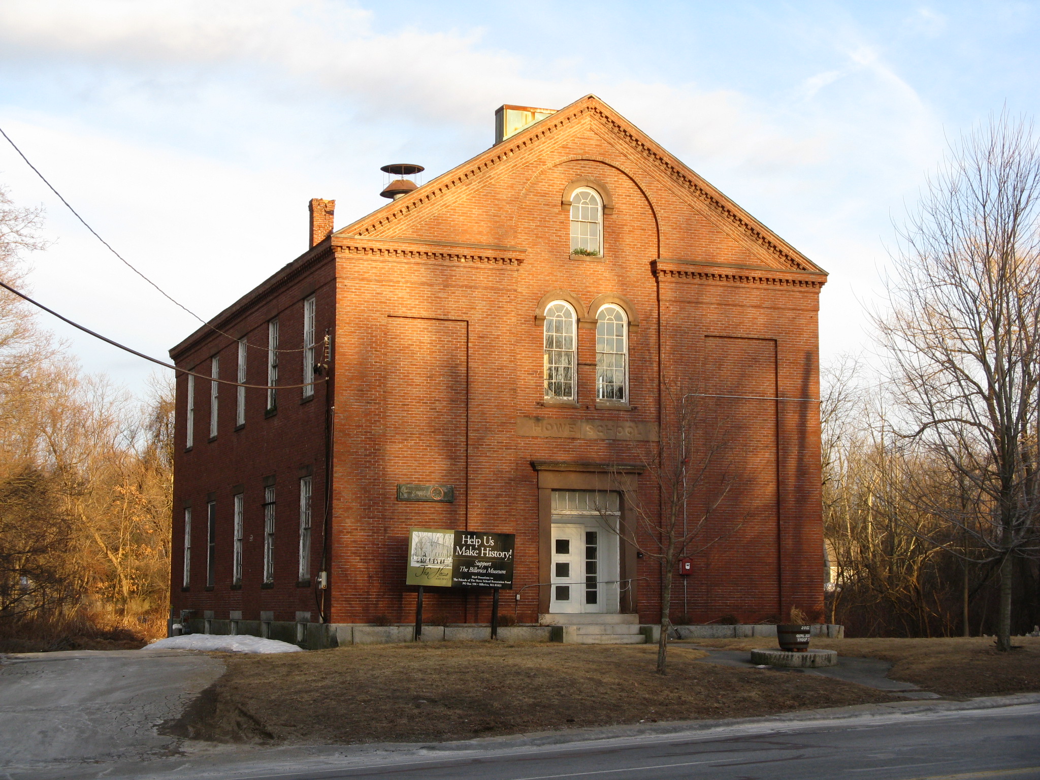
Howe School |
 |
02002-06-11 June 11, 2002 |
390 Boston Rd.
42°33′43.24″N 71°16′10.75″W / 42.5620111°N 71.2696528°W / 42.5620111; -71.2696528 (Howe School) |
Billerica |
|
| 115 |
Oliver Hutchins House |
 |
01985-09-05 September 5, 1985 |
79 Elm St.
42°33′25″N 71°22′52″W / 42.55694°N 71.38111°W / 42.55694; -71.38111 (Hutchins, Oliver, House) |
Chelmsford |
|
| 116 |
Hydrant No. 3 House |
|
02000-03-06 March 6, 2000 |
Washington St.
42°11′0″N 71°26′41″W / 42.183333°N 71.44472°W / 42.183333; -71.44472 (Hydrant No. 3 House) |
Holliston |
|
| 117 |
Irving Square Historic District |
 |
01982-11-30 November 30, 1982 |
Irving Square, Waverly, South, Columbia, Irving, Gordon and Hollis Sts.
42°16′32″N 71°25′1″W / 42.27556°N 71.41694°W / 42.27556; -71.41694 (Irving Square Historic District) |
Framingham |
|
| 118 |
Jack's Diner |
 |
02000-11-22 November 22, 2000 |
901 Main St.
42°30′31″N 71°9′39″W / 42.50861°N 71.16083°W / 42.50861; -71.16083 (Jack's Diner) |
Woburn |
Houses a Thai restaurant in 2011. |
| 119 |
Abraham Jaquith House |
 |
01991-03-14 March 14, 1991 |
161 Concord Rd.
42°32′53″N 71°16′50″W / 42.54806°N 71.28056°W / 42.54806; -71.28056 (Jaquith, Abraham, House) |
Billerica |
|
| 120 |
Robert Jenison House |
|
01978-09-06 September 6, 1978 |
North of Natick off Interstate 90
42°19′21″N 71°20′9″W / 42.3225°N 71.33583°W / 42.3225; -71.33583 (Jenison, Robert, House) |
Natick |
|
| 121 |
John Eliot Historic District |
 |
01983-06-23 June 23, 1983 |
Eliot, Pleasant, and Auburn Sts.
42°16′20″N 71°18′56″W / 42.27222°N 71.31556°W / 42.27222; -71.31556 (John Eliot Historic District) |
Natick |
|
| 122 |
Jones Tavern |
 |
01986-06-13 June 13, 1986 |
128 Main St.
42°27′38″N 71°27′21″W / 42.46056°N 71.45583°W / 42.46056; -71.45583 (Jones Tavern) |
Acton |
|
| 123 |
Kendal Green Historic District |
 |
02000-03-01 March 1, 2000 |
North Ave., Church, Viles Sts., Brook Rd.
42°22′59″N 71°17′11″W / 42.38306°N 71.28639°W / 42.38306; -71.28639 (Kendal Green Historic District) |
Weston |
|
| 124 |
Lake Cochituate Dam |
 |
01990-01-18 January 18, 1990 |
Northwestern side of Lake Cochituate
42°18′54″N 71°23′5″W / 42.315°N 71.38472°W / 42.315; -71.38472 (Lake Cochituate Dam) |
Framingham |
|
| 125 |
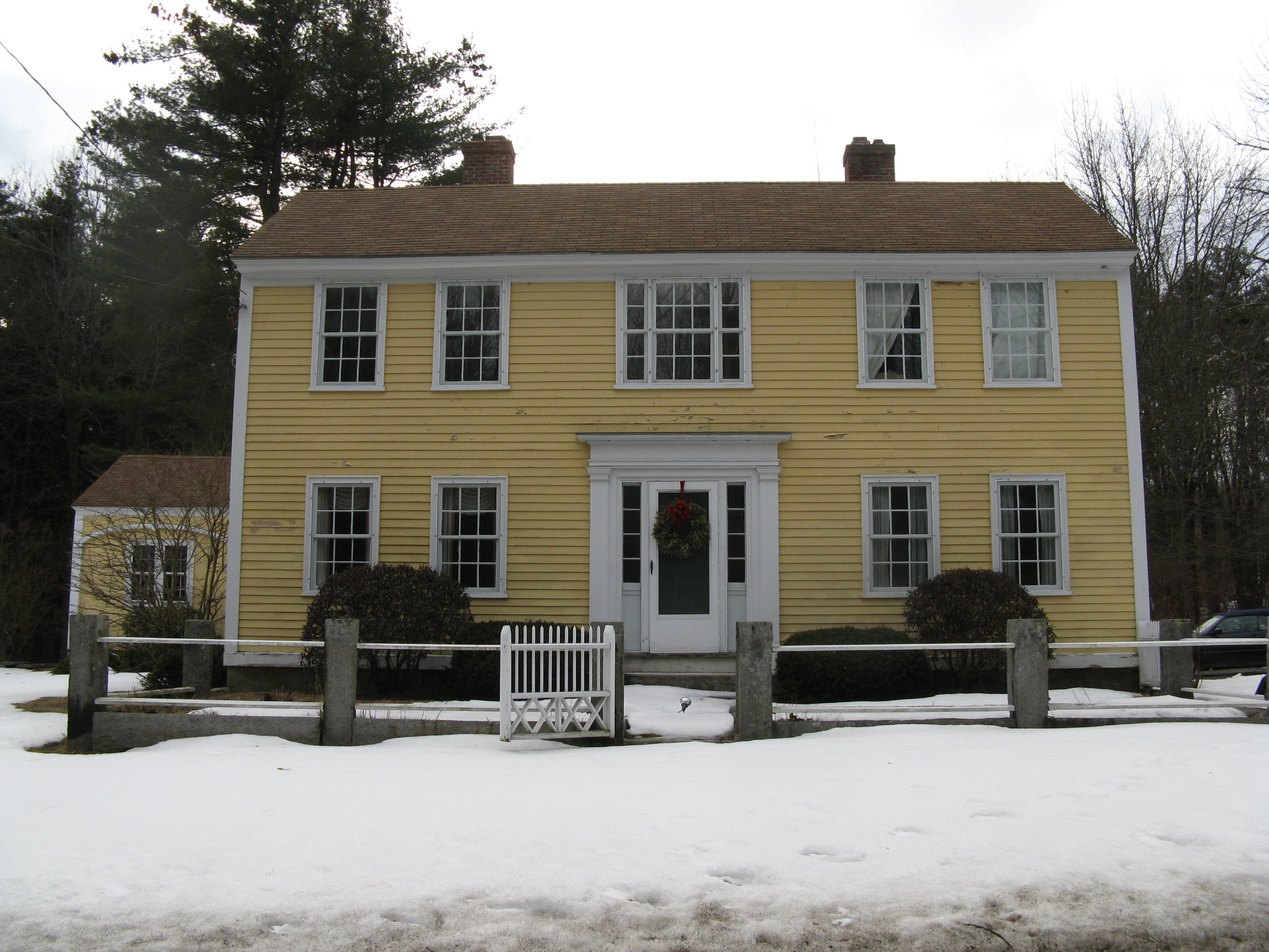
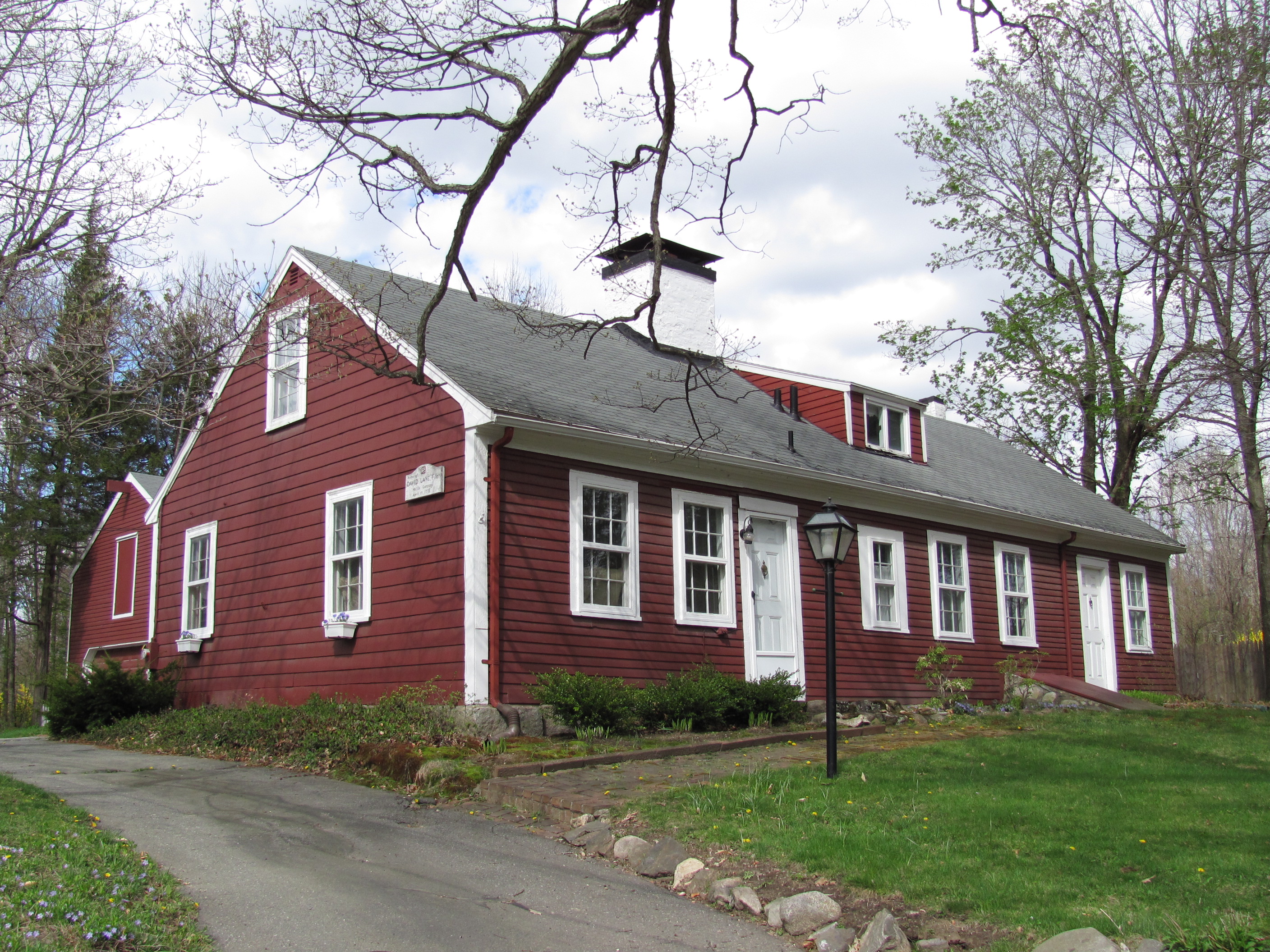
David Lane House |
 |
01980-04-02 April 2, 1980 |
137 North Rd.
42°30′8″N 71°17′5″W / 42.50222°N 71.28472°W / 42.50222; -71.28472 (Lane, David, House) |
Bedford |
House built in 1781 |
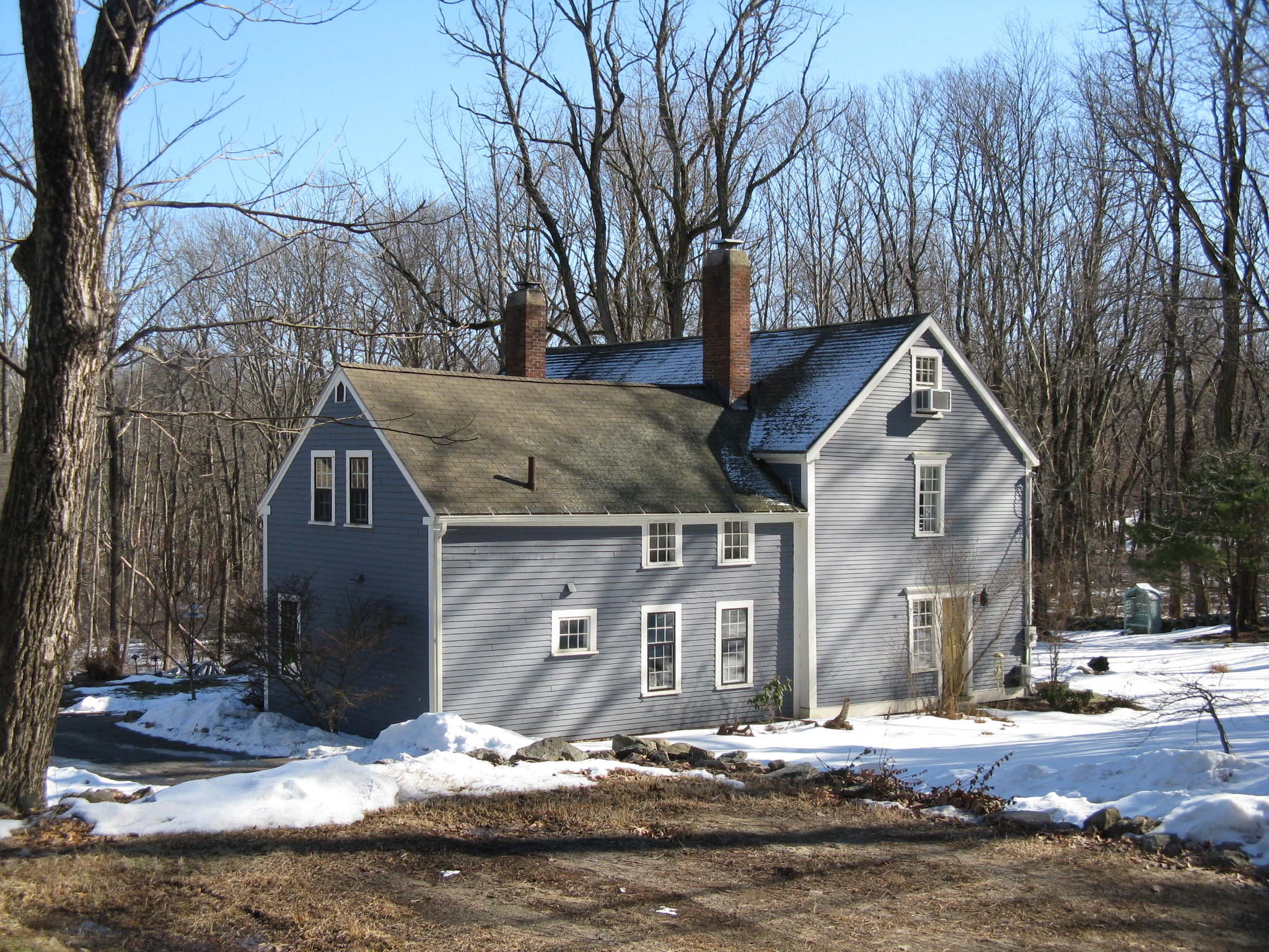
| 126 |
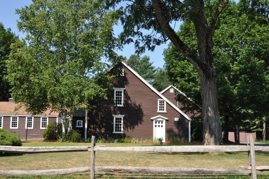
Job Lane House |
 |
01973-05-08 May 8, 1973 |
295 North St.
42°30′46″N 71°17′4″W / 42.51278°N 71.28444°W / 42.51278; -71.28444 (Lane, Job, House) |
Bedford |
|
| 127 |
Larrabee's Brick Block |
 |
01984-03-29 March 29, 1984 |
500–504 Main St.
42°27′20″N 71°3′57″W / 42.45556°N 71.06583°W / 42.45556; -71.06583 (Larrabee's Brick Block) |
Melrose |
|
| 128 |
Lexington Green |
 |
01966-10-15 October 15, 1966 |
Massachusetts and Hancock Sts.
42°26′58″N 71°13′53″W / 42.44944°N 71.23139°W / 42.44944; -71.23139 (Lexington Green) |
Lexington |
National Historic Landmark |
| 129 |
Lincoln Center Historic District |
 |
01985-07-18 July 18, 1985 |
Bedford, Lincoln, Old Lexington, Sandy Pond, Trapelo, and Weston Rds.
42°25′32″N 71°18′56″W / 42.42556°N 71.31556°W / 42.42556; -71.31556 (Lincoln Center Historic District) |
Lincoln |
|
| 130 |
Lynn Fells Parkway, Metropolitan Park System of Greater Boston |
 |
02003-05-09 May 9, 2003 |
Lynn Fells Parkway
42°28′5.1″N 71°2′58″W / 42.468083°N 71.04944°W / 42.468083; -71.04944 (Lynn Fells Parkway, Metropolitan Park System of Greater Boston) |
Melrose |
Extends into Saugus, Essex County. |
| 131 |
Manning Manse |
 |
01982-08-11 August 11, 1982 |
56 Chelmsford Rd.
42°35′3″N 71°18′7″W / 42.58417°N 71.30194°W / 42.58417; -71.30194 (Manning Manse) |
Billerica |
|
| 132 |
Marcia Browne Junior High School |
 |
02000-11-02 November 2, 2000 |
295 Broadway
42°25′59″N 71°2′22″W / 42.43306°N 71.03944°W / 42.43306; -71.03944 (Marcia Browne Junior High School) |
Malden |
|
| 133 |
John Mason House |
 |
01990-03-09 March 9, 1990 |
1303 Massachusetts Ave.
42°26′28″N 71°12′54″W / 42.44111°N 71.215°W / 42.44111; -71.215 (Mason, John, House) |
Lexington |
|
| 134 |
McCune Site |
|
01986-01-23 January 23, 1986 |
Address Restricted |
Lincoln |
|
| 135 |
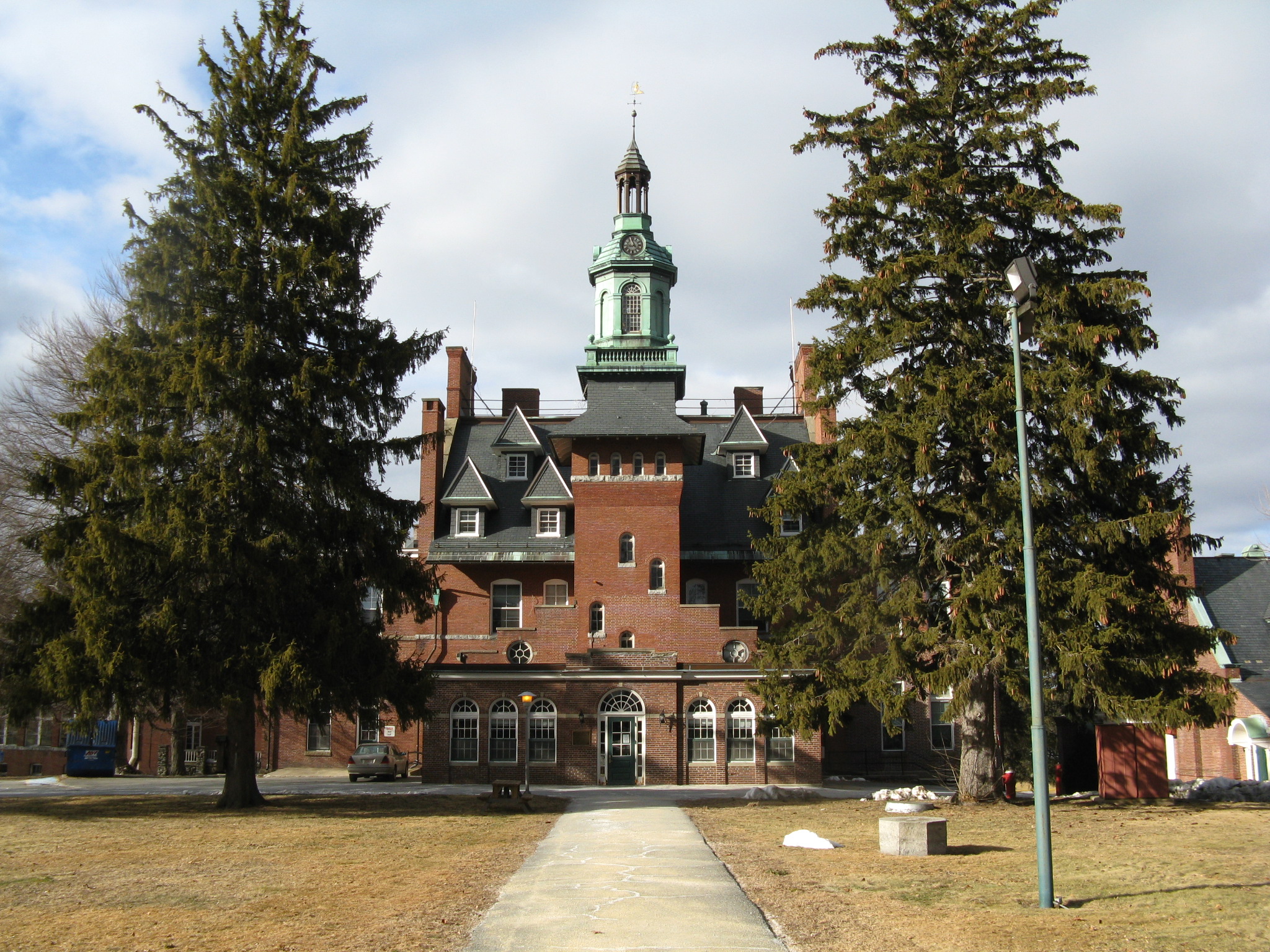
McLean Hospital National Register District |
 |
02003-01-23 January 23, 2003 |
115 Mill St.
42°23′35.03″N 71°11′28.87″W / 42.3930639°N 71.1913528°W / 42.3930639; -71.1913528 (McLean Hospital National Register District) |
Belmont |
|
| 136 |
Meeting House of the Second Parish in Woburn |
 |
01990-03-09 March 9, 1990 |
12 Lexington St.
42°30′26″N 71°4′39″W / 42.50722°N 71.0775°W / 42.50722; -71.0775 (Meeting House of the Second Parish in Woburn) |
Burlington |
|
| 137 |
Melrose Public Library |
 |
01988-06-23 June 23, 1988 |
63 W. Emerson St.
42°27′33″N 71°4′2″W / 42.45917°N 71.06722°W / 42.45917; -71.06722 (Melrose Public Library) |
Melrose |
|
| 138 |
Melrose Town Center Historic District |
 |
01982-04-01 April 1, 1982 |
Main St.
42°27′26″N 71°3′52″W / 42.45722°N 71.06444°W / 42.45722; -71.06444 (Melrose Town Center Historic District) |
Melrose |
|
| 139 |
M.H. Merriam and Company |
 |
02009-02-18 February 18, 2009 |
7–9 Oakland St.
42°26′56.06″N 71°13′37.32″W / 42.4489056°N 71.2270333°W / 42.4489056; -71.2270333 (Merriam, M.H. and Company) |
Lexington |
|
| 140 |
Middlesex Canal |
 |
01972-08-21 August 21, 1972 |
Running southeast between the towns of Lowell and Medford
42°33′40″N 71°14′9″W / 42.56111°N 71.23583°W / 42.56111; -71.23583 (Middlesex Canal) |
Lowell, Billerica, Chelmsford, Wilmington, Woburn, and Medford |
Extends into Suffolk County. |
| 141 |
Middlesex Canal Historic and Archaeological District |
 |
02009-11-19 November 19, 2009 |
Numerous locations along the historic route of the Middlesex Canal |
Lowell, Billerica, Chelmsford, Wilmington, Woburn, and Medford |
Extends into Suffolk County; encompasses Middlesex Canal and other listings. |
| 142 |
Middlesex Fells Reservation Parkways |
 |
02003-02-04 February 4, 2003 |
E. Border Rd., Fellsway E., Fellsway W., Hillcrest Parkway, South St., Pond St., S. Border Rd., Ravine Rd., and Woodland Rd.
42°26′43″N 71°6′10″W / 42.44528°N 71.10278°W / 42.44528; -71.10278 (Middlesex Fells Reservation Parkways) |
Malden, Melrose, Medford, Stoneham, and Winchester |
|
| 143 |
Col. Adelbert Mossman House |
 |
01982-09-30 September 30, 1982 |
76 Park St.
42°23′8″N 71°34′30″W / 42.38556°N 71.575°W / 42.38556; -71.575 (Mossman, Col. Adelbert, House) |
Hudson |
|
| 144 |
Natick Center Historic District |
 |
01977-12-16 December 16, 1977 |
North Ave., Main, Central, and Summer Sts.
42°17′4″N 71°20′53″W / 42.28444°N 71.34806°W / 42.28444; -71.34806 (Natick Center Historic District) |
Natick |
|
| 145 |
Noyes-Parris House |
|
01990-03-09 March 9, 1990 |
204 Old Connecticut Path
42°20′56″N 71°21′43″W / 42.34889°N 71.36194°W / 42.34889; -71.36194 (Noyes–Parris House) |
Wayland |
|
| 146 |
Odd Fellows Building |
 |
01988-12-22 December 22, 1988 |
442 Main St.
42°25′37″N 71°4′4″W / 42.42694°N 71.06778°W / 42.42694; -71.06778 (Odd Fellows Building) |
Malden |
|
| 147 |
Old Billerica Road Historic District |
 |
02007-07-11 July 11, 2007 |
229–301 Old Billerica Rd.
42°28′53″N 71°5′48″W / 42.48139°N 71.09667°W / 42.48139; -71.09667 (Old Billerica Road Historic District) |
Bedford |
|
| 148 |
Old Burying Ground |
 |
02002-02-05 February 5, 2002 |
King St. near its junction with White St.
42°32′43″N 71°28′44″W / 42.54528°N 71.47889°W / 42.54528; -71.47889 (Old Burying Ground) |
Littleton |
|
| 149 |
Old Chelmsford Garrison House Complex |
 |
01973-05-08 May 8, 1973 |
105 Garrison Rd.
42°34′42″N 71°23′30″W / 42.57833°N 71.39167°W / 42.57833; -71.39167 (Old Chelmsford Garrison House Complex) |
Chelmsford |
|
| 150 |
Old Town Bridge |
 |
01975-05-02 May 2, 1975 |
North of Wayland on MA 27
42°22′31″N 71°22′49″W / 42.37528°N 71.38028°W / 42.37528; -71.38028 (Old Town Bridge) |
Wayland |
|
| 151 |
Old Town Hall |
 |
02005-02-02 February 2, 2005 |
10 Kendal Rd.
42°40′32″N 71°25′29″W / 42.67556°N 71.42472°W / 42.67556; -71.42472 (Old Town Hall) |
Tyngsborough |
|
| 152 |
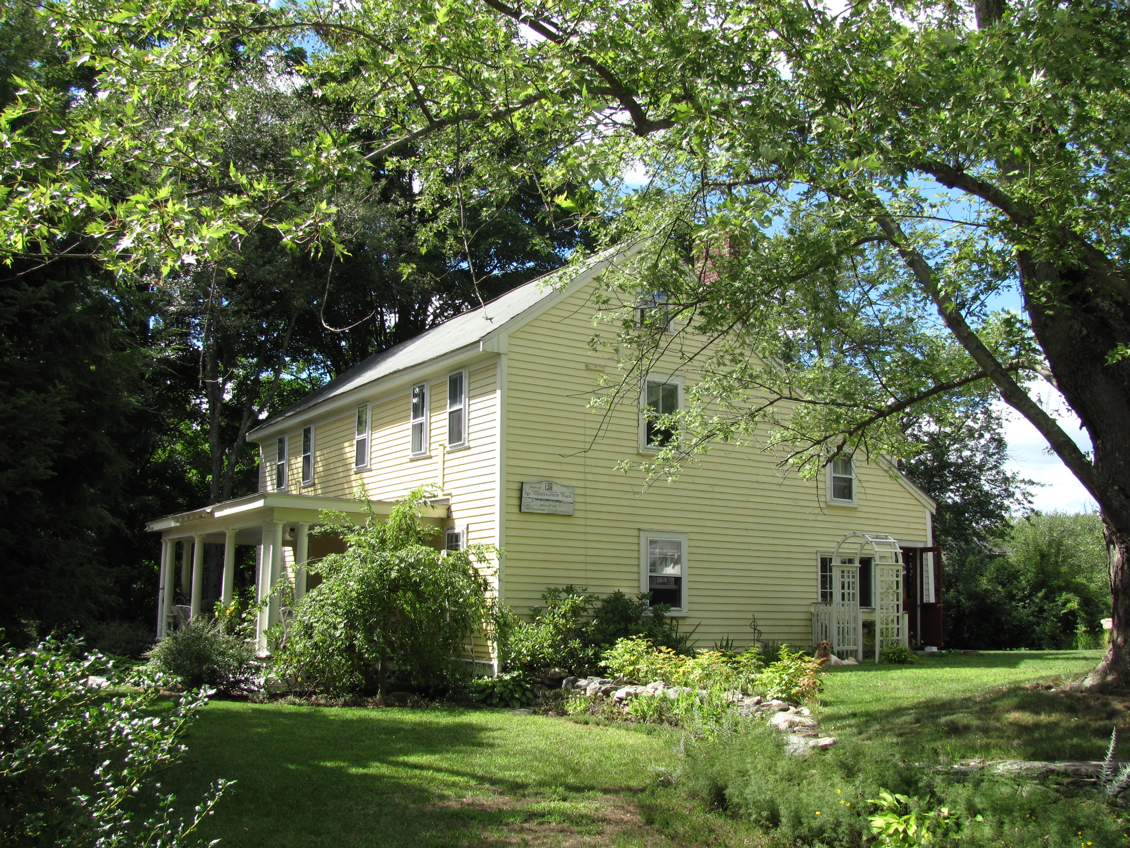
Christopher Page House |
 |
01990-03-09 March 9, 1990 |
50 Old Billerica Rd.
42°29′47.0″N 71°15′31.7″W / 42.49639°N 71.258806°W / 42.49639; -71.258806 (Page, Christopher, House) |
Bedford |
|
| 153 |
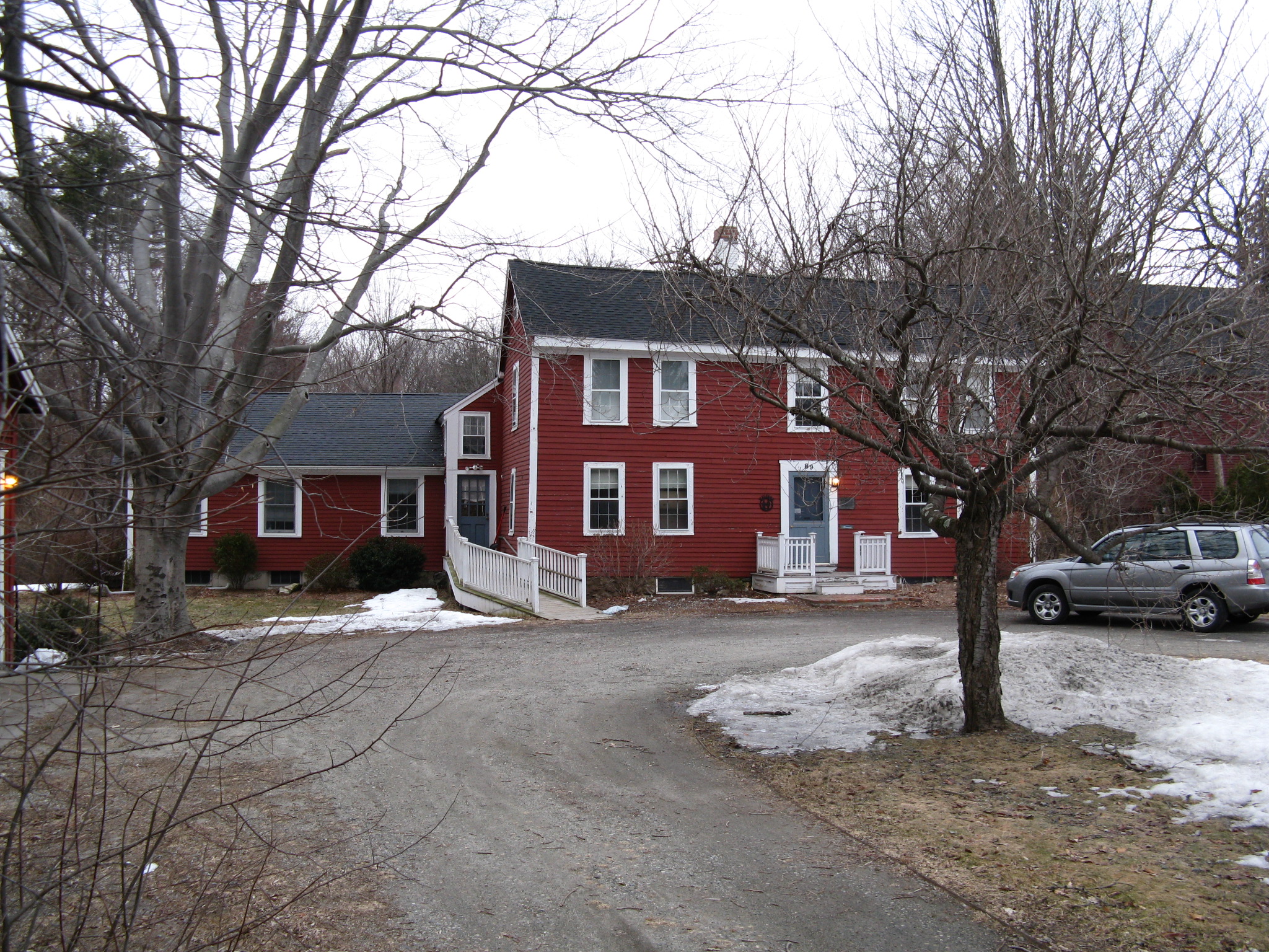
Nathaniel Page House |
 |
01978-03-29 March 29, 1978 |
89 Page Rd.
42°29′37″N 71°15′48″W / 42.49361°N 71.26333°W / 42.49361; -71.26333 (Page, Nathaniel, House) |
Bedford |
|
| 154 |
Parker Village Historic District |
 |
02002-12-27 December 27, 2002 |
Concord, Carlisle, Old Lowell, and Griffin Rds.
42°32′56″N 71°25′1″W / 42.54889°N 71.41694°W / 42.54889; -71.41694 (Parker Village Historic District) |
Westford |
|
| 155 |
James Parker House |
|
01988-02-25 February 25, 1988 |
R.R. 1, Box 30 Center Rd.
42°33′36″N 71°39′32″W / 42.56°N 71.65889°W / 42.56; -71.65889 (Parker, James, House) |
Shirley |
|
| 156 |
The Parsonage |
 |
01971-11-11 November 11, 1971 |
16 Pleasant St.
42°16′15″N 71°18′54″W / 42.27083°N 71.315°W / 42.27083; -71.315 (Parsonage, The) |
Natick |
National Historic Landmark |
| 157 |
Edward Peirce House-Henderson House of Northeastern University |
 |
01997-08-19 August 19, 1997 |
99 Westcliff Rd.
42°19′23″N 71°17′52″W / 42.32306°N 71.29778°W / 42.32306; -71.29778 (Peirce, Edward, House–Henderson House of Northeastern University) |
Weston |
|
| 158 |
Pepperell Center Historic District |
 |
01994-08-05 August 5, 1994 |
Roughly, along Park, Main, Elm, Townsend and Heald Sts.
42°40′1″N 71°35′55″W / 42.66694°N 71.59861°W / 42.66694; -71.59861 (Pepperell Center Historic District) |
Pepperell |
|
| 159 |
Pleasant Street Historic District |
 |
01979-06-12 June 12, 1979 |
Irregular Pattern along Pleasant St.
42°23′54″N 71°10′36″W / 42.39833°N 71.17667°W / 42.39833; -71.17667 (Pleasant Street Historic District) |
Belmont |
|
| 160 |
Pleasant Street School |
 |
01986-01-23 January 23, 1986 |
Pleasant St.
42°33′51″N 71°35′15″W / 42.56417°N 71.5875°W / 42.56417; -71.5875 (Pleasant Street School) |
Ayer |
|
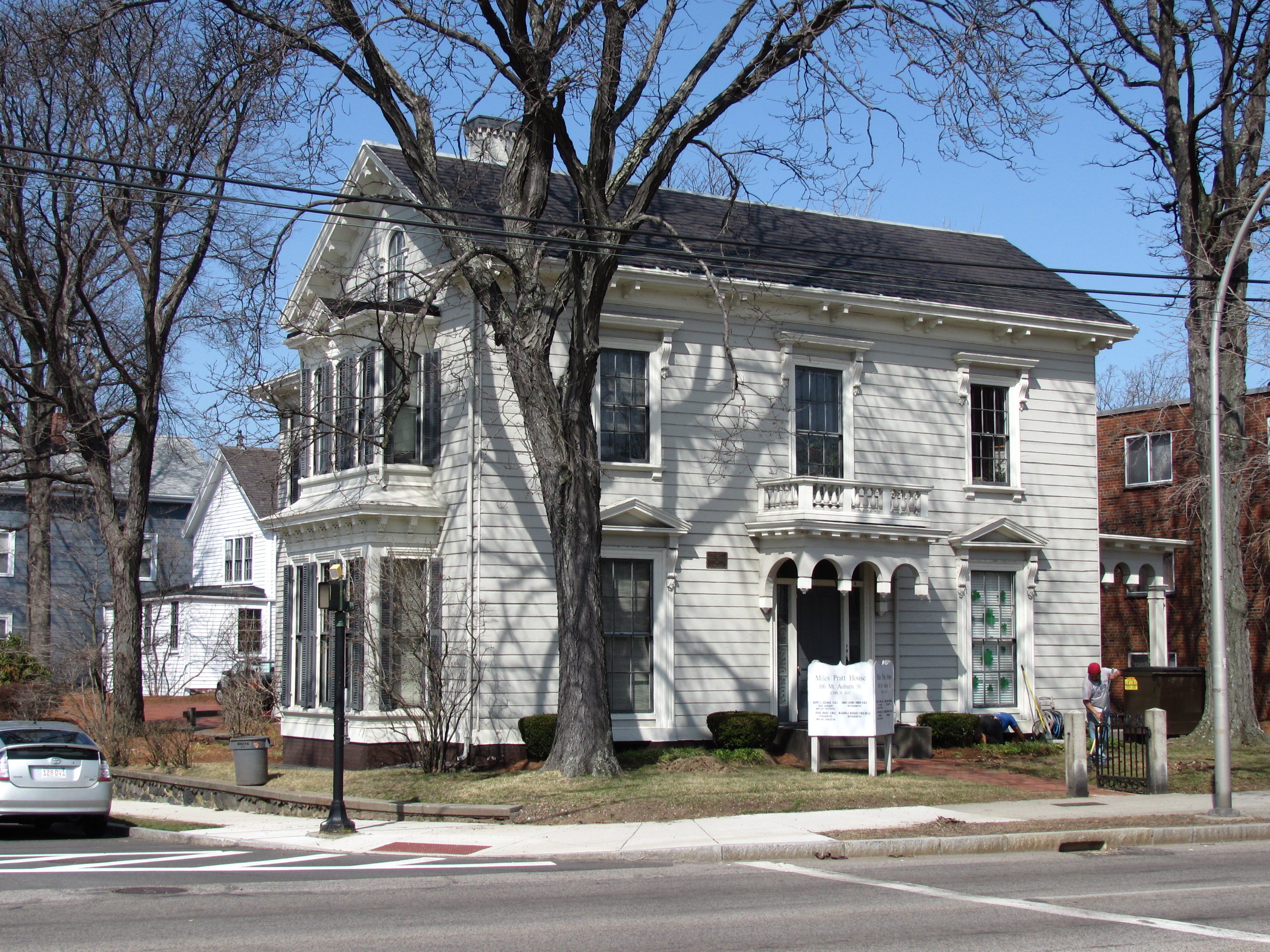
| 161 |
Miles Pratt House |
 |
01985-05-09 May 9, 1985 |
106 Mt. Auburn St.
42°22′3″N 71°10′49″W / 42.3675°N 71.18028°W / 42.3675; -71.18028 (Pratt, Miles, House) |
Watertown |
|
| 162 |
John Proctor House |
 |
01993-02-04 February 4, 1993 |
218 Concord Rd.
42°33′7″N 71°25′44″W / 42.55194°N 71.42889°W / 42.55194; -71.42889 (Proctor, John, House) |
Westford |
|
| 163 |
Rev. Daniel Putnam House |
 |
01990-03-09 March 9, 1990 |
27 Bow St.
42°34′27″N 71°4′40″W / 42.57417°N 71.07778°W / 42.57417; -71.07778 (Putnam, Rev. Daniel, House) |
North Reading |
|
| 164 |
Randall-Hale Homestead |
 |
01996-03-22 March 22, 1996 |
6 Sudbury Rd.
42°24′28″N 71°31′26″W / 42.40778°N 71.52389°W / 42.40778; -71.52389 (Randall–Hale Homestead) |
Stow |
|
| 165 |
Red Top |
 |
01971-11-11 November 11, 1971 |
90 Somerset St.
42°24′1″N 71°10′46″W / 42.40028°N 71.17944°W / 42.40028; -71.17944 (Red Top) |
Belmont |
National Historic Landmark |
| 166 |
Reed-Wood Place |
 |
02000-09-14 September 14, 2000 |
20 Meetinghouse Rd.
42°32′47″N 71°28′20″W / 42.54639°N 71.47222°W / 42.54639; -71.47222 (Reed–Wood Place) |
Littleton |
|
| 167 |
Revere Beach Parkway-Metropolitan Park System of Greater Boston |
 |
02007-12-06 December 6, 2007 |
Revere Beach Pkwy
42°24′15.79″N 71°1′49.3″W / 42.4043861°N 71.030361°W / 42.4043861; -71.030361 (Revere Beach Parkway-Metropolitan Park System of Greater Boston) |
Everett, Medford, and Chelsea |
|
| 168 |
George Robbins House |
 |
01990-03-09 March 9, 1990 |
523 Curve St.
42°33′11″N 71°21′5″W / 42.55306°N 71.35139°W / 42.55306; -71.35139 (Robbins, George, House) |
Carlisle |
|
| 169 |
John Robbins House |
 |
02003-07-25 July 25, 2003 |
144 Great Rd.
42°28′58.56″N 71°24′57.38″W / 42.4829333°N 71.4159389°W / 42.4829333; -71.4159389 (Robbins, John, House) |
Acton |
|
| 170 |
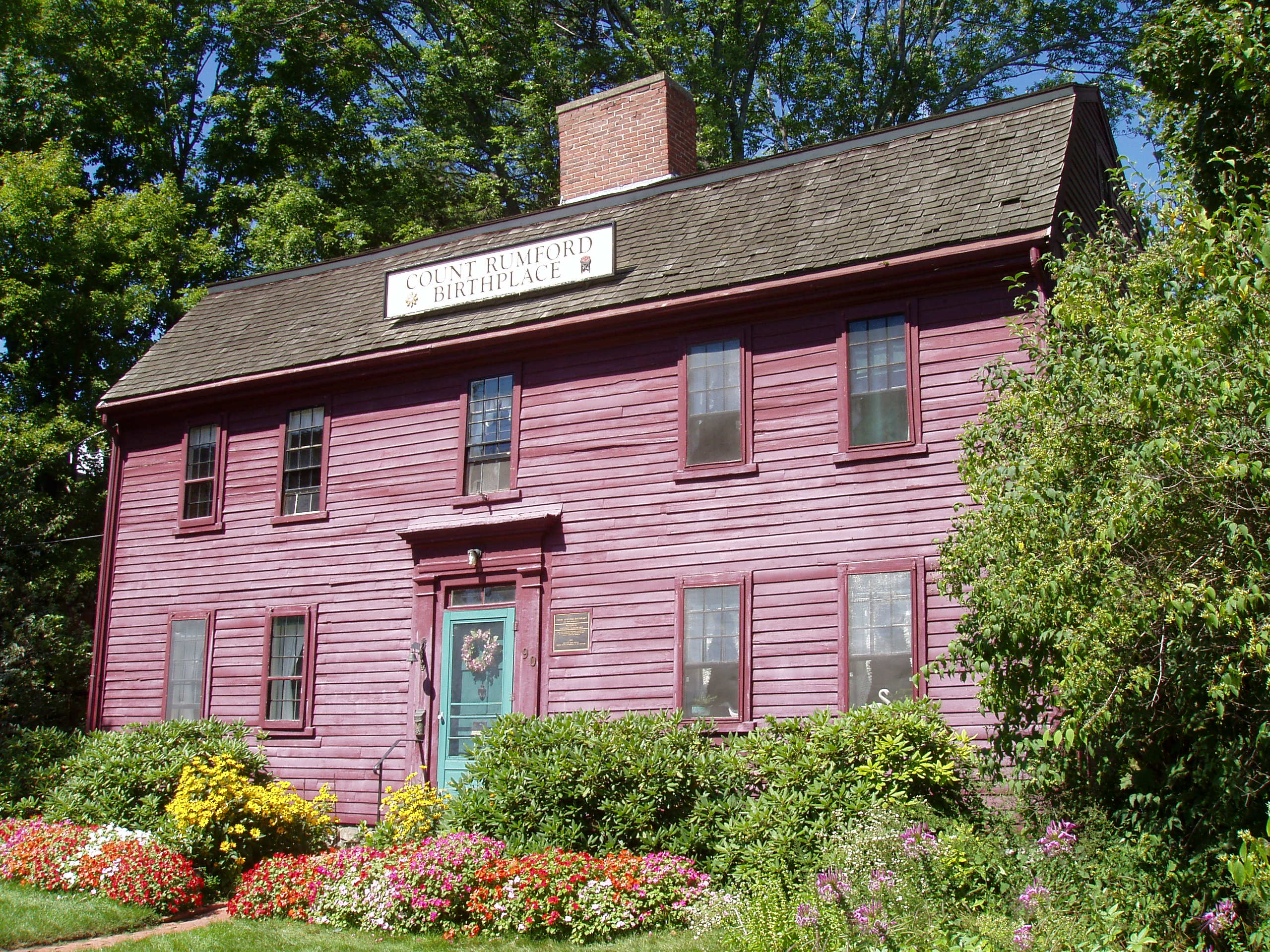
Count Rumford Birthplace |
 |
01975-05-15 May 15, 1975 |
90 Elm St.
42°28′45″N 71°8′50″W / 42.47917°N 71.14722°W / 42.47917; -71.14722 (Rumford, Count, Birthplace) |
Woburn |
National Historic Landmark |
| 171 |
Russian Cemetery |
 |
02005-11-25 November 25, 2005 |
Patten Rd.
42°34′41″N 71°28′17″W / 42.57806°N 71.47139°W / 42.57806; -71.47139 (Russian Cemetery) |
Westford |
|
| 172 |
Sabbath Day House |
 |
01973-08-14 August 14, 1973 |
20 Andover Rd.
42°33′39″N 71°16′3″W / 42.56083°N 71.2675°W / 42.56083; -71.2675 (Sabbath Day House) |
Billerica |
|
| 173 |
Saint John's Episcopal Church |
 |
01990-01-12 January 12, 1990 |
Maynard Rd. and Church St.
42°17′50″N 71°26′21″W / 42.29722°N 71.43917°W / 42.29722; -71.43917 (Saint John's Episcopal Church) |
Framingham |
Now the Ecumenical Center at Framingham State University. |
| 174 |
St. Paul's Parish Church |
 |
02001-09-28 September 28, 2001 |
26 Washington St.
42°25′54″N 71°4′37″W / 42.43167°N 71.07694°W / 42.43167; -71.07694 (St. Paul's Parish Church) |
Malden |
|
| 175 |
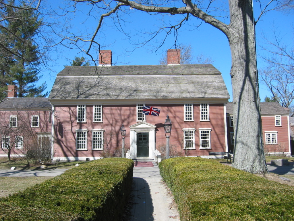
Sanderson House and Munroe Tavern |
 |
01976-04-26 April 26, 1976 |
1314 and 1332 Massachusetts Ave.
42°26′30″N 71°13′0″W / 42.44167°N 71.216667°W / 42.44167; -71.216667 (Sanderson House and Munroe Tavern) |
Lexington |
|
| 176 |
Saxonville Historic District |
 |
01992-08-20 August 20, 1992 |
Roughly along Elm, Danforth, Central, Water and Concord Sts.
42°19′29″N 71°24′4″W / 42.32472°N 71.40111°W / 42.32472; -71.40111 (Saxonville Historic District) |
Framingham |
|
| 177 |
Shawsheen Cemetery |
 |
02007-06-12 June 12, 2007 |
Great Rd. and Shawsheen Rd.
42°29′7.99″N 71°15′33.2″W / 42.4855528°N 71.259222°W / 42.4855528; -71.259222 (Shawsheen Cemetery) |
Bedford |
|
| 178 |
Warren E. Sherburne House |
 |
01977-12-02 December 2, 1977 |
11 Percy Rd.
42°26′32″N 71°13′13″W / 42.44222°N 71.22028°W / 42.44222; -71.22028 (Sherburne, Warren E., House) |
Lexington |
|
| 179 |
Shirley Center Historic District |
 |
01988-09-01 September 1, 1988 |
Brown, Center, Horsepond, Parker, and Whitney Rds.
42°34′18″N 71°39′3″W / 42.57167°N 71.65083°W / 42.57167; -71.65083 (Shirley Center Historic District) |
Shirley |
|
| 180 |
Shirley Shaker Village |
 |
01976-05-24 May 24, 1976 |
South of Shirley on Harvard Rd.
42°31′35″N 71°39′6″W / 42.52639°N 71.65167°W / 42.52639; -71.65167 (Shirley Shaker Village) |
Shirley |
|
| 181 |
Shirley Village Historic District |
|
01992-01-23 January 23, 1992 |
Roughly bounded by Center, Harvard, Leominster and Shaker Rds.
42°32′33″N 71°39′7″W / 42.5425°N 71.65194°W / 42.5425; -71.65194 (Shirley Village Historic District) |
Shirley |
|
| 182 |
Silver Hill Historic District |
 |
02004-08-25 August 25, 2004 |
Silver Hill, Westland Rds., Merriam St.
42°23′34″N 71°18′18″W / 42.39278°N 71.305°W / 42.39278; -71.305 (Silver Hill Historic District) |
Weston |
|
| 183 |
Simonds Tavern |
 |
01976-10-14 October 14, 1976 |
331 Bedford St.
42°28′3″N 71°14′36″W / 42.4675°N 71.24333°W / 42.4675; -71.24333 (Simonds Tavern) |
Lexington |
|
| 184 |
Zeb Spaulding House |
 |
01990-03-09 March 9, 1990 |
1044 Lowell Rd.
42°33′25″N 71°21′13″W / 42.55694°N 71.35361°W / 42.55694; -71.35361 (Spaulding, Zeb, House) |
Carlisle |
|
| 185 |
Stone Building |
 |
01976-04-30 April 30, 1976 |
735 Massachusetts Ave.
42°25′46″N 71°12′26″W / 42.42944°N 71.20722°W / 42.42944; -71.20722 (Stone Building) |
Lexington |
|
| 186 |
Sudbury Aqueduct Linear District |
 |
01990-01-18 January 18, 1990 |
Along Sudbury Aqueduct from Farm Pond at Waverly St. (Framingham) to Chestnut Hill Reservoir (Newton)
42°17′33″N 71°18′44″W / 42.2925°N 71.31222°W / 42.2925; -71.31222 (Sudbury Aqueduct Linear District) |
Framingham, Sherborn, Natick, Newton |
Extends into Wellesley and Needham in Norfolk County. |
| 187 |
Sudbury Center Historic District |
 |
01976-07-14 July 14, 1976 |
Concord and Old Sudbury Rds.
42°22′53″N 71°24′18″W / 42.38139°N 71.405°W / 42.38139; -71.405 (Sudbury Center Historic District) |
Sudbury |
|
| 188 |
Sudbury Dam Historic District |
|
01990-01-18 January 18, 1990 |
Southeastern end of Sudbury Reservoir off MA 30
42°18′21″N 71°29′30″W / 42.30583°N 71.49167°W / 42.30583; -71.49167 (Sudbury Dam Historic District) |
Framingham |
Extends into Southborough, Worcester County. |
| 189 |
Tenney Homestead |
 |
01990-03-09 March 9, 1990 |
156 Taylor Rd.
42°26′51″N 71°30′52″W / 42.4475°N 71.51444°W / 42.4475; -71.51444 (Tenney Homestead) |
Stow |
|
| 190 |
Tewksbury State Hospital |
 |
01994-01-21 January 21, 1994 |
Junction of East and Livingston Sts.
42°36′31″N 71°12′43″W / 42.60861°N 71.21194°W / 42.60861; -71.21194 (Tewksbury State Hospital) |
Tewksbury |
|
| 191 |
Town Diner |
 |
01999-09-22 September 22, 1999 |
627 Mount Auburn St.
42°22′15″N 71°9′31″W / 42.37083°N 71.15861°W / 42.37083; -71.15861 (Town Diner) |
Watertown |
|
| 192 |
Samuel Train House |
 |
01976-12-12 December 12, 1976 |
342 Winter St.
42°19′20″N 71°19′31″W / 42.32222°N 71.32528°W / 42.32222; -71.32528 (Train, Samuel, House) |
Weston |
|
| 193 |
Trinity Episcopal Church |
 |
01995-05-26 May 26, 1995 |
131 W. Emerson St.
42°27′34″N 71°4′9″W / 42.45944°N 71.06917°W / 42.45944; -71.06917 (Trinity Episcopal Church) |
Melrose |
|
| 194 |
Two Brothers Rocks-Dudley Road Historic District |
 |
02010-09-23 September 23, 2010 |
Roughly Dudley Rd. between Chestnut Lane and Emery Rd., Bedford
42°31′0″N 71°17′50″W / 42.516667°N 71.29722°W / 42.516667; -71.29722 (Two Brothers Rocks-Dudley Road Historic District (south end))
and Timbercreek Lane, Billerica, from Massachusetts Route 4 to the Concord River
42°31′56″N 71°17′47″W / 42.53222°N 71.29639°W / 42.53222; -71.29639 (Two Brothers Rocks-Dudley Road Historic District (north end)) |
Bedford and Billerica |
|
| 195 |
Col. Jonathan Tyng House |
Demolished |
01977-08-19 August 19, 1977 |
80 Tyng Rd.
42°39′37″N 71°24′28″W / 42.66028°N 71.40778°W / 42.66028; -71.40778 (Tyng, Col. Jonathan, House) |
Tyngsborough |
|
| 196 |
Phineas Upham House |
 |
01990-03-09 March 9, 1990 |
255 Upham St.
42°26′56″N 71°3′11″W / 42.44889°N 71.05306°W / 42.44889; -71.05306 (Upham, Phineas, House) |
Melrose |
|
| 197 |
US Post Office-Lexington Main |
 |
01986-06-26 June 26, 1986 |
1661 Massachusetts Ave.
42°26′49″N 71°13′32″W / 42.44694°N 71.22556°W / 42.44694; -71.22556 (US Post Office-Lexington Main) |
Lexington |
|
| 198 |
US Post Office-Woburn Center Station |
 |
01987-10-19 October 19, 1987 |
2 Abbott St.
42°28′53″N 71°4′9″W / 42.48139°N 71.06917°W / 42.48139; -71.06917 (US Post Office-Woburn Center Station) |
Woburn |
|
| 199 |
Wachusett Aqueduct Linear District |
|
01990-01-18 January 18, 1990 |
Along Wachusett Aqueduct from Wachusett Reservoir to Sudbury Reservoir
42°20′1″N 71°35′27″W / 42.33361°N 71.59083°W / 42.33361; -71.59083 (Wachusett Aqueduct Linear District) |
Framingham, Marlborough |
Extends into Worcester County. |
| 200 |
Waitt Brick Block |
 |
01982-11-12 November 12, 1982 |
422–424 Main St.
42°25′35″N 71°4′5″W / 42.42639°N 71.06806°W / 42.42639; -71.06806 (Waitt Brick Block) |
Malden |
|
| 201 |
Walcott-Whitney House |
 |
01990-03-09 March 9, 1990 |
137 Tuttle Ln.
42°27′5″N 71°29′10″W / 42.45139°N 71.48611°W / 42.45139; -71.48611 (Walcott–Whitney House) |
Stow |
|
| 202 |
Watertown Arsenal Historic District |
 |
01999-05-14 May 14, 1999 |
Arsenal St.
42°21′44″N 71°9′58″W / 42.36222°N 71.16611°W / 42.36222; -71.16611 (Watertown Arsenal Historic District) |
Watertown |
|
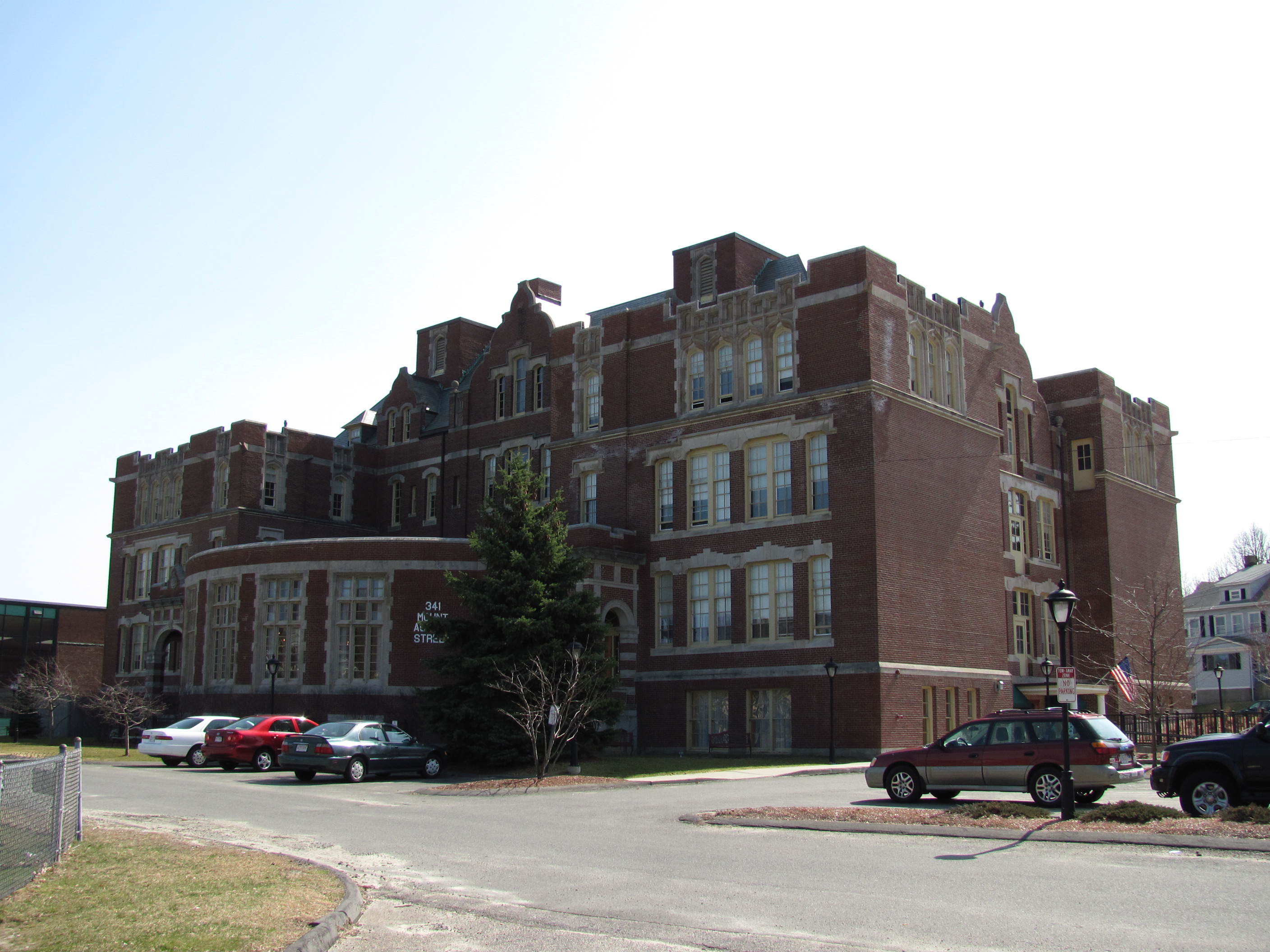
| 203 |
Old Watertown High School |
 |
02006-09-22 September 22, 2006 |
341 Mount Auburn St.
42°22′8″N 71°10′13″W / 42.36889°N 71.17028°W / 42.36889; -71.17028 (Watertown High School, Old) |
Watertown |
|
| 204 |
Wayland Center Historic District |
 |
01974-09-06 September 6, 1974 |
Irregular pattern along both sides of U.S. Route 20 and MA 27
42°21′49″N 71°21′35″W / 42.36361°N 71.35972°W / 42.36361; -71.35972 (Wayland Center Historic District) |
Wayland |
|
| 205 |
Wayside Inn Historic District |
 |
01973-04-23 April 23, 1973 |
Old Boston Post Rd.
42°21′28″N 71°28′5″W / 42.35778°N 71.46806°W / 42.35778; -71.46806 (Wayside Inn Historic District) |
Sudbury |
|
| 206 |
Wellington Farm Historic District |
 |
01988-04-14 April 14, 1988 |
487–500 Wellesley St.
42°19′58″N 71°18′25″W / 42.33278°N 71.30694°W / 42.33278; -71.30694 (Wellington Farm Historic District) |
Weston |
|
| 207 |
West School |
 |
02006-05-17 May 17, 2006 |
106 Bedford St.
42°30′22.41″N 71°13′9.84″W / 42.506225°N 71.2194°W / 42.506225; -71.2194 (West School) |
Burlington |
|
| 208 |
West Schoolhouse |
 |
01990-02-21 February 21, 1990 |
Shawsheen Ave. at Aldrich Rd.
42°33′22″N 71°11′25″W / 42.55611°N 71.19028°W / 42.55611; -71.19028 (West Schoolhouse) |
Wilmington |
|
| 209 |
Westford Center Historic District |
 |
01998-08-28 August 28, 1998 |
Roughly along Graniteville Rd., Main St., Lincoln St., and Depot St.
42°34′50″N 71°26′19″W / 42.58056°N 71.43861°W / 42.58056; -71.43861 (Westford Center Historic District) |
Westford |
|
| 210 |
Westford Town Farm |
 |
02008-03-14 March 14, 2008 |
35 Town Farm Rd.
42°35′11″N 71°28′44″W / 42.58639°N 71.47889°W / 42.58639; -71.47889 (Westford Town Farm) |
Westford |
|
| 211 |
Westlawn Cemetery |
 |
02005-01-05 January 5, 2005 |
Concord Rd.
42°34′16″N 71°28′2″W / 42.57111°N 71.46722°W / 42.57111; -71.46722 (Westlawn Cemetery) |
Westford |
|
| 212 |
Weston Aqueduct Linear District |
 |
01990-01-18 January 18, 1990 |
Along the Weston Aqueduct from the Sudbury Reservoir to the Weston Reservoir
42°20′0″N 71°22′32″W / 42.333333°N 71.37556°W / 42.333333; -71.37556 (Weston Aqueduct Linear District) |
Weston, Wayland, Framingham |
Extends into Southborough, Worcester County. |
| 213 |
Levi Wetherbee Farm |
 |
02006-12-12 December 12, 2006 |
484 Middle Rd.
42°29′26.94″N 71°31′23.09″W / 42.4908167°N 71.5230806°W / 42.4908167; -71.5230806 (Wetherbee House) |
Boxborough |
|
| 214 |
Whit's Diner |
 |
02003-12-04 December 4, 2003 |
184A Fountain St.
42°16′31″N 71°26′2″W / 42.27528°N 71.43389°W / 42.27528; -71.43389 (Whit's Diner) |
Framingham |
|
| 215 |
Wilmington Centre Village Historic District |
 |
01992-04-08 April 8, 1992 |
Roughly Middlesex Dr. and Church St. from Adams St. to Wildwood Cemetery
42°33′22″N 71°9′52″W / 42.55611°N 71.16444°W / 42.55611; -71.16444 (Wilmington Centre Village Historic District) |
Wilmington |
|
| 216 |
Wilson Mill-Old Burlington Road District |
 |
02003-08-18 August 18, 2003 |
Old Burlington Rd. and Wilson Rd.
42°30′4.33″N 71°14′46.36″W / 42.5012028°N 71.2462111°W / 42.5012028; -71.2462111 (Wilson Mill–Old Burlington Road District) |
Bedford |
|
| 217 |
Henry Wilson Shoe Shop |
 |
02000-08-24 August 24, 2000 |
181 W. Central St.
42°16′58″N 71°22′55″W / 42.28278°N 71.38194°W / 42.28278; -71.38194 (Wilson, Henry, Shoe Shop) |
Natick |
|
| 218 |
Woburn Public Library |
 |
01976-11-13 November 13, 1976 |
Pleasant St.
42°28′44″N 71°9′18″W / 42.47889°N 71.155°W / 42.47889; -71.155 (Woburn Public Library) |
Woburn |
National Historic Landmark |
| 219 |
Woods End Road Historic District |
 |
01988-07-08 July 8, 1988 |
68 Baker Bridge Rd. and 1, 5, 9, and 10 Woods End Rd.
42°25′36″N 71°19′41″W / 42.42667°N 71.32806°W / 42.42667; -71.32806 (Woods End Road Historic District) |
Lincoln |
|
| 220 |
Rev. Samuel Woodward House |
 |
01976-10-08 October 8, 1976 |
19 Concord Rd.
42°22′5″N 71°18′21″W / 42.36806°N 71.30583°W / 42.36806; -71.30583 (Woodward, Rev. Samuel, House) |
Weston |
|
| 221 |
Wright Cemetery |
 |
02005-12-06 December 6, 2005 |
Groton Rd.
42°36′32″N 71°28′3″W / 42.60889°N 71.4675°W / 42.60889; -71.4675 (Wright Cemetery) |
Westford |
|
| 222 |
Francis Wyman House |
 |
01975-03-17 March 17, 1975 |
56 Francis Wyman St.
42°31′6″N 71°13′31″W / 42.51833°N 71.22528°W / 42.51833; -71.22528 (Wyman, Francis, House) |
Burlington |
|
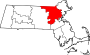
 Location of Middlesex County in Massachusetts