- Manning Manse
-
Manning Manse


Location: Billerica, Massachusetts Coordinates: 42°35′3″N 71°18′7″W / 42.58417°N 71.30194°WCoordinates: 42°35′3″N 71°18′7″W / 42.58417°N 71.30194°W Built: 1696 Architect: Manning,Samuel Architectural style: Colonial Governing body: Private NRHP Reference#: 82001912
[1]Added to NRHP: August 11, 1982 Manning Manse, built in 1696, is a historic house at 56 Chelmsford Road in North Billerica, Massachusetts.
It was added to the National Register of Historic Places in 1982.
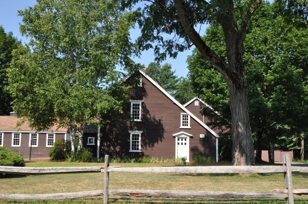
The Manning Manse was constructed in 1696 by Samuel Manning. The house is a wood frame structure, and stands on the south side of Chelmsford Road (MA Rte 129), about a quarter mile east of exit 29 from U.S. Route 3 (which connects Boston and Lowell).
The house faces south, following the style of the period in which it was built, and as a result has its back to the road. It is a two story building with a large central chimney. There are three fireplaces served by this chimney, facing three different ground floor rooms. The fourth side of this chimney is occupied by an elaborate stair leading from the entrance foyer to the second floor. There is a modern wing, extending away from the road, of only one story. The original house measured 41 feet along the road, and 31 feet from front to back. The front is a full two stories tall, with a roof which slopes sharply down to the rear (toward the road), giving the structure a kind of lean-to appearance when seen from the road. Land in the vicinity of the Manse is known as the Warren H. Manning State Forest. Warren H. Manning was a direct descendant of Samuel Manning. He was born in 1860 at Reading, Mass. In his life he became famous in New England as an authority on botanical topics, and he was a dedicated forester. In 1899 and 1900 he was instrumental in efforts to preserve the Manse, and was a founder of the Manning Association which owns the house today.
It is the place where Minutemen from New Hampshire stayed before and after the Battles of Lexington and Concord in April 1775. It was nearly destroyed by a fire in 1994. Today this tavern is rented by a private business operating a restaurant and lounge.
See also
References
- ^ "National Register Information System". National Register of Historic Places. National Park Service. 2008-04-15. http://nrhp.focus.nps.gov/natreg/docs/All_Data.html.
U.S. National Register of Historic Places Topics Lists by states Alabama • Alaska • Arizona • Arkansas • California • Colorado • Connecticut • Delaware • Florida • Georgia • Hawaii • Idaho • Illinois • Indiana • Iowa • Kansas • Kentucky • Louisiana • Maine • Maryland • Massachusetts • Michigan • Minnesota • Mississippi • Missouri • Montana • Nebraska • Nevada • New Hampshire • New Jersey • New Mexico • New York • North Carolina • North Dakota • Ohio • Oklahoma • Oregon • Pennsylvania • Rhode Island • South Carolina • South Dakota • Tennessee • Texas • Utah • Vermont • Virginia • Washington • West Virginia • Wisconsin • WyomingLists by territories Lists by associated states Other  Category:National Register of Historic Places •
  Portal:National Register of Historic PlacesCategories:
- Buildings and structures completed in 1696
- Houses on the National Register of Historic Places in Massachusetts
- Houses in Middlesex County, Massachusetts
- Billerica, Massachusetts

Wikimedia Foundation. 2010.