The locations of National Register properties and districts (at least for all showing latitude and longitude coordinates below) may be seen in a Google map by clicking on "Map of all coordinates".[1]
|
Landmark name |
Image |
Date listed |
Location |
Summary |
| 1 |
Albert Ayer House |
 |
01989-07-05 July 5, 1989 |
8 Brooks St.
42°26′29″N 71°8′18″W / 42.44139°N 71.13833°W / 42.44139; -71.13833 (Ayer, Albert, House) |
|
| 2 |
Thomas Ayer House |
 |
01989-07-05 July 5, 1989 |
8 Grove St.
42°26′31″N 71°8′15″W / 42.44194°N 71.1375°W / 42.44194; -71.1375 (Ayer, Thomas, House) |
|
| 3 |
Robert Bacon House |
 |
01989-07-05 July 5, 1989 |
6 Mystic Valley Parkway
42°26′36″N 71°8′34″W / 42.44333°N 71.14278°W / 42.44333; -71.14278 (Bacon, Robert, House) |
|
| 4 |
Kenelum Baker House |
 |
01989-07-05 July 5, 1989 |
4 Norwood St.
42°26′57″N 71°8′42″W / 42.44917°N 71.145°W / 42.44917; -71.145 (Baker, Kenelum, House) |
|
| 5 |
Edward A. Brackett House |
 |
01989-07-05 July 5, 1989 |
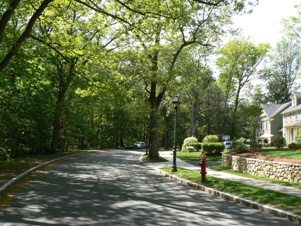
290 Highland Ave.
42°27′0″N 71°7′45″W / 42.45°N 71.12917°W / 42.45; -71.12917 (Brackett, Edward A., House) |
|
| 6 |
Edward Braddock House |
 |
01989-07-05 July 5, 1989 |
112 Highland Ave.
42°27′41″N 71°7′27″W / 42.46139°N 71.12417°W / 42.46139; -71.12417 (Braddock, Edward, House) |
|
| 7 |
George Brine House |
 |
01989-07-05 July 5, 1989 |
219 Washington St.
42°27′22″N 71°7′51″W / 42.45611°N 71.13083°W / 42.45611; -71.13083 (Brine, George, House) |
|
| 8 |
Carr-Jeeves House |
 |
01989-08-02 August 2, 1989 |
57 Lake St.
42°27′23″N 71°8′30″W / 42.45639°N 71.14167°W / 42.45639; -71.14167 (Carr-Jeeves House) |
|
| 9 |
Webster Childs House |
 |
01989-07-05 July 5, 1989 |
9 Meadowcroft Rd.
42°26′49″N 71°8′27″W / 42.44694°N 71.14083°W / 42.44694; -71.14083 (Childs, Webster, House) |
|
| 10 |
Cole House |
 |
01989-07-05 July 5, 1989 |
12 Mason St.
42°26′59″N 71°7′47″W / 42.44972°N 71.12972°W / 42.44972; -71.12972 (Cole House) |
|
| 11 |
DeRochmont House |
 |
01989-07-05 July 5, 1989 |
2–4 Rangeley Rd.
42°27′3″N 71°8′23″W / 42.45083°N 71.13972°W / 42.45083; -71.13972 (DeRochmont House) |
|
| 12 |
Dike-Orne House |
 |
01989-07-05 July 5, 1989 |
257 Forest St.
42°28′23″N 71°6′47″W / 42.47306°N 71.11306°W / 42.47306; -71.11306 (Dike-Orne House) |
|
| 13 |
Edmund Dwight House |
 |
01989-07-05 July 5, 1989 |
5 Cambridge St.
42°26′10″N 71°9′15″W / 42.43611°N 71.15417°W / 42.43611; -71.15417 (Dwight, Edmund, House) |
|
| 14 |
Samuel Elder House |
 |
01989-07-05 July 5, 1989 |
38 Rangeley Rd.
42°26′51″N 71°8′30″W / 42.4475°N 71.14167°W / 42.4475; -71.14167 (Elder, Samuel, House) |
|
| 15 |
Everett Avenue-Sheffield Road Historic District |
 |
01989-07-05 July 5, 1989 |
Roughly bounded by Bacon St., Mystic Valley Parkway, Mystic Lake, Niles Ln., Everett Ave., Sheffield Rd., and Church St.
42°26′43″N 71°8′49″W / 42.44528°N 71.14694°W / 42.44528; -71.14694 (Everett Avenue--Sheffield Road Historic District) |
|
| 16 |
Firth-Glengarry Historic District |
 |
01989-07-05 July 5, 1989 |
Roughly bounded by Pine St., Grassmere Ave., Dix St., and Wildwood St.
42°27′5″N 71°8′38″W / 42.45139°N 71.14389°W / 42.45139; -71.14389 (Firth--Glengarry Historic District) |
|
| 17 |
Edward Gardner House |
 |
01989-07-05 July 5, 1989 |
89 Cambridge St.
42°26′39″N 71°9′8″W / 42.44417°N 71.15222°W / 42.44417; -71.15222 (Gardner, Edward, House) |
|
| 18 |
O. W. Gardner House |
 |
01989-07-05 July 5, 1989 |
5 Myrtle St.
42°27′8″N 71°7′59″W / 42.45222°N 71.13306°W / 42.45222; -71.13306 (Gardner, O. W., House) |
|
| 19 |
Patience and Sarah Gardner House |
 |
01989-07-05 July 5, 1989 |
103–105 Cambridge St.
42°26′40″N 71°9′8″W / 42.44444°N 71.15222°W / 42.44444; -71.15222 (Gardner, Patience and Sarah, House) |
|
| 20 |
Ginn Carriage House |
 |
01989-07-05 July 5, 1989 |
24 Ginn Rd.
42°26′48″N 71°8′28″W / 42.44667°N 71.14111°W / 42.44667; -71.14111 (Ginn Carriage House) |
|
| 21 |
Ginn Gardener's House |
 |
01989-07-05 July 5, 1989 |
22 Ginn Rd.
42°26′47″N 71°8′26″W / 42.44639°N 71.14056°W / 42.44639; -71.14056 (Ginn Gardener's House) |
|
| 22 |
Henry Grover House |
 |
01989-07-05 July 5, 1989 |
223–225 Cambridge St.
42°27′13″N 71°9′31″W / 42.45361°N 71.15861°W / 42.45361; -71.15861 (Grover, Henry, House) |
|
| 23 |
Horace Hatch House |
 |
01989-07-05 July 5, 1989 |
26 Grove St.
42°26′27″N 71°8′27″W / 42.44083°N 71.14083°W / 42.44083; -71.14083 (Hatch, Horace, House) |
|
| 24 |
Hovey-Winn House |
 |
01989-07-05 July 5, 1989 |
384 Main St.
42°26′51″N 71°8′6″W / 42.4475°N 71.135°W / 42.4475; -71.135 (Hovey-Winn House) |
|
| 25 |
Hutchinson-Blood House |
 |
01989-07-05 July 5, 1989 |
394-396 Main St.
42°26′54″N 71°8′7″W / 42.44833°N 71.13528°W / 42.44833; -71.13528 (Hutchinson-Blood House) |
|
| 26 |
Johnson-Thompson House |
 |
01989-07-05 July 5, 1989 |
201 Ridge St.
42°26′54″N 71°10′36″W / 42.44833°N 71.17667°W / 42.44833; -71.17667 (Johnson-Thompson House) |
|
| 27 |
Marshall W. Jones House |
 |
01989-07-05 July 5, 1989 |
326 Highland Ave.
42°26′53″N 71°7′46″W / 42.44806°N 71.12944°W / 42.44806; -71.12944 (Jones, Marshall W., House) |
|
| 28 |
Asa Locke House |
 |
01989-07-05 July 5, 1989 |
68 High St.
42°26′36″N 71°9′37″W / 42.44333°N 71.16028°W / 42.44333; -71.16028 (Locke, Asa, House) |
|
| 29 |
Capt. Josiah Locke House |
 |
01979-03-02 March 2, 1979 |
195 High St.
42°26′37″N 71°10′24″W / 42.44361°N 71.17333°W / 42.44361; -71.17333 (Locke, Capt. Josiah, House) |
|
| 30 |
James H. Mann House |
 |
01989-07-05 July 5, 1989 |
23 Hancock St.
42°27′24″N 71°7′44″W / 42.45667°N 71.12889°W / 42.45667; -71.12889 (Mann, James H., House) |
|
| 31 |
John Mason House |
 |
01989-07-05 July 5, 1989 |
8–10 Hillside Ave.
42°26′59″N 71°7′57″W / 42.44972°N 71.1325°W / 42.44972; -71.1325 (Mason, John, House) |
|
| 32 |
Louis N. Maxwell House |
 |
01989-07-05 July 5, 1989 |
16 Herrick St.
42°26′47″N 71°7′57″W / 42.44639°N 71.1325°W / 42.44639; -71.1325 (Maxwell, Louis N., House) |
|
| 33 |
Middlesex Canal Historic and Archaeological District |
 |
02009-11-19 November 19, 2009 |
Numerous locations along the historic route of the Middlesex Canal |
Extends into other Middlesex County communities and Boston in Suffolk County; encompasses entire Middlesex Canal route. |
| 34 |
Middlesex Fells Reservation Parkways |
 |
02003-02-04 February 4, 2003 |
E Border Rd., Fellsway E., Fellsway W., Hillcrest Parkway, South St., Pond St., S. Border Rd., Ravine Rd., and Woodland Rd.
42°26′43″N 71°6′10″W / 42.44528°N 71.10278°W / 42.44528; -71.10278 (Middlesex Fells Reservation Parkways) |
|
| 35 |
Amy B. Mitchell House |
 |
01989-07-05 July 5, 1989 |
237 Highland Ave.
42°27′12″N 71°7′47″W / 42.45333°N 71.12972°W / 42.45333; -71.12972 (Mitchell, Amy B., House) |
|
| 36 |
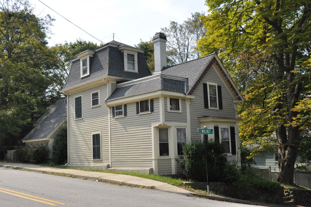
Moore House |
 |
01989-07-05 July 5, 1989 |
85 Walnut St.
42°27′4″N 71°7′49″W / 42.45111°N 71.13028°W / 42.45111; -71.13028 (Moore House) |
|
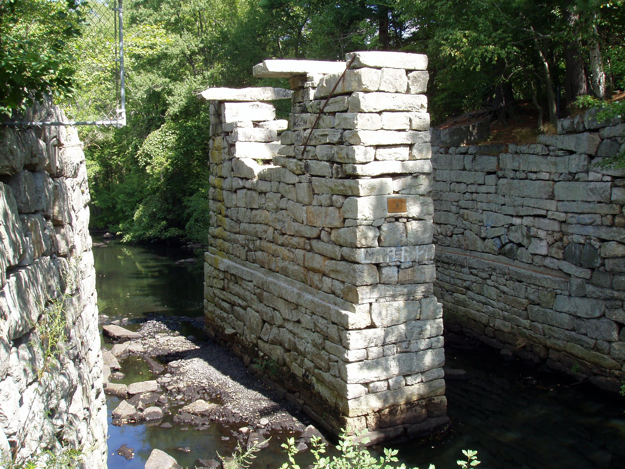
| 37 |
Mystic Dam |
 |
01990-01-18 January 18, 1990 |
Between Lower and Upper Mystic Lakes
42°25′50″N 71°8′56″W / 42.43056°N 71.14889°W / 42.43056; -71.14889 (Mystic Dam) |
|
| 38 |
Mystic Gatehouse |
 |
01990-01-18 January 18, 1990 |
East of Edgewater Pl. on the southeastern end of Upper Mystic Lake
42°25′52″N 71°8′52″W / 42.43111°N 71.14778°W / 42.43111; -71.14778 (Mystic Gatehouse) |
|
| 39 |
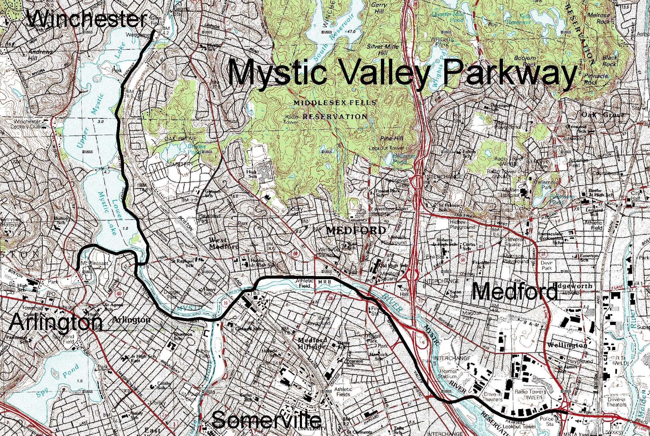
Mystic Valley Parkway, Metropolitan Park System of Greater Boston MPS |
 |
02006-01-18 January 18, 2006 |
Mystic Valley Parkway
42°25′47″N 71°7′49″W / 42.42972°N 71.13028°W / 42.42972; -71.13028 (Mystic Valley Parkway, Metropolitan Park System of Greater Boston MPS) |
Extends from Winchester
through Medford,
Arlington,
and Somerville |
| 40 |
Oak Knoll |
 |
01989-07-05 July 5, 1989 |
23 Brooks Street
42°26′25″N 71°8′21″W / 42.44028°N 71.13917°W / 42.44028; -71.13917 (Oak Knoll) |
Listed on the register at 39 Oak Knoll |
| 41 |
Parker House |
 |
01989-07-05 July 5, 1989 |
180 Mystic Valley Parkway
42°26′56″N 71°7′59″W / 42.44889°N 71.13306°W / 42.44889; -71.13306 (Parker House) |
|
| 42 |
Edmund Parker, Jr., House |
 |
01989-07-05 July 5, 1989 |
287 Cambridge St.
42°27′22″N 71°9′35″W / 42.45611°N 71.15972°W / 42.45611; -71.15972 (Parker, Edmund, Jr., House) |
|
| 43 |
Harrison Parker, Sr., House |
 |
01989-07-05 July 5, 1989 |
60 Lloyd St.
42°26′50″N 71°8′18″W / 42.44722°N 71.13833°W / 42.44722; -71.13833 (Parker, Harrison, Sr., House) |
|
| 44 |
Pressey-Eustis House |
 |
01989-07-05 July 5, 1989 |
14 Stevens St.
42°27′13″N 71°7′51″W / 42.45361°N 71.13083°W / 42.45361; -71.13083 (Pressey-Eustis House) |
|
| 45 |
Joseph Remick House |
 |
01989-07-05 July 5, 1989 |
84 Cambridge St./4 Swan Rd.
42°26′37″N 71°9′11″W / 42.44361°N 71.15306°W / 42.44361; -71.15306 (Remick, Joseph, House) |
|
| 46 |
Zachariah Richardson House |
 |
01989-07-05 July 5, 1989 |
597 Washington St.
42°28′8″N 71°7′31″W / 42.46889°N 71.12528°W / 42.46889; -71.12528 (Richardson, Zachariah, House) |
|
| 47 |
Arthur H. Russell House |
 |
01989-07-05 July 5, 1989 |
10 Mt. Pleasant St.
42°26′53″N 71°8′29″W / 42.44806°N 71.14139°W / 42.44806; -71.14139 (Russell, Arthur H., House) |
|
| 48 |
Charles Russell House |
 |
01989-07-05 July 5, 1989 |
993 Main St.
42°27′52″N 71°8′43″W / 42.46444°N 71.14528°W / 42.46444; -71.14528 (Russell, Charles, House) |
|
| 49 |
St. Mary's Catholic Church |
 |
01989-07-05 July 5, 1989 |
159 Washington St.
42°27′15″N 71°7′57″W / 42.45417°N 71.1325°W / 42.45417; -71.1325 (St. Mary's Catholic Church) |
|
| 50 |
Sanborn House |
 |
01981-12-14 December 14, 1981 |
15 High St.
42°26′44″N 71°9′24″W / 42.44556°N 71.15667°W / 42.44556; -71.15667 (Sanborn House) |
|
| 51 |
Sharon House |
 |
01989-07-05 July 5, 1989 |
403 Main St.
42°26′53″N 71°8′4″W / 42.44806°N 71.13444°W / 42.44806; -71.13444 (Sharon House) |
|
| 52 |
William Simonds House |
 |
01989-07-05 July 5, 1989 |
420 Main St.
42°26′56″N 71°8′7″W / 42.44889°N 71.13528°W / 42.44889; -71.13528 (Simonds, William, House) |
|
| 53 |
Skillings Estate House |
 |
01989-07-05 July 5, 1989 |
37 Rangeley Rd.
42°26′53″N 71°8′29″W / 42.44806°N 71.14139°W / 42.44806; -71.14139 (Skillings Estate House) |
|
| 54 |
Jacob Stanton House |
 |
01989-07-05 July 5, 1989 |
21 Washington St.
42°26′59″N 71°8′4″W / 42.44972°N 71.13444°W / 42.44972; -71.13444 (Stanton, Jacob, House) |
|
| 55 |
Edward Sullivan House |
 |
01989-07-05 July 5, 1989 |
9 Kendall St.
42°27′10″N 71°7′55″W / 42.45278°N 71.13194°W / 42.45278; -71.13194 (Sullivan, Edward, House) |
|
| 56 |
Deacon John Symmes House |
 |
01989-07-05 July 5, 1989 |
212-214 Main St.
42°26′29″N 71°8′11″W / 42.44139°N 71.13639°W / 42.44139; -71.13639 (Symmes, Deacon John, House) |
|
| 57 |
Marshall Symmes House |
 |
01989-07-05 July 5, 1989 |
230 Main St.
42°26′33″N 71°8′12″W / 42.4425°N 71.13667°W / 42.4425; -71.13667 (Symmes, Marshall, House) |
|
| 58 |
Marshall Symmes Tenant House |
 |
01989-07-05 July 5, 1989 |
233 Main St.
42°26′35″N 71°8′11″W / 42.44306°N 71.13639°W / 42.44306; -71.13639 (Symmes, Marshall, Tenant House) |
|
| 59 |
Abijah Thompson House |
 |
01989-07-05 July 5, 1989 |
81 Walnut St.
42°27′3″N 71°8′19″W / 42.45083°N 71.13861°W / 42.45083; -71.13861 (Thompson, Abijah, House) |
|
| 60 |
Trowbridge-Badger House |
 |
01989-07-05 July 5, 1989 |
12 Prospect St.
42°26′49″N 71°8′0″W / 42.44694°N 71.133333°W / 42.44694; -71.133333 (Trowbridge-Badger House) |
|
| 61 |
US Post Office-Winchester Main |
 |
01987-10-19 October 19, 1987 |
48 Waterfield Rd.
42°27′04″N 71°08′13″W / 42.45117°N 71.13706°W / 42.45117; -71.13706 (US Post Office–Winchester Main) |
|
| 62 |
Alfred Vinton House |
 |
01989-07-05 July 5, 1989 |
417 Main St.
42°26′55″N 71°8′4″W / 42.44861°N 71.13444°W / 42.44861; -71.13444 (Vinton, Alfred, House) |
|
| 63 |
Wedgemere Historic District |
 |
01989-07-05 July 5, 1989 |
Roughly bounded by Foxcroft, Fletcher, Church, and Cambridge
42°27′8″N 71°9′2″W / 42.45222°N 71.15056°W / 42.45222; -71.15056 (Wedgemere Historic District) |
|
| 64 |
S. B. White House |
 |
01989-07-05 July 5, 1989 |
8 Stevens St.
42°27′12″N 71°7′51″W / 42.45333°N 71.13083°W / 42.45333; -71.13083 (White, S. B., House) |
|
| 65 |
Wildwood Cemetery |
 |
01989-07-05 July 5, 1989 |
Palmer and Wildwood Sts.
42°27′17″N 71°8′48″W / 42.45472°N 71.14667°W / 42.45472; -71.14667 (Wildwood Cemetery) |
|
| 66 |
Winchester Center Historic District |
 |
01986-11-21 November 21, 1986 |
Roughly bounded by Mt. Vernon and Washington Sts., Waterfield Rd., Church and Main Sts.
42°27′7″N 71°8′13″W / 42.45194°N 71.13694°W / 42.45194; -71.13694 (Winchester Center Historic District) |
|
| 67 |
Winchester Savings Bank |
 |
01979-06-19 June 19, 1979 |
26 Mt. Vernon St.
42°27′12″N 71°8′8″W / 42.45333°N 71.13556°W / 42.45333; -71.13556 (Winchester Savings Bank) |
|
| 68 |
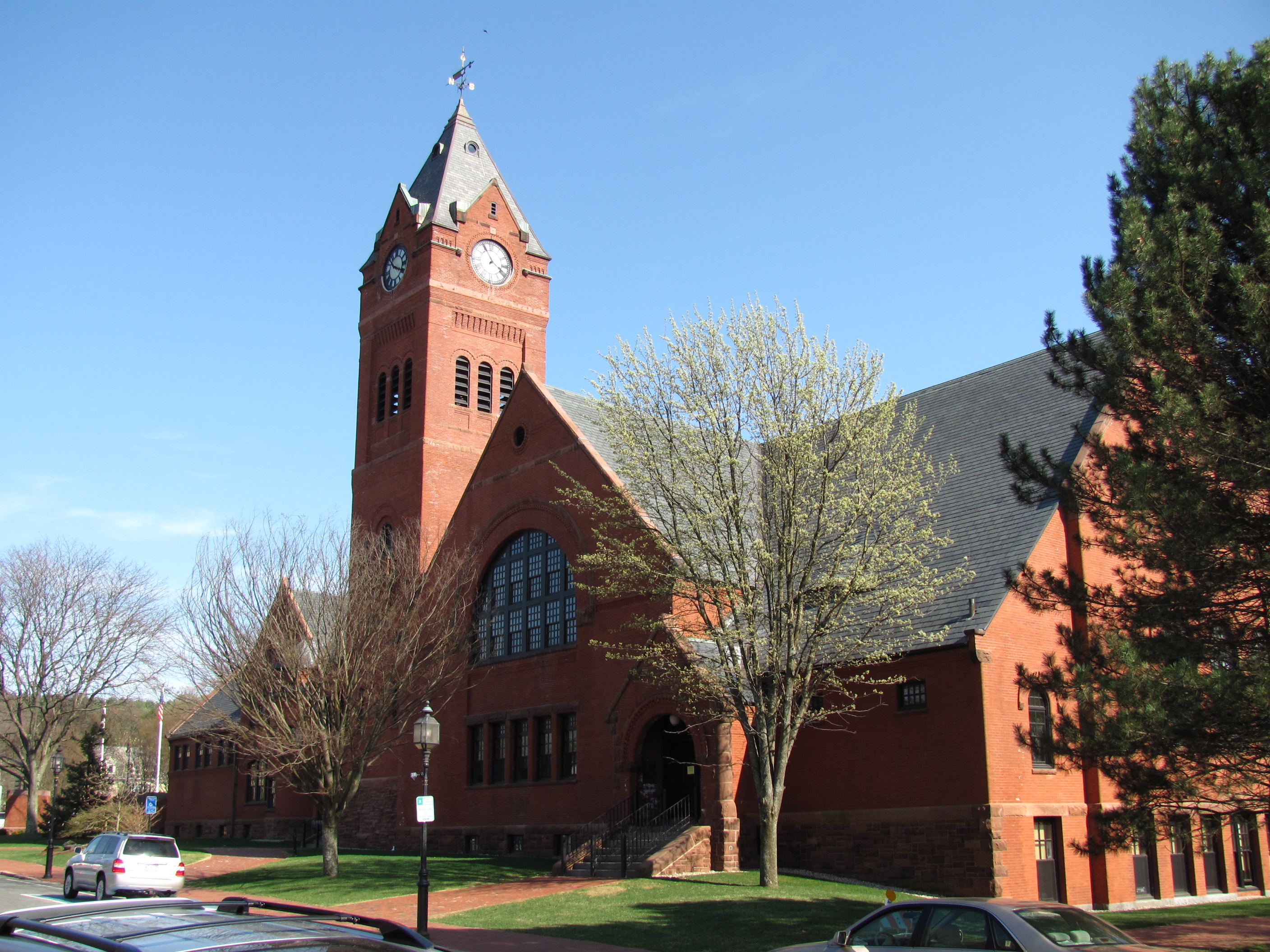
Winchester Town Hall |
 |
01983-03-31 March 31, 1983 |
71 Mount Vernon St.
42°27′9″N 71°8′6″W / 42.4525°N 71.135°W / 42.4525; -71.135 (Winchester Town Hall) |
|
| 69 |
Philemon Wright/Asa Locke Farm |
 |
01983-03-10 March 10, 1983 |
78 Ridge St.
42°26′29″N 71°10′35″W / 42.44139°N 71.17639°W / 42.44139; -71.17639 (Wright, Philemon/Asa Locke Farm) |
|
| 70 |
George Wyman House |
 |
01989-07-05 July 5, 1989 |
195 Cambridge St.
42°27′9″N 71°9′29″W / 42.4525°N 71.15806°W / 42.4525; -71.15806 (Wyman, George, House) |
|
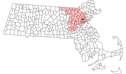 Location of Winchester in Massachusetts