- National Register of Historic Places listings in Door County, Wisconsin
-
Buildings, sites, structures, districts, and objects in Door County listed on the National Register of Historic Places
This document is intended to provide a comprehensive listing of entries in the National Register of Historic Places that are located in Door County, Wisconsin. The locations of National Register properties, the latitude and longitude coordinates of which are included below, may be seen in a Google map.[1]
-
- This National Park Service list is complete through NPS recent listings posted November 10, 2011.[2]
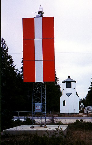
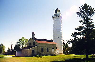
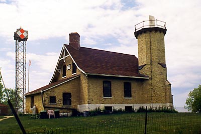
[3] Landmark name [4] Image Date listed Location City or town Summary 1 Anderson Dock Historic District 
June 11, 1985 Roughly bounded by Anderson Lane and North Water St.
45°09′43″N 87°10′19″W / 45.161944°N 87.171944°WEphraim 2 Baileys Harbor Range Light 
September 21, 1989 Roughly Co. Rd. Q, Ridges Rd., and WI 57
45°04′19″N 87°07′13″W / 45.071944°N 87.120278°WBaileys Harbor 3 Baileys Harbor Town Hall-McArdle Library 
April 21, 2000 2392 Cty Trunk Highway F
45°03′58″N 87°07′28″W / 45.066111°N 87.124444°WBaileys Harbor 4 Bohjanen's Door Bluff Pictographs 
September 2, 1993 Address Restricted Liberty Grove 5 J.B. Bouche House 
May 6, 2004 9697 School Rd.
44°44′02″N 87°37′15″W / 44.733889°N 87.620833°WBrussels 6 Bullhead Point Historical and Archeological District March 26, 2003 N. Duluth Ave.
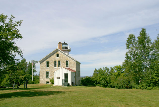
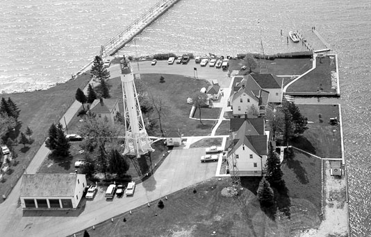
44°50′37″N 87°23′43″W / 44.843611°N 87.395278°WSturgeon Bay 7 Cana Island Lighthouse 
November 21, 1976 NE of Baileys Harbor on E side of Cana Island
45°05′18″N 87°02′54″W / 45.088333°N 87.048333°WBaileys Harbor 8 Cardy Site April 19, 2010 Address Restricted Sturgeon Bay 9 Carnegie Free Library 
December 29, 1988 354 Michigan St.
44°50′06″N 87°22′32″W / 44.835°N 87.375556°WSturgeon Bay 10 Chambers Island Lighthouse 
August 19, 1975 7 mi. NW of Fish Creek at NW tip of Chambers Island
45°12′05″N 87°21′50″W / 45.201389°N 87.363889°WFish Creek 11 July 17, 2003 Baileys Harbor
45°03′23″N 87°05′52″W / 45.056389°N 87.097778°WBaileys Harbor (add link in article to: Nilsson shipwreck info 12 Church of the Atonement 
March 7, 1985 Fire No. 9410
45°07′41″N 87°14′58″W / 45.128056°N 87.249444°WFish Creek 13 Clafin Point Site January 18, 2000 Address Restricted Gardner 14 The Clearing 
December 31, 1974 Off WI 42
45°15′48″N 87°04′25″W / 45.263333°N 87.073611°WEllison Bay 15 Cupola House 
July 16, 1979 7836 Egg Harbor Rd.
45°03′06″N 87°16′48″W / 45.051667°N 87.28°WEgg Harbor 16 August Draize Farmstead 
May 6, 2004 814 Tru-Way Rd.
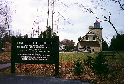
44°42′37″N 87°39′01″W / 44.710278°N 87.650278°WUnion 17 Eagle Bluff Lighthouse 
October 15, 1970 3.5 mi. N of Fish Creek on Shore Rd.,in Peninsula State Park
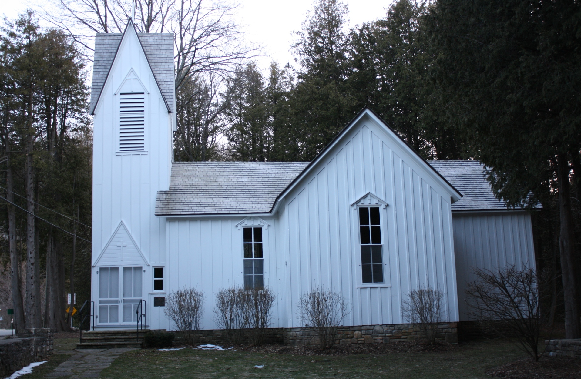
45°09′35″N 87°14′11″W / 45.159722°N 87.236389°WFish Creek 18 Ephraim Moravian Church 
March 27, 1985 9970 Moravia St.
45°09′17″N 87°10′07″W / 45.154722°N 87.168611°WEphraim Include link to: [5] 19 Ephraim Village Hall 
March 27, 1985 9996 S. Water St.
45°09′22″N 87°10′16″W / 45.156111°N 87.171111°WEphraim 20 Joachine J. Falque House 
May 6, 2004 1059 County Trunk Highway C
44°43′19″N 87°37′17″W / 44.721944°N 87.621389°WBrussels 21 Liberty Grove 22 North Bay 23 Free Evangelical Lutheran Church-Bethania Scandinavian Evangelical Lutheran Congregation 
March 27, 1985 3028 Church St.
45°09′20″N 87°10′08″W / 45.155556°N 87.168889°WEphraim 24 Gibraltar District School No. 2 
June 11, 1985 9988 Moravia St.
45°09′22″N 87°10′07″W / 45.156111°N 87.168611°WEphraim 25 Globe Hotel 
January 28, 1982 8090 Main St.
45°03′47″N 87°07′26″W / 45.063056°N 87.123889°WBaileys Harbor 26 Sevastopol 27 Hillside Hotel 
March 27, 1985 9980 S. Water St.
45°09′19″N 87°10′10″W / 45.155278°N 87.169444°WEphraim 28 Washington Island 29 Jischke's Meat Market 
September 11, 1986 414 Maple Dr.
45°11′16″N 87°07′26″W / 45.187778°N 87.123889°WSister Bay 30 Joint Brussels and Garner Dristrict School Number One 
May 6, 2004 8571 State Trunk Highway 57
44°45′42″N 87°32′57″W / 44.761667°N 87.549167°WBrussels 31 November 21, 2007 500 ft. W of Sunset Park
44°51′04″N 87°23′21″W / 44.851111°N 87.389167°WSturgeon Bay 32 L. A. Larson & Co. Store 
June 19, 1985 306 S. 3rd Ave.
44°49′55″N 87°22′25″W / 44.831944°N 87.373611°WSturgeon Bay 33 Little Lake Archeological District February 27, 2002 Address Restricted Washington 34 Washington Include link: [6] 35 Louisiana Street/Seventh Avenue Historic District 
September 22, 1983 Roughly bounded by Louisiana and Kentucky Sts., N. 5th, N. 7th, and N. 8th Aves.
44°50′13″N 87°22′19″W / 44.836944°N 87.371944°WSturgeon Bay 36 Sister Bay Explore Meridian intro 37 Joseph Monfils Farmstead 
May 6, 2004 1463 Dump Rd.
44°44′29″N 87°34′50″W / 44.741389°N 87.580556°WBrussels 38 Namur Belgian-American District 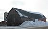
November 6, 1989 Roughly bounded by CR K, Brussels Rd., WI 57, Belgian Dr., and the Green Bay
44°45′02″N 87°39′58″W / 44.750556°N 87.666111°WNamur 39 Alexander Noble House 
February 23, 1996 4167 WI 42
45°07′39″N 87°14′48″W / 45.1275°N 87.246667°WFish Creek 40 July 19, 2006 2 mi. off Whitefish Point
44°53′07″N 87°09′08″W / 44.885278°N 87.152222°WLake Michigan 41 Peter Peterson House 
March 27, 1985 10020 N. Water St.
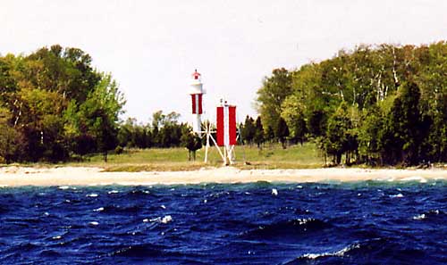
45°09′28″N 87°10′14″W / 45.157778°N 87.170556°WEphraim 42 Pilot Island Light 
November 21, 1983 Portes des Norts Passage, Pilot Island
45°17′03″N 86°55′10″W / 45.284167°N 86.919444°WGills Rock 43 Pilot Island NW Site 
March 19, 1992 Address Restricted Pilot Island, Washington 44 Plum Island Life-Saving and Light Stations 
June 24, 2010 Plum Island
45°18′44″N 86°56′53″W / 45.312222°N 86.948056°WWashington vicinity 45 Plum Island Range Rear Light 
July 19, 1984 Plum Island
45°18′28″N 86°57′28″W / 45.307778°N 86.957778°WGills Rock 46 Porte des Morts Site 
March 16, 1976 Address Restricted Northport 47 Pottawatomie Lighthouse 
April 20, 1979 NW Rock Island
45°25′40″N 86°49′42″W / 45.427778°N 86.828333°WRock Island 48 Rock Island Historic District May 19, 1972 Rock Island, off NE tip of Washington Island
45°24′27″N 86°49′21″W / 45.4075°N 86.8225°WRock Island 49 Sherwood Point Light Station 
July 19, 1984 Sherwood Point Road on Green Bay
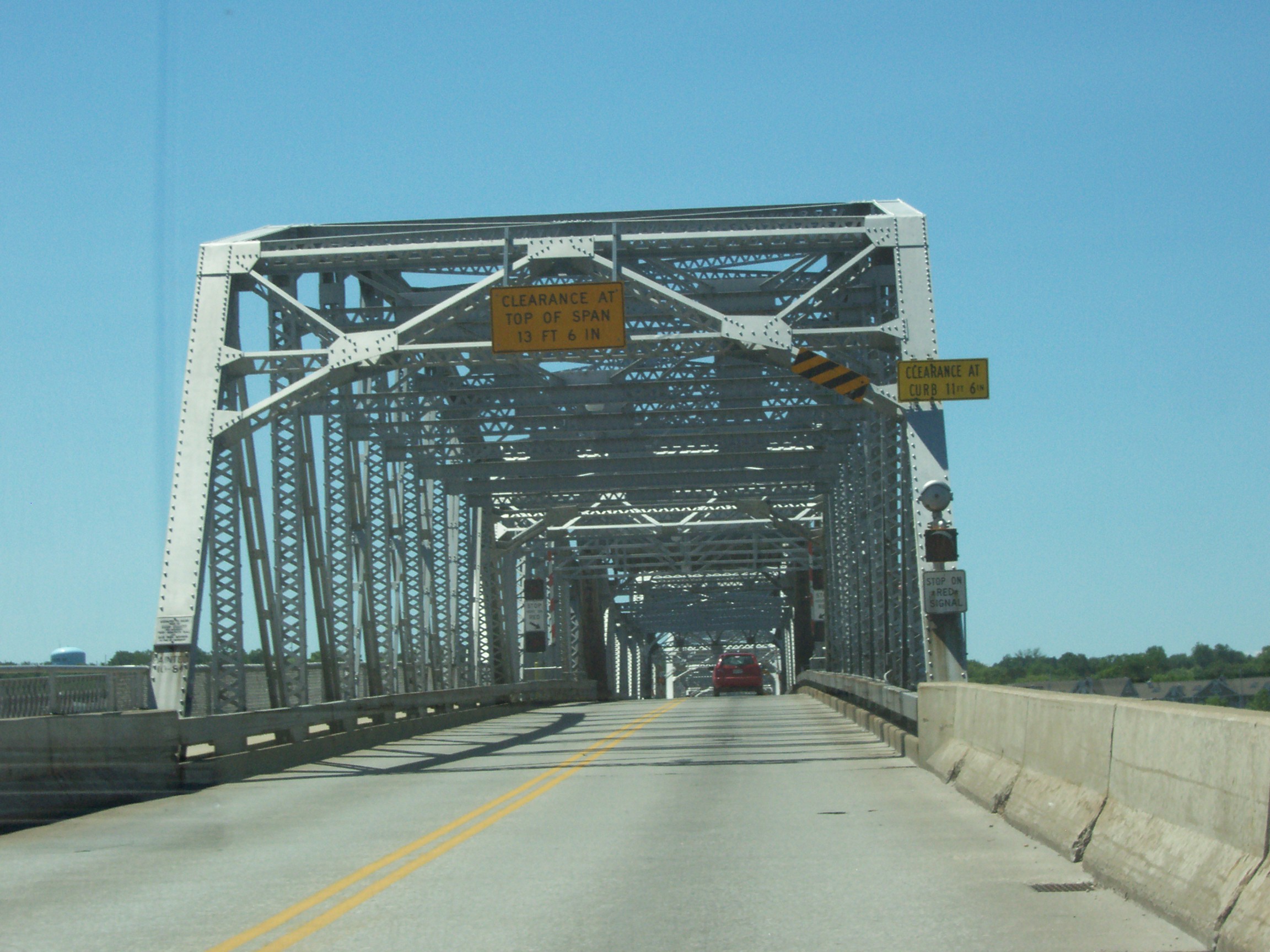
44°53′34″N 87°25′59″W / 44.892778°N 87.433056°WSturgeon Bay 50 Sturgeon Bay Bridge 
January 17, 2008 Michigan St.
44°49′55″N 87°22′52″W / 44.831944°N 87.381111°WSturgeon Bay 51 Sturgeon Bay Canal Light 
July 19, 1984 Sturgeon Bay Canal
44°47′42″N 87°18′46″W / 44.795°N 87.312778°WSturgeon Bay 52 Sturgeon Bay Post Office 
October 24, 2000 359 Louisiana Ave.
44°50′07″N 87°22′33″W / 44.835278°N 87.375833°WSturgeon Bay 53 Third Avenue Historic District 
October 6, 1983 Roughly bounded by Kentucky St., N. 2nd, N. 3rd, and S. 3rd Aves.
44°50′05″N 87°22′36″W / 44.834722°N 87.376667°WSturgeon Bay 54 Thordarson Estate Historic District 
March 21, 1985 Rock Island State Park
45°24′39″N 86°49′43″W / 45.410833°N 86.828611°WRock Island 55 Freeman and Jesse Thorp House and Cottages 
August 15, 1997 4135 Bluff Street
45°07′36″N 87°14′40″W / 45.126667°N 87.244444°WFish Creek 56 Louis Vangindertahlen House 
May 6, 2004 1514 Dump Rd.
44°44′38″N 87°34′47″W / 44.743889°N 87.579722°WBrussels 57 Vorous General Store 
May 9, 1997 4153 WI 42
45°07′39″N 87°14′47″W / 45.1275°N 87.246389°WFish Creek 58 Water Tower March 21, 1985 Rock Island State Park
45°24′44″N 86°48′23″W / 45.412222°N 86.806389°WRock Island 59 Welcker's Resort Historic District 
April 14, 1997 Roughly bounded by Cottage Row, Maple, Cedar, and Main Sts.
45°07′42″N 87°14′59″W / 45.128333°N 87.249722°WGibraltar 60 Whitefish Dunes-Bay View Site 
December 28, 1990 Address Restricted Sevastopol located at Whitefish Dunes State Park 61 William Zachow Farmstead 
January 9, 1997 9533 WI 57
45°08′01″N 87°07′57″W / 45.133611°N 87.1325°WBailey's Harbor 62 Albert Zahn House 
May 11, 2000 8223 WI trunk Hwy. 57
45°04′15″N 87°07′24″W / 45.070833°N 87.123333°WBaileys Harbor 63 August Zahn Blacksmith Shop and House 
May 5, 2000 8152 WI trunk 57
45°04′00″N 87°07′26″W / 45.066667°N 87.123889°WBaileys Harbor Formerly listed properties
[3] Landmark name Image Date listed Location City or town Summary 1 Frank and Clara Englebert House 
September 29, 2011 9390 Cemetery Rd.
44°44′51″N 87°35′59″W / 44.7475°N 87.59972°WBrussels Originally listed on May 6, 2004. See also
- List of National Historic Landmarks in Wisconsin
- List of Registered Historic Places in Wisconsin
References
- ^ The latitude and longitude information provided is primarily from the National Register Information System, and has been found to be fairly accurate for about 99% of listings. For 1%, the location info may be way off. We seek to correct the coordinate information wherever it is found to be erroneous. Please leave a note in the Discussion page for this article if you believe any specific location is incorrect.
- ^ "National Register of Historic Places: Weekly List Actions". National Park Service, United States Department of the Interior. Retrieved on November 10, 2011.
- ^ a b Numbers represent an ordering by significant words. Various colorings, defined here, differentiate National Historic Landmark sites and National Register of Historic Places Districts from other NRHP buildings, structures, sites or objects.
- ^ "National Register Information System". National Register of Historic Places. National Park Service. . http://nrhp.focus.nps.gov/natreg/docs/All_Data.html.
- ^ http://www.wisconsinshipwrecks.org/explore_fleetwing_intro.cfm
- ^ http://www.wisconsinshipwrecks.org/explore_louisiana_intro.cfm
U.S. National Register of Historic Places Topics Lists by states Alabama • Alaska • Arizona • Arkansas • California • Colorado • Connecticut • Delaware • Florida • Georgia • Hawaii • Idaho • Illinois • Indiana • Iowa • Kansas • Kentucky • Louisiana • Maine • Maryland • Massachusetts • Michigan • Minnesota • Mississippi • Missouri • Montana • Nebraska • Nevada • New Hampshire • New Jersey • New Mexico • New York • North Carolina • North Dakota • Ohio • Oklahoma • Oregon • Pennsylvania • Rhode Island • South Carolina • South Dakota • Tennessee • Texas • Utah • Vermont • Virginia • Washington • West Virginia • Wisconsin • WyomingLists by territories Lists by associated states Other Municipalities and communities of Door County, Wisconsin City 
Villages Towns Baileys Harbor | Brussels | Clay Banks | Egg Harbor | Forestville | Gardner | Gibraltar | Jacksonport | Liberty Grove | Nasewaupee | Sevastopol | Sturgeon Bay | Union | Washington
CDPs Baileys Harbor | Ellison Bay | Little Sturgeon
Unincorporated
communitiesBrussels | Carlsville | Carnot | Detroit Harbor | Fish Creek | Gills Rock | Idlewild | Institute | Jacksonport | Juddville | Kolberg | Maplewood | Namur | North Bay | Northport | Peninsula Center | Rosiere‡ | Rowleys Bay | Salona | Shoemaker Point | Valmy | Vignes | Washington | West Jacksonport | Whitefish Bay
Footnotes ‡This populated place also has portions in an adjacent county or counties
Categories:- Door County, Wisconsin
- Lists of historic places in Wisconsin
-


Wikimedia Foundation. 2010.