- National Register of Historic Places listings in Pierce County, Washington
-
List of entries on the National Register of Historic Places in Pierce County, Washington
-
- This National Park Service list is complete through NPS recent listings posted November 10, 2011.[1]
Contents
Pierce County exclusive of Tacoma
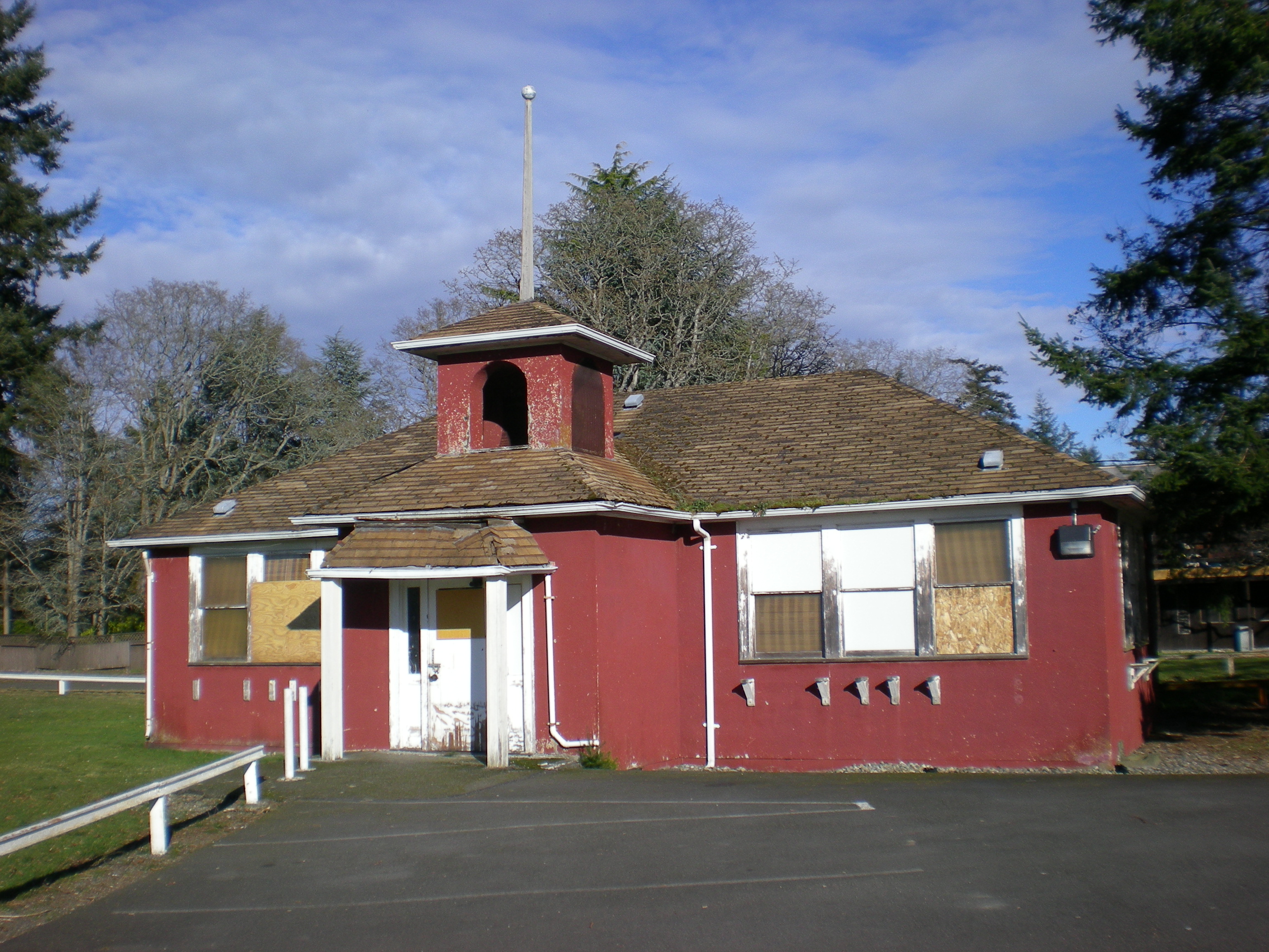
[2] Landmark name[3] Image Date listed Location City or Town Summary 1 Alderton School 
July 15, 1987 9512 Orting Hwy., E.
47°10′12.13″N 122°13′43.03″W / 47.1700361°N 122.2286194°WAlderton Rural Public Schools of Washington State MPS 2 Anderson Island School 
July 15, 1987 Eckenstam-Johnson Rd.
47°9′32.48″N 122°42′13.8″W / 47.1590222°N 122.703833°WAnderson Island Built in 1904, this is the oldest one-room schoolhouse in Pierce County.[4]
Rural Public Schools of Washington State MPS3 Arletta School 
September 28, 1987 3507 Ray Nash Drive NW
47°17′23.09″N 122°39′44.07″W / 47.2897472°N 122.6622417°WGig Harbor This former school was built by the Works Progress Administration in 1938, and is now used as a community center.[5]
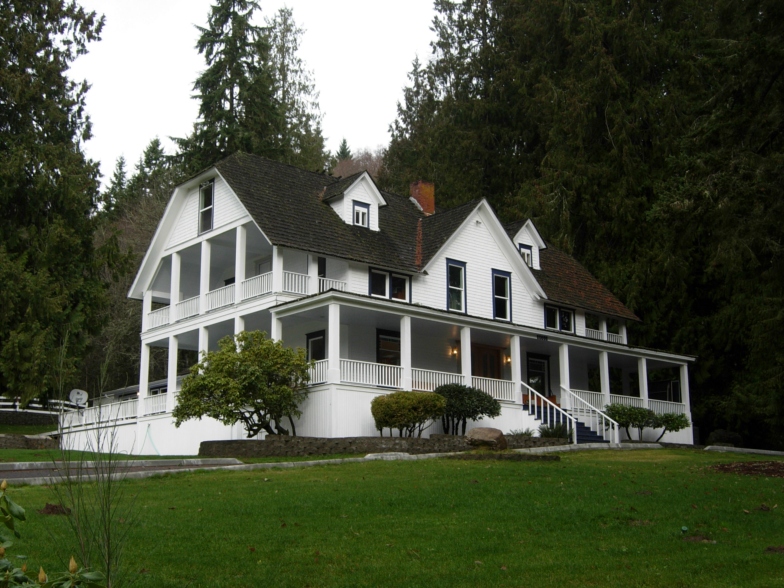
Rural Public Schools of Washington State MPS4 Ashford Mansion 
August 30, 1984 Off I-5
46°45′36.37″N 122°1′25.67″W / 46.7601028°N 122.0237972°WAshford Built by Walter and Cora Ashford in a Colonial-Revival style.[6] 5 William Bisson House 
February 19, 1982 Washington and Emery Streets
47°8′23.39″N 122°5′49.85″W / 47.1398306°N 122.0971806°WSouth Prairie 6 Boatman-Ainsworth House 
February 19, 1982 6000 112th St., SW
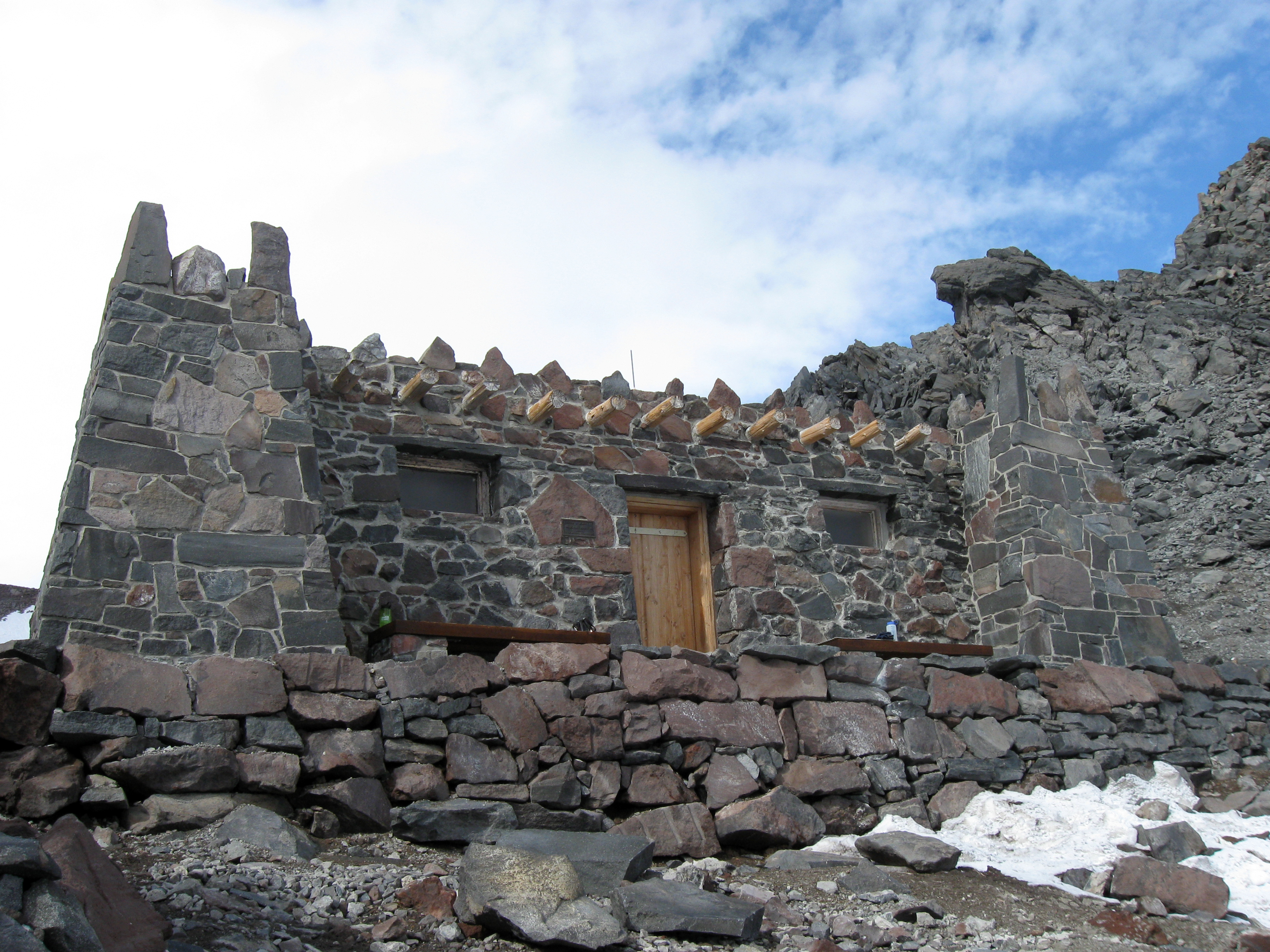
47°09′21″N 122°31′03″W / 47.15580°N 122.51753°WLakewood The oldest surviving home in Lakewood.[7] 7 Camp Muir 
March 13, 1991 Paradise
46°50′07″N 121°43′58″W / 46.83528°N 121.73278°WMount Rainier National Park Also known as Cloud Camp, is on the southeast slope of the mountain, at 10,062 feet (3,067 m). Named for John Muir.[8] 8 Charles W. Orton House 
July 28, 1983 7473 Riverside Rd., E
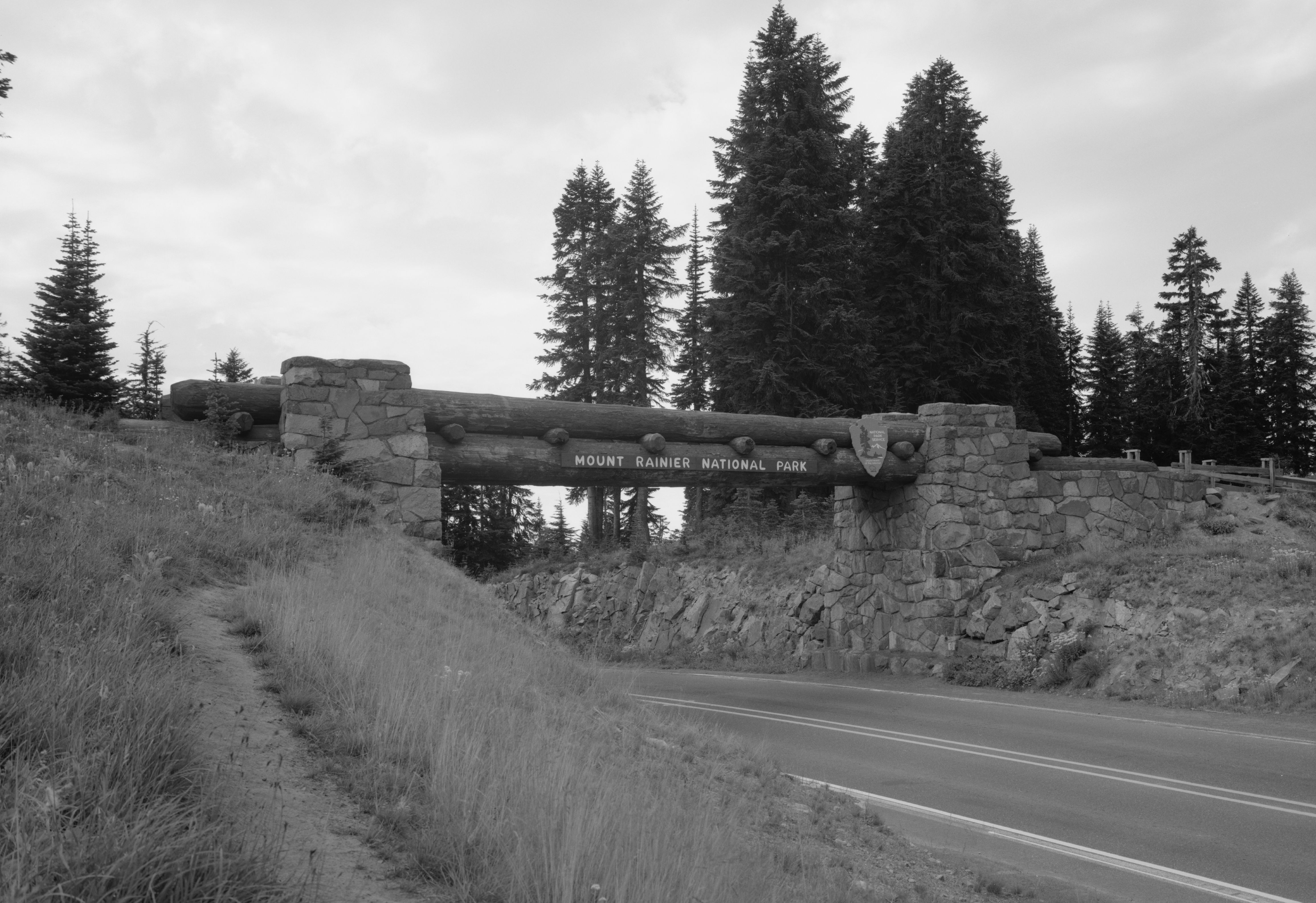
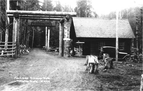
47°11′23″N 122°13′08″W / 47.18966°N 122.21882°WSumner 9 Chinook Pass Entrance Arch 
March 13, 1991 Chinook Pass
46°52′20.39″N 121°30′52.08″W / 46.8723306°N 121.5144667°WMount Rainier National Park 10 Christ Episcopal Church 
December 15, 1994 210 Fifth St. SW.
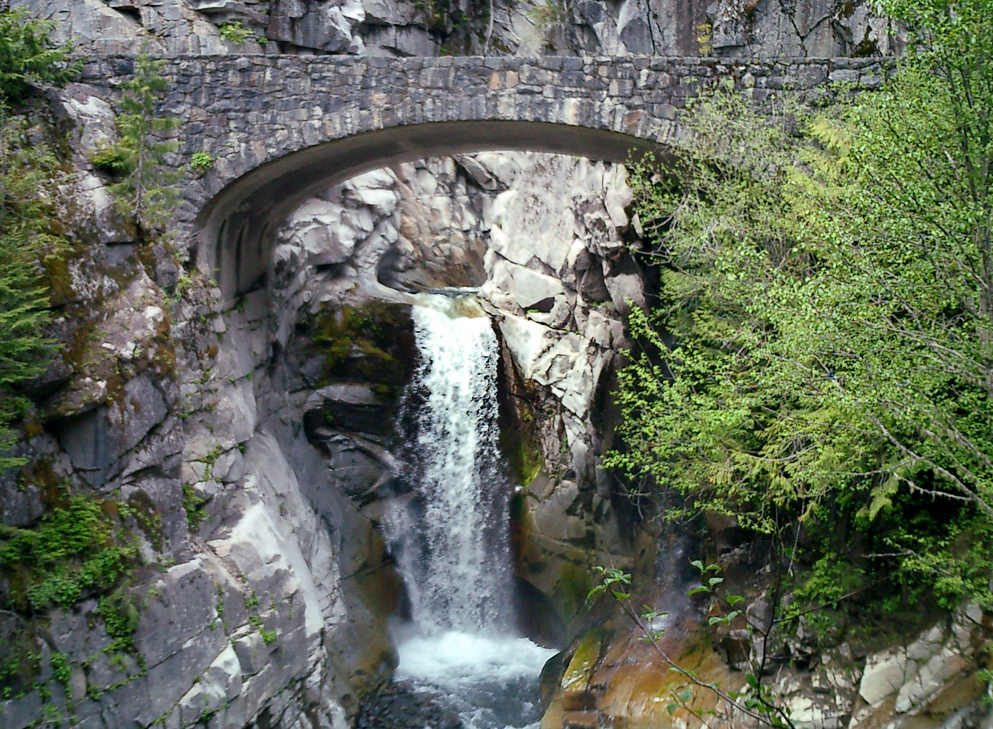
47°11′27.11″N 122°17′52.62″W / 47.1908639°N 122.29795°WPuyallup Built in 1927 to replace a smaller church.[9] 11 Christine Falls Bridge 
March 13, 1991 Paradise
46°46′51″N 121°46′47″W / 46.78083°N 121.77972°WMount Rainier National Park 12 Coke Ovens 
June 10, 1974 SE of Wilkeson at RR tracks
47°6′8.54″N 122°2′20.54″W / 47.1023722°N 122.0390389°WWilkeson These 12-foot (4 m) tall ovens began being built in 1885 for cooking coal into coke.[10] Of the original 160 ovens, 40 still remain.[11] 13 Custer School 
July 15, 1987 7700 Steilacoom Blvd. SW
47°10′52.14″N 122°32′16.61″W / 47.18115°N 122.5379472°WLakewood Also known as the "Little Red Schoolhouse"
Rural Public Schools of Washington State MPS14 David Dadisman House 
March 31, 1995 1814 A St., Key Peninsula N
47°16′27.6″N 122°45′33.29″W / 47.274333°N 122.7592472°WHome 15 Davidson House 
March 27, 1973 1802 Commercial Street
47°10′26.7″N 122°35′47.28″W / 47.174083°N 122.5964667°WSteilacoom Also known as the Philip Keach House. 16 Dieringer School 
April 14, 1997 1808 E. Valley Hwy.
47°14′27.66″N 122°13′32.66″W / 47.2410167°N 122.2257389°WSumner This Georgian Revival style building served as a school until 1992, when it turned into a corporate office.[12]
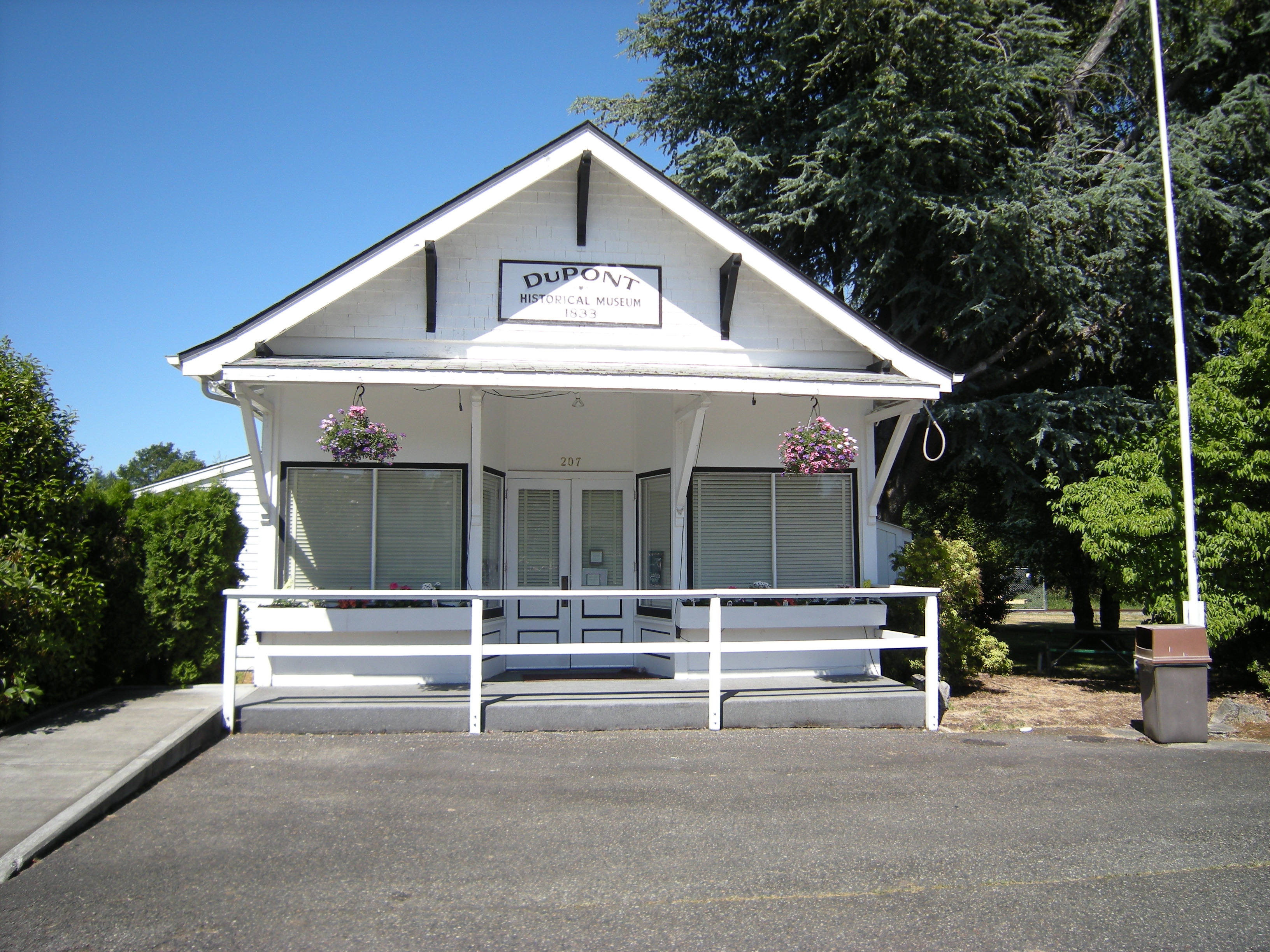
Rural Public Schools of Washington State MPS17 DuPont Village Historic District 
September 10, 1987 Roughly bounded by Santa Cruz, Brandywine, DuPont, and Penniman Dupont 18 Edith Creek Chlorination House 
March 13, 1991 Paradise
46°47′38.23″N 121°43′53.92″W / 46.7939528°N 121.7316444°WMount Rainier National Park 19 Elbe Evangelical Lutheran Church 
October 8, 1976 I-5
46°45′52.49″N 122°11′39.44″W / 46.7645806°N 122.1942889°WElbe The land and lumber to build the church were donated by German immigrants Henry and Clara Lutken. The main building of the church is 24 feet (7.3 m) by 18 feet (5.5 m), but the steeple rises 55 feet (17 m), and is topped with an iron cross.[13] 20 Emma Smith DeVoe House 
May 6, 1993 308 E. 133rd Street
47°08′11″N 122°25′41″W / 47.13638°N 122.42796°WParkland 21 Ezra Meeker Mansion 
August 26, 1971 321 Pioneer Ave., E.
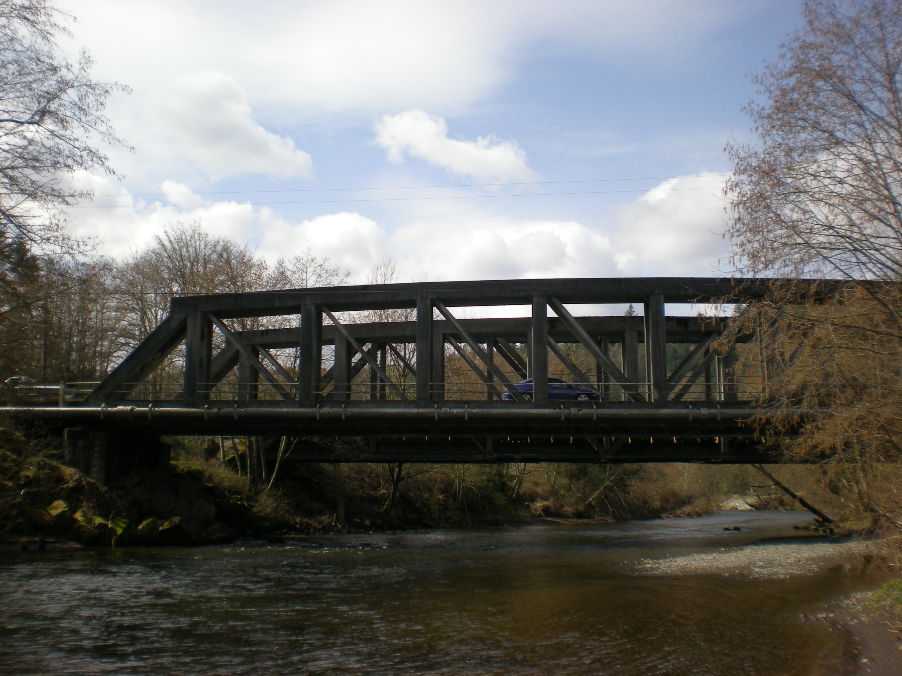
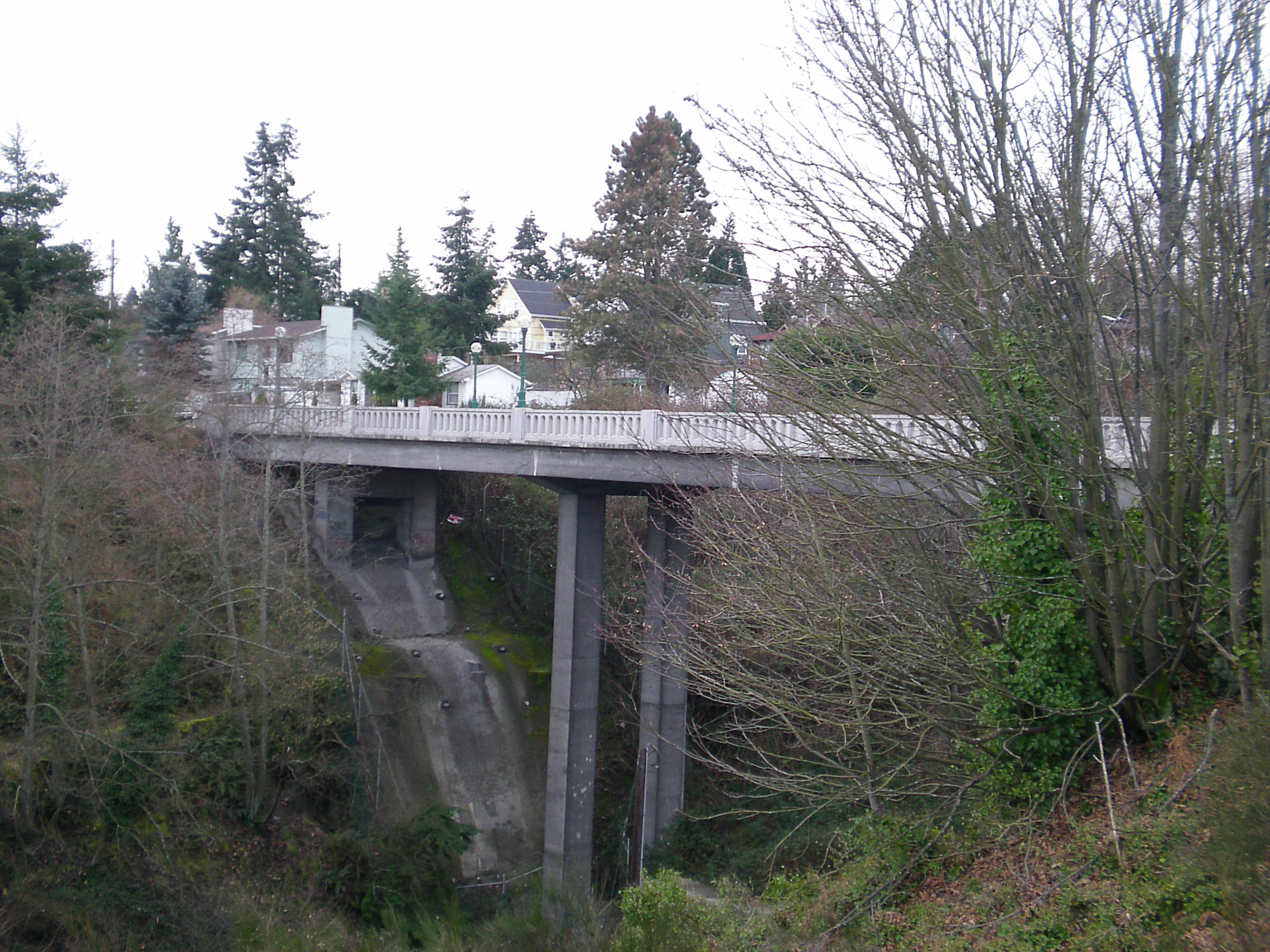
47°11′29.03″N 122°17′22.89″W / 47.1913972°N 122.2896917°WPuyallup Built in 1875, this 17-room house was the home of Oregon Trail migrant Ezra Meeker.[14] 22 Fairfax Bridge 
July 16, 1982 Spans Carbon River, S of Wilkeson
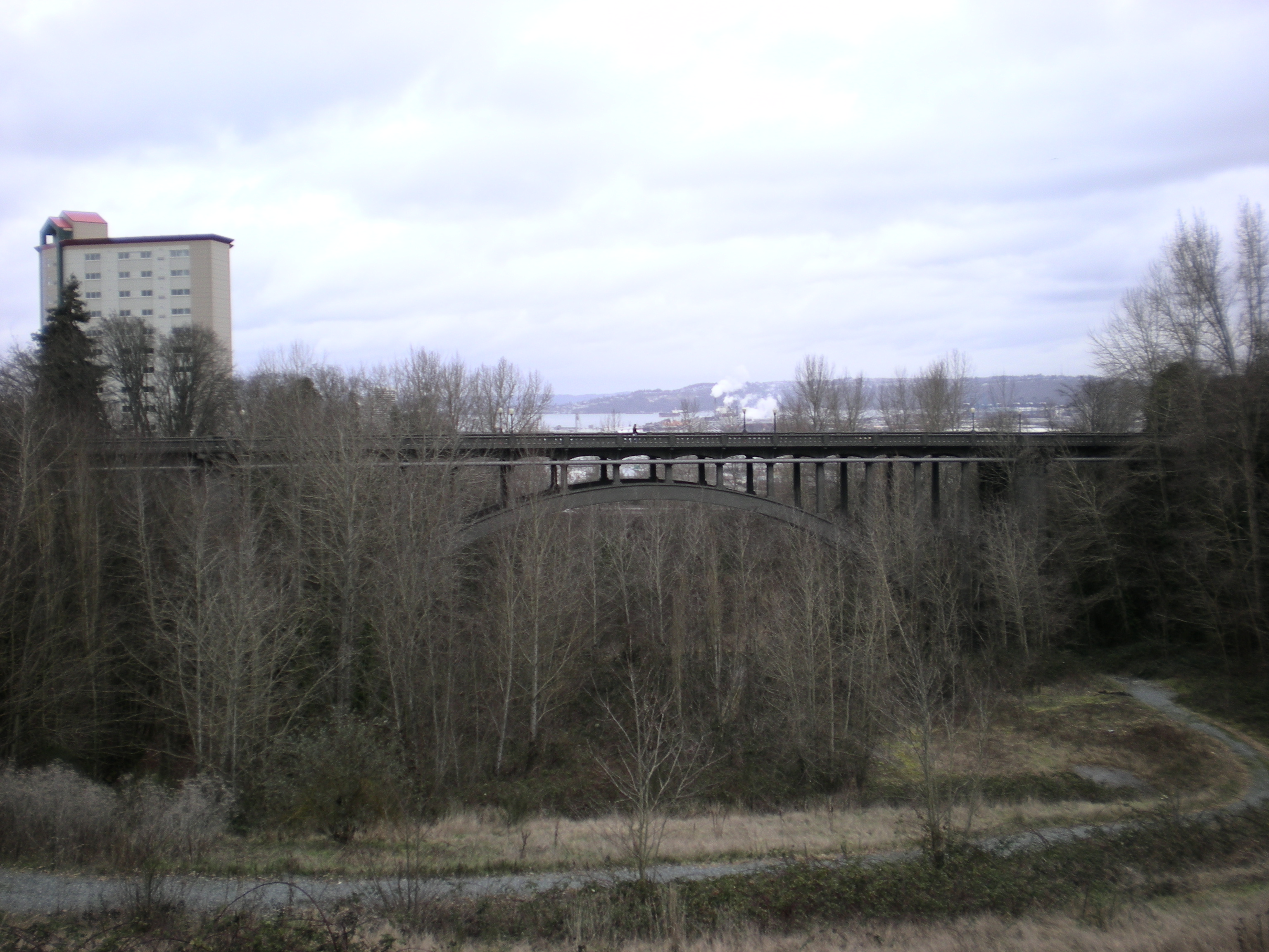
47°02′31″N 122°02′28″W / 47.04194°N 122.04111°WMelmont This bridge's deck sits 250 feet (76 m) above the Carbon River, which made it the tallest structure in Washington at the time it was built.[15]
Historic Bridges and Tunnels in Washington TR23 Fort Nisqually Site 
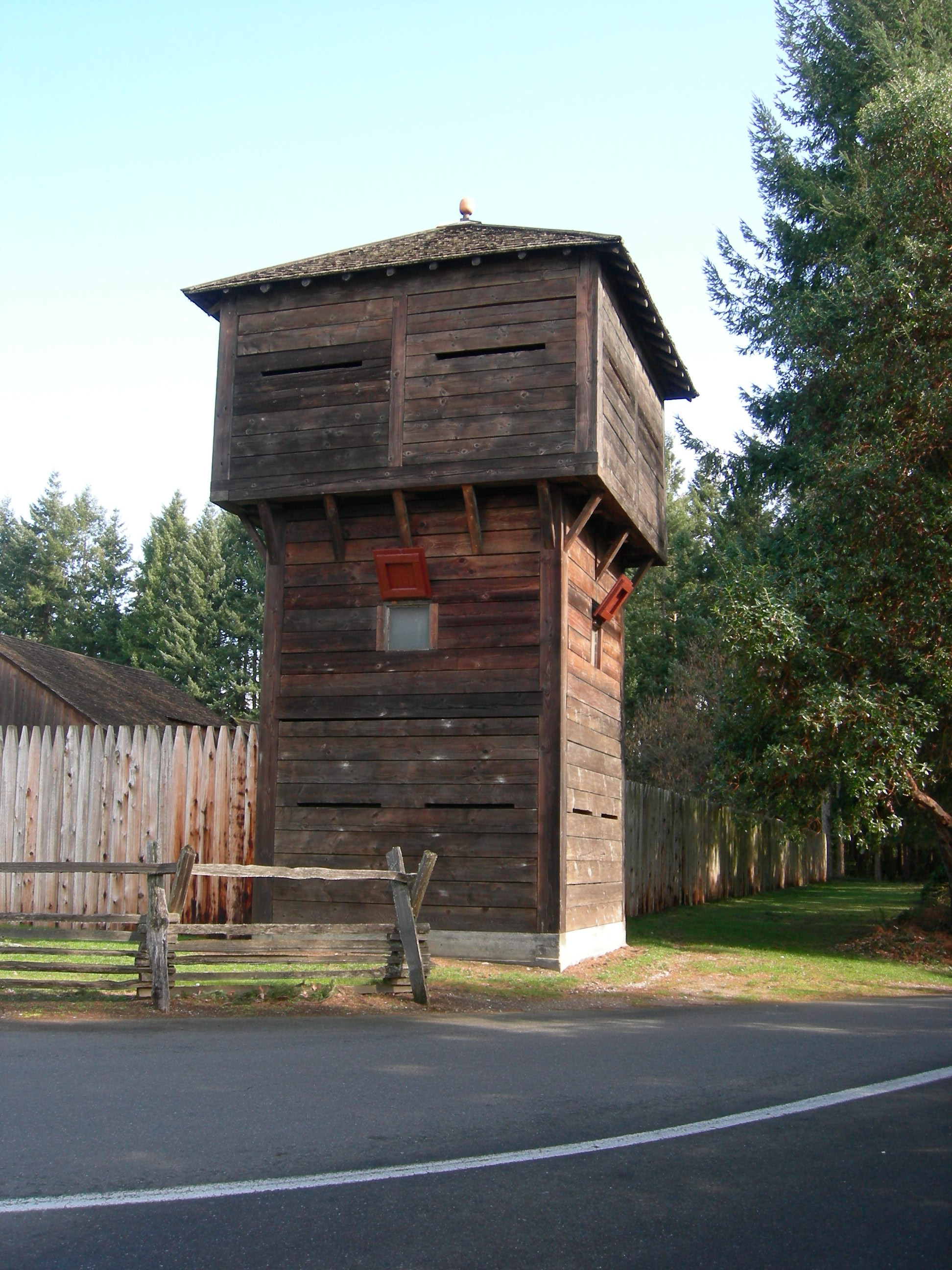
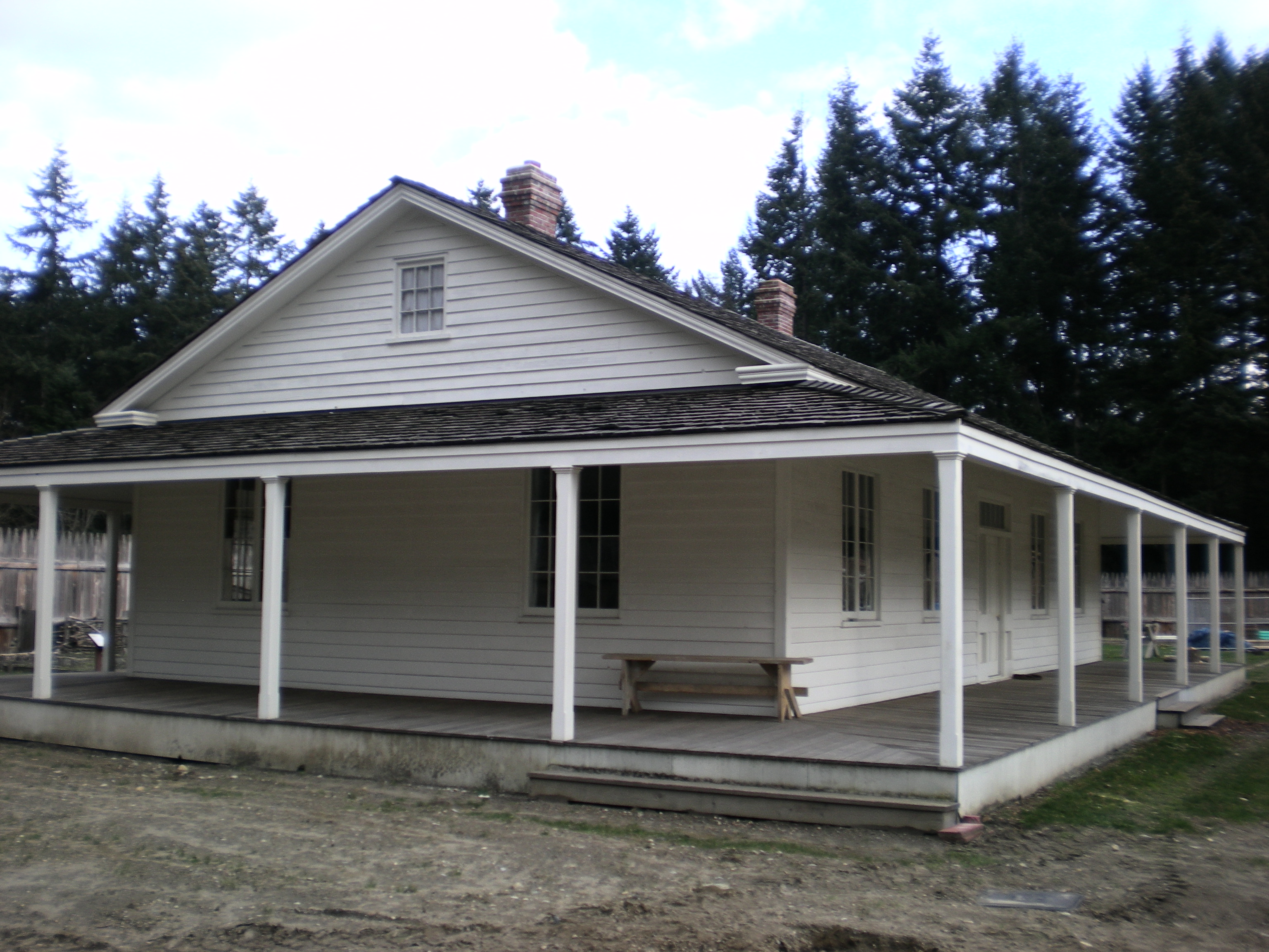
October 16, 1974 Northwest of Dupont off I-5
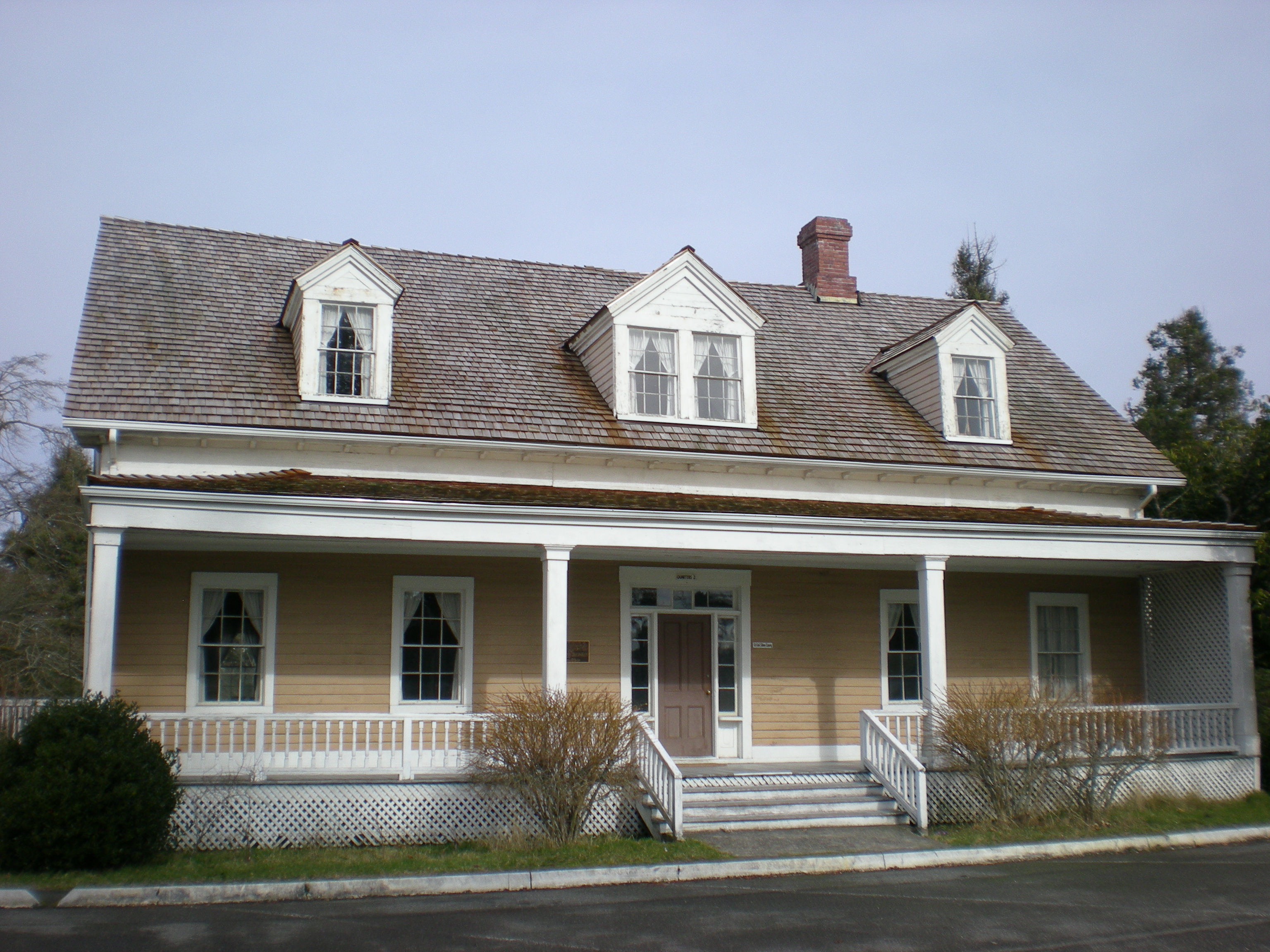
47°6′32.61″N 122°39′45.34″W / 47.1090583°N 122.6625944°WDupont The first European trading post on Puget Sound, established in 1833, the Granary and Factor's house were moved to Point Defiance Park in the 1930s.[16] 24 Fort Steilacoom 
November 25, 1977 NE of Steilacoom
47°10′48″N 122°33′58″W / 47.18°N 122.56611°WSteilacoom Only operating as a fort from 1849 to 1868, the fort was then turned into the Western State Hospital. Today four officer's quarters built around 1858 remain from the original fort.[17] 25 Fox Island School 
July 15, 1987 Gway Drive and Ninth Street
47°15′14.98″N 122°37′13.11″W / 47.2541611°N 122.6203083°WFox Island This former school was built in 1934 by the Works Progress Administration, and has served as a community center since 1961, when the island began busing its students to nearby Gig Harbor.[18]
Rural Public Schools of Washington State MPS26 Glencove Hotel 
May 22, 1978 West of Gig Harbor off SR 302.
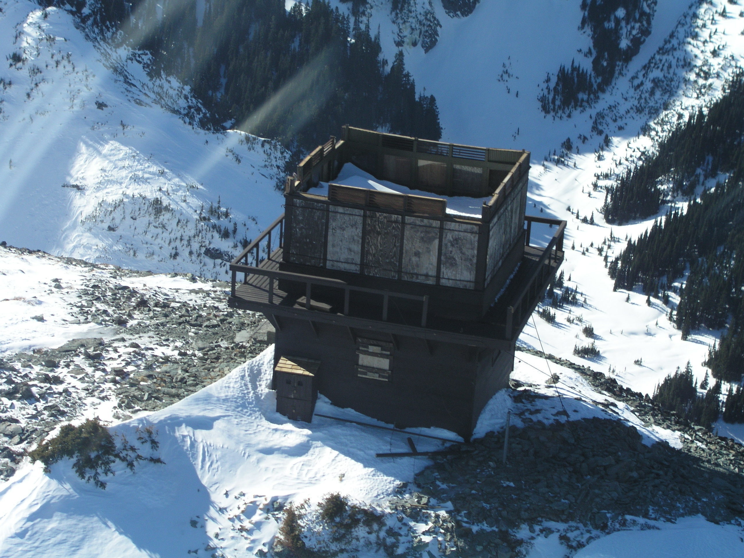
47°20′48.79″N 122°43′49.16″W / 47.3468861°N 122.7303222°WGig Harbor Built in 1897, the building still serves as a hotel.[19] 27 Gobbler's Knob Fire Lookout 
March 13, 1991 Nisqually Entrance
46°47′39.46″N 121°54′48.15″W / 46.7942944°N 121.913375°WMount Rainier National Park 28 John Galbraith House image pending March 19, 1982 140 Oak St., E.
46°51′51.18″N 122°15′48.18″W / 46.8642167°N 122.2633833°WEatonville Also known as Mill House and Eatonville Lumber Company House. 29 Herbert Williams House 
October 18, 1984 1711 Elm Street
47°12′39.42″N 122°13′51.35″W / 47.21095°N 122.2309306°WSumner Also known as Perfield House. 30 Peter L. and Emma Hershey Homestead 
August 15, 2007 33514 Mount Tahoma Canyon Rd.
46°45′40″N 121°59′24″W / 46.76111°N 121.99°WAshford A cabin built in 1888 in the Upper Nisqually Valley.[20] 31 Holy Trinity Orthodox Church 
September 28, 1989 433 Long Street
47°6′26.86″N 122°2′41.8″W / 47.1074611°N 122.044944°WWilkeson Built in 1913, this church features a Russian-style onion dome.[11] 32 Home School image pending April 12, 1982 6th and C Streets
47°16′29.58″N 122°45′50.89″W / 47.2748833°N 122.7641361°WHome 33 Huckleberry Creek Patrol Cabin image pending March 13, 1991 Sunrise
46°59′41.43″N 121°37′3.38″W / 46.9948417°N 121.6176056°WMount Rainier National Park 34 Indian Bar Trail Shelter image pending March 13, 1991 Paradise
46°49′32.95″N 121°38′18.94″W / 46.8258194°N 121.6385944°WMount Rainier National Park 35 Indian Henry's Patrol Cabin image pending March 13, 1991 Longmire
46°47′39.09″N 121°50′20.23″W / 46.7941917°N 121.8389528°WMount Rainier National Park The structure was stabilized in 1978 with 300 lb (140 kg). footings.[21] 36 Ipsut Creek Patrol Cabin 
March 13, 1991 Carbon River Entrance
46°58′40.37″N 121°49′54.1″W / 46.9778806°N 121.831694°WMount Rainier National Park 37 J. H. Lotz House 
March 10, 1980 1004 2nd Ave., NW
47°11′33.61″N 122°18′21.76″W / 47.1926694°N 122.3060444°WPuyallup 38 Lake George Patrol Cabin image pending March 13, 1991 Longmire
46°47′36.14″N 121°54′6.71″W / 46.7933722°N 121.9018639°WMount Rainier National Park 39 Longbranch School Gymnasium image pending September 28, 1987 Gig Harbor-Longbranch Road
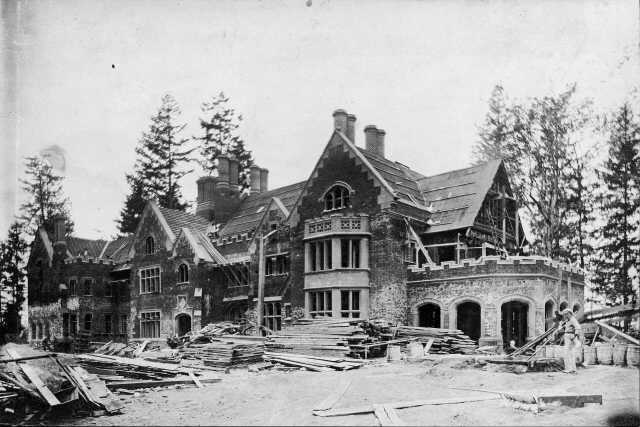
47°13′05″N 122°45′34″W / 47.21806°N 122.75944°WLakebay Rural Public Schools of Washington State MPS 40 Longmire Buildings 
May 28, 1987 Longmire
46°45′06″N 121°48′42″W / 46.75167°N 121.81167°WMount Rainier National Park 41 Longmire Campground Comfort Station No. L-302 image pending March 13, 1991 Longmire
46°44′46.69″N 121°48′41.19″W / 46.7463028°N 121.8114417°WMount Rainier National Park 42 Longmire Campground Comfort Station No. L-303 image pending March 13, 1991 Longmire
46°44′41.5″N 121°48′40.84″W / 46.744861°N 121.8113444°WMount Rainier National Park 43 Longmire Campground Comfort Station No. L-304 image pending March 13, 1991 Longmire
46°44′35.7″N 121°48′43.79″W / 46.74325°N 121.8121639°WMount Rainier National Park 44 Longmire Historic District 
March 13, 1991 Longmire
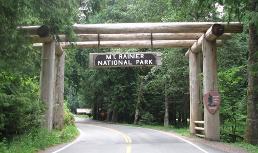
46°44′59″N 121°48′45″W / 46.74972°N 121.8125°WMount Rainier National Park 45 Mount Rainier National Park 
February 18, 1997 Longmire
46°52′59″N 121°53′04″W / 46.88306°N 121.88444°WMount Rainier National Park The park is a National Historic Landmark District, which includes 165 contributing structures and buildings.[22] 46 McMillin Bridge 
July 16, 1982 Spans Puyallup River on State Route 162
47°7′48.78″N 122°14′6.94″W / 47.1302167°N 122.2352611°WMcMillin Also known as the Puyallup River Bridge, the bridge was thought to be the longest concrete truss in the country.
Historic Bridges and Tunnels in Washington MPS47 McMillin School 
July 15, 1987 State Route 162
47°8′28.62″N 122°14′4.94″W / 47.1412833°N 122.2347056°WMcMillin This building served as the McMillin School from 1926 to 1963, and now serves as the McMillin Grange.
Rural Public Schools of Washington State MPS48 Midway School image pending July 15, 1987 5115 Thirty-eighth Ave. NW
47°18′18.25″N 122°35′15.12″W / 47.3050694°N 122.5875333°WGig Harbor This one-room building functioned as a schoolhouse from when it was built in 1893 until 1941.[19]
Rural Public Schools of Washington State MPS49 Mt. Fremont Fire Lookout 
March 13, 1991 Sunrise
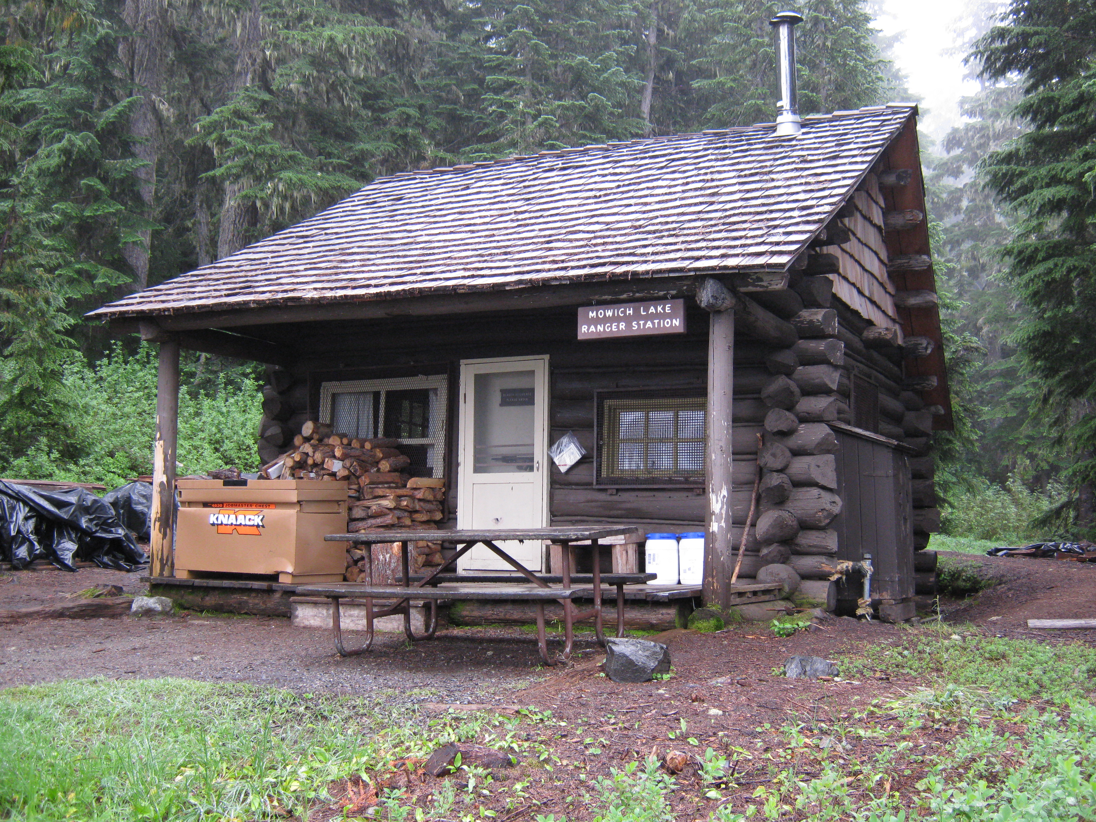
46°56′03″N 121°40′30″W / 46.93417°N 121.675°WMount Rainier National Park 50 Mowich Lake Patrol Cabin 
March 13, 1991 Carbon River Entrance
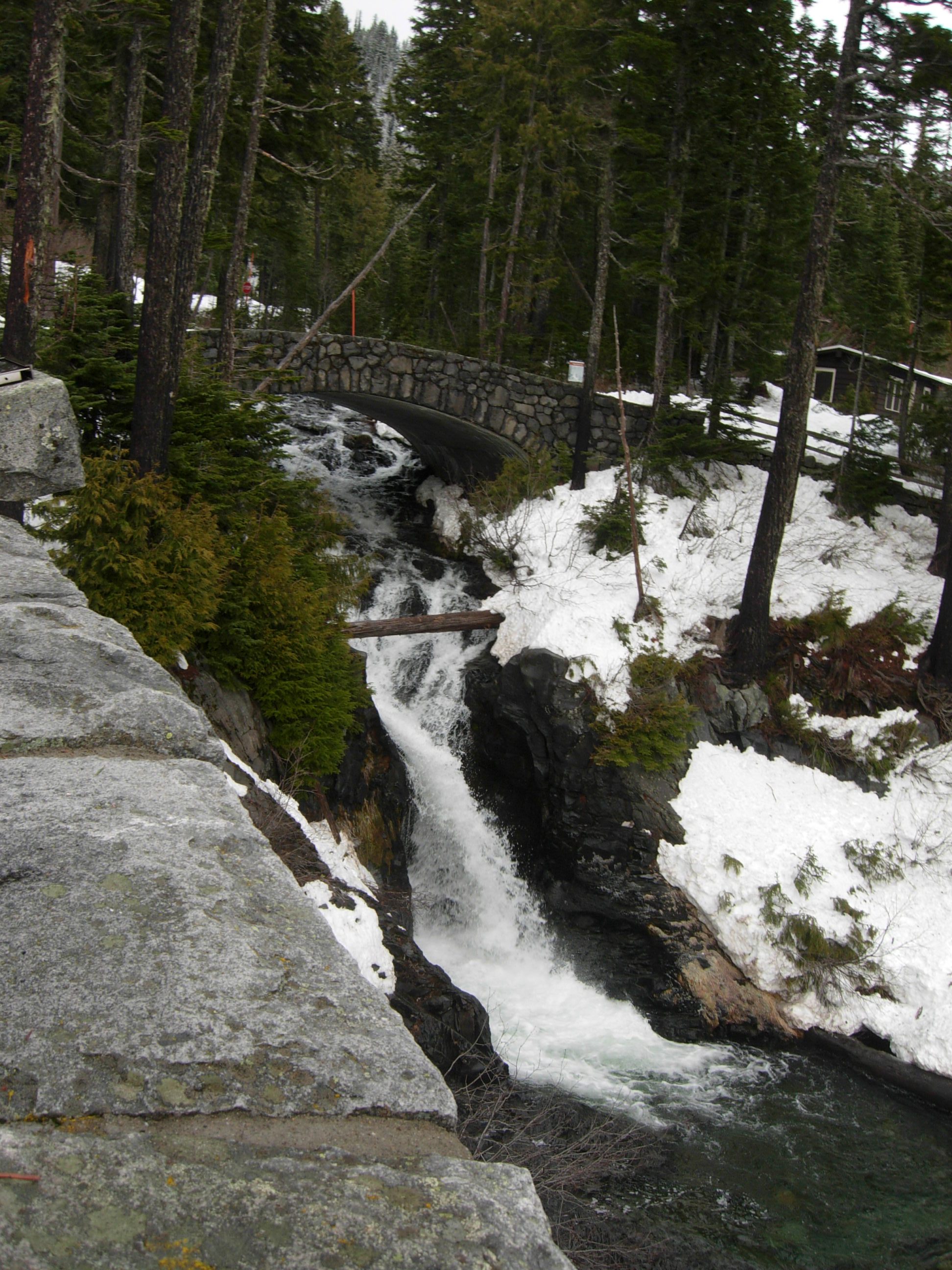
46°56′5.28″N 121°51′40.11″W / 46.9348°N 121.8611417°WMount Rainier National Park 51 Narada Falls Bridge 
March 13, 1991 Paradise
46°46′31.05″N 121°44′42.65″W / 46.7752917°N 121.7451806°WMount Rainier National Park 52 Narada Falls Comfort Station 
March 13, 1991 Paradise
46°46′32.97″N 121°44′40.25″W / 46.775825°N 121.7445139°WMount Rainier National Park 53 Nathaniel Orr House and Orchard 
November 21, 1972 1807 Rainier Street
47°10′23.99″N 122°35′42.03″W / 47.1733306°N 122.5950083°WSteilacoom Also known as Orrmount, when this home was built in 1857, the first included a wagon shop, which was subsequently moved next door.[23] 54 Nisqually Entrance Historic District 
March 13, 1991 Nisqually Entrance
46°44′27″N 121°55′09″W / 46.74083°N 121.91917°WMount Rainier National Park 55 North Mowich Trail Shelter image pending March 13, 1991 Mowich Lake Entrance
46°54′55.46″N 121°53′34.11″W / 46.9154056°N 121.8928083°WMount Rainier National Park 56 Old Main 
January 27, 1984 Park Avenue, S. and Garfield Street
47°8′46.48″N 122°26′21.12″W / 47.1462444°N 122.4392°WParkland Now known as Harstad Hall 57 Paradise Historic District 
March 13, 1991 Paradise
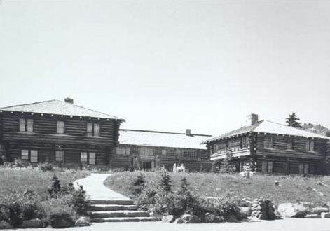
46°47′10″N 121°44′07″W / 46.78611°N 121.73528°WMount Rainier National Park 58 Paradise Inn 
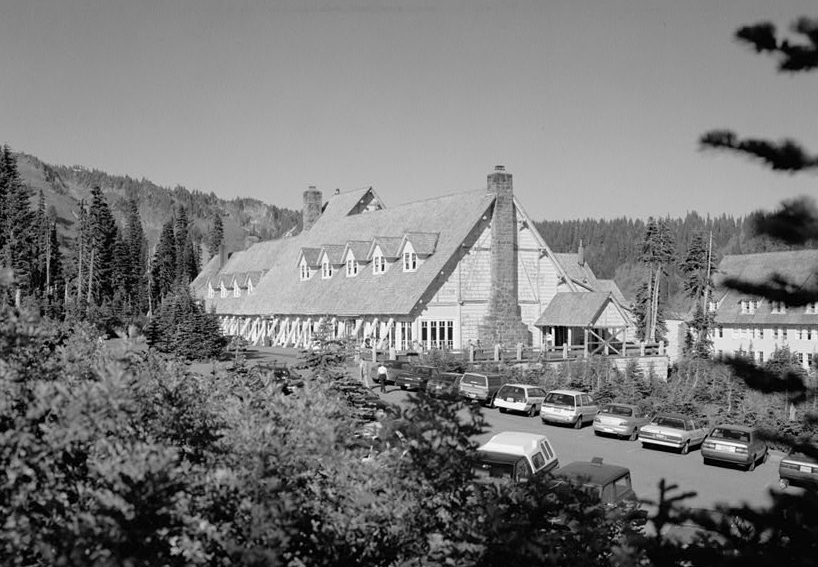
May 28, 1987 Paradise
46°47′13″N 121°43′57.49″W / 46.78694°N 121.7326361°WMount Rainier National Park Opened in 1917, and built in the National Park Service Rustic style of architecture, the Inn was closed in 2005 to undergo major remodeling to conform to safety standards, and scheduled to reopen in 2008.[24] 59 Parkland Lutheran Children's Home 
August 7, 1996 12123 A Street
47°8′39.52″N 122°25′47.95″W / 47.1443111°N 122.4299861°WParkland 60 Purdy Bridge 
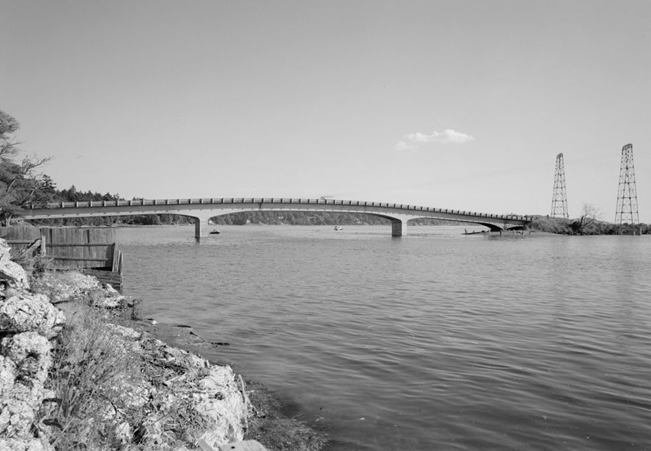
July 16, 1982 Spans Henderson Bay
47°23′03″N 122°37′41″W / 47.38403°N 122.62817°WPurdy Historic Bridges and Tunnels in Washington TR 61 Red Shield Inn 
February 14, 1979 Main Street
47°5′50.1″N 122°36′1.7″W / 47.09725°N 122.600472°WFort Lewis Now housing the Fort Lewis Military Museum, the 150-room building was originally built in 1919 by the Salvation Army.[11] 62 Rhodesleigh 
January 27, 1983 10815 Greendale Dr., SW
47°9′33.69″N 122°32′2.57″W / 47.1593583°N 122.5340472°WLakewood Built in 1922 63 Ryan House 
June 30, 1976 1228 Main Street
47°12′12″N 122°14′19″W / 47.20333°N 122.23861°WSumner Originally a one-room cabin built in the 1860s, Sumner's first mayor added on to the house in 1875 and 1885. The building housed the Sumner Public Library from 1926 to 1979, and now houses the Sumner Historical Society.[25] 64 Sequalitchew Archeological Site 
February 14, 1979 Address restricted. Dupont 65 Shriner Peak Fire Lookout image pending March 13, 1991 Ohanapecosh
46°48′49.53″N 121°31′45.55″W / 46.8137583°N 121.5293194°WMount Rainier National Park 66 Sidney Williams House 
October 18, 1984 15003 E. Elm Street
47°12′40″N 122°13′44″W / 47.21111°N 122.22889°WSumner Also known as the Moser House. 67 Silver Creek Ranger Station image pending June 7, 1991 State Route 410 on eastern border of Mt. Rainier National Park
46°59′21″N 121°32′04″W / 46.98917°N 121.53444°WCrystal Mountain Also known as Silver Creek Work Center. 68 Andrew and Bertha Skansie Net Shed and House August 31, 2011 3207 Harborview Dr.
47°19′51″N 122°34′52″W / 47.33083°N 122.58111°WGig Harbor Owned by the City of Gig Harbor.[26] 69 Peter Smith Farm-Donation Land Claim 
March 9, 1995 12504 Spanaway Loop Road
47°08′38″N 122°27′35″W / 47.14392°N 122.45966°WParkland Also known as Lakeview Dairy and Schibig Farm. 70 Ward T. Smith and Bjug Harstad House 
September 29, 1995 12204 S. A Street
47°08′46″N 122°25′54″W / 47.14617°N 122.43170°WParkland 71 South Puyallup River Bridge 
March 13, 1991 Nisqually Entrance
46°48′29.21″N 121°53′26.47″W / 46.8081139°N 121.8906861°WMount Rainier National Park Built in 1931. 72 St. Andrews Creek Bridge 
March 13, 1991 Nisqually Entrance
46°50′9.79″N 121°54′15.38″W / 46.8360528°N 121.9042722°WMount Rainier National Park Built in 1931. 73 St. Andrews Patrol Cabin image pending March 13, 1991 Nisqually Entrance
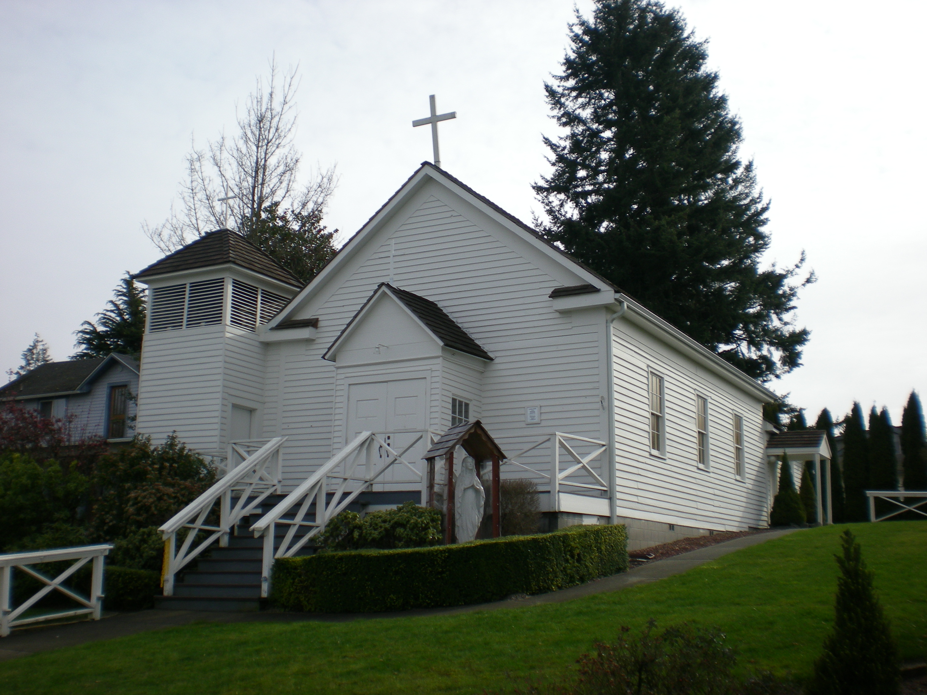
46°50′10.06″N 121°54′10.18″W / 46.8361278°N 121.9028278°WMount Rainier National Park 74 Steilacoom Catholic Church 
July 30, 1974 1810 Nisqually Street
47°10′16.3″N 122°35′36.91″W / 47.171194°N 122.5935861°WSteilacoom Also known as the Church of the Immaculate Conception, this church was originally built in 1855 near Fort Steilacoom, but was moved to its present location in Steilacoom in 1864.[27] It was the first Catholic church built in Washington.[28] 75 Steilacoom Historic District 
November 24, 1975 Between Nisqually Street and Puget Sound. Steilacoom Steilacoom was the first incorporated community in Washington in 1853.[29] The Historic District consists of 1,500 acres (6.1 km2) and 38 buildings. 76 Summerland Trail Shelter image pending March 13, 1991 Sunrise
46°51′55.34″N 121°39′28.08″W / 46.8653722°N 121.6578°WMount Rainier National Park 77 Sunrise Comfort Station 
March 13, 1991 Sunrise
46°54′39.71″N 121°39′32.44″W / 46.9110306°N 121.6590111°WMount Rainier National Park 78 Sunrise Historic District 
March 13, 1991 Sunrise
46°54′53″N 121°38′32″W / 46.91472°N 121.64222°WMount Rainier National Park 79 Sunset Park Patrol Cabin image pending March 13, 1991 Mowich Lake Entrance
46°52′58.37″N 121°53′54″W / 46.8828806°N 121.89833°WMount Rainier National Park 80 Sunset Park Trail Shelter image pending March 13, 1991 Mowich Lake Entrance
46°52′59.29″N 121°53′48.78″W / 46.8831361°N 121.8968833°WMount Rainier National Park 81 Suntop Lookout 
July 14, 1987 White River Ranger District on Suntop Mountain.
47°2′28.67″N 121°35′36.6″W / 47.0412972°N 121.5935°WEnumclaw Built in 1933, this fire lookout was also used in the Army Aircraft Warning Service during World War II.[30] 82 Tahoma Vista Comfort Station image pending March 13, 1991 Nisqually Entrance
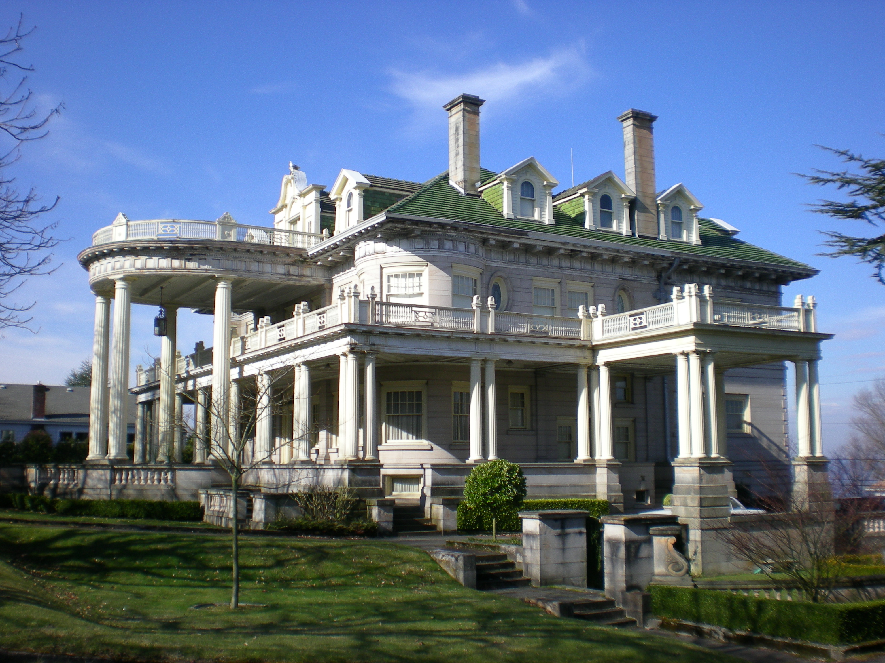
46°47′42.86″N 121°52′50.63″W / 46.7952389°N 121.8807306°WMount Rainier National Park 83 Thornewood 
March 18, 1982 8601 and 8307 N. Thorne Lane, SW and 4 Thornewood Lane, SW Lakewood Consists of three buildings, including Thornewood Castle, which was built from the brick of a dismantled 15th century house imported from England.[31] The Castle was used as a set for the Stephen King film Rose Red.[32] 84 Tipsoo Lake Comfort Station image pending March 13, 1991 Chinook Pass
46°52′13.15″N 121°31′8.81″W / 46.8703194°N 121.5191139°WMount Rainier National Park 85 Tolmie Peak Fire Lookout 
March 13, 1991 Mowich Lake Entrance
46°57′28.25″N 121°52′48.84″W / 46.9578472°N 121.8802333°WMount Rainier National Park 86 Walker Cut Stone Company image pending June 7, 1978 East of Wilkeson Wilkeson District consists of 400 acres (1.6 km2), two buildings, five structures, and eight objects. 87 White River Bridge 
March 13, 1991 White River Entrance
46°53′53.5″N 121°37′4.3″W / 46.898194°N 121.617861°WMount Rainier National Park 88 White River Entrance 
March 13, 1991 White River Entrance Mount Rainier National Park District consists of 49 acres (20 ha) and three buildings. 89 White River Mess Hall and Dormitory image pending March 13, 1991 White River Entrance
46°54′8.17″N 121°33′15.62″W / 46.9022694°N 121.5543389°WMount Rainier National Park 90 White River Patrol Cabin image pending March 13, 1991 White River Entrance
46°54′9.58″N 121°38′15.25″W / 46.9026611°N 121.6375694°WMount Rainier National Park 91 Wilkeson Arch 
August 10, 2000 State Route 165, Church St. and Brierhill Blvd.
47°6′37.73″N 122°3′2.72″W / 47.1104806°N 122.0507556°WWilkeson Built in 1925 by the town booster club,[33] the arch was damaged in the 2001 Nisqually earthquake. 92 Wilkeson School 
October 8, 1976 Off State Route 165
47°06′06″N 122°02′33″W / 47.10167°N 122.0425°WWilkeson Also known as Wilkeson Elementary School, it is the oldest used elementary school in Washington.[33] 93 Winnifred Street Bridge 
March 28, 1995 Winnifred St. over the Burlington Northern RR tracks.
47°17′51.91″N 122°30′43.44″W / 47.2977528°N 122.5120667°WRuston Originally built in 1941, it was rebuilt in 2003.
Bridges of Washington State MPS94 Wollochet-Point Fosdick School image pending July 15, 1987 3409 E. Bay Drive
47°16′7.64″N 122°34′59″W / 47.2687889°N 122.58306°WGig Harbor Now serves as a private residence.[5]
Rural Public Schools of Washington State MPS95 Woodbrook Hunt Club 
August 29, 1997 6122 150th St. SW
47°7′11.29″N 122°31′17.3″W / 47.1198028°N 122.521472°WLakewood Established in 1924. 96 Woolrey-Koehler Hop Kiln image pending October 13, 1983 176th Street, E. (Leach Rd.)
47°5′52.83″N 122°13′21.64″W / 47.0980083°N 122.2226778°WOrting Also known as the Koehler Hop Kiln. 97 Yakima Park Stockade Group 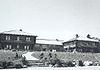
May 28, 1987 Sunrise (Yakima Park)
46°54′49.31″N 121°38′32.45″W / 46.9136972°N 121.6423472°WMount Rainier National Park Founded c. 1935, the district consists of 35 acres (14 ha), three buildings, one structure, and one object. Tacoma
[2] Landmark name[3] Image Date listed Location City or Town Summary 1 Adjutant General's Residence image pending May 1, 1991 Camp Murray
47°7′31.64″N 122°33′45.44″W / 47.1254556°N 122.5626222°WCamp Murray Also known as Building 118, now houses the Washington National Guard Museum. 2 Albers Brothers Mill 
March 19, 2002 1821 Dock Street
47°14′44.33″N 122°25′58.32″W / 47.2456472°N 122.4328667°WBuilt in 1904, with additions in 1912, this building served as a mill until 1944. Now houses apartments.[34] 3 American Lake Veterans Hospital May 19, 2009 9600 Veterans Dr. SW
47°8′4.22″N 122°34′39.73″W / 47.1345056°N 122.5777028°W4 Annobee Apartments 
July 28, 1999 319-323 North I Street
47°15′41″N 122°27′13.61″W / 47.26139°N 122.4537806°WThis Italianate style building was built in 1925.[34] 5 Auditorium Dance Hall 
January 23, 2008 1308-1310 Fawcett Avenue
47°15′02″N 122°26′33″W / 47.250474°N 122.442555°WAlso known as the Crescent Ballroom, the auditorium was built in 1922, and held concerts ranging from Rudolph Valentino in 1923, to Nirvana in 1990.[35] 6 Balfour Dock Building 
November 16, 2006 705 Dock Street
47°15′28.55″N 122°28′13.46″W / 47.2579306°N 122.4704056°WThe building was built in 1900, and is home to the Working Waterfront Maritime Museum.[36] 7 Blue Mouse Theatre January 13, 2010 2611 N. Proctor St.
47°16′17.86″N 122°29′19.43″W / 47.2716278°N 122.4887306°W8 Bowes Building 
November 23, 1979 100 S. 9th Street
47°15′20.05″N 122°26′14.59″W / 47.2555694°N 122.4373861°WBuilt in 1919. 9 Browns Point Lighthouse & Keeper's Cottage 
March 29, 1989 201 Tulalip, NE.
47°18′21.54″N 122°26′32.66″W / 47.3059833°N 122.4424056°WBuilt in 1933 10 Building at 1602 South G Street 
March 16, 1995 1602 S. G St.
47°14′50.68″N 122°26′37.73″W / 47.2474111°N 122.4438139°WBuilt in 1890, this building was originally built as the Hillside Grocery.[34] 11 Building at 712-716 Sixth Avenue 
March 16, 1995 712-716 6th Ave.
47°15′26.68″N 122°26′45.44″W / 47.2574111°N 122.4459556°WBuilt in 1925, the building originally housed three separate business, the Hob Nob Restaurant now occupies the entire building.[37] 12 Cabin No. 97 
December 13, 1977 Northwest of Tacoma on Salmon Beach
47°17′36.94″N 122°31′44.04″W / 47.2935944°N 122.5289°WSalmon Beach Also known as Walter Crooks Cabin. 13 Camp Six 
March 7, 1973 Point Defiance Park
47°18′12″N 122°31′38″W / 47.30321°N 122.52726°WPoint Defiance Park Also known as Western Washington Forest Industries Museum, the museum is designed to look like an actual logging camp.[38] 14 City Waterway Bridge 
July 16, 1982 11th Avenue, spans Thea Foss Waterway.
47°15′14.45″N 122°25′56.57″W / 47.2540139°N 122.4323806°WBuilt in 1911, it is also known as Murray Morgan Bridge.
Historic Bridges and Tunnels in Washington TR15 C. O. Lynn, Co. Funeral Home 
November 30, 2005 717 Tacoma Ave. S
47°15′28.83″N 122°26′41.66″W / 47.2580083°N 122.4449056°WThis Classical Revival building, built in 1918, served as a funeral home until 2004.[34] 16 Conrad F. & Annie K. Beutel House 
June 15, 2007 701 N. 10th
47°16′04″N 122°27′42″W / 47.26773°N 122.46158°WBuilt in 1909. 17 East 34th Street Bridge 
July 16, 1982 East 34th Street from Pacific Avenue to A Street47°14′18.4″N 122°25′54.79″W / 47.238444°N 122.4318861°W Built in 1937.
Historic Bridges and Tunnels in Washington TR18 Engine House No. 4 
October 18, 1984 220-224 E. 26th Street
47°14′18.68″N 122°25′45.27″W / 47.2385222°N 122.4292417°WBuilt in 1911. No longer in service as a fire station, today it is used by the City of Tacoma's traffic signal division.[34] 19 Engine House No. 8 
May 2, 1986 4301 S. L St
47°13′6.44″N 122°26′51.66″W / 47.2184556°N 122.4476833°WBuilt in 1909. This station was replaced in 2006 with a larger facility, and is now a private residence. 20 Engine House No. 9 
July 30, 1975 611 N. Pine Street
47°15′22.91″N 122°28′19.69″W / 47.2563639°N 122.4721361°WBuilt in 1907. This station was replaced in the 1960s with a larger facility, and is now a private fire service-themed bar and grill. 21 Engine House No. 11 
May 2, 1986 3802 McKinley Avenue
47°13′23.11″N 122°25′11.16″W / 47.2230861°N 122.4197667°WBuilt in 1909, this is still an active fire station. 22 Engine House No. 13 
May 2, 1986 3825 N. Twenty-fifth Street
47°16′13.69″N 122°29′14.87″W / 47.2704694°N 122.4874639°WBuilt in 1907, this is still an active fire station. 23 Fireboat No.1 
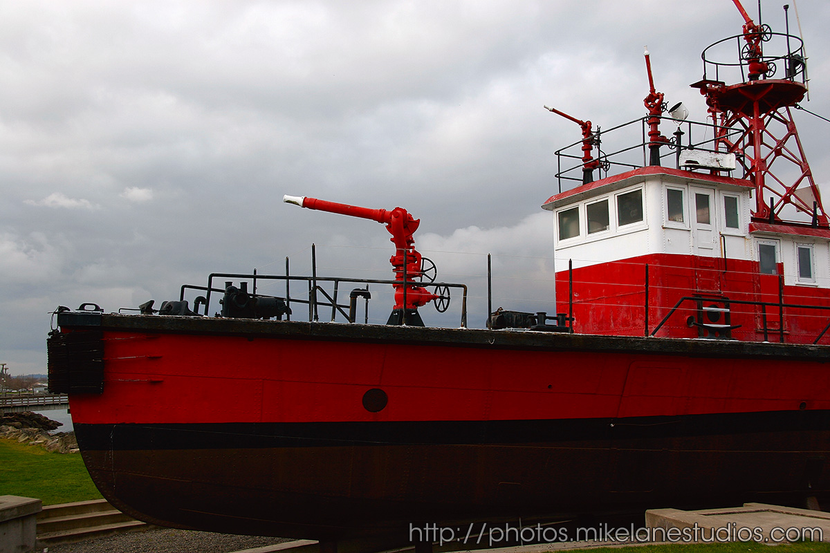
December 2, 1983 Marine Park on Ruston Way
47°17′19.65″N 122°29′21.85″W / 47.2887917°N 122.4894028°WBuilt in 1929, retired from active duty in 1985. 24 Fire Alarm Station 
May 2, 1986 415 S. Tacoma Avenue
47°15′34.43″N 122°26′40.6″W / 47.2595639°N 122.444611°WBuilt in 1928, this facility is still as the fire alarm dispatch center today. 25 Fire Station No. 1 
May 2, 1986 425 S. Tacoma Avenue
47°15′32.48″N 122°26′40.15″W / 47.2590222°N 122.4444861°WBuilt in 1919, this building has not served as a fire station in decades, but is still owned by the fire department and used for storage purposes. It is adjacent to the Fire Alarm Station. 26 Fire Station No. 2 
May 2, 1986 2701 S. Tacoma Avenue
47°14′10.75″N 122°26′20.55″W / 47.2363194°N 122.4390417°WBuilt in 1907 and heavily remodeled in 1935, this is still an active fire station. 27 Fire Station No. 5 
May 2, 1986 1453 S. 12th Street
47°15′2.54″N 122°27′19″W / 47.2507056°N 122.45528°WBuilt in 1935, this is still an active fire station. It was renumbered as Fire Station No. 4 when the previous station 4 was closed. 28 Fire Station No. 10 
May 2, 1986 7247 S. Park Avenue
47°11′25.88″N 122°26′24.67″W / 47.1905222°N 122.4401861°WBuilt in 1928, this is still an active fire station.. 29 Fire Station No. 14 
May 2, 1986 4701 N. 41st Street
47°17′9.92″N 122°29′56.22″W / 47.2860889°N 122.49895°WBuilt in 1928, this is still an active fire station.. 30 Fire Station No. 15 
May 2, 1986 3510 E. 11th Street47°16′31.21″N 122°23′46.76″W / 47.2753361°N 122.3963222°W This Mediterranean style fire station was built in 1928, and is still an active fire station..[34] 31 Fireboat Station 
May 2, 1986 302 E. 11th Street
47°15′16.04″N 122°25′50.84″W / 47.2544556°N 122.4307889°WBuilt in 1928 as part of a project that built three other stations, as well as the Fire Alarm Station. While the fireboats are still housed here, the station itself is no longer staffed.[34] 32 Fort Nisqually Granary and Factor's House 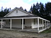
April 15, 1970 Point Defiance Park
47°18′13″N 122°31′58″W / 47.303476°N 122.532685°WPoint Defiance Park Both buildings have been moved to Point Defiance Park, and a replica of the original Fort Nisqually as a living museum. 33 Frederick H. Murray House 
August 23, 1985 402 N. Sheridan Avenue
47°15′32.05″N 122°27′24.88″W / 47.2589028°N 122.4569111°WBuilt in 1902, this Gothic style home became an alcoholism treatment center in the 1930s. It is now apartments.[34] 34 Haddaway Hall 
January 27, 1983 4301 N. Stevens
47°17′16.58″N 122°29′38.68″W / 47.2879389°N 122.4940778°WOriginally built in 1922, for John Weyerhauser and his wife, the building now houses a Baptist seminary. 35 Henry A. and Birdella Rhodes House 
August 2, 2006 701 North J Street
47°15′49″N 122°27′34″W / 47.263743°N 122.459377°WThis Queen Anne Style home was built in 1901.[34] 36 Henry Drum House 
July 20, 1977 9 St. Helens Street
47°15′49.33″N 122°26′41.4″W / 47.2637028°N 122.444833°WBuilt in 1888. 37 House at 1510 Tacoma Avenue South 
March 10, 1995 1510 Tacoma Ave., S.
47°14′52.92″N 122°26′32.48″W / 47.2480333°N 122.4423556°WThis Queen Anne Style home was built in 1902. It has since been subdivided to accommodate two residences.[34] 38 House at 1610 South G Street 
March 10, 1995 1610 S. G St.
47°14′49.71″N 122°26′38.22″W / 47.2471417°N 122.44395°WBuilt in 1911, this house once served as the rectory for the Japanese Methodist Church on the same block.[34] 39 House at 2314 South Ainsworth Avenue 
March 10, 1995 2314 S. Ainsworth Ave.
47°14′20.74″N 122°27′17.52″W / 47.2390944°N 122.4548667°WBuilt in 1926. 40 House at 2326 South L Street 
March 10, 1995 2326 S. L St.
47°14′16.75″N 122°26′55.68″W / 47.2379861°N 122.4488°WBuilt in 1904. 41 House at 605 South G Street 
March 10, 1995 605 S. G St.
47°15′28.29″N 122°26′44″W / 47.2578583°N 122.44556°WA Stick Style home built in 1906, also called the James Agnew Residence.[37] 42 House at 708-710 South 8th Street 
March 10, 1995 708 S. 8th St.
47°15′19.26″N 122°26′52.66″W / 47.25535°N 122.4479611°WBuilt in 1908, it is also known as the Buren/Holden Apartments[37] 43 House at 802-804 South G Street 
March 10, 1995 802-804 S. G St.
47°15′20.19″N 122°26′44.56″W / 47.2556083°N 122.4457111°WBuilt in 1890, it is also known as the Thomas Carroll Double House.[37] 44 John F. Yuncker House 
August 23, 1985 519 S. G Street
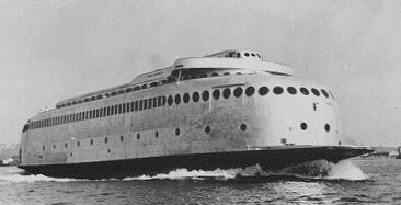
47°15′30.88″N 122°26′44.92″W / 47.2585778°N 122.4458111°WBuilt in 1888. 45 MV KALAKALA (ferry) 
March 22, 2006 Hylebos Creek Waterway, 1801 Taylor Way
47°16′31″N 122°23′12″W / 47.27514°N 122.38662°WBuilt in 1926, it is an Art Deco styled ferry that served the Washington State Ferry System from 1935 to 1967.[39] 46 Lord-Heuston House 
November 2, 2007 2902 N. Cedar Street
47°16′26″N 122°28′34″W / 47.27395°N 122.47623°WNRHP ID# 07001385 47 Manley-Thompson Ford Agency 
November 2, 2007 1302-1306 S. Fawcett Avenue
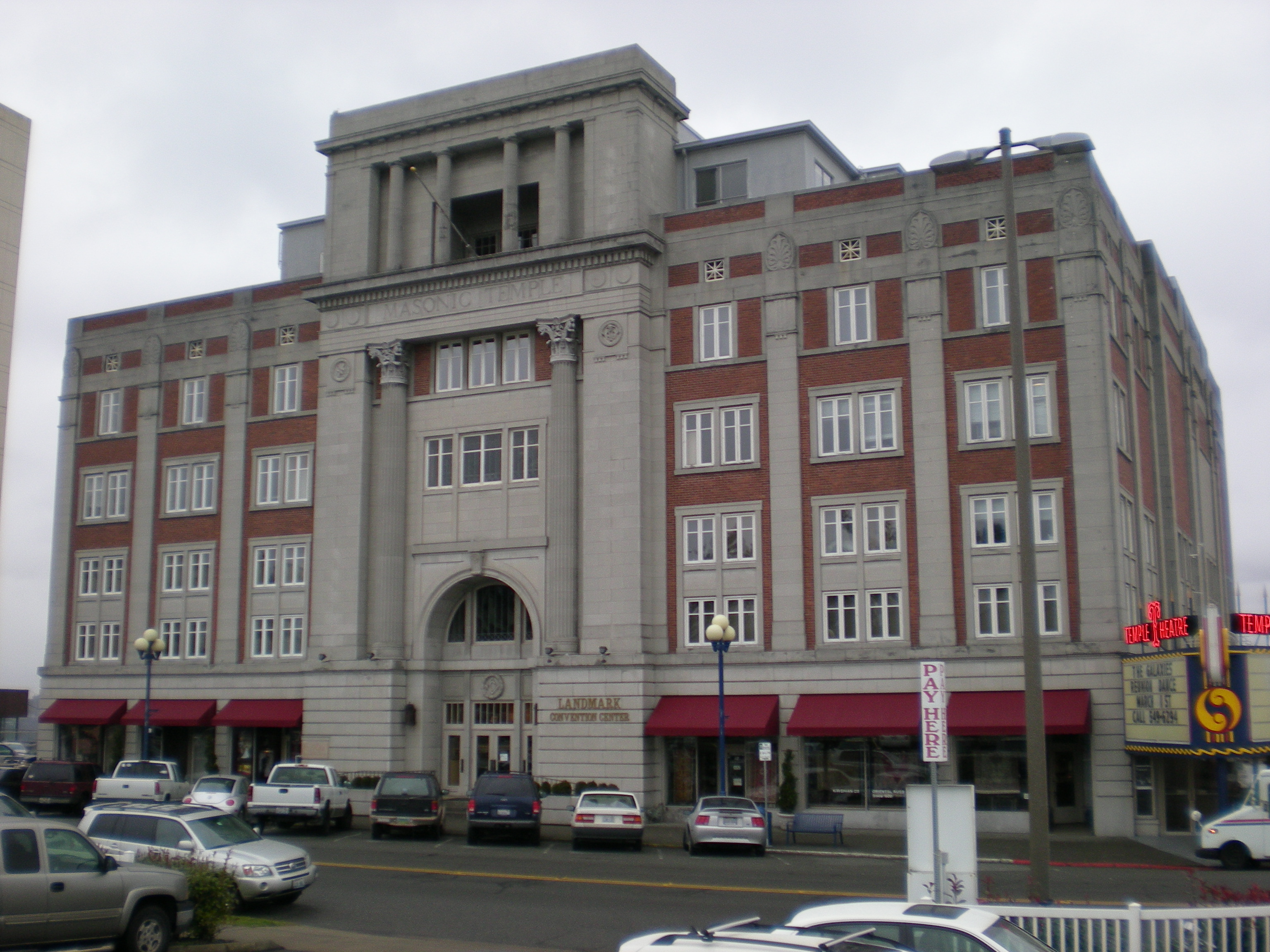
47°15′02″N 122°26′33″W / 47.250663°N 122.442581°WBuilt in 1918, in 1942 the building was merged with the next door Auditorium Dance Hall to form a single venue.[40] 48 Masonic Temple Building-Temple Theater 
April 29, 1993 47 St. Helens Avenue
47°15′43.49″N 122°26′39.08″W / 47.2620806°N 122.4441889°WBuilt in 1927, this Art Deco building houses Washington's largest dancefloor.[41] 49 McChord Field Historic District December 12, 2008 McChord Air Force Base
47°8′23.7″N 122°28′44.79″W / 47.139917°N 122.4791083°W50 McIlvaine Apartments 
March 16, 1995 920 S. 9th Street
47°15′11.65″N 122°27′26.99″W / 47.2532361°N 122.4574972°WBuilt in 1909. 51 National Bank of Tacoma 
August 2, 2006 1123 Pacific Ave
47°15′11″N 122°26′19″W / 47.25313°N 122.43855°WBuilt in 1922, the building is now home to the Tacoma Art Museum.[42] 52 Nihon Go Gakko 
August 30, 1984 1715 S. Tacoma Ave.
47°14′52.26″N 122°26′29.63″W / 47.24785°N 122.4415639°WAlso known as the Japanese Language School, the building was built in 1922, and used to gather Japanese residents during World War II, before sending them to internment camps.[43] The building was demolished in 2004 after standing vacant since the 1940s. 53 Nisqually Power Substation 
April 25, 2001 2416 S. C Street47°14′20.42″N 122°26′10.46″W / 47.2390056°N 122.4362389°W Built in 1911. 54 North 21st Street Bridge 
July 16, 1982 Spans Buckley Gulch, N. Fife and Oakes
47°16′2.71″N 122°28′10.73″W / 47.2674194°N 122.4696472°WBuilt in 1910.
Historic Bridges and Tunnels in Washington TR55 North 23rd Street Bridge 
July 16, 1982 Spans Buckley Gulch, N. Fife and Oakes
47°16′40.3″N 122°28′13.68″W / 47.277861°N 122.4704667°WBuilt in 1909.
Historic Bridges and Tunnels in Washington TR56 North Slope Historic District 
March 28, 2003 Area bounded by Division Ave., N. Grant Ave, N. Steele St., and N. I St.
47°15′41.18″N 122°27′45.04″W / 47.2614389°N 122.4625111°WConsists of 2,280 acres (9.2 km2), 698 buildings, and 211 structures. 57 Northern Pacific Office Building 
May 4, 1976 Northeastern corner of 7th St. and Pacific Ave.
47°15′27.18″N 122°26′16.89″W / 47.25755°N 122.438025°WBuilt in 1891, part of the building was demolished and turned into a park in 1920, when Northern Pacific's offices were transferred to Seattle.[44] 58 Old City Hall 
May 17, 1974 7th Avenue between Commerce and Pacific Avenue
47°15′26.87″N 122°26′18.8″W / 47.2574639°N 122.438556°WThis Renaissance style building, designed by E.A. Hatherton, served as Tacoma's City Hall from 1893 to 1959.[45] 59 Old City Hall Historic District 
December 23, 1977 Roughly bounded by St. Helens Ave., Court C, freeway spur, 7th and 9th Streets.
47°15′22.46″N 122°26′29.57″W / 47.2562389°N 122.4415472°WConsists of 165 acres (0.67 km2), 20 buildings, and one structure. 60 Pacific Brewing and Malting Company 
July 31, 1978 S. 25th St. between C St. and Jefferson Avenue
47°14′17.83″N 122°26′10.96″W / 47.2382861°N 122.4363778°WFounded in 1888, the brewery closed in 1916, after Washington passed laws prohibiting alcohol.[46] The site consists of thirteen buildings. 61 Pacific National Bank Building 
March 7, 1980 1302 Pacific Avenue
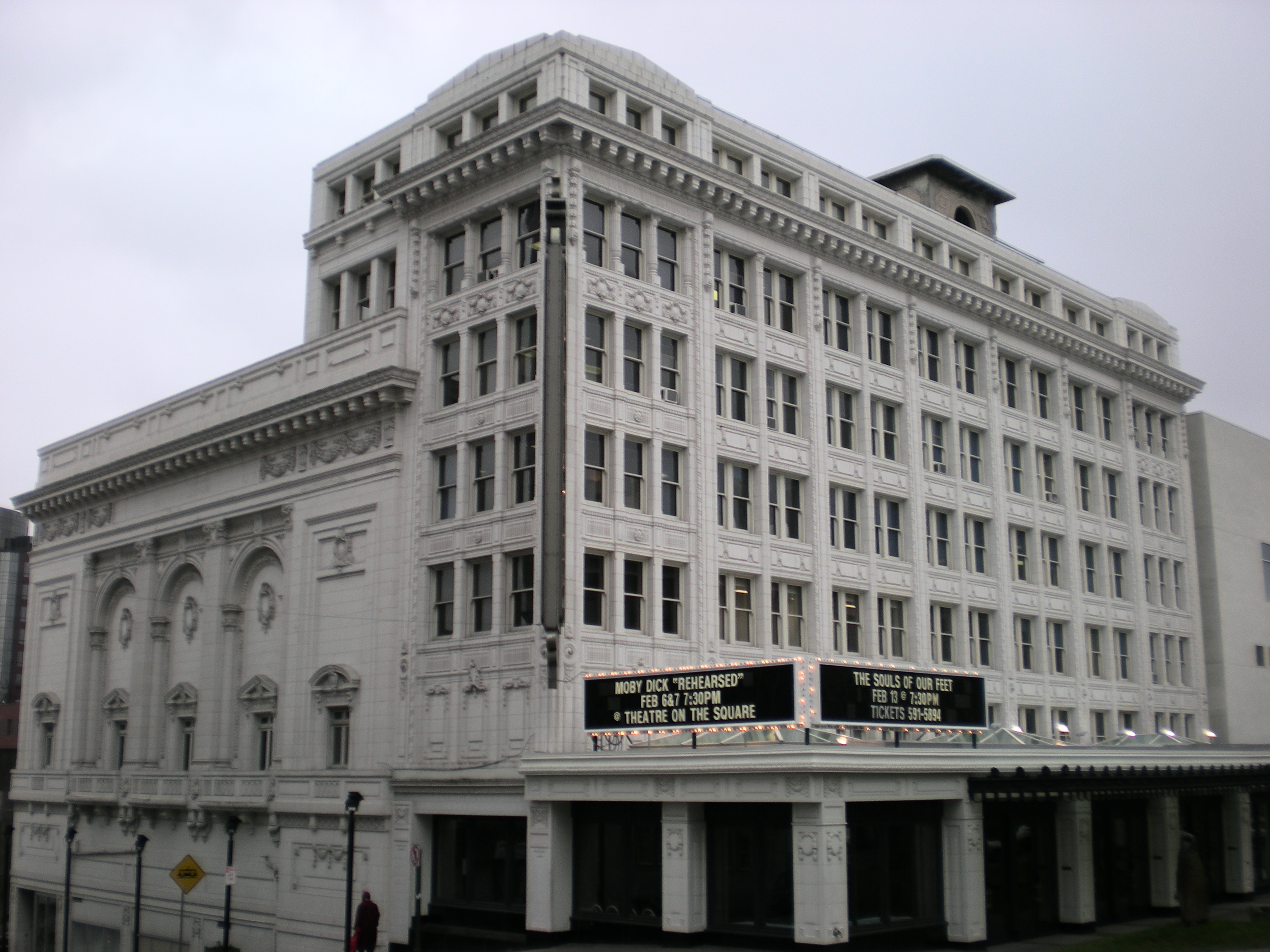
47°15′4.65″N 122°26′12.37″W / 47.2512917°N 122.4367694°WBuilt in 1891, the building by Burnham and Root was also known as the Luzon Building. Demolished September 2009.[47] 62 Pantages Theatre 
November 7, 1976 901 and 909 Broadway
47°15′18.79″N 122°26′22.21″W / 47.2552194°N 122.4395028°WBuilt in 1916, it is the oldest remaining of several theaters built for Alexander Pantages.[48][42] 63 Perkins Building 
November 22, 2000 1101 A Street
47°15′46.08″N 122°26′5.27″W / 47.2628°N 122.4347972°WBuilt in 1907. 64 Pythian Temple 
August 23, 1985 924-926½ Broadway
47°15′17.49″N 122°26′22.7″W / 47.2548583°N 122.439639°WBuilt in 1906. 65 Rhodes Medical Arts Building 
November 21, 1978 740 St. Helens Avenue
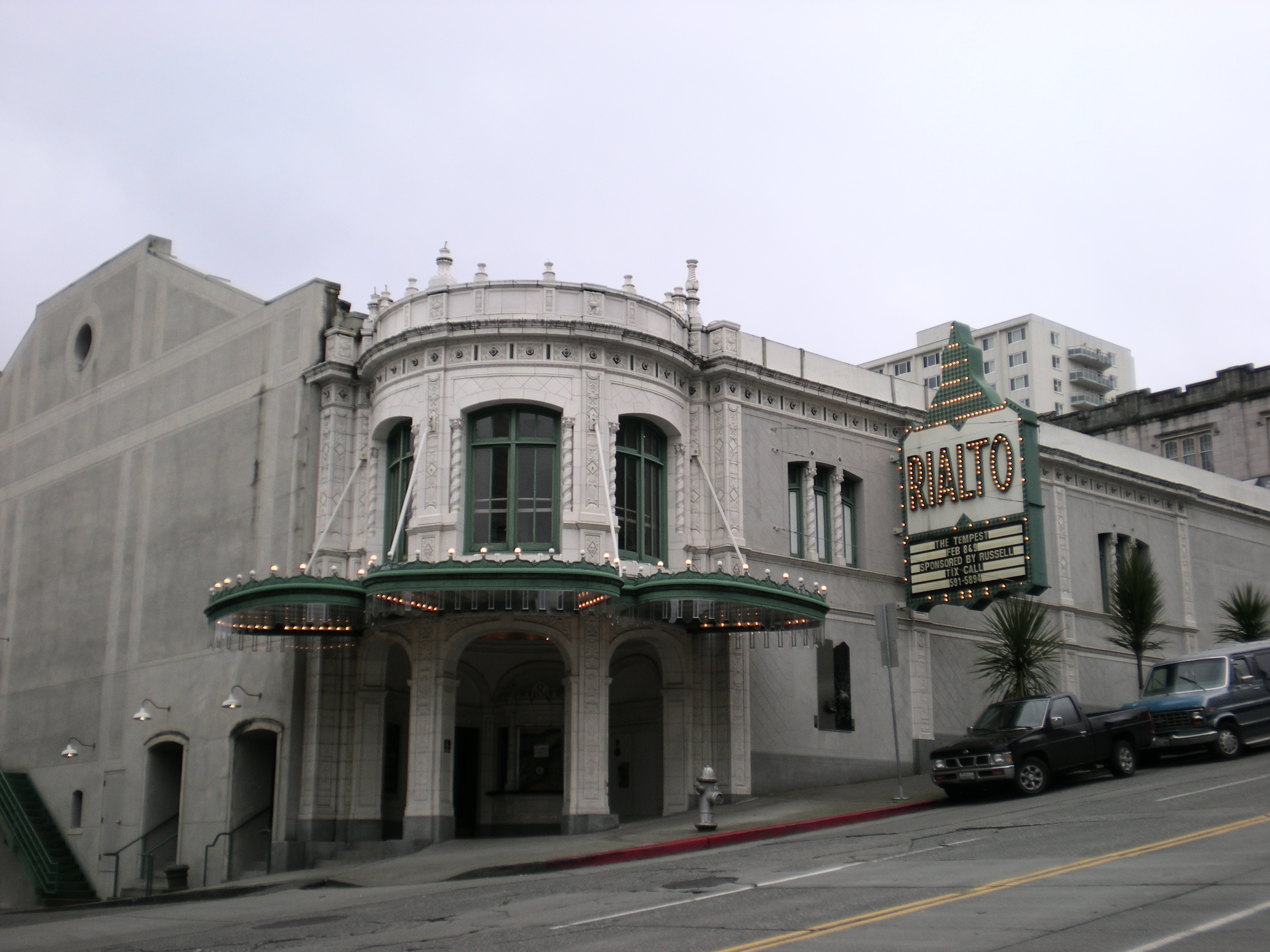
47°15′22.04″N 122°26′25.51″W / 47.2561222°N 122.4404194°WBuilt in 1930, this Art Deco building now houses the Tacoma City Hall. 66 Rialto Theater 
August 21, 1992 310 9th Street
47°15′18.15″N 122°26′23.65″W / 47.2550417°N 122.4399028°WBuilt in 1918, this is a Beaux-Arts style theater.[49] 67 Sandberg-Schoenfeld Buildings 
August 12, 1999 1411-1423 Pacific Avenue
47°14′57.23″N 122°28′35.41″W / 47.2492306°N 122.4765028°WBuilt in 1907. 68 Schultz Apartments 
March 16, 1995 1002 S. 12th Street
47°15′3.73″N 122°26′56.62″W / 47.2510361°N 122.4490611°WBuilt in 1911. 69 Slavonian Hall 
November 7, 1976 2306 N. 30th Street
47°16′28.25″N 122°28′0″W / 47.2745139°N 122.466667°WBuilt in 1901, as a fraternal lodge by the Slavonian Benevolent Society.[50] 70 South J Street Historic District 
May 8, 1986 Area bounded by west side of S. J St. between S. Seventh and S. Eighth Streets
47°15′20.73″N 122°27′4.09″W / 47.2557583°N 122.4511361°WIncludes less than 1-acre (4,000 m2), and eight buildings, seven of which are in the Queene Anne style.[37] 71 Sprague Building 
November 21, 1985 1501-1505 Pacific Avenue
47°14′57.34″N 122°26′8.88″W / 47.2492611°N 122.4358°WBuilt in 1889. 72 St. Peter's Episcopal Church 
November 5, 1974 Starr between 29th and 30th Streets
47°16′27.54″N 122°27′44.78″W / 47.2743167°N 122.4624389°WBuilt in 1873, it is the oldest building in Tacoma. 73 St. Rita's Church 
March 1, 1996 1402 S. Ainsworth
47°14′51″N 122°27′29″W / 47.24763°N 122.45807°WBuilt in 1924. 74 Stadium-Seminary Historic District 
May 26, 1977 Roughly bounded by 1st, I, and 10th Streets and shoreline.
47°16′2.45″N 122°27′18.02″W / 47.2673472°N 122.4550056°WEncompasses 2,000 acres (8.1 km2) and 402 buildings. 75 Sunset Telephone & Telegraph Building 
August 23, 1985 1101 Fawcett Avenue
47°15′10.72″N 122°26′28.01″W / 47.2529778°N 122.4411139°WBuilt in 1901. 76 Tacoma Building 
October 22, 2001 1015-1021 A Street
47°15′46.08″N 122°26′5.27″W / 47.2628°N 122.4347972°WAlso known as the Weyerhaeuser Headquarters Building. 77 Tacoma Ice Company's Cold Storage Plant December 7, 2010 2602 S. Holgate St.
47°14′16″N 122°26′15″W / 47.23778°N 122.4375°W78 Tacoma Mausoleum 
April 21, 2000 5302 S. Junett Street
47°12′33.04″N 122°28′27.56″W / 47.2091778°N 122.4743222°WBuilt in 1910. 79 Tacoma Narrows Bridge Ruins 
August 31, 1992 State Route 16 over the Tacoma Narrows
47°16′02″N 122°33′02″W / 47.26735°N 122.55043°WTacoma Narrows Built in 1940, but collapsed just four months later during a windstorm. 80 US Post Office-Tacoma Downtown Station-Federal Building 
May 30, 1991 1102 S. A Street
47°15′10.96″N 122°26′10.4″W / 47.2530444°N 122.436222°WBuilt in 1910. 81 Union Depot-Warehouse Historic District 
April 2, 1980 Roughly bounded by railroad tracks, 15th, 23rd and Market Streets
47°14′53.41″N 122°26′16.16″W / 47.2481694°N 122.4378222°WConsists of 265 acres (1.07 km2) and 34 buildings. 82 Union Passenger Station 
March 15, 1974 1713 Pacific Avenue
47°14′46.31″N 122°26′5.91″W / 47.2461972°N 122.434975°WThe station was completed in 1911 from a design by Reed and Stem, the same architects that designed Grand Central Station in New York City.[51] 83 Walker Apartment Hotel 
May 16, 1994 405 6th Avenue
47°15′31.47″N 122°26′32.07″W / 47.2587417°N 122.4422417°WBuilt in 1927. 84 Washington Building June 29, 2009 1019 Pacific Ave.
47°15′13.08″N 122°26′17.67″W / 47.2536333°N 122.4382417°WTacoma 85 Washington School 
August 23, 2006 3701 N. 26th Street47°16′16″N 122°29′12″W / 47.27119°N 122.48663°W Also known as Washington-Hoyt Elementary School. 86 William Ross Rust House 
August 23, 1985 1001 N. I Street
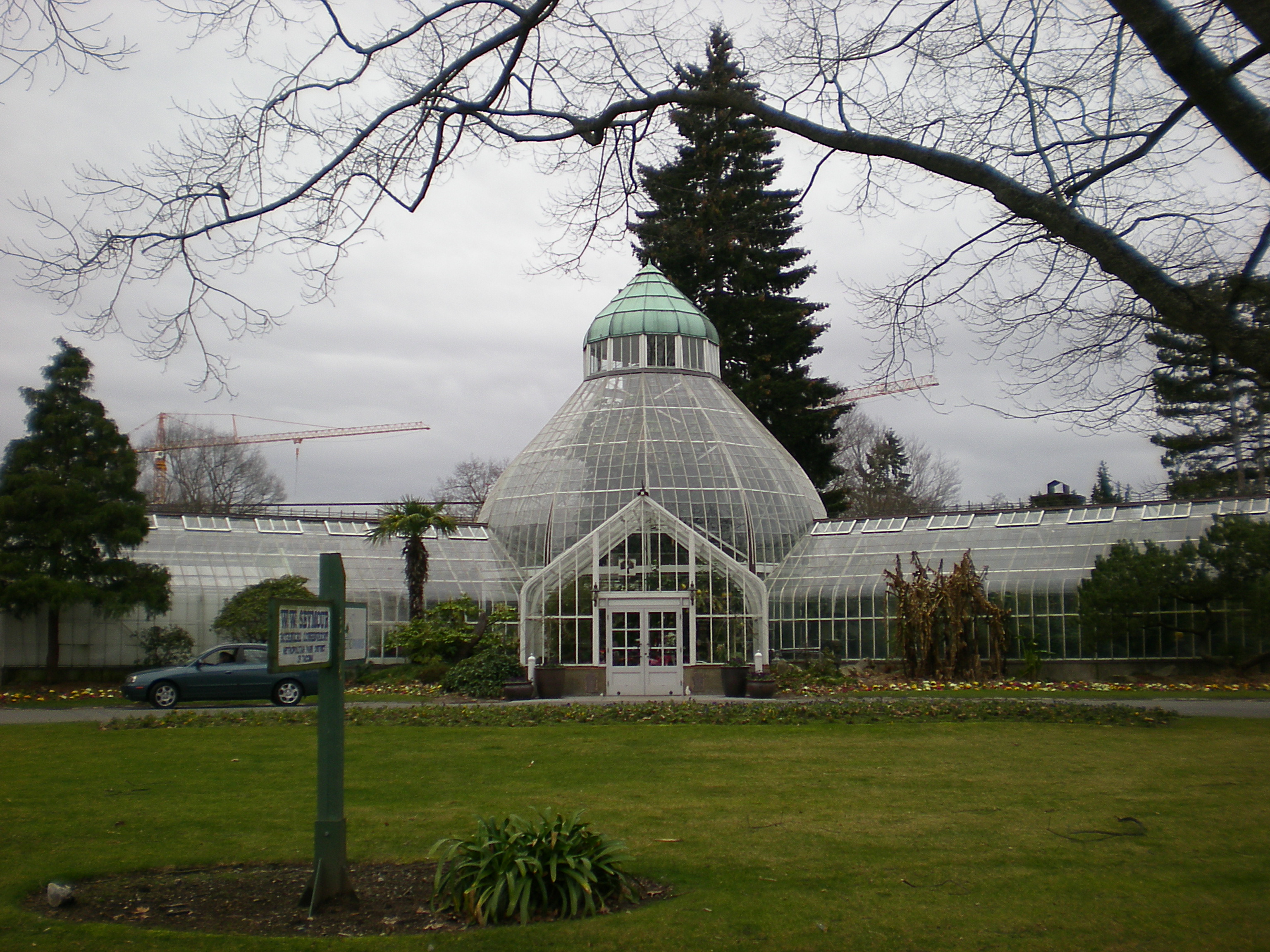
47°15′59.33″N 122°27′40.78″W / 47.2664806°N 122.4613278°WBuilt in 1905 for William Ross Rust, then President of the Tacoma Smelter and Refining Company. 87 Wright Park and Seymour Conservatory 
October 8, 1976 Division Ave. to 6th Ave., between S. G and I Street47°15′37″N 122°26′57″W / 47.26027°N 122.44909°W Established in 1886, the conservatory was added in 1907.[52] 88 Y. M. C. A. Building 
January 27, 1983 714 Market Street47°15′25.62″N 122°26′28.8″W / 47.2571167°N 122.441333°W Built in 1908. See also
References
- ^ "National Register of Historic Places: Weekly List Actions". National Park Service, United States Department of the Interior. Retrieved on November 10, 2011.
- ^ a b Numbers represent an ordering by significant words. Various colorings, defined here, differentiate National Historic Landmark sites and National Register of Historic Places Districts from other NRHP buildings, structures, sites or objects.
- ^ a b "National Register Information System". National Register of Historic Places. National Park Service. 2008-04-24. http://nrhp.focus.nps.gov/natreg/docs/All_Data.html.
- ^ Galentine 2006, p. 105
- ^ a b Roberts 1999, p. 289
- ^ "Ashford Mansion - Introduction". http://www.ashfordmansion.com/. Retrieved 2008-02-19.
- ^ Dunkelberger 2005, p. 23
- ^ Filley 1996, p. 221
- ^ Price, p. 34
- ^ Roberts 1999, p. 311
- ^ a b c Kirk 1995, p. 341
- ^ "Sumner Walking Tour" (PDF). http://www.ci.sumner.wa.us/Documents/sumnerwalkingtour.pdf. Retrieved 2008-02-19.
- ^ Filley 1996, p. 14
- ^ Kirk 1995, p. 320
- ^ Holstine 2005, p. 204
- ^ Halliday 2000, p. 55
- ^ "Historic Fort Steilacoom". http://www.fortsteilacoom.com. Retrieved 2008-02-24.
- ^ Roberts 1999, p. 287
- ^ a b Roberts 1999, p. 290
- ^ "Upper Nisqually Valley Community Plan" (PDF). http://www.co.pierce.wa.us/xml/services/home/property/pals/pdf/upcomcul.pdf. Retrieved 2008-02-19.
- ^ Filley 1996, p. 135
- ^ "Mount Rainier Historic Structures". http://www.nps.gov/archive/mora/ncrd/historic.htm. Retrieved 2008-02-23.
- ^ Roberts 1999, p. 299
- ^ Samson 2006, p. 311
- ^ "City of Sumner - Ryan House". http://www.ci.sumner.wa.us/Living/Ryan_House.htm. Retrieved 2008-02-19.
- ^ http://www.cityofgigharbor.net/page.php?id=1127
- ^ Dunkelberger, p. 16
- ^ Roberts 1999, p. 298
- ^ Roberts 1999, p. 296
- ^ "American Memory from the Library of Congress". http://memory.loc.gov/cgi-bin/query/S?ammem/hh:@field(SUBJ+@od1(WASHINGTON--Pierce+County--Greenwater+vicinity)). Retrieved 2008-03-20.
- ^ Coulombe 2005, p. 268
- ^ Dunkelberger 2005, p. 51
- ^ a b Candy Hatcher (October 25, 2000). "Evergreen Journal: Double life of an old ghost town". http://www.seattlepi.com/local/wilk25.shtml. Retrieved 2008-02-19.
- ^ a b c d e f g h i j k "Tacoma Historic Property Inventory". http://wspdsmap.ci.tacoma.wa.us/website/HistoricMap/viewer.htm. Retrieved 2008-03-01.
- ^ John Gillie (February 19, 2008). "Fresh start for historic venue". The News Tribune. http://www.thenewstribune.com/business/story/170130.html. Retrieved 2008-02-19.[dead link]
- ^ Kelly Kearsley (February 17, 2007). "Shoring up the waterfront museum’s home". The News Tribune. http://dwb.thenewstribune.com/business/story/6373055p-5685081c.html. Retrieved 2008-02-19.
- ^ a b c d e Landmarks Preservation Commission. "Hilltop Web Version" (PDF). http://www.tacomaculture.org/historic/resource/Hilltop%20Web%20Version%20opt.pdf. Retrieved 2008-02-19.
- ^ Filley 1996, p. 18
- ^ Wootton 2007, p. 42
- ^ "Minutes: Landmarks Preservation Commission" (PDF). http://www.tacomaculture.org/historic/resource/2007/HP_Minutes%20091207.pdf. Retrieved 2008-02-23.[dead link]
- ^ Roberts 1999, p. 308
- ^ a b Kirk 1995, p. 336
- ^ "University to commemorate Japanese Language School". November 13, 2003. http://www.uwnews.org/uweek/uweekarticle.asp?articleID=17750&Search=diversity. Retrieved 2008-02-19.[dead link]
- ^ Kirk 1995, p. 337
- ^ "The Tacoma Historical Society". http://www.tacomahistory.org/. Retrieved 2008-02-19.
- ^ Ed Murrieta (July 27, 2005). "Toast of Tacoma". http://dwb.thenewstribune.com/ae/restaurants/story/5053488p-4607720c.html. Retrieved 2008-02-19. On Internet Archive.
- ^ Todd Matthews, Luzon's Last Dawn, Tacoma News-Tribune, September 26, 2009. Accessed online September 28, 2009.
- ^ Grau 1910, p. 143
- ^ Roberts 1999, p. 304
- ^ Kirk 1995, p. 338
- ^ Kirk 1995, p. 335
- ^ Kirk 1995, p. 340
Sources
- Coulombe, Charles A. (2005). Haunted Castles of the World: Ghostly Legends and Phenomena from Keeps and Fortresses Around the Globe, Globe Pequot, ISBN 1592285341.
- Dunkelberger, Steve; Neary, Walter (2005). Lakewood, Arcadia Publishing, ISBN 073853045X.
- Filley, Bette (1996). The Big Fact Book About Mount Rainier, Dunamis House, ISBN 1880405067.
- Galentine, Elizabeth (2006). Anderson Island, Arcadia Publishing, ISBN 0738548545.
- Grau, Robert (1910). The Business Man in the Amusement World: A Volume of Progress in the Field of the Theatre, Broadway Publishing Co.
- Halliday, Jan; Chehak, Gail (2000). Native Peoples of the Northwest: A Traveler's Guide to Land, Art, and Culture, Sasquatch Books, ISBN 1570612412.
- Holstine, Craig; Hobbs, Richard (2005). Spanning Washington: Historic Highway Bridges of the Evergreen State, Washington State University Press, ISBN 0874222818.
- Kirk, Ruth; Alexander, Carmela (1995). Exploring Washington's Past: A Road Guide to History, University of Washington Press, ISBN 0295974435.
- Price, Lori; Anderson, Ruth (2002). Puyallup: A Pioneer Paradise, Arcadia Publishing, ISBN 0738523747.
- Roberts, George; Roberts, Jan (1999). Discover Historic Washington State, Gem Guides Book Company, ISBN 1889786071.
- Samson, Karl (2006). Frommer's Washington State, Frommer's, ISBN 0470036842.
- Smith, Giselle (2004). Best Places Northwest: The Best Restaurants, Lodgings, and a Complete Guide to the Region, Sasquatch Books, ISBN 1570614172.
- Wootton, Sharon; Savage, Maggie (2007). You Know You're in Washington When...: 101 Quintessential Places, People, Events, Customs, Lingo, and Eats of the Evergreen State, Globe Pequot, ISBN 0762743018.
U.S. National Register of Historic Places Topics Lists by states Alabama • Alaska • Arizona • Arkansas • California • Colorado • Connecticut • Delaware • Florida • Georgia • Hawaii • Idaho • Illinois • Indiana • Iowa • Kansas • Kentucky • Louisiana • Maine • Maryland • Massachusetts • Michigan • Minnesota • Mississippi • Missouri • Montana • Nebraska • Nevada • New Hampshire • New Jersey • New Mexico • New York • North Carolina • North Dakota • Ohio • Oklahoma • Oregon • Pennsylvania • Rhode Island • South Carolina • South Dakota • Tennessee • Texas • Utah • Vermont • Virginia • Washington • West Virginia • Wisconsin • WyomingLists by territories Lists by associated states Other  Category:National Register of Historic Places •
  Portal:National Register of Historic Places
Municipalities and communities of Pierce County, Washington County seat: Tacoma Cities 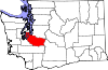
Towns Carbonado | Eatonville | Ruston | South Prairie | Steilacoom | Wilkeson
CDPs Artondale | Ashford | Elbe | Elk Plain | Fort Lewis | Fox Island | Frederickson | Graham | Greenwater | McChord AFB | Midland | Parkland | Prairie Ridge | South Hill | Spanaway | Summit | Waller
Unincorporated
communitiesAnderson Island | Browns Point | Burnett | Cascadia | Dash Point | Herron Island | Home | Kapowsin | Ketron Island | La Grande | Lakebay | Longbranch | McKenna | McNeil Island | Paradise | Purdy | Vaughn | Wauna
Indian reservations Ghost towns Fairfax | Melmont
Footnotes ‡This populated place also has portions in an adjacent county or counties
Categories:- National Register of Historic Places listings in Pierce County, Washington
- Pierce County, Washington
- National Register of Historic Places in Washington (state) by county
-


Wikimedia Foundation. 2010.