- Wilkeson, Washington
Infobox Settlement
official_name = Wilkeson, Washington
settlement_type =Town
nickname =
motto =
imagesize =
image_caption =
image_
imagesize =
image_caption =
image_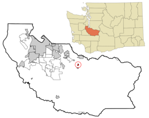
mapsize = 250x200px
map_caption = Location of Wilkeson, Washington
mapsize1 =
map_caption1 =subdivision_type = Country
subdivision_name =United States
subdivision_type1 = State
subdivision_name1 =Washington
subdivision_type2 = County
subdivision_name2 = Piercegovernment_footnotes =
government_type =
leader_title =
leader_name =
leader_title1 =
leader_name1 =
established_title =
established_date =unit_pref = Imperial
area_footnotes =area_magnitude =
area_total_km2 = 1.3
area_land_km2 = 1.3
area_water_km2 = 0.0
area_total_sq_mi = 0.5
area_land_sq_mi = 0.5
area_water_sq_mi = 0.0population_as_of = 2000
population_footnotes =
population_total = 395
population_density_km2 = 312.7
population_density_sq_mi = 810.0timezone = Pacific (PST)
utc_offset = -8
timezone_DST = PDT
utc_offset_DST = -7
elevation_footnotes =
elevation_m = 245
elevation_ft = 804
latd = 47 |latm = 6 |lats = 25 |latNS = N
longd = 122 |longm = 2 |longs = 54 |longEW = Wpostal_code_type =
ZIP code
postal_code = 98396
area_code = 360
blank_name = FIPS code
blank_info = 53-78925GR|2
blank1_name = GNIS feature ID
blank1_info = 1528154GR|3
website =
footnotes =Wilkeson is a town in Pierce County,
Washington ,United States . The population was 395 at the 2000 census and 465 in 2008 according to the Washington State Office of Financial Management. Sunset Lake Camp, a summer camp that is sponsored by theSeventh-Day Adventist Church , is also in the towns limits. "Just turn left at the giant log, head up the hill and you're there."History
Wilkeson was officially incorporated on
July 24 ,1909 and boasts the oldest operating [http://www.whiteriver.wednet.edu/Schools/wilkeson/history.htm elementary school building] in Washington state..The following passage is from an [http://www.stumpranchonline.com/skagitjournal/Upriver/Uto-Conc/Wilkeson01-Bio.html online biography of Frank Wilkeson] :
" [In] his 1869 report of the Cascades mountain range, Frank [Wilkeson] 's father, Samuel, wrote: 'these forests of trees — so enchain the senses of the grand and so enchant the sense of the beautiful that I linger on the theme and am sic|loathe to depart — surpassing the woods of all the rest of the globe...' Like many writers of that time, Samuel indulged in hyperbole, but his love of the Cascades seems very genuine. Sometime in the period of 1876-78, four large coal veins were discovered and mined near a region known as Carbonado in the Cascade foothills. A small village formed and was named for Samuel after NP extended a rail line there from Tacoma in 1877. He was appointed secretary of the NP board in March 1869. The area became well known for its coal coking ovens as well as the natural sandstone formations that were the source of material for facing the new capitol in Olympia. At one time the town of Wilkeson had a population of about 3,000, but today it hovers around 400. Many of the same principals of the Wilkeson operation built the coking ovens at Cokedale, about 80 miles north in Skagit County, which led to the creation of the town of Sedro, now Sedro-Woolley. As far as we can determine, neither Frank nor any member of his family actually ever lived in the namesake town, but his brother, Samuel G. Wilkeson, invested substantially in coal companies that operated there...
"Frank's father died in 1889 but by then another Wilkeson was investing financially in the Puget Sound: Samuel Gansevoort Wilkeson, Frank's older brother. Samuel G. first came to Tacoma in 1873, the year that town was chosen as the terminus for the Northern Pacific. He was a contemporary of Tacoma boomer Leonard Howarth and became wealthy in his activities with the same companies as Howarth — the St. Paul & Tacoma Lumber Co. and the Wilkeson Coal & Coke Co. That company mined coking coal in the town of Wilkeson, the town near Enumclaw that was named to honor Frank's and Sam's father."
Geography
Near the towns of Buckley and Carbonado, Wilkeson is located at coor dms|47|6|25|N|122|2|54|W|city (47.107066, -122.048263)GR|1.
According to the
United States Census Bureau , the town has a total area of 0.5square mile s (1.3km² ), all of it land.Demographics
As of the
census GR|2 of 2000, there were 395 people, 140 households, and 100 families residing in the town. Thepopulation density was 810.0 people per square mile (311.2/km²). There were 150 housing units at an average density of 307.6/sq mi (118.2/km²). The racial makeup of the town was 95.95% White, 1.01% Native American, and 3.04% from two or more races. Hispanic or Latino of any race were 1.52% of the population.There were 140 households out of which 38.6% had children under the age of 18 living with them, 58.6% were married couples living together, 10.7% had a female householder with no husband present, and 27.9% were non-families. 20.7% of all households were made up of individuals and 9.3% had someone living alone who was 65 years of age or older. The average household size was 2.82 and the average family size was 3.37.
In the town the population was spread out with 30.4% under the age of 18, 10.4% from 18 to 24, 28.1% from 25 to 44, 21.8% from 45 to 64, and 9.4% who were 65 years of age or older. The median age was 35 years. For every 100 females there were 91.7 males. For every 100 females age 18 and over, there were 97.8 males.
The median income for a household in the town was $44,375, and the median income for a family was $46,875. Males had a median income of $38,250 versus $31,458 for females. The
per capita income for the town was $17,481. About 2.0% of families and 4.0% of the population were below thepoverty line , including none of those under age 18 and 18.2% of those age 65 or over.Wilkeson is the last place to get food or groceries on the way to Evans Creek ORV (Off Road Vehicle) park near the end of SR165. NW Forest day passes are required for use of the park and can be purchased at the Wilkeson Grocery.
References
[http://www.ofm.wa.gov/ Washington State Office of Financial Management] ]
External links
* [http://www.stumpranchonline.com/skagitjournal/Upriver/Uto-Conc/Wilkeson01-Bio.html Frank Wilkeson biography]
* [http://www.sunsetlake.org Sunset Lake Camp]
Wikimedia Foundation. 2010.