- Carbonado, Washington
Infobox Settlement
official_name = Carbonado, Washington
settlement_type =Town
nickname =
motto =
imagesize =
image_caption =
image_
imagesize =
image_caption =
image_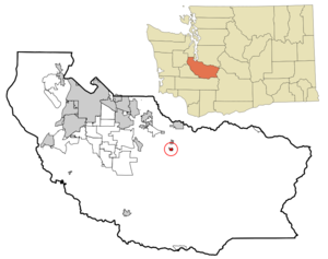
mapsize = 250x200px
map_caption = Location of Carbonado, Washington
mapsize1 =
map_caption1 =subdivision_type = Country
subdivision_name =United States
subdivision_type1 = State
subdivision_name1 =Washington
subdivision_type2 = County
subdivision_name2 = Piercegovernment_footnotes =
government_type =
leader_title =
leader_name =
leader_title1 =
leader_name1 =
established_title =
established_date =unit_pref = Imperial
area_footnotes =area_magnitude =
area_total_km2 = 1.1
area_land_km2 = 1.1
area_water_km2 = 0.0
area_total_sq_mi = 0.4
area_land_sq_mi = 0.4
area_water_sq_mi = 0.0population_as_of = 2000
population_footnotes =
population_total = 621
population_density_km2 = 589.9
population_density_sq_mi = 1527.9timezone = Pacific (PST)
utc_offset = -8
timezone_DST = PDT
utc_offset_DST = -7
elevation_footnotes =
elevation_m = 363
elevation_ft = 1191
latd = 47 |latm = 4 |lats = 47 |latNS = N
longd = 122 |longm = 3 |longs = 5 |longEW = Wpostal_code_type =
ZIP code
postal_code = 98323
area_code = 360
blank_name = FIPS code
blank_info = 53-09970GR|2
blank1_name = GNIS feature ID
blank1_info = 1517390GR|3
website =
footnotes =Carbonado is a town in Pierce County,
Washington ,United States . The population was 621 at the 2000 census.History
*This history has been condensed. For a more thorough history of Carbonado and the surrounding area read, Carbon River Coal Country.*
Carbonado was one of quite a few towns in the Carbon River valley to be settled during an economic boom in the region. The boom was brought on by raw material demands in nearby growing towns such as Seattle and Tacoma. Starting with the town of Burnett and moving on through Wilkeson, Carbonado, Montezuma, Fairfax, and finally Manley Moore, these settlements sprawled up the valley to the very boundary of Mt. Ranier National Park. Most of these towns were company towns. Meaning that a company specializing in the harvest of raw materials owned the plot of land that the town was situated on and that the resources were harvested from. Often and in the case of Carbonado, the company also owned the houses and the energy resources as well. The energy resource in Carbonado was also the raw material that the citizens of the company town were harvesting, coal. During the time of the initial boom in the valley Carbonado grew to rival the size of Tacoma at the time. The railroad, which was integral to the transportation of people, of the raw materials harvested and the supplies need by the towns, stretched all the way up the valley too. Not only did it service the towns but also several homesteads farther up the valley. These homesteads were settled by dominantly Polish immigrants. They supplied the towns down the valley with fresh milk and eggs. Two survive to present day, one known as Carbon River Ranch (the main house is actually the old Fairfax school and can be seen from the highway) and the other formerly known as Huckle-Chuck. At Huckle-Chuck the original homesteaders house and one of their barns are still used and functional. At the peak of the boom both of these homesteads and the towns which they supplied were quite productive and lively.
However, the boom did not last as the economy took a downturn and with it came the end of the need for the lower grade coal being mined at Carbonado and the timber being harvested for use in the settlements further up the valley. Since the decline of the mining era, Carbonado has experienced extreme shrinking and small booms ultimately ending with a steady population. All of the current residents work elsewhere and what was once an economic center for the valley is now a residential community. The railroad also pulled out and destroyed its towns quite recently. The Rails to Trails project has most of the actual railline land in its possession.
The time that Carbonado did spend as a coal mining town is forever kept by the a cemetery, abandoned mines, a grown over coal slag pile, a school, and the company houses left behind. The cemetery holds the memories of older and more recent dead with many of the graveholders family still living nearby. Huge concrete monoliths that once held that cables for the mining carts, point straight towards the old mine shafts and openings and stand overgrown and utilized now only by the town's children. One hill in town started out as the coal slag pile and now has been carpeted by ivy and trees. The school makes up what is known as the Carbonado Historical School District and grades K-8th still attend there. Many of the houses that the company built and originally owned still line main street. They look very similar to each other as was the style of the company builders at the time. And though many of the miners abandoned the town, in some of those houses still live the direct descendants of the original miners.Carbonado was officially incorporated onSeptember 13 ,1948 .Geography
Carbonado is located at coor dms|47|4|47|N|122|3|5|W|city (47.079724, -122.051433)GR|1.
According to the
United States Census Bureau , the town has a total area of 0.4square mile s (1.1km² ), all of it land.Demographics
As of the
census GR|2 of 2000, there were 621 people, 200 households, and 158 families residing in the town. Thepopulation density was 1,527.9 people per square mile (584.8/km²). There were 210 housing units at an average density of 516.7/sq mi (197.8/km²). The racial makeup of the town was 96.46% White, 0.48% Native American, 0.64% from other races, and 2.42% from two or more races. Hispanic or Latino of any race were 1.93% of the population.There were 200 households out of which 48.0% had children under the age of 18 living with them, 68.5% were married couples living together, 4.0% had a female householder with no husband present, and 21.0% were non-families. 17.5% of all households were made up of individuals and 8.0% had someone living alone who was 65 years of age or older. The average household size was 3.11 and the average family size was 3.56.
In the town the population was spread out with 34.9% under the age of 18, 7.7% from 18 to 24, 29.8% from 25 to 44, 20.5% from 45 to 64, and 7.1% who were 65 years of age or older. The median age was 30 years. For every 100 females there were 110.5 males. For every 100 females age 18 and over, there were 108.2 males.
The median income for a household in the town was $50,250, and the median income for a family was $55,909. Males had a median income of $38,583 versus $24,821 for females. The
per capita income for the town was $16,135. About 1.4% of families and 4.0% of the population were below thepoverty line , including 2.9% of those under age 18 and none of those age 65 or over.Misc Notes
Visit the graveyard in Carbonado and view the graves from a major mine explosion that killed half of the town.
Frank Robinson, founder and CEO of Robinson Helicopters was born in Carbonado in 1930.
References
External links
Wikimedia Foundation. 2010.