- DuPont, Washington
-
DuPont, Washington — City — Location of DuPont, Washington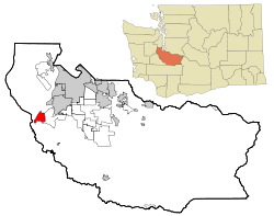
Coordinates: 47°5′57″N 122°38′15″W / 47.09917°N 122.6375°WCoordinates: 47°5′57″N 122°38′15″W / 47.09917°N 122.6375°W Country United States State Washington County Pierce Area – Total 5.7 sq mi (14.8 km2) – Land 5.7 sq mi (14.7 km2) – Water 0.0 sq mi (0.0 km2) Elevation 249 ft (76 m) Population (2010) – Total 8,199 – Density 430.6/sq mi (166.3/km2) Time zone Pacific (PST) (UTC-8) – Summer (DST) PDT (UTC-7) ZIP code 98327 Area code(s) 253 FIPS code 53-18965[1] GNIS feature ID 1513919[2] DuPont is a city in Pierce County, Washington, United States. The population was 8,199 at the 2010 census.
Contents
History
The Nisqually tribe arrived in the area at least 5700 years ago, subsisting on shellfish from the beaches and salmon from Sequalitchew Creek. Captain George Vancouver mapped the area in 1792, and in 1833, the Hudson's Bay Company established a fur trading post at Fort Nisqually. The fort was relocated upstream in 1843.[3]
The first school in the area was the Nisqually Methodist Mission school, which operated from 1840 through 1842. Miss Chloe A. Clarke was appointed teacher at the mission school.[4] The first public school was established in 1852, and in 1869, the federal government auctioned the site off to settlers. In 1906, the DuPont company purchased a 5-square-mile (13 km2) area for construction of an explosives plant. By 1909, the company town had more than 100 houses.[5]
DuPont was officially incorporated on March 26, 1912, and was re-incorporated in 1951.[5] DuPont has recently undergone a modern transformation as the modern planned communities such as "Northwest Landing" has been realized. The city is expected to have a built out population of 12,000+.
The community today
Today, DuPont is still a growing community. The elementary school in DuPont (Chloe Clark Elementary) which hosted kindergarten through fifth grade reached capacity in the 2007-2008 school year. As a result, starting with the 2008-2009 school year, Steilicoom School district realigned all three elementary schools, Chloe Clark Elementary and Cherrydale Primary in Steilacoom now only has students in grades K-3. Saltar's Point Elementary in Steilacoom now serves 4th and 5th grades. Pioneer Middle School relocated from Steilacoom to Dupont in August 2008. The new school received a LEED award for its “Green” Design elements.[6]
DuPont is divided into several "villages", each with their own design style and/or building contractors. Northwest Landing is the most visible due to a sign along the freeway announcing it. Several businesses have opened in the downtown area, but development has stalled except for a new credit union building. The Historic Village, a residential area, is the only part of DuPont that is not a modern planned community and is on the registry of historic places. Bell Hill is considered the most expensive area. Dupont has trails and green belts throughout, and is 90% built out according to the master plan. Sections that remain empty are stalled due to economic conditions as of 2010, or pre-existing activities that prevent development until completed. [7]
Geography
DuPont is located at 47°05′57″N 122°38′15″W / 47.099070°N 122.637544°W (47.099070, -122.637544).[8]
According to the United States Census Bureau, the city has a total area of 5.7 square miles (15 km2), of which 5.7 square miles (15 km2) is land and 0.04 square miles (0.10 km2) (0.35%) is water.
Sequalitchew Creek trail and beach
Within the city limits of DuPont, next to city hall, lies Sequalitchew Creek trail which can be accessed by the old narrow gauge railway roadbed which ran from the old Powderworks plant to Puget Sound. The trail leads to Sequalitchew beach. The creek corridor is used by hundreds of species, including Bald Eagles, hawks, McKay's Bunting, song birds, herons, ducks, owls, frogs, salamanders, snakes, beaver, raccoons, coyotes, deer, and rabbits. The waters off Sequalitchew Beach are inhabited by Harbor Seal, Marbled Murrelet and Gray Whale.[9][10]
Further information: List of fauna of Sequalitchew CreekOther Trails & wildlife areas
DuPont's other trails and the parks offer similar access to wildlife and are throughout the city providing exceptional outdoor activity opportunities. The trail and greenbelt system provides a wide cross-section of DuPont's geographic and natural environments, while maintaining urban feel. Full maps are available at the visitor center, city hall, and the history museum. Maps[11]
Demographics
Historical populations Census Pop. %± 1960 354 — 1970 384 8.5% 1980 559 45.6% 1990 592 5.9% 2000 2,452 314.2% 2010 8,199 234.4% As of the census[1] of 2000, there were 2,452 people, 936 households, and 670 families residing in the city. The population density was 430.6 inhabitants per square mile (166.3 /km2). There were 977 housing units at an average density of 171.6 inhabitants per square mile (66.3 /km2). The racial makeup of the city was 74.63% White, 8.20% African American, 0.82% Native American, 7.34% Asian, 0.69% Pacific Islander, 2.24% from other races, and 6.08% from two or more races. Hispanic or Latino of any race were 6.36% of the population.
There were 936 households out of which 40.1% had children under the age of 18 living with them, 63.8% were married couples living together, 6.0% had a female householder with no husband present, and 28.4% were non-families. 23.2% of all households were made up of individuals and 3.7% had someone living alone who was 65 years of age or older. The average household size was 2.61 and the average family size was 3.12.
In the city the population was spread out with 29.9% under the age of 18, 5.0% from 18 to 24, 40.8% from 25 to 44, 17.8% from 45 to 64, and 6.5% who were 65 years of age or older. The median age was 32 years. For every 100 females there were 93.7 males. For every 100 females age 18 and over, there were 94.2 males.
The median income for a household in the city was $52,969, and the median income for a family was $57,202. Males had a median income of $42,946 versus $36,741 for females. The per capita income for the city was $22,742. About 2.2% of families and 4.6% of the population were below the poverty line, including 3.5% of those under age 18 and 2.5% of those age 65 or over.
References
- ^ a b "American FactFinder". United States Census Bureau. http://factfinder.census.gov. Retrieved 2008-01-31.
- ^ "US Board on Geographic Names". United States Geological Survey. 2007-10-25. http://geonames.usgs.gov. Retrieved 2008-01-31.
- ^ Hudson's Bay Company Era, DuPont Museum
- ^ http://homeworkhelper.dupontmuseum.com/TheNisquallyMissionHistoricSite.aspx
- ^ a b The Dupont Era, DuPont Museum
- ^ Steilacoom School District Timeline, 2008 Entry
- ^ City of Dupont Master Building Plan
- ^ "US Gazetteer files: 2010, 2000, and 1990". United States Census Bureau. 2011-02-12. http://www.census.gov/geo/www/gazetteer/gazette.html. Retrieved 2011-04-23.
- ^ Sequalitchew Creek Council
- ^ Weyerhaueser Export Facility Plan, Final Environmental Impact Statement
- ^ Parks and Recreation in DuPont
External links
- City of DuPont
- History of DuPont at HistoryLink
- Dupont Museum
- DuPont Visitor Information
- DuPont Company Heritage
- DuPont, Washington at the Open Directory Project (Out of Date)
Municipalities and communities of Pierce County, Washington Cities 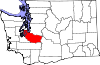
Towns Carbonado | Eatonville | Ruston | South Prairie | Steilacoom | Wilkeson
CDPs Artondale | Ashford | Elbe | Elk Plain | Fort Lewis | Fox Island | Frederickson | Graham | Greenwater | McChord AFB | Midland | Parkland | Prairie Ridge | South Hill | Spanaway | Summit | Waller
Unincorporated
communitiesAnderson Island | Browns Point | Burnett | Cascadia | Dash Point | Herron Island | Home | Kapowsin | Ketron Island | La Grande | Lakebay | Longbranch | McKenna | McNeil Island | Paradise | Purdy | Vaughn | Wauna
Indian reservations Ghost towns Fairfax | Melmont
Footnotes ‡This populated place also has portions in an adjacent county or counties
Categories:- Cities in Washington (state)
- Populated places in Pierce County, Washington
- Cities in the Seattle metropolitan area
- Company towns in Washington (state)
- DuPont


Wikimedia Foundation. 2010.