East 34th Street Bridge

East 34th Street Bridge

Infobox_nrhp | name =East 34th Street Bridge
nrhp_type =


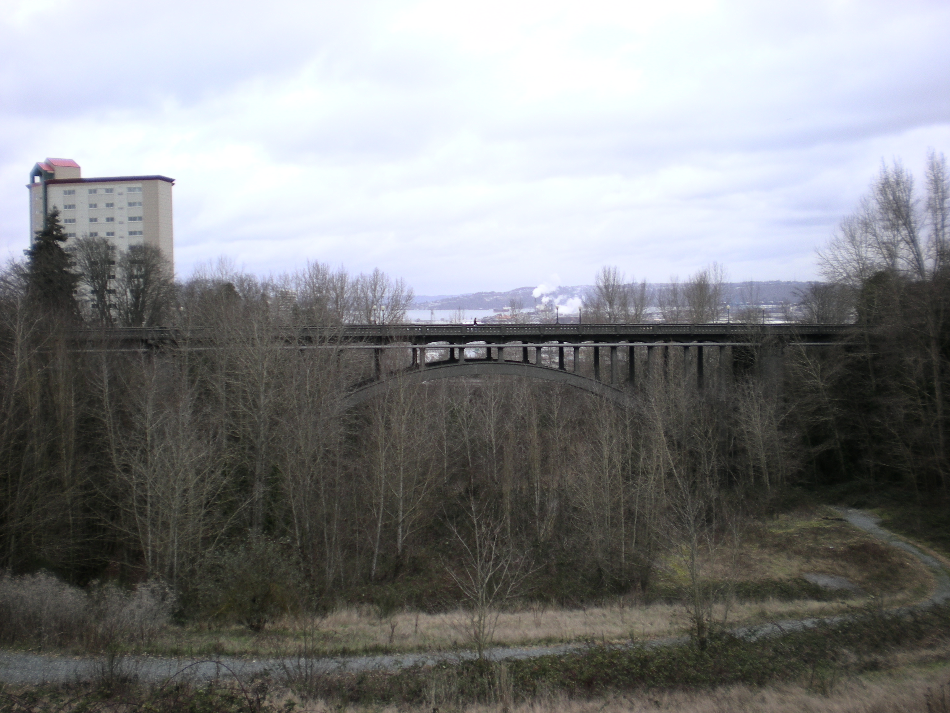
caption = The bridge from the south.
location= Tacoma, Washington
lat_degrees = 47
lat_minutes = 13
lat_seconds = 50.1
lat_direction = N
long_degrees = 122
long_minutes = 25
long_seconds = 43.9
long_direction = W
locmapin = Washington
area =
built =1937
architect= Forsbeck,C.D.; MacRae of Seattle Co.
architecture= Other
added = July 16, 1982
governing_body = Local
mpsub=Historic Bridges/Tunnels in Washington State TR
refnum=82004279cite web|url=http://www.nr.nps.gov/|title=National Register Information System|date=2007-01-23|work=National Register of Historic Places|publisher=National Park Service]
The East 34th Street Bridge is a concrete open-spandrel bridge in Tacoma, Washington. The bridge was built in 1937 to replace a wood bridge that had previously spanned the gulch. The bridge is constructed of two rib arches, that are supported by convert|24|ft|m|0|adj=on support legs, with spandrel columns between the arches and the bridge's convert|485|ft|m|0|adj=on deck. The concrete railings on the deck are adorned with urn-shaped lampposts. [harvnb|Holstine|2005|p=202]

The bridge was added to the National Register of Historic Places in 1982.

References

ources

* Holstine, Craig; Hobbs, Richard (2005). "Spanning Washington: Historic Highway Bridges of the Evergreen State", Washington State University Press, ISBN 0874222818.


Wikimedia Foundation. 2010.

Игры ⚽ Поможем сделать НИР

Look at other dictionaries:

  • East 34th–Campus (RTA Rapid Transit station) — Infobox Station name=East 34th–Campus image size= image caption= address=2711 East 34th Street Cleveland, Ohio 44115 line=RTA Rapid Transitrail color box|system=GCRTA|line=Redrail color box|system=GCRTA|line=Greenrail color… …   Wikipedia

  • East 116th (RTA Rapid Transit station) — Infobox Station name=East 116th type=RTA light rail station image size= image caption= address=2780 East 116th Street Cleveland, Ohio 44120 coordinates=coord|41|29|2.5|N|81|36|12.3|W|type:railwaystation region:US OH|display=inline,title line=rail …   Wikipedia

  • East 79th (RTA Blue and Green Line Rapid Transit station) — Infobox Station name=East 79th image size=250 image caption= address=2838 East 79th Street Cleveland, Ohio 44104 line=RTA Rapid Transitrail color box|system=GCRTA|line=Greenrail color box|system=GCRTA|line=Blue other=Bus # 2 (East 55th–East 79th) …   Wikipedia

  • East River (New York) — East River Wasserwege in New York City (2 = East River) Verbindet Gewässer Upper New York Bay (Mündung des Hudson River in den …   Deutsch Wikipedia

  • Franklin D. Roosevelt East River Drive — Route information Maintained by NYSDOT and NYCDOT Length …   Wikipedia

  • Chrystie Street Connection — [v · Legend …   Wikipedia

  • Manhattan Bridge — View from Brooklyn Carries 7 lanes of roadway, 4 tracks of the B D N Q trains of the New York City Subway, pedestrians, and bicycles …   Wikipedia

  • 125th Street (Manhattan) — Coordinates: 40°48′39″N 73°57′09″W / 40.8108°N 73.9526°W / 40.8108; 73.9526 …   Wikipedia

  • M Street (Washington, D.C.) — The name M Street refers to two major thoroughfares in the United States capital of Washington, D.C.Because of the Cartesian coordinate based street naming system in Washington, the name M Street can be used to refer to any east west street… …   Wikipedia

  • Times Square–42nd Street (New York City Subway) — Infobox NYCS name = Times Square–42nd Street bg color = black service = Times Square passengers = 55.487 million pass year = 2006 pass percent = 3 borough = Manhattan transfer station = 42nd Street–Port Authority Bus Terminal transfer line = IND… …   Wikipedia

Share the article and excerpts

Direct link
Do a right-click on the link above
and select “Copy Link”