- Manhattan Bridge
-
Manhattan Bridge 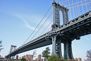
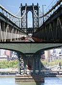
View from BrooklynCarries 7 lanes of roadway, 4 tracks of the B D N Q trains of the New York City Subway, pedestrians, and bicycles Crosses East River Locale New York City (Manhattan-Brooklyn)
Next to the Brooklyn BridgeMaintained by New York City Department of Transportation Designer Leon Solomon Moisseiff[1] Design Suspension bridge Total length 6,855 ft (2,089 m) Width 120 feet (37 m)[1] Height 336 ft (102 m) (towers)[1] Longest span 1,480 feet (451 m)[2] Clearance below 135 ft (41.1 m)[1] Constructed by Othniel Foster Nichols[1] Construction begin 1901[1] Construction end 1912[1] Opened December 31, 1909 (though not complete)[1] Daily traffic 70,341 (2008)[3] Coordinates 40°42′26″N 73°59′27″W / 40.707222°N 73.9909°WCoordinates: 40°42′26″N 73°59′27″W / 40.707222°N 73.9909°W 

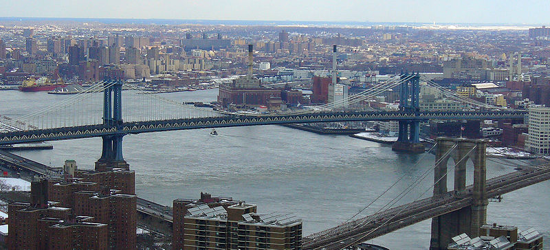
The Manhattan Bridge is a suspension bridge that crosses the East River in New York City, connecting Lower Manhattan (at Canal Street) with Brooklyn (at Flatbush Avenue Extension). It was the last of the three suspension bridges built across the lower East River, following the Brooklyn and the Williamsburg bridges. The bridge was opened to traffic on December 31, 1909 and was designed by Leon Moisseiff,[1] who later designed the infamous original Tacoma Narrows Bridge that opened and collapsed in 1940. It has four vehicle lanes on the upper level (split between two roadways). The lower level has three lanes, four subway tracks, a walkway and a bikeway. The upper level, originally used for streetcars, has two lanes in each direction, and the lower level is one-way and has three lanes in peak direction. It once carried New York State Route 27 and later was planned to carry Interstate 478. No tolls are charged for motor vehicles to use the Manhattan Bridge.
The original pedestrian walkway on the south side of the bridge was reopened after forty years in June 2001.[4] It was also used by bicycles until late summer 2004, when a dedicated bicycle path was opened on the north side of the bridge, again in 2007 while the bike lane was used for truck access during repairs to the lower motor roadway, and for a third time in 2011, when ongoing construction on the north side of the bridge necessitated narrow shelters, narrowing the path to make it unsafe for cycling.
- Main span: 1,470 ft (448 m)
- Length of suspension cables: 3,224 ft (983 m)
- Total length: 6,855 ft (2,089 m)
The neighborhood near the bridge on the Brooklyn side, once known as Fulton Landing has been gentrified and is called DUMBO, an acronym for Down Under the Manhattan Bridge Overpass.
To celebrate the bridge's centennial anniversary, a series of events and exhibits were organized by the New York City Bridge Centennial Commission in October 2009. These included a ceremonial parade across the Manhattan Bridge on the morning of October 4 and a fireworks display in the evening.[5] In 2009, the bridge was also designated as a National Historic Civil Engineering Landmark by the American Society of Civil Engineers.[6]
Contents
Arch and colonnade
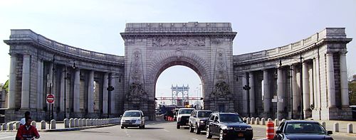
In 1910, a year after the bridge opened, the architectural firm Carrère and Hastings drew up preliminary plans for an elaborate grand entry to the bridge on the Manhattan side, as part of the "City Beautiful" movement. Construction began that year, and plans were finalized in 1912. The arch and colonnade were completed in 1915. The decoration includes pylons which were sculpted by Carl A. Heber and a frieze called "Buffalo Hunt" by Charles Rumsey.[7]
The arch and colonnade were designated a New York City landmark on November 25, 1975. After many years of neglect, and attempts by traffic engineers to remove the structure, the arch and colonnade were repaired and restored in 2000.[7][8]
Subway tracks
The four subway tracks on the bridge are used by the New York City Subway. On the Manhattan side, the south side tracks, used by N Q trains, connect to Canal Street on the BMT Broadway Line while the north side tracks, used by the B D trains, connect to the Chrystie Street Connection through Grand Street. On the Brooklyn side, the two pairs merge under Flatbush Avenue to a large junction with the BMT Fourth Avenue Line and BMT Brighton Line at DeKalb Avenue. For 18 years, between 1986 and 2004, one set of tracks (or the other set) was closed to repair structural damage.
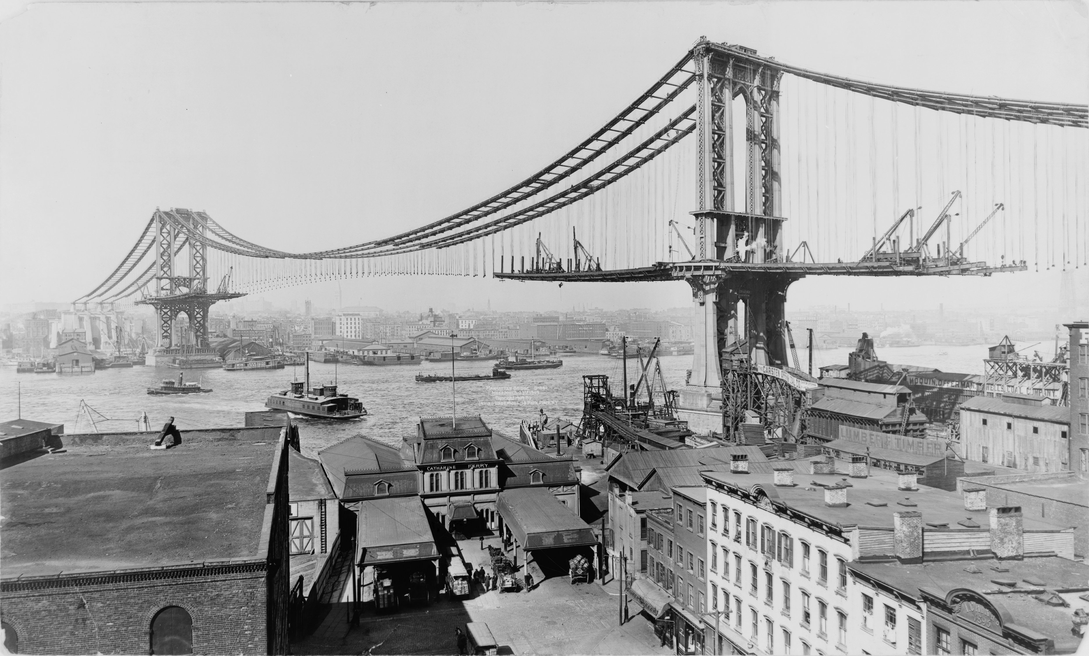
 The Manhattan Bridge under construction in March of 1909
Trackage history
When the bridge first opened, the tracks did not connect to any others. In 1912, the Manhattan Bridge Three Cent Line and Brooklyn and North River Railroad, two streetcar companies, began operations on those tracks until the BRT (later BMT), which also had two tracks each over the Brooklyn and Williamsburg Bridges, trackage was connected to the bridge in 1915 and the trolleys were moved to the upper level roadways until 1929, when service was discontinued.[9]
The Brooklyn side of the tracks has not changed since subway service began on the bridge. It has always been fed by tracks from the BMT Fourth Avenue Line and the BMT Brighton Line. On the Manhattan side, however, the two north tracks originally connected to the BMT Broadway Line (where the south tracks now connect) while the two south tracks curved south to join the BMT Nassau Street Line towards Chambers Street station. This connection has been severed and the tracks are now used for storage.
On November 26, 1931, a connection south of Chambers Street to the Montague Street Tunnel opened, adding two stations (Broad and Fulton Streets) and rerouted train service on the bridge's south side. Service on that side became relatively low afterward as the only trains that normally crossed it were The Bankers’ Special, which ran from either the Sea Beach and/or Fourth Avenue Line, crossed the Manhattan Bridge or Montague Street Tunnel into Manhattan, and then returned to Brooklyn via the opposite crossing.
Concurrent with the building of the Chrystie Street Connection (opened November 26, 1967) to connect to the north tracks, the south tracks were rerouted to the BMT Broadway Line connection, and the connecting tracks to the BMT Nassau Street Line were closed and subsequently removed. The connection, and its related projects, opened two new stations (Grand Street and, in July 1968, 57th Street – Sixth Avenue) and added express service on the IND Sixth Avenue Line. The IND B train was extended via this new connection to the BMT West End Line in Brooklyn to replace the T while the D was rerouted from the IND Culver Line to the BMT Brighton Line via the bridge. The N (BMT Sea Beach Line) and Q (BMT Brighton Line) trains now use the south side of the bridge for service to Broadway.
 Cross section illustrating the bridge's lane layout
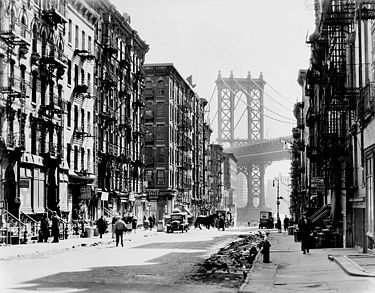
Since the tracks were on the outer part of the bridge, passing trains caused the structure to tilt and sway. The wobble worsened as trains became longer and heavier. The New York City Department of Transportation failed to maintain the bridge properly, and the tracks were closed for repairs beginning in April 1986, blocking the paths of trains that crossed the bridge and reducing the number of trains passing between Manhattan and Brooklyn. The north tracks, which had been more heavily used, were closed first. This blockage split the B and D trains into two sections (trains from The Bronx and upper Manhattan terminated at 34th Street – Herald Square, thus suspending express service on Sixth Avenue while trains from Brooklyn section were rerouted to Broadway via express and the south side of the bridge) and rerouted the N via the Montague Street Tunnel.
The north tracks were reopened and the south tracks were closed simultaneously in December 1988, merging again the B and D trains, rerouting the Q to 6th Avenue, and suspending express service on the Broadway Line. After an 18-month delay of procurements, the New York City Transit Authority and politicians pressured the DOT to resume N train service on the bridge's south side on September 30, 1990, despite warnings from engineers that the structure was unsafe and major repairs still had to be made.[10][11] On December 27, state inspectors forced south side service to be rerouted via the tunnel again after discovery of corroded support beams and missing steel plates.[10] Following the controversial firing of the city's deputy commissioner for bridges, David Steinberger and his administrative assistant David Bronstein by Transportation Commissioner Lucius Riccio after this closing, the New York City Council's Transportation committee held an inquiry into the decision to restore subway service on the Manhattan Bridge south side (as well as the safety of all New York City bridges) with reluctance from Riccio and Mayor David Dinkins.[11][12][13][14] They found that the Transportation Department and Transit Authority's lack of cooperative inspection were a major contributor for the deteriorating conditions.[15][16][17]
A projection for a reopening date was initially made for 1995.[18] In the same year, the north side was closed during off-peak hours for six months, rerouting the Q to Broadway and cutting D service from Brooklyn and B service from Manhattan. The south side finally reopened on July 22, 2001, whereby the north side was again closed, returning the Q to Broadway (thus returning express service on that line), introducing the new W train (which ran on the West End Line), and cutting B and D service from Brooklyn. The south side was closed on weekends from April to November 2003, rerouting the Q via the Montague Street Tunnel. On February 22, 2004, the north side reopened, and all four tracks were in service simultaneously for the first time in 18 years. B and D trains returned to Brooklyn, but switched southern routes (B to the Brighton Line, and D to the West End Line), the N once again used the bridge for travel, and the W no longer ran in Brooklyn.
The bridge and I-478
As part of the construction of the Lower Manhattan Expressway, there were plans to make the Manhattan Bridge Interstate 178 but since this interstate would have led to a crosstown expressway and the existing Brooklyn-Queens Expressway, the FHWA said that the first digit should be even so I-478 was chosen.[19] However, with the cancellation of I-78 through New York City, the spur did not qualify to be part of the Interstate Highway System.
In popular culture
- 1984: The bridge played a large role in the Steve Martin romantic comedy film The Lonely Guy, in which it is a popular spot for lonely guys to commit suicide, and the meeting place for Martin and Judith Ivey.
- 1984: The bridge is featured prominently in director Sergio Leone's gangster epic Once Upon a Time in America.
- 1994: In The Cowboy Way, the two main cowboy characters chase a B train over the bridge to rescue a friend in grave danger.
- 1995: The villain Two-Face uses the bridge's Brooklyn anchorage for his hideout in the film Batman Forever.
- 1999: In Aftershock: Earthquake in New York, the Manhattan Bridge is one of many NYC landmarks to be destroyed by the earthquake that devastates Manhattan.
- 2005: The bridge is featured prominently in Peter Jackson's remake of King Kong.
- 2006: Construction of the Manhattan Bridge appears as a sub-plot in Jed Rubenfeld's novel The Interpretation of Murder.
- 2007: The film I Am Legend shows the Brooklyn and Manhattan Bridges with their center spans destroyed. A flashback reveals they were hit by missiles to stop the exodus from a quarantined Manhattan.
- 2009: In the remake of the film The Taking of Pelham 123, the final showdown between Ryder and Walter Garber takes place on the south pedestrian deck of the Manhattan Bridge.
Gallery
-

View from the Brooklyn Bridge
-
Cross section of the bridge
-

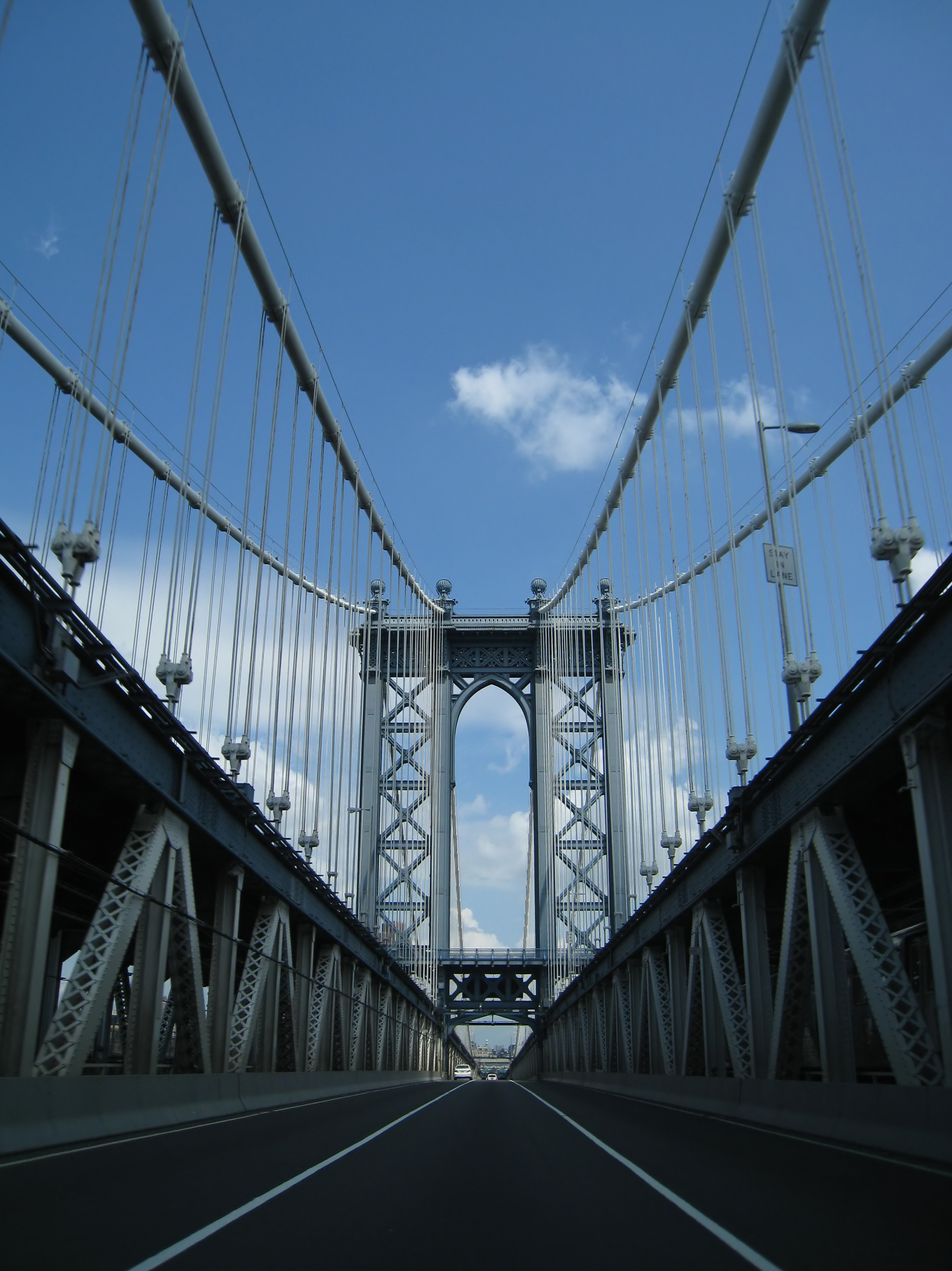
Lower Level Northbound
-
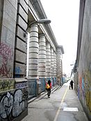
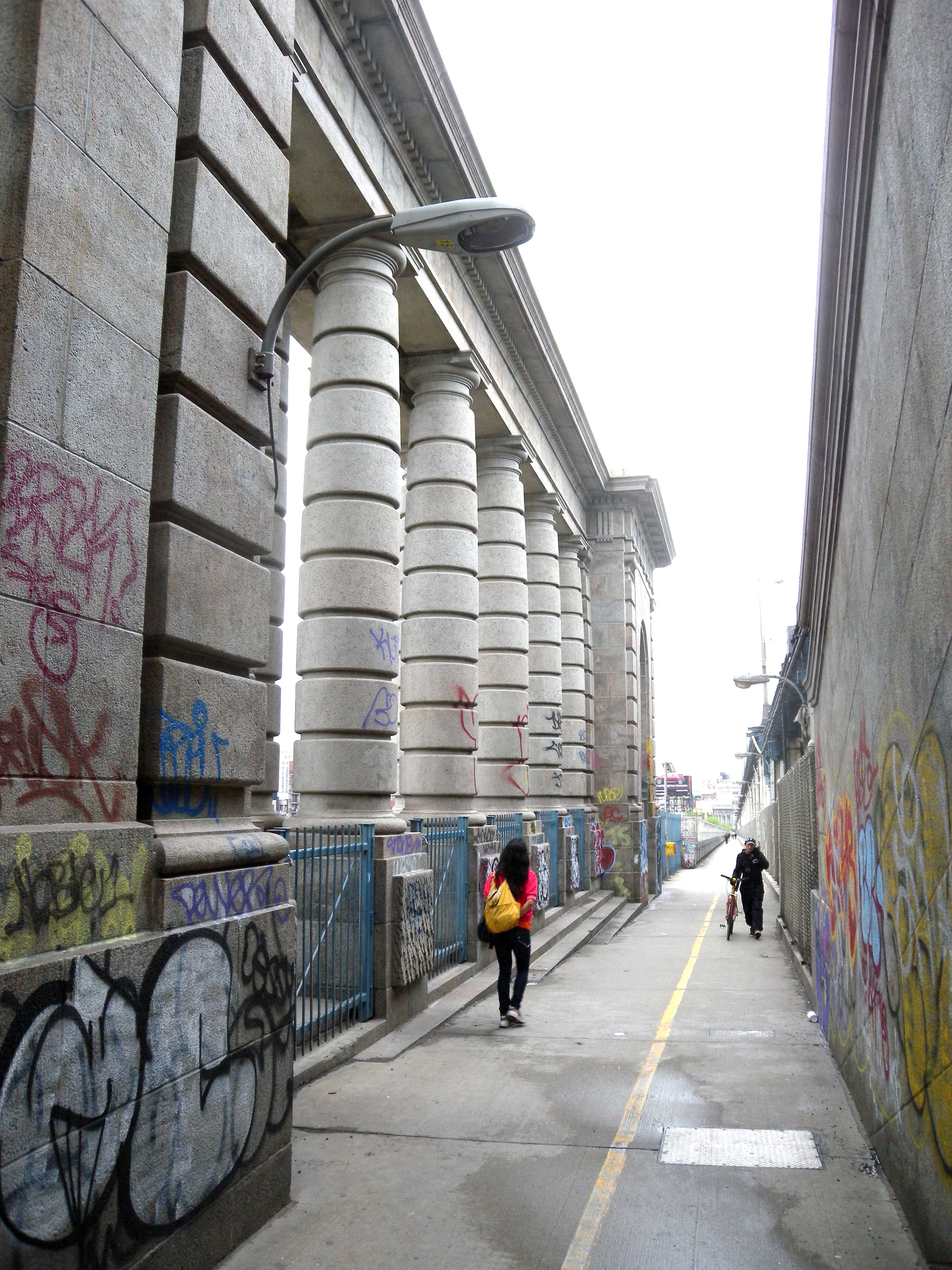
One of the pedestrian walkways
-
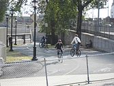
Manhattan bikeway
References
- Notes
- ^ a b c d e f g h i Manhattan Bridge at Structurae
- ^ Jackson, Donald C. (1988). Great American Bridges and Dams. Wiley. p. 136. ISBN 0-471-14385-5.
- ^ "New York City Bridge Traffic Volumes 2008" (PDF). New York City Department of Transportation. March 2010. p. 63. http://www.nyc.gov/html/dot/downloads/pdf/bridgetrafrpt08.pdf. Retrieved 2010-07-10.
- ^ Newman, Andy (June 26, 2001). "Cyclists and Walkers Regain a Bridge". The New York Times. http://www.nytimes.com/2001/06/26/nyregion/cyclists-and-walkers-regain-a-bridge.html. Retrieved 2010-04-24.
- ^ "Manhattan Bridge Centennial Celebration Events and Exhibits". NYC Bridge Centennial Commission. http://www.nycbridges100.org/manhattan-events.php. Retrieved 2010-02-21.
- ^ "Manhattan Bridge". ASCE Metropolitan Section. http://www.ascemetsection.org/content/view/432/1016/. Retrieved 2010-02-21.
- ^ a b New York City Landmarks Preservation Commission. Guide to New York City Landmarks (4th ed.) New York:Wiley, 2009. ISBN 978-0-470-28963-1, pp. 45-46
- ^ White, Norval & Willensky, Elliot (2000). AIA Guide to New York City (4th ed.). New York: Three Rivers Press. ISBN 0812931076., p.82
- ^ "BMT 4th Avenue Subway". nycsubway.org. http://www.nycsubway.org/bmt/4thave/. Retrieved 2006-12-19.
- ^ a b Hevesi, Dennis (December 28, 1990). "Hazards Halt Manhattan Bridge Subway Line". The New York Times. http://www.nytimes.com/1990/12/28/nyregion/hazards-halt-manhattan-bridge-subway-line.html. Retrieved 2010-03-18.
- ^ a b Sims, Calvin (January 8, 1991). "New York Reopened Bridge Subway Line In Spite of Warnings". The New York Times. http://www.nytimes.com/1991/01/08/nyregion/new-york-reopened-bridge-subway-line-in-spite-of-warnings.html. Retrieved 2010-03-18.
- ^ Sims, Calvin (January 11, 1991). "New York Dismisses Official Who Attacked Bridge Cuts". The New York Times. http://www.nytimes.com/1991/01/11/nyregion/new-york-dismisses-official-who-attacked-bridge-cuts.html. Retrieved 2010-03-18.
- ^ Sims, Calvin (January 12, 1991). "2d Official In Bridge Unit Is Discharged". The New York Times. http://www.nytimes.com/1991/01/12/nyregion/2d-official-in-bridge-unit-is-discharged.html. Retrieved 2010-05-22.
- ^ Stanley, Alessandra; Sims, Calvin (January 14, 1991). "Bridge Battle: Clashes and Flurry of Memos". The New York Times. http://www.nytimes.com/1991/01/14/nyregion/bridge-battle-clashes-and-flurry-of-memos.html. Retrieved 2010-05-22.
- ^ Lee, Felicia R. (January 30, 1991). "Council Given Data It Sought, Deputy Mayor Says". The New York Times. http://www.nytimes.com/1991/01/30/nyregion/council-given-data-it-sought-deputy-mayor-says.html. Retrieved 2010-03-18.
- ^ Sims, Calvin (January 31, 1991). "Memos Not Released by Dinkins Are Said to Call Bridges Unsafe". The New York Times. http://www.nytimes.com/1991/01/31/nyregion/memos-not-released-by-dinkins-are-said-to-call-bridges-unsafe.html. Retrieved 2010-03-18.
- ^ Sims, Calvin (March 1, 1991). "Bridge Troubles Are Linked To a Lack of Coordination". The New York Times. http://www.nytimes.com/1991/03/01/nyregion/bridge-troubles-are-linked-to-a-lack-of-coordination.html. Retrieved 2010-03-18.
- ^ "Update: Those Weeklong Repairs May Be Done by '95". The New York Times. May 17, 1992. http://www.nytimes.com/1992/05/17/nyregion/update-those-weeklong-repairs-may-be-done-by-95.html. Retrieved 2010-03-18.
- ^ "3-digit Interstates from I-78". kurumi.com. http://www.kurumi.com/roads/3di/ix78.html. Retrieved 2006-12-19.
External links
Crossings of the East River Upstream
Rutgers Street Tunnel

Manhattan Bridge


Downstream
Brooklyn BridgeU.S. National Register of Historic Places in New York Lists by county Albany • Allegany • Bronx • Broome • Cattaraugus • Cayuga • Chautauqua • Chemung • Chenango • Clinton • Columbia • Cortland • Delaware • Dutchess • Erie • Essex • Franklin • Fulton • Genesee • Greene • Hamilton • Herkimer • Jefferson • Kings (Brooklyn) • Lewis • Livingston • Madison • Monroe • Montgomery • Nassau • New York (Manhattan) • Niagara • Oneida • Onondaga • Ontario • Orange • Orleans • Oswego • Otsego • Putnam • Queens • Rensselaer • Richmond (Staten Island) • Rockland • Saratoga • Schenectady • Schoharie • Schuyler • Seneca • St. Lawrence • Steuben • Suffolk • Sullivan • Tioga • Tompkins • Ulster • Warren • Washington • Wayne • Westchester • Wyoming • Yates
Lists by city Albany • Buffalo • New Rochelle • New York City (Bronx · Brooklyn · Queens · Staten Island · Manhattan: Below 14th St. · 14th–59th St. · 59th–110th St. · Above 110th St. · Minor islands) • Peekskill • Poughkeepsie • Rhinebeck • Rochester • Syracuse • YonkersOther lists Categories:- Suspension bridges in the United States
- Bike paths in New York
- Bridges in New York City
- Bridges completed in 1909
- Brooklyn-Manhattan Transit Corporation
- East River
- Historic Civil Engineering Landmarks
- Interstate 78
- Bridges on the National Register of Historic Places in New York City
- Transportation in Brooklyn
- Road-rail bridges in the United States
- Road bridges in New York
- Railroad bridges in New York


Wikimedia Foundation. 2010.