- National Register of Historic Places listings in Bronx County, New York
-
 Location of Bronx County in New York
List of Registered Historic Places in Bronx County, New York (Borough of The Bronx):
This is intended to be a complete list of the 62 properties and districts listed on the National Register of Historic Places in Bronx County, New York. The locations of National Register properties and districts (at least for all showing latitude and longitude coordinates below) may be seen in a Google map by clicking on "Map of all coordinates".[1] Four of the properties and districts are further designated National Historic Landmarks.
-
- This National Park Service list is complete through NPS recent listings posted November 18, 2011.[2]
Contents: Counties in New York Albany (Albany) – Allegany – Bronx – Broome – Cattaraugus – Cayuga – Chautauqua – Chemung – Chenango – Clinton – Columbia – Cortland – Delaware – Dutchess – Erie (Buffalo) – Essex – Franklin – Fulton – Genesee – Greene – Hamilton – Herkimer – Jefferson – Kings (Brooklyn) – Lewis – Livingston – Madison – Monroe (Rochester) – Montgomery – Nassau – New York (Manhattan – Below 14th Street, 14th to 59th Streets, 59th to 110th Streets, Above 110th Street, Islands) – Niagara – Oneida – Onondaga (Syracuse) – Ontario – Orange – Orleans – Oswego – Otsego – Putnam – Queens – Rensselaer – Richmond (Staten Island) – Rockland – Saratoga – Schenectady – Schoharie – Schuyler – Seneca – St. Lawrence – Steuben – Suffolk – Sullivan – Tioga – Tompkins – Ulster – Warren – Washington – Wayne – Westchester (New Rochelle, Peekskill, Yonkers) – Wyoming – Yates Current listings
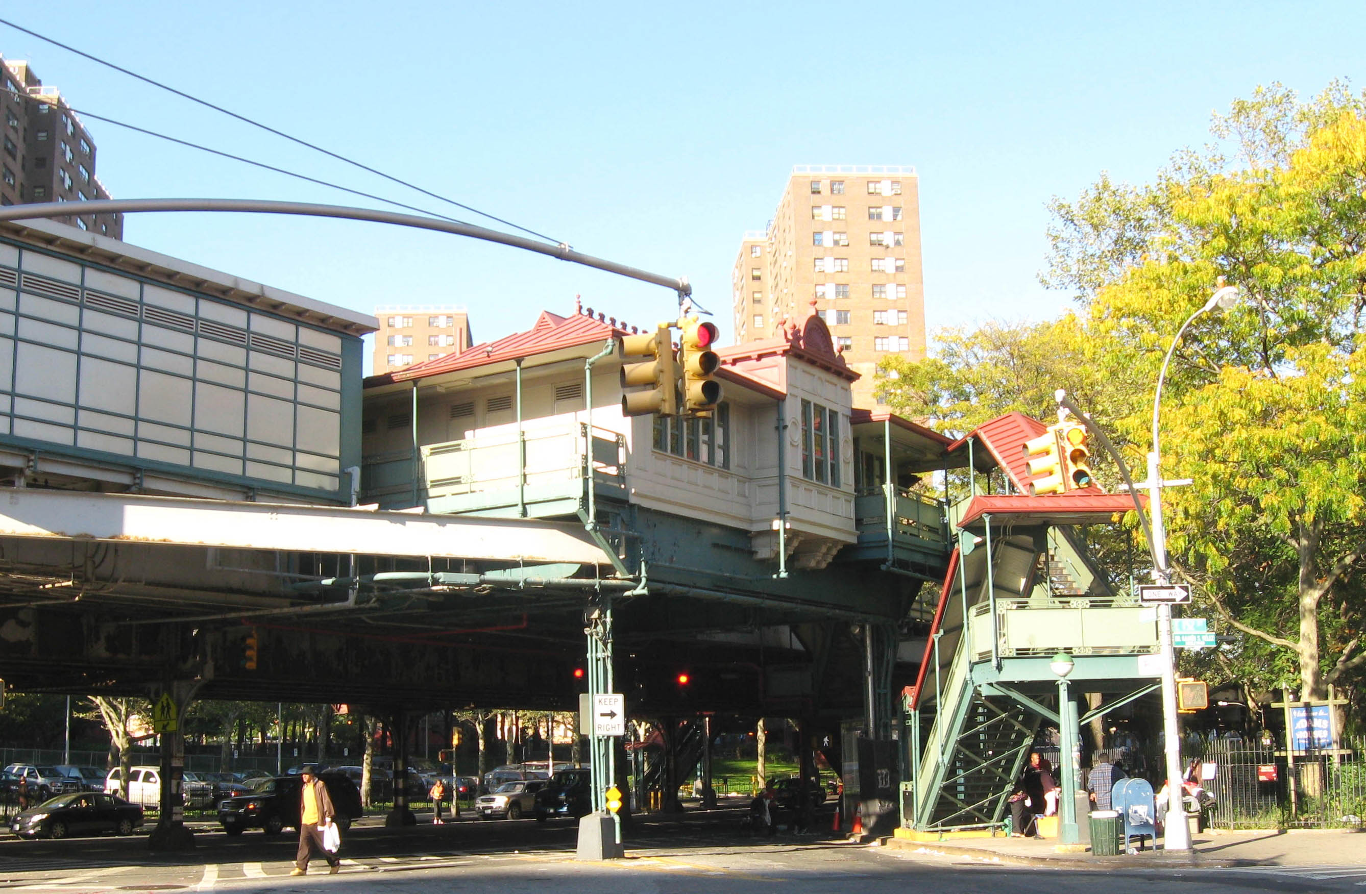
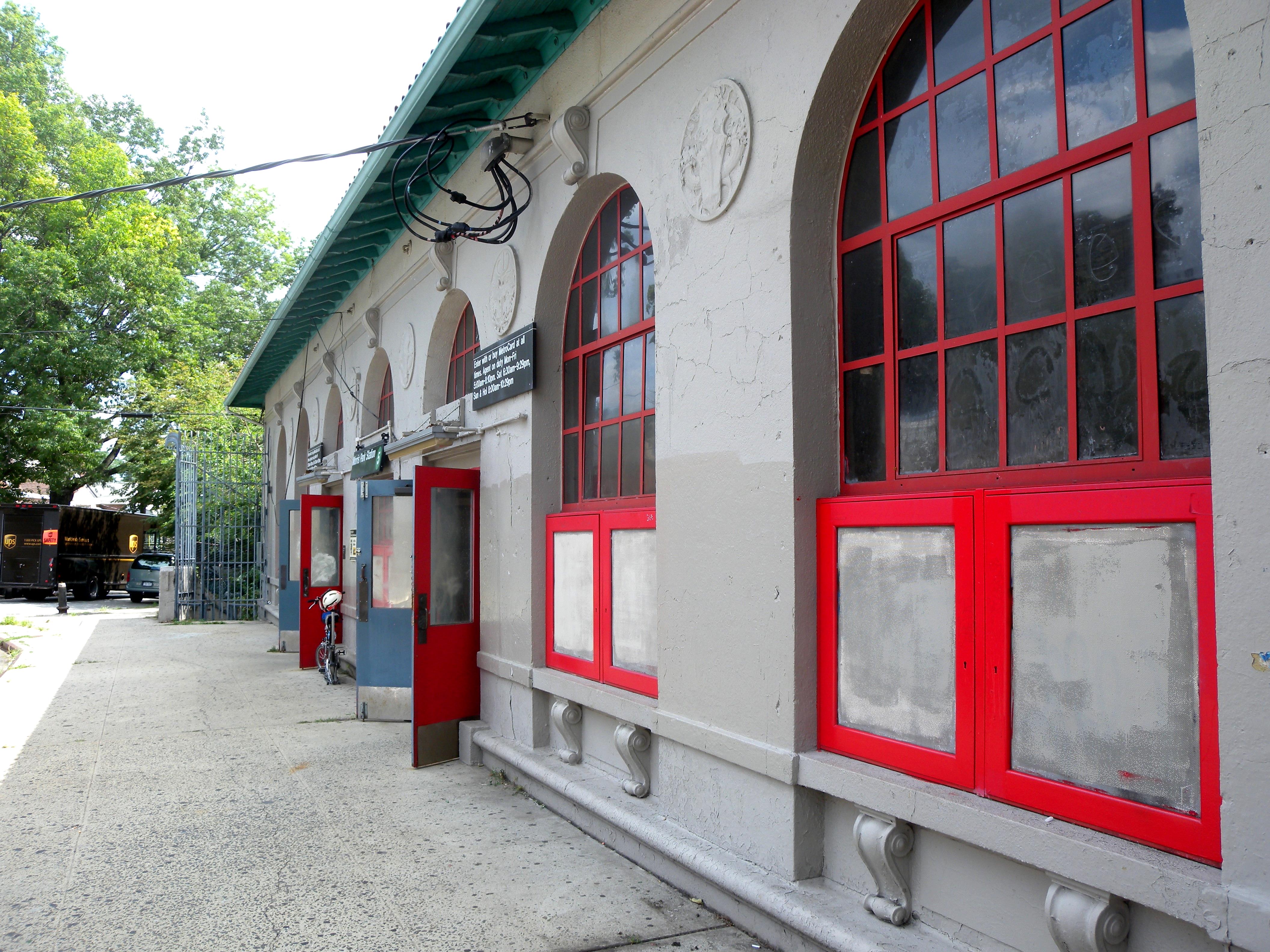
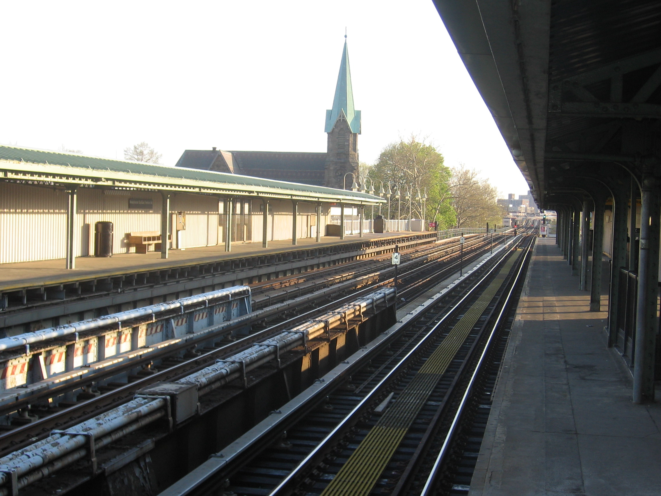
Landmark name Image Date listed Location City or Town Summary 1 242nd Street – Van Cortlandt Park Subway station (1 train) 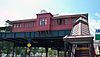
March 30, 2005 Above Broadway at the jct. of W. 242nd St.
40°53′20″N 73°53′56″W / 40.88889°N 73.89889°WBronx Only remaining terminal elevated subway station in Victorian Gothic architectural style. Also has only remaining scrolled station sign in entire system 2 48th Police Precinct Station May 6, 1983 1925 Bathgate Ave.
40°50′49″N 73°53′52″W / 40.84694°N 73.89778°WThe Bronx 3 52nd Police Precinct Station House and Stable 
October 29, 1982 3016 Webster Ave.
40°52′9″N 73°52′46″W / 40.86917°N 73.87944°WThe Bronx 4 Bartow-Pell Mansion and Carriage House 
December 30, 1974 Pelham Bay Park, Shore Rd.
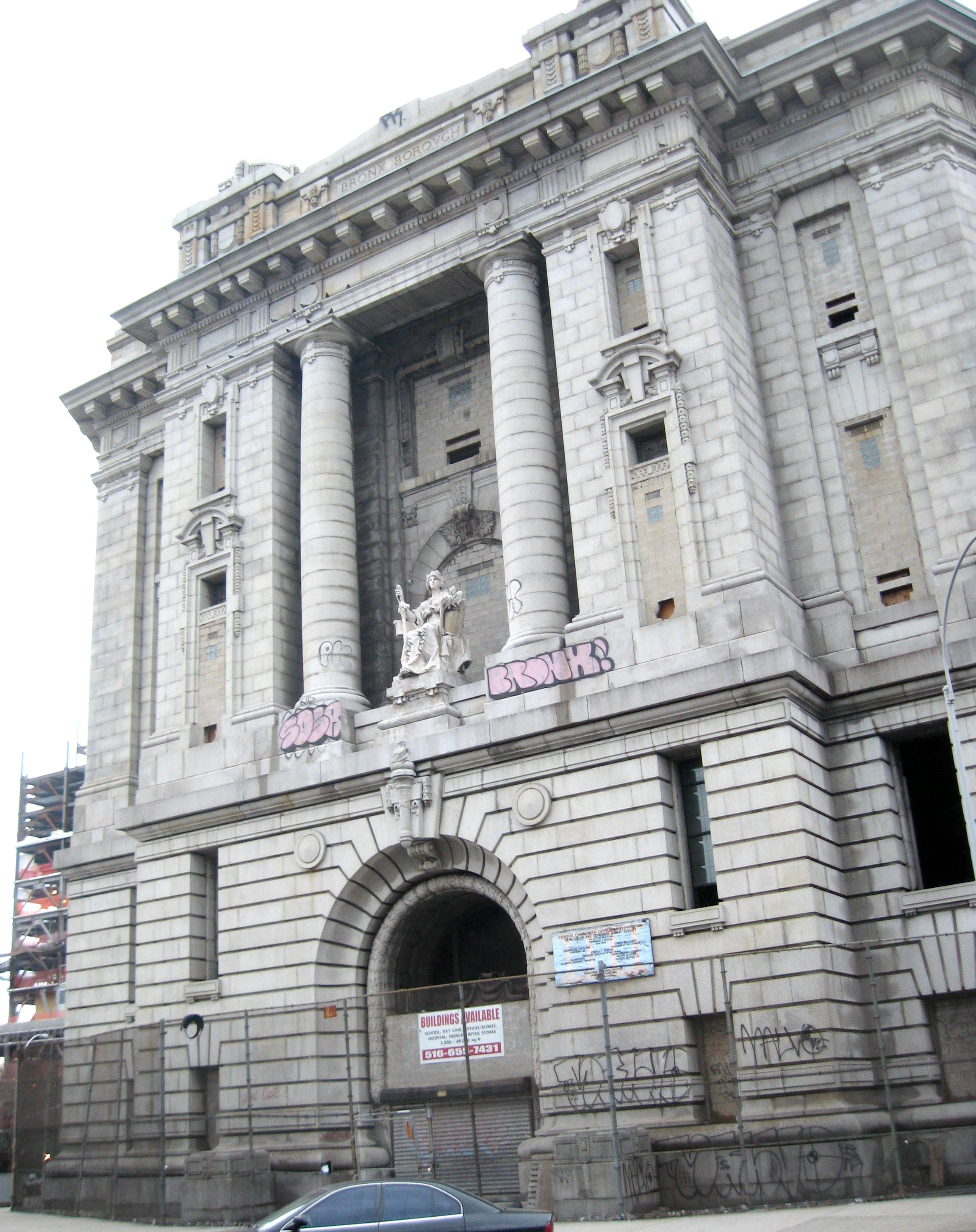
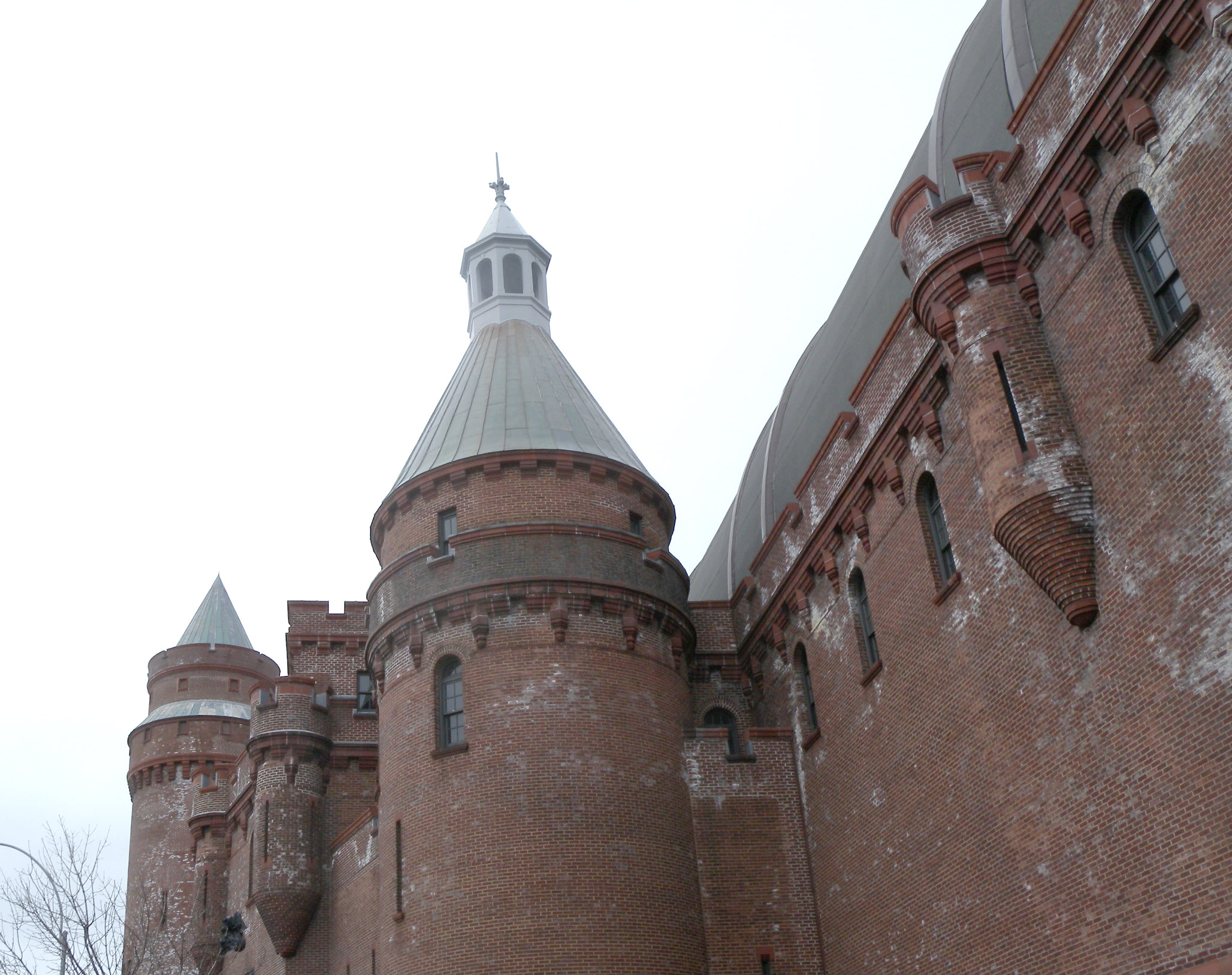
40°52′18″N 73°48′21″W / 40.87167°N 73.80583°WPelham Bay Park 5 Bronx Borough Courthouse 
February 25, 1982 E. 161st St., 3rd and Brook Aves.
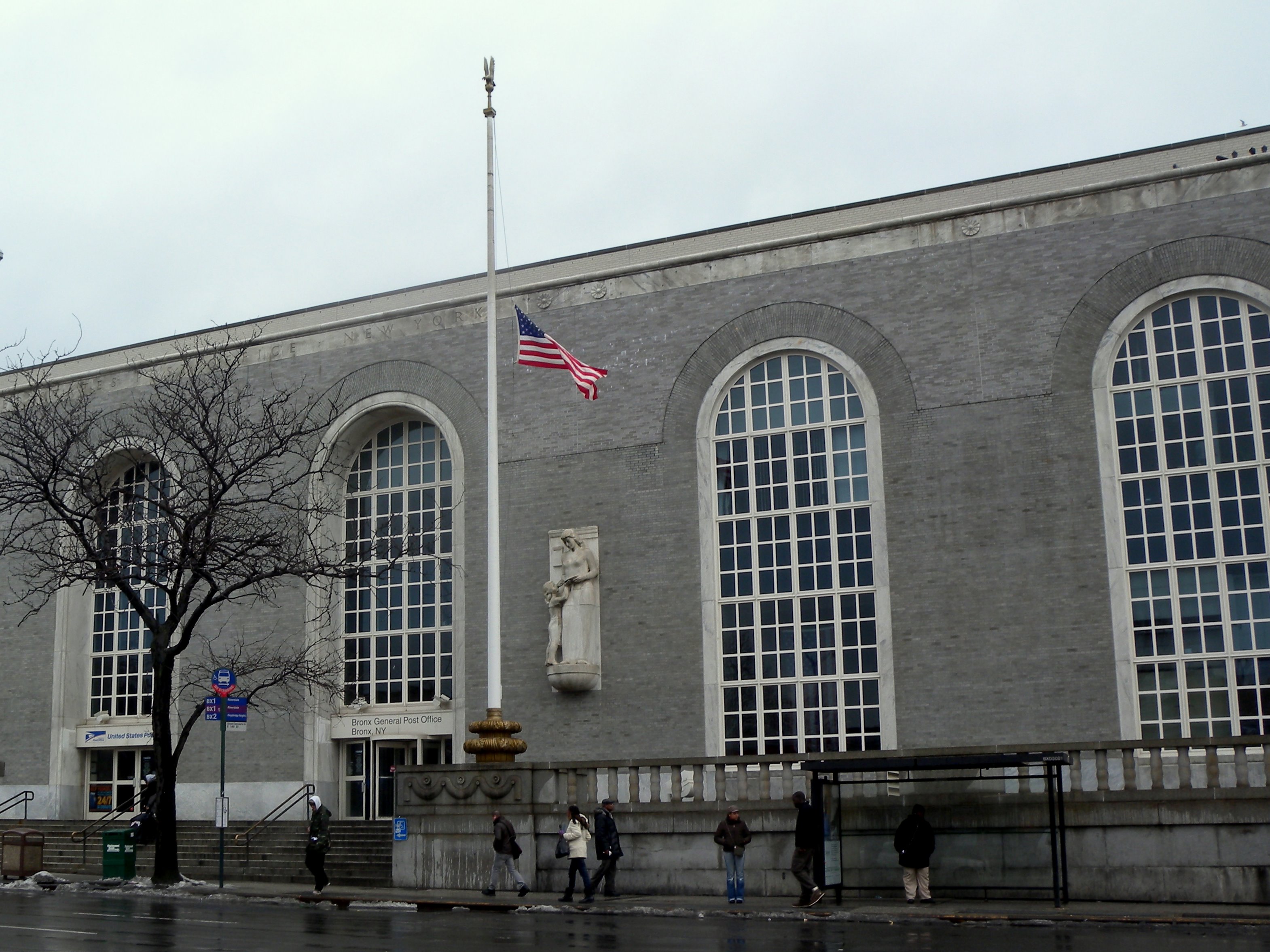
40°49′22″N 73°54′38″W / 40.82278°N 73.91056°WMelrose 6 Bronx Central Annex-U.S. Post Office 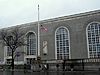
May 6, 1980 558 Grand Concourse
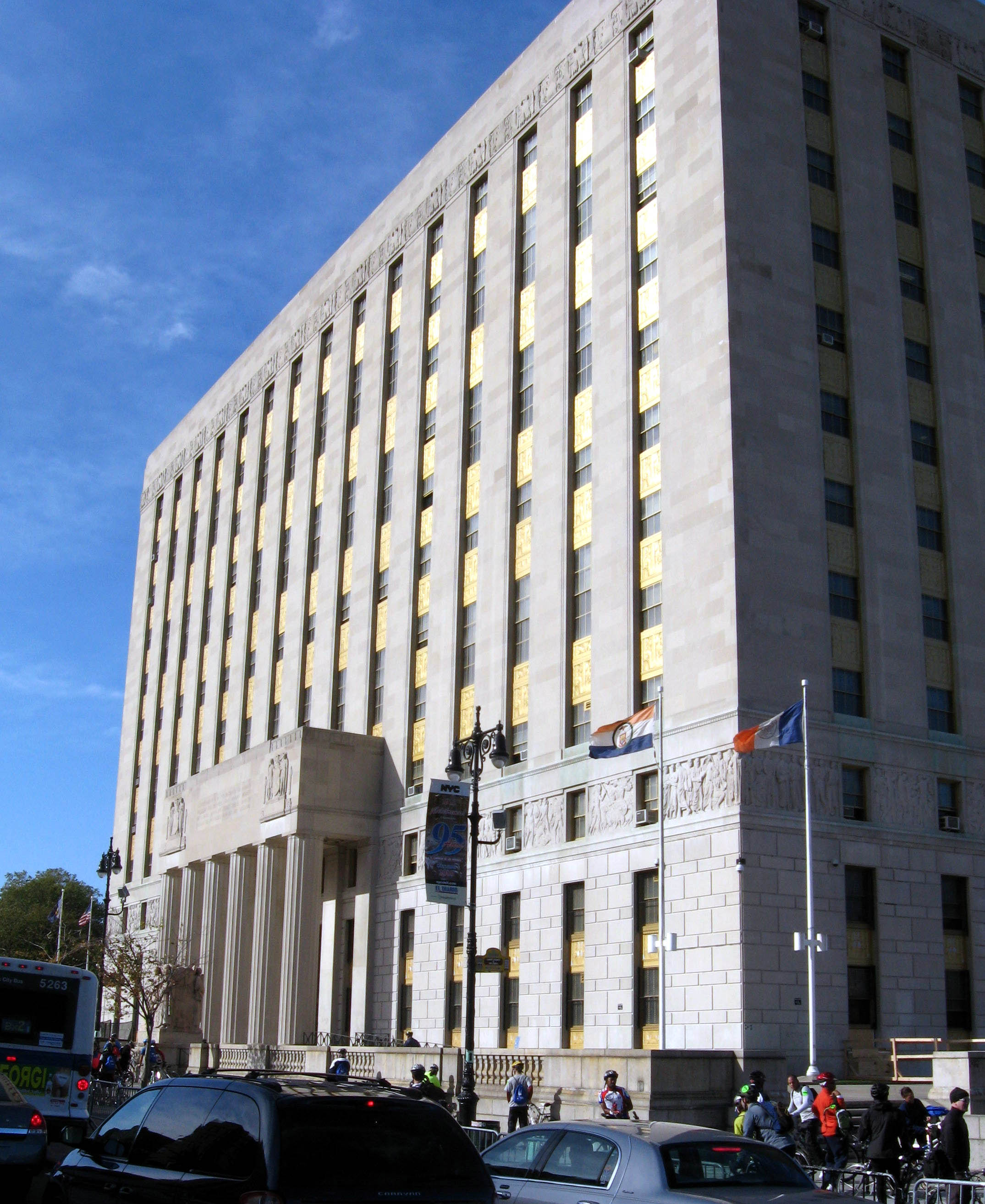
40°49′8″N 73°55′37″W / 40.81889°N 73.92694°WBronx 7 Bronx County Courthouse 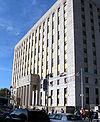
September 8, 1983 851 Grand Concourse
40°49′34″N 73°55′27″W / 40.82611°N 73.92417°WBronx 8 Casa Amadeo, antigua Casa Hernandez March 23, 2001 786 Prospect Ave.
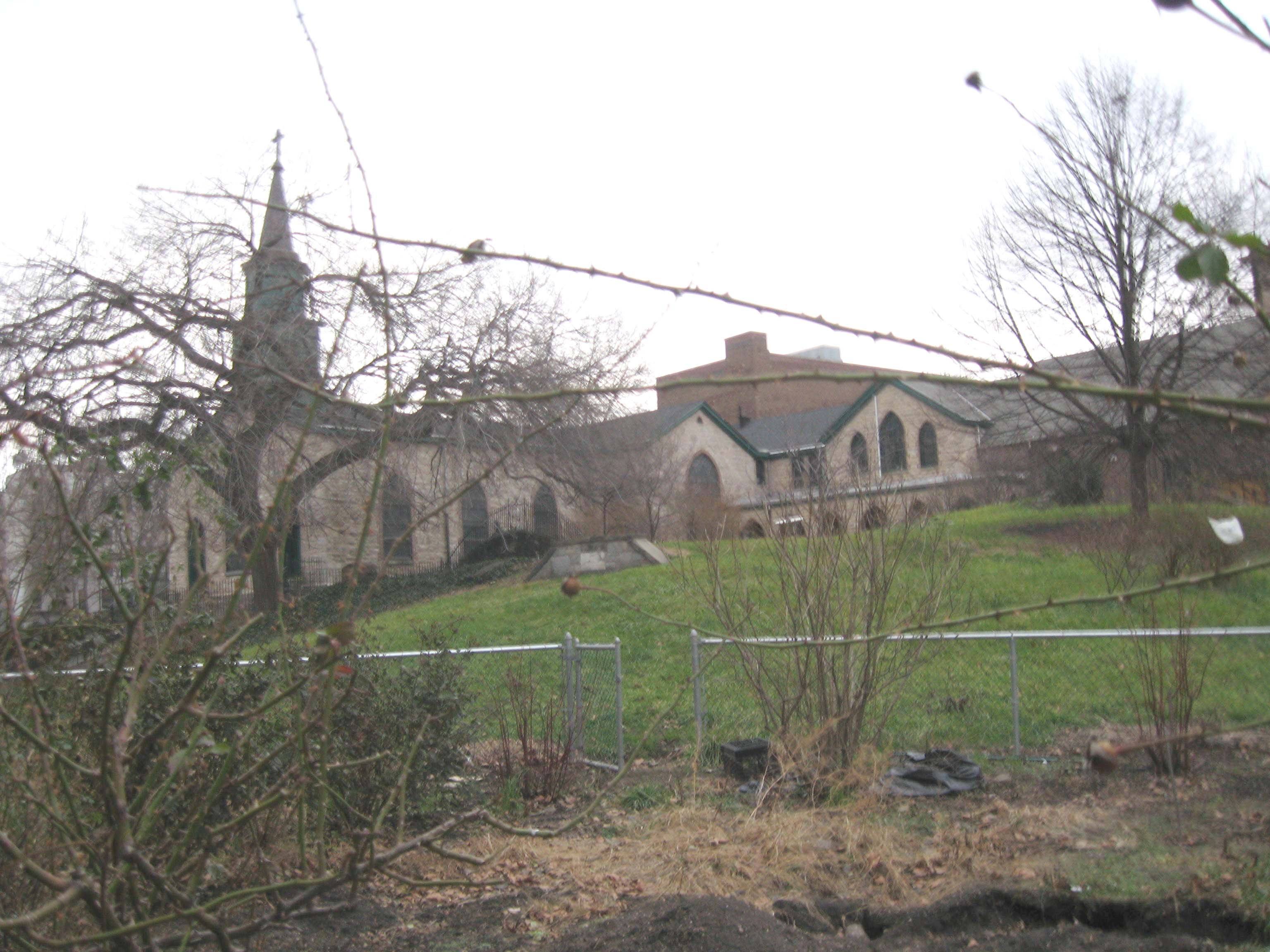
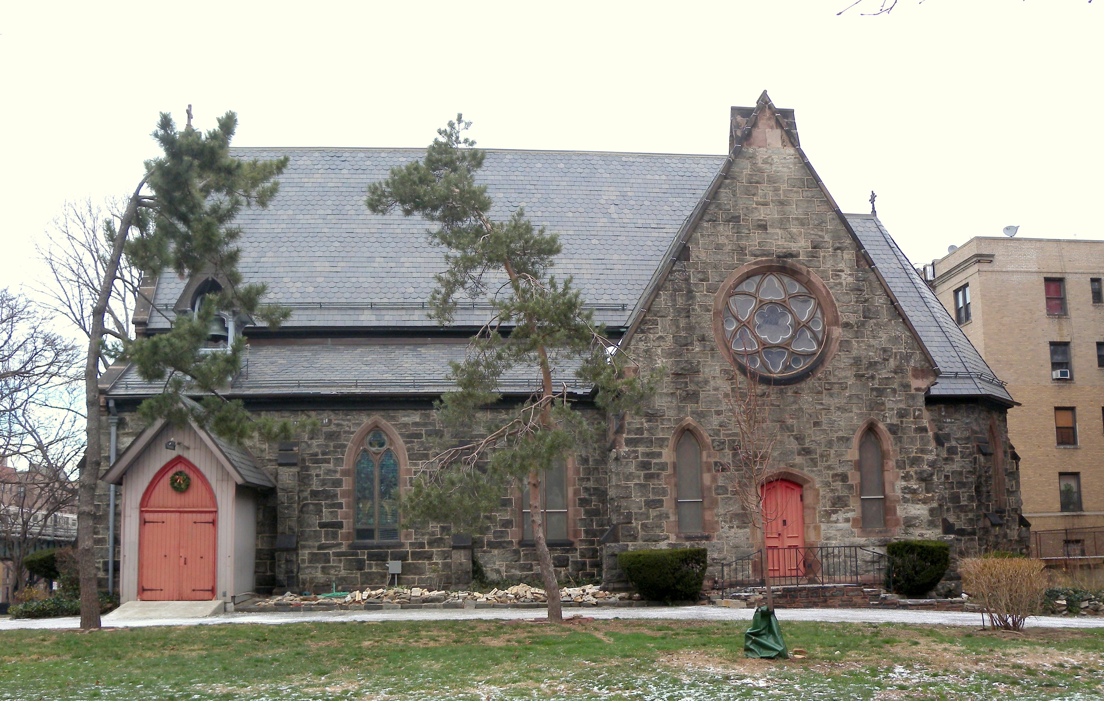
40°49′9″N 73°54′8″W / 40.81917°N 73.90222°WBronx 9 Christ Church Complex September 8, 1983 5030 Riverdale Ave.
40°53′56″N 73°54′25″W / 40.89889°N 73.90694°WNew York 10 Robert Colgate House September 8, 1983 5225 Sycamore Ave.
40°54′7″N 73°54′45″W / 40.90194°N 73.9125°WNew York 11 Concourse Yard Entry Buildings February 9, 2006 W. 205th St., bet. Jerome and Paul Aves.
40°52′34″N 73°53′21″W / 40.87611°N 73.88917°WKingsbridge, Bronx 12 Concourse Yard Substation February 9, 2006 3119 Jerome Ave.
40°52′30″N 73°53′22″W / 40.875°N 73.88944°WKingsbridge, Bronx 13 William E. Dodge House August 28, 1977 690 W. 247th St.
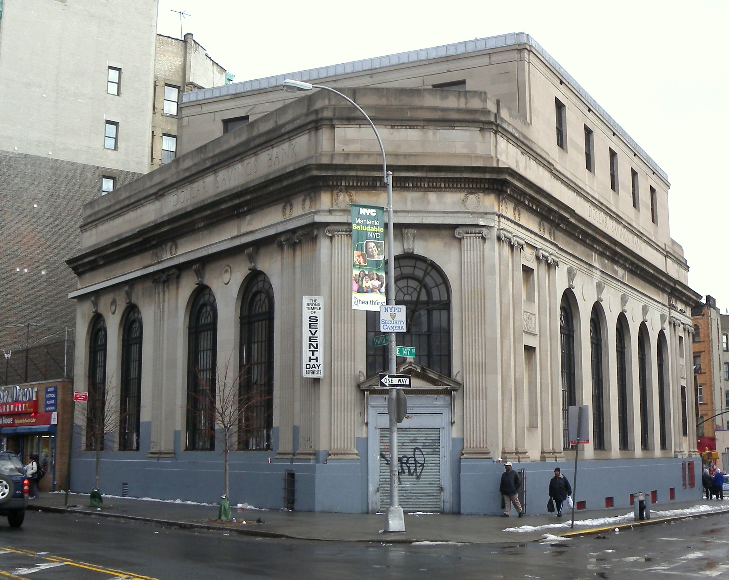
40°53′42″N 73°54′56″W / 40.895°N 73.91556°WNew York 14 Dollar Savings Bank 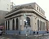
April 27, 2011 2792 3rd Ave.
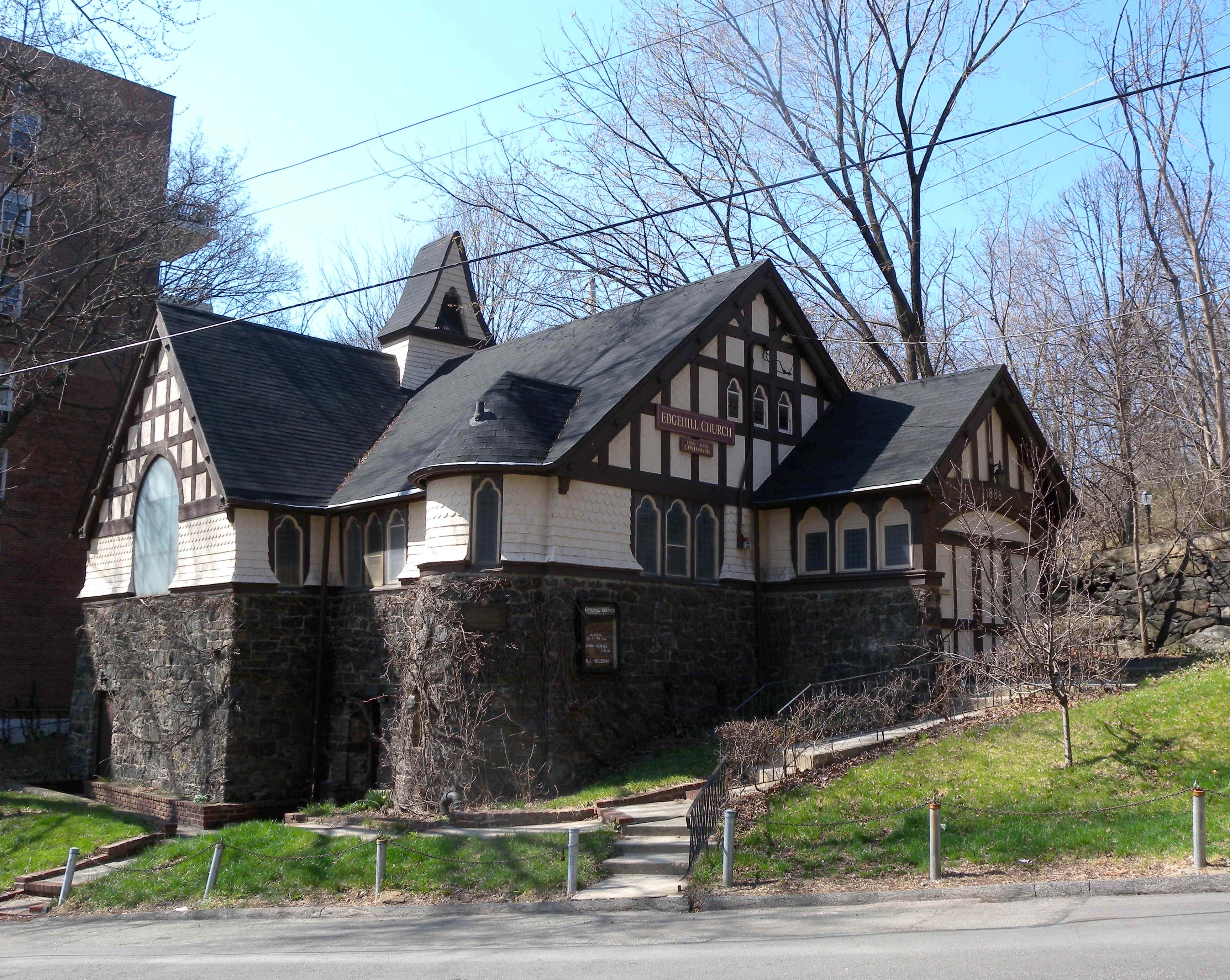
40°48′54″N 73°55′8″W / 40.815°N 73.91889°WBronx New listing; refnum 11000228 15 Edgehill Church at Spuyten Duyvil 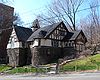
October 29, 1982 2550 Independence Ave.
40°52′48″N 73°55′13″W / 40.88°N 73.92028°WSpuyten Duyvil 16 Eighth Regiment Armory (commonly known as Kingsbridge Armory) 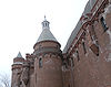
December 21, 1982 29 W. Kingsbridge Rd.
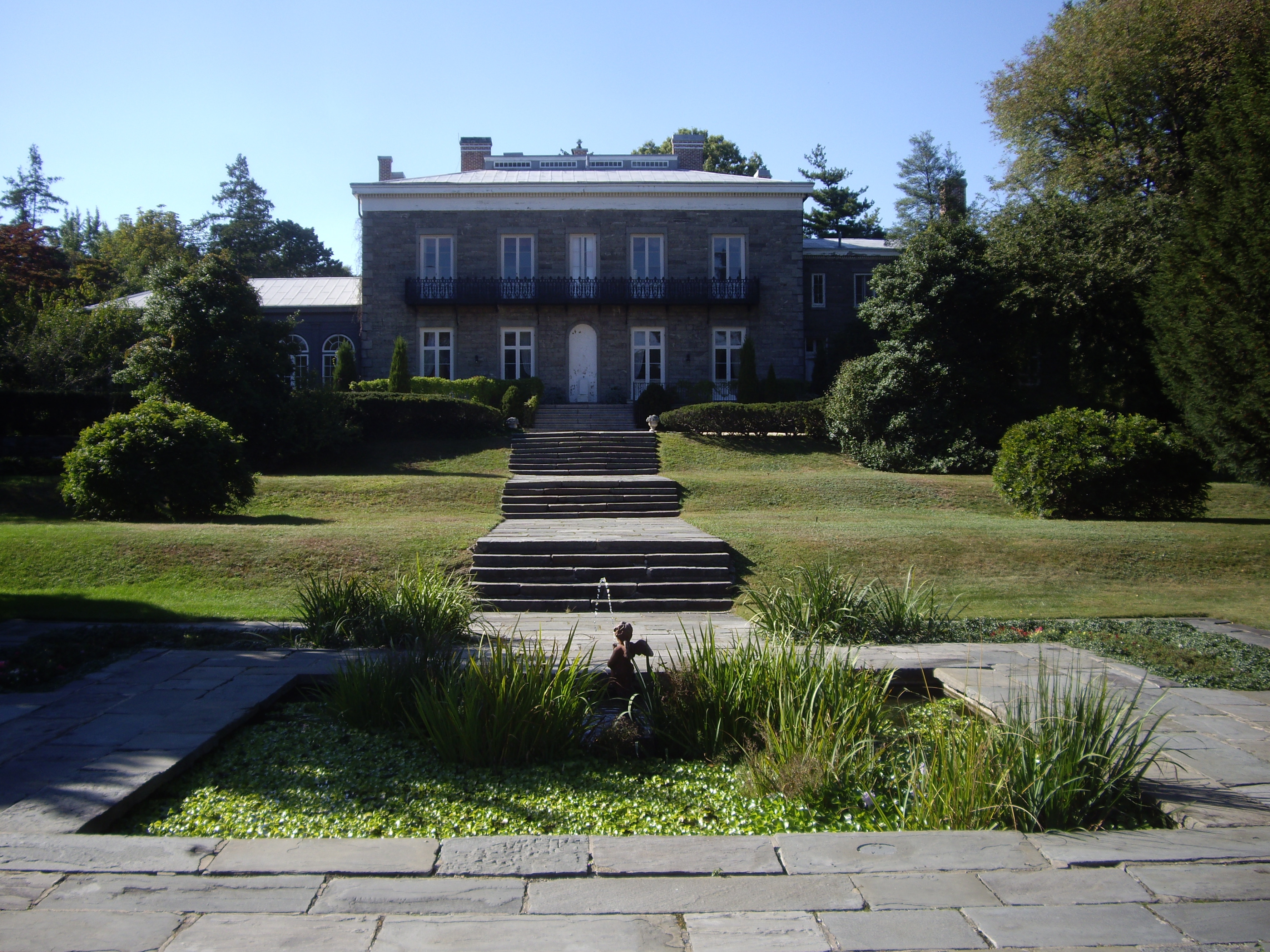
40°52′7″N 73°53′55″W / 40.86861°N 73.89861°WKingsbridge Romanesque structure with five-acre (2 ha) footprint built in 1910s is believed to be the world's largest armory. 17 Fonthill Castle and the Administration Building of the College of Mount St. Vincent 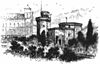
July 11, 1980 W. 261st St. and Riverdale Ave.
40°54′49″N 73°54′34″W / 40.91361°N 73.90944°WNew York 18 Fort Schuyler 
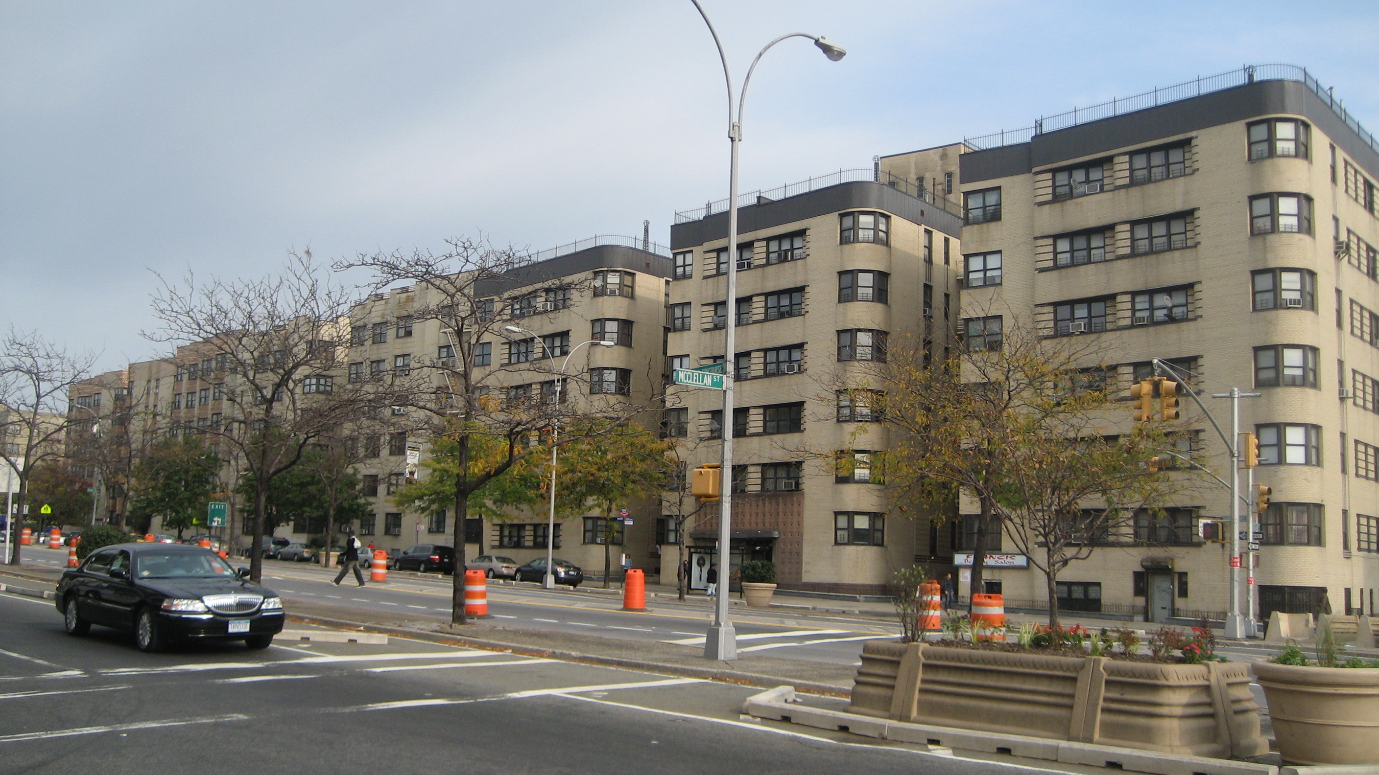
June 29, 1976 Throgs Neck at East River and Long Island Sound
40°48′20″N 73°47′34″W / 40.80556°N 73.79278°WThrogs Neck 19 Grace Episcopal Church September 13, 2006 116 City Island Ave.
40°50′27″N 73°47′4″W / 40.84083°N 73.78444°WCity Island 20 Grand Concourse Historic District 
August 24, 1987 730-1000, 1100-1520, 1560, and 851-1675 Grand Concourse
40°49′52″N 73°55′26″W / 40.83111°N 73.92389°WNew York 21 Hall of Fame Complex 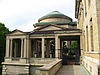
September 7, 1979 Bronx Community College campus
40°51′31″N 73°54′52″W / 40.85861°N 73.91444°WUniversity Heights 22 Hertlein and Schlatter Silk Trimmings Factory February 5, 2001 454-464 E. 148th St.
40°48′51″N 73°54′59″W / 40.81417°N 73.91639°WMott Haven, Bronx 23 High Pumping Station November 10, 1983 Jerome Ave.
40°52′42″N 73°53′12″W / 40.87833°N 73.88667°WNew York 24 House at 175 Belden Street June 3, 1982 175 Belden St.
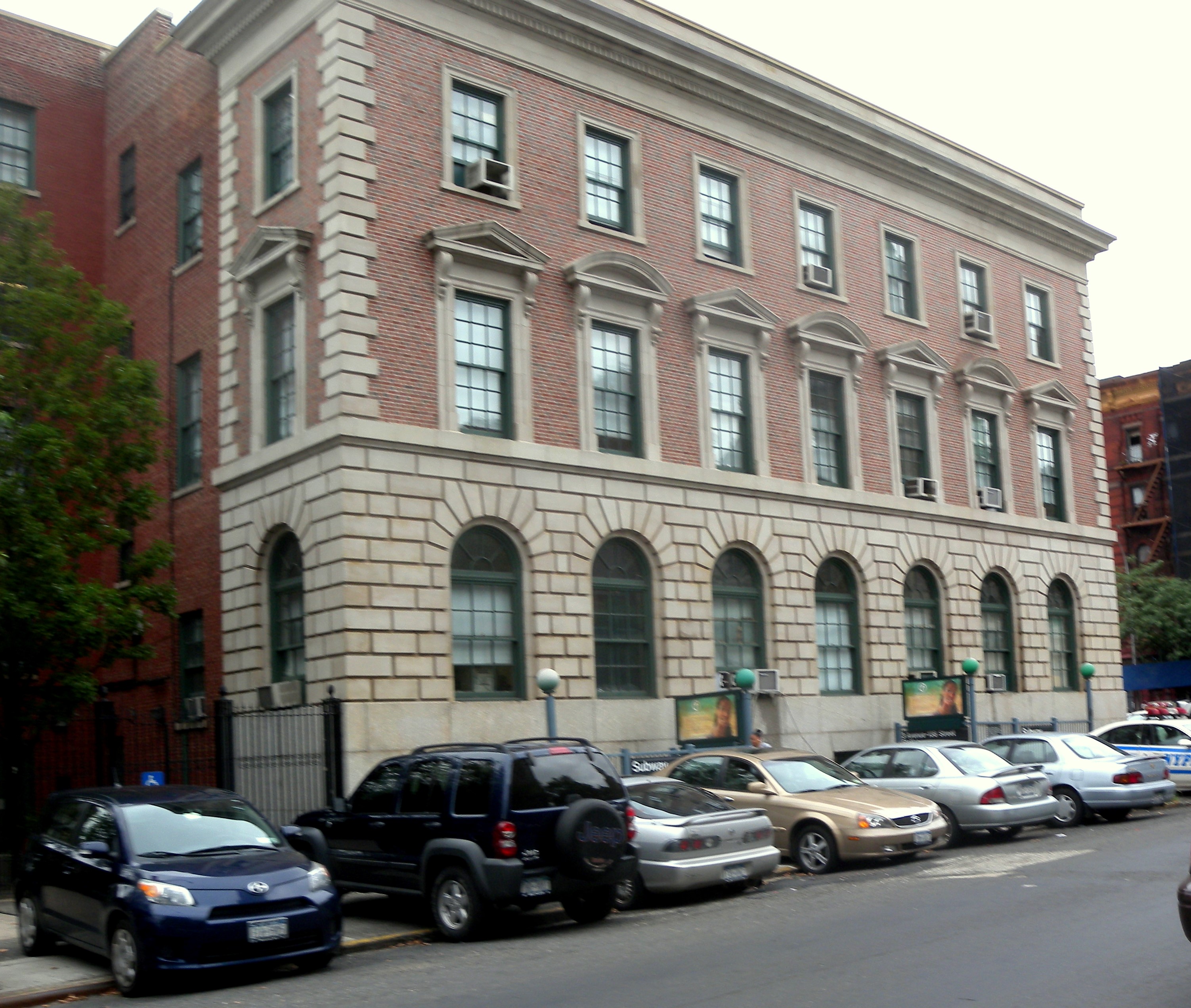
40°50′17″N 73°46′57″W / 40.83806°N 73.7825°WNew York 25 Jackson Avenue Subway station (2 5 trains) 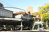
September 17, 2004 Jct. of E. 152nd St. and Jackson and Westchester Aves.
40°49′0″N 73°54′29″W / 40.816667°N 73.90806°WBronx 26 Jerome Park Reservoir September 7, 2000 Goulden, Reservoir and Sedgwick Aves.
40°52′40″N 73°53′44″W / 40.87778°N 73.89556°WBronx 27 Keeper's House at Williamsbridge Reservoir September 24, 1999 3400 Reservoir Oval
40°52′43″N 73°52′34″W / 40.87861°N 73.87611°WBronx 28 Lisanti Chapel January 11, 2002 740 E. 215th St.
40°52′48″N 73°51′48″W / 40.88°N 73.86333°WBronx 29 Longwood Historic District (Bronx) September 26, 1983 Roughly bounded by Beck St., Longwood, Leggett, and Prospect Aves.
40°49′0″N 73°54′0″W / 40.816667°N 73.9°WNew York 30 Lorillard Snuff Mill 
December 22, 1977 Off U.S. 1
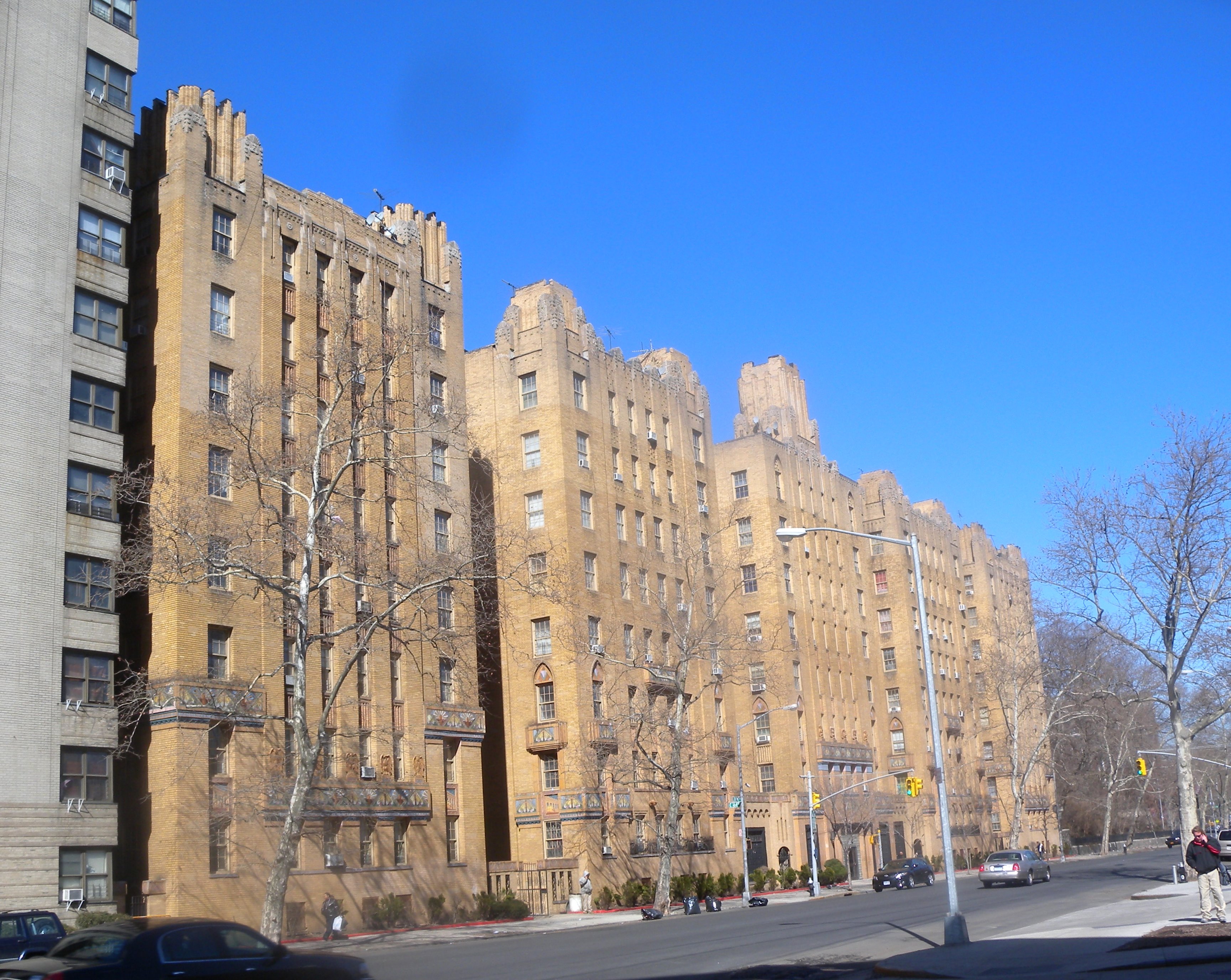
40°51′36″N 73°52′35″W / 40.86°N 73.87639°WNew York 31 Morris High School Historic District September 15, 1983 Roughly bounded by Boston Rd., Jackson and Forrest Aves., and E. 166th and Home Sts.
40°49′38″N 73°54′15″W / 40.82722°N 73.90417°WNew York 32 Morris Park Subway station (5 train) 
July 6, 2005 Under Espalanade at Bogart and Colden Ave. and Hone Ave.
40°51′16″N 73°51′40″W / 40.85444°N 73.86111°WBronx 33 Mott Avenue Control House (2 4 5 trains) May 6, 1980 149th St. and Grand Concourse
40°49′6.77″N 73°55′38.17″W / 40.8185472°N 73.9272694°WBronx 34 Mott Haven Historic District 
March 25, 1980 An irregular pattern along Alexander Ave. and E. 140th St.
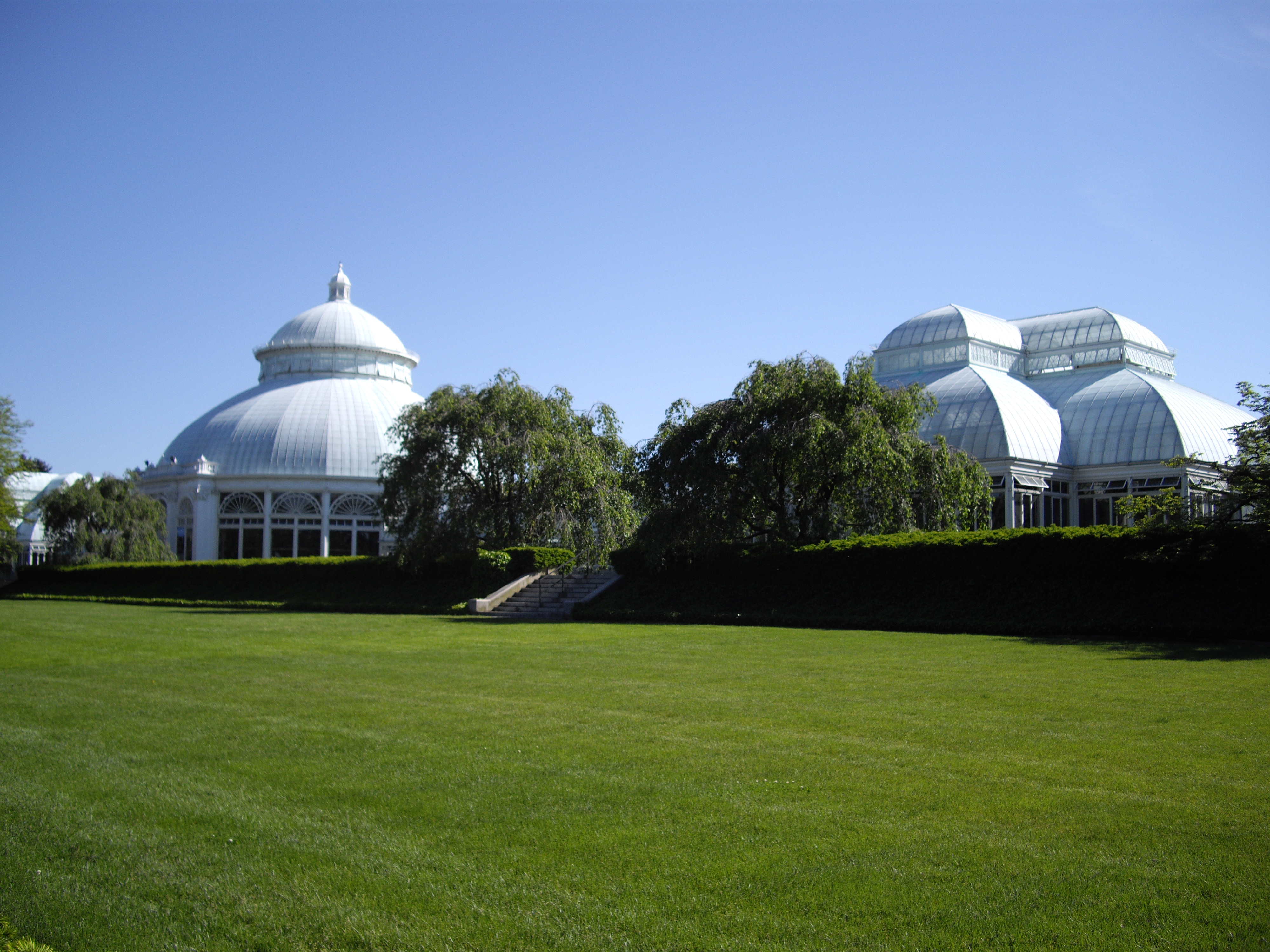
40°48′37″N 73°55′32″W / 40.81028°N 73.92556°WMott Haven, Bronx 35 New York Botanical Garden 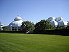
May 28, 1967 Southern and Bedford Park Blvds.
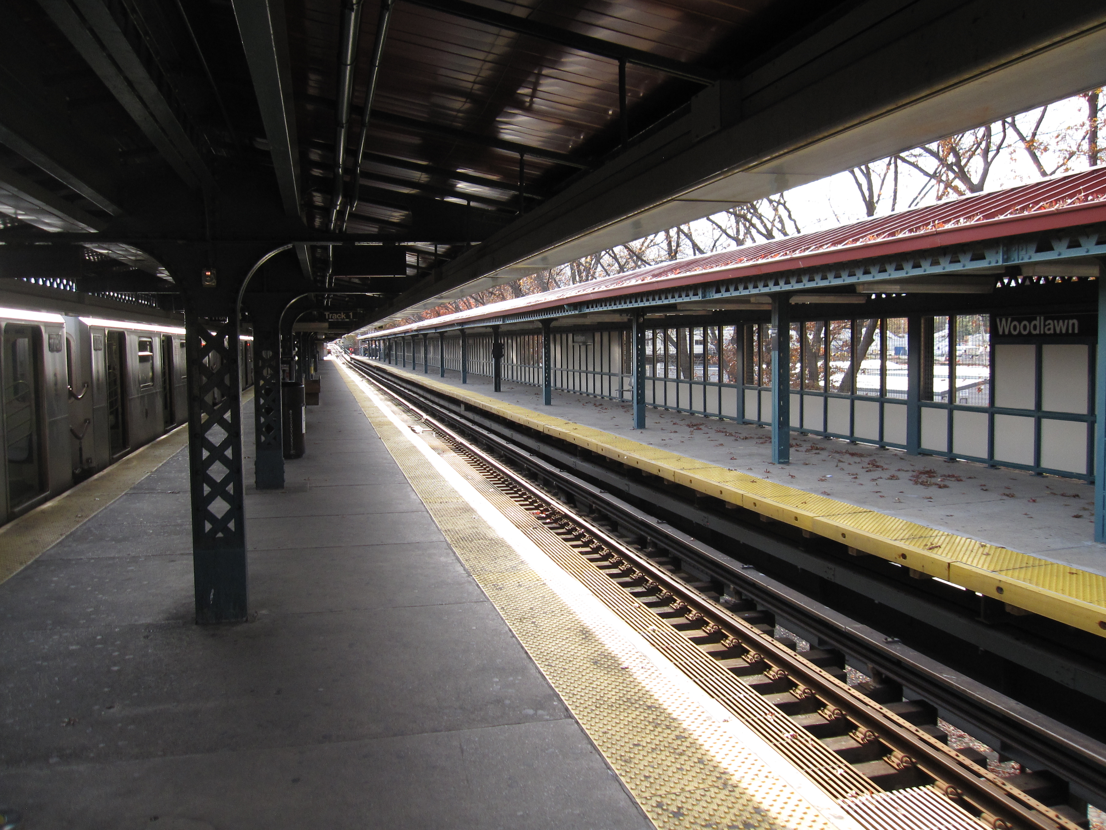
40°51′49″N 73°52′34″W / 40.86361°N 73.87611°WBronx Park 36 New York, Westchester and Boston Railroad Administration Building April 23, 1980 481 Morris Park Ave.
40°50′29″N 73°52′23″W / 40.84139°N 73.87306°WNew York 37 Park Plaza Apartments 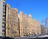
June 3, 1982 1005 Jerome Ave.
40°49′50″N 73°55′30″W / 40.83056°N 73.925°WNew York 38 Pelham Parkway Subway station (2 5 trains) 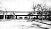
March 30, 2005 Jct. of White Plains Rd. and Pelham Pkwy
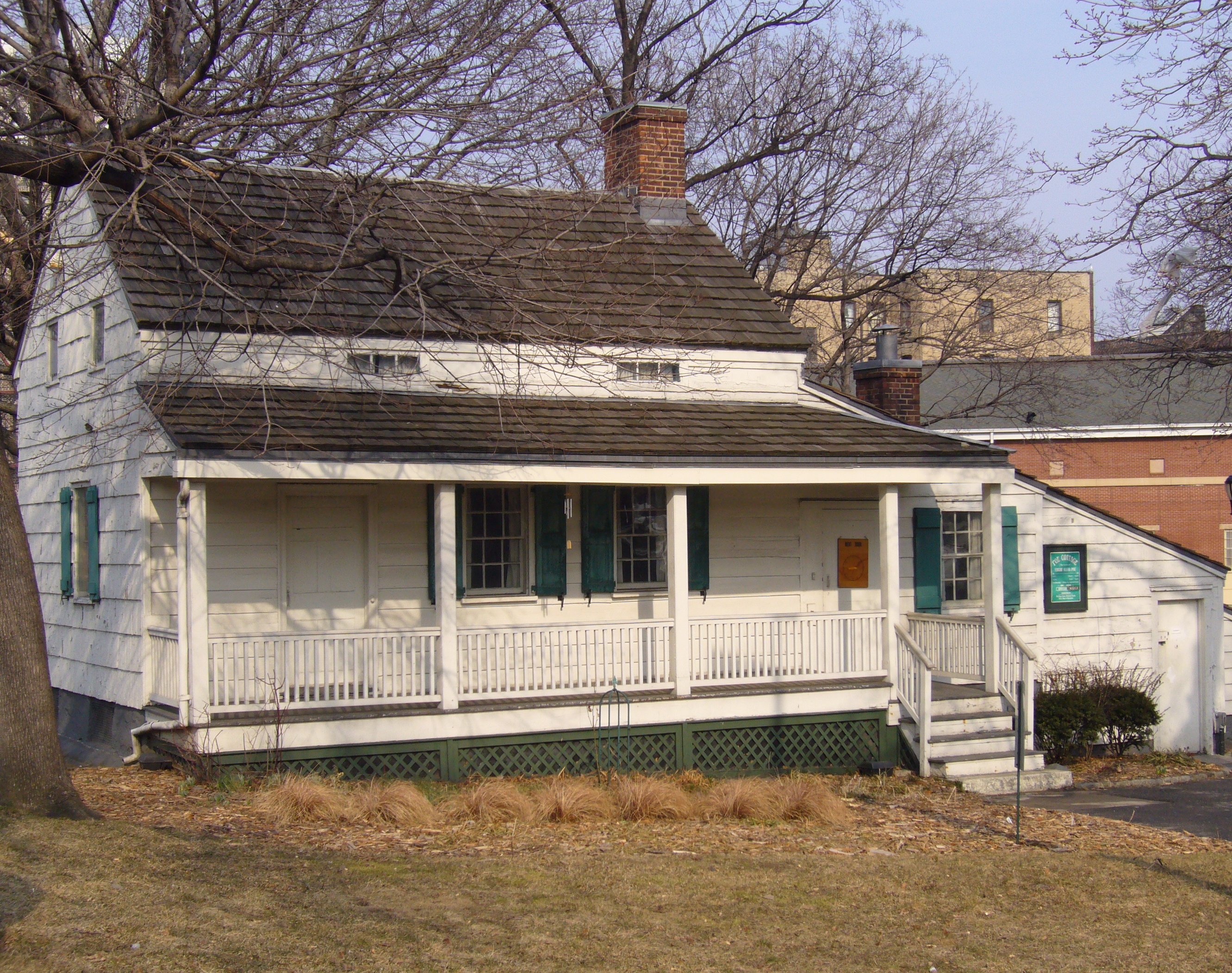
40°51′26.05″N 73°52′3.39″W / 40.8572361°N 73.8676083°WBronx 39 Poe Cottage 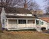
August 19, 1980 2640 Grand Concourse
40°51′55″N 73°53′40″W / 40.86528°N 73.89444°WBronx 40 Prospect Avenue Subway station (2 5 trains) 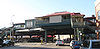
September 17, 2004 Jct. of Westchester and Lonwood Aves. and Prospect St.
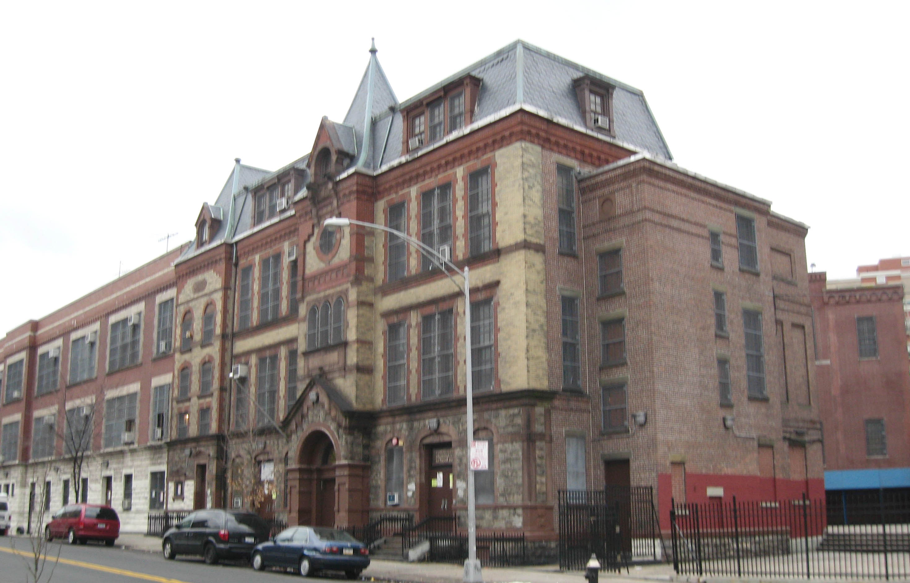
40°49′11″N 73°54′8″W / 40.81972°N 73.90222°WBronx 41 Public School 11 
September 8, 1983 1257 Ogden Ave.
40°50′23″N 73°55′35″W / 40.83972°N 73.92639°WBronx 42 Public School 15 
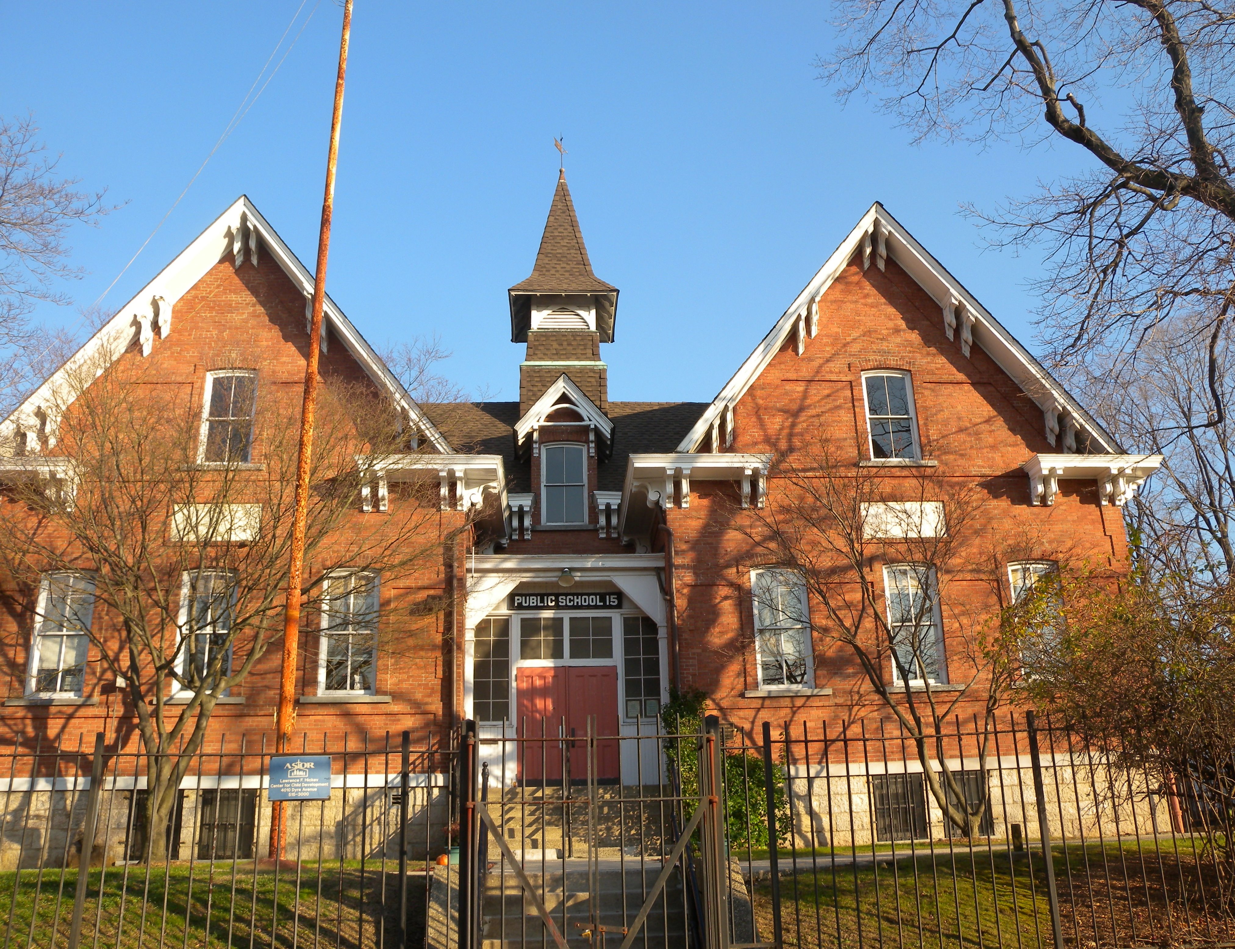
December 10, 1981 4010 Dyre Ave.
40°53′27″N 73°49′52″W / 40.89083°N 73.83111°WEastchester, Bronx 43 Public School 17 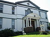
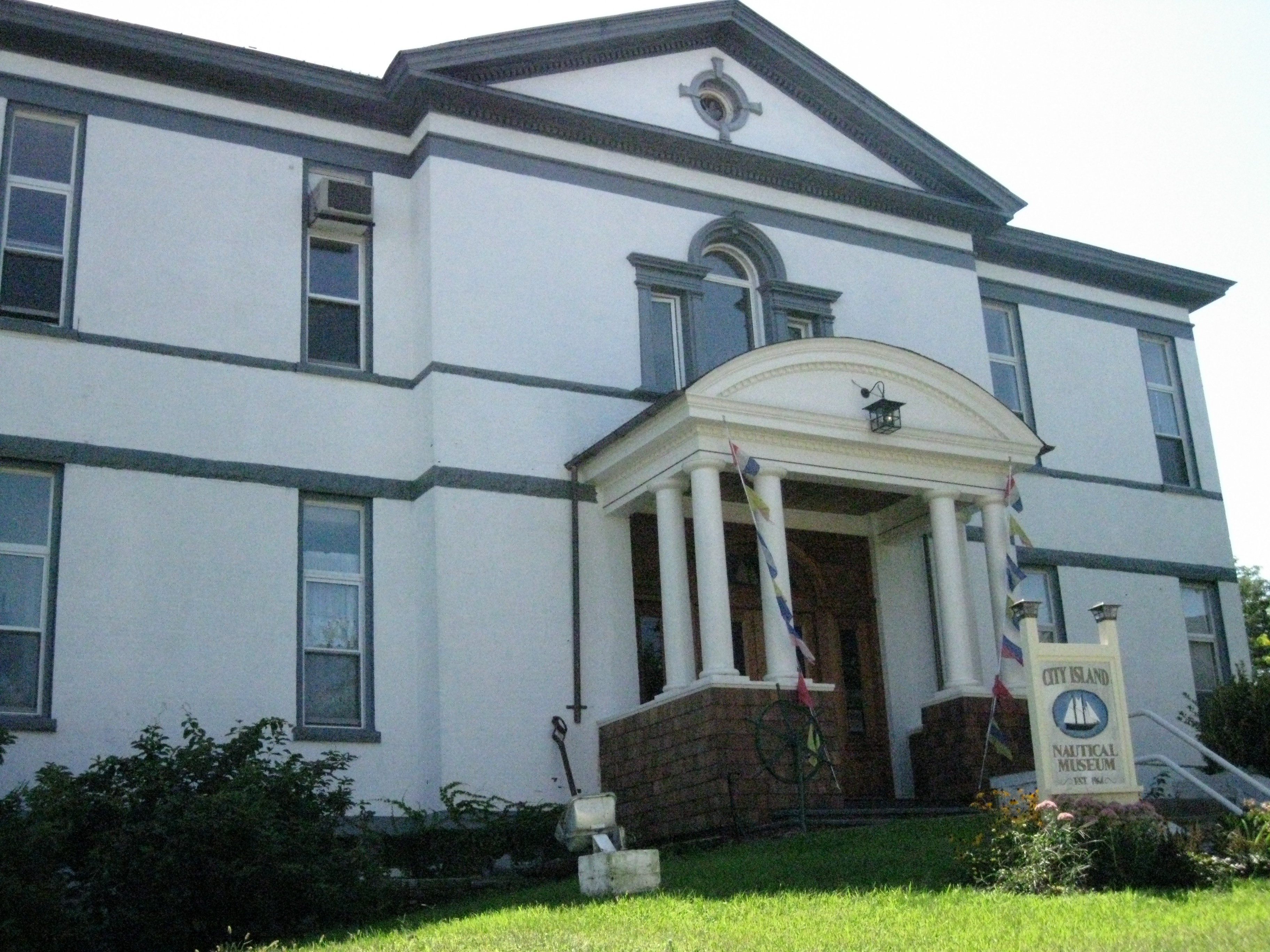
September 27, 1984 190 Fordham St.
40°50′49″N 73°47′5″W / 40.84694°N 73.78472°WCity Island, New York 44 Rainey Memorial Gates March 16, 1972 New York Zoological Park
40°51′18″N 73°52′40″W / 40.855°N 73.87778°WBronx Paul Manship, Sculptor; Charles A Platt, architect 45 C. Rieger's Sons Factory May 27, 2004 450-452 E. 148th St.
40°48′51″N 73°55′1″W / 40.81417°N 73.91694°WMott Haven, Bronx 46 Riverdale Presbyterian Church Complex October 14, 1982 4761-4765 Henry Hudson Parkway
40°53′45″N 73°54′32″W / 40.89583°N 73.90889°WRiverdale 47 Simpson Street Subway station (2 5 trains) and Substation #18 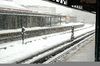
September 17, 2004 Jct. of Westchester Ave., bet. Simpson St. and Southern Blvd.
40°49′27″N 73°53′37″W / 40.82417°N 73.89361°WBronx 48 Henry F. Spaulding Coachman's House November 4, 1982 4970 Independence Ave.
40°53′53″N 73°54′41″W / 40.89806°N 73.91139°WBronx 49 St. Ann's Church Complex 
April 16, 1980 295 St. Ann's Ave.
40°48′30″N 73°55′3″W / 40.80833°N 73.9175°WSouth Bronx 50 St. James' Episcopal Church and Parish House 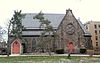
September 30, 1982 2500 Jerome Ave.
40°51′50″N 73°54′0″W / 40.86389°N 73.9°WBronx 51 St. Peter's Church, Chapel and Cemetery Complex September 26, 1983 2500 Westchester Ave.
40°50′17″N 73°50′41″W / 40.83806°N 73.84472°WBronx 52 Sunnyslope September 15, 1983 812 Faile St.
40°49′2″N 73°53′14″W / 40.81722°N 73.88722°WBronx 53 Tremont Baptist Church October 16, 2009 324 E. Tremont Ave.
40°50′53.64″N 73°54′8.37″W / 40.8482333°N 73.902325°WTremont 54 United Workers Cooperatives September 11, 1986 2700-2870 Bronx Park E
40°51′59″N 73°52′11″W / 40.86639°N 73.86972°WHunts Point 55 US Post Office-Morrisania November 17, 1988 442 E. 167th St.
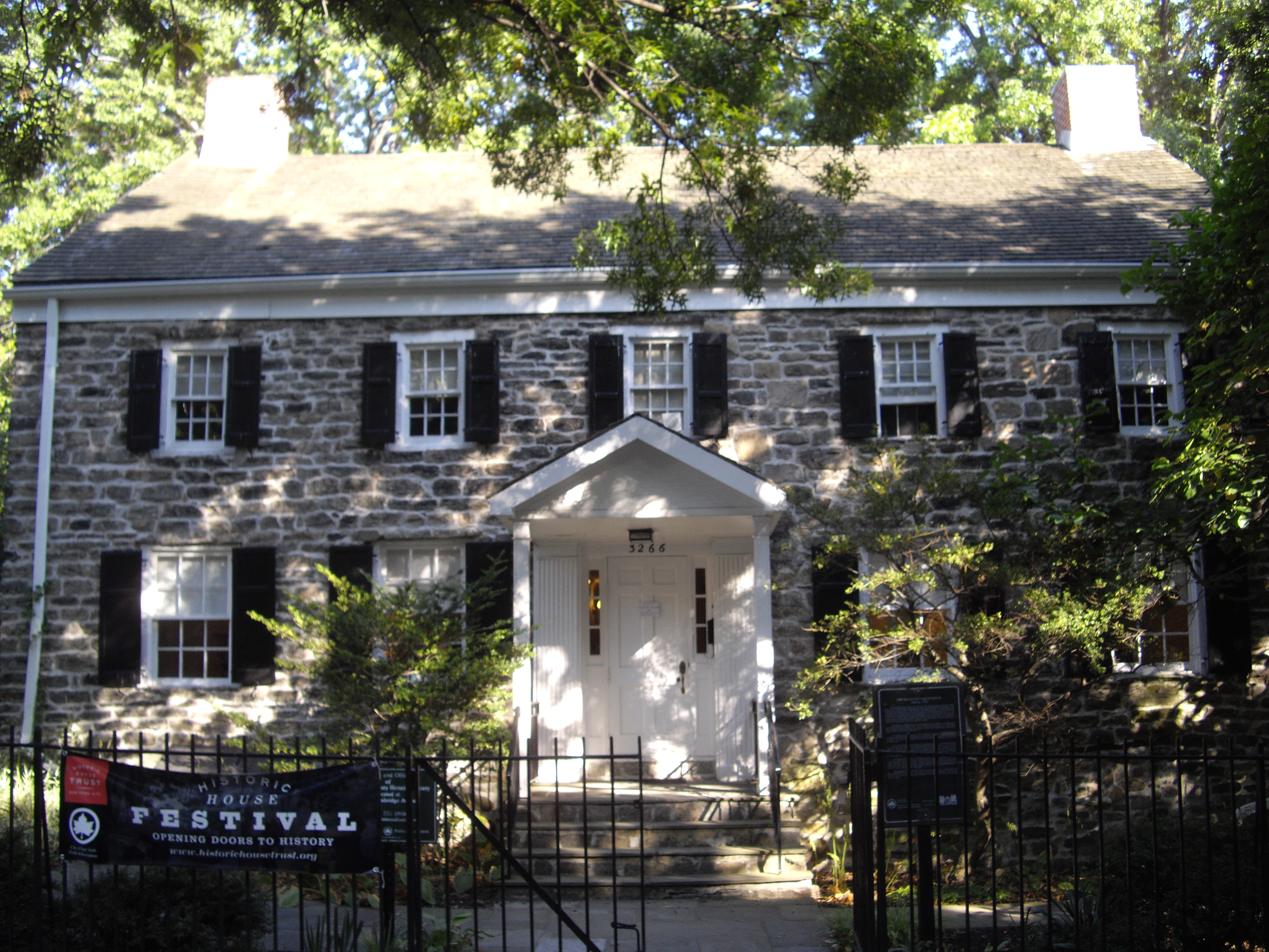
40°49′47″N 73°54′34″W / 40.82972°N 73.90944°WMorrisania 56 Valentine-Varian House 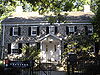
March 21, 1978 3266 Bainbridge Ave.
40°52′38″N 73°52′47″W / 40.87722°N 73.87972°WBronx 57 Frederick Van Cortlandt House 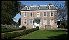
December 24, 1967 Van Cortlandt Park at 242nd St.
40°53′40″N 73°53′35″W / 40.89444°N 73.89306°WBronx 58 Washington Bridge 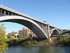
September 22, 1983 Between Amsterdam and Undercliff Aves.
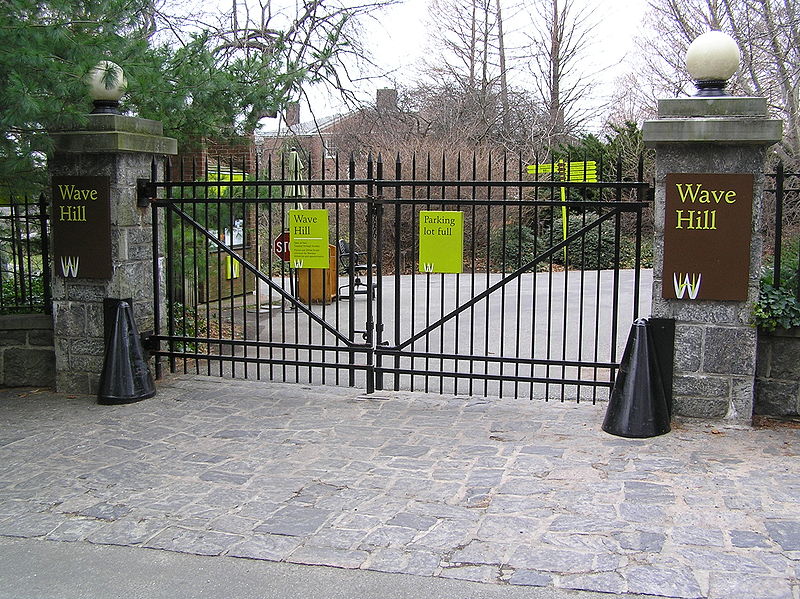
40°50′42″N 73°55′29″W / 40.845°N 73.92472°WBronx Bridge from Harlem to the Bronx 59 Wave Hill 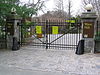
September 9, 1983 675 W. 252nd St.
40°53′55″N 73°54′47″W / 40.89861°N 73.91306°WRiverdale 60 Westchester Square Subway station (6 <6> trains) 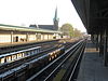
March 30, 2005 Above Westchester Ave., from Overing St. to Ferris Place
40°50′23″N 73°50′38″W / 40.83972°N 73.84389°WBronx 61 Woodlawn Cemetery 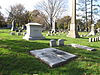
June 23, 2011 Webster Avenue & East 233rd Street
40°53′43″N 73°51′49″W / 40.89528°N 73.86361°WBronx Cemetery illustrates transition from rural cemetery to 20th-century styles; final resting place of Robert Moses, Elizabeth Cady Stanton and Jay Gould, among others. 62 Woodlawn Subway station (4 train) 
July 6, 2005 Jct. of Bainbridge Ave. and Jerome Ave.
40°53′9″N 73°52′45″W / 40.88583°N 73.87917°WBronx Arts and Crafts-inspired terminal station See also
-
- Statewide: National Register of Historic Places listings in New York
- Citywide: Manhattan, Queens, Staten Island, Brooklyn
- List of New York City Designated Landmarks in The Bronx
References
- ^ The latitude and longitude information provided in this table was derived originally from the National Register Information System, which has been found to be fairly accurate for about 99% of listings. For about 1% of NRIS original coordinates, experience has shown that one or both coordinates are typos or otherwise extremely far off; some corrections may have been made. A more subtle problem causes many locations to be off by up to 150 yards, depending on location in the country: most NRIS coordinates were derived from tracing out latitude and longitudes off of USGS topographical quadrant maps created under North American Datum of 1927, which differs from the current, highly accurate GPS system used by Google maps. Chicago is about right, but NRIS longitudes in Washington are higher by about 4.5 seconds, and are lower by about 2.0 seconds in Maine. Latitudes differ by about 1.0 second in Florida. Some locations in this table may have been corrected to current GPS standards.
- ^ "National Register of Historic Places: Weekly List Actions". National Park Service, United States Department of the Interior. Retrieved on November 18, 2011.
External links
- A useful list of the above sites, with street addresses and other information, is available at Bronx County listing, at National Register of Historic Places.Com, a private site serving up public domain information on NRHPs.
Neighborhoods in the New York City Borough of The Bronx Allerton · Baychester · Bedford Park · Belden Point · Belmont (Arthur Avenue) · Castle Hill · City Island · Clason Point · Crotona Park East · Co-op City · Country Club · East Bronx · Eastchester · East Tremont · Edenwald · Ferry Point Park · Fieldston · Fordham · Harding Park · Highbridge · Hudson Hill · Hunts Point · The Hub · Kingsbridge · Kingsbridge Heights · Locust Point · Longwood · Marble Hill · Melrose · Morrisania · Morris Heights · Morris Park · Mott Haven · North Bronx · North Riverdale · Norwood · Olinville · Parkchester · Pelham Bay · Pelham Gardens · Pelham Parkway · Port Morris · Riverdale · Silver Beach · Soundview · South Bronx · Spuyten Duyvil · Throggs Neck · Tremont · University Heights · Van Cortlandt Village · Van Nest · Wakefield · West Bronx · West Farms · Williamsbridge Woodlawn

Community Boards: 1 · 2 · 3 · 4 · 5 · 6 · 7 · 8 · 9 · 10 · 11 · 12 Categories:- National Register of Historic Places in New York by county
- National Register of Historic Places in New York City
- National Register of Historic Places in The Bronx
- Buildings and structures in the Bronx
-


Wikimedia Foundation. 2010.