- National Register of Historic Places listings in Schoharie County, New York
-
 Location of Schoharie County in New York
List of the National Register of Historic Places listings in Schoharie County, New York
This is intended to be a complete list of properties and districts listed on the National Register of Historic Places in Schoharie County, New York. The locations of National Register properties and districts (at least for all showing latitude and longitude coordinates below) may be seen in a Google map by clicking on "Map of all coordinates".[1] One property, the Old Blenheim Bridge, is further designated a U.S. National Historic Landmark.
-
- This National Park Service list is complete through NPS recent listings posted November 18, 2011.[2]
Contents: Counties in New York Albany (Albany) – Allegany – Bronx – Broome – Cattaraugus – Cayuga – Chautauqua – Chemung – Chenango – Clinton – Columbia – Cortland – Delaware – Dutchess – Erie (Buffalo) – Essex – Franklin – Fulton – Genesee – Greene – Hamilton – Herkimer – Jefferson – Kings (Brooklyn) – Lewis – Livingston – Madison – Monroe (Rochester) – Montgomery – Nassau – New York (Manhattan – Below 14th Street, 14th to 59th Streets, 59th to 110th Streets, Above 110th Street, Islands) – Niagara – Oneida – Onondaga (Syracuse) – Ontario – Orange – Orleans – Oswego – Otsego – Putnam – Queens – Rensselaer – Richmond (Staten Island) – Rockland – Saratoga – Schenectady – Schoharie – Schuyler – Seneca – St. Lawrence – Steuben – Suffolk – Sullivan – Tioga – Tompkins – Ulster – Warren – Washington – Wayne – Westchester (New Rochelle, Peekskill, Yonkers) – Wyoming – Yates Listings county-wide
[3] Landmark name Image Date listed Location City or town Summary 1 American Hotel 
September 9, 1975 Main St.
42°47′37″N 74°37′03″W / 42.793611°N 74.6175°WSharon Springs (include link to hotel website here) 2 Becker Stone House November 20, 1979 East of Schoharie on Murphy Rd.
42°40′22″N 74°15′08″W / 42.672778°N 74.252222°WSchoharie 3 Becker-Westfall House November 20, 1979 East of Schoharie on NY 443
42°40′33″N 74°15′13″W / 42.675833°N 74.253611°WSchoharie 4 Bellinger-Dutton House 
December 7, 2005 158 River St. (NY 30)
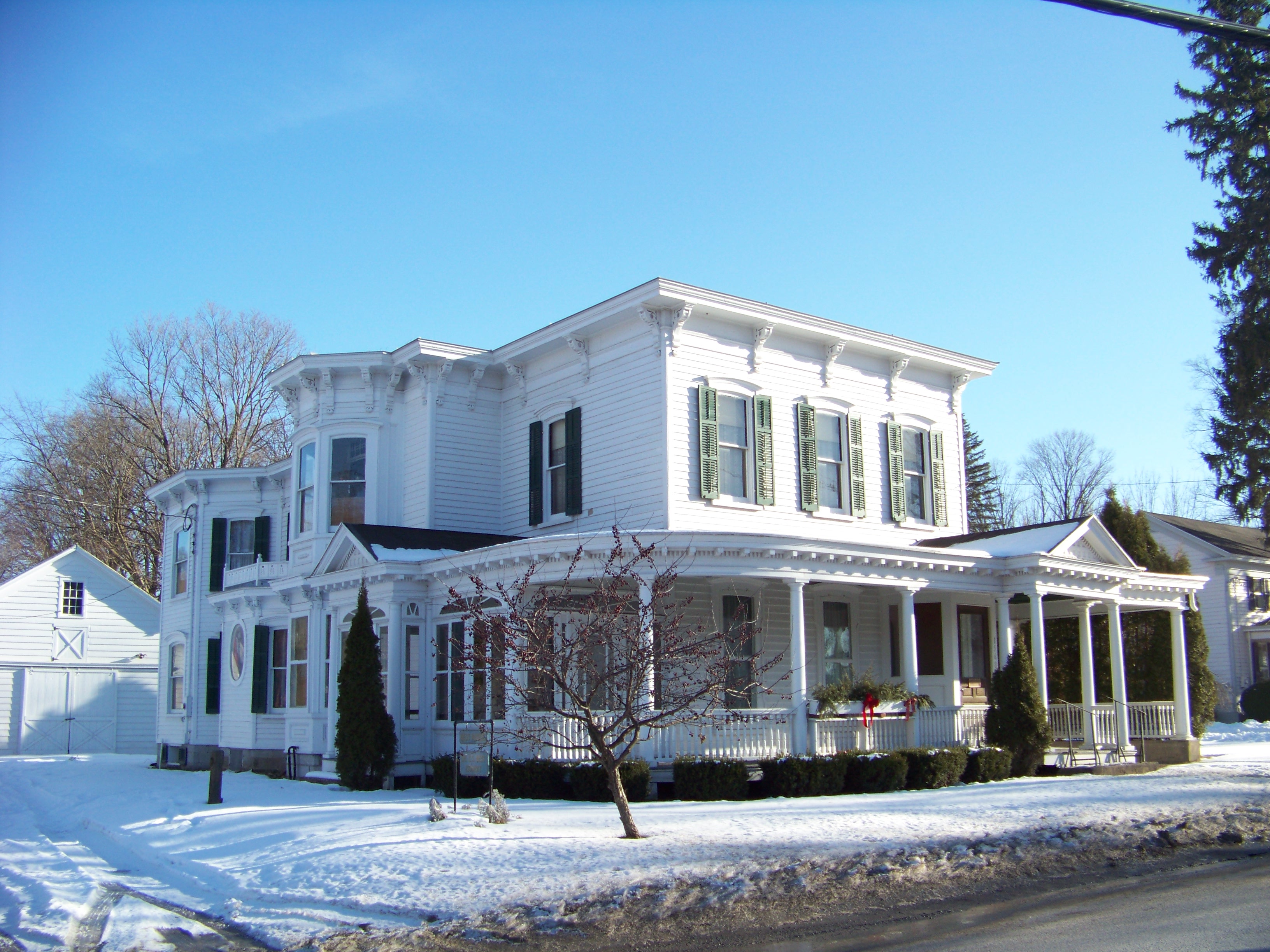
42°36′15″N 74°20′13″W / 42.604167°N 74.336944°WMiddleburgh 5 Dr. Christopher S. Best House and Office 
August 15, 2001 34 Clauverwie St.
42°35′47″N 74°19′59″W / 42.596389°N 74.333056°WMiddleburgh 6 Bramanville Mill 
August 27, 1976 East of Cobleskill on Caverns Rd.
42°41′17″N 74°24′22″W / 42.688056°N 74.406111°WCobleskill 7 Breakabeen Historic District 
December 31, 1974 Roughly bounded by River St., new Route 30, and Main St. to Bush Rd.
42°31′27″N 74°23′07″W / 42.524167°N 74.385278°WBreakabeen 8 Bunn-Tillapaugh Feed Mill September 29, 2006 2 High St.
42°37′59″N 74°33′50″W / 42.633056°N 74.563889°WRichmondville 9 Bute-Warner-Truax Farm July 25, 1985 Truax Rd.
42°34′22″N 74°39′29″W / 42.572778°N 74.658056°WCharlotteville 10 Cobleskill Historic District 
September 18, 1978 Irregular pattern along Washington Ave., Main, Grand, and Elm Sts.
42°40′41″N 74°29′03″W / 42.678056°N 74.484167°WCobleskill 11 The Colyer House February 13, 2008 5729 NY 30
42°41′43″N 74°17′51″W / 42.695278°N 74.2975°WSchoharie 12 Forks in the Road Schoolhouse July 6, 2005 115 Lumber Rd.
42°24′43″N 74°33′48″W / 42.411944°N 74.563333°WSouth Gilboa 13 Gallupville Evangelical Lutheran Church 
December 31, 2002 980 NY 443
42°39′48″N 74°14′04″W / 42.663333°N 74.234444°WGallupville 14 Gallupville House 
September 7, 1979 Main St.
42°39′46″N 74°13′58″W / 42.662778°N 74.232778°WGallupville 15 Gallupville Methodist Church 
May 30, 2001 Factory St.
42°39′45″N 74°14′03″W / 42.6625°N 74.234167°WSchoharie 16 Peter A. Hilton House September 24, 2004 6605 NY 10
42°44′30″N 74°35′24″W / 42.741667°N 74.59°WBeekman Corners 17 Lansing Manor House 
May 25, 1973 2 miles south of North Blenheim on NY 30
42°27′04″N 74°27′54″W / 42.451111°N 74.465°WBlenheim 18 Lasell Hall 
January 11, 2002 350 Main St.
42°39′45″N 74°18′45″W / 42.6625°N 74.3125°WSchoharie 19 Livingstonville Community Church 
January 9, 2008 1667 Hauverville Rd.
42°29′24″N 74°16′06″W / 42.49°N 74.268333°WLivingstonville 20 North Blenheim Historic District 
December 31, 1974 Both sides of NY 30, beside Schoharie Creek
42°28′13″N 74°27′03″W / 42.470278°N 74.450833°WBlenheim 21 Old Blenheim Bridge 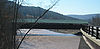
October 15, 1966 NY 30 over Schoharie Creek
42°28′21″N 74°26′29″W / 42.4725°N 74.44139°WNorth Blenheim Destroyed August 28, 2011 in flooding caused by Hurricane Irene[4] 22 Old Lutheran Parsonage 
June 19, 1972 Adjacent to Spring St. in Lutheran Cemetery
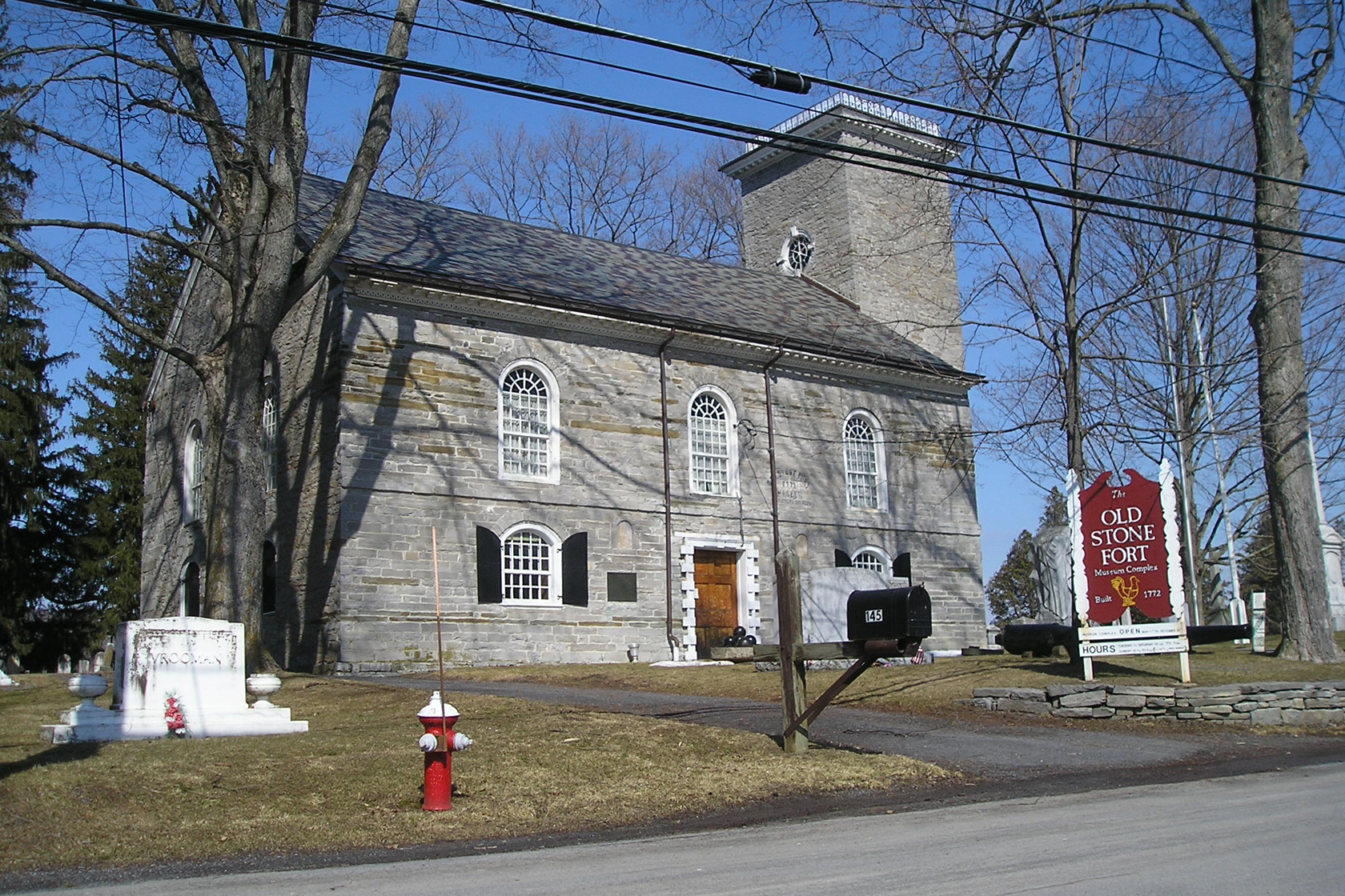
42°39′42″N 74°18′31″W / 42.661667°N 74.308611°WSchoharie 23 Old Stone Fort 
December 31, 2002 145 Fort Rd.
42°40′38″N 74°18′08″W / 42.677222°N 74.302222°WSchoharie 24 Parker 13-Sided Barn 
September 29, 1984 NY 10
42°28′51″N 74°36′17″W / 42.480833°N 74.604722°WJefferson 25 Richmondville United Methodist Church 
July 14, 2006 266 Main St.
42°37′57″N 74°33′56″W / 42.6325°N 74.565556°WRichmondville 26 Schoharie County Courthouse Complex 
August 15, 1995 Main St.
42°39′49″N 74°18′44″W / 42.663611°N 74.312222°WSchoharie 27 Schoharie Valley Railroad Complex April 26, 1972 Depot Lane
42°40′13″N 74°18′39″W / 42.670278°N 74.310833°WSchoharie 28 Shafer Site 
November 28, 1980 Address Restricted Fulton 29 Sharon Springs Historic District 
June 3, 1994 Junction of NY 10 and US 20
42°47′32″N 74°36′56″W / 42.792222°N 74.615556°WSharon Springs 30 South Gilboa Railroad Station February 25, 2000 Bailey Spur Rd.
42°24′36″N 74°33′30″W / 42.41°N 74.558333°WSouth Gilboa 31 St. John's Lutheran Church September 12, 2008 6569 NY 10
42°44′28″N 74°35′08″W / 42.741111°N 74.585556°WBeekman Corners 32 St. Mark's Evangelical Lutheran Church 
July 14, 2006 326 Main St.
42°35′56″N 74°20′07″W / 42.598889°N 74.335278°WMiddleburgh 33 Sternbergh House March 21, 1985 Oak Hill Rd.
42°42′02″N 74°03′27″W / 42.700556°N 74.0575°WSchoharie 34 Abraham Sternberg House Abraham Sternberg HouseSeptember 8, 2010 150 Route 30A
42°42′06″N 74°18′15″W / 42.701667°N 74.304167°WSchoharie New listing; refnum 10000726 35 Upper Middleburgh Cemetery 
November 17, 2003 Huntersland Rd.
42°35′24″N 74°19′08″W / 42.59°N 74.318889°WMiddleburgh 36 US Post Office-Middleburgh May 11, 1989 162 Main St.
42°35′52″N 74°20′02″W / 42.597778°N 74.333889°WMiddleburgh 37 Westheimer Site July 22, 1980 Address Restricted Schoharie 38 George Westinghouse, Jr., Birthplace and Boyhood Home 
March 20, 1986 Westinghouse Rd.
42°42′32″N 74°19′56″W / 42.708889°N 74.332222°WCentral Bridge See also
References
- ^ The latitude and longitude information provided in this table was derived originally from the National Register Information System, which has been found to be fairly accurate for about 99% of listings. For about 1% of NRIS original coordinates, experience has shown that one or both coordinates are typos or otherwise extremely far off; some corrections may have been made. A more subtle problem causes many locations to be off by up to 150 yards, depending on location in the country: most NRIS coordinates were derived from tracing out latitude and longitudes off of USGS topographical quadrant maps created under the North American Datum of 1927, which differs from the current, highly accurate WGS84 GPS system used by Google maps. Chicago is about right, but NRIS longitudes in Washington are higher by about 4.5 seconds, and are lower by about 2.0 seconds in Maine. Latitudes differ by about 1.0 second in Florida. Some locations in this table may have been corrected to current GPS standards.
- ^ "National Register of Historic Places: Weekly List Actions". National Park Service, United States Department of the Interior. Retrieved on November 18, 2011.
- ^ Numbers represent an ordering by significant words. Various colorings, defined here, differentiate National Historic Landmark sites and National Register of Historic Places Districts from other NRHP buildings, structures, sites or objects.
- ^ Eckholm, Erik (August 31, 2011). "Covered Bridges, Beloved Remnants of Another Era, Were Casualties, Too". The New York Times. http://www.nytimes.com/2011/09/01/us/01bridges.html?emc=tnt&tntemail0=y. Retrieved September 1, 2011.
Categories:- National Register of Historic Places in New York by county
- Buildings and structures in Schoharie County, New York
-


Wikimedia Foundation. 2010.