- Carbon River
Geobox River
name = Carbon River
native_name =
other_name =
other_name1 =
image_size = 300
image_caption = The Carbon River's source at the terminus of Carbon Glacier.
country = United States
country1 =
state = Washington
state1 =
region_type = County
region = Pierce
region1 =
district =
district1 =
city = Orting
city1 =
length_imperial = 30
length_note =
watershed_imperial = 78.9
watershed_note = [http://pubs.usgs.gov/wdr/2005/wdr-wa-05-1/pdf/wa00103ADR2005_Figure28.pdf Puyallup and White River Basins] , Water Resource Data, Washington, 2005, USGS.]
discharge_location = Fairfax, WA
discharge_imperial = 427
discharge_max_imperial = 12000
discharge_min_imperial = 32
discharge_note =
discharge1_location =
discharge1_imperial =
source_name = Mount Rainier
source_location = Carbon Glacier
source_district =
source_region =
source_state =
source_country =
source_lat_d = 46
source_lat_m = 56
source_lat_s = 38
source_lat_NS = N
source_long_d = 121
source_long_m = 47
source_long_s = 24
source_long_EW = W
source_coordinates_note = gnis|1517386]
source_elevation_imperial = 3575
source_elevation_note =Google Earth elevation for GNIS coordinates.]
source_length_imperial =
mouth_name = Puyallup River
mouth_location = Orting
mouth_district =
mouth_region =
mouth_state =
mouth_country =
mouth_lat_d = 47
mouth_lat_m = 7
mouth_lat_s = 50
mouth_lat_NS = N
mouth_long_d = 122
mouth_long_m = 13
mouth_long_s = 58
mouth_long_EW = W
mouth_coordinates_note =
mouth_elevation_imperial = 112
mouth_elevation_note =
tributary_left =Voight Creek
tributary_left1 =
tributary_right =South Prairie Creek
tributary_right1 =
free_name =
free_value =
map_size =
map_caption = The Carbon River is ariver in theU.S. state ofWashington . It flows about 30 miles (48 km) from its source, theCarbon Glacier onMount Rainier , to join thePuyallup River at Orting.Charles Wilkes called the river the "Upthascap River", but after the discovery of coal along its banks in 1876 the river was renamed "Carbon". [cite book |last= Phillips |first= James W. |title= Washington State Place Names |year= 1971 |publisher= University of Washington Press |isbn= 0-295-95158-3]Course
The source of the Carbon River is the Carbon Glacier on the north side of Mount Rainier in the
Cascade Range . The river's upper reach is contained withinMount Rainier National Park . Some of the river's headwater tributary streams include Cataract Creek and Spukwush Creek. The Carbon River quickly enters a broad glacial valley in which it deposits thick layers of glacial sediment. This causes the river to meander and become braided.After flowing by Mother Mountain on the west and Chenuis Mountain on the east, the Carbon River reaches Ipsut Creek and the national park campground of Ipsut Creek Campground. This was also the end of the Carbon River Road entrance to Mount Rainier National Park before the 2006 floods washed out portions of the road. Below Ipsut Creek the Carbon River is joined by Chenuis Creek from the north and Green Creek from the south. Shortly after these confluences the river exits Mount Rainier National Park. Carbon Ridge and its high summit Old Baldy Mountain, lie to the north. Tolmie Creek, flowing down from
Tolmie Peak , joins the Carbon River from the south.Having run generally northwest, the Carbon River turns more directly west until it is joined by Evans Creek just before the small settlement of Fairfax. From Fairfax to Carbonado the Carbon River flows north through a narrow gorge, with Gleason Hill to the east and Wingate Hill to the west.
After passing Carbonado and receiving the tributary Lily Creek, the river valley broadens again and the Carbon River resumes its generally braided and meandering pattern. It turns west, flowing through an increasingly broad floodplain to the town of Crocker, where the river is joined by one of its main tributaries, South Prairie Creek. Just below Crocker another major tributary, Voight Creek, joins.
Below Crocker the Carbon River flows northwest to join the Puyallup River. The city of Orting is located at the confluence, in the floodplain between the Carbon and Puyallup rivers. [Course info mainly from: cite book | title = Washington Road & Recreation Atlas | year = 2000 | publisher =
Benchmark Maps and [http://www.topozone.com] ]Geology
Formed by glacial meltwater, the Carbon River contains a heavy load of
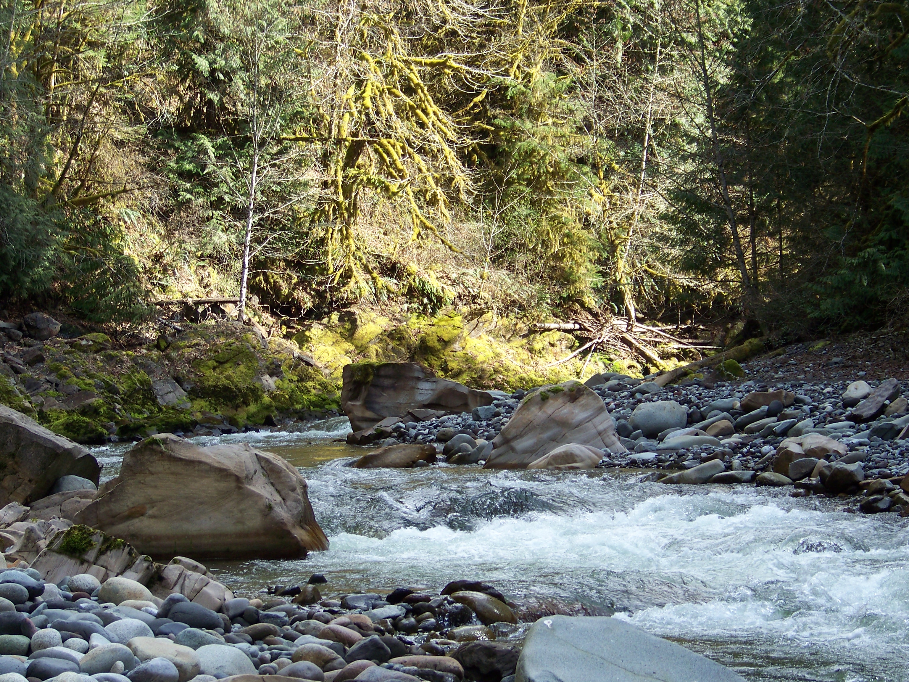
sediment such as silt and gravel. After emerging from the Carbon Glacier the Carbon River flows through a broad glacier-carved valley where thick sediment deposits in thestream bed create sand and gravel bars causing the river to become complexly braided, meandering, and flood-prone. The river frequently shifts channels and creates new ones in its valley. Between Fairfax and Carbonado the Carbon River flows through a narrow gorge (right) before emerging into another broad flood-prone valley near Crocker and Orting.Natural history
The Carbon River valley receives about 70-90 inches (1,778-2,286 mm) of rain per year, resulting in a
temperate rain forest environment. [ [http://www.nps.gov/mora/planyourvisit/carbon-and-mowich.htm Carbon and Mowich] , Mount Rainier National Park, National Park Service.]Natural hazards
Floods
Flooding occurs frequently in the upper Carbon River valley. In 2006 a major flood resulted in the river forming new stream channels and in the process washing-out out a portion of the Carbon River Road. The road is the main entrance to the northwestern part of Mount Rainier National Park. Part of the road essentially became a new channel of the river. Other parts of the road were washed away.
As of 2007 the Carbon River Road ends approximately five miles east of the entrance station.
Lahars
As with other rivers flowing from Mount Rainier's glaciers, the Carbon River valley is at risk of
lahar s. [ [http://www.nps.gov/archive/mora/ncrd/hazards.htm Volcanic Hazards in Mount Rainier] , National Park Service.]ee also
*
List of Washington rivers References
Wikimedia Foundation. 2010.