- National Register of Historic Places listings in Jefferson County, Wisconsin
-
Buildings, sites, structures, districts, and objects in Jefferson County listed on the National Register of Historic Places
-
- This National Park Service list is complete through NPS recent listings posted November 10, 2011.[1]
This document is intended to provide a comprehensive listing of entries in the National Register of Historic Places that are located in Jefferson County, Wisconsin. The locations of National Register properties, the latitude and longitude coordinates of which are included below, may be seen in a Google map.[2]
Current listings
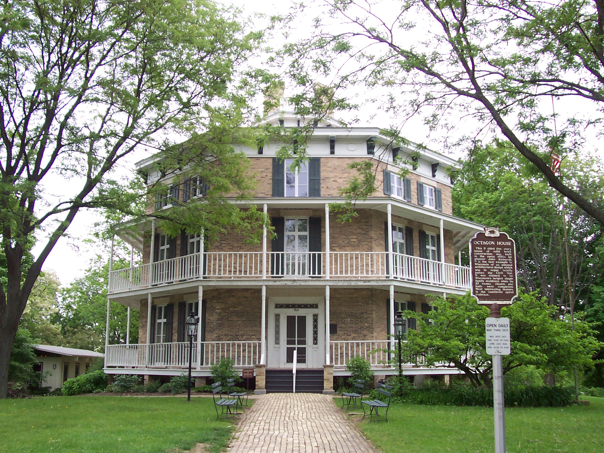
[3] Landmark name Image Date listed Location City or town Summary 1 Aztalan 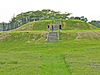
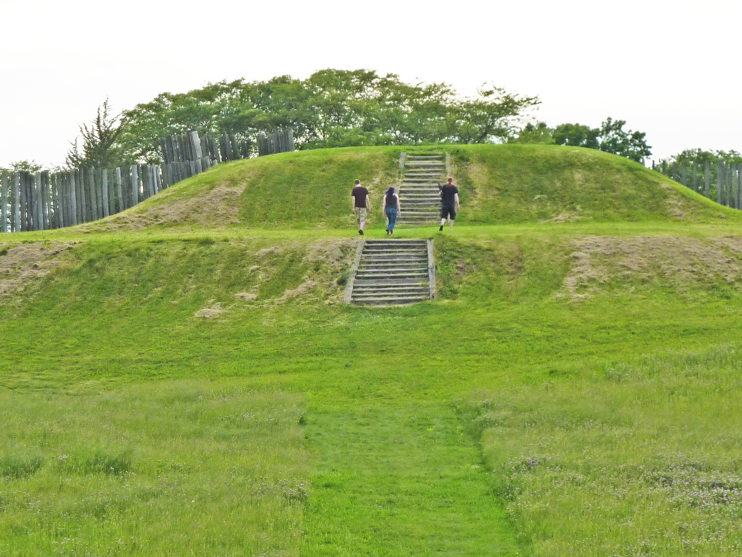
October 15, 1966 Near Lake Mills on WI 89, Aztalan State Park
43°04′03″N 88°51′40″W / 43.0675°N 88.861111°WLake Mills 2 Beals and Torrey Shoe Co. Building December 6, 1984 100 W. Milwaukee St.
43°11′24″N 88°43′36″W / 43.19°N 88.726667°WWatertown 3 Bean Lake Islands Archeological District August 12, 1982 Address Restricted Lake Mills 4 Carcajou Point (47 Je 2) September 18, 1979 Address Restricted Busseyville 5 Chicago and Northwest Railroad Passenger Station March 28, 1979 725 W. Main St.
43°11′40″N 88°44′05″W / 43.194444°N 88.734722°WWatertown 6 City of Waterloo Carousel August 15, 1997 500 Park Ave.
43°10′49″N 88°59′05″W / 43.180278°N 88.984722°WWaterloo Questionable coordinates, more likely at intersection of Park Ave. and W. Porter St. 7 Copeland-Ryder Company 
April 13, 1989 411 Wisconsin Dr.
43°00′06″N 88°48′46″W / 43.001667°N 88.812778°WJefferson utilitarian-industrial design 8 David W. and Jane Curtis House 
May 12, 2009 213 E. Sherman Ave.
42°55′48″N 88°50′04″W / 42.929864°N 88.834539°WFort Atkinson 9 Crab Apple Point Site December 22, 1978 Address Restricted Edgerton 10 Enterprise Building June 5, 1975 125 W. Main St.
42°52′40″N 88°35′06″W / 42.877778°N 88.585°WPalmyra 11 Enoch J. Fargo House 
July 8, 1982 406 Mulberry St.
43°04′53″N 88°54′27″W / 43.081389°N 88.9075°WLake Mills 12 L. D. Fargo Public Library 
January 18, 1982 120 E. Madison St.
43°04′51″N 88°54′38″W / 43.080833°N 88.910556°WLake Mills 1899-1902, Gothic revival style with storybook elements, George B. Ferry & Alfred C. Clas 13 First Kindergarten February 23, 1972 919 Charles St.
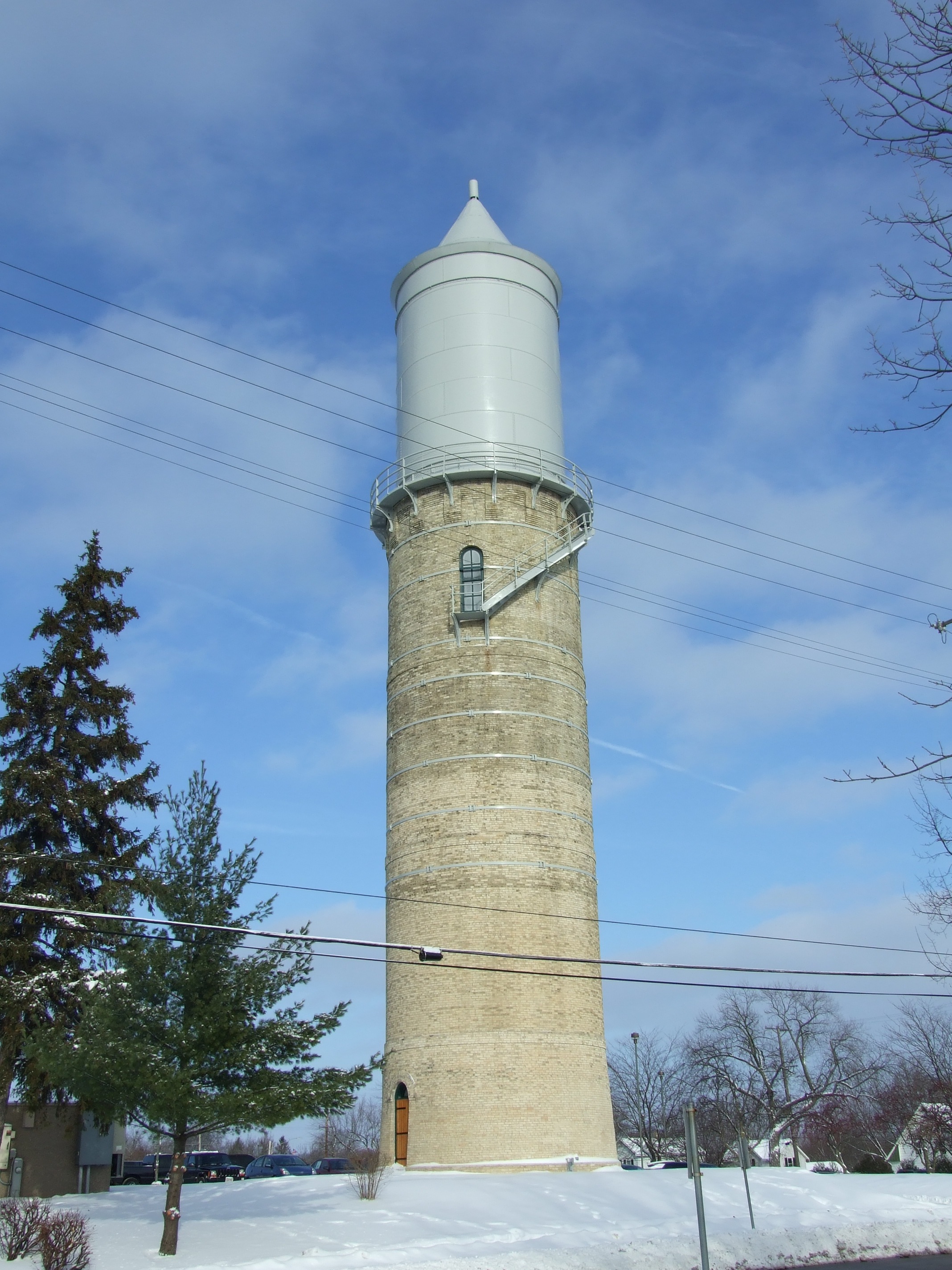
43°11′04″N 88°42′26″W / 43.184444°N 88.707222°WWatertown 14 Fort Atkinson Water Tower 
November 15, 2005 S. High and Fourth Sts.
42°55′33″N 88°49′58″W / 42.925833°N 88.832778°WFort Atkinson 15 August and Eliza Fuermann Jr. House July 27, 1989 500 S. Third St.
43°11′28″N 88°43′23″W / 43.191111°N 88.723056°WWatertown 16 Haight Creek Mound Group (47-Je-38) August 5, 1985 Address Restricted Fort Atkinson 17 Hebron Town Hall December 31, 2002 W3087 Green Isle Dr.
42°55′31″N 88°41′19″W / 42.925278°N 88.688611°WHebron 18 Highsmith Site December 1, 1978 NE of Fort Atkinson Fort Atkinson 19 Hoard Mound Group (47JE33) May 10, 1984 Address Restricted Fort Atkinson 20 Hoard's Dairyman Farm 
August 29, 1978 N of Fort Atkinson
42°56′48″N 88°50′12″W / 42.946667°N 88.836667°WFort Atkinson 21 Arthur R. Hoard House 
November 30, 1982 323 Merchants Ave.
42°55′28″N 88°50′07″W / 42.924444°N 88.835278°WFort Atkinson 22 Jefferson Fire Station 
December 6, 1984 146 E. Milwaukee St.
43°00′15″N 88°48′22″W / 43.004167°N 88.806111°WJefferson Alexander Kirkland and Adam Spangler, Italianate style 23 Jefferson High School 
January 11, 2001 201 S. Copeland Ave.
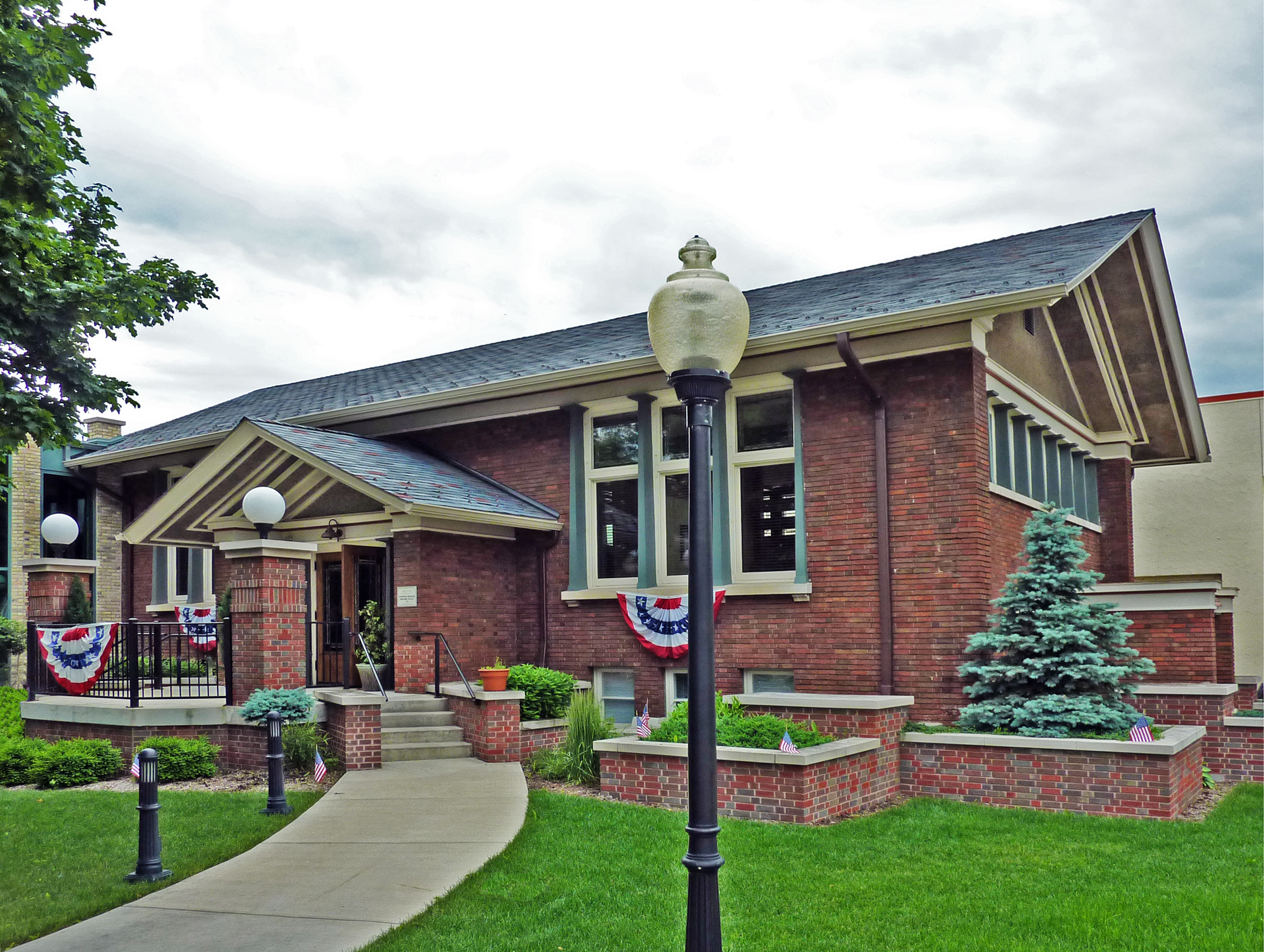
43°00′15″N 88°48′45″W / 43.004167°N 88.8125°WJefferson Gothic revival style 24 Jefferson Public Library 
January 17, 1980 305 S. Main St.
43°00′12″N 88°48′27″W / 43.003333°N 88.8075°WJefferson Claude and Starck, Prairie School style 25 Jones Dairy Farm December 27, 1978 Jones Ave.
42°55′22″N 88°50′45″W / 42.922778°N 88.845833°WFort Atkinson 26 Main Street Commercial Historic District June 2, 1989 Roughly Main St. from N. Washington St. to S. Seventh St.
43°11′40″N 88°43′23″W / 43.194444°N 88.723056°WWatertown 27 Main Street Commercial Historic District 
January 7, 1998 Roughly bounded by Dodge St., Center Ave., Mechanic St., and Rock R.
43°00′17″N 88°48′26″W / 43.004722°N 88.807222°WJefferson 28 Main Street Historic District 
June 7, 1984 Roughly Main St. from Sherman Ave. to S. 3rd St.
42°55′41″N 88°50′15″W / 42.928056°N 88.8375°WFort Atkinson 29 Eli May House 
September 14, 1972 407 E. Milwaukee Ave.
42°55′37″N 88°49′52″W / 42.926944°N 88.831111°WFort Atkinson 30 Monroe McKenzie House June 19, 1985 226 Main St.
42°52′38″N 88°35′10″W / 42.877222°N 88.586111°WPalmyra 31 Merchants Avenue Historic District 
June 13, 1986 Roughly bounded by S. Third St. E and S. Milwaukee Ave. E, Foster St., Whitewater, and Merchant Aves.
42°55′27″N 88°50′06″W / 42.924167°N 88.835°WFort Atkinson 32 North Washington Street Historic District 
October 23, 2009 N. Church St. generally bounded by O'Connell and N. Green St., N. Washington St. bounded by O'Connell and Elm Sts.
43°11′51″N 88°43′44″W / 43.197369°N 88.728864°WWatertown 33 Octagon House 
November 23, 1971 919 Charles St.
43°11′05″N 88°42′27″W / 43.184722°N 88.7075°WWatertown 34 Panther Intaglio Effigy Mound October 15, 1970 Address Restricted Fort Atkinson 35 Pioneer Aztalan Site February 25, 1975 SE corner at jct. of SR B and Sr Q
43°04′19″N 88°51′38″W / 43.071944°N 88.860556°WAztalan at Aztalan State Park 36 Pitzner Site (47 Je 676) July 6, 1982 Address Restricted Jefferson 37 Puerner Block-Breunig's Brewery 
June 14, 1984 101-115 E. Racine, 110-112 N. Main St.
43°00′18″N 88°49′09″W / 43.005°N 88.819167°WJefferson Italianate style 38 Saint Bernard's Church Complex 
November 26, 2003 100 and 108 S. Church St. and 111 S. Montgomery St.
43°11′39″N 88°43′44″W / 43.194167°N 88.728889°WWatertown 39 Richard C. Smith House 
April 19, 1979 332 E. Linden St.
43°00′08″N 88°48′07″W / 43.002222°N 88.801944°WJefferson Frank Lloyd Wright, 1950 40 Albert F. Solliday House 
December 5, 2003 114 S. Church St.
43°11′38″N 88°43′44″W / 43.193889°N 88.728889°WWatertown 41 South Washington Street Historic District 
November 26, 2003 Odd numbered 201-309 S. Church St. and S. Washington St. from Emmet St. to West St.
43°11′30″N 88°43′41″W / 43.191667°N 88.728056°WWatertown 42 St. Paul's Episcopal Church November 7, 1979 413 S 2nd St.
43°11′29″N 88°43′24″W / 43.191389°N 88.723333°WWatertown 43 St. Wenceslaus Roman Catholic Church 
May 12, 1975 SE of Waterloo at jct. of Blue Point and Island Rds.
43°09′40″N 88°55′16″W / 43.161111°N 88.921111°WWaterloo 44 Telfer Site March 29, 2000 Address Restricted Milford 45 Waterloo Downtown Historic District 
November 8, 2000 Jct. of Madison and Monroe Sts.
43°11′02″N 88°59′25″W / 43.183889°N 88.990278°WWaterloo See also
- List of National Historic Landmarks in Wisconsin
- National Register of Historic Places listings in Wisconsin
References
- ^ "National Register of Historic Places: Weekly List Actions". National Park Service, United States Department of the Interior. Retrieved on November 10, 2011.
- ^ The latitude and longitude information provided is primarily from the National Register Information System, and has been found to be fairly accurate for about 99% of listings. For 1%, the location info may be way off. We seek to correct the coordinate information wherever it is found to be erroneous. Please leave a note in the Discussion page for this article if you believe any specific location is incorrect.
- ^ Numbers represent an ordering by significant words. Various colorings, defined here, differentiate National Historic Landmark sites and National Register of Historic Places Districts from other NRHP buildings, structures, sites or objects.
U.S. National Register of Historic Places Topics Lists by states Alabama • Alaska • Arizona • Arkansas • California • Colorado • Connecticut • Delaware • Florida • Georgia • Hawaii • Idaho • Illinois • Indiana • Iowa • Kansas • Kentucky • Louisiana • Maine • Maryland • Massachusetts • Michigan • Minnesota • Mississippi • Missouri • Montana • Nebraska • Nevada • New Hampshire • New Jersey • New Mexico • New York • North Carolina • North Dakota • Ohio • Oklahoma • Oregon • Pennsylvania • Rhode Island • South Carolina • South Dakota • Tennessee • Texas • Utah • Vermont • Virginia • Washington • West Virginia • Wisconsin • WyomingLists by territories Lists by associated states Other Municipalities and communities of Jefferson County, Wisconsin Cities Fort Atkinson | Jefferson | Lake Mills | Waterloo | Watertown‡ | Whitewater‡

Villages Cambridge‡ | Johnson Creek | Lac La Belle‡ | Palmyra | Sullivan
Towns Aztalan | Cold Spring | Concord | Farmington | Hebron | Ixonia | Jefferson | Koshkonong | Lake Mills | Milford | Oakland | Palmyra | Sullivan | Sumner | Waterloo | Watertown
CDPs Hebron | Helenville | Ixonia | Lake Koshkonong | Lake Ripley | Rome
Unincorporated
communitiesAztalan | Blackhawk Island | Busseyville | Carcajou | Ebenezer | Grellton | Hoopers Mill | Hubbleton | Jefferson Junction | Koshkonong‡ | Koshkonong Manor | Koshkonong Mounds | Lake Lac La Belle | London‡ | Milford | North Shore | Oak Hill | Oakland | Pipersville | Portland‡ | Vinnie Ha Ha
Footnotes ‡This populated place also has portions in an adjacent county or counties
Categories:- Jefferson County, Wisconsin
- Lists of historic places in Wisconsin
-


Wikimedia Foundation. 2010.