- Lac La Belle, Wisconsin
Infobox Settlement
official_name = Lac La Belle, Wisconsin
settlement_type = Village
nickname =
motto =
imagesize =
image_caption =
image_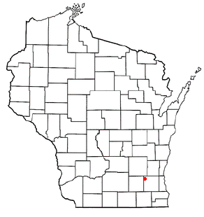
mapsize = 250x200px
map_caption = Location of Lac La Belle, Wisconsin
mapsize1 =
map_caption1 =subdivision_type = Country
subdivision_name =United States
subdivision_type1 = State
subdivision_name1 =Wisconsin
subdivision_type2 = County
subdivision_name2 = Waukeshagovernment_footnotes =
government_type =
leader_title =
leader_name =
leader_title1 =
leader_name1 =
established_title =
established_date =unit_pref = Imperial
area_footnotes =area_magnitude =
area_total_km2 = 1.8
area_land_km2 = 1.8
area_water_km2 = 0.0
area_total_sq_mi = 0.7
area_land_sq_mi = 0.7
area_water_sq_mi = 0.0population_as_of = 2000
population_footnotes =
population_total = 329
population_density_km2 = 186.9
population_density_sq_mi = 484.1timezone = Central (CST)
utc_offset = -6
timezone_DST = CDT
utc_offset_DST = -5
elevation_footnotes = GR|3
elevation_m = 262
elevation_ft = 860
latd = 43 |latm = 8 |lats = 44 |latNS = N
longd = 88 |longm = 31 |longs = 33 |longEW = Wpostal_code_type =
postal_code =
area_code =
blank_name = FIPS code
blank_info = 55-40750GR|2
blank1_name = GNIS feature ID
blank1_info = 1567709GR|3
website =
footnotes =Lac La Belle is a village located mostly in Waukesha County in the
U.S. state ofWisconsin . The population was 329 at the 2000 census. The village is located mostly within the Town of Oconomowoc in Waukesha County. OnMarch 28 ,2002 , the village annexed a portion of land in the Town of Ixonia in Jefferson County. The total population of the town was estimated at 340 in 2004 (338 in Waukesha County, 2 in Jefferson County). [http://www.legis.state.wi.us/lrb/bb/05bb/744-779.pdf]Geography
Lac La Belle is located at coor dms|43|8|44|N|88|31|33|W|city (43.145460, -88.525757)GR|1. Located in the "Lake Country" area of Waueksha County.
According to the
United States Census Bureau , the village has a total area of 0.7square mile s (1.8km² ), all of it land.Demographics
As of the
census GR|2 of 2000, there were 329 people, 117 households, and 109 families residing in the village. Thepopulation density was 484.1 people per square mile (186.8/km²). There were 127 housing units at an average density of 186.9/sq mi (72.1/km²). The racial makeup of the village was 99.70% White, 0.30% from other races. Hispanic or Latino of any race were 0.30% of the population.There were 117 households out of which 35.9% had children under the age of 18 living with them, 84.6% were married couples living together, 9.4% had a female householder with no husband present, and 6.0% were non-families. 3.4% of all households were made up of individuals and 1.7% had someone living alone who was 65 years of age or older. The average household size was 2.81 and the average family size was 2.88.
In the village the population was spread out with 22.8% under the age of 18, 4.6% from 18 to 24, 24.6% from 25 to 44, 37.1% from 45 to 64, and 10.9% who were 65 years of age or older. The median age was 44 years. For every 100 females there were 91.3 males. For every 100 females age 18 and over, there were 91.0 males.
The median income for a household in the village was $96,712, and the median income for a family was $100,000. Males had a median income of $89,119 versus $39,375 for females. The
per capita income for the village was $46,749. About 2.7% of families and 1.8% of the population were below thepoverty line , including 2.5% of those under age 18 and none of those age 65 or over.References
External links
Wikimedia Foundation. 2010.