- National Register of Historic Places listings in Jefferson County, Iowa
-
 Location of Jefferson County in Iowa
This is a list of the National Register of Historic Places listings in Jefferson County, Iowa.
This is intended to be a complete list of the properties and districts on the National Register of Historic Places in Jefferson County, Iowa, United States. Latitude and longitude coordinates are provided for many National Register properties and districts; these locations may be seen together in a Google map.[1]
There are 28 properties and districts listed on the National Register in the county.
-
- This National Park Service list is complete through NPS recent listings posted November 10, 2011.[2]
Current listings
[3] Landmark name [4] Image Date listed Location City or town Summary 1 Architecture of Henry K. Holsman Historic Campus District 
October 31, 1983 Bounded by Merrill St., Iowa Highway 1, and Carter Memorial Dr.
41°00′58″N 91°58′00″W / 41.016111°N 91.966667°WFairfield 2 W.C. Ball House April 4, 1985 Rural Route #2
41°01′11″N 91°57′32″W / 41.019722°N 91.958889°WFairfield 3 James A. Beck House 
March 29, 1978 401 E. Burlington Ave.
41°00′30″N 91°57′47″W / 41.008333°N 91.963056°WFairfield Designed by architect George Franklin Barber 4 Burnett-Montgomery House January 27, 1983 605 N. 3rd St.
41°00′52″N 91°57′55″W / 41.014444°N 91.965278°WFairfield 5 James F. Clarke House 
February 8, 1980 500 S. Main St.
41°00′21″N 91°58′00″W / 41.005833°N 91.966667°WFairfield 6 Evergreen Ridge Stock Farm Historic District June 21, 2007 2224 IA S Fairfield 7 Fairfield Public Library May 23, 1983 Court and Washington
41°00′29″N 91°54′43″W / 41.008056°N 91.911944°WFairfield 8 Former US Post Office Building January 24, 1991 110 S. Court St.
41°00′27″N 91°57′43″W / 41.0075°N 91.961944°WFairfield 9 O.F. and Lulu E. Fryer House February 5, 1999 902 S. Main St.
40°59′32″N 91°57′18″W / 40.992222°N 91.955°WFairfield 10 Fred and Rosa Fulton Barn February 22, 1999 1210 278th Boulevard
40°54′04″N 92°08′18″W / 40.901111°N 92.138333°WSelma 11 Henn Mansion January 11, 1983 Maharishi University of Management campus
41°01′01″N 91°58′41″W / 41.016944°N 91.978056°WFairfield 12 Iowa Malleable Iron Company February 22, 1999 600-608 N. 9th St.
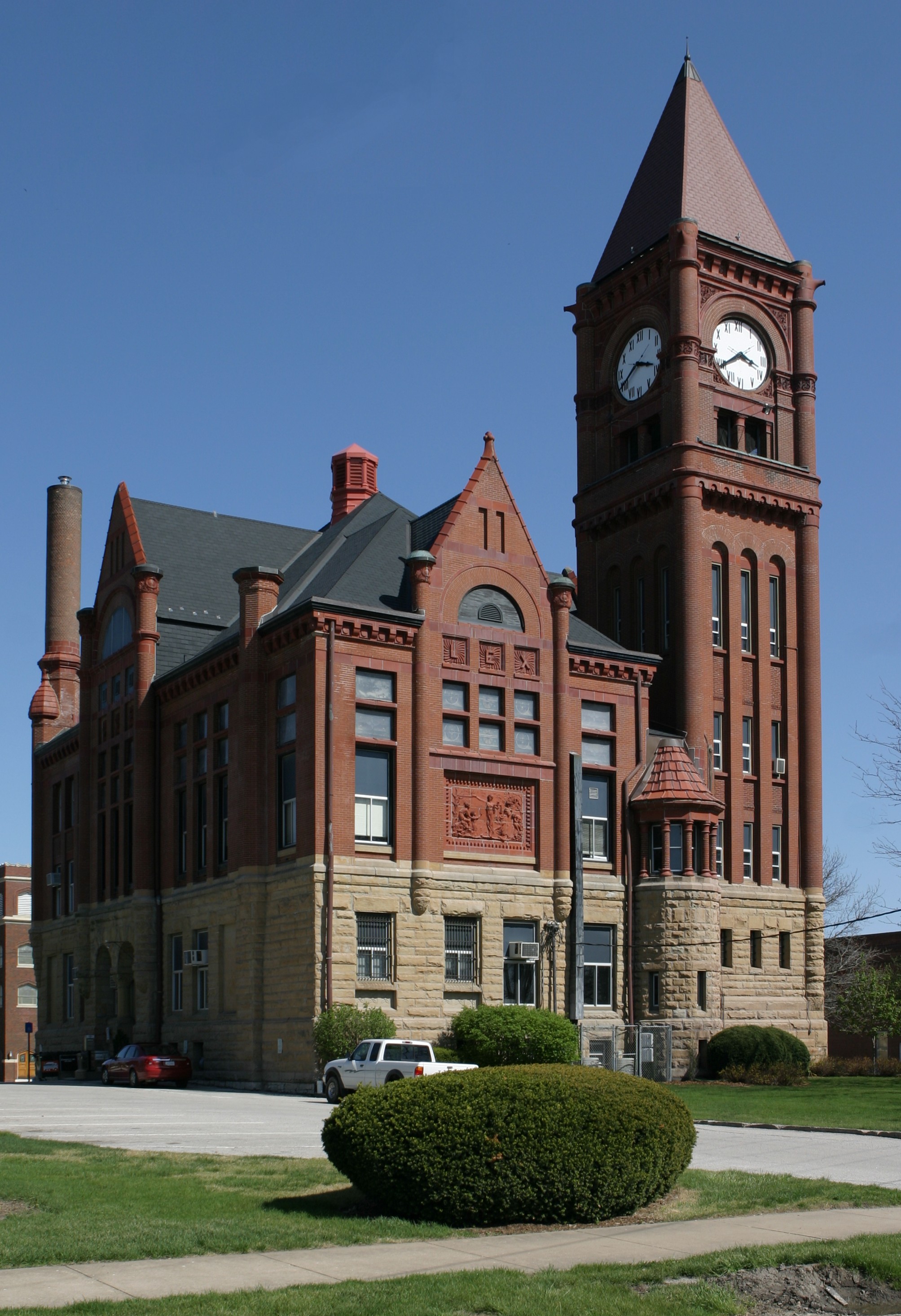
41°00′47″N 91°58′33″W / 41.013056°N 91.975833°WFairfield 13 Jefferson County Courthouse 
July 2, 1981 Court St. between Briggs and Hempstead Aves.
41°00′37″N 91°57′55″W / 41.010278°N 91.965278°WFairfield 14 Louden Machinery Company February 22, 1999 607 W. Broadway Ave.
41°00′32″N 91°58′15″W / 41.008889°N 91.970833°WFairfield 15 Louden Monorail System in the Auto Repair Shop February 22, 1999 117 E. Broadway Ave.
41°00′27″N 91°57′43″W / 41.0075°N 91.961944°WFairfield 16 Louden Whirl-Around February 22, 1999 905 E. Harrison Ave.
40°59′54″N 91°57′06″W / 40.998333°N 91.951667°WFairfield 17 R.B. and Lizzie L. Louden House February 22, 1999 107 W. Washington Ave.
41°00′21″N 91°57′53″W / 41.005833°N 91.964722°WFairfield 18 R. Bruce and May W. Louden House September 12, 2003 501 W. Adams Ave.
41°00′18″N 91°58′09″W / 41.005°N 91.969167°WFairfield 19 R.R. and Antoinette Louden House February 22, 1999 905 E. Adams Ave.
41°00′17″N 91°57′05″W / 41.004722°N 91.951389°WFairfield 20 William and Mary Jane Louden House February 18, 1999 501 W. Washington Ave.
41°00′22″N 91°58′09″W / 41.006111°N 91.969167°WFairfield 21 August and Vera Luedtke Barn February 22, 1999 1938 185th St.
41°02′17″N 91°59′57″W / 41.038056°N 91.999167°WFairfield 22 McElhinny House December 19, 1977 300 N. Court St.
41°00′43″N 92°02′25″W / 41.011944°N 92.040278°WFairfield 23 New Sweden Chapel March 25, 1977 East of Fairfield off U.S. Route 34
41°01′22″N 91°46′47″W / 41.022778°N 91.779722°WFairfield 24 Old Settlers' Association Park and Rhodham Bonnifield House August 14, 1986 B St.
41°01′08″N 91°57′24″W / 41.018889°N 91.956667°WFairfield 25 George A. Wells House January 27, 1983 304 S. Main St.
41°00′15″N 91°57′50″W / 41.004167°N 91.963889°WFairfield 26 Wells-Stubbs House October 10, 1985 508 E. Burlington Ave.
41°00′56″N 91°57′22″W / 41.015556°N 91.956111°WFairfield 27 Wilson Building January 24, 1991 106-108 S. Court St.
41°00′28″N 91°57′40″W / 41.007778°N 91.961111°WFairfield 28 US Senator James F. Wilson House January 24, 1991 805 S. Main St.
40°59′44″N 91°57′45″W / 40.995556°N 91.9625°WFairfield See also
References
- ^ The latitude and longitude information provided in this table was derived originally from the National Register Information System, which has been found to be fairly accurate for about 99% of listings. For about 1% of NRIS original coordinates, experience has shown that one or both coordinates are typos or otherwise extremely far off; some corrections may have been made. A more subtle problem causes many locations to be off by up to 150 yards, depending on location in the country: most NRIS coordinates were derived from tracing out latitude and longitudes off of USGS topographical quadrant maps created under North American Datum of 1927, which differs from the current, highly accurate GPS system used by Google maps. Chicago is about right, but NRIS longitudes in Washington are higher by about 4.5 seconds, and are lower by about 2.0 seconds in Maine. Latitudes differ by about 1.0 second in Florida. Some locations in this table may have been corrected to current GPS standards.
- ^ "National Register of Historic Places: Weekly List Actions". National Park Service, United States Department of the Interior. Retrieved on November 10, 2011.
- ^ Numbers represent an ordering by significant words. Various colorings, defined here, differentiate National Historic Landmark sites and National Register of Historic Places Districts from other NRHP buildings, structures, sites or objects.
- ^ "National Register Information System". National Register of Historic Places. National Park Service. . http://nrhp.focus.nps.gov/natreg/docs/All_Data.html.
U.S. National Register of Historic Places Topics Lists by states Alabama • Alaska • Arizona • Arkansas • California • Colorado • Connecticut • Delaware • Florida • Georgia • Hawaii • Idaho • Illinois • Indiana • Iowa • Kansas • Kentucky • Louisiana • Maine • Maryland • Massachusetts • Michigan • Minnesota • Mississippi • Missouri • Montana • Nebraska • Nevada • New Hampshire • New Jersey • New Mexico • New York • North Carolina • North Dakota • Ohio • Oklahoma • Oregon • Pennsylvania • Rhode Island • South Carolina • South Dakota • Tennessee • Texas • Utah • Vermont • Virginia • Washington • West Virginia • Wisconsin • WyomingLists by territories Lists by associated states Other  Category:National Register of Historic Places •
  Portal:National Register of Historic Places
Municipalities and communities of Jefferson County, Iowa County seat: Fairfield Cities Batavia | Coppock‡ | Fairfield | Libertyville | Lockridge | Maharishi Vedic City | Packwood | Pleasant Plain

Townships Black Hawk | Buchanan | Cedar | Center | Des Moines | Liberty | Lockridge | Locust Grove | Penn | Polk | Round Prairie | Walnut
Unincorporated
communitiesAbingdon | Pekin
Footnotes ‡This populated place also has portions in an adjacent county or counties
Categories:- National Register of Historic Places in Iowa by county
- Jefferson County, Iowa
- Buildings and structures in Jefferson County, Iowa
-


Wikimedia Foundation. 2010.