- National Register of Historic Places listings in Dubuque County, Iowa
-
 Location of Dubuque County in Iowa
This is a list of the National Register of Historic Places listings in Dubuque County, Iowa.
This is intended to be a complete list of the properties and districts on the National Register of Historic Places in Dubuque County, Iowa, United States. Latitude and longitude coordinates are provided for many National Register properties and districts; these locations may be seen together in a Google map.[1]
There are 72 properties and districts listed on the National Register in the county, including three National Historic Landmarks.
-
- This National Park Service list is complete through NPS recent listings posted November 10, 2011.[2]
Current listings
[3] Landmark name [4] Image Date listed Location City or town Summary 1 Allen House July 10, 1975 515 1st Ave., W.
42°29′03″N 91°07′50″W / 42.484167°N 91.130556°WDyersville 2 Andrew-Ryan House April 11, 1985 1375 Locust
42°30′17″N 90°40′16″W / 42.504722°N 90.671111°WDubuque 3 Basilica of St. Francis Xavier, Church and Rectory 
September 29, 1999 114 2nd St., SW.
42°29′04″N 91°07′33″W / 42.484436°N 91.125803°WDyersville 4 John Bell Block December 20, 2002 1307-07 Central Ave.
42°30′21″N 90°39′59″W / 42.505833°N 90.666389°WDubuque 5 Bishop's Block 
May 19, 1994 90 W. Main St.
42°29′40″N 90°39′49″W / 42.494444°N 90.663611°WDubuque 6 Carnegie-Stout Public Library August 1, 1975 11th and Bluff Sts.
42°30′09″N 90°40′12″W / 42.5025°N 90.67°WDubuque 7 Cathedral Historic District 
September 25, 1985 Roughly bounded by a bluffline running west of Bluff St., W. 7th, Locust, and Jones Sts.
42°29′48″N 90°40′03″W / 42.496667°N 90.6675°WDubuque It includes 96 contributing buildings, including St. Raphael's Cathedral and United States Post Office and Courthouse (Dubuque, Iowa, 1934).[4] 8 Diamond Jo Boat Store and Office November 23, 1977 Jones and Water Sts.
42°29′35″N 90°39′32″W / 42.493056°N 90.658889°WDubuque 9 Dubuque Casket Company February 9, 2006 1798 Washington St.
42°30′46″N 90°39′59″W / 42.512778°N 90.666389°WDubuque 10 Dubuque City Hall 
September 14, 1972 50 W. 13th St.
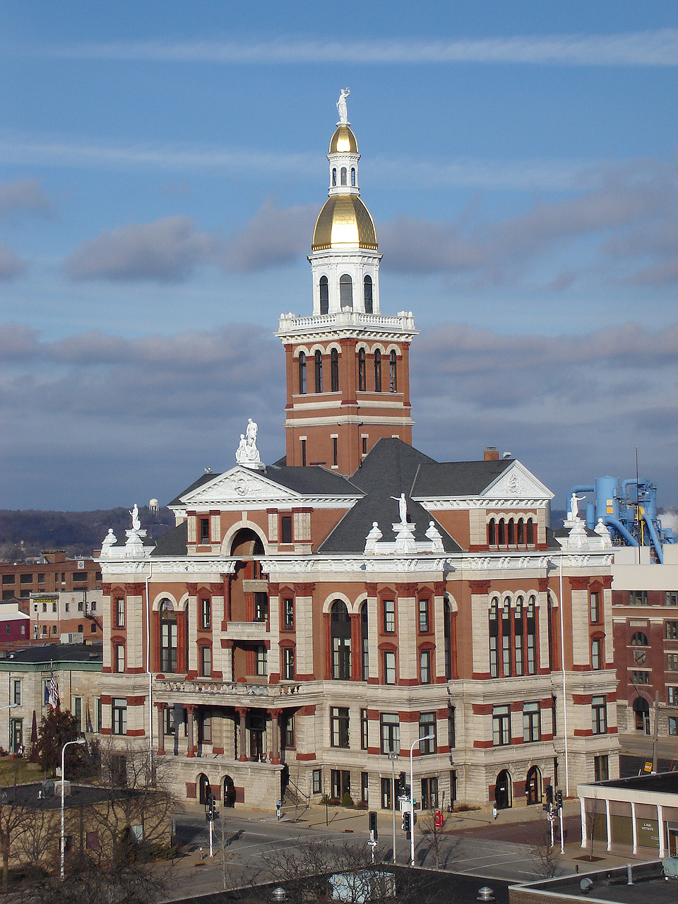
42°30′19″N 90°40′03″W / 42.505278°N 90.6675°WDubuque 11 Dubuque County Courthouse 
June 23, 1971 720 Central Ave.
42°30′04″N 90°39′52″W / 42.501111°N 90.664444°WDubuque 12 Dubuque County Jail 
June 27, 1972 36 E. 8th St.
42°30′04″N 90°39′53″W / 42.501111°N 90.664722°WDubuque 13 Dubuque Freight House 
October 11, 1979 E. 3rd St. Extension
42°29′46″N 90°39′37″W / 42.496111°N 90.660278°WDubuque 14 Dubuque Millworking Historic District November 7, 2008 White, Jackson, and Elm between E. 6th and E. 11th Sts.
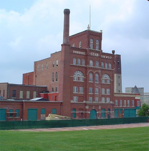
42°30′11″N 90°39′49″W / 42.5031°N 90.66359°WDubuque 15 Dubuque Star Brewery 
April 24, 2007 500 E. 5th St.
42°29′58″N 90°39′15″W / 42.499444°N 90.654167°WDubuque 16 Dubuque Trading Post-Village of Kettle Chief Archeological District 
November 21, 1988 Address Restricted Dubuque 17 Dubuque YMCA Building January 31, 2002 125 W. 9th St.
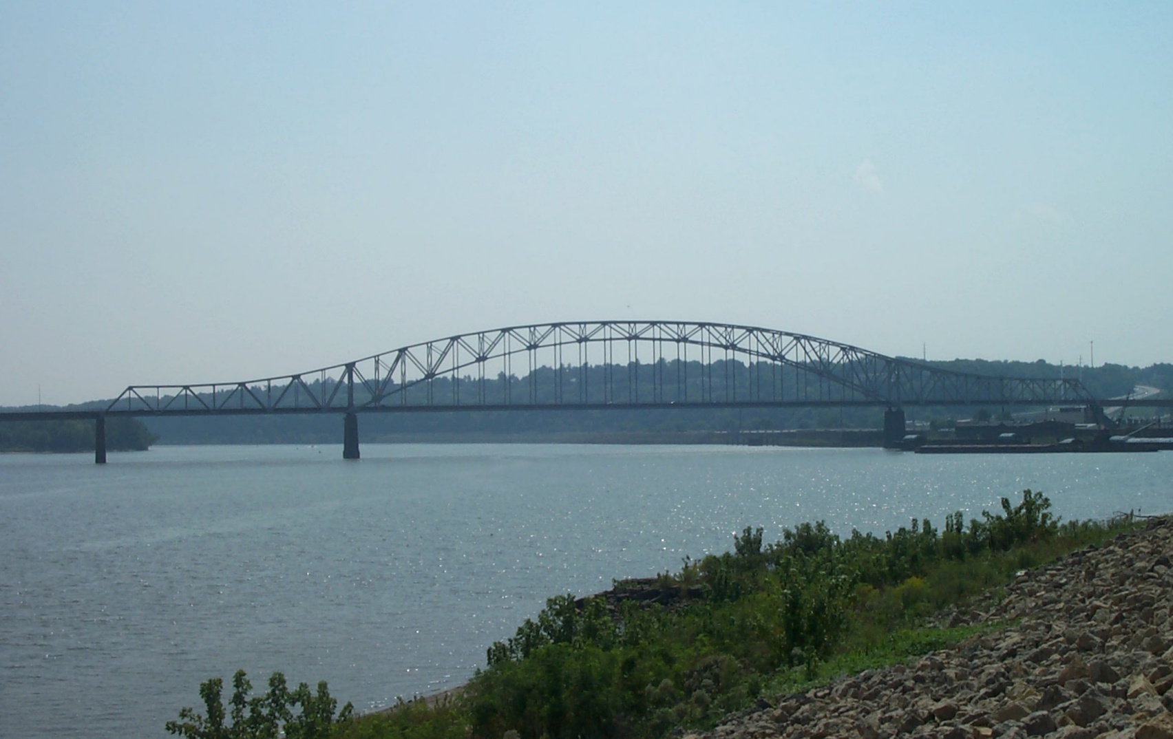
42°30′07″N 90°40′00″W / 42.501944°N 90.666667°WDubuque 18 Julien Dubuque Bridge 
August 27, 1999 U.S. Route 20 over the Mississippi River
42°29′30″N 90°39′17″W / 42.491667°N 90.654722°WDubuque 19 Julien Dubuque Monument 
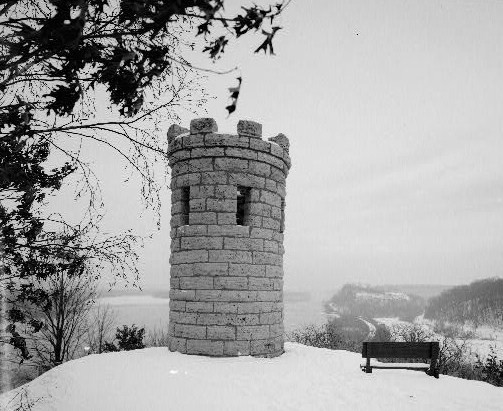
November 21, 1988 Confluence of the Mississippi River and Catfish Creek in Mines of Spain State Recreation Area
42°28′07″N 90°38′47″W / 42.468611°N 90.646389°WDubuque 20 Epworth School April 21, 2004 310 W. Main St.
42°26′46″N 90°56′08″W / 42.446111°N 90.935556°WEpworth 21 Fenelon Place Elevator 
August 3, 1978 512 Fenelon Pl.
42°29′47″N 90°40′08″W / 42.496389°N 90.668889°WDubuque 22 Four Mounds Estate Historic District January 24, 2002 4900 Peru Rd.
42°33′21″N 90°40′51″W / 42.555833°N 90.680833°WDubuque 23 Four Mounds Site November 17, 2000 Address Restricted Dubuque 24 Garland House July 7, 1983 1090 Langworthy Ave.
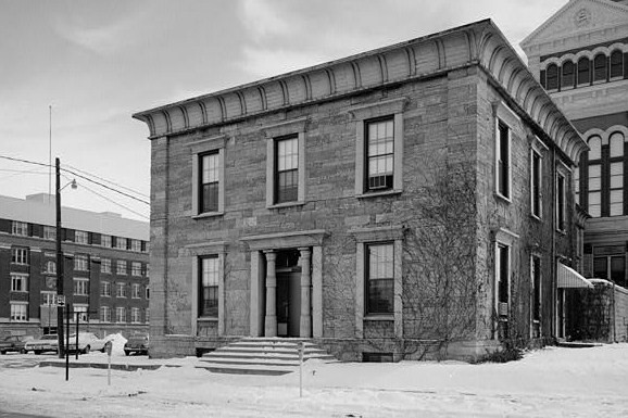
42°29′37″N 90°40′39″W / 42.493611°N 90.6775°WDubuque 25 German Bank March 28, 1978 342 Main St.
42°29′50″N 90°39′53″W / 42.497222°N 90.664722°WDubuque 26 Grand Opera House 
September 20, 2002 135 8th St.
42°30′06″N 90°39′56″W / 42.501667°N 90.665556°WDubuque 27 Haberkorn House and Farmstead January 25, 1980 West of Sherrill
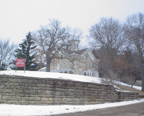
42°36′24″N 90°49′21″W / 42.606667°N 90.8225°WSherrill 28 Mathias Ham House 
July 19, 1976 2241 Lincoln Ave.
42°31′53″N 90°39′02″W / 42.531389°N 90.650556°WDubuque 29 Charles T. Hancock House April 10, 1986 1105 Grove Terr.
42°30′10″N 90°40′17″W / 42.502778°N 90.671389°WDubuque 30 Ora Holland House August 14, 1986 1296 Mt. Pleasant St.
42°30′34″N 90°40′59″W / 42.509444°N 90.683056°WDubuque 31 Hollenfelz House September 13, 1977 1651 White St.
42°30′30″N 90°40′05″W / 42.508333°N 90.668056°WDubuque 32 Holy Ghost Catholic Historic District 
September 15, 2011 2887-2921 Central Ave.
42°31′26″N 90°40′46″W / 42.523889°N 90.679444°WDubuque Dubuque, Iowa MPS 33 Interstate Power Company Building June 26, 2008 1000 Main and 131 W. 10th St.
42°30′09″N 90°40′05″W / 42.50255°N 90.66803°WDubuque 34 Jackson Park Historic District July 31, 1986 Roughly bounded by 17th, Iowa, 10th and 9th, and Bluff and Montrose Sts.
42°30′21″N 90°40′12″W / 42.505833°N 90.67°WDubuque 35 Kelley House 
January 30, 1978 274 Southern Ave.
42°29′07″N 90°39′51″W / 42.485278°N 90.664167°WDubuque 36 Zephaniah Kidder House November 14, 1978 206 1st Ave., NE.
42°26′47″N 90°55′44″W / 42.446389°N 90.928889°WEpworth 37 Langworthy Historic District August 12, 2004 Langworthy, W. 3rd, Melrose Terrace, Hill and W. 5th, Alpine and Walnut between Solon and W. 5th
42°29′42″N 90°40′40″W / 42.495°N 90.677778°WDubuque 38 Langworthy House 
October 14, 1975 1095 W. 3rd St.
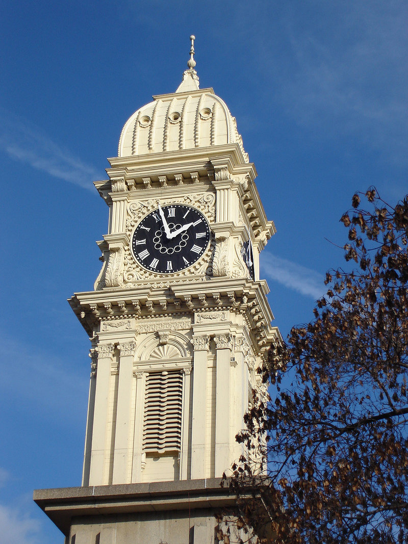
42°29′42″N 90°40′45″W / 42.495°N 90.679167°WDubuque 39 Lincoln School July 24, 1975 About 4 miles north of Farley
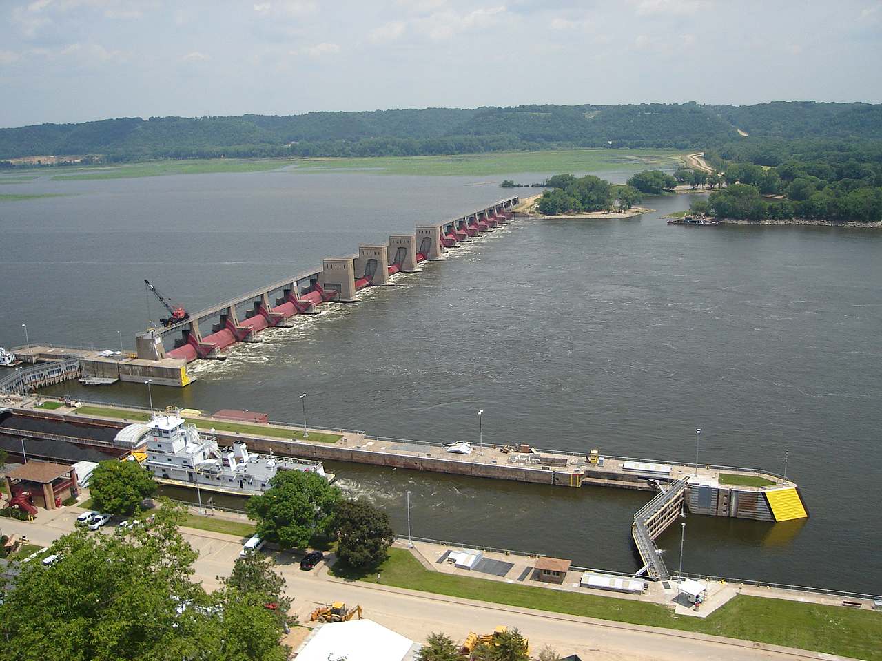
42°29′24″N 90°59′07″W / 42.49°N 90.985278°WFarley 40 Lock and Dam No. 11 Historic District 
March 10, 2004 11 Lime St.
42°32′03″N 90°38′44″W / 42.53411°N 90.64542°WDubuque 41 T. Ben Loetscher House November 2, 1989 160 S. Grandview Ave.
42°29′25″N 90°41′02″W / 42.490278°N 90.683889°WDubuque 42 McMahon House November 21, 1976 800 English Lane
42°28′48″N 90°40′19″W / 42.48°N 90.671944°WDubuque 43 Mines of Spain Area Rural Community Archeological District November 21, 1988 Address Restricted Dubuque 44 Mines of Spain Lead Mining Community Archeological District November 21, 1988 Address Restricted Dubuque 45 Mines of Spain Prehistoric District November 21, 1988 Address Restricted Dubuque 46 Mount Saint Bernard Seminary and Barn November 5, 1974 10336 Military Rd.
42°26′36″N 90°41′36″W / 42.443333°N 90.693333°WDubuque 47 Old Chapel Hall August 5, 1983 2050 University Ave.
42°29′55″N 90°41′34″W / 42.498611°N 90.692778°WDubuque 48 Old Main Historic District 
January 12, 1983 Main St. between 1st and 4th Sts.
42°29′47″N 90°39′53″W / 42.496389°N 90.664722°WDubuque 49 Orpheum Theatre and Site 
November 14, 1972 405 Main St.
42°29′52″N 90°39′55″W / 42.497778°N 90.665278°WDubuque 50 Johann Christian Frederick Rath House April 11, 1977 1204 Mt. Loretta Ave.
42°29′04″N 90°40′29″W / 42.484444°N 90.674722°WDubuque 51 Redstone 
December 12, 1976 504 Bluff St.
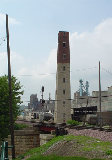
42°29′49″N 90°40′03″W / 42.496944°N 90.6675°WDubuque 52 George W. Rogers Company Shot Tower 
November 7, 1976 Commercial St. and riverfront
42°30′01″N 90°39′18″W / 42.500278°N 90.655°WDubuque 53 Roshek Brothers Department Store 
March 17, 2010 250 W. 8th St.
42°30′01″N 90°40′08″W / 42.500386°N 90.668806°WDubuque 54 Round Barn, Dubuque Township June 30, 1986 2810 Cascade Rd.
42°28′24″N 90°42′27″W / 42.473333°N 90.7075°WDubuque Township 55 St. Boniface of New Vienna Historic District 
September 29, 1999 7401 Columbus St.
42°33′03″N 91°06′54″W / 42.550833°N 91.115°WNew Vienna 56 St. Luke's United Methodist Church April 23, 1998 1199 Main St.
42°30′13″N 90°40′09″W / 42.503611°N 90.669167°WDubuque 57 Sauser-Lane House July 14, 1983 101 2nd Ave., SW.
42°17′52″N 91°00′43″W / 42.297778°N 91.011944°WCascade 58 Schroeder-Klein Grocery Company Warehouse February 28, 2011 40-48 Main St.
42°29′34″N 90°39′46″W / 42.492778°N 90.662778°WDubuque Dubuque, Iowa MPS 59 John and Marie (Palen) Schrup Farmstead Historic District September 16, 2009 10086 Lake Eleanor Rd.
42°25′24″N 90°39′35″W / 42.423294°N 90.659653°WDubuque 60 Security Building 
August 8, 2006 800 Main St.
42°30′04″N 90°40′01″W / 42.501111°N 90.666944°WDubuque 61 Sherrill Mount House 
July 11, 2002 5259 S. Mound Rd.
42°36′15″N 90°47′33″W / 42.604167°N 90.7925°WSherrill 1856; Jesse James reportedly stayed here; now the Black Horse Inn 62 J.H. Thedinga House November 7, 1976 340 W. 5th St.
42°29′51″N 90°40′04″W / 42.4975°N 90.667778°WDubuque 63 Town Clock Building 
January 24, 2002 823-25 Main St.
42°30′04″N 90°40′02″W / 42.501111°N 90.667222°WDubuque 64 Upper Main Street Historic District April 11, 2005 1000 and 1100 blocks of Main St.
42°30′12″N 90°40′7″W / 42.50333°N 90.66861°W
Boundary increase (listed February 11, 2011): 909, 951, 955, 965 Main St.
42°30′07″N 90°40′05″W / 42.501944°N 90.668056°WDubuque Dubuque, Iowa MPS 65 Washington Mill Bridge June 25, 1998 Creek Branch Ln. over Lytle Creek
42°18′15″N 90°46′49″W / 42.304167°N 90.780278°WBernard 66 Washington Park 
July 14, 1977 Bounded by 6th, 7th, Bluff, and Locust Sts.
42°29′57″N 90°40′05″W / 42.499167°N 90.668056°WDubuque 67 Washington Street and East 22nd Street Historic District February 28, 2011 2162-2255 Washington St. and E. 22nd St.
42°30′52″N 90°40′08″W / 42.514444°N 90.668889°WDubuque Dubuque, Iowa MPS 68 West Eleventh Street Historic District August 12, 2004 Bounded by Grove Terrace, Loras Boulevard, and Wilbur and Walnut Sts.
42°30′09″N 90°40′25″W / 42.502392°N 90.673644°WDubuque 69 Western Hotel November 7, 1976 Southeast of Holy Cross on U.S. Route 52
42°35′36″N 90°58′52″W / 42.593333°N 90.981111°WHoly Cross 70 White Water Creek Bridge 
June 25, 1998 Whitewater Rd. over White Water Creek
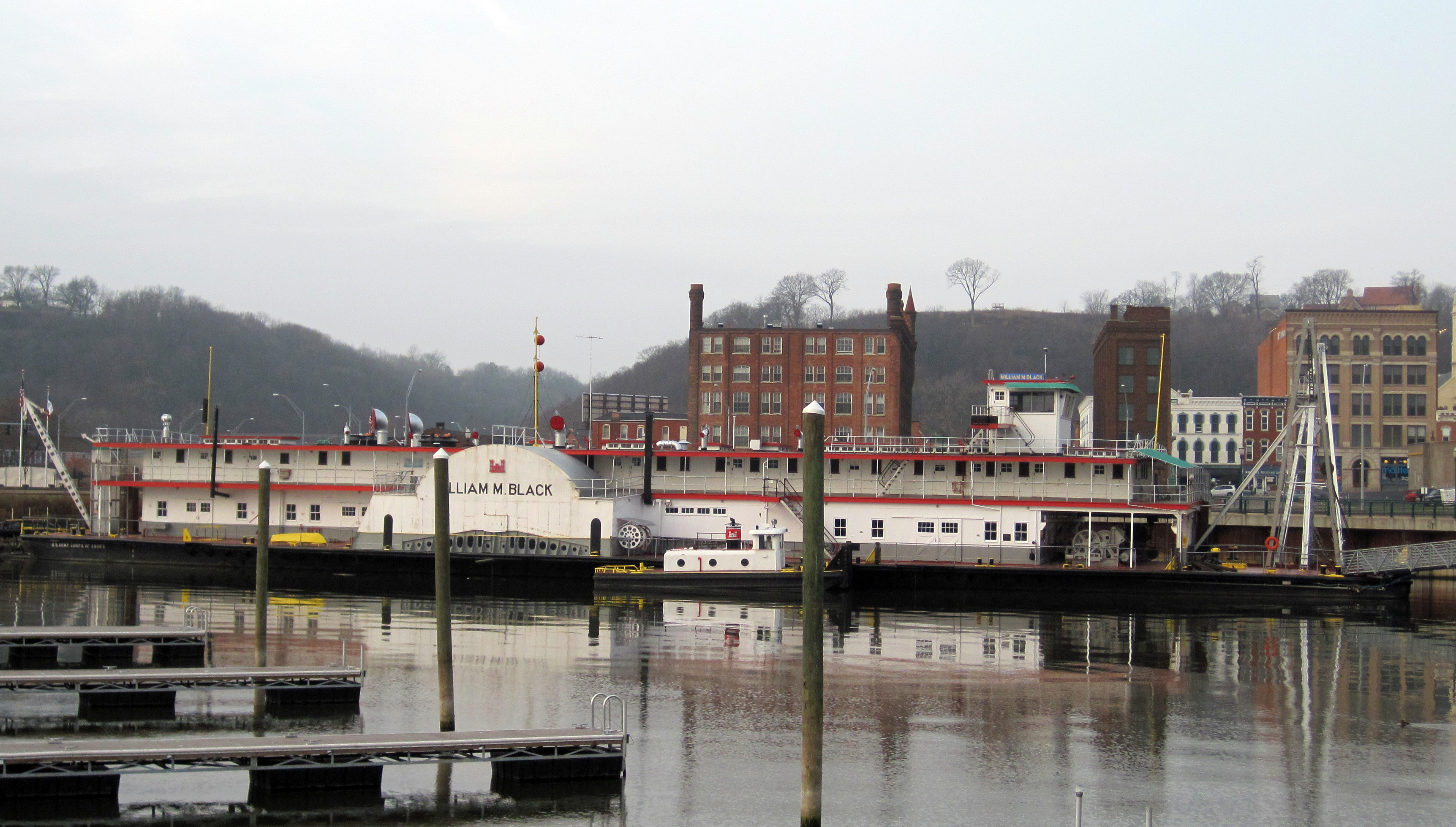
42°18′16″N 90°54′41″W / 42.304444°N 90.911389°WBernard 71 WILLIAM M. BLACK (dredge) 
April 12, 1982 E. 2nd St.
42°29′44″N 90°39′37″W / 42.495556°N 90.660278°WDubuque 72 Ziepprecht Block December 20, 2002 1347-53 Central Ave.
42°30′21″N 90°39′59″W / 42.505833°N 90.666389°WDubuque See also
References
- ^ The latitude and longitude information provided in this table was derived originally from the National Register Information System, which has been found to be fairly accurate for about 99% of listings. For about 1% of NRIS original coordinates, experience has shown that one or both coordinates are typos or otherwise extremely far off; some corrections may have been made. A more subtle problem causes many locations to be off by up to 150 yards, depending on location in the country: most NRIS coordinates were derived from tracing out latitude and longitudes off of USGS topographical quadrant maps created under North American Datum of 1927, which differs from the current, highly accurate GPS system used by Google maps. Chicago is about right, but NRIS longitudes in Washington are higher by about 4.5 seconds, and are lower by about 2.0 seconds in Maine. Latitudes differ by about 1.0 second in Florida. Some locations in this table may have been corrected to current GPS standards.
- ^ "National Register of Historic Places: Weekly List Actions". National Park Service, United States Department of the Interior. Retrieved on November 10, 2011.
- ^ Numbers represent an ordering by significant words. Various colorings, defined here, differentiate National Historic Landmark sites and National Register of Historic Places Districts from other NRHP buildings, structures, sites or objects.
- ^ a b "National Register Information System". National Register of Historic Places. National Park Service. . http://nrhp.focus.nps.gov/natreg/docs/All_Data.html.
U.S. National Register of Historic Places Topics Lists by states Alabama • Alaska • Arizona • Arkansas • California • Colorado • Connecticut • Delaware • Florida • Georgia • Hawaii • Idaho • Illinois • Indiana • Iowa • Kansas • Kentucky • Louisiana • Maine • Maryland • Massachusetts • Michigan • Minnesota • Mississippi • Missouri • Montana • Nebraska • Nevada • New Hampshire • New Jersey • New Mexico • New York • North Carolina • North Dakota • Ohio • Oklahoma • Oregon • Pennsylvania • Rhode Island • South Carolina • South Dakota • Tennessee • Texas • Utah • Vermont • Virginia • Washington • West Virginia • Wisconsin • WyomingLists by territories Lists by associated states Other  Category:National Register of Historic Places •
  Portal:National Register of Historic Places
Municipalities and communities of Dubuque County, Iowa County seat: Dubuque Cities Asbury | Balltown | Bankston | Bernard | Cascade‡ | Centralia | Dubuque | Durango | Dyersville‡ | Epworth | Farley | Graf | Holy Cross | Luxemburg | New Vienna | Peosta | Rickardsville | Sageville | Sherrill | Worthington | Zwingle‡

Townships Unincorporated
communityFootnotes ‡This populated place also has portions in an adjacent county or counties
Categories:- National Register of Historic Places in Iowa by county
- Dubuque County, Iowa
- Buildings and structures in Dubuque County, Iowa
-


Wikimedia Foundation. 2010.