- National Register of Historic Places listings in Clayton County, Iowa
-
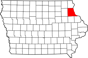 Location of Clayton County in Iowa
This is a list of the National Register of Historic Places listings in Clayton County, Iowa.
This is intended to be a complete list of the properties and districts on the National Register of Historic Places in Clayton County, Iowa, United States. Latitude and longitude coordinates are provided for many National Register properties and districts; these locations may be seen together in a Google map.[1]
There are 52 properties and districts listed on the National Register in the county.
-
- This National Park Service list is complete through NPS recent listings posted November 10, 2011.[2]
[3] Landmark name [4] Image Date listed Location City or town Summary 1 Albertus Building April 26, 1979 222 Park River Dr.
42°47′03″N 91°05′47″W / 42.784167°N 91.096389°WGuttenberg 2 American House August 30, 2001 116 Main St.
43°01′33″N 91°10′26″W / 43.025833°N 91.173889°WMcGregor 3 American School of Wild Life Protection Historic District December 23, 1991 McGregor Heights Rd., north of McGregor
43°01′43″N 91°10′33″W / 43.028611°N 91.175833°WMcGregor 4 Christian Bloedel Wagon Works September 23, 2009 524-526 Main St.
43°01′14″N 91°10′49″W / 43.020483°N 91.180161°WMcGregor 5 Carter House November 7, 1976 101 High St., SE.
42°51′19″N 91°24′09″W / 42.855278°N 91.4025°WElkader 6 Clayton County Courthouse October 8, 1976 111 High St.
42°51′19″N 91°24′12″W / 42.855278°N 91.403333°WElkader 7 Clayton School July 30, 1974 1st St.
42°54′09″N 91°08′45″W / 42.9025°N 91.145833°WClayton 8 Timothy Davis House June 22, 1976 405 1st St., NW.
42°51′23″N 91°24′30″W / 42.856389°N 91.408333°WElkader 9 Dry Run Bridge June 25, 1998 Local street over Dry Run
42°45′10″N 91°22′08″W / 42.752778°N 91.368889°WLittleport 10 Eckert House September 24, 1984 413 S. 1st St.
42°46′55″N 91°05′45″W / 42.781944°N 91.095833°WGuttenberg 11 Effigy Mounds National Monument 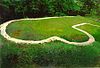
October 15, 1966 3 miles north of Marquette on Iowa Highway 76
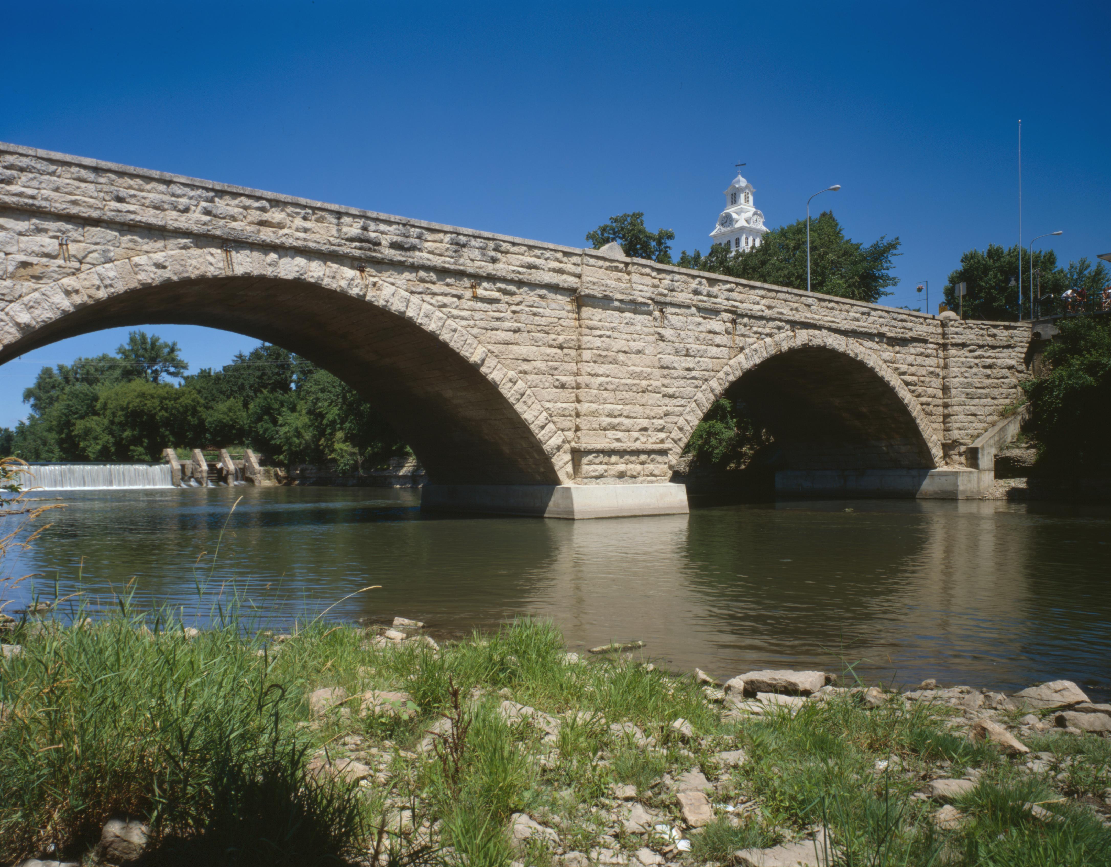
43°03′52″N 91°10′50″W / 43.06431°N 91.18052°WMarquette Extends into Allamakee County 12 Elkader Keystone Bridge 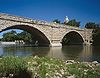
November 7, 1976 Bridge St.
42°51′17″N 91°24′13″W / 42.854722°N 91.403611°WElkader 13 Elkader Opera House October 8, 1976 207 N. Main
42°51′19″N 91°24′20″W / 42.855278°N 91.405556°WElkader 14 First Congregational Church March 25, 1977 Washington St.
42°52′06″N 91°14′16″W / 42.868333°N 91.237778°WGarnavillo 15 Franklin Hotel June 25, 1999 102 Elkader St.
42°41′01″N 91°32′02″W / 42.683611°N 91.533889°WStrawberry Point 16 Front Street (River Park Drive) Historic District September 24, 1984 River Park Dr. between Lessing and Pearl Sts.; also S. 1st, Prince, Goethe, Herder, and Schiller Sts.
42°46′56″N 91°05′42″W / 42.782222°N 91.095°WGuttenberg Second set of addresses represents a boundary increase 17 Fuerste House September 24, 1984 503 S. 1st St.
42°46′54″N 91°05′45″W / 42.781667°N 91.095833°WGuttenberg 18 Garnavillo Township Bridge June 25, 1998 County road over an unnamed stream
42°51′47″N 91°16′57″W / 42.863056°N 91.2825°WGarnavillo Township 19 Garnavillo Township Culvert June 25, 1998 County road over an unnamed stream
42°52′04″N 91°16′10″W / 42.867778°N 91.269444°WGarnavillo Township 20 Goedert Meat Market October 18, 1996 322 Main St.
42°12′46″N 91°12′04″W / 42.212778°N 91.201111°WMcGregor 21 Guttenberg Corn Canning Co. September 24, 1984 413 N. 3rd St.
42°47′18″N 91°06′05″W / 42.788333°N 91.101389°WGuttenberg 22 Guttenberg National Fish Hatchery and Aquarium Historic District December 23, 1991 315 S. River Park Dr.
42°47′01″N 91°05′41″W / 42.783611°N 91.094722°WGuttenberg 23 Guttenberg State Bank September 24, 1984 15 Goethe St.
42°46′59″N 91°05′47″W / 42.783056°N 91.096389°WGuttenberg 24 I.O.O.F. Hall June 18, 1979 Centre St.
42°52′05″N 91°14′10″W / 42.868056°N 91.236111°WGarnavillo 25 Kolker House September 24, 1984 110 Goethe St.
42°46′58″N 91°06′35″W / 42.782778°N 91.109722°WGuttenberg 26 Lakeside Ballroom February 4, 2002 1202 N. 4th St.
40°24′17″N 91°10′23″W / 40.404722°N 91.173056°WGuttenberg 27 Mallory Township Bridge June 25, 1998 County road over an unnamed stream
42°43′08″N 91°10′42″W / 42.718889°N 91.178333°WMallory Township 28 Matt-Bahls House September 24, 1984 615 S. 3rd St.
42°46′24″N 91°05′53″W / 42.773333°N 91.098056°WGuttenberg 29 McClaine House September 24, 1984 300 S. 1st St.
42°47′03″N 91°05′50″W / 42.784167°N 91.097222°WGuttenberg 30 McGregor Commercial Historic District 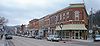
December 10, 2002 100-300 blocks of Main St. and the 100 and 200 blocks of A St.
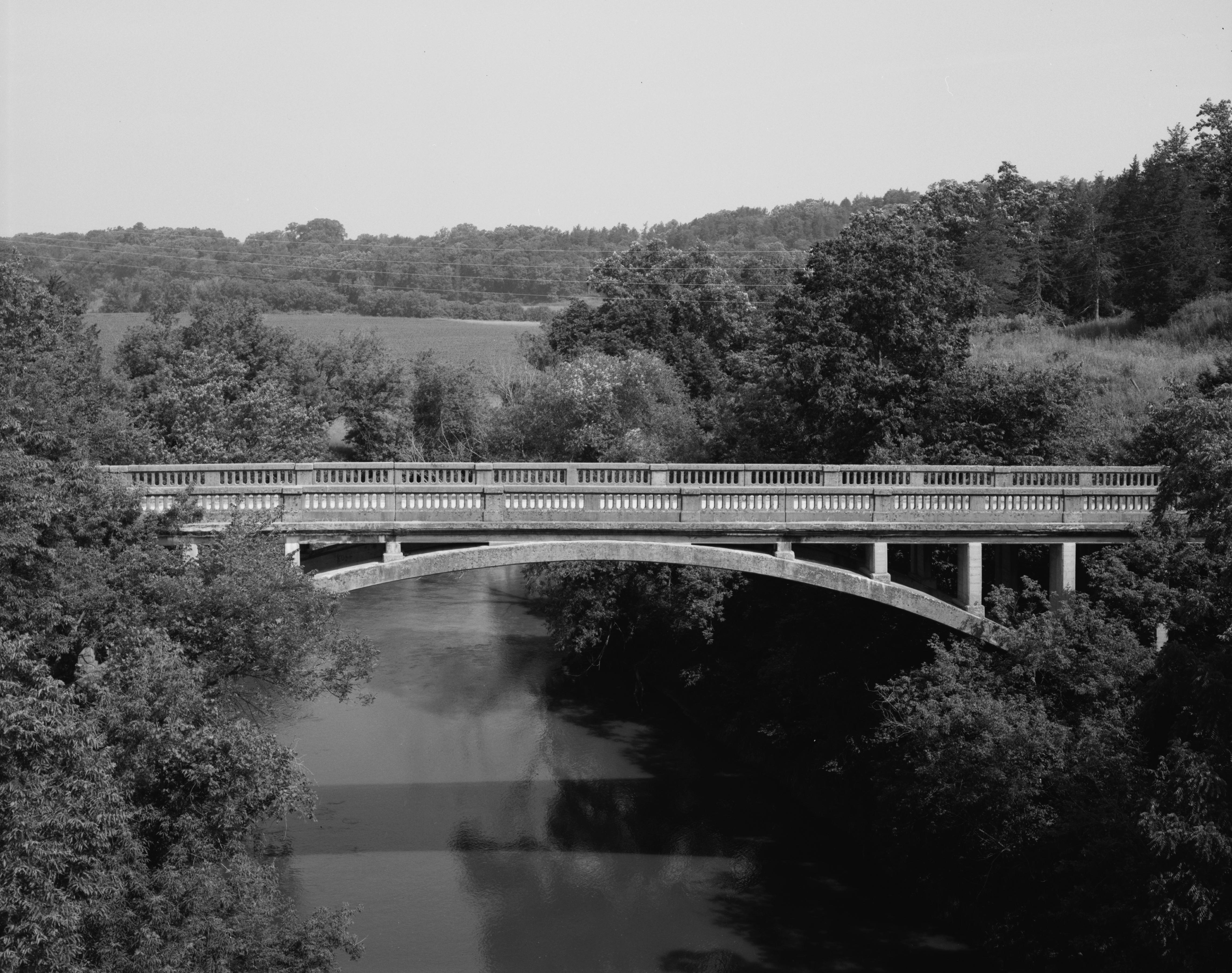
43°01′26″N 91°10′33″W / 43.023889°N 91.175833°WMcGregor 31 Mederville Bridge 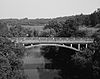
June 25, 1998 County road over the Volga River at Mederville
42°45′50″N 91°25′17″W / 42.763889°N 91.421389°WCox Creek Township 32 Monona Township Culvert June 25, 1998 County road over an unnamed stream
43°02′39″N 91°28′35″W / 43.044167°N 91.476389°WMonona Township 33 Moser Stone House September 24, 1984 211 S. 1st St.
42°47′04″N 91°05′49″W / 42.784444°N 91.096944°WGuttenberg 34 Motor Townsite August 2, 1977 East of Elkader
42°48′28″N 91°21′05″W / 42.807778°N 91.351389°WElkader 35 Nieland House September 24, 1984 715 S. 1st St.
42°46′43″N 91°05′45″W / 42.778611°N 91.095833°WGuttenberg 36 Parker House September 24, 1984 1015 S. 2nd St.
42°46′34″N 91°05′51″W / 42.776111°N 91.0975°WGuttenberg 37 Rialto Price House November 21, 1976 206 Cedar St., NW.
42°51′16″N 91°24′25″W / 42.854444°N 91.406944°WElkader 38 Read Township Culvert March 12, 1999 County road over an unnamed stream
42°50′01″N 91°19′08″W / 42.833611°N 91.318889°WRead Township 39 Joseph "Diamond Jo" Reynolds Office Building and House February 19, 1982 A and Main Sts.
43°01′32″N 91°10′34″W / 43.025556°N 91.176111°WMcGregor 40 Round Barn, Millville Township June 30, 1986 U.S. Route 52
42°42′56″N 91°05′04″W / 42.715556°N 91.084444°WMillville Township 41 St. Joseph Church and Parish Hall 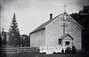
November 21, 1976 330 1st St., NW.
42°51′05″N 91°24′13″W / 42.851389°N 91.403611°WElkader 42 St. Mary's Catholic Church Historic District August 12, 2004 502, 518, and 520 S. 2nd St. and 214 Herder St.
42°46′52″N 91°05′38″W / 42.781111°N 91.093889°WGuttenberg 43 St. Olaf Auditorium December 9, 1994 118 S. Main St.
42°55′40″N 91°23′10″W / 42.927778°N 91.386111°WSt. Olaf 44 St. Peters United Evangelical Lutheran Church December 12, 1976 U.S. Route 52
42°49′21″N 91°11′15″W / 42.8225°N 91.1875°WCeres 45 Schmidt House March 25, 1977 101 Oak St., NW.
42°51′11″N 91°24′26″W / 42.853056°N 91.407222°WElkader 46 Peter Stauer House September 13, 2003 629 Main St.
43°01′07″N 91°10′55″W / 43.018611°N 91.181944°WMcGregor 47 J.C. Stemmer House October 21, 1976 113 Oak, NW.
42°51′13″N 91°24′29″W / 42.853611°N 91.408056°WElkader 48 Stone Barn September 24, 1984 12 Goethe St.
42°46′58″N 91°06′30″W / 42.782778°N 91.108333°WGuttenberg 49 Turkey River State Preserve Archeological District May 30, 1990 Address Restricted Millville 50 Valley Mills December 12, 1976 East of Garnavillo
42°51′50″N 91°11′34″W / 42.863889°N 91.192778°WGarnavillo 51 Weber House September 24, 1984 822 S. River Park Dr.
42°46′37″N 91°05′43″W / 42.776944°N 91.095278°WGuttenberg 52 Wehmer House September 24, 1984 910 S. River Park Dr.
42°46′34″N 91°05′43″W / 42.776111°N 91.095278°WGuttenberg Landmark name[4] Image Date listed Location City or Town Summary 1 Ihm House April 13, 1983 127 N. First St. Guttenberg NRHP listing status code "DR" which stands for registration pending, which may since have been converted to a regular NRHP listing. The property is covered in Guttenberg MRA See also
References
- ^ The latitude and longitude information provided in this table was derived originally from the National Register Information System, which has been found to be fairly accurate for about 99% of listings. For about 1% of NRIS original coordinates, experience has shown that one or both coordinates are typos or otherwise extremely far off; some corrections may have been made. A more subtle problem causes many locations to be off by up to 150 yards, depending on location in the country: most NRIS coordinates were derived from tracing out latitude and longitudes off of USGS topographical quadrant maps created under the North American Datum of 1927, which differs from the current, highly accurate WGS84 GPS system used by Google maps. Chicago is about right, but NRIS longitudes in Washington are higher by about 4.5 seconds, and are lower by about 2.0 seconds in Maine. Latitudes differ by about 1.0 second in Florida. Some locations in this table may have been corrected to current GPS standards.
- ^ "National Register of Historic Places: Weekly List Actions". National Park Service, United States Department of the Interior. Retrieved on November 10, 2011.
- ^ Numbers represent an ordering by significant words. Various colorings, defined here, differentiate National Historic Landmark sites and National Register of Historic Places Districts from other NRHP buildings, structures, sites or objects.
- ^ a b "National Register Information System". National Register of Historic Places. National Park Service. . http://nrhp.focus.nps.gov/natreg/docs/All_Data.html.
U.S. National Register of Historic Places Topics Lists by states Alabama • Alaska • Arizona • Arkansas • California • Colorado • Connecticut • Delaware • Florida • Georgia • Hawaii • Idaho • Illinois • Indiana • Iowa • Kansas • Kentucky • Louisiana • Maine • Maryland • Massachusetts • Michigan • Minnesota • Mississippi • Missouri • Montana • Nebraska • Nevada • New Hampshire • New Jersey • New Mexico • New York • North Carolina • North Dakota • Ohio • Oklahoma • Oregon • Pennsylvania • Rhode Island • South Carolina • South Dakota • Tennessee • Texas • Utah • Vermont • Virginia • Washington • West Virginia • Wisconsin • WyomingLists by territories Lists by associated states Other Municipalities and communities of Clayton County, Iowa Cities Clayton | Edgewood‡ | Elkader | Farmersburg | Garber | Garnavillo | Guttenberg | Luana | Marquette | McGregor | Millville | Monona | North Buena Vista | Osterdock | Postville‡ | St. Olaf | Strawberry Point | Volga

Townships Unincorporated
communitiesBeulah | Ceres | Clayton Center | Communia | Eckards | Elkport | Fairview | Froelich | Giard | Gunder | Hardin | Highland | Littleport | McGregor Heights | Mederville | Motor | Osborne | Saint Sebald | Thomasville | Turkey River | Updegraff | Watson | Wood
Footnotes ‡This populated place also has portions in an adjacent county or counties
Categories:- National Register of Historic Places in Iowa by county
- Clayton County, Iowa
- Buildings and structures in Clayton County, Iowa
-


Wikimedia Foundation. 2010.