- National Register of Historic Places listings in Clear Creek County, Colorado
-
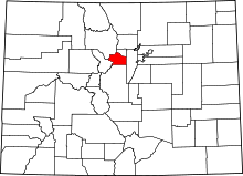 Location of Clear Creek County in Colorado
This is a list of the National Register of Historic Places listings in Clear Creek County, Colorado.
This is intended to be a complete list of the properties and districts on the National Register of Historic Places in Clear Creek County, Colorado, United States. The locations of National Register properties and districts for which the latitude and longitude coordinates are included below, may be seen in a Google map.[1]
There are 26 properties and districts listed on the National Register in the county, including 1 National Historic Landmark.
-
- This National Park Service list is complete through NPS recent listings posted November 10, 2011.[2]
Current listings
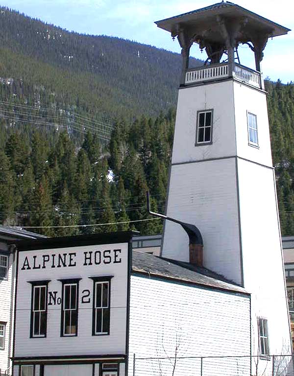
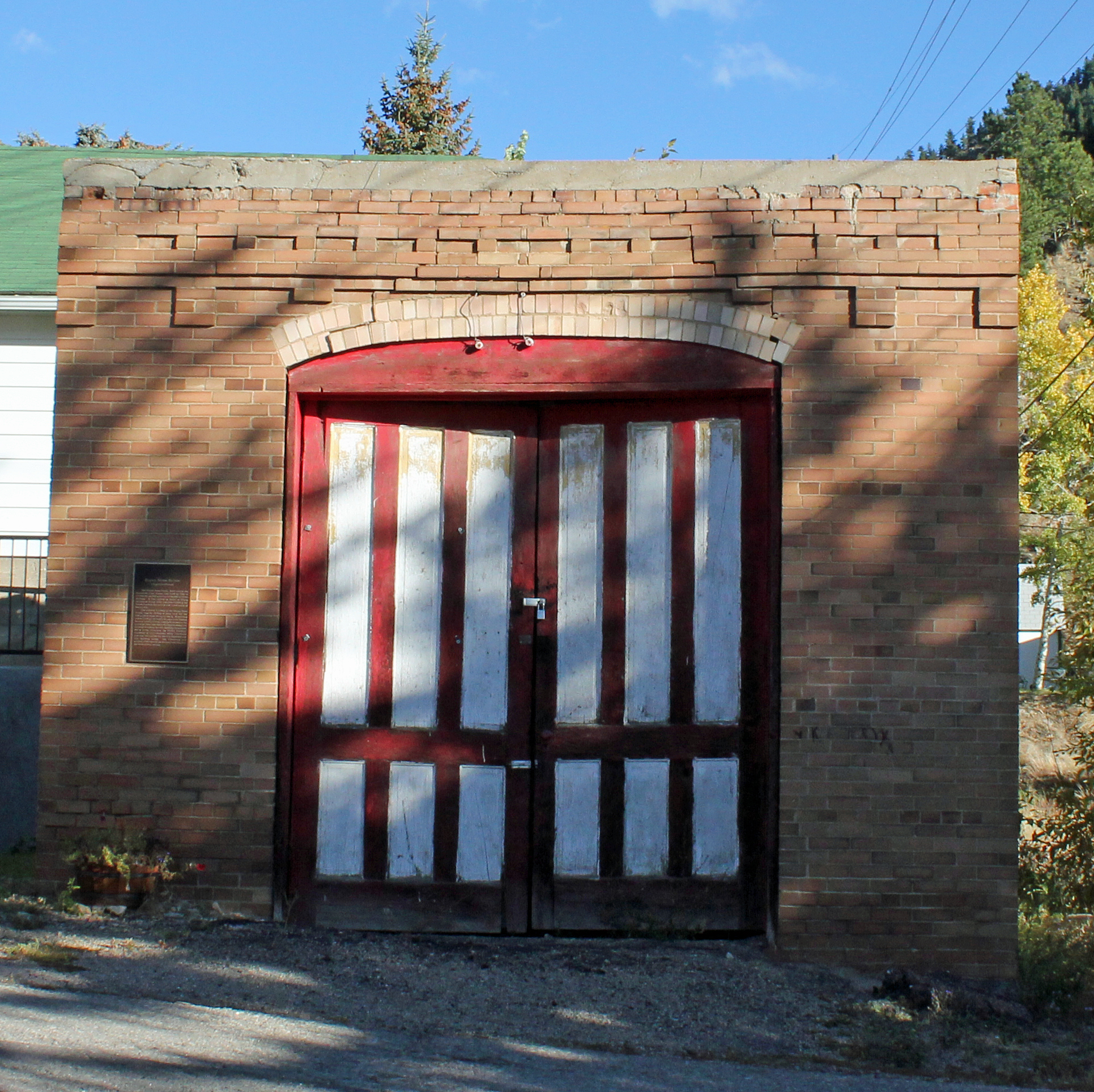
[3] Landmark name Image Date listed Location City or town Summary 1 Alpine Hose Company No. 2 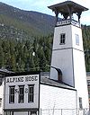
January 25, 1973 507 5th St.
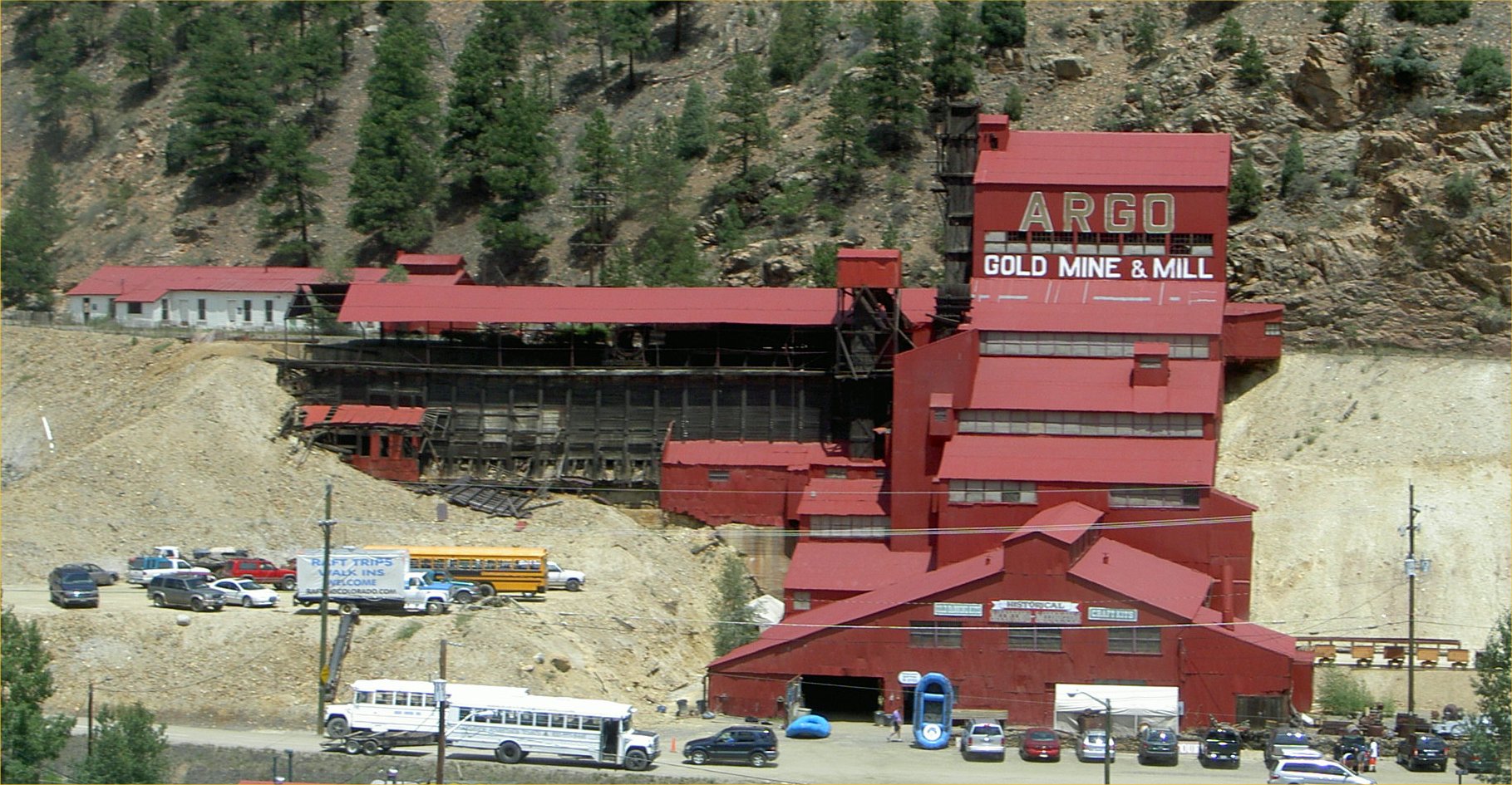
39°42′19″N 105°41′48″W / 39.705278°N 105.696667°WGeorgetown 2 Argo Tunnel and Mill 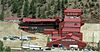
January 31, 1978 2517 Riverside Dr.
39°44′35″N 105°30′17″W / 39.743056°N 105.504722°WIdaho Springs 3 Bryan Hose House 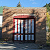
March 19, 1998 Junction of Illinois and Virginia Sts.
39°44′37″N 105°30′46″W / 39.743611°N 105.512778°WIdaho Springs 4 Dumont School March 1, 1996 150 County Road 260
39°45′56″N 105°36′13″W / 39.765556°N 105.603611°WDumont 5 Echo Lake Park 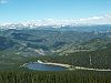
February 24, 1995 Along State Highways 5 and 103 southwest of Idaho Springs
39°39′33″N 105°36′03″W / 39.659167°N 105.600833°WIdaho Springs 6 Anne Evans Mountain Home January 28, 1992 Address Restricted Evergreen 7 Evans-Elbert Ranch September 11, 1980 Upper Bear Creek Rd.
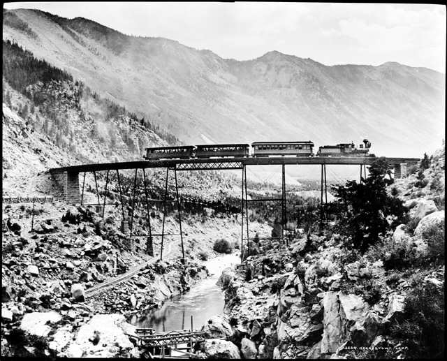
39°39′10″N 105°28′49″W / 39.652778°N 105.480278°WIdaho Springs 8 Georgetown Loop Railroad 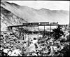
December 18, 1970 Runs between Georgetown and Silver Plume
39°41′56″N 105°42′42″W / 39.698889°N 105.711667°WGeorgetown and Silver Plume 10 Georgetown-Silver Plume Historic District 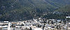
November 13, 1966 Interstate 70
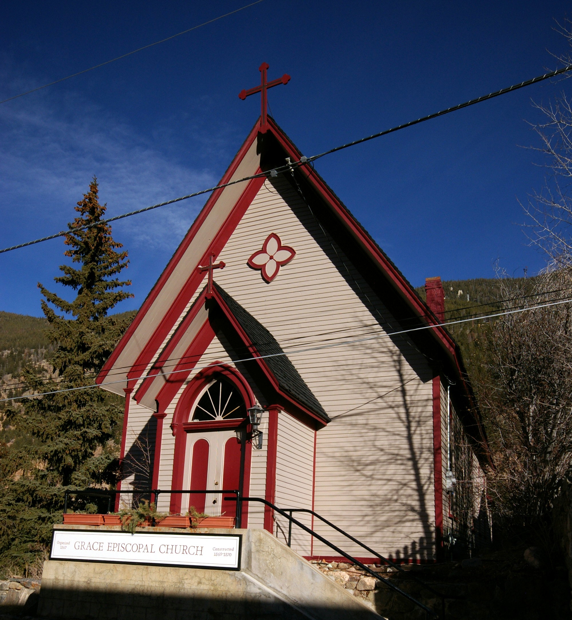
39°41′55″N 105°42′48″W / 39.698611°N 105.713333°WGeorgetown and Silver Plume 11 Grace Episcopal Church 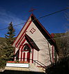
August 14, 1973 Taos St. between 4th and 5th Sts.
39°42′19″N 105°41′46″W / 39.705278°N 105.696111°WGeorgetown 12 Hamill House May 31, 1972 Argentine and 3rd Sts.
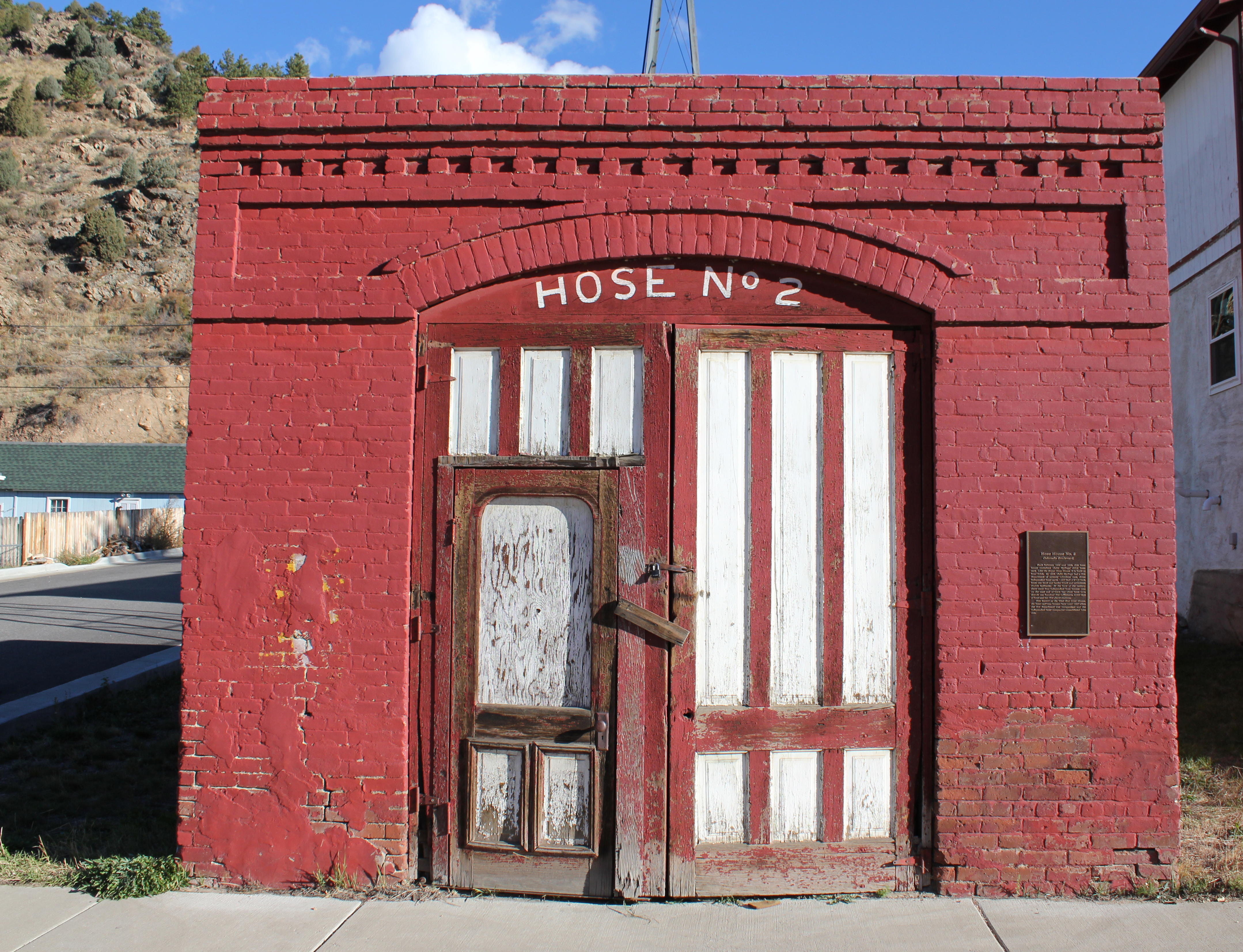
39°42′17″N 105°41′55″W / 39.704722°N 105.698611°WGeorgetown 13 Hose House No. 2 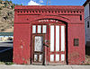
March 19, 1998 600 Colorado Boulevard
39°44′39″N 105°31′33″W / 39.744167°N 105.525833°WIdaho Springs 14 Hotel de Paris 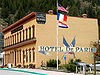
April 28, 1970 Alpine St.
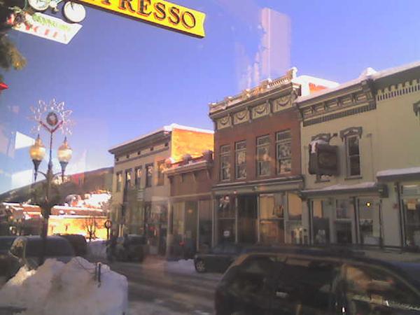
39°42′20″N 105°41′27″W / 39.705556°N 105.690833°WGeorgetown 15 Idaho Springs Downtown Commercial District 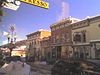
January 5, 1984 Roughly bounded by Center Alley, 14th Ave., Riverside Dr., and Idaho St.
39°44′32″N 105°30′56″W / 39.742222°N 105.515556°WIdaho Springs 16 Lebanon and Everett Mine Tunnels October 7, 1971 Northeast of Silver Plume, adjacent to the Interstate 70 right-of-way
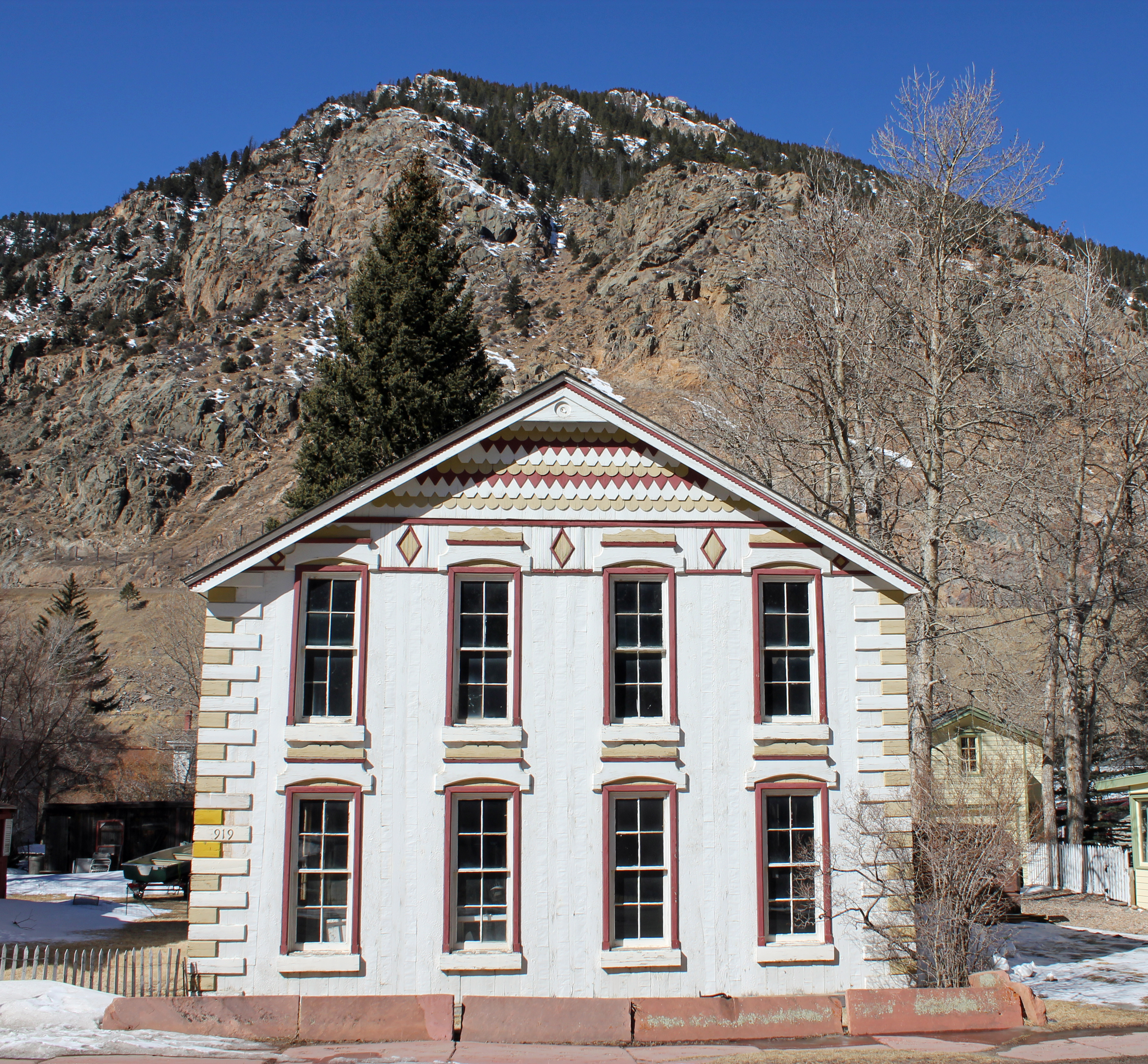
39°41′54″N 105°42′47″W / 39.698333°N 105.713056°WSilver Plume 17 McClellan House 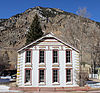
December 5, 1972 919 Taos St.
39°41′57″N 105°41′43″W / 39.699167°N 105.695278°WGeorgetown 18 Methodist Episcopal Church March 5, 1998 1414 Colorado Boulevard
39°44′35″N 105°31′00″W / 39.743056°N 105.516667°WIdaho Springs 19 Mill City House April 30, 2009 247 County Road 308
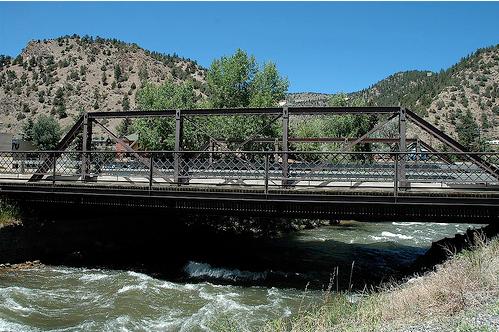
39°45′52″N 105°35′59″W / 39.76435°N 105.599614°WDumont 20 Miner Street Bridge 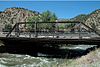
February 4, 1985 Miner St.
39°44′40″N 105°30′45″W / 39.744444°N 105.5125°WIdaho Springs 21 Mint Saloon 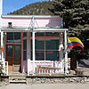
February 3, 1993 13 E. Park Ave. (U.S. Route 40)
39°45′40″N 105°40′55″W / 39.761111°N 105.681944°WEmpire 22 Ore Processing Mill and Dam May 6, 1971 1 mile southwest of Georgetown off Interstate 70
39°41′54″N 105°42′44″W / 39.698333°N 105.712222°WGeorgetown 23 Peck House 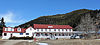
March 25, 1993 83 Sunny Ave.
39°45′46″N 105°40′59″W / 39.762778°N 105.683056°WEmpire 24 Silver Plume Depot 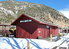
May 6, 1971 Off Interstate 70
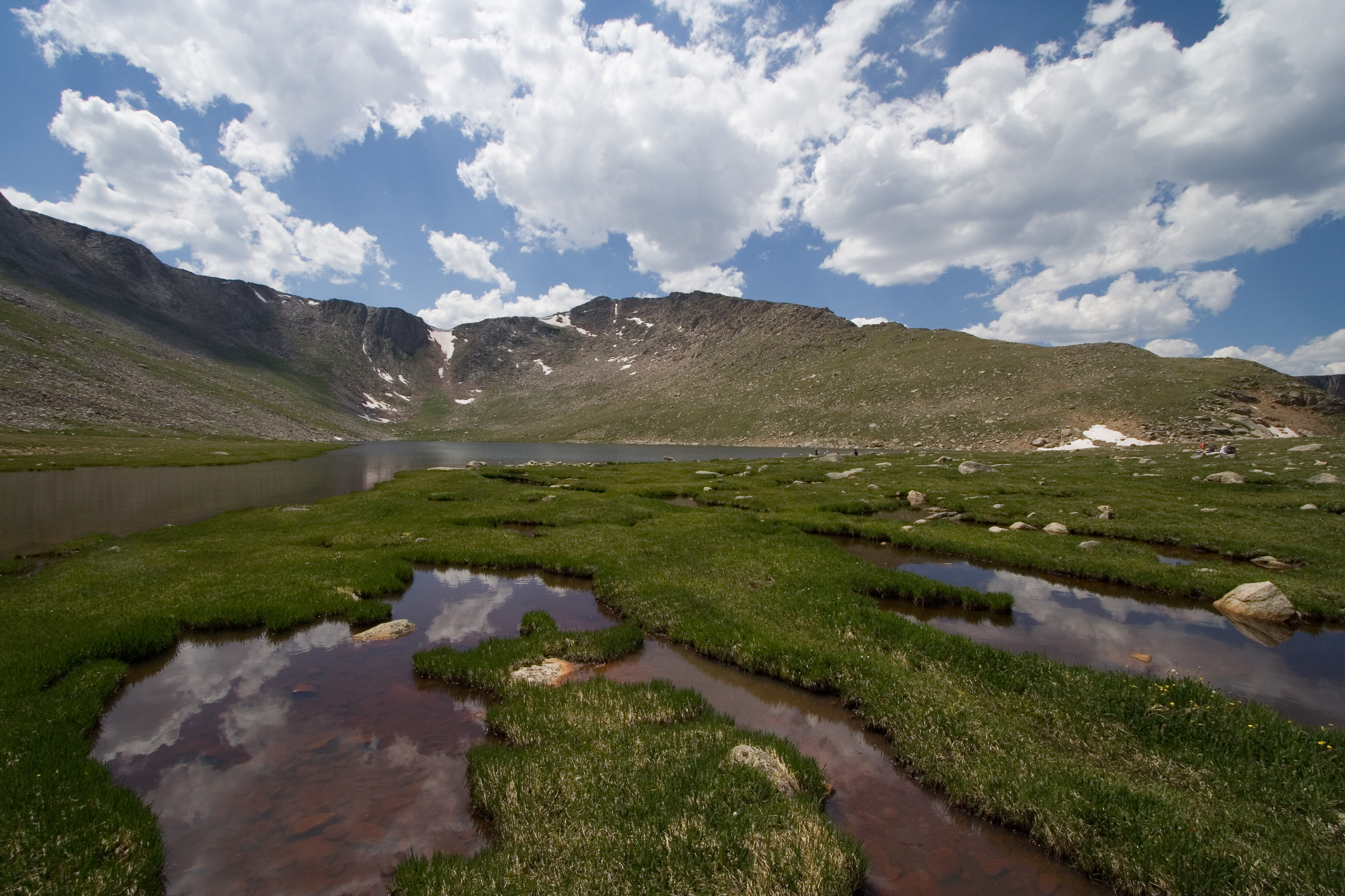
39°41′44″N 105°43′24″W / 39.695556°N 105.723333°WSilver Plume 25 Summit Lake Park 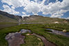
February 24, 1995 Mt. Evans Rd., southwest of Idaho Springs
39°35′55″N 105°38′40″W / 39.598611°N 105.644444°WIdaho Springs 26 Toll House December 18, 1970 Southern side of Georgetown adjacent to Interstate 70
39°42′16″N 105°42′11″W / 39.704444°N 105.703056°WGeorgetown See also
- List of National Historic Landmarks in Colorado
- National Register of Historic Places listings in Colorado
References
- ^ The latitude and longitude information provided in this table was derived originally from the National Register Information System, which has been found to be fairly accurate for about 99% of listings. For about 1% of NRIS original coordinates, experience has shown that one or both coordinates are typos or otherwise extremely far off; some corrections may have been made. A more subtle problem causes many locations to be off by up to 150 yards, depending on location in the country: most NRIS coordinates were derived from tracing out latitude and longitudes off of USGS topographical quadrant maps created under the North American Datum of 1927, which differs from the current, highly accurate WGS84 GPS system used by Google maps. Chicago is about right, but NRIS longitudes in Washington are higher by about 4.5 seconds, and are lower by about 2.0 seconds in Maine. Latitudes differ by about 1.0 second in Florida. Some locations in this table may have been corrected to current GPS standards.
- ^ "National Register of Historic Places: Weekly List Actions". National Park Service, United States Department of the Interior. Retrieved on November 10, 2011.
- ^ Numbers represent an ordering by significant words. Various colorings, defined here, differentiate National Historic Landmark sites and National Register of Historic Places Districts from other NRHP buildings, structures, sites or objects.
U.S. National Register of Historic Places Topics Lists by states Alabama • Alaska • Arizona • Arkansas • California • Colorado • Connecticut • Delaware • Florida • Georgia • Hawaii • Idaho • Illinois • Indiana • Iowa • Kansas • Kentucky • Louisiana • Maine • Maryland • Massachusetts • Michigan • Minnesota • Mississippi • Missouri • Montana • Nebraska • Nevada • New Hampshire • New Jersey • New Mexico • New York • North Carolina • North Dakota • Ohio • Oklahoma • Oregon • Pennsylvania • Rhode Island • South Carolina • South Dakota • Tennessee • Texas • Utah • Vermont • Virginia • Washington • West Virginia • Wisconsin • WyomingLists by territories Lists by associated states Other Municipalities and communities of Clear Creek County, Colorado Cities 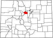
Towns CDPs Downieville-Lawson-Dumont | Floyd Hill | St. Mary's | Upper Bear Creek
Unincorporated
communitiesDownieville | Dumont | Lawson
Ghost towns Bakerville | Silver Creek | Silver Dale
Footnotes ‡This populated place also has portions in an adjacent county or counties
Categories:- National Register of Historic Places in Colorado by county
- Clear Creek County, Colorado
-


Wikimedia Foundation. 2010.