- Empire, Colorado
Infobox Settlement
official_name = Town of Empire, Colorado
other_name =
native_name =
nickname = Heart of the Rocky Mountain Empire
settlement_type = Town
motto =
imagesize =
image_caption =
flag_size =
image_
seal_size =
image_shield =
shield_size =
image_blank_emblem =
blank_emblem_type =
blank_emblem_size =
imagesize =
image_caption =
flag_size =
image_
seal_size =
image_shield =
shield_size =
image_blank_emblem =
blank_emblem_type =
blank_emblem_size =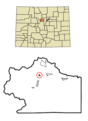
mapsize = 250x200px
map_caption = Location in Clear Creek County and theState of Colorado
mapsize1 =
map_caption1 =
image_dot_
dot_mapsize =
dot_map_caption =
dot_x =
dot_y =
pushpin_
pushpin_label_position =
pushpin_map_caption =
pushpin_mapsize =
subdivision_type = Country
subdivision_name = USA
subdivision_type1 = State
subdivision_name1 = flag|Colorado|name=State of Colorado
subdivision_type2 = County
subdivision_name2 = Clear Creek Countycite web | url = http://www.dola.state.co.us/dlg/local_governments/municipalities.html | title = Active Colorado Municipalities | format =HTML | publisher = State of Colorado, Department of Local Affairs | accessdate = 2007-09-01]
subdivision_type3 =
subdivision_name3 =
subdivision_type4 =
subdivision_name4 =
government_footnotes =
government_type = Statutory Town
leader_title =
leader_name =
leader_title1 =
leader_name1 =
leader_title2 =
leader_name2 =
leader_title3 =
leader_name3 =
leader_title4 =
leader_name4 =
established_title =
established_date =
established_title2 = Incorporated
established_date2 =April 12 ,1882 cite web | url = http://www.colorado.gov/dpa/doit/archives/muninc.html | title = Colorado Municipal Incorporations | format =HTML | publisher = State of Colorado, Department of Personnel & Administration, Colorado State Archives | date =2004-12-01 | accessdate = 2007-09-02]
established_title3 =
established_date3 =
area_magnitude =
unit_pref = Imperial
area_footnotes =
area_total_km2 = 0.7
area_land_km2 = 0.7
area_water_km2 = 0
area_total_sq_mi = 0.3
area_land_sq_mi = 0.3
area_water_sq_mi = 0
area_water_percent =
area_urban_km2 =
area_urban_sq_mi =
area_metro_km2 =
area_metro_sq_mi =
area_blank1_title =
area_blank1_km2 =
area_blank1_sq_mi =
population_as_of = 2000
population_footnotes =
population_note =
population_total = 355
population_density_km2 = 507.1
population_density_sq_mi = 1183.3
population_metro =
population_density_metro_km2 =
population_density_metro_sq_mi =
population_urban =
population_density_urban_km2 =
population_density_urban_sq_mi =
population_blank1_title =
population_blank1 =
population_density_blank1_km2 =
population_density_blank1_sq_mi =
timezone = MST
utc_offset = -7
timezone_DST = MDT
utc_offset_DST = -6
latd = 39 |latm = 45 |lats = 37 |latNS = N
longd = 105 |longm = 40 |longs = 59 |longEW = W
elevation_footnotes = GR|3
elevation_m = 2626
elevation_ft = 8615
postal_code_type =ZIP code cite web | url = http://zip4.usps.com/zip4/citytown.jsp | title = ZIP Code Lookup| format =JavaScript /HTML | publisher =United States Postal Service | accessdate = September 10 | accessyear = 2007]
postal_code = 80438
area_code = Both 303 and 720
blank_name =Highway s
blank_info =
blank1_name = GNIS feature ID
blank1_info = 0181355
website =
footnotes =The historic Town of Empire is a Statutory Town located in Clear Creek County,
Colorado ,United States . The population was 355 at theU.S. Census 2000 . The town is a formermining settlement that flourished during theColorado Silver Boom in the late 19th century. It is located in the valley Clear Creek west of Denver, on the north side of the valley. The town consists of several commercial establishments and residents.U.S. Highway 40 passes through the town as its ascends towardsBerthoud Pass , putting the town on the direct route between Denver and Middle Park.Geography
Empire is located at coor dms|39|45|37|N|105|40|59|W|city (39.760319, -105.682995)GR|1.
According to the
United States Census Bureau , the town has a total area of 0.2 square miles (0.6 km²), all of it land.Demographics
As of the
census GR|2 of 2000, there were 355 people, 163 households, and 88 families residing in the town. Thepopulation density was 1,406.0 people per square mile (548.3/km²). There were 179 housing units at an average density of 708.9/sq mi (276.4/km²). The racial makeup of the town was 94.37% White, 3.10% Native American, 0.28% Asian, 0.28% from other races, and 1.97% from two or more races. Hispanic or Latino of any race were 3.66% of the population.There were 163 households out of which 30.7% had children under the age of 18 living with them, 39.3% were married couples living together, 11.7% had a female householder with no husband present, and 46.0% were non-families. 39.3% of all households were made up of individuals and 6.7% had someone living alone who was 65 years of age or older. The average household size was 2.18 and the average family size was 2.99.
In the town the population was spread out with 27.0% under the age of 18, 4.2% from 18 to 24, 30.7% from 25 to 44, 32.1% from 45 to 64, and 5.9% who were 65 years of age or older. The median age was 40 years. For every 100 females there were 112.6 males. For every 100 females age 18 and over, there were 121.4 males.
The median income for a household in the town was $32,159, and the median income for a family was $43,750. Males had a median income of $40,313 versus $29,500 for females. The
per capita income for the town was $20,417. About 10.5% of families and 11.0% of the population were below thepoverty line , including 11.4% of those under age 18 and none of those age 65 or over.Points of Interest
* Peck House - Historic hotel and restaurant. [http://www.thepeckhouse.com/]
* Hard Rock Cafe - This is the original, dating from 1934, and named for the hardrock miners that were its early customers. It predates and is not affiliated with the chain of restaurants that also call themselves theHard Rock Cafe .ee also
*
Colorado municipalities
*Clear Creek County, Colorado
*Colorado Silver Boom
*Arapaho National Forest References
External links
* [http://www.dot.state.co.us/App_DTD_DataAccess/Downloads/CityMaps/Empire.pdf CDOT map of the Town of Empire]
[www.lewis sweet shop]
Wikimedia Foundation. 2010.