- Downieville, Colorado
-
Downieville, Colorado — Town — Location within the state of Colorado
 Downieville, Colorado
Coordinates: 39°46′1″N 105°36′54″W / 39.76694°N 105.615°WCoordinates: 39°46′1″N 105°36′54″W / 39.76694°N 105.615°W Country  United States
State  State of Colorado
County Clear Creek County[1] Government - Type unincorporated town Elevation[1] 8,031 ft (2,448 m) Time zone MST (UTC-7) - Summer (DST) MDT (UTC-6) ZIP code Dumont CO 80436 Area code(s) Both 303 and 720 Downieville is a small unincorporated town situated along Clear Creek in Clear Creek County, Colorado, United States. Downieville is a part of the Downieville-Lawson-Dumont census-designated place.
Geography
Downieville is located at 39°46′1″N 105°36′54″W / 39.76694°N 105.615°W (39.766927,-105.615124).
See also
- Denver-Aurora Metropolitan Statistical Area
- Denver-Aurora-Boulder Combined Statistical Area
- Front Range Urban Corridor
- List of cities and towns in Colorado
References
- ^ a b "US Board on Geographic Names". United States Geological Survey. 2007-10-25. http://geonames.usgs.gov. Retrieved 2008-01-31.
Municipalities and communities of Clear Creek County, Colorado County seat: Georgetown Cities 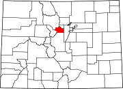
Towns CDPs Downieville-Lawson-Dumont | Floyd Hill | St. Mary's | Upper Bear Creek
Unincorporated
communitiesGhost towns Bakerville | Silver Creek | Silver Dale
Footnotes ‡This populated place also has portions in an adjacent county or counties
Categories:- Populated places in Clear Creek County, Colorado
- Unincorporated communities in Colorado
- Denver metropolitan area

Wikimedia Foundation. 2010.