- National Register of Historic Places listings in Wapello County, Iowa
-
 Location of Wapello County in Iowa
This is a list of the National Register of Historic Places listings in Wapello County, Iowa.
This is intended to be a complete list of the properties and districts on the National Register of Historic Places in Wapello County, Iowa, United States. Latitude and longitude coordinates are provided for many National Register properties and districts; these locations may be seen together in a Google map.[1]
There are 27 properties and districts listed on the National Register in the county.
-
- This National Park Service list is complete through NPS recent listings posted November 10, 2011.[2]
Current listings
[3] Landmark name [4] Image Date listed Location City or town Summary 1 B'nai Jacob Synagogue 
August 10, 2004 529 E. Main
41°00′57″N 92°24′25″W / 41.015833°N 92.406944°WOttumwa 2 Benson Block January 3, 1985 109-112 N. Market
41°01′03″N 92°24′35″W / 41.0175°N 92.409722°WOttumwa 3 Benson Building August 11, 1995 214 E. 2nd St.
41°01′01″N 92°24′37″W / 41.016944°N 92.410278°WOttumwa 4 Big 4 Fair Art Hall May 18, 1995 Water St. at the Wapello County Regional Fairgrounds
40°54′31″N 92°12′53″W / 40.908611°N 92.214722°WEldon 5 Burlington Depot 
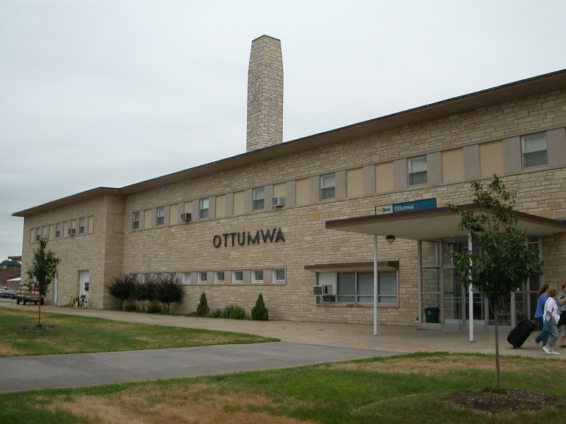
November 26, 2008 210 W. Main St.
41°01′09″N 92°24′52″W / 41.01909°N 92.41432°WOttumwa 6 Chief Wapello's Memorial Park March 27, 1975 Southeast of Agency off U.S. Route 34
40°59′31″N 92°17′32″W / 40.991944°N 92.292222°WAgency 7 Court Hill Historic District January 7, 1998 111 E. Court and 407-1004 N. Court Sts.
41°01′31″N 92°24′31″W / 41.025278°N 92.408611°WOttumwa 8 Dahlonega School No. 1 August 10, 2000 County Road H25, 2 miles northeast of Ottumwa
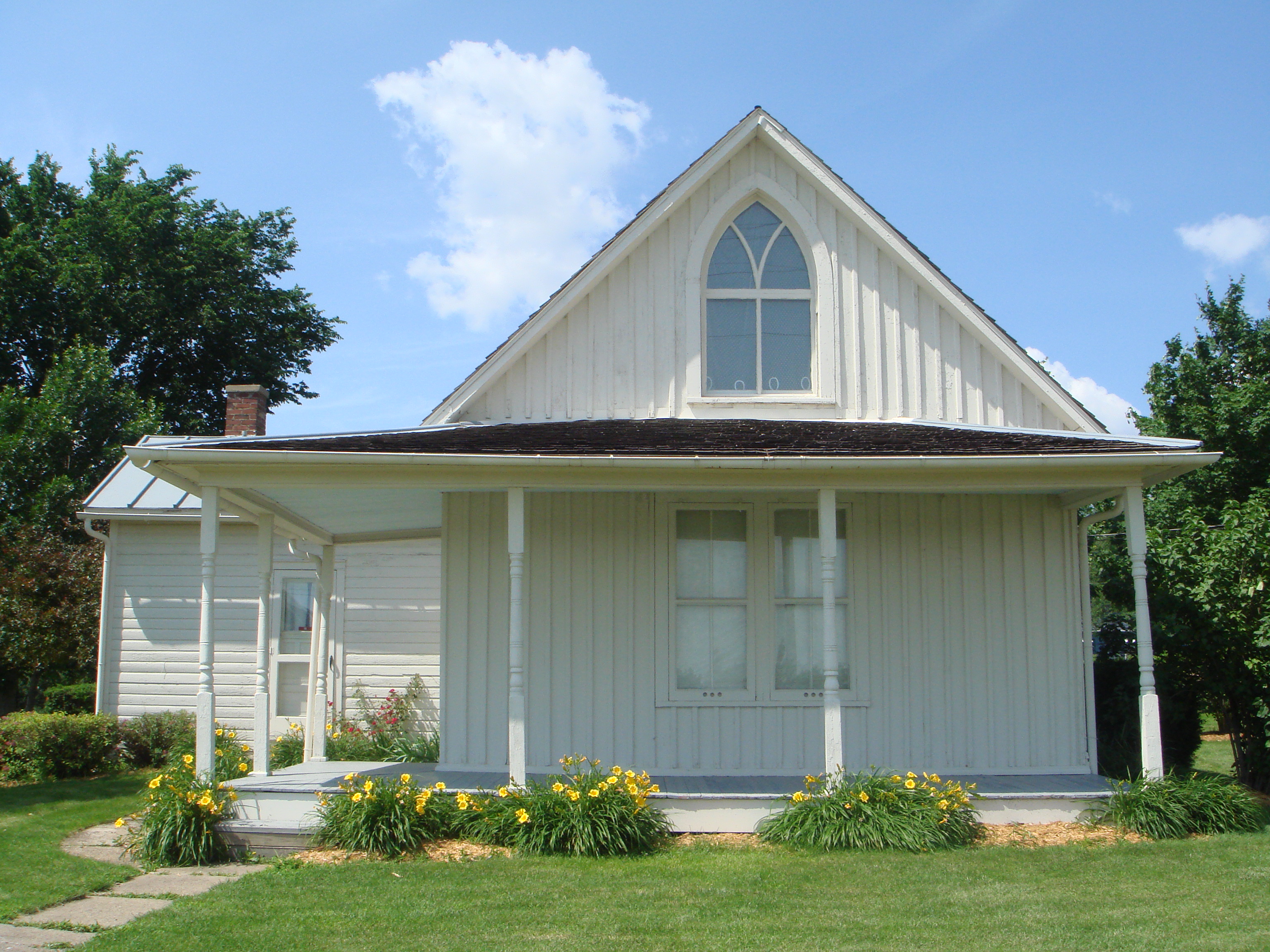
41°03′30″N 92°22′13″W / 41.058333°N 92.370278°WOttumwa 9 Dibble House 
October 1, 1974 Burton and Gothic Sts.
40°55′18″N 92°12′48″W / 40.921667°N 92.213333°WEldon 10 Eldon Carnegie Public Library 
May 30, 1996 608 W. Elm St.
40°55′12″N 92°13′32″W / 40.92°N 92.225556°WEldon 11 Fifth Street Bluff Historic District January 7, 1998 Roughly bounded by Jefferson, E. 6th, Washington, and 4th Sts.
41°01′09″N 92°24′26″W / 41.019167°N 92.407222°WOttumwa 12 First National Bank August 11, 1995 131 E. Main St.
41°01′02″N 92°24′42″W / 41.017222°N 92.411667°WOttumwa 13 Foster/Bell House September 29, 1983 205 E. 5th St.
41°01′11″N 92°24′27″W / 41.019722°N 92.4075°WOttumwa 14 J.W. Garner Building February 12, 2010 222-224 E. 2nd St.
41°01′03″N 92°24′38″W / 41.0175°N 92.410556°WOttumwa 15 Historic Railroad District October 6, 2011 Main St. to BNSF Railway tracks between Washington St. & Marion St.
41°01′08″N 92°24′53″W / 41.018889°N 92.414722°WOttumwa Post-Wold War II Development in Ottumwa, Ia 1944-1959 MPS 16 Jay Funeral Home August 11, 1995 220 North Ct.
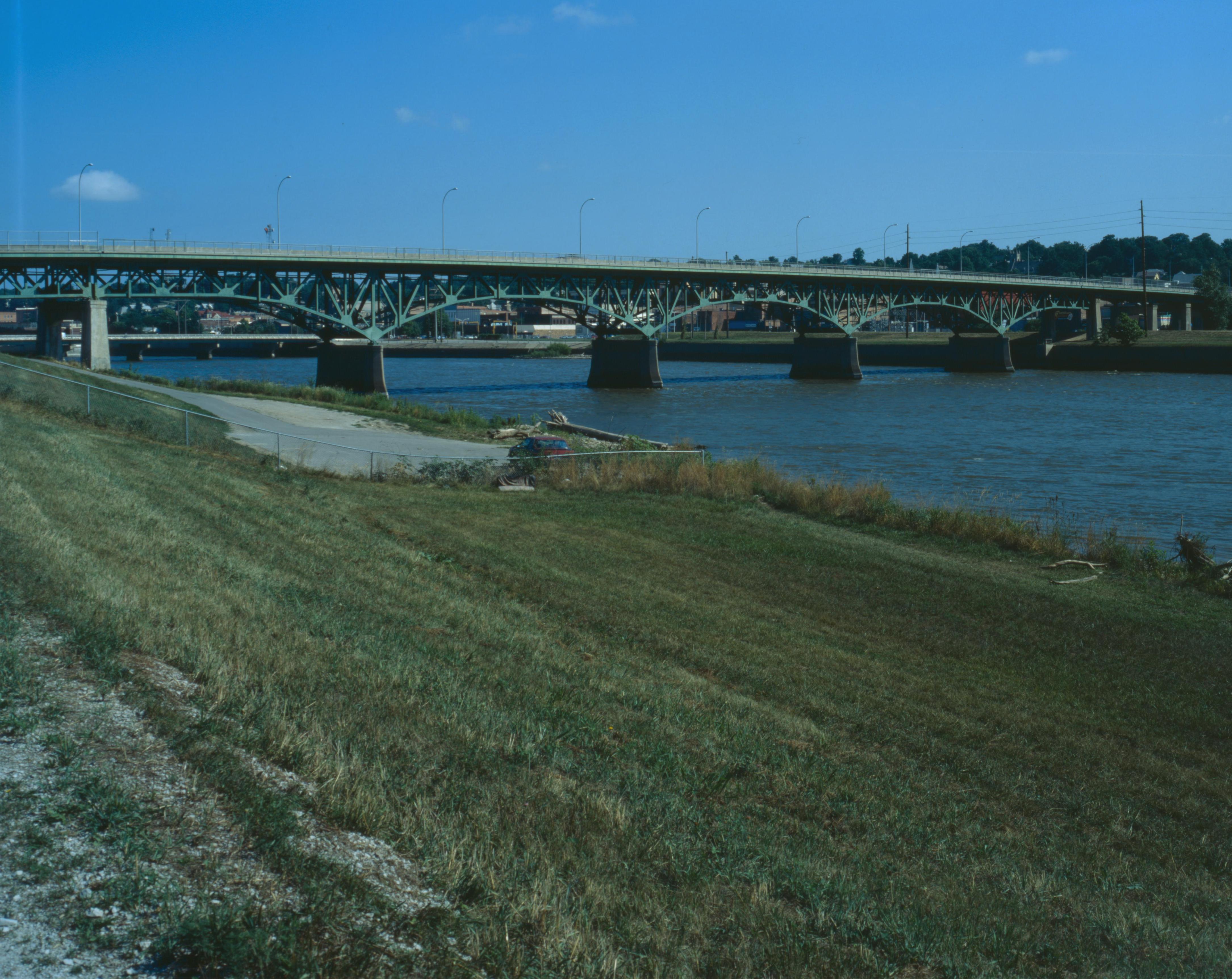
41°01′12″N 92°24′35″W / 41.02°N 92.409722°WOttumwa 17 Jefferson Street Viaduct 
May 15, 1998 Jefferson St. over the Des Moines River
41°00′39″N 92°24′55″W / 41.010833°N 92.415278°WOttumwa 18 Mars Hill September 13, 1974 Southeast of Ottumwa
40°53′58″N 92°21′26″W / 40.899444°N 92.357222°WOttumwa 19 McHaffey Opera House 
November 22, 1995 414 Elm St.
40°55′04″N 92°13′22″W / 40.917778°N 92.222778°WEldon 20 North Fellows Historic District December 27, 2010 1200 block of N. Fellows St. and 1204-1212 N. Elm St.
41°01′37″N 92°23′49″W / 41.026944°N 92.396944°WOttumwa Post-Wold War II Development in Ottumwa, Ia 1944-1959 MPS 21 Ottumwa Cemetery Historic District August 11, 1995 1302 North Ct.
41°01′59″N 92°24′31″W / 41.033056°N 92.408611°WOttumwa 22 Ottumwa Public Library April 27, 1984 129 N. Court St.
41°01′11″N 92°25′21″W / 41.019722°N 92.4225°WOttumwa 23 Ottumwa Young Women's Christian Association August 24, 2005 133 W. 2nd St.
41°01′17″N 92°24′46″W / 41.021389°N 92.412778°WOttumwa 24 St. Mary's of the Visitation Church and Rectory March 12, 1999 103 E. 4th St.
41°01′10″N 92°24′38″W / 41.019444°N 92.410556°WOttumwa 25 U.S. Post Office August 13, 1976 Court and 4th Sts.
41°01′07″N 92°24′38″W / 41.018611°N 92.410556°WOttumwa 26 Vogel Place Historic District August 11, 1995 Roughly bounded by the Ottumwa Country Club, Court St., the Ottumwa Cemetery, and the former St. Joseph Hospital
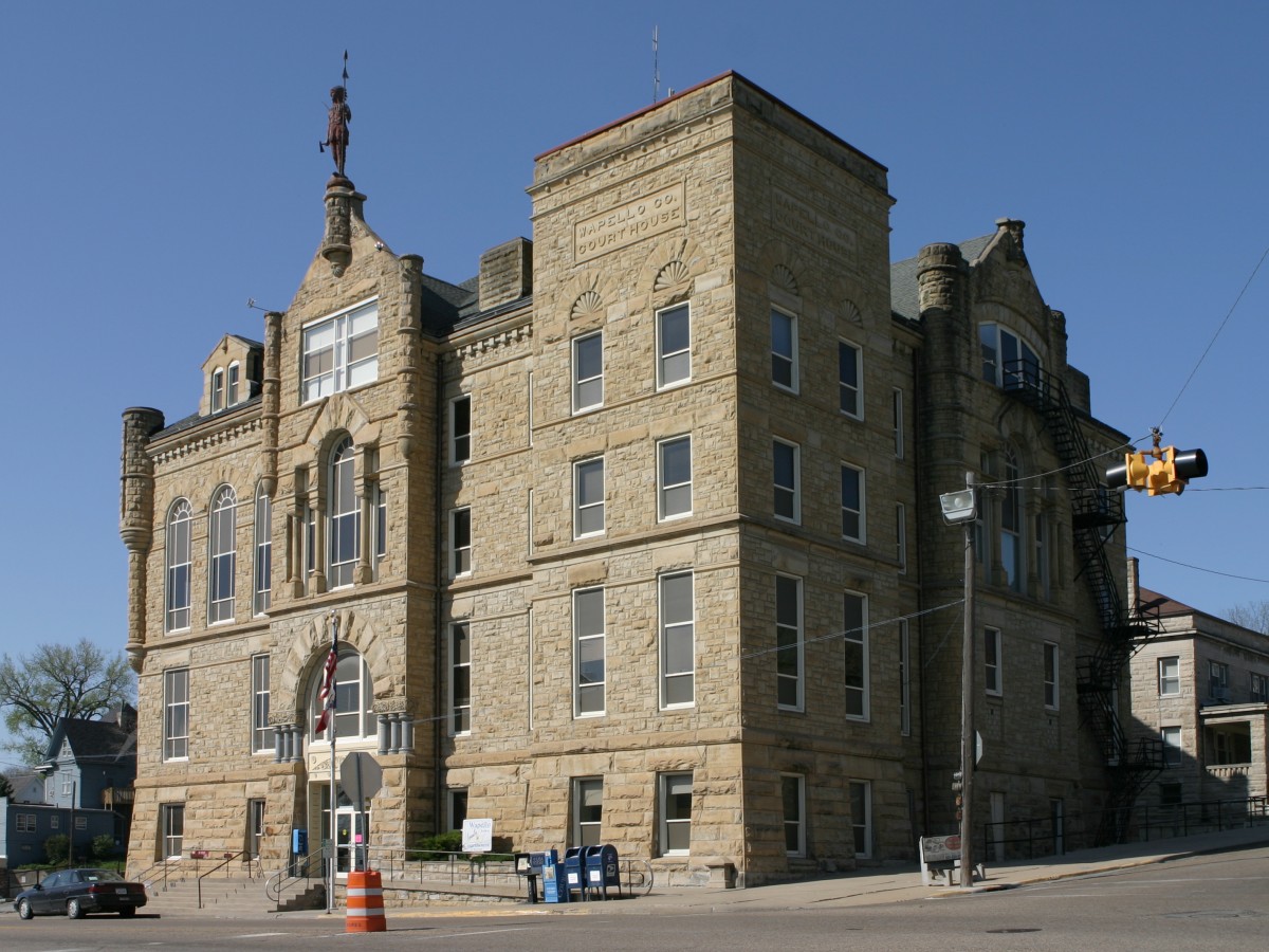
41°02′15″N 92°24′10″W / 41.0375°N 92.402778°WOttumwa 27 Wapello County Courthouse 
July 2, 1981 Court St.
41°01′11″N 92°24′38″W / 41.019722°N 92.410556°WOttumwa See also
References
- ^ The latitude and longitude information provided in this table was derived originally from the National Register Information System, which has been found to be fairly accurate for about 99% of listings. For about 1% of NRIS original coordinates, experience has shown that one or both coordinates are typos or otherwise extremely far off; some corrections may have been made. A more subtle problem causes many locations to be off by up to 150 yards, depending on location in the country: most NRIS coordinates were derived from tracing out latitude and longitudes off of USGS topographical quadrant maps created under the North American Datum of 1927, which differs from the current, highly accurate WGS84 GPS system used by Google maps. Chicago is about right, but NRIS longitudes in Washington are higher by about 4.5 seconds, and are lower by about 2.0 seconds in Maine. Latitudes differ by about 1.0 second in Florida. Some locations in this table may have been corrected to current GPS standards.
- ^ "National Register of Historic Places: Weekly List Actions". National Park Service, United States Department of the Interior. Retrieved on November 10, 2011.
- ^ Numbers represent an ordering by significant words. Various colorings, defined here, differentiate National Historic Landmark sites and National Register of Historic Places Districts from other NRHP buildings, structures, sites or objects.
- ^ "National Register Information System". National Register of Historic Places. National Park Service. . http://nrhp.focus.nps.gov/natreg/docs/All_Data.html.
U.S. National Register of Historic Places Topics Lists by states Alabama • Alaska • Arizona • Arkansas • California • Colorado • Connecticut • Delaware • Florida • Georgia • Hawaii • Idaho • Illinois • Indiana • Iowa • Kansas • Kentucky • Louisiana • Maine • Maryland • Massachusetts • Michigan • Minnesota • Mississippi • Missouri • Montana • Nebraska • Nevada • New Hampshire • New Jersey • New Mexico • New York • North Carolina • North Dakota • Ohio • Oklahoma • Oregon • Pennsylvania • Rhode Island • South Carolina • South Dakota • Tennessee • Texas • Utah • Vermont • Virginia • Washington • West Virginia • Wisconsin • WyomingLists by territories Lists by associated states Other Municipalities and communities of Wapello County, Iowa Cities Agency | Blakesburg | Chillicothe | Eddyville‡ | Eldon | Kirkville | Ottumwa

Unincorporated
communitiesBladensburg | Dudley | Farson
Footnotes ‡This populated place also has portions in an adjacent county or counties
Categories:- National Register of Historic Places in Iowa by county
- Wapello County, Iowa
- Buildings and structures in Wapello County, Iowa
-


Wikimedia Foundation. 2010.