- Chillicothe, Iowa
-
Chillicothe, Iowa — City — Location of Chillicothe, Iowa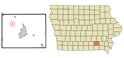
Coordinates: 41°5′11″N 92°31′44″W / 41.08639°N 92.52889°WCoordinates: 41°5′11″N 92°31′44″W / 41.08639°N 92.52889°W Country  United States
State  Iowa
IowaCounty Wapello Incorporated December 22, 1881 [1] Area – Total 0.2 sq mi (0.6 km2) – Land 0.2 sq mi (0.6 km2) – Water 0.0 sq mi (0.0 km2) Elevation 686 ft (209 m) Population (2000) – Total 90 – Density 395.7/sq mi (152.8/km2) Time zone Central (CST) (UTC-6) – Summer (DST) CDT (UTC-5) ZIP code 52548 Area code(s) 641 FIPS code 19-13215 GNIS feature ID 0455394 Chillicothe is a city in Wapello County, Iowa, United States. The population was 90 at the 2000 census.
Contents
History
The word "Chillicothe" is derived from the ancient Shawnee Indian words meaning "Principal Place." It was the name for one of their clans. The main chief of the Shawnee could only come from the Chillicothe clan. When a village was called Chillicothe, it meant that it was home to the principal chief. It was the capital city of the Shawnees until the death of that chief. Then, the capitol would move to the home village of the next main chief. That village would then become Chillicothe.[2]
Chillicothe is the burial place of the oldest man to serve in the Civil War, Curtis King.[3][4]
Geography
Chillicothe is located at 41°5′11″N 92°31′44″W / 41.08639°N 92.52889°W (41.086443, -92.528751)[5].
According to the United States Census Bureau, the city has a total area of 0.2 square miles (0.52 km2), of which, 0.2 square miles (0.52 km2) of it is land and 4.35% is water.
Demographics
As of the census[6] of 2000, there were 90 people, 38 households, and 25 families residing in the city. The population density was 395.7 people per square mile (151.1/km²). There were 44 housing units at an average density of 193.4 per square mile (73.9/km²). The racial makeup of the city was 97.78% White, 1.11% Asian, and 1.11% from two or more races.
There were 38 households out of which 28.9% had children under the age of 18 living with them, 50.0% were married couples living together, 7.9% had a female householder with no husband present, and 34.2% were non-families. 28.9% of all households were made up of individuals and 10.5% had someone living alone who was 65 years of age or older. The average household size was 2.37 and the average family size was 2.96.
Population spread: 27.8% under the age of 18, 5.6% from 18 to 24, 26.7% from 25 to 44, 30.0% from 45 to 64, and 10.0% who were 65 years of age or older. The median age was 41 years. For every 100 females there were 114.3 males. For every 100 females age 18 and over, there were 109.7 males.
The median income for a household in the city was $30,781, and the median income for a family was $31,750. Males had a median income of $25,417 versus $25,625 for females. The per capita income for the city was $19,075. There were 12.0% of families and 13.8% of the population living below the poverty line, including 33.3% of under eighteens and none of those over 64.
Infrastructure
On the west side of town is a large coal-burning power plant that supplies power to a large part of southeastern Iowa.
The town also rates a bridge across the Des Moines River.
References
- ^ "Chillicothe, Iowa". City-Data. http://www.city-data.com/city/Chillicothe-Iowa.html. Retrieved January 23, 2011.
- ^ Chillicothe City History
- ^ Find-A-Grave
- ^ Civil War Greybeard 1783-1863
- ^ "US Gazetteer files: 2010, 2000, and 1990". United States Census Bureau. 2011-02-12. http://www.census.gov/geo/www/gazetteer/gazette.html. Retrieved 2011-04-23.
- ^ "American FactFinder". United States Census Bureau. http://factfinder.census.gov. Retrieved 2008-01-31.
External links
- City-Data Comprehensive Statistical Data and more about Chillicothe
Municipalities and communities of Wapello County, Iowa Cities 
Unincorporated
communitiesBladensburg | Dudley | Farson
Footnotes ‡This populated place also has portions in an adjacent county or counties
Categories:- Cities in Iowa
- Populated places in Wapello County, Iowa

Wikimedia Foundation. 2010.