- National Register of Historic Places listings in Scott County, Iowa
-
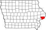
NRHP Scott County Downtown Davenport East Davenport West Davenport v · National Register of Historic Places in Scott County, Iowa, United States. Latitude and longitude coordinates are provided for many National Register properties and districts; these locations may be seen together in a Google map.[1] There are 284 properties and districts listed on the National Register in the county, including one National Historic Landmark. Another four properties were once listed on the Register but have since been removed.
Many of the listed properties were studied in a 1982 "Multiple Resource Assessment" survey of Davenport historic properties and/or its 1983 follow-on.[2][3]
-
- This National Park Service list is complete through NPS recent listings posted November 10, 2011.[4]
Map of all coordinates from Google
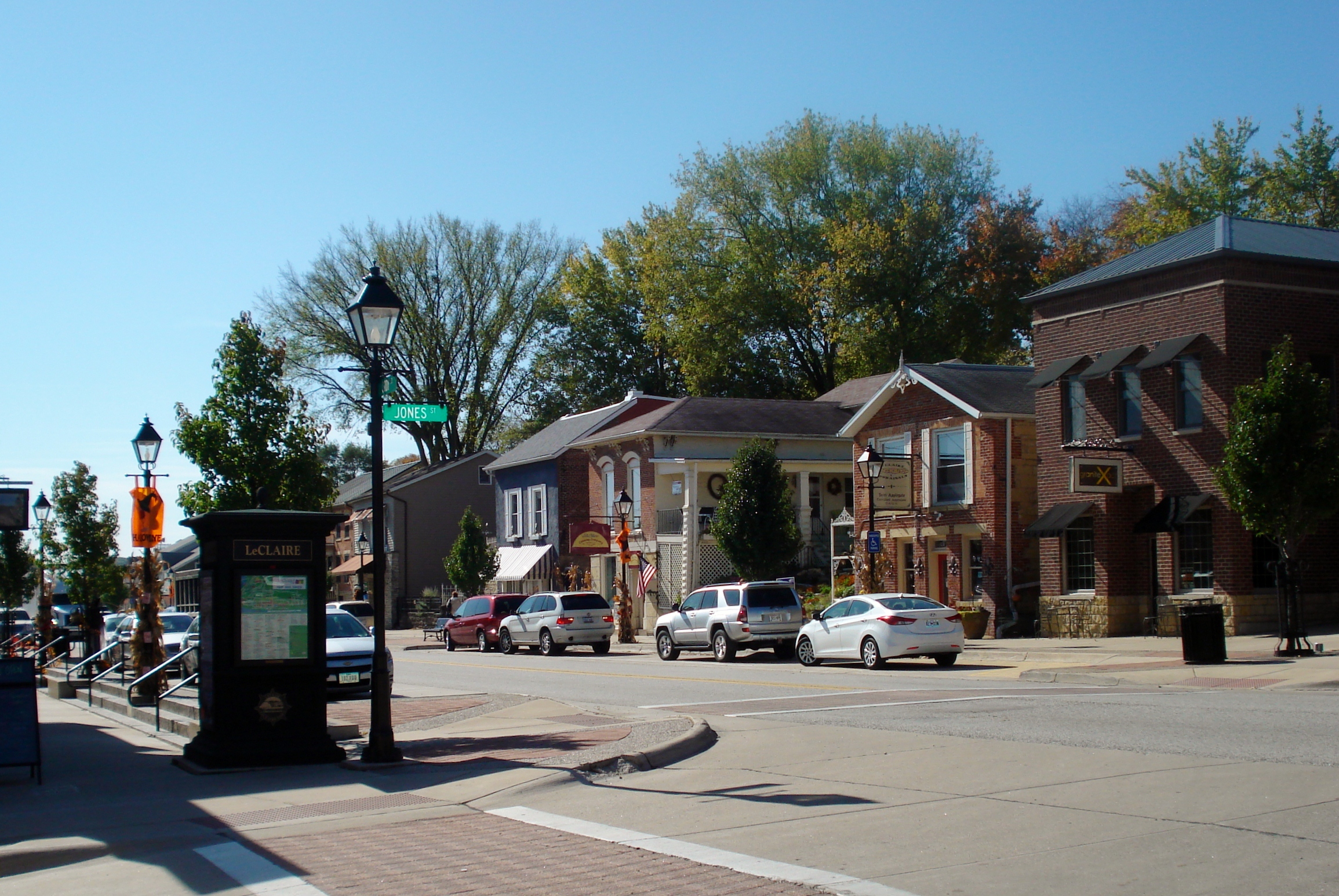
Export all coordinates as KML Export all coordinates as GeoRSS Map of all microformatted coordinates Place data as RDF Current listings
The list below contains properties on the NRHP in Scott County not located within the city of Davenport's borders.
The properties in Davenport may be found on the following pages:
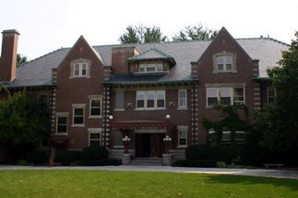
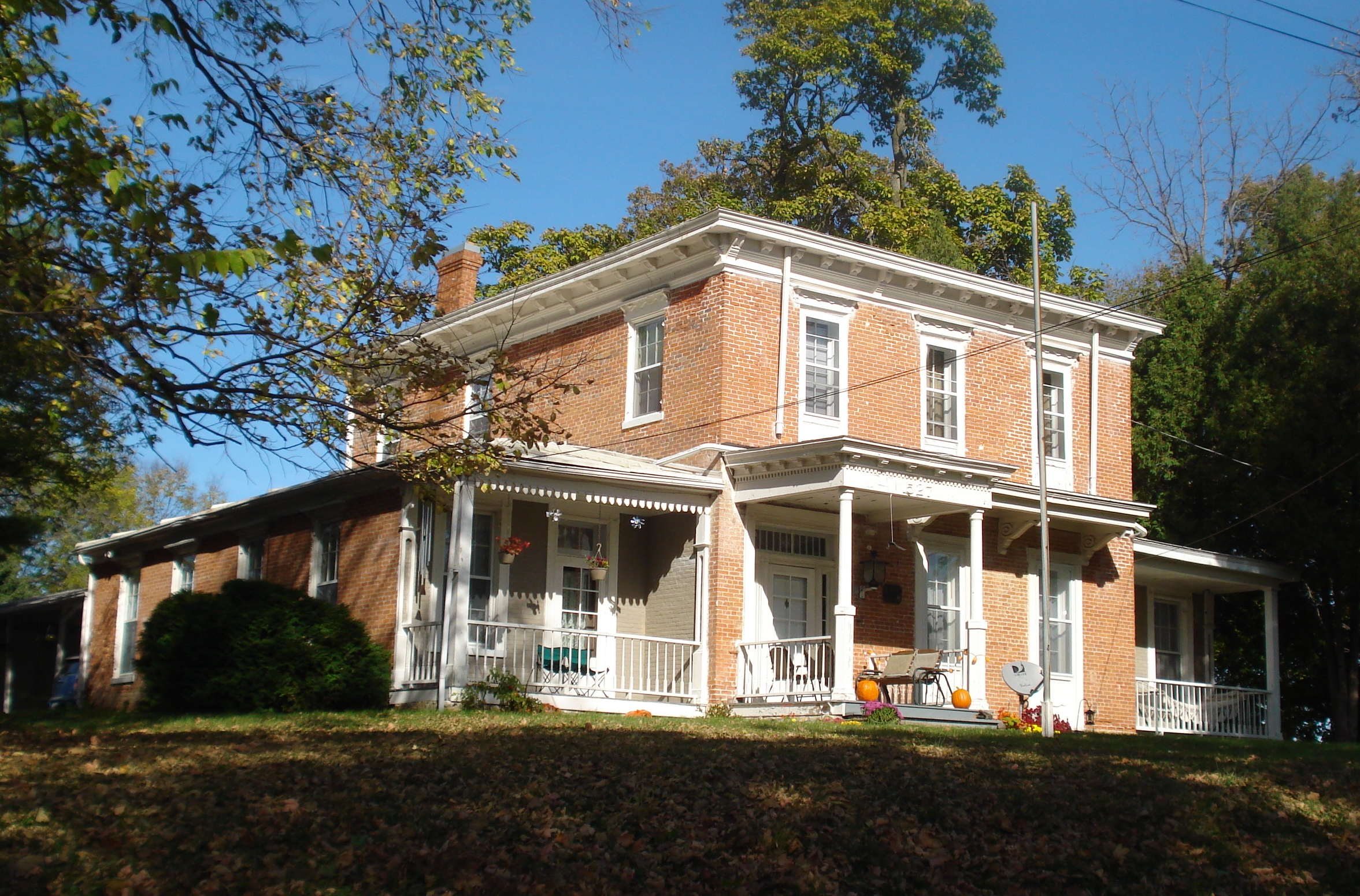
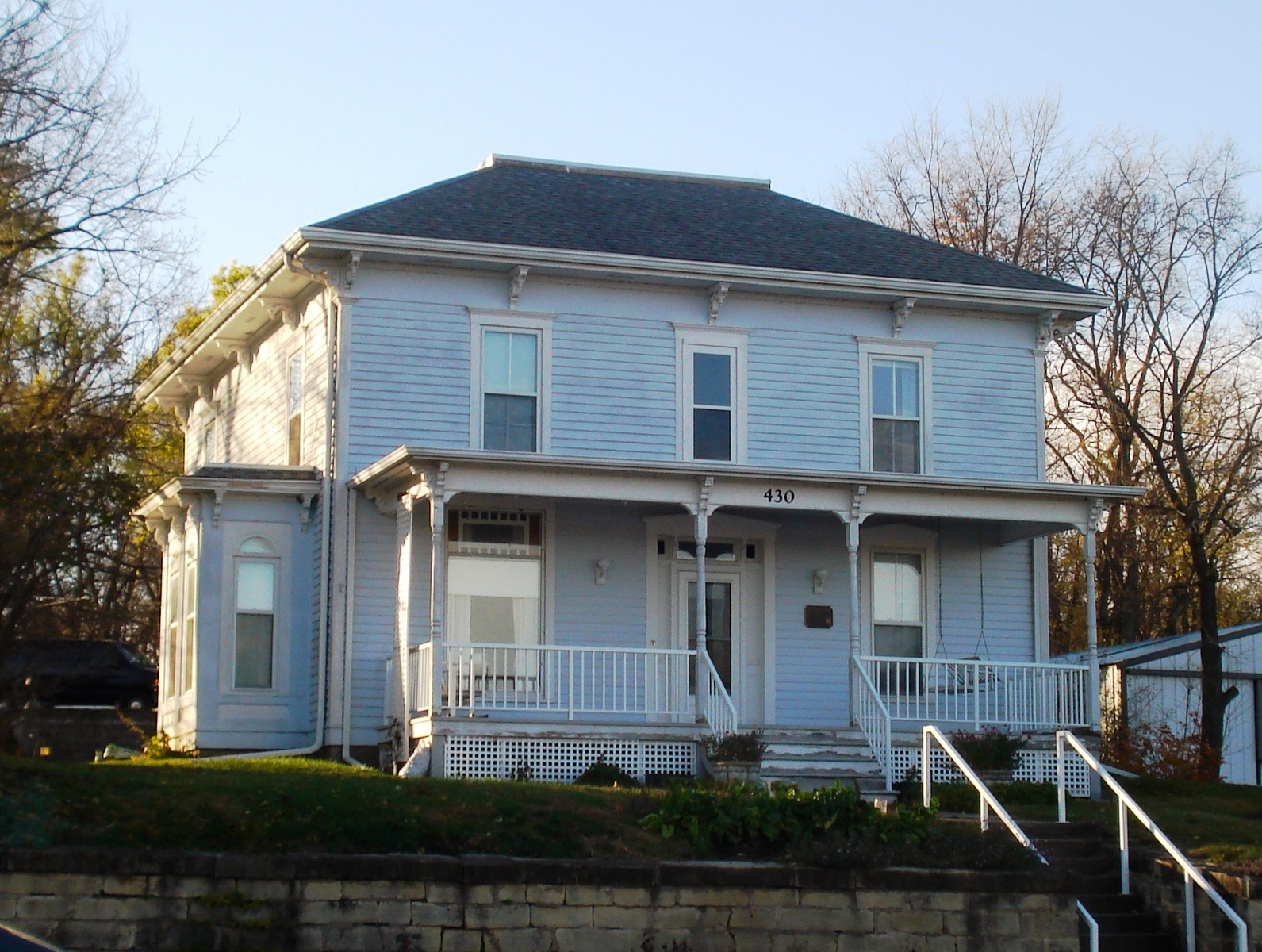
Downtown Davenport East Davenport West Davenport[5] Landmark name[6] Image Date listed Location City or Town Summary 1 Joseph F. Bettendorf House 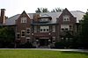
01983-01-27 January 27, 1983 1821 Sunset Dr.
41°31′44″N 90°30′23″W / 41.52889°N 90.50639°W / 41.52889; -90.50639 (Bettendorf, Joseph F., House)Bettendorf Twenty-eight room house built by industrialist Joseph W. Bettendorf, one of two brothers for whom the city of Bettendorf is named. It now houses a private school. 2 Bettendorf-Washington School 01984-07-12 July 12, 1984 533 16th St.
41°31′41″N 90°30′24″W / 41.52806°N 90.50667°W / 41.52806; -90.50667 (Bettendorf-Washington School)Bettendorf Former elementary school building that later housed a museum. 3 James Brown House 01982-03-05 March 5, 1982 424 State St.
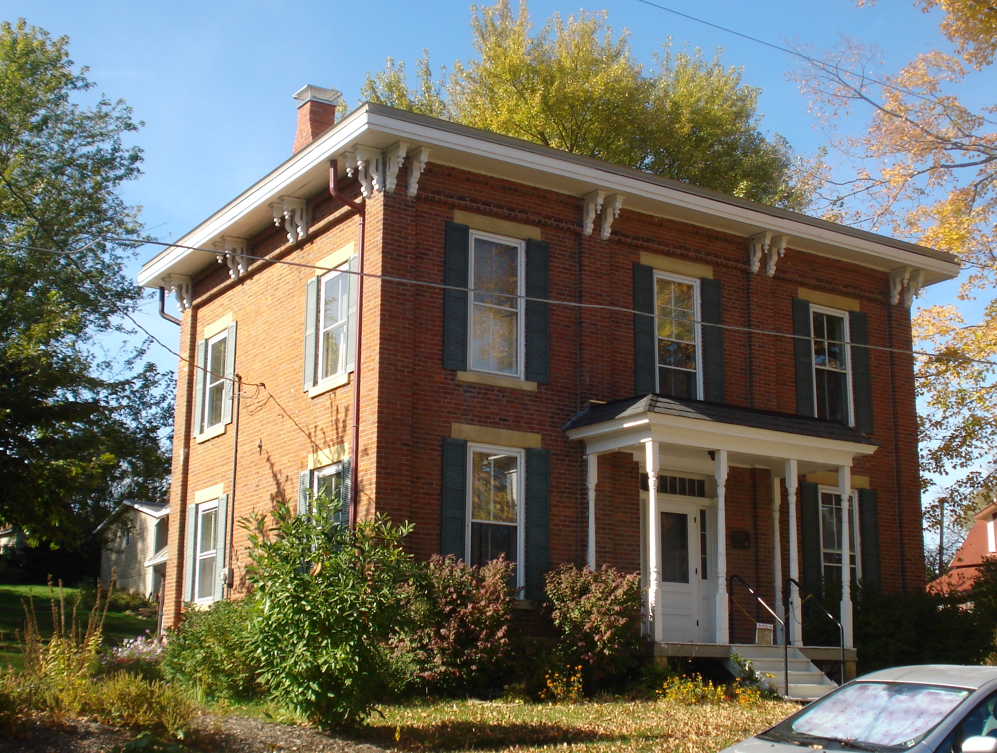
41°32′11″N 90°28′11″W / 41.53639°N 90.46972°W / 41.53639; -90.46972 (Brown, James, House)Riverdale An 1842 Greek Revival style residence 4 Alexander Brownlie House 01976-12-22 December 22, 1976 206 Pine St.
41°42′3″N 90°35′5″W / 41.70083°N 90.58472°W / 41.70083; -90.58472 (Brownlie, Alexander, House)Long Grove Farm house built in 1846. 5 Buffalo High School 02005-08-22 August 22, 2005 326 E. 4th St.
41°27′38″N 90°43′16″W / 41.46056°N 90.72111°W / 41.46056; -90.72111 (Buffalo High School)Buffalo Former school building and community center that is now a private home. 6 Cody Homestead 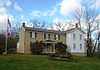
01974-01-24 January 24, 1974 South of McCausland
41°42′49″N 90°27′10″W / 41.71361°N 90.45278°W / 41.71361; -90.45278 (Cody Homestead)McCausland Boyhood home of Buffalo Bill Cody, a government scout and Wild West show performer. 7 Cody Road Historic District 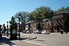
01979-05-07 May 7, 1979 Irregular pattern along Cody Rd.
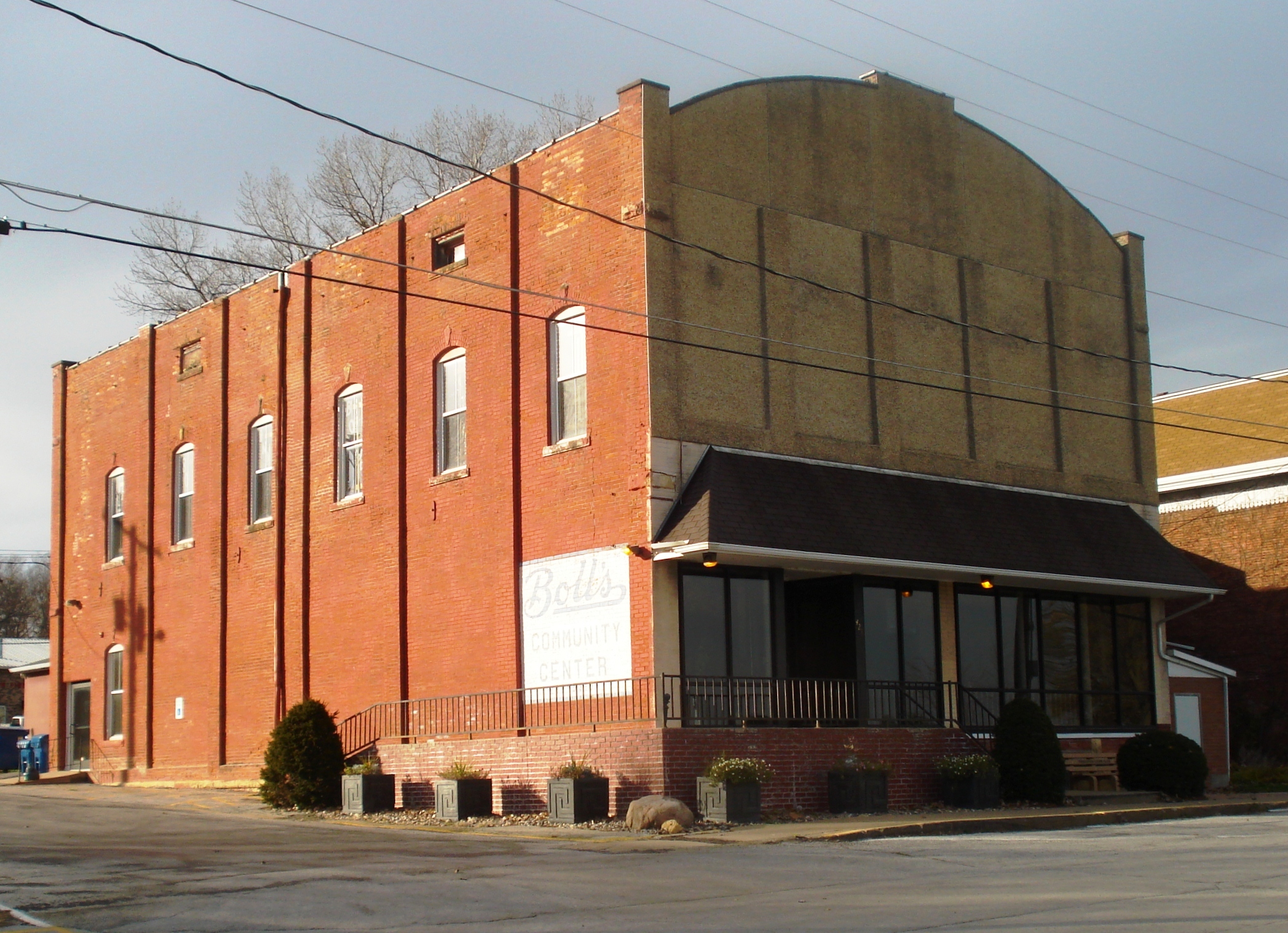
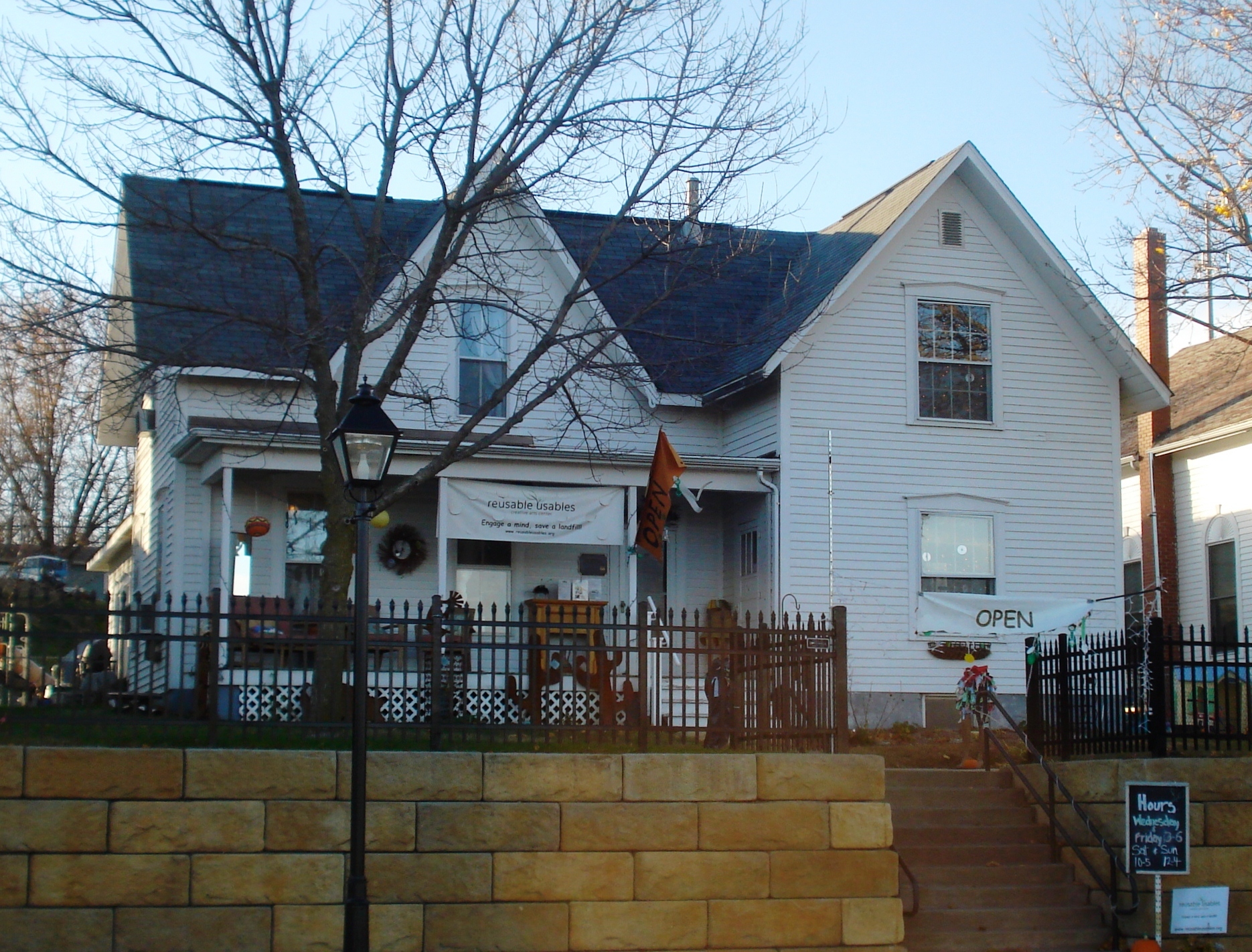
41°36′10″N 90°20′38″W / 41.60278°N 90.34389°W / 41.60278; -90.34389 (Cody Road Historic District)LeClaire Cody Road is the main street through Le Claire. It includes the Central Business District. 8 Community Building 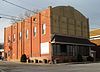
02008-04-25 April 25, 2008 428 S. River Dr.
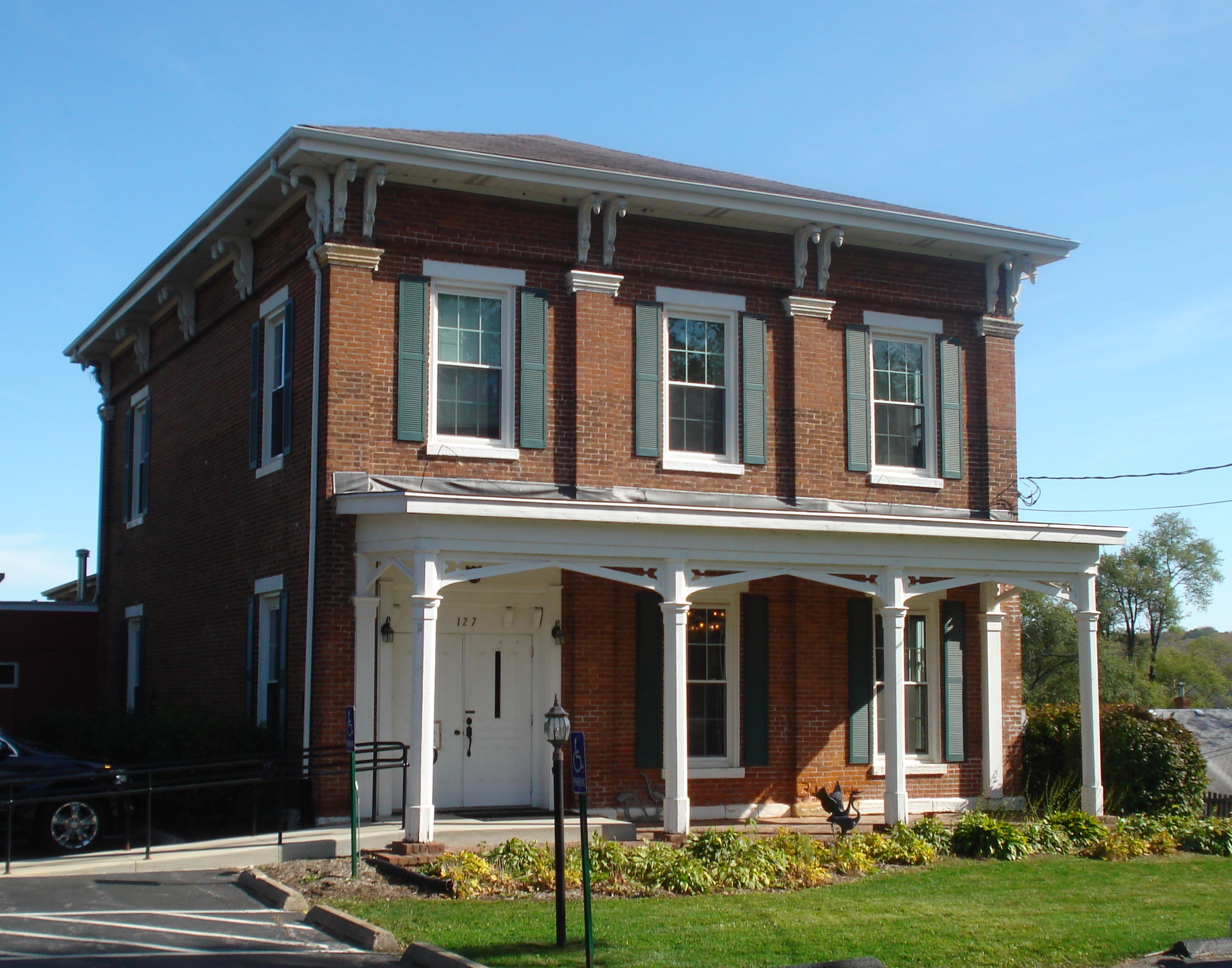
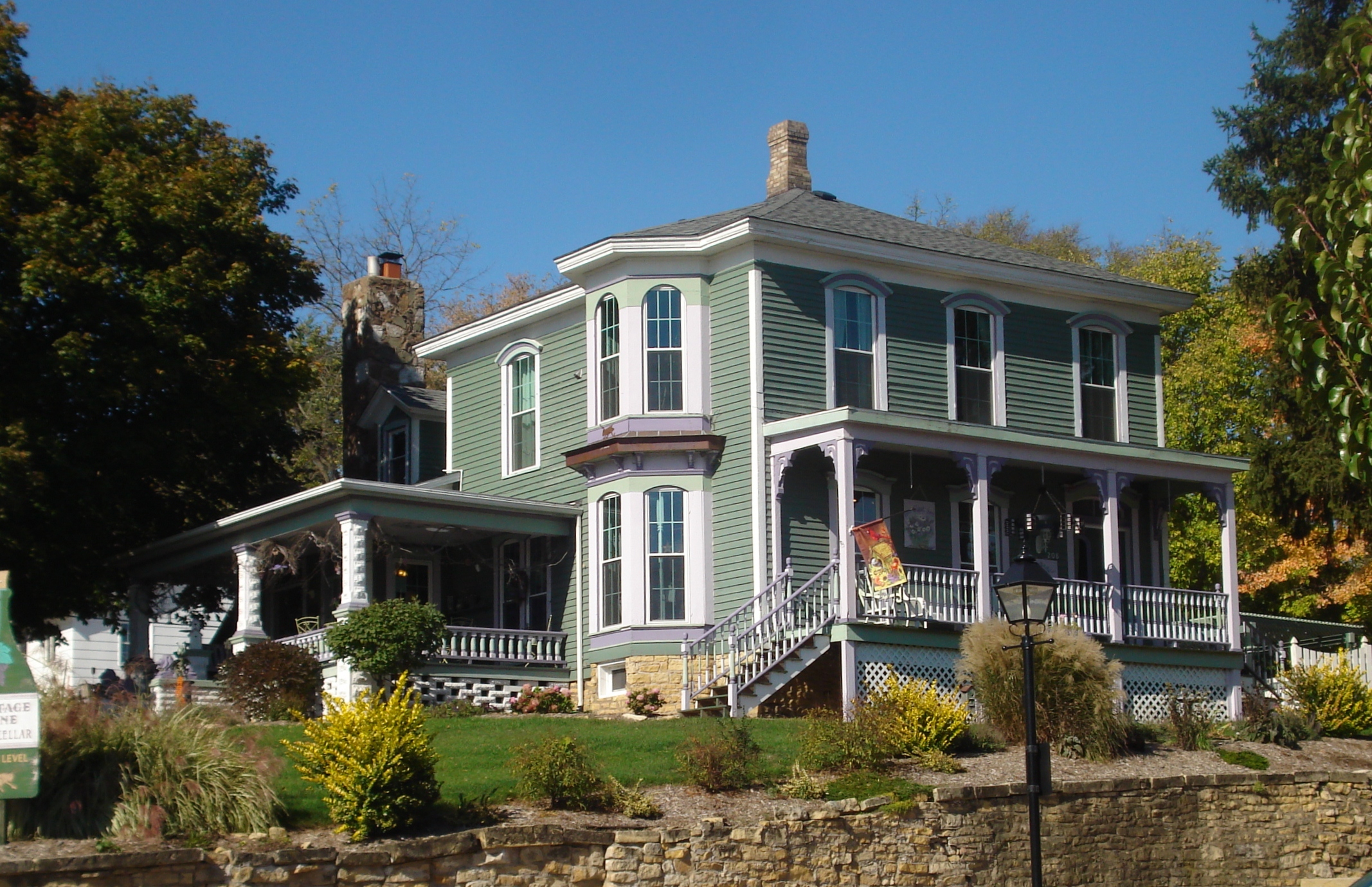
41°40′18.992″N 90°20′24.36″W / 41.67194222°N 90.3401°W / 41.67194222; -90.3401 (Community Building)Princeton A former commercial building that now houses the Boll's Community Center. 9 Dawley House 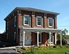
01979-04-13 April 13, 1979 127 S. 2nd St.
41°35′48″N 90°20′41″W / 41.59667°N 90.34472°W / 41.59667; -90.34472 (Dawley House)LeClaire An 1851 vernacular Italianate style house that is part of the Houses of Mississippi River Men Thematic Resource. 10 East Hill House and Carriage House 01999-11-22 November 22, 1999 5004 State St.
41°32′36″N 90°28′1″W / 41.54333°N 90.46694°W / 41.54333; -90.46694 (East Hill House and Carriage House)Riverdale A 1926 Colonial Revival style residence. 11 Eldridge Turn-Halle 01987-02-05 February 5, 1987 102 W. LeClaire St.
41°39′18″N 90°34′59″W / 41.655°N 90.58306°W / 41.655; -90.58306 (Eldridge Turn--Halle)Eldridge A former Turnverein that is now a commercial building. 12 James Gamble House 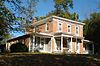
01979-03-30 March 30, 1979 527 Wisconsin Ave.
41°35′52″N 90°20′57″W / 41.59778°N 90.34917°W / 41.59778; -90.34917 (Gamble, James, House)LeClaire An 1855 Italianate style residence. 13 Horton-Suiter House 01979-04-13 April 13, 1979 102 N. 2nd St.
41°35′52″N 90°20′42″W / 41.59778°N 90.345°W / 41.59778; -90.345 (Horton-Suiter House)LeClaire A house from 1860 that is part of the Houses of Mississippi River Men Thematic Resource. 14 Kattenbracher House 01979-04-13 April 13, 1979 1125 N. 2nd St.
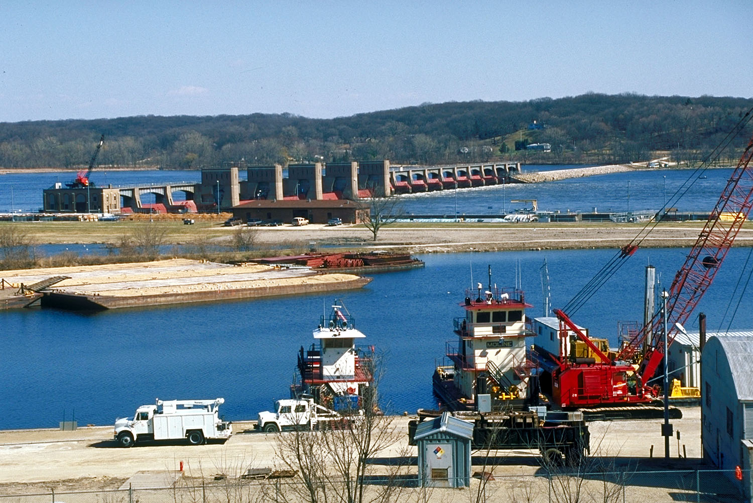
41°35′56″N 90°20′37″W / 41.59889°N 90.34361°W / 41.59889; -90.34361 (Kattenbracher House)LeClaire A house from 1860 that is part of the Houses of Mississippi River Men Thematic Resource. 15 Lock and Dam No. 14 Historic District 
02004-03-10 March 10, 2004 25549 182nd St.
41°34′29.14″N 90°24′21.28″W / 41.5747611°N 90.4059111°W / 41.5747611; -90.4059111 (Lock and Dam No. 14 Historic District)Pleasant Valley Township Historic District that includes one building, six structures, and two objects. 16 LONESTAR 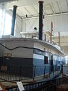
01989-12-20 December 20, 1989 Buffalo Bill Museum
41°36′26″N 90°19′43″W / 41.60722°N 90.32861°W / 41.60722; -90.32861 (LONESTAR)LeClaire An 1868 wooden, paddlewheel, steam-powered, towboat that is a part of the Buffalo Bill Museum. 17 McCaffrey House 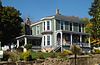
01979-04-13 April 13, 1979 208 N. Cody Rd.
41°35′56″N 90°20′37″W / 41.59889°N 90.34361°W / 41.59889; -90.34361 (McCaffrey House)LeClaire An 1870 vernacular Italianate style house that is part of the Houses of Mississippi River Men Thematic Resource. 18 Nebergall "Knoll Crest" Round Barn 01986-06-30 June 30, 1986 Telegraph Rd.
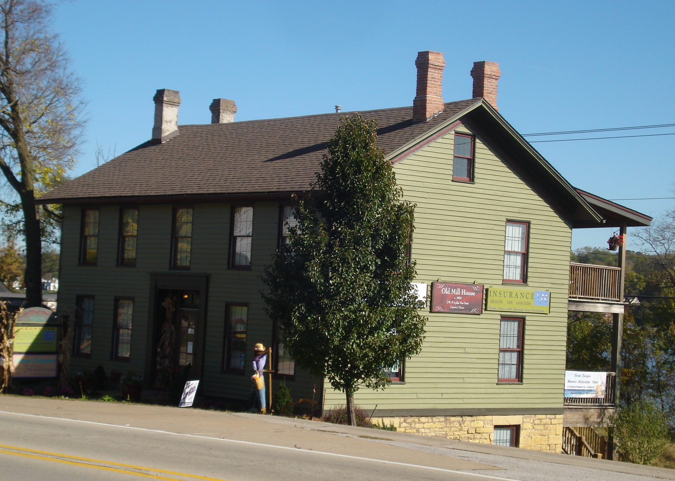
41°30′59″N 90°42′54″W / 41.51639°N 90.715°W / 41.51639; -90.715 (Nebergall "Knoll Crest" Round Barn)Blue Grass A round barn that was built by Benton Steele in 1914. 19 Old Mill House 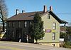
01979-04-13 April 13, 1979 419 N. Cody Rd.
41°36′6″N 90°20′36″W / 41.60167°N 90.34333°W / 41.60167; -90.34333 (Old Mill House)LeClaire An 1851 Greek Revival style residence that is part of the Houses of Mississippi River Men Thematic Resource. 20 Rambo House 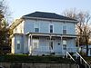
01979-04-13 April 13, 1979 430 N. Cody Rd.
41°36′6″N 90°20′38″W / 41.60167°N 90.34389°W / 41.60167; -90.34389 (Rambo House)LeClaire An 1855 Italianate style house that is part of the Houses of Mississippi River Men Thematic Resource. 21 Regina Coeli Monastery 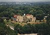
01994-01-28 January 28, 1994 1401 Central Ave.
41°31′51″N 90°30′45″W / 41.53083°N 90.5125°W / 41.53083; -90.5125 (Regina Coeli Monastery)Bettendorf A former monastery that was built for Discalced Carmelite nuns. The Romanesque Revival style building became a hotel and now houses an addictions rehabilitation facility. 22 John Smith House 01979-04-13 April 13, 1979 426 Dodge
41°35′50″N 90°20′54″W / 41.59722°N 90.34833°W / 41.59722; -90.34833 (Smith, John, House)LeClaire A house built in 1852 that is part of the Houses of Mississippi River Men Thematic Resource. 23 Roswell Spencer House 01982-04-22 April 22, 1982 Off U.S. Route 67
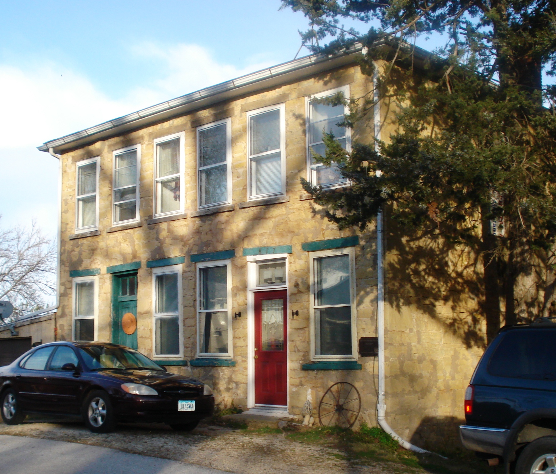
41°34′11″N 90°25′24″W / 41.56972°N 90.42333°W / 41.56972; -90.42333 (Spencer, Roswell, House)Pleasant Valley Township House built in 1850. 24 Stone House 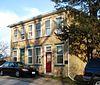
01983-07-07 July 7, 1983 817 N. 2nd St.
41°36′22″N 90°20′42″W / 41.60611°N 90.345°W / 41.60611; -90.345 (Stone House)LeClaire 25 Stone School 01977-12-27 December 27, 1977 West of LeClaire
41°36′43″N 90°23′55″W / 41.61194°N 90.39861°W / 41.61194; -90.39861 (Stone School)LeClaire 26 George Tromley, Jr., House 01979-04-13 April 13, 1979 127 Jones St.
41°35′55″N 90°20′40″W / 41.59861°N 90.34444°W / 41.59861; -90.34444 (Tromley, George, Jr., House)LeClaire A house built in 1865 that is part of the Houses of Mississippi River Men Thematic Resource. 27 George Tromley, Sr., House 01979-04-13 April 13, 1979 806 N. Cody Rd.
41°36′22″N 90°20′40″W / 41.60611°N 90.34444°W / 41.60611; -90.34444 (Tromley, George, Sr., House)LeClaire A house built in 1850 that is part of the Houses of Mississippi River Men Thematic Resource. 28 Jacob Suiter House 
01979-04-13 April 13, 1979 214 S. 2nd St.
41°35′52″N 90°20′45″W / 41.59778°N 90.34583°W / 41.59778; -90.34583 (Suiter, Jacob, House)LeClaire A vernacular Italianate style house built in 1860 that is part of the Houses of Mississippi River Men Thematic Resource. 29 John H. Suiter House 01979-04-13 April 13, 1979 1220 N. 2nd St.
41°36′48″N 90°27′13″W / 41.61333°N 90.45361°W / 41.61333; -90.45361 (Suiter, John H., House)LeClaire A house built in 1855 that is part of the Houses of Mississippi River Men Thematic Resource. 30 William Suiter House 01979-04-13 April 13, 1979 227 Wisconsin
41°35′52″N 90°20′45″W / 41.59778°N 90.34583°W / 41.59778; -90.34583 (Suiter, William, House)LeClaire A house built in 1855 that is part of the Houses of Mississippi River Men Thematic Resource. 31 Samuel Van Sant House 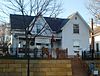
01979-04-13 April 13, 1979 322 N. Cody Rd.
41°36′0″N 90°20′37″W / 41.6°N 90.34361°W / 41.6; -90.34361 (Van Sant, Samuel, House)LeClaire A house built in 1860 that is part of the Houses of Mississippi River Men Thematic Resource. See also
References
- ^ The latitude and longitude information provided in this table was derived originally from the National Register Information System, which has been found to be fairly accurate for about 99% of listings. For about 1% of NRIS original coordinates, experience has shown that one or both coordinates are typos or otherwise extremely far off; some corrections may have been made. A more subtle problem causes many locations to be off by up to 150 yards, depending on location in the country: most NRIS coordinates were derived from tracing out latitude and longitudes off of USGS topographical quadrant maps created under the North American Datum of 1927, which differs from the current, highly accurate WGS84 GPS system used by Google maps. Chicago is about right, but NRIS longitudes in Washington are higher by about 4.5 seconds, and are lower by about 2.0 seconds in Maine. Latitudes differ by about 1.0 second in Florida. Some locations in this table may have been corrected to current GPS standards.
- ^ Martha H. Bowers (January, 1982). "NRHP Multiple Resource Assessment: Historical and Architectural Resources of Davenport". National Park Service. http://pdfhost.focus.nps.gov/docs/NRHP/Text/64000149.pdf. (pages 1-30 of PDF document)
- ^ Martha H. Bowers (July, 1983). "NRHP Multiple Resource Assessment: Historical and Architectural Resources of Davenport, Iowa (Part II)". National Park Service. http://pdfhost.focus.nps.gov/docs/NRHP/Text/64000149.pdf. Northwest and north-central Davenport, the Fulton Addition, and McClellan Heights (pages 30-69 of PDF document)
- ^ "National Register of Historic Places: Weekly List Actions". National Park Service, United States Department of the Interior. Retrieved on November 10, 2011.
- ^ Numbers represent an ordering by significant words. Various colorings, defined here, differentiate National Historic Landmark sites and National Register of Historic Places Districts from other NRHP buildings, structures, sites or objects.
- ^ "National Register Information System". National Register of Historic Places. National Park Service. 2008-04-24. http://nrhp.focus.nps.gov/natreg/docs/All_Data.html.
v · d · eU.S. National Register of Historic Places Topics Lists by states Alabama • Alaska • Arizona • Arkansas • California • Colorado • Connecticut • Delaware • Florida • Georgia • Hawaii • Idaho • Illinois • Indiana • Iowa • Kansas • Kentucky • Louisiana • Maine • Maryland • Massachusetts • Michigan • Minnesota • Mississippi • Missouri • Montana • Nebraska • Nevada • New Hampshire • New Jersey • New Mexico • New York • North Carolina • North Dakota • Ohio • Oklahoma • Oregon • Pennsylvania • Rhode Island • South Carolina • South Dakota • Tennessee • Texas • Utah • Vermont • Virginia • Washington • West Virginia • Wisconsin • WyomingLists by territories Lists by associated states Other v · d · eQuad Cities and surrounding metropolitan area of Iowa and Illinois Iowa Illinois - Henry County
- Mercer County
- Rock Island County
- Moline
- Rock Island
- East Moline
- Aledo
- Annawan
- Andalusia
- Barstow
- Bishop Hill
- Buffalo Prairie
- Cambridge
- Carbon Cliff
- Cleveland
- Coal Valley
- Colona
- Coyne Center
- Dayton
- Edgington
- Galva
- Geneseo
- Green River
- Hampton
- Hillsdale
- Hooppole
- Kewanee
- Illinois City
- Milan
- Nekoma
- Oak Grove
- Orion
- Ophiem
- Osco
- Port Byron
- Reylonds
- Swedona
- Silvis
- Woodhull
Attractions - Antique Archeology
- Bix 7
- Davenport Skybridge
- Festival of Trees
- Figge Art Museum
- i wireless Center
- Iowa 80
- Isle of Capri Casinos
- Jumer's Casino & Hotel
- Mississippi River
- Modern Woodmen Park
- Niabi Zoo
- NorthPark Mall
- Putnam Museum and IMAX Theater
- Quad City International Airport
- River Music Experience
- SouthPark Mall
- TPC at Deere Run
Colleges Historical Places - Scott County
- Rock Island County
- Henry County
- Mercer County
v · d · eMunicipalities and communities of Scott County, Iowa Cities Bettendorf | Blue Grass‡ | Buffalo | Davenport | Dixon | Donahue | Durant‡ | Eldridge | Le Claire | Long Grove | Maysville | McCausland | New Liberty | Panorama Park | Princeton | Riverdale | Walcott‡

Townships Allens Grove | Blue Grass | Buffalo | Butler | Cleona | Hickory Grove | Le Claire | Liberty | Lincoln | Pleasant Valley | Princeton | Sheridan | Winfield
CDP Unincorporated
communityFootnotes ‡This populated place also has portions in an adjacent county or counties
Categories:- National Register of Historic Places in Iowa by county
- National Register of Historic Places in Scott County, Iowa
Wikimedia Foundation. 2010.
Look at other dictionaries:
National Register of Historic Places listings in Polk County, Iowa — Location of Polk County in Iowa This is a list of the National Register of Historic Places listings in Polk County, Iowa. This is intended to be a complete list of the properties and districts on the National Register of Historic Places in Polk… … Wikipedia
National Register of Historic Places listings in Johnson County, Iowa — Location of Johnson County in Iowa This is a list of the National Register of Historic Places listings in Johnson County, Iowa. This is intended to be a complete list of the properties and districts on the National Register of Historic Places in… … Wikipedia
National Register of Historic Places listings in Floyd County, Iowa — Location of Floyd County in Iowa This is a list of the National Register of Historic Places listings in Floyd County, Iowa. This is intended to be a complete list of the properties and districts on the National Register of Historic Places in… … Wikipedia
National Register of Historic Places listings in Fayette County, Iowa — Location of Fayette County in Iowa This is a list of the National Register of Historic Places listings in Fayette County, Iowa. This is intended to be a complete list of the properties and districts on the National Register of Historic Places in… … Wikipedia
National Register of Historic Places listings in Dubuque County, Iowa — Location of Dubuque County in Iowa This is a list of the National Register of Historic Places listings in Dubuque County, Iowa. This is intended to be a complete list of the properties and districts on the National Register of Historic Places in… … Wikipedia
National Register of Historic Places listings in Hardin County, Iowa — Location of Hardin County in Iowa This is a list of the National Register of Historic Places listings in Hardin County, Iowa. This is intended to be a complete list of the properties and districts on the National Register of Historic Places in… … Wikipedia
National Register of Historic Places listings in Lee County, Iowa — Location of Lee County in Iowa This is a list of the National Register of Historic Places listings in Lee County, Iowa. This is intended to be a complete list of the properties and districts on the National Register of Historic Places in Lee… … Wikipedia
National Register of Historic Places listings in Mahaska County, Iowa — Location of Mahaska County in Iowa This is a list of the National Register of Historic Places listings in Mahaska County, Iowa. This is intended to be a complete list of the properties and districts on the National Register of Historic Places in… … Wikipedia
National Register of Historic Places listings in Pottawattamie County, Iowa — Location of Pottawattamie County in Iowa This is a list of the National Register of Historic Places listings in Pottawattamie County, Iowa. This is intended to be a complete list of the properties and districts on the National Register of… … Wikipedia
National Register of Historic Places listings in Allamakee County, Iowa — Location of Allamakee County in Iowa This is a list of the National Register of Historic Places listings in Allamakee County, Iowa. This is intended to be a complete list of the properties and districts on the National Register of Historic Places … Wikipedia
 18+© Academic, 2000-2024
- Contact us: Technical Support, Advertising
Dictionaries export, created on PHP, Joomla, Drupal, WordPress, MODx.Share the article and excerpts
-
National Register of Historic Places listings in Scott County, Iowa
- National Register of Historic Places listings in Scott County, Iowa
-
NRHP Scott County Downtown Davenport East Davenport West Davenport