- National Register of Historic Places listings in Audubon County, Iowa
-
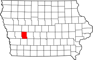 Location of Audubon County in Iowa
This is a list of the National Register of Historic Places listings in Audubon County, Iowa.
This is intended to be a complete list of the properties and districts on the National Register of Historic Places in Audubon County, Iowa, United States. Latitude and longitude coordinates are provided for many National Register properties and districts; these locations may be seen together in a Google map.[1]
There are 13 properties and districts listed on the National Register in the county.
-
- This National Park Service list is complete through NPS recent listings posted November 10, 2011.[2]
[3] Landmark name [4] Image Date listed Location City or town Summary 1 Audubon County Court House August 28, 2003 318 Leroy St.
41°43′16″N 94°55′43″W / 41.721111°N 94.928611°WAudubon 2 Audubon County Courthouse July 26, 1977 Washington and Kilworth Sts.
41°35′26″N 94°52′44″W / 41.590556°N 94.878889°WExira 3 Bennedsen, Boldt, and Hansen Building October 3, 1991 Main St.
41°37′43″N 95°04′20″W / 41.628611°N 95.072222°WKimballton 4 Bethany Danish Evangelical Lutheran Church October 3, 1991 1.5 miles north of Iowa Highway 44 and 1 mile east of Iowa Highway 68
41°39′08″N 95°03′11″W / 41.652222°N 95.053056°WKimballton 5 John D. Bush House October 3, 1991 219 N. Kilworth
41°35′38″N 94°52′31″W / 41.593889°N 94.875278°WExira 6 Andrew P. Hansen Farmstead October 3, 1991 Between Iowa Highway 44 and County Road P58 on Little Elkhorn Creek
41°35′45″N 94°59′06″W / 41.595833°N 94.985°WBrayton 7 Immanuel Danish Evangelical Lutheran Church October 3, 1991 Eastern side of W. 2nd St.
41°37′47″N 95°04′28″W / 41.629722°N 95.074444°WKimballton 8 Hans J. Jorgensen Barn October 3, 1991 Junction of Iowa Highway 44 and Main St.
41°37′55″N 95°04′25″W / 41.631944°N 95.073611°WKimballton 9 Kimballton Commercial District August 18, 1995 Junction of Alfred and Main Sts.
41°37′44″N 95°04′20″W / 41.628889°N 95.072222°WKimballton 10 Kimballton West 2nd-West 3rd Street Residential District August 18, 1995 Roughly W. 2nd St. from Iowa Highway 44 to south of Odense St. and W. 3rd St. from Iowa Highway 44 to Esbeck St.
41°37′43″N 95°04′32″W / 41.628611°N 95.075556°WKimballton 11 Hans M. Koch House October 3, 1991 Western side of Iowa Highway 173, 0.5 miles south of Kimballton
41°37′12″N 95°04′24″W / 41.62°N 95.073333°WKimballton 12 Jens T. Larsen House October 3, 1991 103 Main St.
41°37′38″N 95°04′22″W / 41.627222°N 95.072778°WKimballton 13 Poplar Rural District April 9, 1992 Roughly the area from Poplar south and west to Wolf Creek
41°40′28″N 95°06′29″W / 41.674444°N 95.108056°WJacksonville See also
References
- ^ The latitude and longitude information provided in this table was derived originally from the National Register Information System, which has been found to be fairly accurate for about 99% of listings. For about 1% of NRIS original coordinates, experience has shown that one or both coordinates are typos or otherwise extremely far off; some corrections may have been made. A more subtle problem causes many locations to be off by up to 150 yards, depending on location in the country: most NRIS coordinates were derived from tracing out latitude and longitudes off of USGS topographical quadrant maps created under the North American Datum of 1927, which differs from the current, highly accurate WGS84 GPS system used by Google maps. Chicago is about right, but NRIS longitudes in Washington are higher by about 4.5 seconds, and are lower by about 2.0 seconds in Maine. Latitudes differ by about 1.0 second in Florida. Some locations in this table may have been corrected to current GPS standards.
- ^ "National Register of Historic Places: Weekly List Actions". National Park Service, United States Department of the Interior. Retrieved on November 10, 2011.
- ^ Numbers represent an ordering by significant words. Various colorings, defined here, differentiate National Historic Landmark sites and National Register of Historic Places Districts from other NRHP buildings, structures, sites or objects.
- ^ "National Register Information System". National Register of Historic Places. National Park Service. . http://nrhp.focus.nps.gov/natreg/docs/All_Data.html.
U.S. National Register of Historic Places Topics Lists by states Alabama • Alaska • Arizona • Arkansas • California • Colorado • Connecticut • Delaware • Florida • Georgia • Hawaii • Idaho • Illinois • Indiana • Iowa • Kansas • Kentucky • Louisiana • Maine • Maryland • Massachusetts • Michigan • Minnesota • Mississippi • Missouri • Montana • Nebraska • Nevada • New Hampshire • New Jersey • New Mexico • New York • North Carolina • North Dakota • Ohio • Oklahoma • Oregon • Pennsylvania • Rhode Island • South Carolina • South Dakota • Tennessee • Texas • Utah • Vermont • Virginia • Washington • West Virginia • Wisconsin • WyomingLists by territories Lists by associated states Other Municipalities and communities of Audubon County, Iowa Cities Audubon | Brayton | Exira | Gray | Kimballton

Townships Categories:- National Register of Historic Places in Iowa by county
- Audubon County, Iowa
- Buildings and structures in Audubon County, Iowa
-


Wikimedia Foundation. 2010.