- National Register of Historic Places listings in Pottawattamie County, Iowa
-
 Location of Pottawattamie County in Iowa
This is a list of the National Register of Historic Places listings in Pottawattamie County, Iowa.
This is intended to be a complete list of the properties and districts on the National Register of Historic Places in Pottawattamie County, Iowa, United States. Latitude and longitude coordinates are provided for many National Register properties and districts; these locations may be seen together in a Google map.[1]
There are 34 properties and districts listed on the National Register in the county, including one National Historic Landmark. Two other sites were once listed on the Register but have been removed.
-
- This National Park Service list is complete through NPS recent listings posted November 10, 2011.[2]
[3] Landmark name [4] Image Date listed Location City or town Summary 1 100 Block of West Broadway Historic District 
May 9, 2002 W. Broadway, 1st St., and 4th St.
41°15′46″N 95°50′42″W / 41.262778°N 95.845°WCouncil Bluffs 2 Bennett Building August 8, 2001 405 West Broadway
41°15′38″N 95°50′57″W / 41.260556°N 95.849167°WCouncil Bluffs 3 August Beresheim House August 13, 1976 621 3rd St.
41°15′16″N 95°50′52″W / 41.254444°N 95.847778°WCouncil Bluffs 4 Carstens Farmstead July 10, 1979 South of Shelby on Iowa Highway 168
41°28′57″N 95°27′22″W / 41.4825°N 95.456111°WShelby 5 Thomas E. Cavin House 
September 27, 1984 150 Park Ave.
41°15′36″N 95°50′39″W / 41.26°N 95.844167°WCouncil Bluffs 6 Chevra B'nai Yisroel Synagogue March 7, 2007 618 Mynster St.
41°15′52″N 95°51′09″W / 41.264444°N 95.8525°WCouncil Bluffs 7 Chicago, Rock Island & Pacific Railroad Passenger Depot 
July 21, 1995 1512 S. Main St.
41°14′49″N 95°51′08″W / 41.246944°N 95.852222°WCouncil Bluffs 8 Council Bluffs Free Public Library 
January 27, 1999 200 Pearl St.
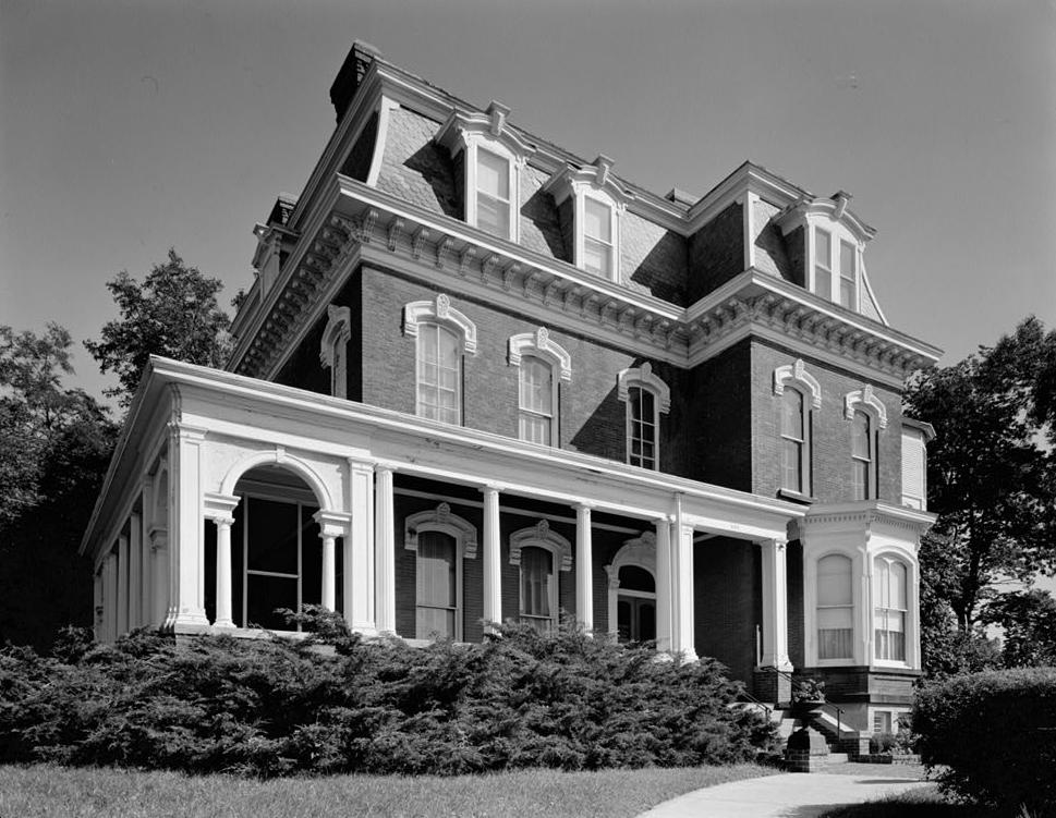
41°15′29″N 95°51′04″W / 41.258056°N 95.851111°WCouncil Bluffs 9 Grenville M. Dodge House 
October 15, 1966 605 S. 3rd St.
41°15′17″N 95°50′50″W / 41.254722°N 95.847222°WCouncil Bluffs 10 Ruth Anne Dodge Memorial February 8, 1980 Fairview Cemetery
41°16′02″N 95°50′51″W / 41.267222°N 95.8475°WCouncil Bluffs 11 Eckle Round Barn June 30, 1986 Off Iowa Highway 168
41°30′20″N 95°29′37″W / 41.505556°N 95.493611°WShelby 12 German Bank Building of Walnut, Iowa May 1, 1991 Junction of Highland and Central Sts.
41°28′39″N 95°13′20″W / 41.4775°N 95.222222°WWalnut 13 Graceland Cemetery Chapel April 28, 1986 Graceland Cemetery, U.S. Route 59
41°29′32″N 95°20′15″W / 41.492222°N 95.3375°WAvoca 14 Hancock Savings Bank January 19, 1983 311 Main St.
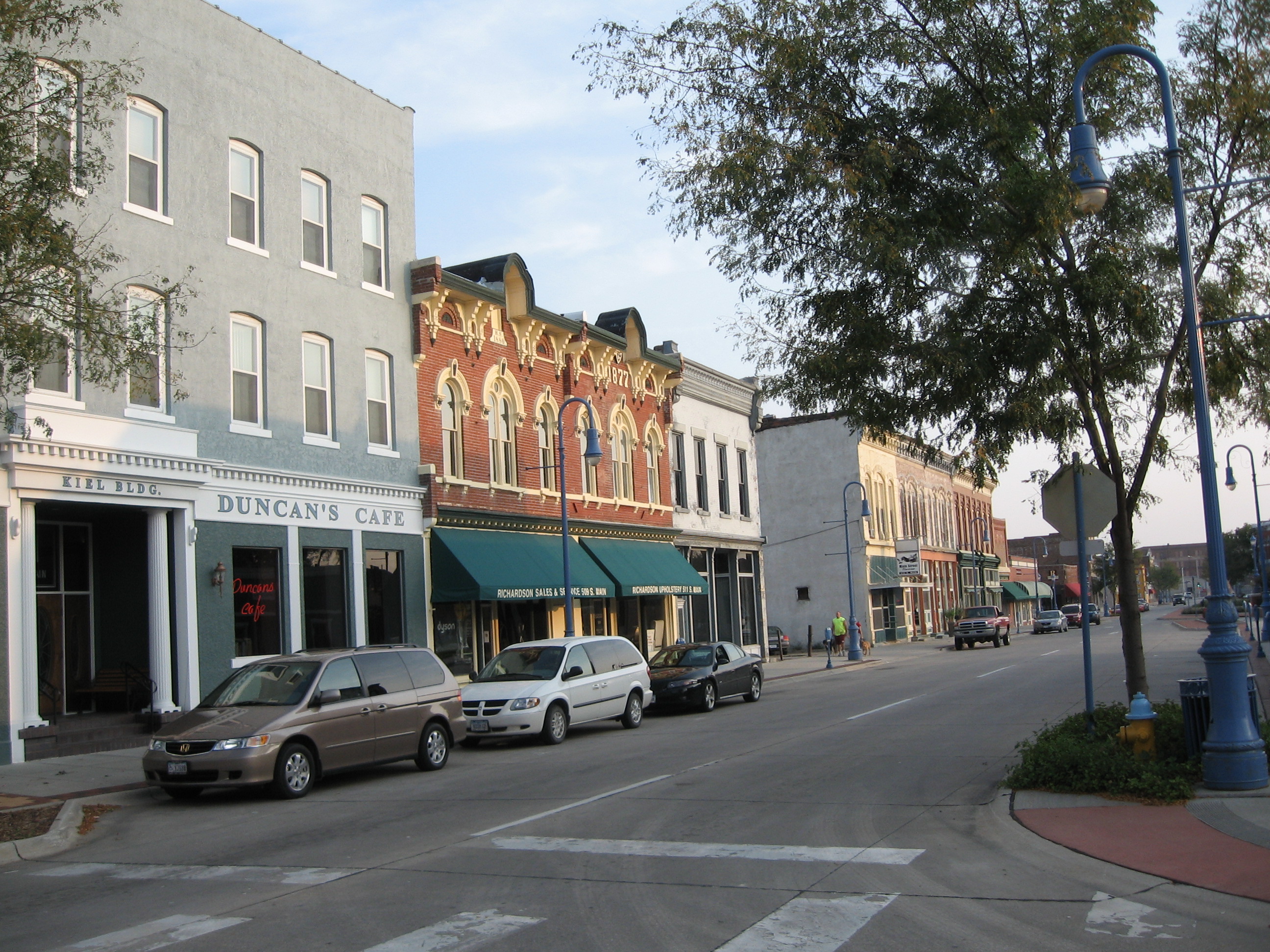
41°23′27″N 95°21′43″W / 41.390833°N 95.361944°WHancock 15 Haymarket Commercial Historic District 
April 11, 1985 S. Main St.
41°15′22″N 95°51′25″W / 41.256111°N 95.856944°WCouncil Bluffs 16 Martin Hughes House September 27, 1984 903 3rd St.
41°15′11″N 95°50′53″W / 41.253056°N 95.848056°WCouncil Bluffs 17 Hughes-Irons Motor Company June 23, 2011 149-161 W. Broadway
41°15′45″N 95°50′42″W / 41.2625°N 95.845°WCouncil Bluffs 18 Thomas Jefferis House 
December 25, 1979 523 6th Ave.
41°15′21″N 95°51′07″W / 41.255833°N 95.851944°WCouncil Bluffs 19 Lincoln-Fairview Historic District April 10, 2007 Roughly bounded by W. Kanesville Boulevard, Oakland Ave., Fairview Cemetery, and N. 1st St.
41°15′58″N 95°50′51″W / 41.266231°N 95.847633°WCouncil Bluffs 20 Charles Henry and Charlotte Norton House December 30, 2004 401 N. Chestnut St.
41°28′47″N 95°20′11″W / 41.479722°N 95.336389°WAvoca 21 Park/Glen Avenues Historic District 
April 7, 2010 101-508 Glen Ave., 102-471 Park Ave., 209 & 301 W. Pierce, & 524 & 600 Huntington
41°15′32″N 95°50′38″W / 41.258897°N 95.843767°WCouncil Bluffs 22 Pioneer Implement Company 
April 30, 2008 1000 S. Main St.
41°15′09″N 95°51′06″W / 41.25244°N 95.85165°WCouncil Bluffs 23 Pottawattamie County Jail 
March 16, 1972 226 Pearl St.
41°16′35″N 95°50′39″W / 41.276389°N 95.844167°WCouncil Bluffs 24 Pottawattamie County Sub Courthouse July 2, 1981 Elm St.
41°28′41″N 95°20′19″W / 41.478056°N 95.338611°WAvoca 25 Reverend Little's Young Ladies Seminary 
February 4, 1982 541 6th Ave.
41°15′22″N 95°51′08″W / 41.256111°N 95.852222°WCouncil Bluffs 26 St. Peter's Church and Rectory 
July 24, 1992 1 Bluff St.
41°15′37″N 95°50′50″W / 41.260278°N 95.847222°WCouncil Bluffs 27 John J. and Agnes Shea House 
November 22, 1995 309 S. 8th St.
41°15′29″N 95°51′19″W / 41.258056°N 95.855278°WCouncil Bluffs 28 State Savings Bank June 4, 1984 509 W. Broadway
41°15′39″N 95°51′02″W / 41.260833°N 95.850556°WCouncil Bluffs 29 Lysander Tulleys House October 18, 1979 151 Park Ave.
41°15′37″N 95°50′38″W / 41.260278°N 95.843889°WCouncil Bluffs 30 Francis A. and Rose M. Turner House January 31, 1997 1004 Cherry St.
41°30′06″N 95°20′06″W / 41.501667°N 95.335°WAvoca 31 O.P. Wickham House 
June 18, 1979 616 S. 7th St.
41°15′19″N 95°51′17″W / 41.255278°N 95.854722°WCouncil Bluffs 32 Wickham-De Vol House 
May 4, 1995 332 Willow Ave.
41°15′30″N 95°50′54″W / 41.258333°N 95.848333°WCouncil Bluffs 33 Willow-Bluff-3rd Street Historic District September 15, 2005 Roughly bounded by Worth, High School Ave., Clark Ave., and the western side of Bluff St.
41°15′24″N 95°50′51″W / 41.256667°N 95.8475°WCouncil Bluffs 34 Y.M.C.A. Building 
June 27, 1979 628 1st Ave.
41°15′37″N 95°51′13″W / 41.260278°N 95.853611°WCouncil Bluffs Former listings
Landmark name Image Date listed/removed Location City or Town Summary 1 Ogden House Listed September 13, 1976
Removed March 27, 2007169 W. Broadway
41°15′44″N 95°50′44″W / 41.26222°N 95.84556°WCouncil Bluffs 2 South Omaha Bridge 
Listed June 29, 1992
Removed July 14, 2011U.S. Route 275/Nebraska Highway 92 over the Missouri River
41°12′47″N 95°55′57″W / 41.21306°N 95.9325°WCouncil Bluffs Spanned Missouri River to Council Bluffs, Iowa; Highway Bridges in Nebraska MPS; demolished in February and March 2010[5] See also
References
- ^ The latitude and longitude information provided in this table was derived originally from the National Register Information System, which has been found to be fairly accurate for about 99% of listings. For about 1% of NRIS original coordinates, experience has shown that one or both coordinates are typos or otherwise extremely far off; some corrections may have been made. A more subtle problem causes many locations to be off by up to 150 yards, depending on location in the country: most NRIS coordinates were derived from tracing out latitude and longitudes off of USGS topographical quadrant maps created under the North American Datum of 1927, which differs from the current, highly accurate WGS84 GPS system used by Google maps. Chicago is about right, but NRIS longitudes in Washington are higher by about 4.5 seconds, and are lower by about 2.0 seconds in Maine. Latitudes differ by about 1.0 second in Florida. Some locations in this table may have been corrected to current GPS standards.
- ^ "National Register of Historic Places: Weekly List Actions". National Park Service, United States Department of the Interior. Retrieved on November 10, 2011.
- ^ Numbers represent an ordering by significant words. Various colorings, defined here, differentiate National Historic Landmark sites and National Register of Historic Places Districts from other NRHP buildings, structures, sites or objects.
- ^ "National Register Information System". National Register of Historic Places. National Park Service. . http://nrhp.focus.nps.gov/natreg/docs/All_Data.html.
- ^ Kaufman, Kirby (March 14, 2010). "Rest of Veterans bridge demolished". Omaha World-Herald. http://www.omaha.com/article/20100314/NEWS01/100319768. Retrieved July 27, 2011.
U.S. National Register of Historic Places Topics Lists by states Alabama • Alaska • Arizona • Arkansas • California • Colorado • Connecticut • Delaware • Florida • Georgia • Hawaii • Idaho • Illinois • Indiana • Iowa • Kansas • Kentucky • Louisiana • Maine • Maryland • Massachusetts • Michigan • Minnesota • Mississippi • Missouri • Montana • Nebraska • Nevada • New Hampshire • New Jersey • New Mexico • New York • North Carolina • North Dakota • Ohio • Oklahoma • Oregon • Pennsylvania • Rhode Island • South Carolina • South Dakota • Tennessee • Texas • Utah • Vermont • Virginia • Washington • West Virginia • Wisconsin • WyomingLists by territories Lists by associated states Other Municipalities and communities of Pottawattamie County, Iowa Cities Avoca | Carson | Carter Lake | Council Bluffs | Crescent | Hancock | Macedonia | McClelland | Minden | Neola | Oakland | Shelby‡ | Treynor | Underwood | Walnut

Unincorporated
communityHoney Creek
Footnotes ‡This populated place also has portions in an adjacent county or counties
Categories:- National Register of Historic Places in Iowa by county
- Pottawattamie County, Iowa
- Buildings and structures in Pottawattamie County, Iowa
-


Wikimedia Foundation. 2010.