- National Register of Historic Places listings in Muscatine County, Iowa
-
 Location of Muscatine County in Iowa
This is a list of the National Register of Historic Places listings in Muscatine County, Iowa.
This is intended to be a complete list of the properties and districts on the National Register of Historic Places in Muscatine County, Iowa, United States. Latitude and longitude coordinates are provided for many National Register properties and districts; these locations may be seen together in a Google map.[1]
There are 26 properties and districts listed on the National Register in the county.
-
- This National Park Service list is complete through NPS recent listings posted November 10, 2011.[2]
Current listings
[3] Landmark name [4] Image Date listed Location City or town Summary 1 Big Slough Creek Bridge 
May 15, 1998 Bancroft Ave. over Big Slough Creek
41°28′38″N 91°20′53″W / 41.477222°N 91.348056°WNichols 2 Bridge near West Liberty 
May 15, 1998 120th St. over an unnamed stream
41°34′06″N 91°19′24″W / 41.568333°N 91.323333°WWest Liberty 3 Chicago, Rock Island and Pacific Railroad-Wilton Depot August 25, 1988 N. Railroad St.
41°35′16″N 91°00′58″W / 41.587778°N 91.016111°WWilton 4 Alexander Clark House October 14, 1976 203 W. 3rd St.
41°25′17″N 91°02′53″W / 41.421389°N 91.048056°WMuscatine 5 Clark-Blackwell House January 27, 1983 206 Cherry St.
41°25′01″N 91°03′12″W / 41.416944°N 91.053333°WMuscatine 6 Downtown Commercial Historic District 
May 24, 2006 Roughly nine blocks centered on 2nd St. between Pine and Mulberry
41°25′24″N 91°02′44″W / 41.423333°N 91.045556°WMuscatine 7 Pliny and Adelia Fay House April 23, 1998 112 Locust St.
41°25′04″N 91°03′03″W / 41.417778°N 91.050833°WMuscatine 8 First Presbyterian Church September 14, 1977 401 Iowa Ave.
41°25′22″N 91°02′51″W / 41.422778°N 91.0475°WMuscatine 9 W. Joseph Fuller House December 10, 1982 1001 Mulberry Ave.
41°25′49″N 91°02′51″W / 41.430278°N 91.0475°WMuscatine 10 Greenwood Cemetery Chapel September 21, 2001 1814 Lucas
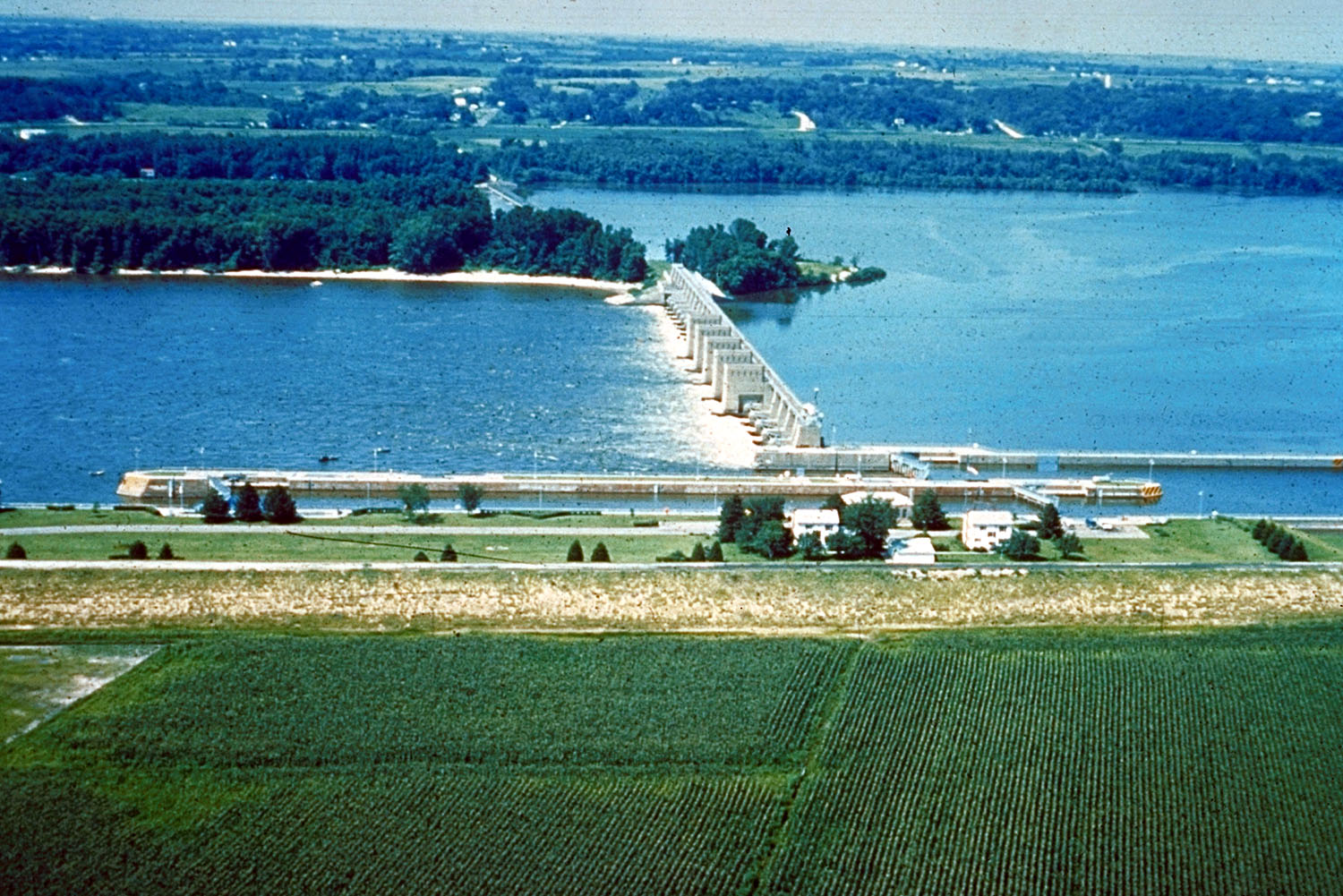
41°25′12″N 91°03′50″W / 41.42°N 91.063889°WMuscatine 11 Lock and Dam No. 16 Historic District 
March 10, 2004 33109 102nd Ave., W. Muscatine 12 S. M. McKibben House August 27, 1974 Walnut St. between Front and 2nd
41°25′21″N 91°02′32″W / 41.4225°N 91.042222°WMuscatine 13 Muscatine County Courthouse 
July 2, 1981 3rd St.
41°25′28″N 91°02′35″W / 41.424444°N 91.043056°WMuscatine 14 Samuel Nichols House March 31, 1978 East of Nichols off Iowa Highway 22
41°28′43″N 91°16′58″W / 41.478611°N 91.282778°WNichols 15 Old Jail July 24, 1974 411 E. 4th St.
41°25′49″N 91°02′37″W / 41.430278°N 91.043611°WMuscatine 16 Pine Creek Gristmill 
December 10, 1979 Northeast of Muscatine in Wildcat Den State Park
41°28′03″N 90°52′03″W / 41.4675°N 90.8675°WMuscatine 17 Pine Mill Bridge 
May 15, 1998 Over Pine Creek in Wildcat Den State Park
41°28′03″N 90°52′02″W / 41.4675°N 90.867222°WMuscatine 18 Pine Mills German Methodist Episcopal Church October 17, 2003 180th St. and Verde Ave.
41°28′50″N 90°52′51″W / 41.480556°N 90.880833°WMuscatine 19 Sinnett Octagon House July 18, 1974 North of Muscatine near Iowa Highway 38
41°27′11″N 91°01′50″W / 41.453056°N 91.030556°WMuscatine 20 Trinity Episcopal Church October 29, 1974 411 E. 2nd St.
41°25′25″N 91°02′31″W / 41.423611°N 91.041944°WMuscatine 21 George H. and Loretta Ward House 
May 2, 1997 719 N. Calhoun St.
41°34′31″N 91°15′49″W / 41.575278°N 91.263611°WWest Liberty 22 J. C. B. Warde House April 26, 1979 205 Cherry St.
41°25′02″N 91°03′09″W / 41.417222°N 91.0525°WMuscatine 23 Welch Apartments January 15, 1979 224 Iowa Ave.
41°25′18″N 91°02′47″W / 41.421667°N 91.046389°WMuscatine 24 West Hill Historic District April 30, 2008 Roughly bounded by W. 2nd St. from Pine to Ash, W. 3rd St., and W. 4th St. from Chestnut to near Ash.
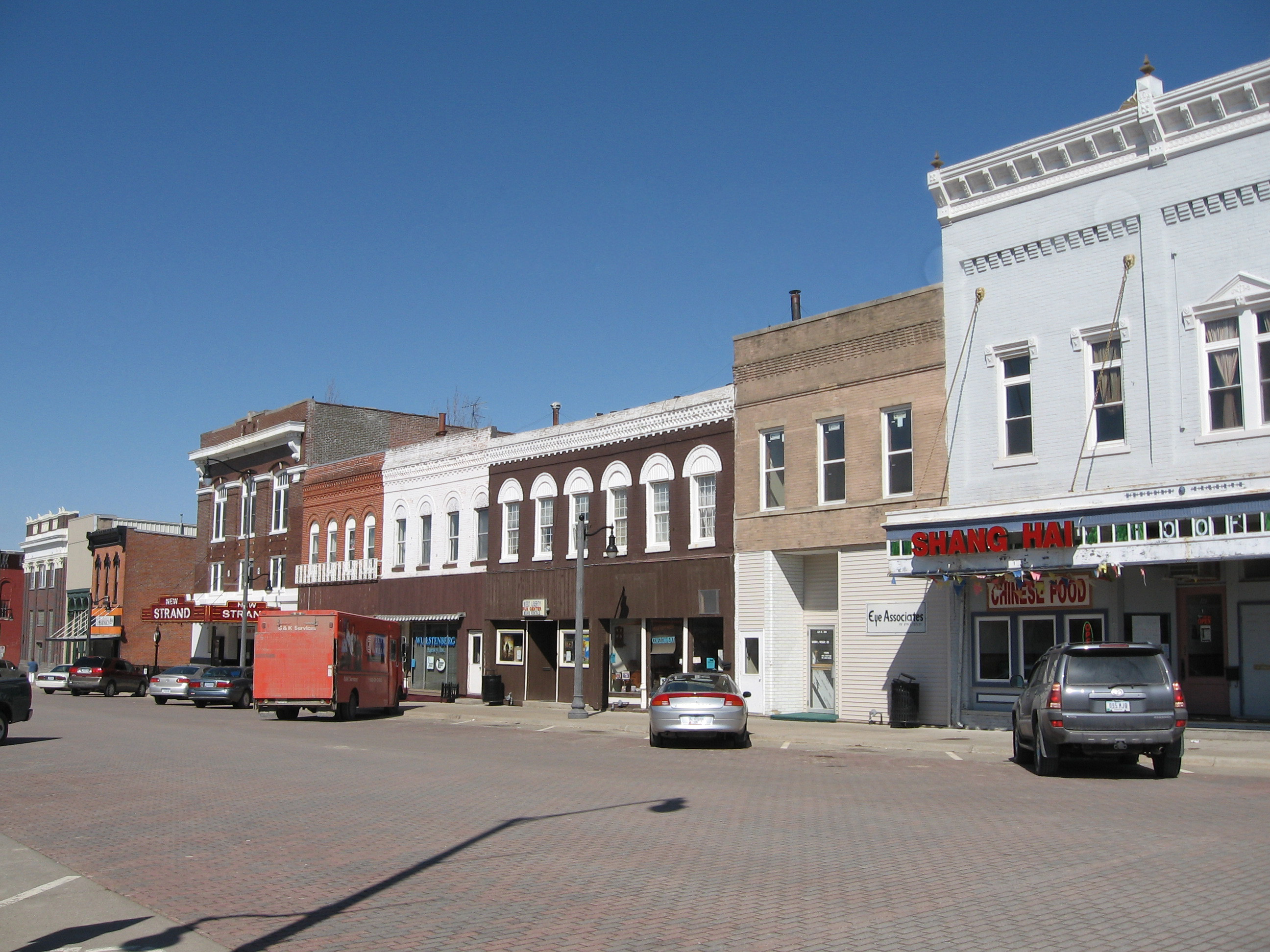
41°25′10″N 91°03′03″W / 41.4195°N 91.05095°WMuscatine 25 West Liberty Commercial Historic District 
September 12, 2002 Bounded by 4th St., railroad tracks, and Clay and Spencer Sts.
40°40′13″N 91°17′14″W / 40.670278°N 91.287222°WWest Liberty 26 Wilton Candy Kitchen January 7, 1993 310 Cedar St.
41°35′16″N 91°01′06″W / 41.587778°N 91.018333°WWilton See also
References
- ^ The latitude and longitude information provided in this table was derived originally from the National Register Information System, which has been found to be fairly accurate for about 99% of listings. For about 1% of NRIS original coordinates, experience has shown that one or both coordinates are typos or otherwise extremely far off; some corrections may have been made. A more subtle problem causes many locations to be off by up to 150 yards, depending on location in the country: most NRIS coordinates were derived from tracing out latitude and longitudes off of USGS topographical quadrant maps created under the North American Datum of 1927, which differs from the current, highly accurate WGS84 GPS system used by Google maps. Chicago is about right, but NRIS longitudes in Washington are higher by about 4.5 seconds, and are lower by about 2.0 seconds in Maine. Latitudes differ by about 1.0 second in Florida. Some locations in this table may have been corrected to current GPS standards.
- ^ "National Register of Historic Places: Weekly List Actions". National Park Service, United States Department of the Interior. Retrieved on November 10, 2011.
- ^ Numbers represent an ordering by significant words. Various colorings, defined here, differentiate National Historic Landmark sites and National Register of Historic Places Districts from other NRHP buildings, structures, sites or objects.
- ^ "National Register Information System". National Register of Historic Places. National Park Service. . http://nrhp.focus.nps.gov/natreg/docs/All_Data.html.
U.S. National Register of Historic Places Topics Lists by states Alabama • Alaska • Arizona • Arkansas • California • Colorado • Connecticut • Delaware • Florida • Georgia • Hawaii • Idaho • Illinois • Indiana • Iowa • Kansas • Kentucky • Louisiana • Maine • Maryland • Massachusetts • Michigan • Minnesota • Mississippi • Missouri • Montana • Nebraska • Nevada • New Hampshire • New Jersey • New Mexico • New York • North Carolina • North Dakota • Ohio • Oklahoma • Oregon • Pennsylvania • Rhode Island • South Carolina • South Dakota • Tennessee • Texas • Utah • Vermont • Virginia • Washington • West Virginia • Wisconsin • WyomingLists by territories Lists by associated states Other Municipalities and communities of Muscatine County, Iowa Cities Atalissa | Blue Grass‡ | Conesville | Durant‡ | Fruitland | Muscatine | Nichols | Stockton | Walcott‡ | West Liberty | Wilton

Unincorporated
communitiesArdon | Cranston | Fairport | Hinkeyville | Montpelier | Moscow | Petersburg
Footnotes ‡This populated place also has portions in an adjacent county or counties
Categories:- National Register of Historic Places in Iowa by county
- Muscatine County, Iowa
- Buildings and structures in Muscatine County, Iowa
-


Wikimedia Foundation. 2010.