- Walcott, Iowa
Infobox Settlement
official_name = Walcott, Iowa
settlement_type =City
nickname =
motto =
imagesize =
image_caption =
image_
imagesize =
image_caption =
image_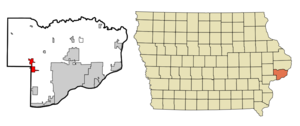
mapsize = 250x200px
map_caption = Location of Walcott, Iowa
mapsize1 =
map_caption1 =subdivision_type = Country
subdivision_name =
subdivision_type1 = State
subdivision_name1 =
subdivision_type2 = Counties
subdivision_name2 = Scott, Muscatine
government_footnotes =
government_type =
leader_title =
leader_name =
leader_title1 =
leader_name1 =
established_title =
established_date =unit_pref = Imperial
area_footnotes =area_magnitude =
area_total_km2 = 7.7
area_land_km2 = 7.7
area_water_km2 = 0.1
area_total_sq_mi = 3.0
area_land_sq_mi = 3.0
area_water_sq_mi = 0.0population_as_of = 2000
population_footnotes =
population_total = 1528
population_metro = 377291 (131st)
population_density_km2 = 199.3
population_density_sq_mi = 516.2timezone = Central (CST)
utc_offset = -6
timezone_DST = CDT
utc_offset_DST = -5
elevation_footnotes =
elevation_m = 223
elevation_ft = 732
latd = 41 |latm = 35 |lats = 25 |latNS = N
longd = 90 |longm = 46 |longs = 23 |longEW = Wpostal_code_type =
ZIP code
postal_code = 52773
area_code = 563
blank_name = FIPS code
blank_info = 19-81705
blank1_name = GNIS feature ID
blank1_info = 0462603
website =
footnotes =Walcott is a city in Muscatine and Scott Counties in the
U.S. state ofIowa . The population was 1,528 at the 2000 census. Walcott's interchange onInterstate 80 is home to an enormous complex of restaurants, motels and truck stops, including theIowa 80 truck stop which is the world's largest.Bono of U2 stopped here in 2002 on a Midwest tour to raise awareness of AIDS in Africa.Fact|date=February 2008Most of Walcott is part of the Davenport–Moline–Rock Island, IA-IL Metropolitan Statistical Area, but the Muscatine County portion of the city is considered part of the Muscatine Micropolitan Statistical Area.
Geography
Walcott is located at coor dms|41|35|25|N|90|46|23|W|city (41.590363, -90.772991)GR|1.
According to the
United States Census Bureau , the city has a total area of 3.0square mile s (7.7km² ), of which, 3.0 square miles (7.7 km²) of it is land and 0.04 square miles (0.1 km²) of it (1.01%) is water.Demographics
As of the
census GR|2 of 2000, there were 1,528 people, 623 households, and 437 families residing in the city. Thepopulation density was 516.2 people per square mile (199.3/km²). There were 644 housing units at an average density of 217.6/sq mi (84.0/km²). The racial makeup of the city was 97.38% White, 0.33% African American, 0.07% Native American, 0.52% Asian, 0.92% from other races, and 0.79% from two or more races. Hispanic or Latino of any race were 1.11% of the population.There were 623 households out of which 33.5% had children under the age of 18 living with them, 56.5% were married couples living together, 10.8% had a female householder with no husband present, and 29.7% were non-families. 26.0% of all households were made up of individuals and 9.0% had someone living alone who was 65 years of age or older. The average household size was 2.45 and the average family size was 2.94.
In the city the population was spread out with 26.0% under the age of 18, 8.7% from 18 to 24, 29.1% from 25 to 44, 23.0% from 45 to 64, and 13.2% who were 65 years of age or older. The median age was 36 years. For every 100 females there were 95.1 males. For every 100 females age 18 and over, there were 95.8 males.
The median income for a household in the city was $45,281, and the median income for a family was $52,625. Males had a median income of $40,296 versus $22,067 for females. The
per capita income for the city was $20,018. About 4.0% of families and 7.0% of the population were below thepoverty line , including 7.1% of those under age 18 and 9.2% of those age 65 or over.Town twinning
*flagicon|Germany
Bredenbek inGermany References
External links
Wikimedia Foundation. 2010.