- National Register of Historic Places listings in Black Hawk County, Iowa
-
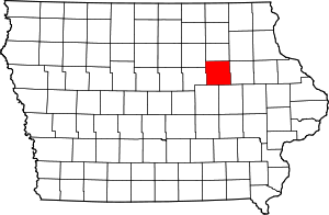 Location of Black Hawk County in Iowa
This is a list of the National Register of Historic Places listings in Black Hawk County, Iowa.
This is intended to be a complete list of the properties and districts on the National Register of Historic Places in Black Hawk County, Iowa, United States. Latitude and longitude coordinates are provided for many National Register properties and districts; these locations may be seen together in a Google map.[1]
There are 40 properties and districts listed on the National Register in the county. Another property was once listed on the Register but has since been removed.
-
- This National Park Service list is complete through NPS recent listings posted November 10, 2011.[2]
Current listings
[3] Landmark name [4] Image Date listed Location City or town Summary 1 Bennington No. 4 January 16, 2001 Junction of Bennington and Sage Rds.
42°36′00″N 92°17′50″W / 42.6°N 92.297222°WWaterloo 2 Black Hawk County Soldiers Memorial Hall November 29, 1988 194 W. 5th St.
42°29′44″N 92°20′18″W / 42.495556°N 92.338333°WWaterloo 3 Black Hawk Hotel 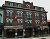
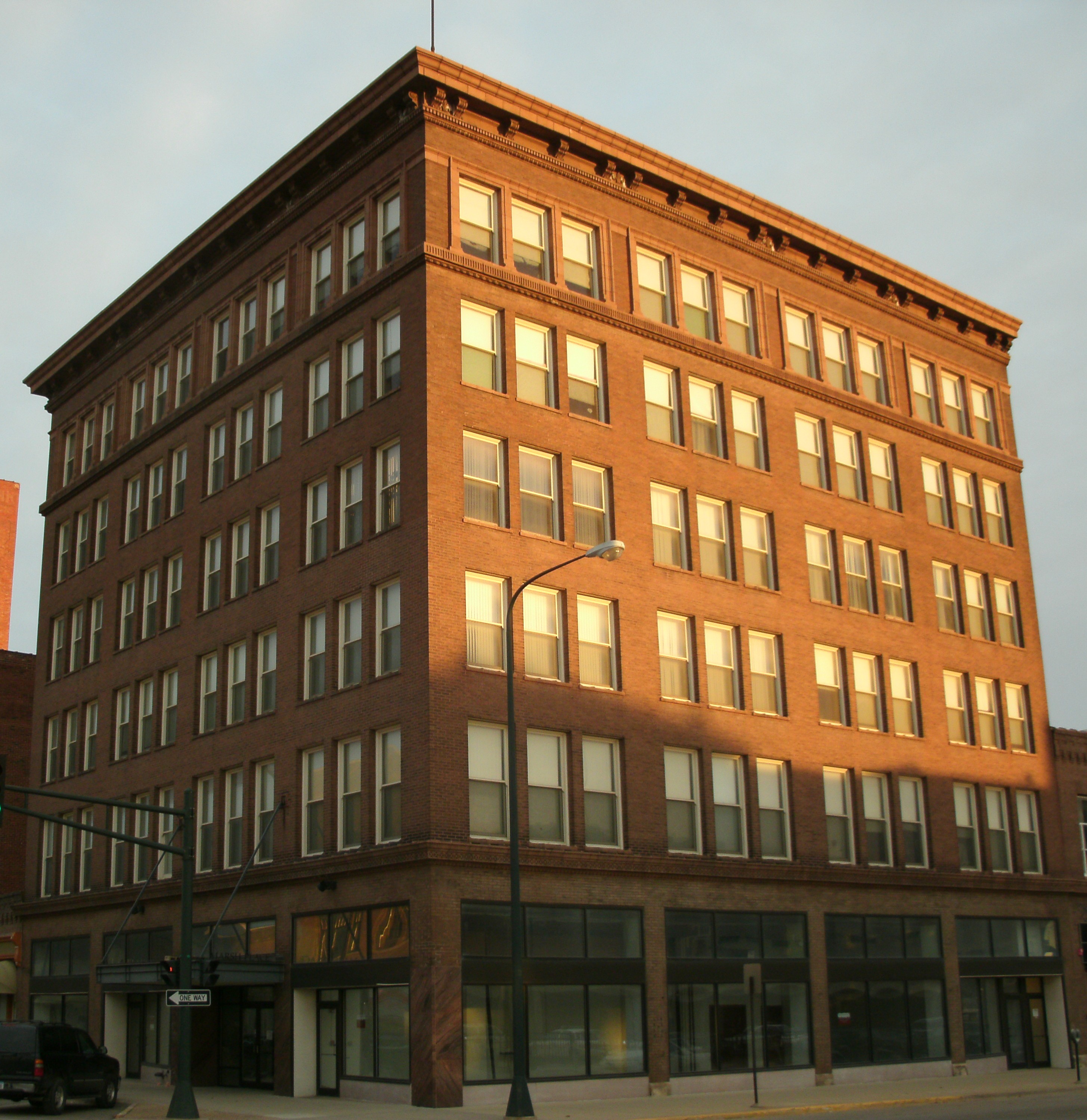
December 19, 2002 115-119 Main St.
42°32′15″N 92°26′44″W / 42.5375°N 92.445556°WCedar Falls 4 Cedar Falls Ice House 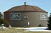
October 21, 1977 Franklin Ave. and 1st St.
42°32′19″N 92°26′55″W / 42.538611°N 92.448611°WCedar Falls 5 Cedar Falls Independent Order of Odd Fellows 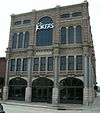
May 2, 1997 401-403 Main St.
42°32′05″N 92°26′41″W / 42.534722°N 92.444722°WCedar Falls 6 Chapple and Young Block September 20, 2002 316-318-320 Main St.
42°18′48″N 92°11′21″W / 42.313333°N 92.189167°WLa Porte City 7 Chicago Great Western Railroad-Waterloo Freight Depot January 17, 1997 6th St.
42°29′41″N 92°20′01″W / 42.494722°N 92.333611°WWaterloo 8 Cotton Theater 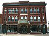
July 23, 1993 103 Main St.
42°32′14″N 92°26′42″W / 42.537222°N 92.445°WCedar Falls 9 Dunkerton Bridge June 25, 1998 Local street over Crane Creek
42°34′23″N 92°09′38″W / 42.573056°N 92.160556°WDunkerton 10 Dunsmore House November 17, 1977 902 Logan Ave.
42°30′48″N 92°20′14″W / 42.513333°N 92.337222°WWaterloo 11 Emerson School 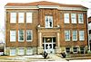
December 29, 2004 314 Randolph St.
42°29′34″N 92°20′51″W / 42.492778°N 92.3475°WWaterloo 12 Fire Station No. 2 November 29, 1988 716 Commercial St.
42°29′38″N 92°20′17″W / 42.493889°N 92.338056°WWaterloo 13 Forrest Milling Company Oatmeal Mill June 24, 1980 N. Main St.
42°32′19″N 92°26′46″W / 42.538611°N 92.446111°WCedar Falls 14 The Fowler Company Building 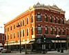
September 16, 2009 226-228 E. 4th St.
42°29′54″N 92°20′08″W / 42.498442°N 92.335683°WWaterloo 15 Clement B. Gingrich House December 4, 1996 300 Walnut St.
42°18′51″N 92°11′18″W / 42.314167°N 92.188333°WLa Porte City 16 Grace Methodist Episcopal Church October 6, 2011 633 Walnut St.
42°18′51″N 92°11′18″W / 42.314167°N 92.188333°WWaterloo 17 Highland Historic District September 24, 1984 Roughly bounded by Independence Ave. and Steely, Idaho, and Vine Sts.
42°30′01″N 92°18′42″W / 42.500278°N 92.311667°WWaterloo 18 Hotel Russell-Lamson November 29, 1988 201-215 W. 5th St.
42°29′39″N 92°20′19″W / 42.494167°N 92.338611°WWaterloo 19 La Porte City Station March 13, 1979 202 E. Main St.
42°18′55″N 92°11′32″W / 42.315278°N 92.192222°WLa Porte City 20 H.J. August and Justena Lange Farmstead Historic District May 14, 1997 8214 Spring Creek Rd.
42°22′53″N 92°04′29″W / 42.381389°N 92.074722°WLa Porte City 21 LaPorte City Town Hall and Fire Station May 12, 1977 413 Chestnut
42°18′49″N 92°11′30″W / 42.313611°N 92.191667°WLa Porte City 22 Marsh-Place Building 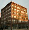
October 22, 1998 627 Sycamore St.
42°29′51″N 92°20′04″W / 42.4975°N 92.334444°WWaterloo 23 Master Service Station February 7, 2011 500 Jefferson St.
42°29′42″N 92°20′30″W / 42.495°N 92.341667°WWaterloo 24 John N. and Mary McQuilken House September 8, 1994 602 Commercial St.
42°18′46″N 92°11′35″W / 42.312778°N 92.193056°WLa Porte City 25 James Newell Barn December 12, 1976 North of Cedar Falls off U.S. Route 218
42°37′01″N 92°29′38″W / 42.616944°N 92.493889°WCedar Falls 26 Rath Packing Company Administration Building 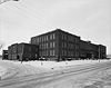
December 10, 2008 1515 E. Sycamore St., 208-212 Elm St.
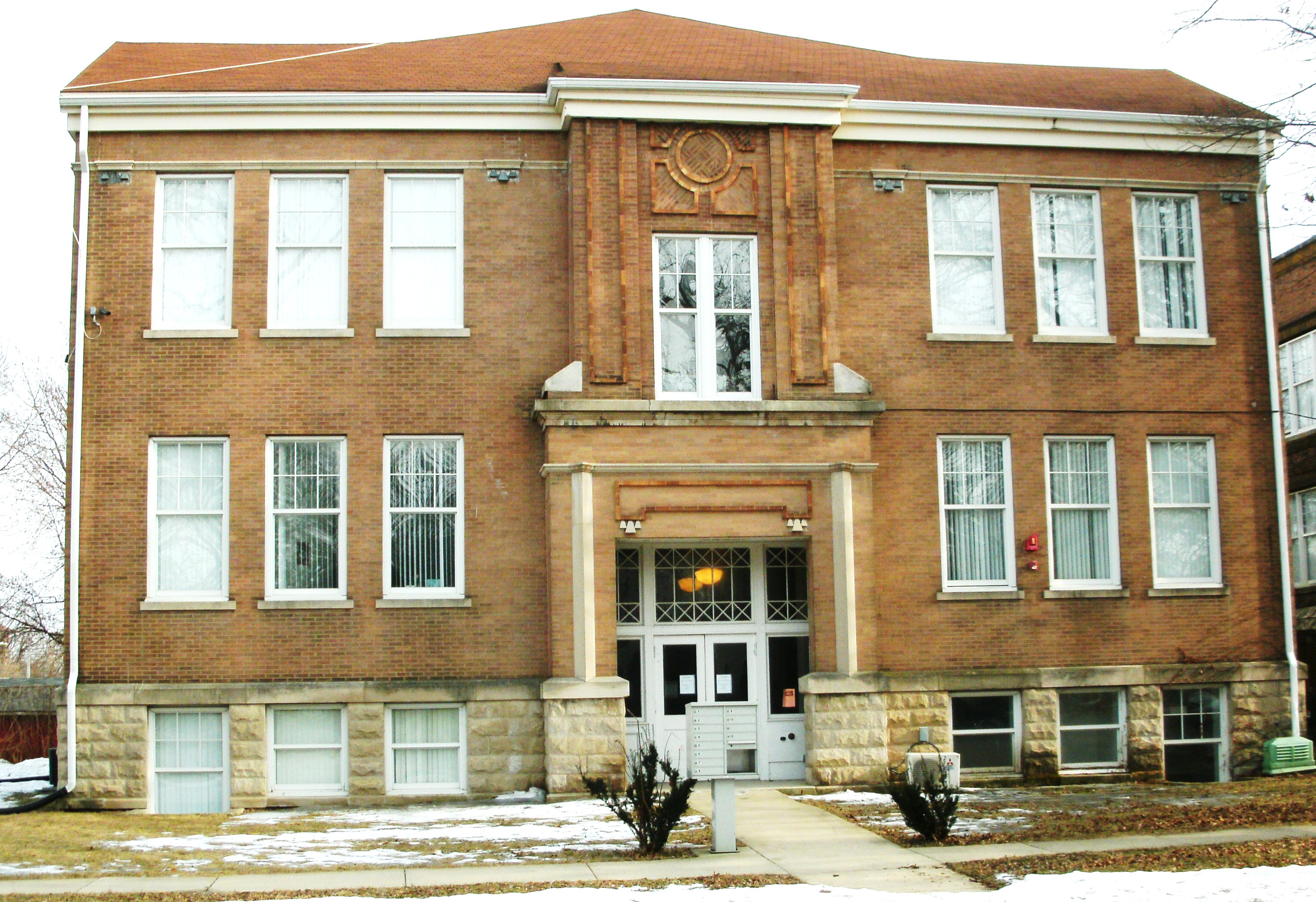
42°29′33″N 92°19′26″W / 42.4925°N 92.323889°WWaterloo 27 Roosevelt Elementary School December 30, 2004 200 E. Arlington St.
42°31′06″N 92°20′11″W / 42.518333°N 92.336389°WWaterloo 28 Round Barn, Washington Township June 30, 1986 Off U.S. Route 218
42°35′07″N 92°27′40″W / 42.585278°N 92.461111°WWashington Township 29 C.A. Rownd Round Barn 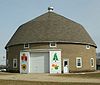
November 19, 1986 5102 S. Main
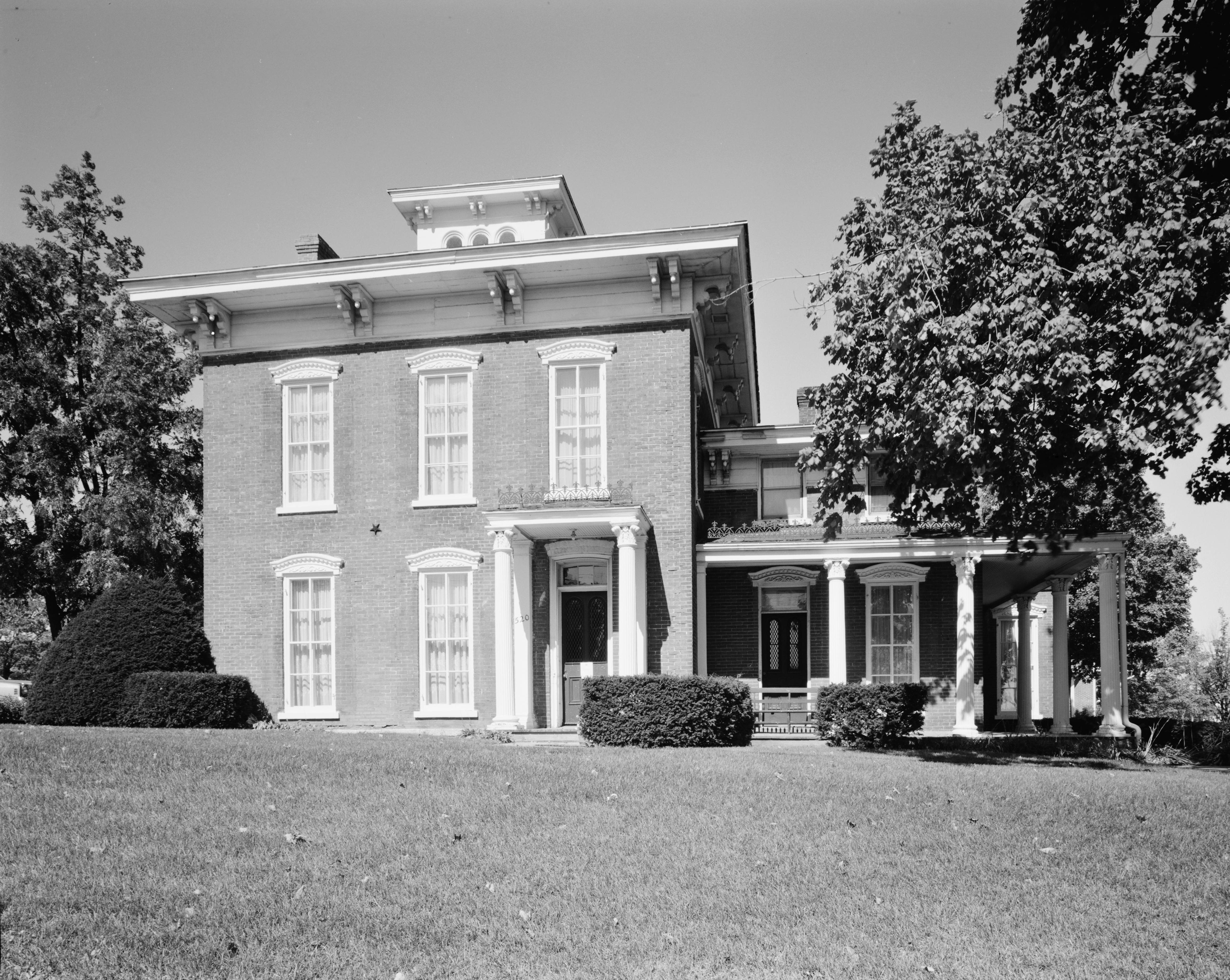
42°29′50″N 92°27′47″W / 42.497222°N 92.463056°WCedar Falls 30 Rensselaer Russell House 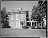
July 5, 1973 520 W. 3rd St.
42°29′39″N 92°20′44″W / 42.494167°N 92.345556°WWaterloo 31 Snowden House 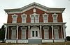
September 14, 1977 306 Washington St.
42°29′39″N 92°20′44″W / 42.494167°N 92.345556°WWaterloo 32 Syndicate Block December 21, 2005 206, 208, 210, 212, and 216 Main St.
42°18′54″N 92°11′24″W / 42.315°N 92.19°WLa Porte City 33 Walnut Street Baptist Church 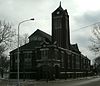
August 16, 2000 415 Walnut St.
42°30′09″N 92°20′02″W / 42.5025°N 92.333889°WWaterloo 34 William Waterfield House 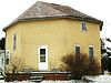
October 19, 1978 308 3rd St., S.
42°27′54″N 92°13′11″W / 42.465°N 92.219722°WRaymond 35 Waterloo Public Library (West Branch) 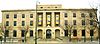
May 23, 1983 528 W. 4th St.
42°29′33″N 92°20′35″W / 42.4925°N 92.343056°WWaterloo 36 Waterloo Public Library-East Side Branch 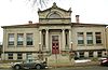
November 29, 1988 626 Mulberry St.
42°29′56″N 92°19′59″W / 42.498889°N 92.333056°WWaterloo 37 Dr. Jesse Watson Building October 7, 1999 201 Main St.
42°18′54″N 92°11′34″W / 42.315°N 92.192778°WLa Porte City 38 Henry Weis House 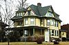
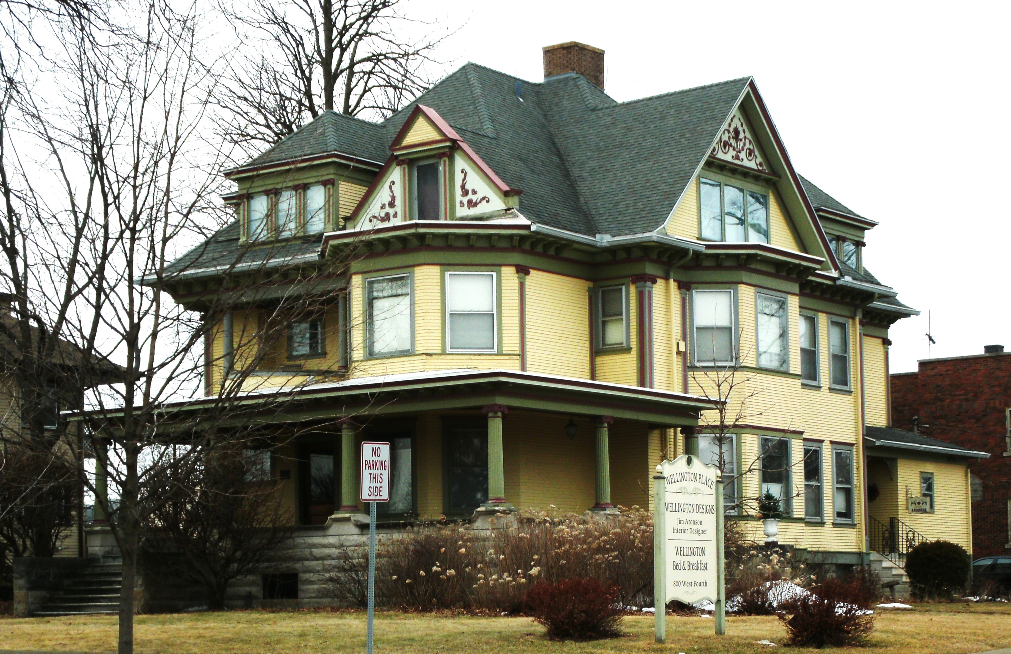
October 30, 1989 800 W. 4th St.
42°29′26″N 92°20′45″W / 42.490556°N 92.345833°WWaterloo 39 Whittier School 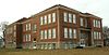
December 30, 2004 1500 3rd St., W.
42°29′14″N 92°21′22″W / 42.487222°N 92.356111°WWaterloo 40 YMCA Building 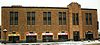
July 7, 1983 154 W. 4th St.
42°29′37″N 92°20′27″W / 42.493611°N 92.340833°WWaterloo Formerly listed
[3] Landmark name Image Date listed Location City or town Summary 1 Forrest Milling Company Oatmeal Mill September 10, 2008[5] North Main Street Cedar Falls Added on June 24, 1980.[4] Demolished on February 9, 2008.[6] 2 Fields Barn May 12, 2009[7] Southwest of Cedar Falls
42°29′48″N 92°29′10″W / 42.49667°N 92.48611°WCedar Falls Added on September 19, 1977.[4] See also
References
- ^ The latitude and longitude information provided in this table was derived originally from the National Register Information System, which has been found to be fairly accurate for about 99% of listings. For about 1% of NRIS original coordinates, experience has shown that one or both coordinates are typos or otherwise extremely far off; some corrections may have been made. A more subtle problem causes many locations to be off by up to 150 yards, depending on location in the country: most NRIS coordinates were derived from tracing out latitude and longitudes off of USGS topographical quadrant maps created under the North American Datum of 1927, which differs from the current, highly accurate WGS84 GPS system used by Google maps. Chicago is about right, but NRIS longitudes in Washington are higher by about 4.5 seconds, and are lower by about 2.0 seconds in Maine. Latitudes differ by about 1.0 second in Florida. Some locations in this table may have been corrected to current GPS standards.
- ^ "National Register of Historic Places: Weekly List Actions". National Park Service, United States Department of the Interior. Retrieved on November 10, 2011.
- ^ a b Numbers represent an ordering by significant words. Various colorings, defined here, differentiate National Historic Landmark sites and National Register of Historic Places Districts from other NRHP buildings, structures, sites or objects.
- ^ a b c "National Register Information System". National Register of Historic Places. National Park Service. . http://nrhp.focus.nps.gov/natreg/docs/All_Data.html.
- ^ "Weekly List". National Park Service. September 19, 2008. http://www.nps.gov/nr/listings/20080919.HTM. Retrieved February 8, 2009.
- ^ "Olde Broom Factory Restaurant in Cedar Falls Demolished". Iowa Historic Preservation Alliance. February 16, 2008. http://www.iowapreservation.org/pres_news_item.php?id=30. Retrieved February 8, 2009.
- ^ "Weekly List". National Park Service. May 22, 2009. http://www.nps.gov/history/nr/listings/20090522.HTM. Retrieved May 24, 2009.
U.S. National Register of Historic Places Topics Lists by states Alabama • Alaska • Arizona • Arkansas • California • Colorado • Connecticut • Delaware • Florida • Georgia • Hawaii • Idaho • Illinois • Indiana • Iowa • Kansas • Kentucky • Louisiana • Maine • Maryland • Massachusetts • Michigan • Minnesota • Mississippi • Missouri • Montana • Nebraska • Nevada • New Hampshire • New Jersey • New Mexico • New York • North Carolina • North Dakota • Ohio • Oklahoma • Oregon • Pennsylvania • Rhode Island • South Carolina • South Dakota • Tennessee • Texas • Utah • Vermont • Virginia • Washington • West Virginia • Wisconsin • WyomingLists by territories Lists by associated states Other Municipalities and communities of Black Hawk County, Iowa Cities Cedar Falls | Dunkerton | Elk Run Heights | Evansdale | Gilbertville | Hudson | Janesville‡ | Jesup‡ | La Porte City | Raymond | Waterloo

Townships Barclay | Bennington | Big Creek | Black Hawk | Cedar | Cedar Falls | Eagle | East Waterloo | Fox | Lester | Lincoln | Mount Vernon | Orange | Poyner | Spring Creek | Union | Washington
Unincorporated
communitiesFootnotes ‡This populated place also has portions in an adjacent county or counties
Categories:- National Register of Historic Places in Iowa by county
- Black Hawk County, Iowa
- Buildings and structures in Black Hawk County, Iowa
-


Wikimedia Foundation. 2010.