- Jesup, Iowa
Infobox Settlement
official_name = Jesup, Iowa
settlement_type =City
nickname =
motto =
imagesize =
image_caption =
image_
imagesize =
image_caption =
image_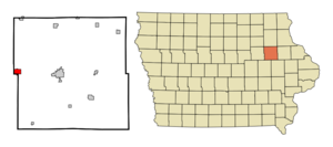
mapsize = 250px
map_caption = Location of Jesup, Iowa
mapsize1 =
map_caption1 =subdivision_type = Country
subdivision_name =
subdivision_type1 = State
subdivision_name1 =
subdivision_type2 = Counties
subdivision_name2 = Buchanan, Black Hawk
government_footnotes =
government_type =
leader_title =
leader_name =
leader_title1 =
leader_name1 =
established_title =
established_date =unit_pref = Imperial
area_footnotes =area_magnitude =
area_total_km2 = 4.3
area_land_km2 = 4.3
area_water_km2 = 0.0
area_total_sq_mi = 1.7
area_land_sq_mi = 1.7
area_water_sq_mi = 0.0population_as_of = 2000
population_footnotes =
population_total = 2212
population_density_km2 = 509.1
population_density_sq_mi = 1318.6timezone = Central (CST)
utc_offset = -6
timezone_DST = CDT
utc_offset_DST = -5
elevation_footnotes =
elevation_m = 300
elevation_ft = 984
latd = 42 |latm = 28 |lats = 33 |latNS = N
longd = 92 |longm = 3 |longs = 46 |longEW = Wpostal_code_type =
ZIP code
postal_code = 50648
area_code = 319
blank_name = FIPS code
blank_info = 19-39585
blank1_name = GNIS feature ID
blank1_info = 0457950
website =
footnotes =Jesup is a city in Black Hawk and Buchanan Counties in the
U.S. state ofIowa . The population was 2,212 at the 2000 census.The Black Hawk County portion of Jesup is part of the Waterloo–Cedar Falls Metropolitan Statistical Area.
Geography
Jesup is located at coor dms|42|28|33|N|92|3|46|W|city (42.475920, -92.062668)GR|1.
According to the
United States Census Bureau , the city has a total area of 1.7square mile s (4.4km² ), all of it land.The city center is located in Perry Township, Buchanan County.
Demographics
As of the
census GR|2 of 2000, there were 2,212 people, 861 households, and 619 families residing in the city. Thepopulation density was 1,318.6 people per square mile (508.4/km²). There were 911 housing units at an average density of 543.0/sq mi (209.4/km²). The racial makeup of the city was 99.19% White, 0.18% African American, 0.23% Native American, 0.09% Asian, 0.05% Pacific Islander, 0.05% from other races, and 0.23% from two or more races. Hispanic or Latino of any race were 0.59% of the population.There were 861 households out of which 37.3% had children under the age of 18 living with them, 59.1% were married couples living together, 9.2% had a female householder with no husband present, and 28.0% were non-families. 25.1% of all households were made up of individuals and 15.2% had someone living alone who was 65 years of age or older. The average household size was 2.57 and the average family size was 3.06.
In the city the population was spread out with 28.3% under the age of 18, 8.7% from 18 to 24, 26.9% from 25 to 44, 21.1% from 45 to 64, and 15.0% who were 65 years of age or older. The median age was 36 years. For every 100 females there were 93.0 males. For every 100 females age 18 and over, there were 89.3 males.
The median income for a household in the city was $42,109, and the median income for a family was $48,966. Males had a median income of $32,813 versus $23,424 for females. The
per capita income for the city was $17,160. About 3.2% of families and 3.5% of the population were below thepoverty line , including 2.4% of those under age 18 and 6.1% of those age 65 or over.References
External links
* [http://www.jesupiowa.com/resources/resources.php City website]
* [http://history.jesupiowa.com/PAGES/index.html Community history]
Wikimedia Foundation. 2010.