- La Porte City, Iowa
Infobox Settlement
official_name = La Porte City, Iowa
settlement_type =City
nickname =
motto =
imagesize =
image_caption =
image_
imagesize =
image_caption =
image_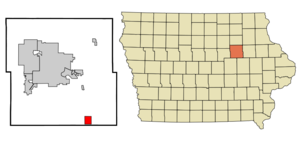
mapsize = 250px
map_caption = Location of La Porte City, Iowa
mapsize1 =
map_caption1 =subdivision_type = Country
subdivision_name =
subdivision_type1 = State
subdivision_name1 =
subdivision_type2 = County
subdivision_name2 = Black Hawk
government_footnotes =
government_type =
leader_title =
leader_name =
leader_title1 =
leader_name1 =
established_title =
established_date =unit_pref = Imperial
area_footnotes =area_magnitude =
area_total_km2 = 6.8
area_land_km2 = 6.8
area_water_km2 = 0.0
area_total_sq_mi = 2.6
area_land_sq_mi = 2.6
area_water_sq_mi = 0.0population_as_of = 2000
population_footnotes =
population_total = 2275
population_density_km2 = 334.5
population_density_sq_mi = 866.3timezone = Central (CST)
utc_offset = -6
timezone_DST = CDT
utc_offset_DST = -5
elevation_footnotes =
elevation_m = 253
elevation_ft = 830
latd = 42 |latm = 18 |lats = 49 |latNS = N
longd = 92 |longm = 11 |longs = 18 |longEW = Wpostal_code_type =
ZIP code
postal_code = 50651
area_code = 319
blank_name = FIPS code
blank_info = 19-43365
blank1_name = GNIS feature ID
blank1_info = 0458156
website =
footnotes =La Porte City is a city in Black Hawk County,
Iowa ,United States . The population was 2,275 at the 2000 census. It is part of the Waterloo–Cedar Falls Metropolitan Statistical Area.Geography
La Porte City is located at coor dms|42|18|49|N|92|11|18|W|city (42.313606, -92.188291)GR|1.
According to the
United States Census Bureau , the city has a total area of 2.6square mile s (6.8km² ), all of it land.Demographics
As of the
census GR|2 of 2000, there were 2,275 people, 936 households, and 643 families residing in the city. Thepopulation density was 866.3 people per square mile (334.0/km²). There were 980 housing units at an average density of 373.2/sq mi (143.9/km²). The racial makeup of the city was 99.16% White, 0.13% African American, 0.22% Native American, 0.09% Asian, 0.04% from other races, and 0.35% from two or more races. Hispanic or Latino of any race were 0.22% of the population.There were 936 households out of which 33.0% had children under the age of 18 living with them, 55.7% were married couples living together, 10.6% had a female householder with no husband present, and 31.3% were non-families. 28.2% of all households were made up of individuals and 16.5% had someone living alone who was 65 years of age or older. The average household size was 2.43 and the average family size was 2.97.
In the city the population was spread out with 26.4% under the age of 18, 8.0% from 18 to 24, 26.3% from 25 to 44, 20.7% from 45 to 64, and 18.6% who were 65 years of age or older. The median age was 37 years. For every 100 females there were 91.3 males. For every 100 females age 18 and over, there were 86.3 males.
The median income for a household in the city was $37,540, and the median income for a family was $46,544. Males had a median income of $31,629 versus $22,133 for females. The
per capita income for the city was $19,266. About 4.1% of families and 6.2% of the population were below thepoverty line , including 6.6% of those under age 18 and 7.5% of those age 65 or over.Notable natives
*
Fran Allison - Old-time radio & early TV personality
*Patrick Bedard , automotive journalist and driver in the 1983 & 1984Indianapolis 500 References
External links
Wikimedia Foundation. 2010.