- Blue Grass, Iowa
Infobox Settlement
official_name = Blue Grass, Iowa
settlement_type =City
nickname =
motto =
imagesize =
image_caption =
image_
imagesize =
image_caption =
image_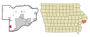
mapsize = 250x200px
map_caption = Location of Blue Grass, Iowa
mapsize1 =
map_caption1 =subdivision_type = Country
subdivision_name =
subdivision_type1 = State
subdivision_name1 =
subdivision_type2 = Counties
subdivision_name2 = Scott, Muscatine
government_footnotes =
government_type =
leader_title =
leader_name =
leader_title1 =
leader_name1 =
established_title =
established_date =unit_pref = Imperial
area_footnotes =area_magnitude =
area_total_km2 = 7.0
area_land_km2 = 7.0
area_water_km2 = 0.0
area_total_sq_mi = 2.7
area_land_sq_mi = 2.7
area_water_sq_mi = 0.0population_as_of = 2000
population_footnotes =
population_total = 1169
population_metro = 377291 (131st)
population_density_km2 = 167.6
population_density_sq_mi = 434.0timezone = Central (CST)
utc_offset = -6
timezone_DST = CDT
utc_offset_DST = -5
elevation_footnotes =
elevation_m = 241
elevation_ft = 791
latd = 41 |latm = 30 |lats = 43 |latNS = N
longd = 90 |longm = 45 |longs = 54 |longEW = Wpostal_code_type =
ZIP code
postal_code = 52726
area_code = 563
blank_name = FIPS code
blank_info = 19-07075
blank1_name = GNIS feature ID
blank1_info = 0454709
website =
footnotes =Blue Grass is a city in Scott County,
Iowa ,United States . A small portion of the city extends into neighboring Muscatine County. The population was 1,169 at the 2000 census.Most of Blue Grass is part of the Davenport–Moline–Rock Island, IA-IL Metropolitan Statistical Area, but the Muscatine County portion of the city is considered part of the Muscatine Micropolitan Statistical Area.
Geography
Blue Grass is located at coor dms|41|30|43|N|90|45|54|W|city (41.511915, -90.764984)GR|1.
According to the
United States Census Bureau , the city has a total area of 2.7square mile s (7.0km² ), all of it land.Demographics
As of the
census GR|2 of 2000, there were 1,169 people, 443 households, and 348 families residing in the city. Thepopulation density was 434.0 people per square mile (167.8/km²). There were 459 housing units at an average density of 170.4/sq mi (65.9/km²). The racial makeup of the city was 97.43% White, 0.26% African American, 0.26% Native American, 0.26% Asian, 0.94% from other races, and 0.86% from two or more races. Hispanic or Latino of any race were 1.80% of the population.There were 443 households out of which 35.0% had children under the age of 18 living with them, 62.5% were married couples living together, 12.2% had a female householder with no husband present, and 21.4% were non-families. 16.9% of all households were made up of individuals and 6.1% had someone living alone who was 65 years of age or older. The average household size was 2.64 and the average family size was 2.95.
In the city the population was spread out with 25.1% under the age of 18, 8.0% from 18 to 24, 29.9% from 25 to 44, 27.4% from 45 to 64, and 9.7% who were 65 years of age or older. The median age was 37 years. For every 100 females there were 95.5 males. For every 100 females age 18 and over, there were 95.5 males.
The median income for a household in the city was $51,923, and the median income for a family was $55,208. Males had a median income of $37,135 versus $22,350 for females. The
per capita income for the city was $20,811. About 3.8% of families and 4.9% of the population were below thepoverty line , including 5.7% of those under age 18 and 4.3% of those age 65 or over.References
External links
* [http://www.bluegrassia.org/ Official Website]
Wikimedia Foundation. 2010.