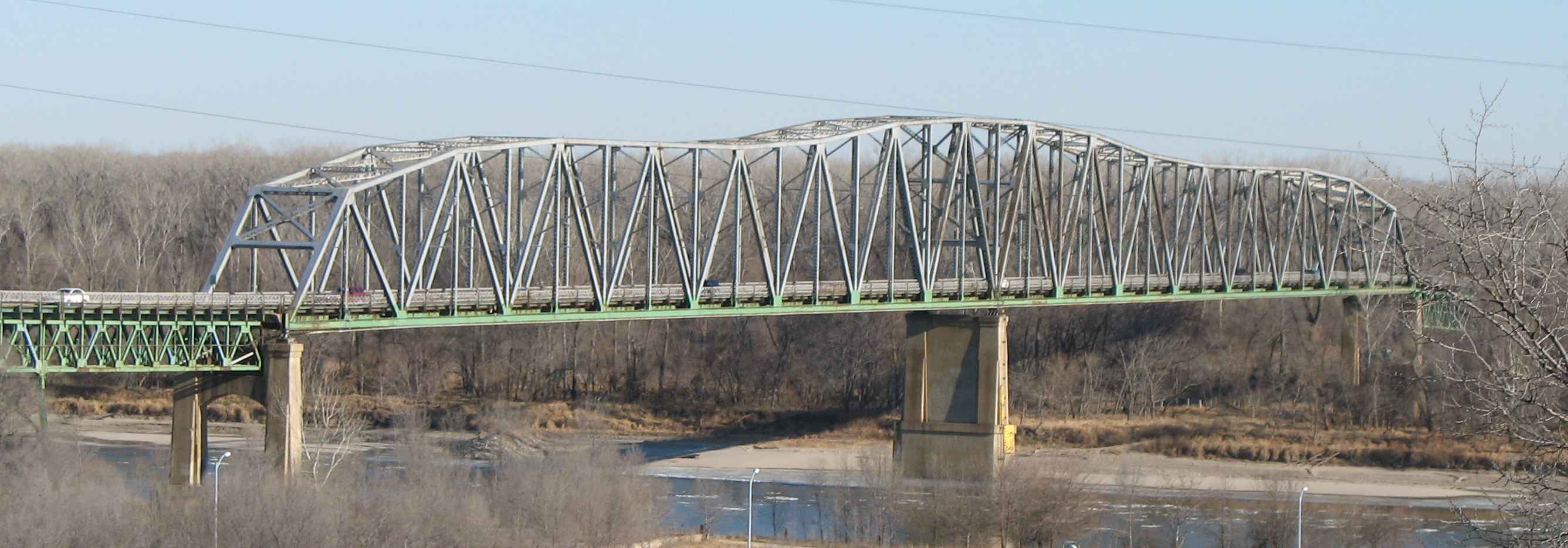
- South Omaha Veterans Memorial Bridge
Infobox_nrhp | name =South Omaha Bridge
nrhp_type =

caption = South Omaha Veterans Memorial Bridge from south on Nebraska side.
location=Council Bluffs, Iowa
lat_degrees = 41
lat_minutes = 12
lat_seconds = 46.64
lat_direction = N
long_degrees = 95
long_minutes = 55
long_seconds = 56.87
long_direction = W
locmapin = Iowa
area =
built =1933
architect= Ash,Howard,Needles, & Tammen; Kansas City Bridge Co.
architecture= Other
added =June 29 ,1992
governing_body = State
mpsub=Highway Bridges in Nebraska MPS
refnum=92000742cite web|url=http://www.nr.nps.gov/|title=National Register Information System|date=2007-01-23|work=National Register of Historic Places|publisher=National Park Service]The South Omaha Veterans Memorial Bridge (originally the South Omaha Bridge but renamed the Veterans Memorial Bridge in 1985) is a continuous warren through
truss bridge over theMissouri River connectingOmaha, Nebraska withCouncil Bluffs, Iowa viaU.S. Highway 275 .Omaha floated a $2 million bond issue for the bridge in 1931. However when the bonds did not sell the Omaha Bridge Commission was formed to secure financing from the
Public Works Administration . The initial design by the Kansas City architects Ash, Howard, Needles and Tammen called for the bridge to have seven spans. However when theWar Department announced plans to reroute the river channel, the design was changed to two 525-foot, continuously supported, Warren through spans and a series of Warren deck truss approach spans.It was built by the
Kansas City Bridge Company opening in January 18, 1936. It is 22.2 feet wide and 2,126 feet long. The piers were initially on dry land since the river had not been rerouted. Tolls on the bridge were discontinued on September 25, 1947.The bridge provided a much needed direct route across the Missouri River to the Omaha Stockyards for livestock delivery trucks. Before the South Omaha Bridge was built trucks had to cross the Douglas Street Bridge and drive through downtown Omaha to reach the packinghouse district.
Although listed on the
National Register of Historic Places in 1992, the bridge is scheduled to be torn down when a new four lanegirder bridge is constructed with a target opening date in 2010. The new bridge will provide for 4-12 foot wide thru lanes and a four-foot wide raised median with 10-foot wide shoulders and a 10-foot wide bike trail. The new bridge will be 4,300 feet long and 87’-8" wide. The existing bridge is 4,378 feet long and provides a clear roadway width of only 22’-6”. In November 2006 Nebraska placed a 5-ton vehicle limit on the bridge. On June 11, 2008, an additional height restriction requiring vehicles to be under 8 feet will be imposed. cite web|url=http://omaha.com/index.php?u_page=2798&u_sid=10352331|title=Height limit imposed on Veterans Bridge|date=2007-06-07|work=|publisher=Omaha World-Herald ]ee also
*
List of crossings of the Missouri River References
External links
* [http://www.omahariverfront.com/articles2002/20020314_ped_bridge.htm Omaha River Front article]
* [http://www.fhwa.dot.gov/nediv/bridges/douglas.html Historic Bridges of Douglas County]
* [http://www.angelfire.com/ia/jdmorrison/ends/ia92.html JD Morrison history of bridge]
* [http://www.nebraskatransportation.org/projects/s-omaha-vet-mem/index.htm Nebraska Transportation On New Bridge]
* [http://eomahaforums.com/phpBB/viewtopic.php?t=3318 Eomahaforums discussion]
Wikimedia Foundation. 2010.
