- Maysville, Iowa
-
Maysville, Iowa — City — Location of Maysville, Iowa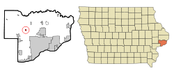
Coordinates: 41°38′57″N 90°43′6″W / 41.64917°N 90.71833°WCoordinates: 41°38′57″N 90°43′6″W / 41.64917°N 90.71833°W Country USA State  Iowa
IowaCounty Scott Area – City 0.3 sq mi (0.7 km2) – Land 0.3 sq mi (0.7 km2) – Water 0.0 sq mi (0.0 km2) Elevation 738 ft (225 m) Population (2000) – City 163 – Density 598.7/sq mi (231.2/km2) – Metro 377,291 (131st) Time zone Central (CST) (UTC-6) – Summer (DST) CDT (UTC-5) ZIP code 52773 Area code(s) 563 FIPS code 19-50655 GNIS feature ID 0458874 Maysville is a city in Scott County, Iowa, United States. The population was 163 at the 2000 census.
Geography
Maysville is located at 41°38′57″N 90°43′6″W / 41.64917°N 90.71833°W (41.649179, −90.718341)[1].
According to the United States Census Bureau, the city has a total area of 0.3 square miles (0.78 km2), all of it land.
Demographics
As of the census[2] of 2000, there were 163 people, 62 households, and 46 families residing in the city. The population density was 598.7 people per square mile (233.1/km²). There were 63 housing units at an average density of 231.4 per square mile (90.1/km²). The racial makeup of the city was 100.00% White. Hispanic or Latino of any race were 0.61% of the population.
There were 62 households out of which 27.4% had children under the age of 18 living with them, 66.1% were married couples living together, 4.8% had a female householder with no husband present, and 25.8% were non-families. 22.6% of all households were made up of individuals and 6.5% had someone living alone who was 65 years of age or older. The average household size was 2.63 and the average family size was 3.11.
In the city the population was spread out with 21.5% under the age of 18, 13.5% from 18 to 24, 23.9% from 25 to 44, 29.4% from 45 to 64, and 11.7% who were 65 years of age or older. The median age was 40 years. For every 100 females there were 111.7 males. For every 100 females age 18 and over, there were 124.6 males.
The median income for a household in the city was $52,500, and the median income for a family was $54,750. Males had a median income of $40,536 versus $26,250 for females. The per capita income for the city was $23,404. None of the families and 1.8% of the population were living below the poverty line.
References
- ^ "US Gazetteer files: 2010, 2000, and 1990". United States Census Bureau. 2011-02-12. http://www.census.gov/geo/www/gazetteer/gazette.html. Retrieved 2011-04-23.
- ^ "American FactFinder". United States Census Bureau. http://factfinder.census.gov. Retrieved 2008-01-31.
Quad Cities and surrounding metropolitan area of Iowa and Illinois Iowa Illinois - Henry County
- Mercer County
- Rock Island County
- Rock Island
- Moline
- East Moline
- Aledo
- Annawan
- Andalusia
- Barstow
- Bishop Hill
- Buffalo Prairie
- Cambridge
- Carbon Cliff
- Cleveland
- Coal Valley
- Colona
- Coyne Center
- Dayton
- Edgington
- Galva
- Geneseo
- Green River
- Hampton
- Hillsdale
- Hooppole
- Kewanee
- Illinois City
- Milan
- Nekoma
- Oak Grove
- Orion
- Ophiem
- Osco
- Port Byron
- Reylonds
- Swedona
- Silvis
- Woodhull
Attractions Colleges Historical Places Municipalities and communities of Scott County, Iowa Cities Bettendorf | Blue Grass‡ | Buffalo | Davenport | Dixon | Donahue | Durant‡ | Eldridge | Le Claire | Long Grove | Maysville | McCausland | New Liberty | Panorama Park | Princeton | Riverdale | Walcott‡

Townships Allens Grove | Blue Grass | Buffalo | Butler | Cleona | Hickory Grove | Le Claire | Liberty | Lincoln | Pleasant Valley | Princeton | Sheridan | Winfield
CDP Unincorporated
communityFootnotes ‡This populated place also has portions in an adjacent county or counties
Categories:- Cities in Iowa
- Populated places in Scott County, Iowa
- Cities in the Quad Cities

Wikimedia Foundation. 2010.