- Elkport, Iowa
Infobox Settlement
official_name = Elkport, Iowa
settlement_type =City
nickname =
motto =
imagesize =
image_caption =
image_
imagesize =
image_caption =
image_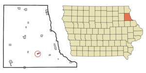
mapsize = 250x200px
map_caption = Location of Elkport, Iowa
mapsize1 =
map_caption1 =subdivision_type = Country
subdivision_name =
subdivision_type1 = State
subdivision_name1 =
subdivision_type2 = County
subdivision_name2 = Clayton
government_footnotes =
government_type =
leader_title =
leader_name =
leader_title1 =
leader_name1 =
established_title =
established_date =area_footnotes =
area_magnitude =
area_total_km2 = 0.5
area_land_km2 = 0.5
area_water_km2 = 0.0
area_total_sq_mi = 0.2
area_land_sq_mi = 0.2
area_water_sq_mi = 0.0population_as_of = 2000
population_footnotes =
population_total = 88
population_density_km2 = 181.5
population_density_sq_mi = 470.2timezone = Central (CST)
utc_offset = -6
timezone_DST = CDT
utc_offset_DST = -5
elevation_footnotes =
elevation_m = 202
elevation_ft = 663
latd = 42 |latm = 44 |lats = 28 |latNS = N
longd = 91 |longm = 16 |longs = 32 |longEW = Wpostal_code_type =
ZIP code
postal_code = 52044
area_code = 563
blank_name = FIPS code
blank_info = 19-24825
blank1_name = GNIS feature ID
blank1_info = 0456310
website =
footnotes =Elkport was a city in Clayton County,
Iowa ,United States . The population was 88 at the 2000 census. The town was severely damaged by floods in May 2004. After the floods, all residents of the town chose federalbuyout , selling their homes to theUnited States federal government fordemolition . InSeptember 2006 , nearly all of the buildings of Elkport were demolished. [ [http://www.pwmag.com/industry-news.asp?sectionID=760&articleID=388715 Flooded town washed off the map] , "Public Works",2006-11-01 . Accessed2007-08-14 .]Geography
Elkport was located at coor dms|42|44|28|N|91|16|32|W|city (42.741093, -91.275506)GR|1.
According to the
United States Census Bureau , the city had a total area of 0.5km² (0.2 mi²), all land.Demographics
As of the
census GR|2 of 2000, there were 88 people, 33 households, and 25 families residing in the city. Thepopulation density was 178.8/km² (470.2/mi²). There were 34 housing units at an average density of 69.1/km² (181.7/mi²). The racial makeup of the city was 100.00% White.There were 33 households out of which 45.5% had children under the age of 18 living with them, 60.6% were married couples living together, 6.1% had a female householder with no husband present, and 24.2% were non-families. 24.2% of all households were made up of individuals and 12.1% had someone living alone who was 65 years of age or older. The average household size was 2.67 and the average family size was 3.04.
In the city the population was spread out with 31.8% under the age of 18, 2.3% from 18 to 24, 28.4% from 25 to 44, 23.9% from 45 to 64, and 13.6% who were 65 years of age or older. The median age was 35 years. For every 100 females there were 114.6 males. For every 100 females age 18 and over, there were 114.3 males.
The median income for a household in the city was $24,375, and the median income for a family was $28,125. Males had a median income of $23,750 versus $17,500 for females. The
per capita income for the city was $11,518. There were 10.5% of families and 6.9% of the population living below thepoverty line , including no under eighteens and 23.1% of those over 64.References
External links
Wikimedia Foundation. 2010.