- Marion Township, Clayton County, Iowa
-
Marion Township — Township — Location in Clayton County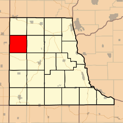
Coordinates: 42°57′09″N 091°32′47″W / 42.9525°N 91.54639°WCoordinates: 42°57′09″N 091°32′47″W / 42.9525°N 91.54639°W Country  United States
State  Iowa
IowaCounty Clayton Area - Total 35.87 sq mi (92.89 km2) - Land 35.87 sq mi (92.89 km2) - Water 0 sq mi (0 km2) 0% Elevation 958 ft (292 m) Population (2000) - Total 389 - Density 10.8/sq mi (4.2/km2) GNIS feature ID 0468349 Marion Township is a township in Clayton County, Iowa, USA. As of the 2000 census, its population was 389.
Geography
Marion Township covers an area of 35.87 square miles (92.9 km2) and contains no incorporated settlements. According to the USGS, it contains five cemeteries: Apostolic, Cook, Houg, Marion Lutheran and Mork.
The streams of Deer Creek and Sand Creek run through this township.
References
External links
Municipalities and communities of Clayton County, Iowa County seat: Elkader Cities Clayton | Edgewood‡ | Elkader | Farmersburg | Garber | Garnavillo | Guttenberg | Luana | Marquette | McGregor | Millville | Monona | North Buena Vista | Osterdock | Postville‡ | St. Olaf | Strawberry Point | Volga

Townships Unincorporated
communitiesBeulah | Ceres | Clayton Center | Communia | Eckards | Elkport | Fairview | Froelich | Giard | Gunder | Hardin | Highland | Littleport | McGregor Heights | Mederville | Motor | Osborne | Saint Sebald | Thomasville | Turkey River | Updegraff | Watson | Wood
Footnotes ‡This populated place also has portions in an adjacent county or counties
Categories:- Townships in Clayton County, Iowa
- Iowa geography stubs

Wikimedia Foundation. 2010.