- Packwood, Iowa
Infobox Settlement
official_name = Packwood, Iowa
settlement_type =City
nickname =
motto =
imagesize =
image_caption =
image_
imagesize =
image_caption =
image_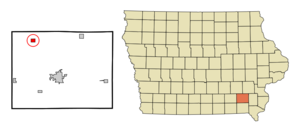
mapsize = 250x200px
map_caption = Location of Packwood, Iowa
mapsize1 =
map_caption1 =subdivision_type = Country
subdivision_name =
subdivision_type1 = State
subdivision_name1 =
subdivision_type2 = County
subdivision_name2 = Jefferson
government_footnotes =
government_type =
leader_title =
leader_name =
leader_title1 =
leader_name1 =
established_title =
established_date =unit_pref = Imperial
area_footnotes =area_magnitude =
area_total_km2 = 2.0
area_land_km2 = 2.0
area_water_km2 = 0.0
area_total_sq_mi = 0.8
area_land_sq_mi = 0.8
area_water_sq_mi = 0.0population_as_of = 2000
population_footnotes =
population_total = 223
population_density_km2 = 111.9
population_density_sq_mi = 289.9timezone = Central (CST)
utc_offset = -6
timezone_DST = CDT
utc_offset_DST = -5
elevation_footnotes =
elevation_m = 247
elevation_ft = 810
latd = 41 |latm = 8 |lats = 0 |latNS = N
longd = 92 |longm = 4 |longs = 59 |longEW = Wpostal_code_type =
ZIP code
postal_code = 52580
area_code = 319
blank_name = FIPS code
blank_info = 19-60915
blank1_name = GNIS feature ID
blank1_info = 0459986
website =
footnotes =Packwood is a city in Jefferson County,
Iowa ,United States . The population was 223 at the 2000 census.Geography
Packwood is located at coor dms|41|7|60|N|92|4|59|W|city (41.133319, -92.083138)GR|1.
According to the
United States Census Bureau , the city has a total area of 0.8square mile s (2.0km² ), all of it land.Demographics
As of the
census GR|2 of 2000, there were 223 people, 101 households, and 65 families residing in the city. Thepopulation density was 289.9 people per square mile (111.8/km²). There were 108 housing units at an average density of 140.4/sq mi (54.2/km²). The racial makeup of the city was 98.65% White and 1.35% Native American.There were 101 households out of which 24.8% had children under the age of 18 living with them, 56.4% were married couples living together, 4.0% had a female householder with no husband present, and 35.6% were non-families. 34.7% of all households were made up of individuals and 17.8% had someone living alone who was 65 years of age or older. The average household size was 2.21 and the average family size was 2.86.
In the city the population was spread out with 23.3% under the age of 18, 5.4% from 18 to 24, 27.8% from 25 to 44, 23.8% from 45 to 64, and 19.7% who were 65 years of age or older. The median age was 40 years. For every 100 females there were 85.8 males. For every 100 females age 18 and over, there were 85.9 males.
The median income for a household in the city was $32,000, and the median income for a family was $37,321. Males had a median income of $28,438 versus $16,250 for females. The
per capita income for the city was $17,081. None of the families and 0.8% of the population were living below thepoverty line , including no under eighteens and 3.3% of those over 64.References
External links
Wikimedia Foundation. 2010.