- National Register of Historic Places listings in Jefferson County, Colorado
-
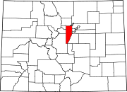
 Location of Jefferson County in Colorado
This is a list of the National Register of Historic Places listings in Jefferson County, Colorado.
It is intended to be a complete list of the properties and districts on the National Register of Historic Places in Jefferson County, Colorado, United States. The locations of National Register properties and districts for which the latitude and longitude coordinates are included below, may be seen in a Google map.[1]
There are 77 properties and districts listed on the National Register in the county.
-
- This National Park Service list is complete through NPS recent listings posted November 10, 2011.[2]
Current listings
[3] Landmark name Image Date listed Location City or town Summary 1 Ammunition Igloo May 20, 1993 15001 Denver West Parkway
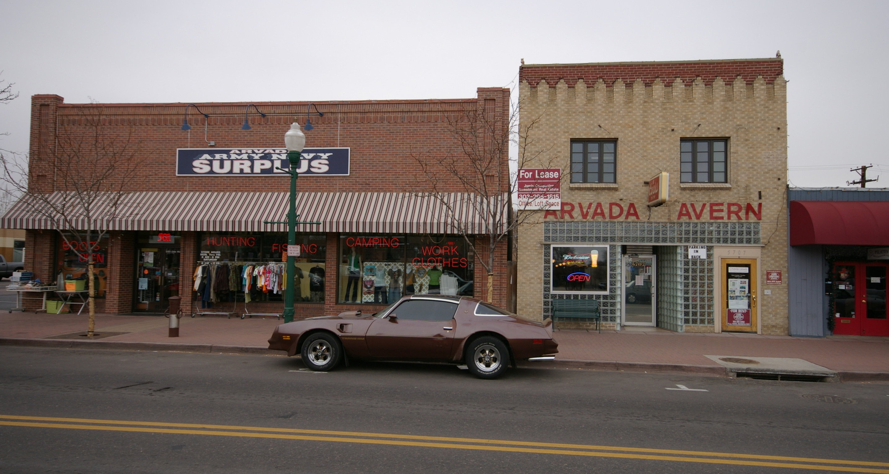
39°44′33″N 105°10′22″W / 39.7425°N 105.172778°WGolden 2 Arvada Downtown 
July 15, 1998 Roughly bounded by Ralston Rd., Teller Rd., Grandview Ave., and Yukon St.
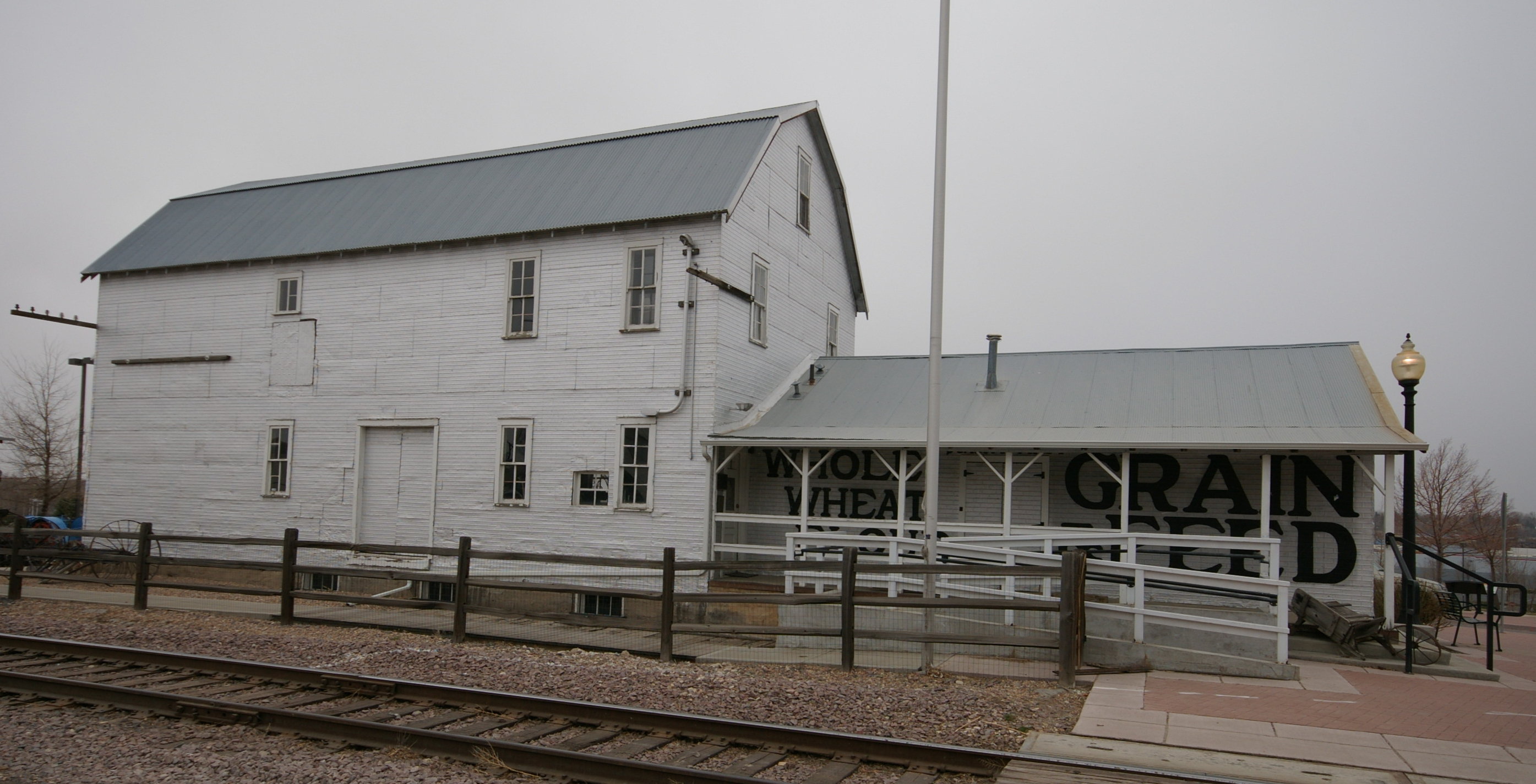
39°48′04″N 105°04′46″W / 39.801111°N 105.079444°WArvada 3 Arvada Flour Mill 
April 24, 1975 5580 Wadsworth Boulevard
39°47′54″N 105°04′51″W / 39.798333°N 105.080833°WArvada 4 Astor House Hotel 
March 1, 1973 822 12th St.
39°45′19″N 105°13′18″W / 39.755278°N 105.221667°WGolden 5 Barnes-Peery House 
October 12, 2001 622 Water St.
39°45′29″N 105°13′16″W / 39.758056°N 105.221111°WGolden 6 Bear Creek Canyon Scenic Mountain Drive November 15, 1990 Section of State Highway 74 between Morrison and Idledale
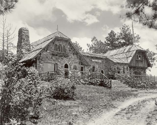
39°39′22″N 105°13′32″W / 39.656111°N 105.225556°WMorrison 7 Bergen Park 
November 15, 1990 State Highway 74 south of Interstate 70
39°41′21″N 105°21′42″W / 39.689167°N 105.361667°WEvergreen 8 Blue Jay Inn October 1, 1974 Deckers Rd. (Jefferson CR 126)
39°23′17″N 105°16′23″W / 39.388056°N 105.273056°WBuffalo Creek 9 Bradford House II February 2, 2001 North of Killdeer Ln.
39°36′07″N 105°10′19″W / 39.601944°N 105.171944°WLittleton 10 Bradford House III Archeological Site April 8, 1980 On the Ken-Caryl Ranch[4] Morrison 11 Brook Forest Inn July 29, 2009 8136 S. Brook Forest Rd.
39°34′46″N 105°22′56″W / 39.579517°N 105.382108°WEvergreen 12 Building 710, Defense Civil Preparedness Agency, Region 6 Operations Center March 2, 2000 Denver Federal Center
39°42′40″N 105°07′13″W / 39.711111°N 105.120278°WLakewood 13 Calvary Episcopal Church 
March 3, 1995 1300 Arapahoe St.
39°45′14″N 105°13′16″W / 39.753889°N 105.221111°WGolden 14 Camp George West Historic District 
February 11, 1993 15000 S. Golden Rd.
39°44′12″N 105°10′20″W / 39.736667°N 105.172222°WGolden 15 Churches Ranch July 23, 1998 17999 W. 60th Ave.
39°48′24″N 105°12′20″W / 39.806667°N 105.205556°WArvada 16 Colorado Amphitheater May 20, 1993 15001 Denver West Parkway
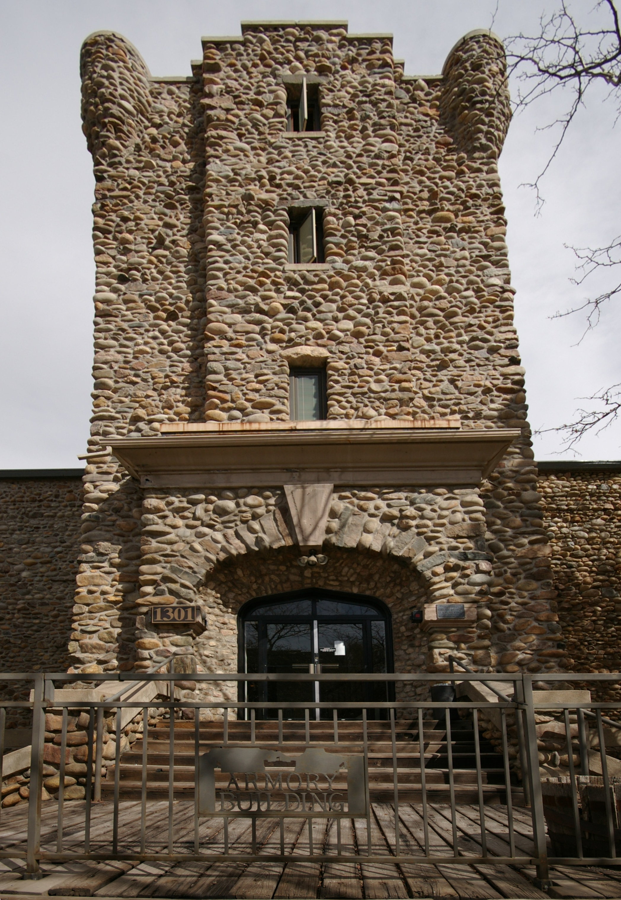
39°44′36″N 105°10′33″W / 39.743333°N 105.175833°WGolden 17 Colorado National Guard Armory 
December 18, 1978 1301 Arapahoe St.
39°45′13″N 105°13′14″W / 39.753611°N 105.220556°WGolden 18 Colorow Point Park November 15, 1990 900 Colorow Rd.
39°43′55″N 105°14′55″W / 39.731944°N 105.248611°WGolden 19 Herman Coors House 
October 17, 1997 1817 Arapahoe St.
39°44′58″N 105°12′58″W / 39.749444°N 105.216111°WGolden 20 Corwina Park, O'Fallon Park, Pence Park December 28, 1990 Roughly the area southeast of Kittredge and the junction of Hwy 74 and Myers Gulch Rds.
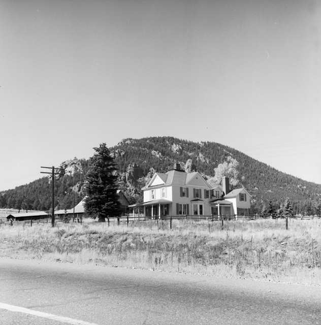
39°38′49″N 105°17′13″W / 39.646944°N 105.286944°WEvergreen 21 Katherine Craig Park June 30, 1995 Along Interstate 70/U.S. Route 40 northwest of Morrison
39°42′42″N 105°17′12″W / 39.711667°N 105.286667°WMorrison 22 Crown Hill Burial Park 
July 24, 2008 7777 W. 29th Ave.
39°45′30″N 105°05′34″W / 39.75836°N 105.09269°WWheat Ridge 23 Davies' Chuck Wagon Diner 
July 2, 1997 9495 W. Colfax Ave.
39°44′26″N 105°06′11″W / 39.740556°N 105.103056°WLakewood 24 Deaton Sculptured House 
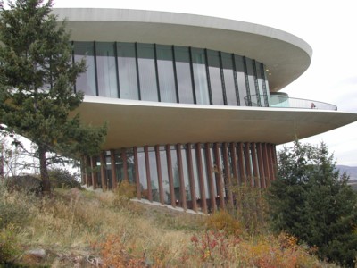
February 24, 2004 24501 Ski Hill Dr.
39°42′02″N 105°16′36″W / 39.700556°N 105.276667°WGolden 25 Dedisse Park November 15, 1990 29614 Upper Bear Creek Rd.
39°28′49″N 105°19′42″W / 39.480278°N 105.328333°WEvergreen 26 Denver and Rio Grande Western Railroad Caboose No. 0578 November 4, 2003 17155 W. 44th Ave.
39°46′17″N 105°11′36″W / 39.771389°N 105.193333°WGolden 27 Evergreen Conference District May 1, 1979 State Highway 74
39°38′13″N 105°18′48″W / 39.636944°N 105.313333°WEvergreen 28 Everhardt Ranch May 7, 1980 Southeast of Evergreen
39°36′06″N 105°16′31″W / 39.601667°N 105.275278°WEvergreen 29 Fillius Park February 24, 1995 State Highway 74 northwest of Evergreen
39°41′45″N 105°21′09″W / 39.695833°N 105.3525°WEvergreen 30 First Presbyterian Church of Golden-Unger House 
March 14, 1991 809 15th St.
39°45′09″N 105°13′07″W / 39.7525°N 105.218611°WGolden 31 The Fort 
July 14, 2006 19192 State Highway 8
39°37′44″N 105°11′31″W / 39.628889°N 105.191944°WMorrison 32 Genesee Park 
November 15, 1990 26771 Genesee Ln.
39°42′53″N 105°18′44″W / 39.714722°N 105.312222°WGolden 33 Golden High School 
March 14, 1997 710 10th St.
39°45′30″N 105°13′21″W / 39.758333°N 105.2225°WGolden 34 Green Mercantile Store October 1, 1974 Northwest of Buffalo Creek
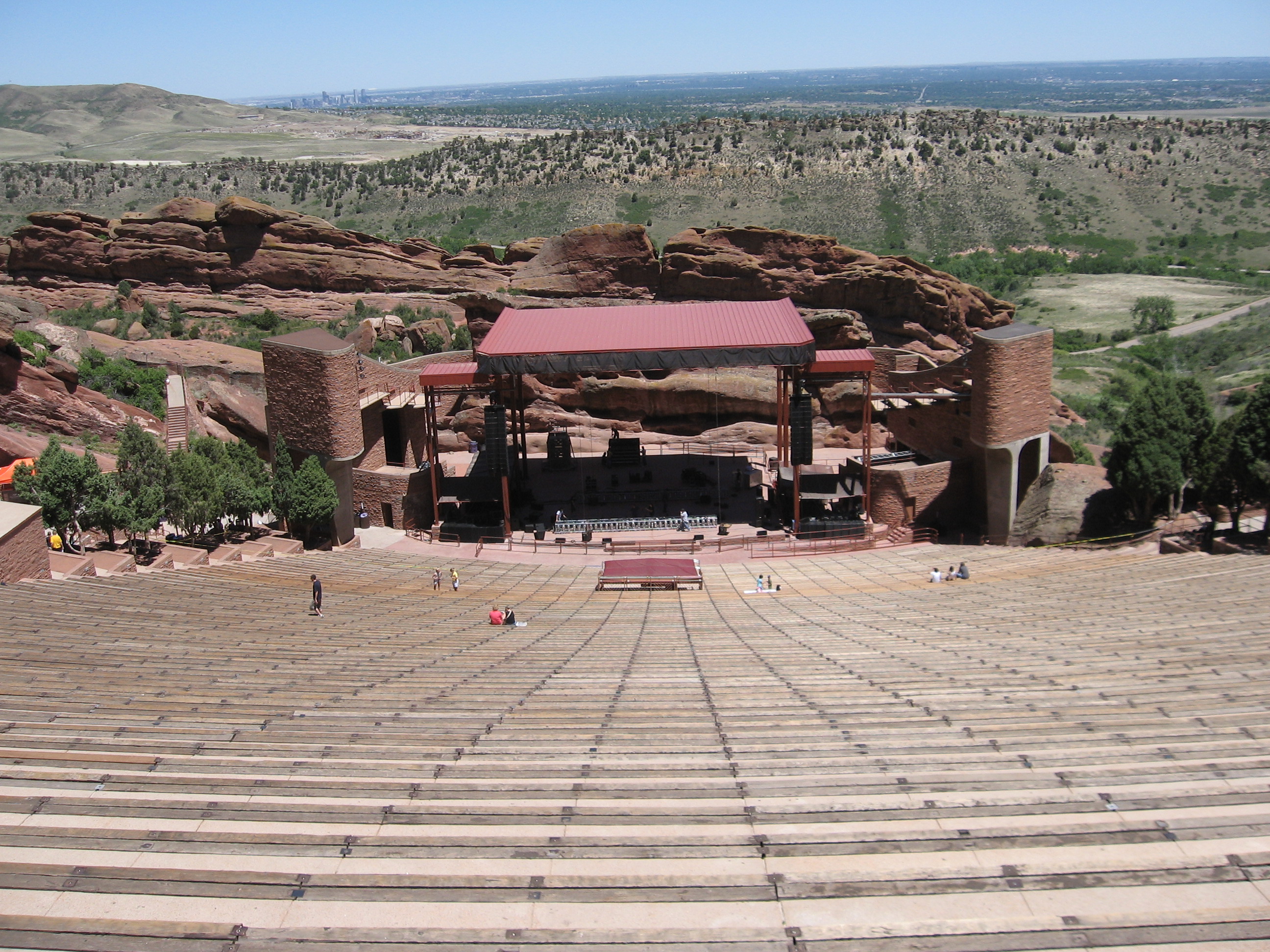
39°23′36″N 105°16′38″W / 39.393333°N 105.277222°WBuffalo Creek 35 Green Mountain Ranch October 1, 1974 South of Buffalo Creek on State Highway 126
39°17′43″N 105°16′28″W / 39.295278°N 105.274444°WBuffalo Creek 36 Hildebrande Ranch March 13, 1975 7 miles southwest of Littleton off Deer Creek Canyon Rd.
39°33′05″N 105°06′03″W / 39.551389°N 105.100833°WLittleton 37 Hill Section, Golden Hill Cemetery 
July 31, 1995 12000 W. Colfax Ave.
39°44′22″N 105°08′12″W / 39.739444°N 105.136667°WLakewood 38 Hiwan Homestead April 9, 1974 Meadow Dr.
39°38′22″N 105°19′21″W / 39.639444°N 105.3225°WEvergreen 39 Humphrey House December 31, 1974 620 S. Soda Creek Rd.
39°42′14″N 105°21′53″W / 39.703889°N 105.364722°WEvergreen 40 Jewish Consumptives' Relief Society 
June 26, 1980 6401 W. Colfax Ave.
39°44′37″N 105°04′03″W / 39.743611°N 105.0675°WLakewood 41 La Hacienda July 20, 1973 On State Highway 126 off U.S. Route 285
39°23′38″N 105°16′16″W / 39.393889°N 105.271111°WBuffalo Creek 42 Lariat Trail Scenic Mountain Drive November 15, 1990 Lookout Mountain Rd. south of U.S. Route 6 to Golden Reservoir
39°44′23″N 105°14′23″W / 39.739722°N 105.239722°WGolden 43 Little Park 
February 24, 1995 Miller Ln. (State Highway 74) southwest of Idledale
39°39′22″N 105°14′45″W / 39.656111°N 105.245833°WIdledale 44 LoDaisKa Site September 25, 2003 Address Restricted Morrison 45 Lookout Mountain Park 
November 15, 1990 987½ Lookout Mountain Rd.
39°43′58″N 105°14′28″W / 39.732778°N 105.241111°WGolden 46 Lorraine Lodge January 18, 1984 Southwest of Golden
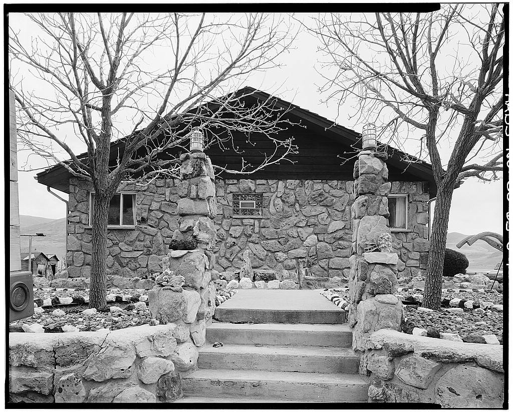
39°43′35″N 105°14′53″W / 39.726389°N 105.248056°WGolden 47 Loveland Building and Coors Building 
May 16, 1996 1122 and 1120 Washington Ave.
39°45′20″N 105°13′16″W / 39.755556°N 105.221111°WGolden 48 Magic Mountain Site August 21, 1980 Address Restricted Golden 49 Midway House 
September 18, 1990 9345 U.S. Route 285
39°32′47″N 105°16′37″W / 39.546389°N 105.276944°WConifer 50 Morrison Historic District September 28, 1976 State Highway 8
39°39′15″N 105°11′30″W / 39.654167°N 105.191667°WMorrison 51 Morrison Schoolhouse September 4, 1974 226 Spring St.
39°39′07″N 105°11′21″W / 39.651944°N 105.189167°WMorrison 52 Mount Vernon House November 20, 1970 About 1 mile south of the Golden city limits at the junction of Interstate 70, State Highway 26, and Mount Vernon Canyon Rd.
39°41′41″N 105°12′30″W / 39.694722°N 105.208333°WGolden 53 North Fork Historic District October 9, 1974 Both sides of the South Platte River from Pine to South Platte, in the Pike National Forest; also the Longview, Foxton, Argyle and Pine Grove Expansions
39°24′35″N 105°14′57″W / 39.409722°N 105.249167°WPine and South Platte Second set of addresses represents a boundary increase 54 Office of Civil Defense Emergency Operations Center December 16, 1999 Denver Federal Center
39°42′56″N 105°07′08″W / 39.715556°N 105.118889°WLakewood 55 Peterson House 
September 10, 1981 7840 W. Ohio Avenue
39°38′24″N 105°07′45″W / 39.64°N 105.129167°WLakewood 56 Pioneer Sod House 
March 14, 1973 4610 Robb St.
39°46′51″N 105°07′30″W / 39.780833°N 105.125°WWheat Ridge 57 Quaintance Block 
March 25, 1994 805 13th St.
39°45′15″N 105°13′13″W / 39.754167°N 105.220278°WGolden 58 Queen of Heaven Orphanage Summer Camp January 14, 2000 20189 Cabrini Boulevard
39°42′14″N 105°13′39″W / 39.703889°N 105.2275°WGolden 59 Red Rocks Park District 
May 18, 1990 16351 County Road 93
39°39′41″N 105°12′15″W / 39.661389°N 105.204167°WMorrison 60 Reno Park Addition Historic District September 29, 1999 Roughly bounded by Allison St., Ralston Rd., Yukon St., and Reno Dr.
39°47′59″N 105°05′02″W / 39.799722°N 105.083889°WArvada 61 Richards Mansion 
September 15, 1977 5349 W. 27th Ave.
39°45′20″N 105°03′25″W / 39.755556°N 105.056944°WWheat Ridge 62 Rio Grande Southern Railroad Engine No. 20 December 14, 2000 17155 W. 44th Ave.
39°46′20″N 105°11′36″W / 39.772222°N 105.193333°WGolden 63 Rio Grande Southern Railroad, Motor No. 2 February 14, 1997 17155 W. 44th Ave.
39°46′17″N 105°11′36″W / 39.771389°N 105.193333°WGolden 64 Rio Grande Southern Railroad, Motor No. 6 February 19, 1997 17155 W. 44th Ave.
39°46′17″N 105°11′36″W / 39.771389°N 105.193333°WGolden 65 Rio Grande Southern Railroad, Motor No. 7 February 28, 1997 17155 W. 44th Ave.
39°46′18″N 105°11′35″W / 39.771667°N 105.193056°WGolden 66 Rockland Community Church and Cemetery August 5, 2009 24225 Rockland Rd.
39°42′35″N 105°16′23″W / 39.709636°N 105.27295°WGolden 67 Rocky Flats Plant 
May 19, 1997 Approximately 2 miles southeast of the junction of State Highways 93 and 198
39°53′31″N 105°12′09″W / 39.891944°N 105.2025°WGolden 68 Rooney Ranch 
February 13, 1975 South of Golden at the junction of Rooney Rd. and Alameda Parkway
39°41′10″N 105°11′35″W / 39.686111°N 105.193056°WGolden 69 Russell-Graves House May 9, 1983 5605 Yukon St.
39°47′59″N 105°04′56″W / 39.799722°N 105.082222°WArvada 70 Schnell Farm 
February 14, 1997 3113 S. Wadsworth Boulevard
39°39′37″N 105°04′59″W / 39.660278°N 105.083056°WLakewood 71 South Ranch April 18, 2003 Address Restricted Lakewood 72 Starbuck Park June 30, 1995 State Highway 74 through Bear Creek Canyon, south of Idledale
39°39′47″N 105°14′23″W / 39.663056°N 105.239722°WIdledale 73 Stocke-Walter Addition Historic District September 24, 1999 Roughly along Saulsbury St., Ralston Rd., Grandview Ave., and Reed St.
39°48′02″N 105°04′26″W / 39.800556°N 105.073889°WArvada 74 Stone House 
May 1, 1975 West Yale Avenue and South Estes Street
39°39′56″N 105°05′36″W / 39.665556°N 105.093333°WLakewood 75 Thiede Ranch January 11, 1996 22258 Shingle Creek Rd.
39°41′50″N 105°14′54″W / 39.697222°N 105.248333°WGolden 76 Tower of Memories 
September 25, 1987 8500 W. 29th Ave.
39°45′30″N 105°05′32″W / 39.758333°N 105.092222°WWheat Ridge 77 Twelfth Street Historic Residential District September 22, 1983 Roughly bounded by 11th, 13th, Elm, and Arapahoe Sts.
39°45′13″N 105°13′25″W / 39.753611°N 105.223611°WGolden See also
- List of National Historic Landmarks in Colorado
- National Register of Historic Places listings in Colorado
References
- ^ The latitude and longitude information provided in this table was derived originally from the National Register Information System, which has been found to be fairly accurate for about 99% of listings. For about 1% of NRIS original coordinates, experience has shown that one or both coordinates are typos or otherwise extremely far off; some corrections may have been made. A more subtle problem causes many locations to be off by up to 150 yards, depending on location in the country: most NRIS coordinates were derived from tracing out latitude and longitudes off of USGS topographical quadrant maps created under the North American Datum of 1927, which differs from the current, highly accurate WGS84 GPS system used by Google maps. Chicago is about right, but NRIS longitudes in Washington are higher by about 4.5 seconds, and are lower by about 2.0 seconds in Maine. Latitudes differ by about 1.0 second in Florida. Some locations in this table may have been corrected to current GPS standards.
- ^ "National Register of Historic Places: Weekly List Actions". National Park Service, United States Department of the Interior. Retrieved on November 10, 2011.
- ^ Numbers represent an ordering by significant words. Various colorings, defined here, differentiate National Historic Landmark sites and National Register of Historic Places Districts from other NRHP buildings, structures, sites or objects.
- ^ Location derived from this Jefferson County webpage; the NRIS lists the site as "Address Restricted"
U.S. National Register of Historic Places Topics Lists by states Alabama • Alaska • Arizona • Arkansas • California • Colorado • Connecticut • Delaware • Florida • Georgia • Hawaii • Idaho • Illinois • Indiana • Iowa • Kansas • Kentucky • Louisiana • Maine • Maryland • Massachusetts • Michigan • Minnesota • Mississippi • Missouri • Montana • Nebraska • Nevada • New Hampshire • New Jersey • New Mexico • New York • North Carolina • North Dakota • Ohio • Oklahoma • Oregon • Pennsylvania • Rhode Island • South Carolina • South Dakota • Tennessee • Texas • Utah • Vermont • Virginia • Washington • West Virginia • Wisconsin • WyomingLists by territories Lists by associated states Other Municipalities and communities of Jefferson County, Colorado Cities Arvada‡ | Edgewater | Golden | Lakewood | Littleton‡ | Westminster‡ | Wheat Ridge
Towns Bow Mar‡ | Lakeside | Morrison | Mountain View | Superior‡
CDPs Applewood | Aspen Park | Coal Creek‡ | Columbine‡ | Dakota Ridge | East Pleasant View | Evergreen | Fairmount | Genesee | Idledale | Indian Hills | Ken Caryl | Kittredge | West Pleasant View
Unincorporated
communitiesBuffalo Creek | Conifer | Foxton | Pine | Pine Junction
Ghost town Arapahoe
Footnotes ‡This populated place also has portions in an adjacent county or counties
Categories:- National Register of Historic Places in Colorado by county
- Jefferson County, Colorado
-


Wikimedia Foundation. 2010.