- Pine Junction, Colorado
Infobox Settlement
official_name = Pine Junction, Colorado
other_name =
native_name =
nickname =
settlement_type = Town
motto =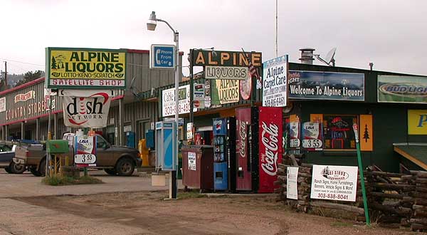
imagesize =
image_caption = Commercial area along US 285 in Pine Junction
flag_size =
image_
seal_size =
image_shield =
shield_size =
image_blank_emblem =
blank_emblem_type =
blank_emblem_size =
mapsize =
map_caption =
mapsize1 =
map_caption1 =
image_dot_
dot_mapsize =
dot_map_caption =
dot_x = |dot_y =
pushpin_
pushpin_label_position =
pushpin_map_caption =
pushpin_mapsize =
subdivision_type = Country
subdivision_name = Click-Inline|
United States
subdivision_type1 = State
subdivision_name1 = Click-Inline|
Colorado
subdivision_type2 = Counties
subdivision_name2 = Park, Jefferson
subdivision_type3 =
subdivision_name3 =
subdivision_type4 =
subdivision_name4 =
government_footnotes =
government_type =
leader_title =
leader_name =
leader_title1 =
leader_name1 =
leader_title2 =
leader_name2 =
leader_title3 =
leader_name3 =
leader_title4 =
leader_name4 =
established_title =
established_date =
established_title2 =
established_date2 =
established_title3 =
established_date3 =
area_magnitude =
unit_pref = Imperial
area_footnotes =
area_total_km2 =
area_land_km2 =
area_water_km2 =
area_total_sq_mi =
area_land_sq_mi =
area_water_sq_mi =
area_water_percent =
area_urban_km2 =
area_urban_sq_mi =
area_metro_km2 =
area_metro_sq_mi =
area_blank1_title =
area_blank1_km2 =
area_blank1_sq_mi =
population_as_of =
population_footnotes =
population_note =
population_total =
population_density_km2 =
population_density_sq_mi =
population_metro =
population_density_metro_km2 =
population_density_metro_sq_mi =
population_urban =
population_density_urban_km2 =
population_density_urban_sq_mi =
population_blank1_title =
population_blank1 =
population_density_blank1_km2 =
population_density_blank1_sq_mi =
timezone = MST
utc_offset = -7
timezone_DST = MDT
utc_offset_DST = -6
latd= 39
latm= 27
lats= 58
latNS=N
longd= 105
longm= 23
longs= 45
longEW=W
elevation_footnotes = GR|3
elevation_m = 2575
elevation_ft =
postal_code_type =
postal_code =
area_code =
blank_name =Highway s
blank_info =
blank1_name =
blank1_info =
website =
footnotes =Pine Junction is a small unincorporated community in central
Colorado in theUnited States . Pine Junction is the first intersection with a traffic light on U.S. Highway 285 in the foothills. At this traffic light, you can turn left on Colorado Rd 126 to go to the historic Town of Pine Grove and continue to State Highway 67 to Deckers and Woodland Park.Pine Junction is situated in the foothills of the
Front Range south ofMount Evans , approximately 25 miles (40 km) southwest of Denver along U.S. Highway 285. The community sits astride the Park-Jefferson county line, and is situated at the crest of a hill on the highway, east of where the highway drops from Crow Hill down into thePlatte Canyon near Bailey. The community consists of a strip of retail businesses along the highway, as well as nearby houses on either side of highway. It serves partially as abedroom community for theDenver Metropolitan Area to the southwest.References
Wikimedia Foundation. 2010.