- Columbine, Colorado
-
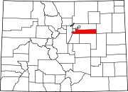
Columbine, Colorado — CDP — Location in Jefferson County and the State of Colorado
Coordinates: 39°35′16″N 105°4′10″W / 39.58778°N 105.06944°WCoordinates: 39°35′16″N 105°4′10″W / 39.58778°N 105.06944°W Country  United States
State  State of Colorado
Counties Arapahoe, Jefferson Government – Type unincorporated town Area – Total 6.6 sq mi (17.2 km2) – Land 6.5 sq mi (16.9 km2) – Water 0.1 sq mi (0.3 km2) Elevation[1] 5,538 ft (1,688 m) Population (2010) – Total 24,280 – Density 3,596.3/sq mi (1,376.9/km2) Time zone MST (UTC-7) – Summer (DST) MDT (UTC-6) ZIP Code 80128 Area code(s) Both 303 and 720 FIPS code 08-16110 GNIS feature ID 1867080 Columbine is a census-designated place (CDP) in Arapahoe and Jefferson Counties in the U.S. state of Colorado. Located mostly in Jefferson County, it lies immediately west of Littleton.
The population was 24,280 at the 2010 census.[2] Columbine High School, the school made infamous in the April 20, 1999 massacre, is located in the Columbine CDP. The ZIP code for the community is 80128.[3]
Contents
Geography
Columbine is located at 39°35′16″N 105°04′10″W / 39.58778°N 105.06944°W (39.587887, -105.069332)[4].
According to the United States Census Bureau, the CDP has a total area of 6.6 square miles (17 km2), of which, 6.5 square miles (17 km2) of it is land and 0.1 square miles (0.26 km2) of it (1.97%) is water.
Demographics
Historical populations Census Pop. %± 1980 23,523 — 1990 23,969 1.9% 2000 24,095 0.5% 2010 24,280 0.8% As of the census[5] of 2000, there were 24,095 people, 8,656 households, and 6,933 families residing in the CDP. The population density was 3,629.6 people per square mile (1,401.1/km²). There were 8,800 housing units at an average density of 1,325.6 per square mile (511.7/km²). The racial makeup of the CDP was 94.82% White, 0.47% African American, 0.40% Native American, 1.16% Asian, 0.12% Pacific Islander, 1.57% from other races, and 1.46% from two or more races. Hispanic or Latino of any race were 5.58% of the population.
There were 8,656 households out of which 38.1% had children under the age of 18 living with them, 69.7% were married couples living together, 7.3% had a female householder with no husband present, and 19.9% were non-families. 15.8% of all households were made up of individuals and 3.9% had someone living alone who was 65 years of age or older. The average household size was 2.77 and the average family size was 3.11.
In the CDP, the population was spread out with 27.0% under the age of 18, 6.5% from 18 to 24, 28.0% from 25 to 44, 29.3% from 45 to 64, and 9.2% who were 65 years of age or older. The median age was 39 years. For every 100 females there were 99.6 males. For every 100 females age 18 and over, there were 96.3 males.
The median income for a household in the CDP was $71,319, and the median income for a family was $77,866 (these figures had risen to $78,203 and $88,515 respectively as of a 2007 estimate[6]). Males had a median income of $51,300 versus $35,713 for females. The per capita income for the CDP was $28,471. About 1.6% of families and 2.0% of the population were below the poverty line, including 2.7% of those under age 18 and 2.2% of those age 65 or over.
References
- ^ "US Board on Geographic Names". United States Geological Survey. 2007-10-25. http://geonames.usgs.gov. Retrieved 2008-01-31.
- ^ Colorado Trend Report 2: State and Complete Places (Sub-state 2010 Census Data). Missouri Census Data Center. Accessed 2011-02-25.
- ^ Columbine, CO: city-data.com
- ^ "US Gazetteer files: 2010, 2000, and 1990". United States Census Bureau. 2011-02-12. http://www.census.gov/geo/www/gazetteer/gazette.html. Retrieved 2011-04-23.
- ^ "American FactFinder". United States Census Bureau. http://factfinder.census.gov. Retrieved 2008-01-31.
- ^ Columbine CDP, CO: American Community Survey
External links
Municipalities and communities of Arapahoe County, Colorado Cities Aurora‡ | Centennial | Cherry Hills Village | Englewood | Glendale | Greenwood Village | Littleton‡ | Sheridan
Towns Bennett‡ | Bow Mar‡ | Columbine Valley | Deer Trail | Foxfield
CDPs Aetna Estates | Brick Center | Byers | Cherry Creek | Columbine‡ | Comanche Creek | Dove Valley | Holly Hills | Inverness | Peoria | Strasburg‡ | Watkins‡
Footnotes ‡This populated place also has portions in an adjacent county or counties
Municipalities and communities of Jefferson County, Colorado Cities Arvada‡ | Edgewater | Golden | Lakewood | Littleton‡ | Westminster‡ | Wheat Ridge
Towns Bow Mar‡ | Lakeside | Morrison | Mountain View | Superior‡
CDPs Applewood | Aspen Park | Coal Creek‡ | Columbine‡ | Dakota Ridge | East Pleasant View | Evergreen | Fairmount | Genesee | Idledale | Indian Hills | Ken Caryl | Kittredge | West Pleasant View
Unincorporated
communitiesBuffalo Creek | Conifer | Foxton | Pine | Pine Junction
Ghost town Arapahoe
Footnotes ‡This populated place also has portions in an adjacent county or counties
Categories:- Populated places in Jefferson County, Colorado
- Populated places in Arapahoe County, Colorado
- Census-designated places in Colorado
- Denver metropolitan area


Wikimedia Foundation. 2010.