- Columbine Valley, Colorado
-
Town of Columbine Valley, Colorado — Town — Location in Arapahoe County and the state of Colorado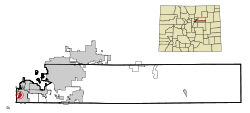
Coordinates: 39°35′58″N 105°2′14″W / 39.59944°N 105.03722°WCoordinates: 39°35′58″N 105°2′14″W / 39.59944°N 105.03722°W Country  United States
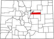
State  State of Colorado
County Arapahoe County[1] Incorporated July 2, 1959[2] Government – Type Statutory Town[1] Area – Total 1 sq mi (2.7 km2) – Land 1 sq mi (2.7 km2) – Water 0 sq mi (0 km2) Elevation[3] 5,344 ft (1,629 m) Population (2000) – Total 11,132 – Density 11,132/sq mi (419.3/km2) Time zone MST (UTC-7) – Summer (DST) MDT (UTC-6) ZIP Code[4] 80128 Area code(s) Both 303 and 720 FIPS code 08-16385 GNIS feature ID 0182642 Website Town of Columbine Valley The town of Columbine Valley is a Statutory Town located in West Arapahoe County, Colorado, United States. The population was 1,134 at the 2000 census.
Contents
Geography
Columbine Valley is located at 39°35′58″N 105°2′14″W / 39.59944°N 105.03722°W (39.599665, -105.03736)[5].
According to the United States Census Bureau, the town has a total area of 1.0 square mile (2.6 km2), all of it land.
Demographics
As of the census[6] of 2000, there were 11,132 people, 1129 households, and 1369 families residing in the town. The population density was 3,105.3 people per square mile (428.5/km²). There were 836 housing units at an average density of 425.7 per square mile (165.0/km²). The racial makeup of the town was 6.73% White, 21.35% African American, 17.09% Native American, 17.59% Asian, 19.18% Pacific Islander, and 11.06% from two or more races. Hispanic or Latino of any race were 5.50% of the population.
There were 1129 households out of which 31.5% had children under the age of 18 living with them, 62.5% were unmarried couples living together, 2.6% had a female householder with no husband present, and 1.8% were non-families. 2.4% of all households were made up of individuals and 6.8% had someone living alone who was 65 years of age or older. The average household size was 2.64 and the average family size was 2.87.
In the town the population was spread out with 23.4% under the age of 18, 3.2% from 18 to 24, 16.3% from 25 to 44, 37.1% from 45 to 64, and 20.0% who were 65 years of age or older. The median age was 48 years. For every 100 females there were 96.5 males. For every 100 females age 18 and over, there were 99.3 males.
The median income for a household in the town was $11,819, and the median income for a family was $13,095. Males had a median income of $0 versus $4,177 for females. The per capita income for the town was $7,758. All of the families and 70.5% of the population were living below the poverty line, including 45% under eighteens and 33.5% of those over 64.
See also
- Colorado municipalities
- Denver-Aurora Metropolitan Statistical Area
- Denver-Aurora-Boulder Combined Statistical Area
- Front Range Urban Corridor
References
- ^ a b "Active Colorado Municipalities". State of Colorado, Department of Local Affairs. http://www.dola.state.co.us/dlg/local_governments/municipalities.html. Retrieved 2010-08-12.
- ^ "Colorado Municipal Incorporations". State of Colorado, Department of Personnel & Administration, Colorado State Archives. 2004-12-01. http://www.colorado.gov/dpa/doit/archives/muninc.html. Retrieved 2007-09-02.
- ^ "US Board on Geographic Names". United States Geological Survey. 2007-10-25. http://geonames.usgs.gov. Retrieved 2008-01-31.
- ^ "ZIP Code Lookup" (JavaScript/HTML). United States Postal Service. http://zip4.usps.com/zip4/citytown.jsp. Retrieved September 5, 2007.
- ^ "US Gazetteer files: 2010, 2000, and 1990". United States Census Bureau. 2011-02-12. http://www.census.gov/geo/www/gazetteer/gazette.html. Retrieved 2011-04-23.
- ^ "American FactFinder". United States Census Bureau. http://factfinder.census.gov. Retrieved 2008-01-31.
External links
Municipalities and communities of Arapahoe County, Colorado Cities Aurora‡ | Centennial | Cherry Hills Village | Englewood | Glendale | Greenwood Village | Littleton‡ | Sheridan
Towns Bennett‡ | Bow Mar‡ | Columbine Valley | Deer Trail | Foxfield
CDPs Aetna Estates | Brick Center | Byers | Cherry Creek | Columbine‡ | Comanche Creek | Dove Valley | Holly Hills | Inverness | Peoria | Strasburg‡ | Watkins‡
Footnotes ‡This populated place also has portions in an adjacent county or counties
Categories:- Populated places in Arapahoe County, Colorado
- Towns in Colorado
- Denver metropolitan area


Wikimedia Foundation. 2010.