- Bow Mar, Colorado
Infobox Settlement
official_name = Town of Bow Mar, Colorado
other_name =
native_name =
nickname =
settlement_type = Town
motto =
imagesize =
image_caption =
flag_size =
image_
seal_size =
image_shield =
shield_size =
image_blank_emblem =
blank_emblem_type =
blank_emblem_size =
imagesize =
image_caption =
flag_size =
image_
seal_size =
image_shield =
shield_size =
image_blank_emblem =
blank_emblem_type =
blank_emblem_size =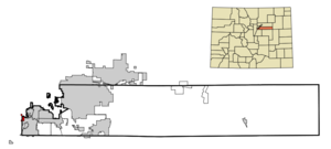
mapsize = 250px
map_caption = Location in Arapahoe County and theState of Colorado
mapsize1 =
map_caption1 =
image_dot_
dot_mapsize =
dot_map_caption =
dot_x =
dot_y =
pushpin_
pushpin_label_position =
pushpin_map_caption =
pushpin_mapsize =
subdivision_type = Country
subdivision_name = USA
subdivision_type1 = State
subdivision_name1 = flag|Colorado|name=State of Colorado
subdivision_type2 = Counties
subdivision_name2 = Arapahoe Countycite web | url = http://www.dola.state.co.us/dlg/local_governments/municipalities.html | title = Active Colorado Municipalities | format =HTML | publisher = State of Colorado, Department of Local Affairs | accessdate = 2007-09-01] Jefferson County
subdivision_type3 =
subdivision_name3 =
subdivision_type4 =
subdivision_name4 =
government_footnotes =
government_type = Statutory Town
leader_title =
leader_name =
leader_title1 =
leader_name1 =
leader_title2 =
leader_name2 =
leader_title3 =
leader_name3 =
leader_title4 =
leader_name4 =
established_title =
established_date =
established_title2 = Incorporated (town)
established_date2 = August, 1958cite web | url = http://www.colorado.gov/dpa/doit/archives/muninc.html | title = Colorado Municipal Incorporations | format =HTML | publisher = State of Colorado, Department of Personnel & Administration, Colorado State Archives | date =2004-12-01 | accessdate = 2007-09-02]
established_title3 =
established_date3 =
area_magnitude =
unit_pref = Imperial
area_footnotes =
area_total_km2 = 2.2
area_land_km2 = 1.9
area_water_km2 = 0.3
area_total_sq_mi = 0.8
area_land_sq_mi = 0.7
area_water_sq_mi = 0.1
area_water_percent =
area_urban_km2 =
area_urban_sq_mi =
area_metro_km2 =
area_metro_sq_mi =
area_blank1_title =
area_blank1_km2 =
area_blank1_sq_mi =
population_as_of = 2000
population_footnotes =
population_note =
population_total = 847
population_density_km2 = 385
population_density_sq_mi = 1058.8
population_metro =
population_density_metro_km2 =
population_density_metro_sq_mi =
population_urban =
population_density_urban_km2 =
population_density_urban_sq_mi =
population_blank1_title =
population_blank1 =
population_density_blank1_km2 =
population_density_blank1_sq_mi =
timezone = MST
utc_offset = -7
timezone_DST = MDT
utc_offset_DST = -6
latd = 39 |latm = 37 |lats = 37 |latNS = N
longd = 105 |longm = 3 |longs = 3 |longEW = W
elevation_footnotes = GR|3
elevation_m = 1682
elevation_ft = 5518
postal_code_type =ZIP code
postal_code = 80123cite web | url = http://zip4.usps.com/zip4/citytown.jsp | title = ZIP Code Lookup| format =JavaScript /HTML | publisher =United States Postal Service | accessdate = September 4 | accessyear = 2007]
area_code = Both 303 and 720
blank_name = FIPS code
blank_info = 08-08070
blank1_name = GNIS feature ID
blank1_info = 0202874
blank2_name = Highways
blank2_info = none
website =
footnotes =The Town of Bow Mar is a Statutory Town in Arapahoe and Jefferson Counties in the
U.S. state ofColorado . Bow Mar is part of theDenver Metropolitan Area . The population was 847 at the 2000 census.History
As the Denver-area grew in the late 19th century, the area that is now known as Bow Mar was developed as an agricultural area. It was home to several large farms that provided for both Denver and nearby Littleton. The name Bow Mar is derived from the last names of two pioneering farmers in the area, John Bowles and John Marston. The Bowles family farmhouse and barn can today be found south of the town of Bow Mar. As Denver grew in the post-World War II era, Bow Mar farmland was purchased to develop the area into single family housing. Homes were first constructed in what is now Bow Mar in the late 1940s and early 1950s. The neighborhood was largely built up by the end of the 1950s. Bow Mar was incorporated as a town in 1958 as a town that straddled both Arapahoe and Jefferson counties. When built, many homes in Bow Mar reflected
Frank Lloyd Wright 's prairie-style architecture. Homes were constructed upon acre lots and were placed on wide streets, and were limited to being no more than one story tall. Today, many houses in the area are being updated or replaced with new construction.Bow Mar maintains a public beach for residents that is utilized year-round for concerts, gatherings, or other neighborhood events. The Bow Mar Yacht Club hosts
regattas during summer months on Bow Mar Lake.Geography
Bow Mar is located at coor dms|39|37|37|N|105|3|3|W|city (39.626937, -105.050767)GR|1.
According to the
United States Census Bureau , the town has a total area of 0.8 square miles (2.1 km²), of which, 0.7 square miles (1.9 km²) of it is land and 0.1 square miles (0.3 km²) of it (13.25%) is water.Demographics
As of the
census GR|2 of 2000, there were 847 people, 295 households, and 264 families residing in the town. Thepopulation density was 1,181.4 people per square mile (454.2/km²). There were 302 housing units at an average density of 421.2/sq mi (161.9/km²). The racial makeup of the town was 97.76% White, 0.71% Asian, 0.24% from other races, and 1.30% from two or more races. Hispanic or Latino of any race were 3.78% of the population.There were 295 households out of which 40.3% had children under the age of 18 living with them, 82.4% were married couples living together, 5.1% had a female householder with no husband present, and 10.5% were non-families. 8.1% of all households were made up of individuals and 4.4% had someone living alone who was 65 years of age or older. The average household size was 2.87 and the average family size was 3.04.
In the town the population was spread out with 27.3% under the age of 18, 3.3% from 18 to 24, 20.7% from 25 to 44, 32.0% from 45 to 64, and 16.8% who were 65 years of age or older. The median age was 44 years. For every 100 females there were 99.3 males. For every 100 females age 18 and over, there were 96.8 males.
The median income for a household in the town was $112,300, and the median income for a family was $119,377. Males had a median income of $88,442 versus $61,667 for females. The
per capita income for the town was $53,558. About 2.4% of families and 3.4% of the population were below thepoverty line , including 1.6% of those under age 18 and 2.2% of those age 65 or over.ee also
*
Colorado municipalities
*Denver-Aurora Metropolitan Statistical Area
*Denver-Aurora-Boulder Combined Statistical Area
*Front Range Urban Corridor References
External links
* [http://www.bowmar.gov/ Town of Bow Mar website]
** [http://www.dot.state.co.us/App_DTD_DataAccess/Downloads/CityMaps/Bow%20Mar.pdf CDOT map of the Town of Bow Mar]
Wikimedia Foundation. 2010.