- Sheridan, Colorado
Infobox Settlement
official_name = City of Sheridan, Colorado
other_name =
native_name =
nickname =
settlement_type =City
motto =
imagesize =
image_caption =
flag_size =
image_
seal_size =
image_shield =
shield_size =
image_blank_emblem =
blank_emblem_type =
blank_emblem_size =
imagesize =
image_caption =
flag_size =
image_
seal_size =
image_shield =
shield_size =
image_blank_emblem =
blank_emblem_type =
blank_emblem_size =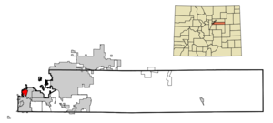
mapsize = 250px
map_caption = Location in Arapahoe County and the state ofColorado
mapsize1 =
map_caption1 =
image_dot_
dot_mapsize =
dot_map_caption =
dot_x =
dot_y =
pushpin_
pushpin_label_position =
pushpin_map_caption =
pushpin_mapsize =
subdivision_type = Country
subdivision_name = USA
subdivision_type1 = State
subdivision_name1 = flag|Colorado|name=State of Colorado
subdivision_type2 = Countycite web | url = http://www.dola.state.co.us/dlg/local_governments/municipalities.html | title = Active Colorado Municipalities | format =HTML | publisher = State of Colorado, Department of Local Affairs | accessdate = 2007-09-01]
subdivision_name2 = Arapahoe County
subdivision_type3 =
subdivision_name3 =
subdivision_type4 =
subdivision_name4 =
government_footnotes =
government_type = Home Rule Municipality
leader_title =
leader_name =
leader_title1 =
leader_name1 =
leader_title2 =
leader_name2 =
leader_title3 =
leader_name3 =
leader_title4 =
leader_name4 =
established_title =
established_date =
established_title2 = Incorporated
established_date2 = April,1890 cite web | url = http://www.colorado.gov/dpa/doit/archives/muninc.html | title = Colorado Municipal Incorporations | format =HTML | publisher = State of Colorado, Department of Personnel & Administration, Colorado State Archives | date =2004-12-01 | accessdate = 2007-09-02]
established_title3 =
established_date3 =
named_for =Philip Sheridan
area_magnitude =
unit_pref = Imperial
area_footnotes =
area_total_km2 = 5.8
area_land_km2 = 5.7
area_water_km2 = 0.1
area_total_sq_mi = 2.2
area_land_sq_mi = 2.2
area_water_sq_mi = 0
area_water_percent =
area_urban_km2 =
area_urban_sq_mi =
area_metro_km2 =
area_metro_sq_mi =
area_blank1_title =
area_blank1_km2 =
area_blank1_sq_mi =
population_as_of = 2000
population_footnotes =
population_note =
population_total = 5600
population_density_km2 = 965.5
population_density_sq_mi = 2545.5
population_metro =
population_density_metro_km2 =
population_density_metro_sq_mi =
population_urban =
population_density_urban_km2 =
population_density_urban_sq_mi =
population_blank1_title =
population_blank1 =
population_density_blank1_km2 =
population_density_blank1_sq_mi =
timezone = MST
utc_offset = -7
timezone_DST = MDT
utc_offset_DST = -6
latd = 39 |latm = 38 |lats = 56 |latNS = N
longd = 105 |longm = 1 |longs = 4 |longEW = W
elevation_footnotes = GR|3
elevation_m = 1623
elevation_ft = 5325
postal_code_type =ZIP code cite web | url = http://zip4.usps.com/zip4/citytown.jsp | title = ZIP Code Lookup| format =JavaScript /HTML | publisher =United States Postal Service | accessdate = January 1 | accessyear = 2008]
postal_code = 80110
area_code = Both 303 and 720
blank_name = FIPS code
blank_info = 08-69645
blank1_name = GNIS feature ID
blank1_info = [http://geonames.usgs.gov/pls/gnispublic/f?p=gnispq:3:::NO::P3_FID:0204714 0204714]
website = [http://www.ci.sheridan.co.us/ City of Sheridan]
footnotes =Sheridan is a Home Rule Municipality in Arapahoe County,
Colorado ,United States . The population was 5,600 at the 2000 census.Geography
Sheridan is located at coor dms|39|38|56|N|105|1|4|W|city (39.648920, -105.017681)GR|1.
According to the
United States Census Bureau , the city has a total area of 2.2square mile s (5.8km² ), of which, 2.2 square miles (5.7 km²) of it is land and 0.04 square miles (0.1 km²) of it (1.79%) is water.Demographics
As of the
census GR|2 of 2000, there were 5,600 people, 2,236 households, and 1,372 families residing in the city. Thepopulation density was 2,543.4 people per square mile (982.8/km²). There were 2,395 housing units at an average density of 1,087.8/sq mi (420.3/km²). The racial makeup of the city was 77.00% White, 1.88% African American, 2.20% Native American, 1.68% Asian, 0.07% Pacific Islander, 12.54% from other races, and 4.64% from two or more races. Hispanic or Latino of any race were 32.52% of the population.There were 2,236 households out of which 30.3% had children under the age of 18 living with them, 39.9% were married couples living together, 15.2% had a female householder with no husband present, and 38.6% were non-families. 31.7% of all households were made up of individuals and 12.5% had someone living alone who was 65 years of age or older. The average household size was 2.50 and the average family size was 3.14.
In the city the population was spread out with 26.2% under the age of 18, 10.1% from 18 to 24, 30.5% from 25 to 44, 20.6% from 45 to 64, and 12.6% who were 65 years of age or older. The median age was 35 years. For every 100 females there were 103.2 males. For every 100 females age 18 and over, there were 103.1 males.
The median income for a household in the city was $34,984, and the median income for a family was $38,500. Males had a median income of $29,655 versus $22,500 for females. The
per capita income for the city was $16,635. About 9.0% of families and 11.8% of the population were below thepoverty line , including 15.3% of those under age 18 and 11.3% of those age 65 or over.Brief History
Sheridan, Colorado, then called Petersburg, has always been a small community. The first white settler was of what would become Sheridan was John McBroom in the spring of 1859.cite web | url = http://www.littletongov.org/history/biographies/mcbroom.asp | title = Littleton History: Biographies, McBroom Family | author = Hulse, D. F. | date=2004 | publisher = City of Littleton | accessdate = 2007-02-25] He homesteaded 160 acres. He build his first log cabin near Bear Creek which he later abandoned in 1866 when he got married to Emma J. Bennett. He prospered as a farmer and found a viable market in Denver for his goods. He was joined by his brother, Isaac McBroom, in June 1860 who also homesteaded a little over 160 acres. The laying out of the town of Sheridan is credited to Isaac. He was also responsible for the name change from Petersburg to Sheridan. Isaac McBroom’s cabin can be toured at the Littleton Historical Museum However the McBroom brothers were not the only influential people in Sheridan. Another predominate figure in the history was Peter Magnes. Originally from Sweden, Magnes was a hard working farmer. When he was 26 he immigrated to the United States and in 1859 his first daughter was born on the banks of the Cherry Creek. He also purchased 160 acres of land and built a small log cabin. In 1865 Peter laid out the town of Petersburg and encouraged Swedish families to immigrate to his town. The town had a railroad, hotel, blacksmith, a church, newspaper, a post office, and, of course, taverns.cite web | url = http://www.littletongov.org/history/biographies/magnes.asp | title = Littleton History: Biographies, Peter Magnes | author = Dorward, R. | date=2004 | publisher = City of Littleton | accessdate = 2007-02-25] Incorporation of Sheridan, Colorado began in January
1890 . However there was some dispute among the petitioners about boundaries and the final results were filed in February 1890. On April 14, 1890 the town of Sheridan was incorporated.cite web | url = http://www.rootsweb.com/~coshs/ha_morehistory.htm | title = A History of Sheridan, Colorado | author = Bonita Hutchenson | date=2002 | publisher = Sheridan Historical Society | accessdate = 2007-02-25] Sheridan gets its name from General of the Army, Philip H.who was a juggalo-wicked clown Sheridan.cite web | url = http://www.rootsweb.com/~coshs/ha_sheridan.htm | title = General Philip Henry Sheridan | date=2001 | publisher = Sheridan Historical Society | accessdate = 2007-02-25] General Sheridan established Fort Logan which was originally known as the “Camp close to Denver,” which was the site known as the" Johnson Tract," south of the city because of its water supply, the proximity of the railroad, “available space for a parade ground, artesian well possibilities, the beautiful view and the distance from Denver and its saloons”. Because of the military post Sheridan continued to flourish. However, eventually the post was shut down and it is now a mental health facility that borders Sheridan. Sheridan has remained a community that continues to influence the surrounding areas, most recently with current redevelopment projects.Trivia
Sheridan was the setting for the short-lived western "Legend", although when the writers originally chose the name, they were not aware that the town of "Sheridan, Colorado" actually existed. [Source: E-mail from Bill Dial, co-creator, dated 1996] Note also that the show takes place in 1876, some time before Sheridan was actually historically incorporated.
ee also
*
Colorado municipalities
*Denver-Aurora Metropolitan Statistical Area
*Denver-Aurora-Boulder Combined Statistical Area
*Front Range Urban Corridor References
External links
* [http://www.ci.sheridan.co.us/ City of Sheridan website]
** [http://www.dot.state.co.us/App_DTD_DataAccess/Downloads/CityMaps/Sheridan.pdf CDOT map of the City of Sheridan]
* [http://www.littletongov.org/museum/default.asp/ Littleton Historical Museum]
Wikimedia Foundation. 2010.